Welcome to the International Cartographic Association
Welcome to the website of the International Cartographic AssociationGet to know the new ICA Executive Committee for the term 2023-2027
Welcome to the website of the International Cartographic Association
Get to know the new ICA Executive Committee for the term 2023-2027

News of the ICA Commission on Cartography for Early Warning and Crisis Management

In the 8th International Conference on Cartography and GIS, June 20-25th June 2022, in Nessebar, Bulgaria, commission members of the ICA Commission on Cartography for Early Warning and Crisis Management participated in four activities.

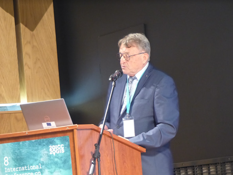
In the first keynote of the conference, Prof. Milan Konecny replaced president Timothy Trainor by his keynote speech titled: The United Nations Challenges for SDGs and Sendai Framework: The Role of Cartographers, where U.N. efforts, including Sendai Framework and GGIM and DBAR activities have been strongly highlighted (June 21).

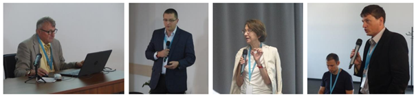
Seminar on Disaster Risk Reduction – Solutions and Innovations organized in cooperation with ICA Commission on Cartgraphy in Early Warning and Crisis Management and Department of Geography, Masaryk University, Brno, Czech Republic was based on physical and video presentations (June 21). The seminar began with a keynote by commission vice-chai Milan Konecny (with co-authors Temenoujka Bandrova (Bulgaria), Petr Kubíček, Zdeněk Stachoň, Radim Štampach (Czech Republic). Jie Shen (China), Irina Rotanova (Russian Federation), Jan Brodský and Pavel Špulák (both Czech Republic), titled: Strategies of Disaster Risk Reduction on the Background of U.N. GGIM and Digital Belt And Road Efforts. Keynote was followed by other papers: Krzysztof Pokonieczny (Poland): Methodology of Developing The Dynamic Maps of Passability, Milaim Sylka (Kosovo (video presentation), Pavel Špulák, Bohuslav Ježek and Zdeněk Červenka (Czech Republic): GIS, Big Data and Mapping in Disaster Management Charts and Maps for Statistical Yearbooks of Fire and Rescue Service of the Czech Republic, Ekaterina Podolskaia, Anastasia Nekrasova, Tatiana Prokhorova, Aleksey Trubenkov and Olga Selyutskaya (Russian Federation): Web-Gis Projects at the Institute of Earthquake Prediction Theory and Mathematical Geophysics, Russian Academy of Sciences (video presentation).

Topics of the seminar were:

  • DRR U.N. Sendai Agenda: Challenges for Cartography and Geoinformatics
  • Cartographic Support for Emergency Evacuation
  • Virtual Reality and Disaster Preparedness
  • VGI Possibilities in DRR
  • Threats Caused by Agricultural Operations

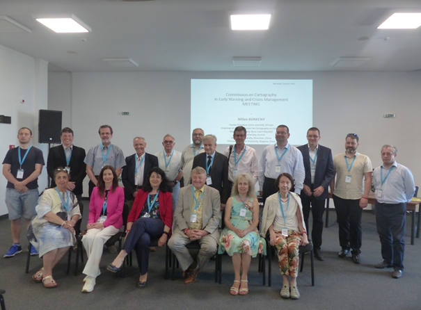
Around 20-25 people particiated in the meeting of the Commission On Cartography on Early Warning and Crisis Management on June 22. They were explained the areas that the commission deals with, especially with regard to the initiatives of the Sendai Framework, but with an emphasis on the scientific and applied development of cartography. The meeting was also attended by ICA vice-president Prof. T. Bandrova, ISDE president Dr. A. Annoni, chairmen of other ICA commissions associate professors O. Čerba, or Jesus Reyes, ESRI representative Dr. N. Land and many others. The discussion results in a recommendation to create a publication on the role of cartography in DRR supplemented by representative outputs promoting cartography itself, unifying terminology or analyzing the potential of cartography in solving a selected disaster.

Tag:

News of the ICA Commission on Cartography for Early Warning and Crisis Management

The ICA Commission Cartography for Early Warning and Crises Management (CEW&CM) has successfully held a pre-conference workshop and two sessions at the ICC 2021 in Florence.

The workshop aimed at combining and addressing as comprehensively as possible the current Big Data issue, cloud computing, and latest trends and technologies in cartographic visualization in the field of early warning, crisis management and Disaster Risk Reduction.

The growth of Internet-based services and cloud services is leading and has led to a comprehensive view on data characterized by the terms Volume, Variety, Velocity and Veracity. The emergence of very large, unstructured, dynamic, time-varying data sets including associated measures of quality (so-called Big Data) offers considerable challenges for cartography which – if processed and visualized
correctly and appropriately for the target audience – can provide significant new insights for information, situation analysis, decision making and alternative actions. Experts from different, interdisciplinary directions discussed different concerns from the above mentioned topics.

The full report of the workshop can be accessed here: https://rimma.org/cartography-for-early-warning-and-crisis-management-report

Follow-up

Further meetings (virtual, hybrid, physical) are planned within the ICA and within the Commission Cartography in Early Warning and Crisis Management. Some of them are relevant for LAINAT regarding exchange of ideas, further development of warning platforms, cartography and platforms as communication tools, as well as regarding the composition of the ICA Commission Cartography in Early Warning and Crisis Management:

  • Eurocarto 2022, 19-21.9.2022 in Vienna Austria, organized by the Austrian Cartographic Commission (ÖKK), the German Cartographic Society (DGfK), the Swiss Cartographic Society (SGK) and the British Cartographic Society
  • 31st ICC 2023, 13-18 August 2023, Cape Town South Africa

Announcement of Seminar on Intelligent Emergency Surveying and Disaster Risk Reduction Mapping Service

Since the countries in Asian regions are currently facing the challenges of frequent disasters, it is more important to fast and intelligent surveying and mapping. In order to improve the capability of emergency mapping support of Asian countries in response to sudden disasters, the Chinese Academy of Surveying and Mapping organizes the Seminar on Intelligent Emergency Surveying and Disaster Reduction Mapping Service, which focuses on exploring new theories, technologies, methodologies and products for intelligent emergency surveying and disaster reduction mapping services because of the significance of rapid perception, accurate measurement, intelligent analysis and forecasting and warning of geospatial information in the process of natural disasters and urban emergency response management. This seminar would provide a technical exchange platform for improving intelligent emergency surveying and disaster reduction mapping in developing countries in Asia.

Time and Location

  • Time: December 10–12, 2019
  • Location: Huandao Tide Hotel, Haikou, Hainan, China

Conference Theme

  • Disaster Management and Emergency Preparedness, Prevention, Alert, Response and Mitigation
  • Multi-Dimension Disaster Information Processes Intelligent Modelling, Applications and Services
  • Geospatial Analysis and Data Mining
  • Intelligent and self-adaptive Disaster Cartography
  • Disaster Risk Analyses and Mapping Using Social Big Data
  • Mobile Disaster Cartography
  • Disaster Big Data Processing and Sharing
  • Remote Sensing Technologies and Applications for Disaster-related Cartography
  • Adaptive Emergency Positioning
  • Intelligent Management of Disaster Models

Participants

Nearly 50 experts from China, Russia, Poland, Switzerland, and Japan will attend the seminar of Intelligent Emergency Surveying and Disaster Reduction Mapping Service (five foreign experts are planned).

Organization

The event is organized by the ICA Commission on Cartography in Early Warning and Crises Management and the Chinese Academy of Surveying and Mapping.

Co-organized by the Hainan Administration of Surveying Mapping And Geoinformation, Chinese Society for Geodesy Photogrammetry and Cartography Instrument and Equipment Committee

Schedule

  • 10 December: Registration
  • 11–12 December: Opening Ceremony, Report Exchange, Technical Visit
  • 13 December: Return

Contact

Announcement of the Pre-ICC Workshop on Disaster Risk Reduction (DRR) Challenges for Cartography in Big Data Era

The Commission on Cartography for Early Warning and Crises Management (CEW&CM) is organizing a pre-conference activitiy of ICC2019 in Tokyo and Tsukuba on July 13–14, 2019.

Structure & Topics

Saturday, July 13, 10:00–18:00, Tokyo, Kokusai Kogyo co., Ltd., Conference Hall

  1. Research Agenda of Cartography for DRR
  2. Public and private partnership in the field of cartography to realize DRR

Subtopics:

  • 2D&3D dynamic visualization for disaster process display
  • Interactive visualization method based on the disaster mechanism model
  • Spatial cognition and map design for indoor emergency mapping

Sunday, July 14, 11:00–17:00, Tsukuba, GSI, Museum Conference Hall

  1. Innovation of geospatial information technology to cope with disaster
  2. International cooperation in cartography for DRR
  3. New trends in Cartography for DRR

Subtopics:

  • Maps for decision support system
  • Smart cartography
  • Adaptive cartography
  • UX-design
  • Virtual Geographic Environment

Participants are also invited to propose topics connected with activities of our commission as well as topics of the Tokyo and Tsukuba workshop.

Organization of the event

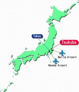
On Saturday July 13 the workshop in Tokyo will be held with the kind help of one of the leading surveying and mapping companies Kokusai Kogyo Ltd. which will provide their conference room and personally endorsed our event by its Chairperson and CEO Ms. Sandra WU. Keynote presentation on behalf of the company will be focused on the role of the private sector for tackling disasters.

On Sunday July 14th Workshop will be held in the Museum building of the Geospatial Information Authority (GSI) of Japan, endorsed by Mr. Shigenobu KAWASAKI, GSI Director General. The keynote will be oriented for the role of GSI in disaster solving activities.

Instructions about transport to both places is available on the workshop website

Abstracts

Information about abstracts formats are available on the workshop website. All abstracts will be blind-reviewed and the best of them will be recommended as papers for high quality journals.

Contacts

Invitation to the ICA Symposium on Early Warning and Crisis Management in the Big Data Era

The ICA Symposium on Early Warning and Disaster Risk Management for Urban Areas in Big Data Era is being reconvened following the success of the previous meetings. This series of symposiums aims to bring together leading academic scientists, researchers and domain experts to share their research results on all aspects of Early Warning (EW) and Crises Management (CM). Recent major disasters such as earthquakes, floods, hurricanes and landslides have resulted in huge losses in terms of human life and property destruction in urban areas. Therefore, policies, mechanisms and solutions to handle the increasing risk of disasters is urgently needed. Organizers would like to provide an interdisciplinary platform for researchers, practitioners and educators to discuss the most recent innovations, trends, challenges and practical solutions of EW and CM for Urban Areas in the Big Data Era.

The event will be held on 1–3 December 2018 at Shenzhen University, Shenzhen.

The final program can be downloaded here.

Further details can be found on the conference website: conf.fishmap.site

Invitation to the 7th International Conference on Cartography & GIS

7th International Conference on Cartography & GIS

7th International Conference on Cartography & GIS and the Seminar with EU cooperation on Early Warning and Disaster Management will be held during 18–23 June 2018 in Sozopol, Bulgaria. A special session “Digital Earth for Smart Solutions” supported by the International Society for Digital Earth will be part of the conference.

The event will be held during the Bulgarian Presidency of the Council of the EU, 2018.

Please find all details and important dates on the conference website: iccgis2018.cartography-gis.com

 
Welcome to Sozopol, Bulgaria

Tag:

Invitation to the ICC Joint Pre-Conference Meeting on Disaster Management, Big Data, Services, and Cartographic Representation

Click here to download the program as PDF

The ICA Commission on Cartography in Early Warning and Crises Management (CCEW&CM) and GEO (Group of Earth Observations) are organizing a joint workshop within the activities of the 28th International Cartographic Conference.

  • Location: Marriott Wardman Park Hotel, Washington, DC
  • Date: Sunday, July 2, 8.30am–6pm
  • Cost: 30 USD
  • Registration: via icc2017.org; also on-site registration starting at 7.30am in front of the workshop room

The final program can be downloaded here.

Milan Konecny, ICA CCEW&CM Commission Chairman, sent us the following details on the event:

You can see that in cooperation with GEO we arranged topic speakers leaded by Ms. Barbara Ryan, The GEO Secretariat Director, and Mr. Craig Fugate, former FEMA (USA) administrator. Keynotes deal with better, faster and smarter solutions in Big Data Era and also with international collaboration and hyper-partnering for Disaster Risk Reduction. Also research agenda of  the ICA CCEW&CM will be presented by commission chairman.

We also invited  specialists and experts in cartography and GI sciences and remote sensing, investigating various topics connected with workshop agenda, such as: problems with help of  geospatial information for disaster risk management, investigation on positioning technologies for emergency rescue, cartographic generalization and visualization  for disaster  management response, isaster risk, impact and recovery mapping supported by data and information from  Space, geodisasters for capacity building dealing with  Big Data, from satellites, drones and others, to products, attempts of  new Paradigm to access and interact with disaster related data services, and last but not least using data and creating and designers of new approaches inside the research frontiers efforts like Smart Cities or Big Data, from Japan, USA, P.R. of China, Czech Republic, Bulgaria, Chile, South Africa.

As inspiring are expected also speeches from important organizations dealing with early warning, crises management and civil protection, like NASA, World Bank and U.S. Geological Survey.

All research agenda of the workshop would like to contribute to the agenda defined by Sendai U.N. Conference for Disaster Risk Reduction (DRR).

Contacts: 

An overview over the ICC2017 Pre-Conference Workshops

white-house-451544_1920-1180x450

Many ICA commissions use the days before the ICC conference for dedicated workshops on their fields of research. This year, the following workshops will take place:

Charting the Cosmos of Cartography: History – Names – Atlases

Meeting on Maps & the Internet, Ubiquitous Mapping and Education & Training

Mapping Tools for Non-Mapping Experts: Incorporating Geospatial Visualization Tools in Libraries

Different Fields – One Cartography

Supporting sustainable development with geoinformation management and modern maps: things you hardly consider

Workshop on Maps & Emotions

Workshop on Spatial Data Infrastructures, Standards, Open Source and Open Data for Geospatial (SDI-Open 2017)

Workshop on Generalisation and Multiple Representation

Symposium on Location-Based Social Media and Tracking Data

Critical Review on Using Developable Surfaces in Map Projections Theory & Standardization in Map Projections

  • Date: July 2
  • Location: Marriott Wardman Park Hotel, Washington, DC
  • Involved commission: Map Projections

Disaster Management, Big Data, Services and Cartographic Representation

Preserving Map Production Methodology Information

Updates by the Commission on Cartography in Early Warning and Crisis Management

There are two upcoming events by the ICA Commission on Cartography in Early Warning and Crisis Management (CEW&CM):

The first one is a Seminar with EU Cooperation on Early Warning & Disaster / Crisis Management Topics as a part of the 6th International Conference on Cartography & GIS which will be held on 13–17 June 2016, Albena, Bulgaria, organized by the Bulgarian Cartographic Association and several ICA commissions.

big-data-early-warning

The second upcoming event is the International Conference on Cartographic Visualization of Big Data for Early Warning and Disaster / Crisis Management (EW&CM): Methodology, Techniques and Applications, organized by the Department of Geography of the Nanjing Normal University and the ICA Commission Cartography for Early Warning and Crises Management, 27–31 October 2016 in Nanjing, China.

Both events welcome cooperations with other commissions.

– Milan Konecný
Chair of the ICA Commission on Cartography in Early Warning and Crisis Management

Invitation to the 6th International Conference on Cartography & GIS

iccgis2016_Banner_620x350px_RGB

6th International Conference on Cartography & GIS
& Seminar with EU cooperation on Early Warning and Disaster/Crisis Management

Albena, Bulgaria, 13–17 June 2016

After very successful events in 2006, 2008, 2010, 2012 and 2014, the 6th edition of the International Conference on Cartography and GIS (ICC & GIS) is organized in Bulgaria.

The aim of the conference is to collect knowledge and share experience about the latest achievements in the field of cartography and GIS. Particular attention is paid to the important European region – the Balkan Peninsula. Last conferences were very influential for public administrations and we would like to enhance this trend also in 2016, when the situation in Europe and especially in Balkan countries is very complicated, e.g. facing the immigrant crises could be improved with support of our technologies.

The ICC & GIS conference is organized by the International Cartographic Association (ICA), the Bulgarian Cartographic Association and the University of Architecture, Civil Engineering and Geodesy, Sofia, Bulgaria.

As a part of the conference several other events will be held during 13–17 June:

Deadlines

  • Deadline for abstract submission: 10 January 2016
  • Payment of early registration fee: 29 January 2016
  • Final full paper submission and payment of regular registration fee: 1 May 2016

Proceedings will be registered in SCOPUS and Web of Science.

Conference website

The Call for Papers can be found on iccgis2016.cartography-gis.com, including information on registration, programme and accommodation.

Proceed to the conference website

Tag: ,
rawboned-refined