Welcome to the International Cartographic Association
Welcome to the website of the International Cartographic AssociationGet to know the new ICA Executive Committee for the term 2023-2027
Welcome to the website of the International Cartographic Association
Get to know the new ICA Executive Committee for the term 2023-2027

New venue for Pre-ICC workshop SDI-Open 2019

The ICA Commission on SDI and Standards is very glad that the SDI-Open 2019 pre-conference workshop (Monday, 15th July 2019) is now easily to reach from the ICC conference.

The new location is Room Mars, Miraikan – National Museum of Emerging Science and Innovation. More details can be found here and on OpenStreetMap.

Registration is still possible here.

The updated and extended programme is ready for download.

Invitation to Pre-ICC Workshop on Spatial Data Infrastructures, Standards, Open Source and Open Data for Geospatial (SDI-Open 2019)

SDI-Open 2019, the pre-conference workshop on spatial data infrastructures, standards, open source and open data for geospatial will be held on 15 July 2019 in Tokyo, Japan, immediately before the 29th International Cartographic Conference. The workshop is jointly organized by the Commission on SDI and Standards, the Commission on Open Source Geospatial Technologies and the Commission on Map Production & Geoinformation Management.

Mr Reese Plews from Japan, who chairs the ISO/TC 211 Terminology Maintenance Group, will make a special contribution with a presentation about the standardization and harmonization of geospatial information terminology in ISO standards, including the maintenance of a multi-lingual register of terms.

Other presentations on the program cover topics, such as international geospatial information standards and interoperability, UN-GGIM Europe and GeoSTAT requirements for spatial data integration, academic SDIs and open science, open source components for service-oriented mapping, and supply chains.

The day is concluded with an interactive and collaborative mapping session in OpenStreetMap. Delegates should bring their own laptops! Details, including a link for registration, are available on the website of the Commission on SDI & Standards at http://sdistandards.icaci.org/

The detailed program can be found on https://sdistandards.icaci.org/program-sdi-open-2019/.

An overview over the ICC2017 Pre-Conference Workshops

white-house-451544_1920-1180x450

Many ICA commissions use the days before the ICC conference for dedicated workshops on their fields of research. This year, the following workshops will take place:

Charting the Cosmos of Cartography: History – Names – Atlases

Meeting on Maps & the Internet, Ubiquitous Mapping and Education & Training

Mapping Tools for Non-Mapping Experts: Incorporating Geospatial Visualization Tools in Libraries

Different Fields – One Cartography

Supporting sustainable development with geoinformation management and modern maps: things you hardly consider

Workshop on Maps & Emotions

Workshop on Spatial Data Infrastructures, Standards, Open Source and Open Data for Geospatial (SDI-Open 2017)

Workshop on Generalisation and Multiple Representation

Symposium on Location-Based Social Media and Tracking Data

Critical Review on Using Developable Surfaces in Map Projections Theory & Standardization in Map Projections

  • Date: July 2
  • Location: Marriott Wardman Park Hotel, Washington, DC
  • Involved commission: Map Projections

Disaster Management, Big Data, Services and Cartographic Representation

Preserving Map Production Methodology Information

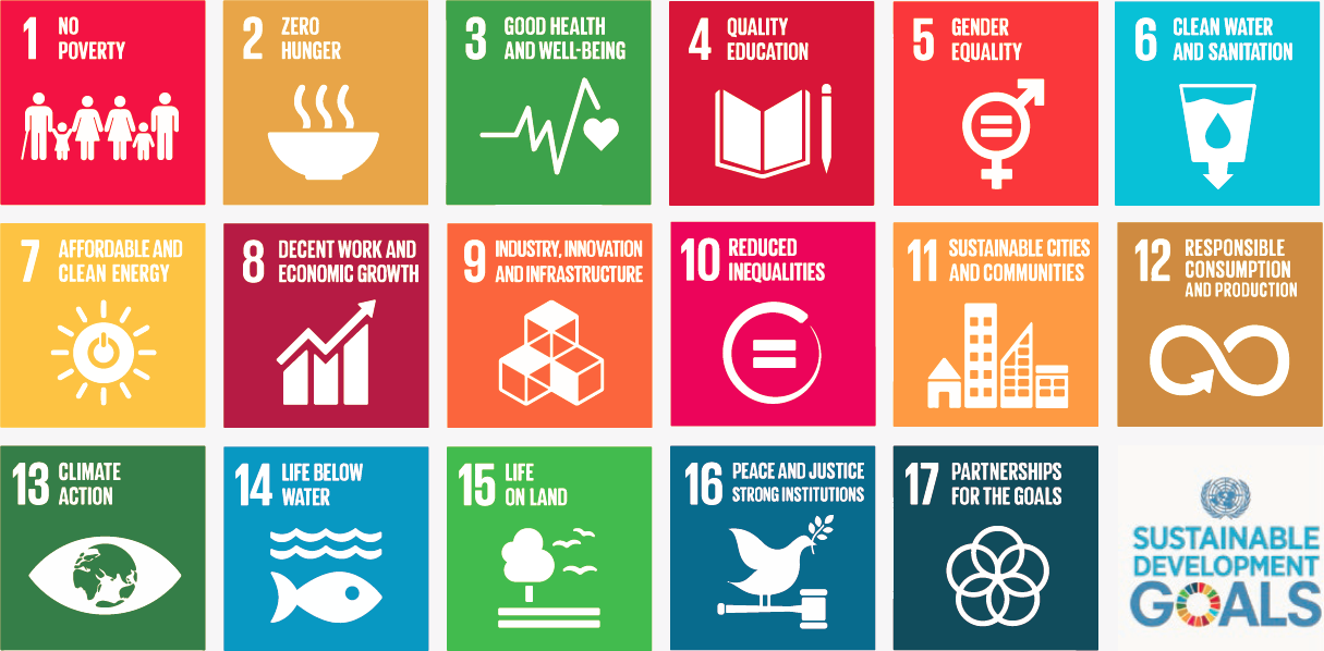
President’s Blog: A map perspective on the sustainable development goals

The Sustainable Development Goals, officially known as Transforming our world: the 2030 Agenda for Sustainable Development are a UN Initiative. Official website: https://sustainabledevelopment.un.org

In the light of the International Map Year (IMY), the ICA and its commissions are highlighting the value of cartography by “mapping” the UN sustainable development goals.

In the past months, a set of posters has been created, one for each sustainable development goal. They do not map the goals and their target based on indicators as such. The poster series tells the story of cartographic diversity, of mapping options, and of multiple map perspectives. Each of the goals has been mapped from a particular perspective by different ICA Commissions. All posters have a short take-home-message that should make one aware of particular strengths of the map.

The posters as well as the catalog for the poster exhibition can be found on icaci.org/maps-and-sustainable-development-goals

A huge thank you to all commissions involved and to Wim Feringa from ITC for the poster design and production. Let’s make the world a better place with maps!

Menno-Jan Kraak
– President of the International Cartographic Association

Save the Date & Call for Papers: 6th International Symposium on the History of Cartography

dubrovnik_History-of-Cartography1

The Dissemination of Cartographic Knowledge:
Production – Trade – Consumption – Preservation

Dubrovnik (Croatia), October 13–14, 2016

The ICA Commissions on the History of Cartography, Map Production & Geoinformation Management, Use, User & Usability Issues and the Institute of Social Sciences Ivo Pilar (Zagreb, Croatia) invite the submission of abstracts for papers and posters for a joint conference in Dubrovnik (Croatia), the medieval port city on the coast of the Adriatic and UNESCO World Heritage Site. The symposium and planned optional excursions are open to cartographers, geographers, historians, map collectors, academics and everyone with an interest in the diverse aspects of the history of cartography.

The Call for Papers can be found at the conference website histacartodubrovnik2016.com, including information on registration, programme, transportation and accommodation.

Questions regarding the conference and call for papers can be send to: Dr. Mirela Altic

dubrovnik

Tag: ,

Joint ICA meeting in Vienna, November 8–9

ica-commission-meeting

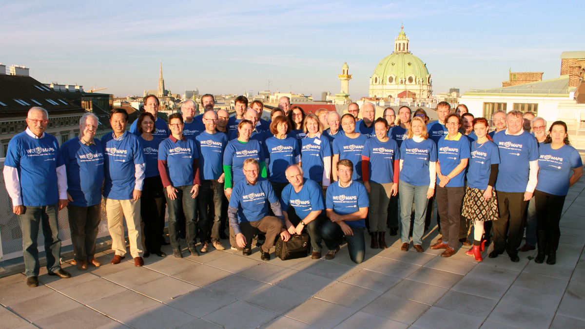
All chairs and vice-chairs of the ICA commissions and working groups were invited to join an ICA meeting in Vienna on 8–9 November 2015 to plan and discuss their activities for the term 2015–2019. 46 chairs, vice-chairs and members of the executive committee followed the invitation and spent two intensive workshop days at Technische Universität Wien.

Meeting participants

Commission chairs and vice-chairs

Working Group International Map Year

Executive Committee

Website

More photos of the workshop can be found on the ICA Facebook page.

Get to know the new ICA commissions for the term 2015–2019

27 commissions and 3 working groups were elected for the term 2015–2019 by the ICA General Assembly 2015. We are currently in the process of updating the website to reflect these changes. Also some of the commissions are still preparing or updating their websites. In the meantime, we invite you to have a look at the short “Commissions at a glance” presentations, which the new commissions chairs gave during ICC 2015:

Tag:

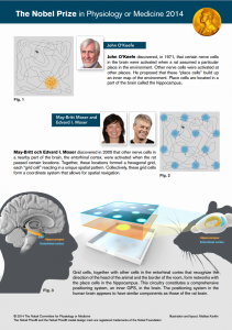
A place for maps in the human brain

Figure Nobel Prize in Physiology or Medicine 2014

Figure by Mattias Karlén

The 2014 Nobel Prize in Physiology or Medicine honors the discoveries of cells that constitute a positioning system in the brain. These efforts are crucial for many research agendas in the cartographic community concerned with cognitive processes and impact-oriented maps.

Recent investigations with brain imaging techniques, as well as studies of patients undergoing neurosurgery, have provided evidence that place and grid cells exist also in humans. In patients with Alzheimer’s disease, the hippocampus and entorhinal cortex are frequently affected at an early stage, and these individuals often lose their way and cannot recognize the environment. Knowledge about the brain’s positioning system may, therefore, help us understand the mechanism underpinning the devastating spatial memory loss that affects people with this disease.

The discovery of the brain’s positioning system represents a paradigm shift in our understanding of how ensembles of specialized cells work together to execute higher cognitive functions. It has opened new avenues for understanding other cognitive processes, such as memory, thinking and planning.

Sources:

Second Symposium on Service-Oriented Mapping 2014

– Update: SOMAP 2014 is merged with the LBS 2014 symposium and will take place in Vienna, Austria, from 26–28 November 2014. Please find all details on the SOMAP website: somap.cartography.at –

The International Cartographic Association (ICA) is pleased to invite you to the Second International Symposium on Service-Oriented Mapping (SOMAP) in Potsdam from 6–8 October 2014 in Vienna, Austria from 26–28 November 2014.

Logo SOMAP2014

This symposium is coorganised by four ICA Commissions:

The call for papers is ongoing and registration has started at http://somap.cartography.at

Geospatial data and services are the main building blocks for geospatial infrastructures and fundamental to service-oriented mapping and realtime applications. Geospatial infrastructures make use of different paradigms: maintaining, sharing and use (instead of collect and own). Developments in these paradigms are leading to evolutions in availability and accessibility of geospatial data and services coupled with the added value of geospatial products and applications in the modern geospatial production environment.

Geospatial trends are constantly growing and developing such as sensor networks, realtime processing, volunteered geographic information, open governmental data, in-situ geospatial processing and striking visualization techniques creating many new possibilities but also new restrictions and problems based on massiveness, heterogeneity and contextual flexibility. Challenges like handling big data, aggregate different sources, standards for a homogenuous data, and disappearing sources/content are growing.

SOMAP2014 is a venue that brings together experts from research, government, non-governmental organisations, standardization bodies and industry to present, document and discuss trends in service-based mapping, which covers delivery, processing, integration, analysis, collaboration as well as visualization of geospatial data and services.

Markus Jobst
ICA Commission on Map Production and Geobusiness

Commissions at a glance
During ICC 2013 all commission chairs presented their commissions in a speed presentation. You can check out the presentation slides below (or via our ICC 2013 sub-page).

rawboned-refined