Welcome to the International Cartographic Association
Welcome to the website of the International Cartographic AssociationGet to know the new ICA Executive Committee for the term 2023-2027
Welcome to the website of the International Cartographic Association
Get to know the new ICA Executive Committee for the term 2023-2027

Invitation to ICC 2015 Pre-Conference Symposium at the Fluminense Federal University in Niteroi, Brazil

niteroi3

The ICA Commissions on Cartography and Children, Maps for Blind and Visually Impaired People, Planetary Cartography and Cartography for Early Warning and Crisis Management have the pleasure to invite you to participate in our Joint ICA Symposium entitled “Cartography Beyond the Ordinary World”. The event will be held in the Institute of Geosciences of the Fluminense Federal University in Niteroi (Brazil) during the 21st and 22nd of August, 2015 and it is organized within the International Map Year as well as the activities previous to ICC 2015 in Rio de Janeiro.

More detailed information can be found on the symposium website: http://niteroi2015.elte.hu

All the colleagues involved in the organization of the event hope that the symposium will be an excellent occassion to exchange opinions and experiences about the common points in the work of our commissions. One of our main aims is to bring an opportunity to connect the international academic research and educational community with the Brazilian scientific potential in each of our research fields to foster a professional, constructive and innovative dialogue. It is open not only for commission members, but for all those colleagues across the wide spectrum of research, teaching and other activities covered by the world of cartography.

Looking forward to meeting you in Niteroi next August!

On behalf of the four participating commissions,
Jesus Reyes

Joint commission meeting children/planets

cccmeeting2014A day before beginning the 9th International Workshop on Digital Approaches to Cartographic Heritage, the Commission on Cartography and Children will have a meeting together with the Commission on Planetary Cartography. There will be a special presentation by former ICA President Bengt Rystedt representing the Working Group on the International Map Year.

All of you are invited to participate!

For more information, please see the Preliminary Programme.

Planetary Cartography for Children

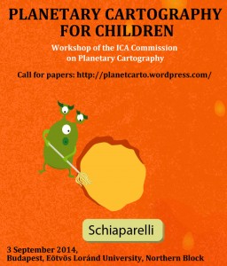
call4papersThe ICA Commission on Planetary Cartography‘s annual meeting will be held in Budapest, on 3 September 2014, one day prior to the 9th ICA Workshop Digital Approaches to Cartographic Heritage.

The meeting will be accompanied with a one-session workshop on the topic Planetary Cartography for Children.

Read the Call for papers here!

Participation in the meeting and workshop is free.

Commissions at a glance

During ICC 2013 all commission chairs presented their commissions in a speed presentation. You can check out the presentation slides below (or via our ICC 2013 sub-page).

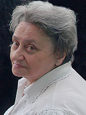
Obituary: Kira Borisovna Shingareva (1938–2013)

Kira B. Shingareva (Photo by Henrik Hargitai)

Kira Borisovna Shingareva (Photo by Henrik Hargitai)

We are very sad to inform you, that our colleague Kira Borisovna Shingareva passed away on Sunday, 15 September 2013.

The following text was taken from the book “Map Worlds: A History of Women in Cartography” by Will C. van den Hoonaard (Waterloo, ON: Wilfrid Laurier University Press, 2013, pp. 149–151):

Kira B. Shingareva, professor at Moscow State University for Geodesy and Cartography was Principal Scientist at the Planetary Cartography Laboratory and the Laboratory of Comparative Planetology at the Institute of Space Researches at the Academy of Science. She was one of the most eminent cartographers of extra-terrestrial bodies and was among the first people to succeed in mapping the “dark” (reverse) side of the Moon. She headed the Commission on Planetary Cartography of the International Association of Cartography.

Shingareva was born in 1938 in Russia. Her mother died when she was five years old. Her father was a chemical engineer. It was her father who suggested, at a critical point in her studies, that she should study mathematics in the university’s astronomical curriculum. She admitted that “she is forever grateful to him for that, loving him dearly.”

She studied in Dresden, Germany where she graduated from the Technical University in 1961 (at the age of 23), obtained a PhD in 1974, and a Dr of Science in 1992. Before then, she had gone to the University of Moscow. She wanted to become a mathematician and to study the theory of mathematics. During the exams she did not have enough points to be allowed to continue with mathematics (she just missed it by 1 point). As a consequence, she went to another university which included mathematics in the astronomical curriculum.

After having returned to Moscow from Dresden in 1962, she connected with a friend who was heading the Moon project, and he asked her to work for him at the Laboratory of Comparative Planetology at the Institute of Space Researches under the aegis of the Academy of Science. In October 1959, the Soviet Luna 3 had already succeeded in photographing the Moon’s far side. Three years after her arrival at the Institute, then at the University, she participated, in 1965, in the National Space program and mapped the Moon, Mars, Phobos, and Venus. As a 27-year-old, she was very excited to work on the project. Her main task was to select the landing sites for the moon probes. On 3 February 1966, Luna 9 was able to safely land on the Moon (the first-ever to do so) and take surface close-up images in the Oceanus Procellarum; Luna 13 was able to follow up on these images on 24 December in the same year (Williams, 2005: 2,3).

A turning point early in her career was the 1967 Congress of the International Astronomical Union (IAU) where she presented, for the first time, the nomenclature of the reverse side of the Moon. She was then only 29 years old. The Soviet presentation of Atlas Obratnoi Storony Luny, Ghast 2, 1967 (Atlas of the Far Side of the Moon, Part 2) at the Union failed on several accounts. Shingareva claimed, “the images were of bad quality and there were mistakes.” Ewen A. Whitaker (1999: 176), who was closely involved with the proceedings, noted that the map and a list of new names seemed like a fait accompli. Moreover, some 45% of the names were Russian. In any case, when the USSR delegation presented their nomenclature of the Moon, they faced opposition from the United States National Committee on Lunar Mapping and Nomenclature. It suggested that only numbers should be assigned to the 450 features on the reverse side of the Moon and that “we should be very conservative in assigning names,” and “use names of permanent renown” (Commission de la Lune, 1967: 104).

According to a participant in the tri-annual meetings of the IAU congresses in the 1960s, the controversy started a year earlier, in 1966, when Dr. A. Mikhailov of the USSR Academy of Science sent a letter to Dr. D. Menzel, President of the Lunar nomenclature Commission. Dr. Mikhailov suggested that “names of poets, painters, composers, etc. be used to identify the newly imaged craters on the Zond 3 photos” (Letter from Ewen A. Whitaker to W.C. van den Hoonaard, 28 March 2011). Later that year, the USSR published a list of 153 new names, of which some 66 were Russian, by-passing the rules of the IAU Lunar Nomenclature Committee.

When she presented her map, it became evident that the standards that applied to the near side of the Moon, could not apply to the far side. The near side showed the south pole on top of the map; the far side would show it at the bottom of the map. And where would “east” and “west” be (Whitaker, 1999: 173)? The United States scientists already had much information from their own lunar orbital photographic missions (1966–1967) involving 600,000 high-resolution images (Lunar and Planetary Institute, 2010), but the Soviets wanted her to select craters and name them. The scientists from Europe agreed with the approach taken by the Russian delegation.

After Shingareva had returned to Moscow, a United States colleague sent her a map with a small crater named “Kira” in recognition of her remarkable achievements. She always had that map on her wall. All of her grandchildren know about the Kira crater. She fondly recounts the story of a 102-year-old Russian lunar scientist, naming something after him and believing that he was dead. Soon, she received a letter from him, saying, “I’m very much alive!”  It is the International Commission of Nomenclature of the IAU that then ruled that one could now name craters after people who are over 100 years old! Shingareva was busy for 10 years at the USSR Academy of Sciences, participating in the Moon Exploration Project until 1977.
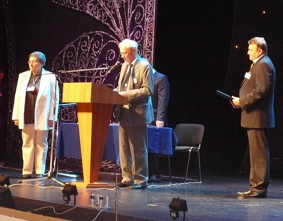
Kira B. Shingareva receiving an ICA award in 2007

Kira B. Shingareva receiving the ICA Honorary Fellowship in 2007

More than 150 publications to her name, including “Atlas of Terrestrial Planets and their Moons” and “Space Activity in Russia – Background, Current State, Perspectives” (Karachevtseva et al., 2003), she was appointed as co-chairman of ICA Planetary Cartography Working Group, 1995–1999, Chair of the ICA Planetary Cartography Commission, 1999–2003, and, according to the Proceedings of the International Cartographic Conference, “managed such projects as a series of multilingual maps of planets and their moons, glossary on planetary cartography, and specialized map-oriented DB on planetary cartography in the frames of commission activity” (Shingareva, Karachevtseva, and Cherepanova, 2007). On the initiative of the Moscow State University for Geodesy and Cartography (MIIGAiK), several groups in Europe involving Shingareva were working on a Multilingual Planetary Map Series (Hargitai, 2004:150).

More recently, Shingareva has been trying to bring her graduate students to more earth-bound projects such as bringing her experience to bear, in 2006, on finding solutions related to the Moscow Megacity Road and Transport Complex (Sinitsyna and Shingareva, 2006).

Shingareva is well recognized. She was elected Honorary Fellow of the International Cartographic Association (ICA Newsletter, Dec. 2007: 5).

Please also read In Memoriam Kira B. Shingareva by her colleagues from the Commission on Planetary Cartography.

Programme of joint symposium “Sharing Knowledge”

Pre-Conference Symposium to ICC2013
23 August 2013 @ the Dresden University of Technology, Germany

The ICA Commissions on Cartography and Children, Education and Training, Maps and Graphics for Blind and Partially Sighted People and Planetary Cartography have the pleasure to invite you to a one day joint symposium on August 23.

The aim of the symposium – as expressed by the title – is to give an opportunity to the members of the four commissions (and participants in general) to share and learn about the research in the topics covered by the commissions during the last years. This will be a one-day programme divided into four sessions, each of them dedicated to one of the participating commissions.

Please find the final programme on the symposium website: http://lazarus.elte.hu/jointsymposium2013/

If you have any question in relation to the event, please contact José Jesús Reyes Nunez.

[ More pre-conference events and activities can be found at https://icaci.org/icc2013/ ]

Invitation to joint symposium “Sharing Knowledge”

Pre-Conference Symposium to ICC2013
23 August 2013 @ the Dresden University of Technology, Germany

The ICA Commissions on Cartography and Children, Education and Training, Maps and Graphics for Blind and Partially Sighted People and Planetary Cartography have the pleasure to invite you to a one day joint symposium on August 23.

The aim of the symposium – as expressed by the title – is to give an opportunity to the members of the four commissions (and participants in general) to share and learn about the research in the topics covered by the commissions during the last years. This will be a one-day programme divided into four sessions, each of them dedicated to one of the participating commissions.

The Call for Papers is open until April 26.
Please visit the symposium website for more information: http://lazarus.elte.hu/jointsymposium2013/
If you have any question in relation to the event, please contact José Jesús Reyes Nunez.

[ More pre-conference events and activities can be found at https://icaci.org/icc2013/ ]

Extraterrestrial lab supporting Russian space program

Report from the 2012 Moscow meeting of the ICA Commission on Planetary Cartography

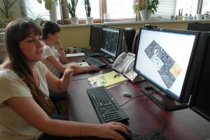
Evgeniia Gusakova explaining the DTM of the Lunokhod-1 landing site visualized in ArcScene; Ludmila Shishkina working on a Lunar photomosaic in ISIS (in the back).

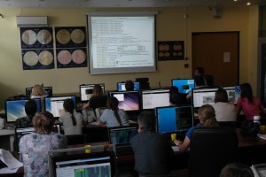
Training on how to use command line ISIS, one of the using software in planetary cartography and image processing.

Moscow State University of Geodesy and Cartography (MIIGAiK) is the oldest of Russian Universities (since 1779) that now has 8500 students and a staff of over 600. In 2010 the university created a new Laboratory for space research named as MIIGAiK Extraterrestrial Lab (MExLab) where cartographic support for future Russian planetary missions is provided.

Students studying at this lab are devoted planetary cartographers. “We came here because this way we can support our future space missions; and we can also work on past missions’ datasets that had not been processed or analyzed; however, many of the data recorded on magnetic tapes are lost by now. And there is always something new in space” – say Ludmila Shishkina and Natalia Kozlova, who work at MExLab. The activities are carried out in four groups: Cartography and mapping; Multispectral image processing; Photogrammetry; and Geodesy and Navigation.

The MExLab was established from a mega-scale three-year grant from the Ministry of Education and Science of the Russian Federation called “Measures to attract leading scientists to Russian Educational Institutions”. The winning joint proposal by Jürgen Oberst (DLR) and Kira Shingareva (MIIGAiK) was selected from 500 proposals in 2010. The subject of the proposal was “to develop infrastructure and capability for MIIGAIK to take a significant role in planning, execution and analysis of data from Russian planetary missions” and also to develop “job opportunities to attract young scientists and students to pursue careers in geodesy, cartography and planetary science”. “This is very important”, explains Kira Shingareva, leader of planetary cartographic activities at MIIGAiK, “because after the perestroyka, planetary cartography was not at all attractive to students. They went to other companies who could pay them. This is why there is a large gap between the old generation and the new one: there are no middle-aged experts. The consequences are even worst in the space industry, where the lack of expertise may lead to rocket failures”.

Now there are about 50 scientists, including about 30 young, PhD students and half last-year students working at MExLab. “When they get diploma, they can join the Russian space program and help it to get back on its feet” – says Jürgen Oberst, who is the scientific leader of the project and head of the MExLab Photogrammetry group. However, if everything fails, these students will still be able to find a job, since they are very well educated in terrestrial geodesy and cartography. But the head of MExLab, Vasiliy Malinnikov believes that the Russian Federation will support future space research works and young scientists could continue their studies.

They participate in diverse projects which they presented at the meeting of the ICA Commission on Planetary Cartography held at MIIGAiK: Alexander Lojkin is working on Enceladus limb profiles; Natalia Kozlova creates DTMs of Soviet landing sites on the Moon while Marina Baskakova is producing the maps of these sites; Maxim Andreev and Anton Bystrov are creating image processing support the selection of Luna Glob landing sites for which Alexander Kokhanov is creating topographic maps in GIS, Alexander Zharov and his brother Oleg Zharov are hard working on producing a control network  of more than 100 thousand manually selected control points for the 3D modelling of Phobos, Vasily Dmitriev is modeling  martian meteoroid streams, Bulgn Mukabenova and Svetlana Afanasyeva are making crater statistics for the Phobos, Maria and Ekaterina Karpunkina are making crater statistics for the Moon, Evgeniia Gusakova is working on Lunokhod-1,2  landing site maps, just to name a few of the ongoing projects at MExLab, three years after its foundation. The students are making an incredible job here, which is also a result of the tireless work of the all scientists the lab, says Irina Karachevtseva, who is the head of the Cartography Group of MExLab. Post doc scientists Dmitry and Denis Uchaev study gravity fields of Phobos and Deimos using fractal modeling approach. Irina Nadejdina and Anatoliy Zubarev are leading young scientists of Geodesy Group who investigate Io, Ganymede, Enceladus, Ida and the Moon. They make photogrammetry image processing using Photomod software (produced by Russian developers) and teach students to create DEMs and orthomosaics of these bodies, including cartographic support of future Russian missions to the Polar area of Moon (Luna-Globe and Luna-Resource). All scientists hope that there will be a future Russian mission to Phobos, one of the Martian satellites, and they work on it.

Group photo of the scientists and students, who participated in the commission meeting at MIIGAiK.

rawboned-refined