Welcome to the International Cartographic Association
Welcome to the website of the International Cartographic AssociationGet to know the new ICA Executive Committee for the term 2023-2027
Welcome to the website of the International Cartographic Association
Get to know the new ICA Executive Committee for the term 2023-2027

Call for Presentations: ICC 2023 Pre-Conference Workshop on Cartography and AI (MapAI)

The ICA Commissions on Visual Analytics and Cognitive Issues in Geographic Information Visualization are pleased to announce a Workshop on Cartography and AI (MapAI 2023) taking place on August 12, 2023 in Stellenbosch, South Africa before the ICC 2023.

Motivation

Cartographers have assessed the potential use of artificial intelligence for mapping for decades. Early work on expert systems explored AI as early as the 1980s (e.g., Buttenfield 1984; Fisher & Mackaness 1987; Brassel & Weibel, 1988; Johnson & Basoglu 1989). The AI tools of the time were limited by the (lack of) availability of computing power and data. More recently, as AI tools have become both more powerful and easier to use, a few cartographers and computer scientists have begun experimenting with artificial intelligence technologies to see how they might be applied to maps and mapping processes (e.g., Kang et al., 2019; Zhao et al, 2021; Christophe et al., 2022; Zhou et al, 2022; Santos et al., 2023). Others have made initial efforts to review the potential of AI technologies for cartography (Kang et al., 2022), laying out some possibilities and also some points of caution by identifying ethical issues these technologies raise and/or exacerbate. The 2022 launches of DALL·E 2, ChatGPT, and other AI platforms have caught the attention of the general public by making artificial intelligence technologies easy to use for a range of everyday tasks. Some cartographers have already put these to use for assisting their mapping practice (see, for example, https://www.youtube.com/watch?v=OCOpxy3wk-o). There is much more for cartographers to explore, including the potential impacts of the use of AI on map users’ and map makers’ cognitive processes (see Keskin & Kettunen, 2023 for an initial investigation).

In this workshop, we aim to bring together ideation and practical experimentation to collaboratively explore some of the potential and limits of current AI technologies for cartographic practice and map use.

Call for Presentations

The first half of our planned 1-day workshop will be for participants to present Lightning Talks. In 5 minutes presenters will showcase either one major challenge or one significant opportunity you see that intersects between AI and Cartography.

These presentations should focus on frontiers in cartographic research that intersect with AI tools or techniques, and creative/unorthodox approaches are welcomed. Work-in-progress is the intended target, versus projects that are already fully completed.

Example topics could include, but are not limited to:

  • Implications of deepfake maps and satellite images
  • Machine-learning / AI based map updating based on image input
  • AI-generated wayfinding directions
  • Geographic aspects of algorithmic bias
  • Automated means of iterating design elements in cartographic layouts
  • Explainable AI & mapping
  • Natural language interaction with maps
  • Mapping with ChatGPT, DALL-E, Midjourney, Stable Diffusion, etc…
  • Human-machine collaboration using maps

Workshop presentations will be used to motivate group discussions and hands-on experimentation in the second half of the planned 1-day workshop. We are excited to work together to push the limits of various AI mechanisms for cartographic design and inquiry, learning along the way about where the frontiers lie for future research and applications of AI in Cartography.

Submission Details

Please submit an abstract of <250 words that showcases either one major challenge or one significant opportunity that intersects AI and Cartography by May 15, 2023 to EasyChair.  All submissions will be reviewed by the workshop organizers for clarity and fit with workshop themes. A final workshop agenda including accepted talks will be communicated by June 23, 2023.

Venue & Workshop Logistics

This workshop will take place on August 12, 2023 in Stellenbosch, South Africa. If you are attending the ICC 2023 in Cape Town, Stellenbosch is roughly an hour away by Taxi/Private Car. We recommend staying in Stellenbosch for 1 or 2 nights if you prefer not to commute to/from Cape Town. Stellenbosch is famous for its wineries and there are many scenic hotels located on wineries nearby.

We will notify authors and publish a preliminary workshop schedule by June 23, 2023.

Organizers

  • Amy L. Griffin, RMIT
  • Anthony C. Robinson, Penn State University
  • Arzu Çöltekin, FHNW – University of Applied Sciences Northwestern Switzerland

Please find more information on the workshop website.

First Call For Papers: 2020 ICA Workshop on Analytical Reasoning for Cartography, Visualization, and Design


Date: Monday 14 September 2020 (ahead of GIScience 2020)
Location: University of Warsaw | Warsaw, Poland
Workshop website: http://carto-vis-workshop.uw.edu.pl/

Purpose

It has been 15 years since visual analytics was first established as the science of analytical reasoning facilitated by interactive maps and visualizations. Since then, new models have been proposed to understand cognitive reasoning processes, new technologies have been released to support interactive, mobile, and immersive mapping, and new methods have been developed to examine and evaluate user experiences with analytical support systems. We call for research papers in cartography, visualization, and allied design fields to capture the state-of-science on visuospatial analytical reasoning.

Analytical Reasoning goes beyond simply noticing a pattern, and invokes a complex set of processes that aim to explain what has been seen, or to predict what will happen next. Creating the conditions in which users are able to reason about spatial information is a difficult task, and there are many challenges to overcome. This workshop invites short reports on ongoing and emergent work that aims to tackle one of the many dimensions in cartography that relate to supporting analytical reasoning. Broadly speaking, we are seeking work that focuses on understanding users, their cognitive processes, and/or their interactions with visual representations and computational methods via maps or geographic visualization. We welcome research that tackles these and related problem areas through computational, representational, or contextual methodological lenses. This workshop will provide a forum in which new approaches and ideas can be discussed and where new research collaborations can be formed.
Early stage work is explicitly encouraged, especially by junior scholars or those who might be new to cartography.

This workshop represents the joint efforts of the University of Warsaw Department of Geoinformatics, Cartography, and Remote Sensing in collaboration with the International Cartographic Association Commissions on Cognitive Issues in Geographic Information VisualizationVisual Analytics, and User Experience (UX).

Format

We invite two kinds of contributions. First, we seek two-page short papers on completed research. Two-page short papers should be prepared using the CHI format, with accepted papers receiving 20 minutes for presentation and discussion. Second, we seek 150-word abstracts on work in progress or early graduate proposal ideas. Short abstracts will receive 5 minutes for a lightning talk presentation with discussion following all lightning talks. Select papers may be encouraged for expansion into a special journal issue, depending on participation.

Short papers and abstracts will be reviewed by two program committee members to gauge appropriateness for the workshop.

Relevant topics include:

  • Geovisualization and visual analytics
  • Storytelling for improved comprehension of geographic processes
  • User experience design for expert systems
  • Visuospatial cognition and reasoning
  • Models of spatial cognition
  • Models of human visuospatial reasoning
  • Individual and group differences in spatial abilities
  • Wayfinding and navigation
  • Reasoning on the go with augmented and mixed realities
  • Thematic map design
  • Visual variables and visual semiotics
  • User perspectives on thematic cartography
  • Human-computer interaction
  • Immersive analytics
  • Understandable machine learning
  • Algorithms and spatial decision making
  • Spatial decision support systems

Submission Details & Important Dates

Papers and abstracts should be submitted using our EasyChair site located at: https://easychair.org/conferences/?conf=cartoviz20

  • 2-page paper deadline: 15 May 2020
  • Short abstract deadline: 1 June 2020
  • Notification of acceptance: 15 June 2020
  • Registration deadline: 31 July 2020

If you need a visa to Poland to participate, or have other questions about the workshop, please contact the local organizers at carto-vis-workshop@uw.edu.pl.

Registration

Please visit our workshop website for registration details: http://carto-vis-workshop.uw.edu.pl/

Tag: ,

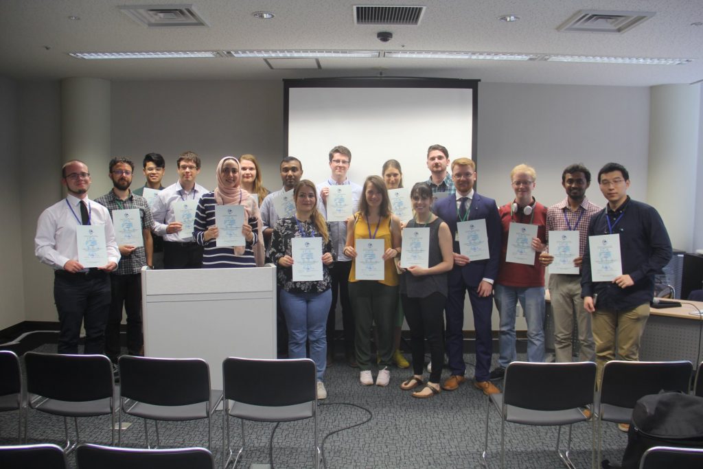
Congratulations to the ICA scholarship awardees at ICC2019 and pre-conference workshops

The goal of ICA Scholarships is to stimulate young scientists or professionals to direct their careers toward fundamental studies in the fields of Cartography and GISciences. The following scholarships were awarded for participation in the ICC2019 and pre-conference workshops.

Scholars at ICC2019

ScholarTitle of paper / poster
Nargiz Safaraliyeva, AzerbaijanTeaching basic map concepts in three countries: Azerbaijan, Hungary and United Arab Emirates
Malak Alasli, MoroccoToponyms’ contribution to identity: The case study of Rabat (Morocco) | Static Risk Mapping of Forest Fires – In the case of the Province of Chefchaouen (Morocco)
Shyamantha SUBASINGHE, Sri LankaUrban Growth: From pixel to reality
Dr. Alena Vondráková, Czech RepublicTouchIt3D: Technology (not only) for Tactile Maps | The Specifics of Cartographic Semiology in Tactile Maps
Ashna Kareem Zada, IraqTesting Maps for Visually Impaired People in Kurdistan
Jagadish B, IndiaDeriving Multiple Representation Database: A Model Generalisation Approach
Lukasz Halik, PolandTeaching of geographical space relations for cartography – Academic Outdoor Station in Poznan (Poland) | Workflow for 3D geovisualization of the data obtained with the use of Unmanned Aerial Vehicle in Augmented Reality | The visualization of the use of land on the basis of the dynamics of the pedestrian movement from the interval UAV imaging | Measuring user preferences in virtual reality (VR): 2D versus 3D urban geovisualizations of topographic data
Márton Pál, HungaryDigital cartography for geoheritage: turning an analogue geotourist map into digital | Possibilities of high precision GPS data in autonomous driving
Nikola Yonov, BulgariaSchool Atlas with Augmented Reality
Radek Barvir, Czech RepublicThe Specifics of Cartographic Semiology in Tactile Maps | TouchIt3D: Technology (not only) for Tactile Maps
Pongpichaya William Limpisathian, USA/ThailandRepresentations of Place in the Human Brain
Ivan Evgenyevich Fokin, RussiaThe automation of processes of atlas mapping | Methods and algorithms for creation of structural schemes of rivers
Nick Lally, USAMapping dynamic, non-Euclidean spaces | Interactive & Multiscale Thematic Maps: A Preliminary Study
Xiao Huang, USA/ChinaLinking picture with text: tagging flood relevant tweets for rapid flood inundation mapping
Carolyn S. Fish, USAEmotional responses to climate change map framing using facial emotion recognition technology
Harrison Cole, USAToward Accessible Hazard Mapping: Tactile Risk Maps and Disaster Preparedness
Laure De Cock, BelgiumLinking perception to decision point complexity for adaptive indoor wayfinding support
Maja Kalinic, Germany/Bosnia-HerzegovinaFloating Car Data and Fuzzy Logic for classifying congestion indexes in the city of Shanghai
Ross Thorn, USAHow to Play with Maps

Scholars at pre-conference workshops

ScholarWorkshopTitle of paper / poster
Aytaç YÜRÜKÇÜ, TurkeyHistory of Cartography and the Topographic MappingHow East and West Cartographic Studies Influenced the Most Important 16th Century Ottoman Cartographer of Piri Reis and His World Maps
Dr. Lei ZOU, USALocBigData 2019Leveraging Location-Based Social Media for Smart Emergency Management
Christian RÖGER, GermanyLocBigData 2019Visualizing the Complexity of Crossings using Star-Plot Maps
Wangshu WANG, AustriaJoint Pre-Conference Workshop of the ICA Commission on Use, Users, and Usability, the Commission on Cognitive Visualization, the Commission on Location-based Services and the Commission on Visual AnalyticsTowards a Functional Ontology for Mobile Map Applications

From left to right: Márton Pál, Nick Lally, Pongpichaya William Limpisathian, Radek Barvir, Malak Alasli, Dr. Alena Vondráková, Shyamantha Subasinghe, Ashna Kareem Zada, Harrison Cole, Maja Kalinic, Laure De Cock, Carolyn S. Fish, Nikola Yonov, Lukasz Halik, Ivan Evgenyevich Fokin, Jagadish B, Xiao Huang

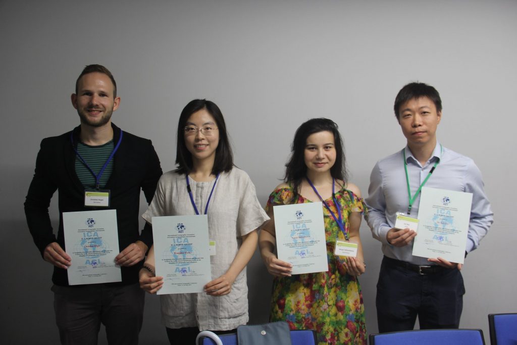
From left to right: Christian Röger (pre-conference), Wangshu Wang (pre-conference), Nargiz Safaraliyeva (ICC), Dr. Lei ZOU (pre-conference)

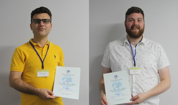
Left: Aytaç YÜRÜKÇÜ, Pre-conference; Right: Ross Thorn, ICC


Congratulations to all scholars!

Obituary: Godfried Theodore Toussaint

Portrait Godfried Theodore Toussaint (CC BY-SA 3.0 via Wikimedia)

Godfried Theodore Toussaint

It is with great sadness that we share the news that Godfried Theodore Toussaint passed away while sharing his work at the International Cartographic Conference 2019 in Tokyo. He attended ICC2019 to present his work on “The Levenshtein distance as a measure of mirror symmetry and homogeneity for binary digital patterns” in a special session titled “Design & Computation in Geovisualization” convened by the Commission on Visual Analytics.

Godfried Theodore Patrick Toussaint (1944–2019) was a Canadian Computer Scientist, a Professor of Computer Science, and the Head of the Computer Science Program at New York University Abu Dhabi (NYUAD) in Abu Dhabi, United Arab Emirates. He was considered to be the father of computational geometry in Canada. He did research on various aspects of computational geometry, discrete geometry, and their applications: pattern recognition (k-nearest neighbor algorithm, cluster analysis), motion planning, visualization (computer graphics), knot theory (stuck unknot problem), linkage (mechanical) reconfiguration, the art gallery problem, polygon triangulation, the largest empty circle problem, unimodality (unimodal function), and others. Other interests include meander (art), compass and straightedge constructions, instance-based learning, music information retrieval, and computational music theory.


Announcement of the Pre-ICC Joint Commission Workshop on Mobile Map UX

The ICA Commissions on Cognitive Issues in Geographic Information Visualization, Location Based Services, Visual Analytics, and Use, User and Usability Issues are pleased to announce a joint workshop to outline a research agenda on Mobile Map UX. Since their first description in the cartographic literature, interactive mapping applications drawing on location-based services and mobile technologies have fundamentally transformed the way that people experience place. Accordingly, established tenets of cartography need to be reexamined and updated for the mobile platform. Further, new cartographic design strategies are needed for mobile maps to ensure a productive and satisfying user experience (UX).

Position Papers

This workshop builds upon the successful ICA joint workshops and special issues on Big Challenges in Interactive Cartography and Location Based Services to develop a research agenda for Mobile Map UX. To this end, we solicit 2-page position papers proposing emerging issues and pressing needs regarding Mobile Map UX. We encourage position statements from multiple sectors, including academia, industry, and government.

Format

The workshop will cross two days, the first focused on student engagement and establishing common ground on topics related to Mobile Map UX and the second on developing a working research agenda for Mobile Map UX (capped registration).

Day #2 papers should be 2-pages and focus on “big problems”, or key research challenges and opportunities, related to the dimensions of Mobile Map UX listed above. Please submit your 2-page white paper in the CHI Archive Format. Please use positions papers from the 2015 workshop as examples for reference (available for download the bottom of the page). Position papers will be peer-reviewed by the organizing committee based on intellectual merit, scope and timeliness, and engagement with new literature and technology.

Venue

The Beijing Normal University (BNU) Faculty of Geography was founded in 1910 and is one of the premier institutions for cartography and mapping sciences in China. BNU is located between the 2nd and 3rd city rings and is within 2km of multiple metro lines. BNU has graciously offered to provide space and coffee, as well as assistance with visas.

Timeline

  • 1 February 2019: Deadline for 2-page Position Papers (sent to reroth@wisc.edu)
  • 1 March 2019: Notification of Accepted Papers & Preliminary Schedule; Registration Opens
  • 1 June 2019: Deadline to Register (no cost)
  • 11–12 July 2019: Workshop


Please find more information on the workshop website: use.icaci.org/user-experience-design-for-mobile-cartography-setting-the-agenda

Invitation to Workshop on New Directions in Geovisual Analytics

The ICA Commission on Visual Analytics is pleased to announce a Call for Papers for a pre-conference workshop to be held in conjunction with GIScience 2018 on August 28, 2018 in Melbourne, Australia.

New Directions in Geovisual Analytics: Visualization, Computation, and Evaluation

The workshop focuses on eliciting and sharing nascent challenges in visual design, evaluation, and computation related to geovisual analytics. The core concept of this workshop is to focus on exploring ideas for new approaches – not simply to recap what has already been accomplished. Toward that end, workshop participants will be asked to submit extended abstracts that describe new research directions in visualization, evaluation, or computation (and may synthesize across these areas as well). We especially encourage high-risk ideas that have a potentially high-return in terms of scientific and social impact. Potential topics may include:

  • New visual representation types in geovisual analytics
  • Novel computational and visual methods for handling massive, streaming, spatiotemporal data
  • Opportunities for integrating immersive environments and geovisual analytics
  • Artistic approaches for expressing or interacting with big spatial data
  • New approaches for integrating users in the design of geovisual analytics systems
  • Ideas for integrating sensemaking into geovisual analytics

This workshop will have a discussion-centric format. Accepted talks will be given in short formats (10min or 5min in length) with an emphasis on having ample discussion and networking time connected to each series of talks.

The workshop will be held August 28, 2018 in Melbourne, Australia.

Deadline

The deadline for submitting extended abstracts (no longer than six pages using the GIScience 2018 format) has been extended to May 11, 2018.

A dedicated workshop website can be found at viz.icaci.org/GVIZ2018

Tag: ,

IJGI Special Issue on Human-Centered Geovisual Analytics

The ICA Commission on Visual Analytics and the ISPRS Working Group on Geovisualization, Augmented and Virtual Reality are excited to announce a special issue of IJGI.

Overview

Guest Editors: Dr. Arzu Çöltekin, Dr. Sidonie Christophe, Dr. Urška Demšar, Dr. Anthony Robinson

This special issue seeks papers on geovisual analytics and visuospatial display design with human-centered approaches.

Human abilities, limitations and attitudes are defining factors for adaptation of technological solutions, such as visuospatial displays used in geovisual analytics software environments. Human-centered issues (and associated solutions) can be complex to understand, model, and, importantly, generalize from individual experiments. Therefore, it is important that we continue asking new questions, or answer the old questions again with fresh perspectives to advance and solidify our knowledge. In addition to fundamental knowledge, technical solutions that are informed by fundamental knowledge (e.g., on the perceptual and cognitive factors) are still rare, even though it is understood that they could benefit users.

With this Special Issue, we intend to create a compendium of state-of-the-art knowledge on human-centered approaches to creating and using geovisual analytics environments; and the design of the visuospatial displays that are of core importance in visual analytics processes. We welcome contributions that feature technical solutions informed by human-centered user research; experimental studies demonstrating new knowledge in human visuospatial information processing, spatial perception and cognition, and studies focusing on usability engineering. Furthermore, we welcome literature reviews and theoretical papers that consolidates knowledge on any of the listed topics, or topics related to the scope of the Special Issue.

Topics of interest include (but are not limited to)

  • User-centered techniques for representing and interacting with big spatial data
  • Usability and utility evaluation of geovisual analytics
  • Cognitive studies of geovisualization
  • Personalization and customization of visuospatial displays
  • Ageing and visuospatial displays
  • Perceptually informed design principles for geovisual displays
  • Design and evaluation of virtual environments and augmented reality approaches for geovisualization
  • What about time? User-centered visual analytics for spatio-temporal data
  • Geovisual analytical solutions for movement and dynamic phenomena
  • Geovisual analytical solutions for environment and climate change
  • Geovisual analytics solutions for sustainability (from local to global scales)

Submission details

An expression of interest with a 200-word abstract should be sent to the editorial team latest by 15th of August 2018 at the email address human.isprs.ijgi@gmail.com. Please also mention if you will need a discount or waiver on the open access fees. If your institution has funds for open access publications, please consider that others might not, before asking for the waiver or discount.

Deadline for full paper submissions: 15 November 2018


Tag: ,

News from ICA Commission on Visual Analytics

A quick update on the two workshops that the ICA Commission on Visual Analytics is running this year:

Visually-Supported Computational Movement Analysis

cropped-Header_Blue-1

We have just published the list of accepted papers at the Visually-Supported Computational Movement Analysis (VCMA2016) workshop in Helsinki, Finland (14 June 2016). The contributions were excellent, promising a high-quality workshop. Stay tuned for final updates at the VCMA2016 website or on twitter (#VCMA2016) and join us for the workshop (registration details are on the website, and a side note that this is a co-located workshop with the AGILE2016 conference, which has the honour to have the ICA President, Prof Menno-Jan Kraak, as the keynote speaker).

Workshop website: viz.icaci.org/vcma2016

Understanding Spatial Data (Big and Small) with Visual Analytics

GIScience_2016_WorkshopHeader

Our second workshop, Understanding Spatial Data (Big and Small) with Visual Analytics (SpatialVA2016), will take place in Montreal, Canada (27 Sept 2016) and we are delighted to have two prominent scientists as keynote speakers: Prof Sheelagh Carpendale from the University of Calgary and Prof Alan MacEachren from Penn State University.

There is still time to contribute to this workshop: the deadline has been extended to 29 April 2016. So submit a contribution and join us in Canada for a great event.

Workshop website: http://viz.icaci.org/SpatialVA2016/


See you in Helsinki and Montreal!

– Urska Demsar & Anthony Robinson

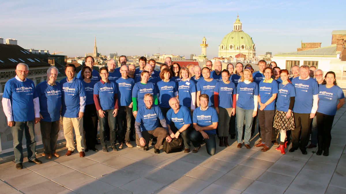
Joint ICA meeting in Vienna, November 8–9

ica-commission-meeting

All chairs and vice-chairs of the ICA commissions and working groups were invited to join an ICA meeting in Vienna on 8–9 November 2015 to plan and discuss their activities for the term 2015–2019. 46 chairs, vice-chairs and members of the executive committee followed the invitation and spent two intensive workshop days at Technische Universität Wien.

Meeting participants

Commission chairs and vice-chairs

Working Group International Map Year

Executive Committee

Website

More photos of the workshop can be found on the ICA Facebook page.

Call for Participation, AAG Special Sessions on Cognition, Visualization, and User Issues

AAG Annual Meeting 2016The ICA Commission on Cognitive Issues in Geographic Information Visualization (Amy Griffin, UNSW Canberra), the Commission on Visual Analytics (Anthony Robinson, Penn State) and the Commission on Use, User, and Usability Issues (Kristien Ooms, UGent) invite papers on spatial cognition, geovisual analytics, and usability/utility of geographic information systems to be included in a series of sessions at the 2016 Association of American Geographers Annual Meeting in San Francisco from March 29–April 2, 2015.

We welcome theoretical and empirical contributions exploring geocomputation, geovisualization, navigation and wayfinding, map use, user studies, and methodologies for designing, developing, and evaluating geographic information and tools that leverage geographic data.

Topics for these sessions include (but are not limited to):

  • geovisualization and visual analytics, implementation and use (technical and/or cognitive issues)
  • visualization, cognition, and use of uncertainty in decision making
  • application of geovisualization displays & tools to understanding spatial cognition
  • methods, techniques and tools for usability research
  • methods for and application of cognitive theories
  • human-geovisualization interaction and usability research
  • cognition of space-time representations
  • wayfinding and navigation: visualisation, usability and cognitive issues
  • cognitive map design research
  • user requirements for and usability of digital geographic displays

Participants

In addition to geographers, GIScientists, cartographers, and cognitive or behavioral geographers we also invite speakers from a broad range of disciplines, including psychology, cognitive science, education, HCI, etc.

To be considered for these sessions, please:

  1. Register and submit your abstract online following the AAG Guidelines.
  2. Email your presenter identification number (PIN), paper title, and abstract to Amy Griffin by October 25, 2015.
Tag: , ,
rawboned-refined