Welcome to the International Cartographic Association
Welcome to the website of the International Cartographic AssociationGet to know the new ICA Executive Committee for the term 2023-2027
Welcome to the website of the International Cartographic Association
Get to know the new ICA Executive Committee for the term 2023-2027

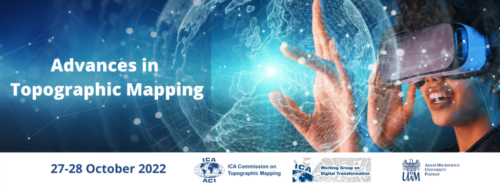
Call for Papers for the International Virtual Conference Advances in Topographic Mapping

The International Cartographic Association’s Commission on Topographic Mapping and the Working Group on Digital Transformation of the National Mapping Agencies will jointly host the Virtual International Conference on the Advances in Topographic Mapping on 27-28 October 2022.

Conference Topics

  • Topographic mapping and Immersive Virtual Environments (IVE)
  • AI and machine-learning applications in topographic map production
  • Enhancing user experience of, and trust in, topographic maps
  • Developing Augmented/Virtual Reality environments using topographic data
  • Utilising open source data in topographic mapping
  • Developing effective national geoportals in an era of digitalization

Call for Papers

The organizers invite the submission of abstracts for papers. These need to reach the organisers by the 4 September 2022. You can submit your abstract here.

Registration

Registration is open here. Deadline for registration is 21 October 2022

For more information visit the conference website: https://topo.icaci.org/advances-in-topographic-mapping-2022/

News of the ICA Commission on Cartography for Early Warning and Crisis Management

In the 8th International Conference on Cartography and GIS, June 20-25th June 2022, in Nessebar, Bulgaria, commission members of the ICA Commission on Cartography for Early Warning and Crisis Management participated in four activities.

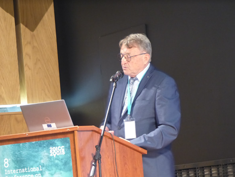
In the first keynote of the conference, Prof. Milan Konecny replaced president Timothy Trainor by his keynote speech titled: The United Nations Challenges for SDGs and Sendai Framework: The Role of Cartographers, where U.N. efforts, including Sendai Framework and GGIM and DBAR activities have been strongly highlighted (June 21).

Seminar on Disaster Risk Reduction – Solutions and Innovations organized in cooperation with ICA Commission on Cartgraphy in Early Warning and Crisis Management and Department of Geography, Masaryk University, Brno, Czech Republic was based on physical and video presentations (June 21). The seminar began with a keynote by commission vice-chai Milan Konecny (with co-authors Temenoujka Bandrova (Bulgaria), Petr Kubíček, Zdeněk Stachoň, Radim Štampach (Czech Republic). Jie Shen (China), Irina Rotanova (Russian Federation), Jan Brodský and Pavel Špulák (both Czech Republic), titled: Strategies of Disaster Risk Reduction on the Background of U.N. GGIM and Digital Belt And Road Efforts. Keynote was followed by other papers: Krzysztof Pokonieczny (Poland): Methodology of Developing The Dynamic Maps of Passability, Milaim Sylka (Kosovo (video presentation), Pavel Špulák, Bohuslav Ježek and Zdeněk Červenka (Czech Republic): GIS, Big Data and Mapping in Disaster Management Charts and Maps for Statistical Yearbooks of Fire and Rescue Service of the Czech Republic, Ekaterina Podolskaia, Anastasia Nekrasova, Tatiana Prokhorova, Aleksey Trubenkov and Olga Selyutskaya (Russian Federation): Web-Gis Projects at the Institute of Earthquake Prediction Theory and Mathematical Geophysics, Russian Academy of Sciences (video presentation).

Topics of the seminar were:

  • DRR U.N. Sendai Agenda: Challenges for Cartography and Geoinformatics
  • Cartographic Support for Emergency Evacuation
  • Virtual Reality and Disaster Preparedness
  • VGI Possibilities in DRR
  • Threats Caused by Agricultural Operations

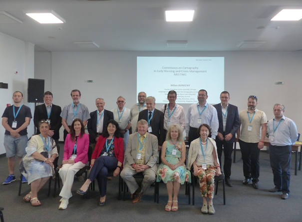
Around 20-25 people particiated in the meeting of the Commission On Cartography on Early Warning and Crisis Management on June 22. They were explained the areas that the commission deals with, especially with regard to the initiatives of the Sendai Framework, but with an emphasis on the scientific and applied development of cartography. The meeting was also attended by ICA vice-president Prof. T. Bandrova, ISDE president Dr. A. Annoni, chairmen of other ICA commissions associate professors O. Čerba, or Jesus Reyes, ESRI representative Dr. N. Land and many others. The discussion results in a recommendation to create a publication on the role of cartography in DRR supplemented by representative outputs promoting cartography itself, unifying terminology or analyzing the potential of cartography in solving a selected disaster.

Tag:

News of the ICA Commission on Cartography for Early Warning and Crisis Management

The ICA Commission Cartography for Early Warning and Crises Management (CEW&CM) has successfully held a pre-conference workshop and two sessions at the ICC 2021 in Florence.

The workshop aimed at combining and addressing as comprehensively as possible the current Big Data issue, cloud computing, and latest trends and technologies in cartographic visualization in the field of early warning, crisis management and Disaster Risk Reduction.

The growth of Internet-based services and cloud services is leading and has led to a comprehensive view on data characterized by the terms Volume, Variety, Velocity and Veracity. The emergence of very large, unstructured, dynamic, time-varying data sets including associated measures of quality (so-called Big Data) offers considerable challenges for cartography which – if processed and visualized
correctly and appropriately for the target audience – can provide significant new insights for information, situation analysis, decision making and alternative actions. Experts from different, interdisciplinary directions discussed different concerns from the above mentioned topics.

The full report of the workshop can be accessed here: https://rimma.org/cartography-for-early-warning-and-crisis-management-report

Follow-up

Further meetings (virtual, hybrid, physical) are planned within the ICA and within the Commission Cartography in Early Warning and Crisis Management. Some of them are relevant for LAINAT regarding exchange of ideas, further development of warning platforms, cartography and platforms as communication tools, as well as regarding the composition of the ICA Commission Cartography in Early Warning and Crisis Management:

  • Eurocarto 2022, 19-21.9.2022 in Vienna Austria, organized by the Austrian Cartographic Commission (ÖKK), the German Cartographic Society (DGfK), the Swiss Cartographic Society (SGK) and the British Cartographic Society
  • 31st ICC 2023, 13-18 August 2023, Cape Town South Africa

Obituary: Eddy Lynn Usery

On March 22, 2022, the world lost a GIS giant and cartography compadre when Dr. E. Lynn Usery, current Chair of the ICA Commission on Map Projections and former ICA Vice-President, passed from this earthly plane. Not even a week earlier, Lynn was busily planning workshops for AutoCarto 2022. He will be sorely missed by ICA and our community, not only for his many research contributions, leadership and vision, and tireless service, but also for his friendship and camaraderie.

Michael Tischler of the U.S. Geological Survey (USGS) wrote, “On paper, we knew him as the Director of the Center of Excellence for Geographic Information Science [CEGIS]. But he was far more than that title would lead one to believe. Lynn leaves a remarkable legacy given his extraordinary scientific accomplishments, presence as a leader in the geographic science community, and impact on individual geographic scientists inside USGS and around the world.”

It’s a challenge to specify the impact that Lynn has had on the field of GIScience because of the breadth and depth of his involvement and contributions. He was centrally involved in many areas of the discipline, including cartography, GIS, remote sensing, and spatial analysis. His eclectic research interests included digital cartography, map projections, scale and resolution, image classification, temporal GIS, geospatial semantics and ontology, and high-performance computing for geospatial data. It would be difficult to name a subject in our field about which Lynn could not speak knowledgably and insightfully.

Lynn was unique in that his impact came through his careers in both government and academia. Lynn started working for the USGS in 1977. He was a cartographer and geographer for the USGS from 1978 to 1988 focusing on developing automated cartographic production systems. In 1988, he took on a geography faculty position at the University of Wisconsin (UW) – Madison. In January of 1994, he moved to Georgia to serve on the geography faculty at the University of Georgia (UGA). In May of 1999, Lynn took on a Research Geographer position with the USGS in addition to his academic job at UGA. In 2005, he returned to USGS and ultimately conceived and became Director of CEGIS. In this role, he directed the science program and the visions and plans for topographic mapping research. While at USGS, Lynn also taught remote sensing at the Missouri University of Science and Technology.

In all his positions, Lynn was a ground breaker. In his early days at USGS, he began the development of digital mapping systems for the automated production of printed topographic maps. At UW, he helped found a GIS program. At UGA, he helped establish certificate programs in GIScience at both the undergraduate and graduate levels. When he returned to USGS, he started a cartography research program that led to CEGIS. For CaGIS, he chaired AutoCarto 2005 to close an eight-year gap and resurrect the symposium series. He also spearheaded the effort to bring the International Cartographic Conference back to the United States for only the second time, the first being in 1978.

Lynn was involved in multiple activities of the ICA:

  • 2004–2008 US National Committee to the ICA member
  • 2007–2011 ICA Map Projections Commission Secretary
  • 2007–2015 US National Committee to the ICA Chair
  • 2011–2012 ICA Technology Outreach Working Group Chair
  • 2011–2015 ICA Map Projections Commission Vice Chair
  • 2011 Bid for ICC 2017
  • 2012–2017 ICC 2017 Conference Organizer
  • 2015–2019 ICA Vice President
  • 2018–2019 ICA Body of Knowledge for Cartography Working Group Chair
  • 2019–2022 ICA Map Projections Commission Chair

That Lynn was so involved in the association is admirable. That he did the same with many other societies, at the same time, makes Lynn exceptional and unparalleled. There is truly no match for him in this regard, and really not even anyone in the running. No other person has been elected vice-president of the ICA, president of the Cartography and Geographic Information Society (CaGIS), president of the American Society for Photogrammetry and Remote Sensing (ASPRS), and president of the University Consortium for Geographic Information Science (UCGIS), as Lynn was in 2015, 2002, 2004, and 2015, respectively. Additionally, as with the ICA, in all these associations, he also served in other roles.

On a personal note, Lynn was born in December 1951. He had two children, a son Kelynn, born 1986, and a daughter, Lacy, born 1988. Lynn received his BS in geography from the University of Alabama and MA and Ph.D. degrees in geography from UGA. He died Tuesday, March 22, 2022, after a brief illness.


Tim Trainor, President of ICA &
Aileen Buckley, U.S. national representative to ICA

Call for Papers for the 9th International Symposium on the History of Cartography

The International Cartographic Association’s Commission on the History of Cartography and the Staatsbibliothek zu Berlin (Berlin State Library) will jointly host the 9th International Symposium on the History of Cartography on the topic of The Surveying Turn in Cartography: Revolutionizing Maps & Charts in the 18th and 19th Centuries on 24-26 October 2022.

Theme

The joint organizers encourage contributions investigating the global “surveying turn” in cartography, hinting to the increasing professionalization and mechanization to gather base data for drawing ‘ever truer to nature’ maps, especially during, but not limited to, the eighteenth and nineteenth centuries.

Call for Papers

The organizers invite the submission of abstracts for papers and posters. These need to reach the organisers by the 1st of June 2022. You can submit your abstract here.

Registration

Registration will open in the summer of 2022.

For more information visit the conference website: history.icaci.org/berlin-2022/

Tag:

Invitation to the 17th International Conference on Location Based Services (LBS 2022)

The ICA Commission on Location Based ServicesApplied Geoinformatics @ Augsburg University, Prof. Dr. Jukka M. Krisp and the Chair of Cartography @ TUM, Prof. Dr. Liqiu Meng, are pleased to invite you to the 17th International Conference on Location Based Services which takes place in Munich on 12. – 14. September 2022.

Call for Papers

The Call for Papers is currently open: Please consider submitting a full paper or an abstract.

  • Deadline for full paper submission: 15 May 2022
  • Deadline for abstract submission: 1 June 2022

 
More information regarding LBS 2022 can be found at lbsconference.org.

We are looking forward to welcome you in Munich!

Prof. Dr. Jukka M. Krisp
Prof. Dr. Liqiu Meng
Dr. Holger Kumke
and the LBS2022 Organizing Committee

Tag: ,

Call for Papers: Cartography and Geospatial Information Education – Theories and Practices

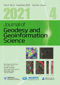
We are inviting papers for a Special Issue with the Journal of Geodesy and Geoinformation Science, September, 2022 on Cartography and Geospatial Information Education: Theories and Practices.
Background

With development of geospatial information science and technology and applications in numerous areas, cartography and geospatial information education becomes increasingly more important in training graduates equipped with new capacities. The contents have always gradually been changing, as well as corresponding effective approaches to deliver sustainable and resilient education. COVID-19 has caused an unprecedented impact on every aspect of society since December of 2019. According to UNESCO monitoring, more than one billion students have experienced school closure [1]. With the help of rapidly improving online meeting tools, some institutions have set teaching and learning onto digital platforms, though some may choose other ways to continue sharing knowledge. Shifting from typical classroom lecturing and face-to-face meeting to online and hybrid learning poses challenges, but it also offers opportunities for education. Cartography and geospatial information education is no exception.

The ICA Commission on Education and Training organized an online workshop “Challenges and Opportunities of Cartography and GIS Education: in the Classroom and in the Cloud” on October 28, 2021. Fourteen speakers presented their research and reflections on education and cartographic theory. And two prestigious educators shared their professional experiences and suggestions with young participants. The workshop received registrations from over thirty countries. In addition, there has been increasing numbers of submissions on education theme during previous International Cartographic Conferences.

To further offer more space for knowledge sharing, this issue invites educators and researchers to contribute research and studies on cartography and geospatial information education and other related topics. Suggested topics of interest can include, but are not limited to, the following:

  • Theories of cartography and theoretical foundations for teaching and learning of cartography,
  • Spatial thinking, spatial understanding and cognition of cartographic education,
  • New paradigms of geospatial information teaching and fieldworks in a social transforming era,
  • Development of a ‘Body of Knowledge’ for cartography and course design,
  • Sustainable and resilient curriculum and course design for cartography and GIS education,
  • Developing online educational resources and open textbooks for cartography and GIS,
  • Experiences in online cartography and GIS teaching at various levels,
  • Technical support, including open source software and datasets, for academic education in cartography and geospatial information,
  • Linking cartographic education with education in other geo-related disciplines

You are warmly invited to consider to submit your paper before Jun 1, 2022 to this special issue. Please leave a message during your submission that “this paper is submitted to the special issue on Cartography and Geospatial Information Education: Theories and Practices”. After review, the tentative publishing date is September, 2022. Please find submission information and author guide lines at: http://jggs.sinomaps.com/

For more information and contact details, please visit the commission website.

Guest editors

Guest editors of the special issue are:

  • Tao Wang, Capital Normal University, Beijing, CHINA
  • David Fairbairn, Newcastle University, Newcastle Upon Tyne, UK
  • Georg Gartner, Vienna University of Technology, Vienna, AUSTRIA
  • Xiaojuan Li, Capital Normal University, Beijing, CHINA
  • Terje Midtbø, Norwegian University of Science and Technology, Trondheim, NORWAY
  • László Zentai, Eötvös Loránd University, Budapest, HUNGARY

Call for Participation: LBS 2021, 24-25 November 2021, online

The ICA Commission on Location Based Services and the University of Glasgow are pleased to invite you to the 16th International Conference on Location Based Services (LBS 2021), which will take place fully online on 24—25 November 2021.

Note that the preliminary program of LBS 2021 has been published online. It features five keynotes:

  • Michael Batty, University College London, “More Than One Digital Twin”
  • Urška Demšar, University of St Andrews, “Studying migratory bird navigation with spatial data science”
  • Matt Duckham, RMIT University, “LBS and Indigenous Data Sovereignty”
  • Anita Graser, Austrian Institute of Technology, “Open LBS Research: Why (not)?”
  • Ross Purves, University of Zurich, “Location, place and language”

The conference also features a “Best paper session” on the 2nd conference day, and five oral sessions on “Wayfinding and Navigation Systems”, “Positioning”, “Location tracking and systems”, “Mobility and Activity Analytics”, and “Visualization, Perception and Analysis”.
Please note that registration for the conference is free, but required. The registration will close on 20 Nov 2021.

More information regarding LBS 2021 can be found at lbsconference.org

Invitation to Pre-ICC Online Workshop on Challenges and Opportunities of Cartography and Geospatial Information Education in the Classroom and in the Cloud

Online workshop on October 28, 2021

Cartography and geospatial information education has always gradually been changing its contents, as well as corresponding effective approaches to deliver resilient education. COVID-19 has caused an unprecedented impact on every aspect of society since December of 2019. According to UNESCO monitoring, more than one billion students have experienced school closure. Cartography and geospatial information education is no exception. With the help of rapidly improving online meeting tools, some institutions have set teaching and learning onto digital platforms, though some may choose other ways to continue sharing knowledge. Shifting from typical classroom lecturing and face-to-face meeting to online and hybrid learning poses challenges for us, but it also offers opportunities.

The ICA Commission on Education and Training is organizing an online workshop “Challenges and Opportunities of Cartography and GIS Education: in the Classroom and in the Cloud” on October 28, 2021. The workshop will be scheduled 12.30–16.30pm GMT.

A preliminary workshop program as well as details on how to join our workshop is available on our ICA-CET website: education.icaci.org/pre-icc2021-cet-workshop/

The workshop is free of charge and open to all interested with cartography and geospatial information education. We hope the workshop can be a platform for educators and researchers to exchange and share best practices and experiences.

We are very much looking forward to meeting you during our online workshop.

Kind regards
Tao and Stefan

Invitation to Pre-ICC Joint Workshop on Cartography Connecting Schools

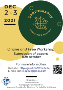
The Commissions on Cartography and Children and Maps and Graphics for Blind and Partially Sighted People have the pleasure to invite all interested colleagues to participate in the Joint ICA Workshop Cartography Connecting Schools on December 2-3, 2021.

General Information

The participation in the online event is free, but previous registration is needed. Both commissions plan to organize the event using the Google Meet platform. More detailed information will be published on the workshop website.

A special session will be dedicated to Latin-America with presentations in Spanish language. However, interested colleagues should submit their registration, as well as their abstracts or papers in English for its publication in the proceedings.

Digital proceedings with ISBN code will be available for all the registered participants.

Deadlines

  • Deadline for the submission of papers and abstracts with registration form: October 31, 2021
  • Notification of the authors: November 12, 2021
  • Deadline for the submission of the registration form (without full paper, only participant): November 29, 2021

Please, send your submission and/or registration form to the following e-mail address: jointica2021 [at] gmail.com

Organizing Committee

  • Carla Cristina R. G. de Sena, Chair, ICA Commission on Cartography and Children (Brazil)
  • Waldirene Ribeiro do Carmo, Chair, ICA Commission on Maps and Graphics for Blind and Partially Sighted People (Brazil)
  • José Jesús Reyes Nunez, Vice-Chair, ICA Commission on Cartography and Children (Hungary)
  • Alejandra Coll Escanilla, Vice-Chair, ICA Commission on Maps and Graphics for Blind and Partially Sighted People (Chile)
  • Barbara Jordão, ICA Commission on Cartography and Children (Brazil)


Please find more information on the symposium website: jointica2021.elte.hu/

rawboned-refined