Welcome to the International Cartographic Association
Welcome to the website of the International Cartographic AssociationGet to know the new ICA Executive Committee for the term 2023-2027
Welcome to the website of the International Cartographic Association
Get to know the new ICA Executive Committee for the term 2023-2027

Cartographier pour un monde durable – French version of Mapping for a Sustainable World published

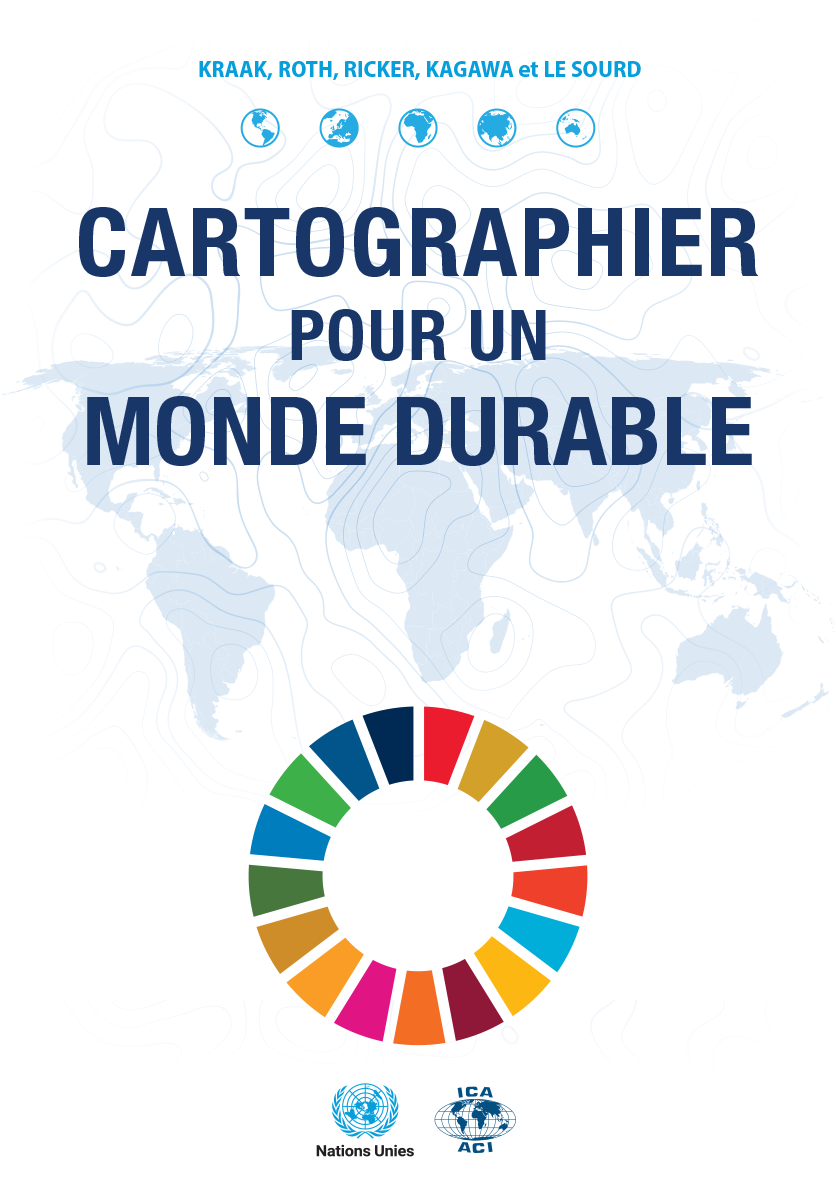
The book “Mapping for a Sustainable World”, a co-publication by the United Nations and the International Cartographic Association, has been translated to French – the second offical language of the ICA.

The pdf-version of the book written by Menno-Jan Kraak (ICA), Robert E. Roth (ICA), Britta Ricker (ICA), Ayako Kagawa (UN) and Guillaume Le Sourd (UN) can be downloaded from digitallibrary.un.org/record/3898826. A printed version is in preparation.

Category: General News

eCARTO News April 2023

eCARTO News captures the latest cartographic news and developments from around the world. If you have any general cartography items of interest then please email them to David Fraser, editor of eCARTO News.

The Environment

  • Smartphone data can help create global vegetation maps – miragenews.com
  • GISS Surface Temperature Analysis – data.giss.nasa.gov
  • Mapping floods of the future reveals communities at risk due to climate change – phys.org
  • Mapping Wetland Loss Across Three Centuries – eos.org

Water

  • Ved Chirayath is on mission to map world’s oceans – miragenews.com
  • World Water Day: Mapping water stress across the Middle East – aljazeera.com
  • Mapping hidden meltwater paths in glaciers: importance – miragenews.com
  • Recent, rapid ocean warming ahead of El Niño alarms scientists – bbc.com
  • Mapping the Catalan coast using airborne Lidar bathymetry – hydro-international.com

History

  • Virginia T. Norwood: The Mother of Landsat – landsat.gsfc.nasa.gov
  • Europe’s Oldest Map Shows Tiny Bronze Age Kingdom – atlasobscura.com
  • From Dragons To Mythic Locations, These Are The Biggest Mistakes In Ancient Maps – iflscience.com
  • Seoul : A variation of “Daedongyeojido,” a famous map of the Korean Peninsula created in the 19th century by the Korean cartographer Kim Jeong – ho #Gallery – socialnews.xyz

Industry News

  • Google Maps Rival Gets Major Update With a Little Something for Everybody – autoevolution.com
  • Garmin Launches Motorcycle GPS Navigator That Puts Google Maps to Shame – autoevolution.com
  • I Thought Google Maps Was the Best Navigation App, But This Alternative Blew My Mind – autoevolution.com
  • Smartphone Screen Material Maps Magnetic Fields – miragenews.com

Just Maps

Out of this world

Opportunity

  • NIST Seeks UAS 3D Map Researchers for Grand Prize Challenge – miragenews.com

Chats

Collections

  • The Smithsonian Puts 4.5 Million High-Res Images Online and Into the Public Domain, Making Them Free to Use – openculture.com

A Mapping Game


Disclaimer: The views and opinions expressed by the weblink authors are their own and do not represent the official position of the ICA. The links are assembled for information and education purposes only.

ICA News 79 now online

ICA News, Number 79, December 2022

We are pleased to announce that the 79th issue of the ICA News is now available for download:

In this issue of ICA News, we are updated on the ICC 2023 preparations by our South African colleagues and celebrate the life of Lynn Usery who passed away last year. We are invited to Vancouver in 2025 and briefed on a number of cartographic meetings and events that took place around the world. Many thanks for your support!

– Igor Drecki, Editor ICA News

fyi: The issue ICA News 78, June 2022, is still in preparation.

Category: General News
Tag:

eCARTO News March 2023

eCARTO News captures the latest cartographic news and developments from around the world. If you have any general cartography items of interest then please email them to David Fraser, editor of eCARTO News.

Publications

Research & Investigations

  • Where the sidewalk ends – news.mit.edu
  • Conservation of Spanish Armada invasion maps reveals red ink details were added hundreds of years later – theartnewspaper.com
  • New Research Overturns 100-Year-Old Understanding of Color Perception – scitechdaily.com
  • A universe without mathematics is beyond the scope of our imagination – phys.org
  • Ancient maps of Jupiter’s path show Babylonians’ advanced maths – newscientist.com

Maps – Collected & Exhibited

  • Barry Lawrence Ruderman Map Collection – Stanford
  • Maps unfolded: exhibition in Amsterdam – Allard Pierson
  • 14 maps you need to see to understand Wales and the challenges we face – walesonline.co.uk
  • 40 Unusual And Fascinating Maps That Might Change Your Perspective On The World .boredpanda.com
  • Windows on Collections: Maps – youtube.com
  • The world’s languages, in 7 maps and charts – washingtonpost.com
  • Rare maps charting England’s defeat of the Spanish Armada will remain in the UK – dailymail.co.uk

Opportunity

Connections

  • Maps Chart Emotional Connection to Local Landscape – miragenews.com
  • Mapping path from smell to perception – miragenews.com
  • Fascinating map of the world reveals each country’s second language – dailymail.co.uk
  • Stanford research explores novel perspectives on the evolution of Spanish – news.stanford.edu
  • You can now try the Spanish Google Maps, unique in the world – gearrice.com
  • A new map reveals the most famous people born in Czechia – expats.cz

The Environment

  • Mapping Technology Boosts Land Managers’ Carbon Trading Options – miragenews.com
  • Mapping the risks of isolation due to sea level rise associated with global warming – phys.org
  • Return of the Gedi: space mission that maps Earth’s forests saved from destruction – theguardian.com
  • Smartphone data can help create global vegetation maps – miragenews.com
  • A Treasure Map to Falling Stars? This Glaciologist Made One – explorersweb.com
  • Study reveals map of moon’s water near its south pole – phys.org
  • Accuracy at risk as governments reject specialist mapping tools – miragenews.com
  • New mapping tools helping to protect seagrass in Dorset – miragenews.com
  • Scientists map nearly 10 billion trees, stored carbon, in Africa’s drylands – news.mongabay.com

Maps & Atlases & Globes

Virtual Mapping

  • Linux Foundation Takes on Metaverse, Physical World Mapping Challenges – linuxinsider.com

Archaeological Mapping

  • University of Bradford’s Croatia project to map ancient lands – bbc.com

History

  • This Google Maps Feature Takes Your Street Back in Time – cnet.com
  • Ireland’s maps: Retracing how they made world history – bbc.com

Industry

  • Hivemapper is 1M kilometers closer to goal of beating Google Maps – geospatialworld.net
  • Esri Joins the Overture Maps Foundation to Help Build Interoperable Open Map Data – businesswire.com

Transport Mapping

A Chat

  • Mapping reception of latitude and longitude in early modern China – miragenews.com


Disclaimer: The views and opinions expressed by the weblink authors are their own and do not represent the official position of the ICA. The links are assembled for information and education purposes only.

International Journal of Cartography, Issue 9.1, 2023 published

Cover International Journal of CartographyThe new issue of the International Journal of Cartography is now available on the Journal website

The list of papers published is provided below:

  • Leilani A. Arthurs, Sarah P. Baumann, Joel M. Rice & Shelby Dianne Litton, in their contribution, The Development of Individuals’ Map-Reading Skill: What Research and Theory Tell Us, addressed the question: “How do individuals develop map-reading skill from childhood to adulthood?”.  Their research analysed articles related to ‘Fischer’s skill theory’ and subsequently developed a theory of map-reading skill development.
  • The Second Engraver of the Mercator-Thevet Map, by A. Terry Bahill, reports on research undertaken to identify the two engravers of a map held by the US Library of Congress accredited to Gerald Mercator and André Thevet (1569).
  • Martin Davis’s and Alexander Kent’s research analysed symbology from the global mapping initiatives of Soviet 1:10,000 city plans of La Paz, Bolivia (1977), Port-au-Prince, Haiti (1983) and Frankfurt am Main, West Germany (1983).  It compared the symbology employed in the Soviet maps with contemporary OpenStreetMap coverage of the same cities.  Their paper, Soviet city plans and OpenStreetMap: a comparative analysis, reports that results from the research indicate that Soviet and OSM symbologies are similarly comprehensive regarding some topographic features, but dissimilar in the way that physical and urban environments are portrayed.
  • Use of Cartosat-1 elevation data for local-scale terrain studies in India: A case study by Rahul Ranade describes the application of CartoDEM to develop a coarse geographic narrative of the terrain at the tehsil level.  This was undertaken in a study area in Udaipur district of Rajasthan, India.
  • Chenyu Zuo, Linfang Ding, Xiaoyu Liu, Hui Zhang and Liqiu Meng contribute a paper entitled Map-based Dashboard Design with Open Government Data for Learning and Analysis of Industrial Innovation Environment. Their paper reports that they designed and implemented a map-based dashboard – InDash – to represent spatial and semantic information of the industrial innovation environment at different levels of detail. Twenty-four relevant factors –  from economy, habitation, infrastructure, and research & development – were employed to illustrate the design.
  • Well-Being Evocative Places: Validating the Conceptual Model of an Evocative Place Based on the Inter-Rater Reliability Test by Alenka Poplin, Erin Duffer and Georg Gartner complete the research papers in this issue.  Here, data was collected relating to evocative places – places that evoke emotions, memories and images – and descriptions were collected in a series of mapping experiments undertaken in three cities. The Conceptual Model of an Evocative Place (CMEP) was designed based on the collected data from the three cities studied.  It was then evaluated using the Inter-Rater Reliability test as a framework.
  • As is usual in all issues of this Journal we include an Invited essay from Imre Demhardt.  His piece in this issue is entitled: Allegorical Maps in human shapes.

Two Book Reviews are also included:

  • Visual analytics for data scientists by Natalia Andrienko, Gennady Andrienko, Georg Fuchs, Aidan Slingsby, Cagatay Turkay and Stefan Wrobel, Springer International Publishing (Switzerland), 2021, 440 pp., GBP 75 (hardback) ISBN 9783030561451. Reviewed by Sarah Battersby.
  • Newcastle Upon Tyne: Mapping the City by Michael Barke, Brian Robson and Anthony Champion, Edinburgh, Birlinn, 2021, GBP 30 (hardback)  ISBN 9781780277264. Reviewed by Peter Vujakovic.

Also, you may have papers that you might wish to publish in the Journal. We would welcome the submission of appropriate papers.

William Cartwright, Melbourne, Australia
Anne Ruas, Paris, France
Editors, International Journal of Cartography

Category: General News

eCARTO News February 2023

eCARTO News captures the latest cartographic news and developments from around the world. If you have any general cartography items of interest then please email them to David Fraser, editor of eCARTO News.

Young Cartographers

  • Students harness GIS technology to help with earthquake recovery efforts in Turkey and Syria – clarku.edu
  • Ouray teen launches San Juan maps business – ouraynews.com
  • A TikTokker has created a map of new London boroughs – with hilarious results – timeout.com

Education

Theory & Practice

  • What new symbols would you add to Ordnance Survey maps? – t3.com

Geospatial Understanding

  • Making sense of place through personal connection to location – youtube.com

Conservation

Maps & Atlases & Globes

Mapping Related

  • The mysterious doodles hidden in a 1,300-year-old book – bbc.com

Geological Mapping

  • Flights Above Puerto Rico To Map Geology – usgs.gov
  • The First Geological Map of Yellowstone National Park – usgs.gov

History

Industry

  • How BMW-, Mercedes-owned map specialist Here aims to stay a step ahead of Google – autonews.com
  • Navman Quits Market As Google Maps Takes Over – channelnews.com.au
  • Mappedin Raises Series A to Accelerate Growth as Demand for Indoor Mapping Increases – yahoo.com
  • Esri Joins the Overture Maps Foundation to Help Build Interoperable Open Map Data – businesswire.com

Vegetation Mapping

  • Purdue launches new AI-based global forest mapping project – purdue.edu
  • Bluesky Tree Map Enhances Online Urban Forest Mapping Platform – einnews.com
  • Accuracy at risk as governments reject specialist forest mapping tools – phys.org
  • A new vegetation mapping of Qinghai-Tibet Plateau based on terrain-climate-remote sensing – eurekalert.org

Risk & Awareness Mapping

  • Maps Show How Landscapes Stop Fires – miragenews.com
  • Groundbreaking map shows toxic ‘forever chemicals’ in more than 330 wildlife species – ewg.org
  • Sensitivity Mapping: Accelerating offshore wind expansion and protecting nature – birdlife.org
  • Mexico: Mapping Dengue Fever Hotspots – com
  • Take a Look at This Map of PFAS Pollution Across the UK and Europe – envirotech-online.com
  • County’s latest seawater intrusion maps reveal an intractable problem that’s getting worse. – montereycountyweekly.com
  • Recount with digital map leads to doubling of listed Japanese islands – kyodonews.net

Out of This world

  • Over a Billion Galaxies Shine in New Sky Map – gizmodo.com
  • NASA device maps out dust storms from space to curb climate change – deseret.com
  • NASA’s SWOT Mission Aims To Map Earth’s Surface Water – dogonews.com
  • Scientists release newly accurate map of all the matter in the universe – uchicago.edu
  • Astronomers map the “dark chemistry” of outer space – earth.com

Esoteric Map Themes

  • Mapping Melbourne’s ‘ghost signs’ – theguardian.com
  • SBS World News introduces First Nations place names in nightly national weather forecast – sbs.com.au
  • Hiker Finds Out the Hard Way That a Traditional Map Is Better Than Google Maps – autoevolution.com

Opinion

  • The Growing Demand for Electronic Cartography Market 2023 – marketwatch.com
  • Google Maps Rival Says the Future of Navigation Is All About Car Sensors – autoevolution.com
  • What’s old is new again, paper maps making a comeback – cbsnews.com


Disclaimer: The views and opinions expressed by the weblink authors are their own and do not represent the official position of the ICA. The links are assembled for information and education purposes only.

eCARTO News January 2023

eCARTO News captures the latest cartographic news and developments from around the world. If you have any general cartography items of interest then please email them to David Fraser, editor of eCARTO News.

Feature

  • Lifetime Achievement Honor for Mark Monmonier, Distinguished Professor Emeritus of Geography and the Environment – news.syr.edu

Opportunities

Maps & Atlases & Books

Theory

  • Exploring the mathematical universe – connections, contradictions, and kale – theconversation.com
  • The power of lines and strokes: How our brain recognizes line drawings – medicalxpress.com

Academia

History

AI-Assisted Mapping

Transport

  • HD Map for Autonomous Vehicles Market Report 2022 – businesswire.com
  • Luminar acquires HD Mapping Startup Civil Maps – geoweeknews.com
  • Google Maps Rival Says the Future of Navigation Is All About Car Sensors – autoevolution.com
  • Google Maps Chief Sees New Directions for Digital Navigation – wsj.com
  • Google’s higher-resolution driving maps will premiere in the Polestar 3 – engadget.com

Cartography Adopting Industries

Risk & Awareness Mapping

  • Oregon wants to delay controversial wildfire risk mapping – again – oregonlive.com
  • DNR shares results from summer 2022 Milwaukee heat mapping campaign – adysmithnews.com
  • Fairtrade launches new map to identify human rights and environmental risks in cocoa and other commodities – confectionerynews.com
  • Snow map predicts chances of it falling where you live as UK’s bitter cold snap continues – mirror.co.uk
  • Estonian Rescue Board unveils nationwide public shelters online map – news.err.ee
  • Social media and aerial mapping of sea floor reveal that tourists love Hawaiian coral reefs just a little too much – phys.org
  • It’ll take 150 years to map Africa’s biodiversity at the current rate. We can’t protect what we don’t know – modernghana.com
  • Snow Day Forecast – images.squarespace-cdn.com

Imagery

Inspired by Mapping

  • YouTuber Gaurav Taneja Draws Largest Map of India By Flying Plane on Republic Day – news18.com

Opinion

  • Forget Google Maps: Why Paper Map Sales Are Booming – wsj.com
  • Who are the Flat Earthers and what do they believe? – msn.com
  • Congressional mapmaker Bob Orr speaks: No one had the ability to ‘cook the books’ – wfae.org


Disclaimer: The views and opinions expressed by the weblink authors are their own and do not represent the official position of the ICA. The links are assembled for information and education purposes only.

eCARTO News December 2022

eCARTO News captures the latest cartographic news and developments from around the world. If you have any general cartography items of interest then please email them to David Fraser, editor of eCARTO News.

Awareness

  • Amazon Network of Georeferenced Socio-Environmental Information – raisg.org

Step Back In Time

  • Maps of past may shed light on our climate future – miragenews.com
  • New maps of asteroid Psyche reveal an ancient world of metal and rock – news.mit.edu

Industry news

  • Redesigned Apple Maps experience expands to users in these five countries – 9to5mac.com
  • Google Maps is available again on Wear OS 2 smartwatches – androidauthority.com
  • Amazon’s Roomba Deal Is Really About Mapping Your Home – bloomberg.com
  • Google Maps update to offer energy-efficient routes for electric vehicles – drive.com.au
  • Google rivals join forces in online maps – hurriyetdailynews.com
  • US-France satellite to map world’s oceans, rivers, lakes – aljazeera.com

Conference

  • XVIII Conferencia Iberoamericana de Sistemas de Información Geográfica – geografia.unex.es

The Human Factor in Mapping

  • Local bodies in Kerala to ready Buffer zone mapping…… – english.mathrubhumi.com
  • Have Soldiers Forgotten How to Use a Map and Compass? – news.yahoo.com
  • Interactive NYC tree map aims to help residents care for urban forest – smartcitiesdive.com
  • Sydney suburbs remapped according to how they feel, sound and smell – abc.net.au
  • NOAA and communities to map heat inequities in 14 U.S. cities and counties – noaa.gov

Open Map Data

  • Tech giants band together to set up open-source mapping platform – techradar.com

Interactive and Animated Maps

  • This Interactive Map Shows Which Indigenous Lands You Live On – smithsonianmag.com
  • Scrollable Map of the Cosmos Reminds Us How Tiny We Really Are – cnet.com
  • Map shows cascading extinction of species from climate change – abc.net.au
  • You can interact with over 1 million NYC trees through this awesome new map – timeout.com

Mapping the Environment

Adapting Technology

  • Tiger sharks with cameras on their backs map ‘world’s biggest’ seagrass meadow in Bahamas – abc.net.au
  • NASA Dust Detective Delivers First Maps From Space for Climate Science – climate.nasa.gov

Relax with Cartography

  • Data reveals what really defines the American South – .washingtonpost.com
  • 27 Facts About The Planet’s Geography That Will Completely Distort Your Sense Of Being – buzzfeed.com
  • First Ever Street View Style Map of Lake Tahoe – tahoefund.org
  • USGS Newsletters – usgs.gov
  • Rivers in the Sky – www.usgs.gov
  • Mapped: Global Happiness Levels in 2022 – visualcapitalist.com
  • A Map of the Online World in Incredible Detail – visualcapitalist.com
  • Who Is Marie Tharp? Google Celebrates Creator of ‘World Ocean Floor Map’ – newsweek.com
  • Satirical cartography: a century of American humor in twisted maps – bigthink.com
  • Make My Drive Fun, An Interactive Map That Plots Interesting Sites to See While on a Road Trip – laughingsquid.com
  • Meteorologist has fun with weather map – abcnews.go.com
  • 30 Interesting Maps That Might Change Your Perspective, As Shared On This Instagram Account – boredpanda.com
  • “Daily Educational Maps”: 40 Interesting And Informative Maps That Might Change The Way You Look At The World Forever – boredpanda.com
  • 25 funny Google Street View pictures – techadvisor.com
  • Why Swiss maps are full of hidden secrets – bigthink.com


Disclaimer: The views and opinions expressed by the weblink authors are their own and do not represent the official position of the ICA. The links are assembled for information and education purposes only.

ICC 2023 in Cape Town, South Africa – submissions deadline extended to 9 and 16 January respectively

Smart Cartography for Sustainable Development
31st International Cartographic Conference (ICC 2023),
13-18 August 2023,
Cape Town, South Africa

Call for abstracts and papers

The International Cartographic Association (ICA) invites you to share your research, practice and experiences in cartography and GIScience at the 31st International Cartographic Conference (ICC 2023), to be held from 13 to 18 August 2023 in Cape Town, South Africa. Submissions of abstracts (1-2 pages) and full papers (8 pages) in English are accepted, following the respective ICA templates.

Abstracts and full papers will be peer reviewed by a minimum of two experts in the field against the following criteria: scientific originality, potential interest to the community, proper documentation of prior work, clarity of presentation, technical correctness and correct use of language. Authors of accepted abstracts and papers will be invited to present their work in English at the ICC 2023, either as oral presentation or as poster. The presenting author must register for the conference. Accompanying persons, who are registered for the conference, will receive one complementary entry to one technical session of their choice, such as to support a speaker when delivering their presentation. Submit your abstract or paper at https://easychair.org/conferences/?conf=icc2023.

Important dates

  • 9 January 2023 – Extended submission of full papers closes
  • 16 January 2023 – Extended submission of abstracts closes
  • February 2023 – Conference registration opens
  • 28 February 2023 – Notification of acceptance
  • 8 May 2023 – Submission of revised abstracts and papers
  • 15 May 2023 – Early Bird registration closes
  • 15 May 2023 – Registration deadline for presenters of abstracts, papers and posters

Conference publications

ICC 2023 publications follow the ICA publication regulations. Accepted abstracts and papers that have been revised to address reviewer comments will be published in one of the ICA publications: Abstracts of the ICA, Proceedings of the ICA, Advances of the ICA or International Journal of Cartography. Authors of accepted abstracts have the option to expand their abstract into a full paper of 8 pages for publication in the Proceedings of the ICA. If they opt not to do this, their abstract will be published in the Abstracts of the ICA.

Full papers are accepted for publication in the Proceedings of the ICA or in the Advances of the ICA. Selected papers accepted for the Advances will be invited to submit their papers to the International Journal of Cartography, for inclusion in a special issue.

On submission, authors will be able to indicate whether they would like their abstracts and papers to be considered for a special issue in one of the ICA’s three affiliated journals – Cartographica, Cartography and Geographic Information Science (CAGIS) and The Cartographic Journal. Following the submission of revisions, editors of the affiliated journals will invite authors of selected abstracts and papers with the potential to be developed into a full journal paper to submit a substantially revised and/or expanded paper to a special issue in their journal, to be published in 2024.

Conference theme and topics

The conference theme is Smart Cartography for Sustainable Development. Conference topics are related to ICA Commissions and other topics of interest to the ICA community:

  • Art and cartography
  • Atlases
  • Augmented, virtual and mixed reality in cartography
  • Beyond SDIs towards the future geospatial ecosystem
  • Cartographic heritage into the digital
  • Cartography and children
  • Cartography and GIScience for climate change
  • Cartography in early warning and crisis management
  • Cognitive issues in geographic information visualization
  • Crowdsourcing in cartography and GIScience
  • Earth Observation and cartography
  • Education and training
  • Ethical issues in cartography and GIScience
  • Generalisation and multiple representation
  • Geospatial analysis and modelling
  • Geospatial data, analysis and mapping for SDGs
  • Geospatial data, analysis and mapping for service delivery
  • Geospatial data hubs for SDGs
  • Geospatial semantics
  • History of cartography
  • Informal settlement mapping
  • Location-based services
  • Map design
  • Mapping Africa for Africa
  • Map production and geoinformation management
  • Map projections
  • Maps and graphics for blind and partially sighted people
  • Maps and the internet
  • Maps for sport and leisure activities, such as trekking cycling and orienteering
  • Marine cartography
  • Military cartography
  • Mountain cartography
  • Open data for cartography and GIScience
  • Open science in cartography and GIScience
  • Open source geospatial technologies
  • Participatory mapping
  • Planetary cartography
  • SDI and standards
  • Sensor-driven mapping
  • Theoretical cartography
  • Standardization in cartography
  • Topographic mapping
  • Toponymy
  • Ubiquitous mapping
  • UN GGIM IGIF implementations
  • User experience
  • Visual analytics

Looking forward to seeing you all in Cape Town next year!

Regards,
Serena Coetzee
Head of the scientific programme at ICC2023

Category: General News
rawboned-refined