Welcome to the International Cartographic Association
Welcome to the website of the International Cartographic AssociationGet to know the new ICA Executive Committee for the term 2023-2027
Welcome to the website of the International Cartographic Association
Get to know the new ICA Executive Committee for the term 2023-2027

Obituary: Eddy Lynn Usery

On March 22, 2022, the world lost a GIS giant and cartography compadre when Dr. E. Lynn Usery, current Chair of the ICA Commission on Map Projections and former ICA Vice-President, passed from this earthly plane. Not even a week earlier, Lynn was busily planning workshops for AutoCarto 2022. He will be sorely missed by ICA and our community, not only for his many research contributions, leadership and vision, and tireless service, but also for his friendship and camaraderie.

Michael Tischler of the U.S. Geological Survey (USGS) wrote, “On paper, we knew him as the Director of the Center of Excellence for Geographic Information Science [CEGIS]. But he was far more than that title would lead one to believe. Lynn leaves a remarkable legacy given his extraordinary scientific accomplishments, presence as a leader in the geographic science community, and impact on individual geographic scientists inside USGS and around the world.”

It’s a challenge to specify the impact that Lynn has had on the field of GIScience because of the breadth and depth of his involvement and contributions. He was centrally involved in many areas of the discipline, including cartography, GIS, remote sensing, and spatial analysis. His eclectic research interests included digital cartography, map projections, scale and resolution, image classification, temporal GIS, geospatial semantics and ontology, and high-performance computing for geospatial data. It would be difficult to name a subject in our field about which Lynn could not speak knowledgably and insightfully.

Lynn was unique in that his impact came through his careers in both government and academia. Lynn started working for the USGS in 1977. He was a cartographer and geographer for the USGS from 1978 to 1988 focusing on developing automated cartographic production systems. In 1988, he took on a geography faculty position at the University of Wisconsin (UW) – Madison. In January of 1994, he moved to Georgia to serve on the geography faculty at the University of Georgia (UGA). In May of 1999, Lynn took on a Research Geographer position with the USGS in addition to his academic job at UGA. In 2005, he returned to USGS and ultimately conceived and became Director of CEGIS. In this role, he directed the science program and the visions and plans for topographic mapping research. While at USGS, Lynn also taught remote sensing at the Missouri University of Science and Technology.

In all his positions, Lynn was a ground breaker. In his early days at USGS, he began the development of digital mapping systems for the automated production of printed topographic maps. At UW, he helped found a GIS program. At UGA, he helped establish certificate programs in GIScience at both the undergraduate and graduate levels. When he returned to USGS, he started a cartography research program that led to CEGIS. For CaGIS, he chaired AutoCarto 2005 to close an eight-year gap and resurrect the symposium series. He also spearheaded the effort to bring the International Cartographic Conference back to the United States for only the second time, the first being in 1978.

Lynn was involved in multiple activities of the ICA:

  • 2004–2008 US National Committee to the ICA member
  • 2007–2011 ICA Map Projections Commission Secretary
  • 2007–2015 US National Committee to the ICA Chair
  • 2011–2012 ICA Technology Outreach Working Group Chair
  • 2011–2015 ICA Map Projections Commission Vice Chair
  • 2011 Bid for ICC 2017
  • 2012–2017 ICC 2017 Conference Organizer
  • 2015–2019 ICA Vice President
  • 2018–2019 ICA Body of Knowledge for Cartography Working Group Chair
  • 2019–2022 ICA Map Projections Commission Chair

That Lynn was so involved in the association is admirable. That he did the same with many other societies, at the same time, makes Lynn exceptional and unparalleled. There is truly no match for him in this regard, and really not even anyone in the running. No other person has been elected vice-president of the ICA, president of the Cartography and Geographic Information Society (CaGIS), president of the American Society for Photogrammetry and Remote Sensing (ASPRS), and president of the University Consortium for Geographic Information Science (UCGIS), as Lynn was in 2015, 2002, 2004, and 2015, respectively. Additionally, as with the ICA, in all these associations, he also served in other roles.

On a personal note, Lynn was born in December 1951. He had two children, a son Kelynn, born 1986, and a daughter, Lacy, born 1988. Lynn received his BS in geography from the University of Alabama and MA and Ph.D. degrees in geography from UGA. He died Tuesday, March 22, 2022, after a brief illness.


Tim Trainor, President of ICA &
Aileen Buckley, U.S. national representative to ICA

eCARTO News March 2022

eCARTO News captures the latest cartographic news and developments from around the world. If you have any general cartography items of interest then please email them to David Fraser, editor of eCARTO News.

Mapping the Environment

  • Even the sea has light pollution. These new maps show its extent – Science News
  • Mapping and measuring Australia’s ever-changing landscape – Mirage News
  • These maps from satellite data show how much Earth has changed in only five years – fastcompany.com
  • Stanford researchers map wildlife and infrastructure to maximize tourism in Costa Rica – Stanford

World

History

  • The oldest complete map of London is finally going on display – timeout.com
  • For the first time, over 30 antique maps on display in month-long exhibition – msn.com
  • Alumnus donates historic map, artifacts to CVCC – hickoryrecord.com

Opinion

Opportunities

Animation

  • One year later, this animation looks at the impact caused when the shipping container (Ever Given) ran aground in the Suez Canal [OC] – reddit.com

Indicative Mapping

  • New maps show airplane contrails over the U.S. dropped steeply in 2020 – EurekAlert!
  • Where did Americans move in 2021? This population map will show you – fastcompany.com
  • 4.4 million galaxies are visible in this new map of the night sky – CBS News

Publications

Contemporary Maps


Disclaimer: The views and opinions expressed by the weblink authors are their own and do not represent the official position of the ICA. The links are assembled for information and education purposes only.

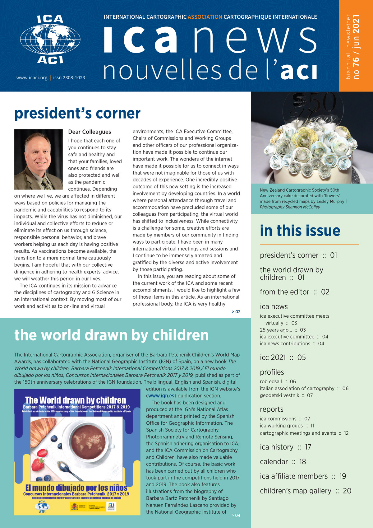
ICA News 76 now online

ICA News, Number 76, June 2021

We are pleased to announce that the 76th issue of the ICA News is now available for download:

This issue of ICA News reports on two anniversaries of our national members – New Zealand and Bulgaria – and announces
a new publication devoted to the Barbara Petchenik Children’s World Map competitions. Many thanks for your support.

– Igor Drecki, Editor ICA News

Category: General News
Tag:

International Cartographic Association Statement on Ukraine

The International Cartographic Association expresses its shock and dismay at the incursion by Russia into the sovereign state of Ukraine. Violation of a sovereign nation is unacceptable. Without provocation, innocent victims within the borders of Ukraine suffer unbearable intrusion and danger causing loss of life, intolerable pain and suffering on children, women and men, mass migrations to neighboring countries, and unnecessary destruction of property. The violent interruption of normalcy undermines global security and stability for every part of our world watching these horrible events unfold.

The International Cartographic Association calls for an end to all actions stemming from the forceful intrusion of Ukraine’s borders and a resolution for restoring the sovereignty of Ukraine and its people. The International Cartographic Association is in solidarity with the people of Ukraine and specifically with cartographers in both Ukraine and Russia who can contribute to protecting the sovereignty of Ukraine while beginning a path back to normalcy.

Category: General News

eCARTO News February 2022

eCARTO News captures the latest cartographic news and developments from around the world. If you have any general cartography items of interest then please email them to David Fraser, editor of eCARTO News.

Mapping the Environment

  • 20 years of Forest Loss in Indonesia & Malaysia – reddit.com
  • High-tech operation on Sydney Harbour steps up hunt for illegal fishers – ABC News
  • Mapping microplastics on Australian beaches – cosmosmagazine.com
  • Mapping a River Beneath the Sea – eos.org
  • LiDAR mapping reveals park’s complex geologic history – mtstandard.com
  • Revealed: First ever global map of whale migration exposes growing dangers along superhighways – Sky News
  • The Milky Way is a messy eater. This map shows the crumbs it has left behind – science.org

Humanity

  • Infographic: Hunger and food insecurity in maps and charts – Al Jazeera
  • Covid Maps Reveal Personal Pandemic Landscapes – Bloomberg

Indoor Mapping

  • Michael Gram Talks About the Growing Need for Indoor Mapping – globenewswire.com
  • Virtual reality home – linked.in
  • Intel, GoodMaps Collaborate On Mapping Software Project To Make Indoor Navigation More Accessible – forbes.com

Interactive Cartography

Opinion

  • Maps That Changed Our World – loc.gov
  • Mapping error raises question of location of 9 islands – AP News
  • Shackleton’s Endurance: Modern star maps hint at famous wreck’s location – BBC News

Opportunities

  • Call for Papers: Cartography and Geospatial Information Education – Theories and Practices – icaci.org
  • Special Issue “Geovisualization: Current Trends, Challenges, and Applications” – mdpi.com

Education

  • Cartography: an introduction – BCS
  • Mapas y sus proyecciones cartográficas – Aragón en Abierto – YouTube
  • Best Practice for How to Map Features and Overlapping Labels – LinkedIn
  • Enhance. – esri.com

Resources

Mapping Related Technologies

  • Land Info Completes 10m Countrywide Mapping Dataset of USA – gim-international.com
  • Drone mapping: One in six villages covered in India, shows data – business-standard.com
  • Latest update for popular C-MAP navigation app includes host of new features – sail-world.com
  • 3D Models from Drone Data Support Disaster Efforts and Define City Mapping Possibilities – UAV News

Publications

Cartographers

  • Proxi is making digital maps cooler – TechCrunch
  • Student story: Cartography M.Sc. students participated at the International Cartographic Conference 2021 in Florence, Italy – cartographymaster.eu

Lite Cartography

  • Sea Chase – xkcd: Sea Chase
  • A Sphere, Projecting Against a Plane – metmuseum.org
  • Jungholz: A ski town stuck in the wrong nation – BBC Travel
  • Shackleton’s Endurance: Modern star maps hint at famous wreck’s location – BBC News
  • Snapchat Will Allow Users To Share Live Location With New Snap Map Feature – news18.com
  • ‘Underground maps’ segment cities using fashion, AI – Cornell Chronicle
  • Nicolaus Copernicus – nasa.gov
  • 10 Bizarre World Maps – Listverse


Disclaimer: The views and opinions expressed by the weblink authors are their own and do not represent the official position of the ICA. The links are assembled for information and education purposes only.

eCARTO News January 2022

eCARTO News captures the latest cartographic news and developments from around the world. If you have any general cartography items of interest then please email them to David Fraser, editor of eCARTO News.

Cartographers

  • Carleton’s Fraser Taylor Named to the Order of Canada – carleton.ca
  • Pioneer of Cybercartography and Indigenous Mapping Fraser Taylor Named to the Order of Canada – Geospatial World
  • 40-year map project, History of Cartography, draws to a close – wisc.edu
  • Story of MapMyIndia – hindustantimes.com

Visualisations

Cartographic Animations

Opinion

Opportunities

Education

Retrospectives

  • How a Map Mistake Led to the Founding of New York City (New Amsterdam) – YouTube

Monitoring

  • NASA Greenland Mission Completes Six Years of Mapping Unknown Terrain – NASA
  • Mapping off Pasco and Hernando reveals healthy, growing sea grass meadows – suncoastnews.com
  • Real-time mapping assists Tonga – Defence News
  • City offers online map to help improve pedestrian, bicycle network – statesman.com
  • UIC Researchers Create Interactive Map to Track Pollution – WTTW

Publications

  • Gandara-Chacana on Padron, ‘The Indies of the Setting Sun: How Early Modern Spain Mapped the Far East as the Transpacific West’ [review] – reviews
  • Deux siècles de cartographie calédonienne 1774-1979 – caledolivres.nc
  • Descarga la revista digital Cartógrafo.CL – cartografo.cl
  • Cartography The Ideal and Its History – uchicago.edu
  • World Heritage Map – UNESCO

Genesis Technologies

  • Cycloramas in Melbourne – slv.vic.gov.au
  • Before cinemas existed, this is where you’d go to see the latest blockbuster – ABC News


Disclaimer: The views and opinions expressed by the weblink authors are their own and do not represent the official position of the ICA. The links are assembled for information and education purposes only.

eCARTO News December 2021

eCARTO News captures the latest cartographic news and developments from around the world. If you have any general cartography items of interest then please email them to David Fraser, editor of eCARTO News.

Global View

  • Mapping the world’s oil and gas pipelines – Al Jazeera
  • Release of 2021 Atlas of Canada World Map – Mirage News
  • Why Making Accurate World Maps Is Mathematically Impossible – Open Culture

Flora & Fauna Mapping

  • Scientists on a quest to map worldwide web of fungi beneath our feet – mongabay.com
  • Helping map the future of hazel dormouse conservation – phys.org
  • Map of transparent butterflies highlights biodiversity hotspot in Andes Mountains – Mirage News
  • Government study to map mosquito-borne virus risk – Taipei Times
  • New analysis using Canada’s carbon map shows how wildlife conservation also benefits climate – yahoo.com

Innovative

  • New digital maps make sightseeing in Shinjuku fun and easy – traveldailymedia.com
  • Genesys International Ltd files two patents in 3D and Mobile mapping space – prnewswire.com
  • Digital map of Rio’s biggest favela is reintegrating vital public services – mashable.com
  • Drop A Magnet On A Map And This ‘Window To The World’ Will Take You To That Place – wonderfulengineering.com
  • Walking in a 360° video with foot vibrations for seated observers – EurekAlert!
  • ‘A new navigation experience’: Apple’s flash feature coming to iPhone – news.com.au
  • Making maps with Anton Thomas – RNZ

Cartographic Animations

Transport

  • New biking map of Athens eases the ride around town – uga.edu
  • Forget Google Maps as Rival Joins Forces with VW for New Navigation Solution – autoevolution

Opportunities

Education

Historical

Cartographic Reads

Just Maps

Lite Cartography


Disclaimer: The views and opinions expressed by the weblink authors are their own and do not represent the official position of the ICA. The links are assembled for information and education purposes only.

eCARTO News November 2021

eCARTO News captures the latest cartographic news and developments from around the world. If you have any general cartography items of interest then please email them to David Fraser, editor of eCARTO News.

Atlases and other publications

  • 40-year map project, History of Cartography, draws to a close – wisc.edu
  • State of Israel – 70 Years of Statistics, Historical Statistical Atlas 1948-2018 – cbs.gov.il
  • See a selection of fabulous old maps of Newcastle from a new book published this week – Chronicle Live

Environmental Mapping

  • Researchers map the impact of human sewage on coastlines around the world – abc.net.au
  • Infographic: COP26 goals explained in maps and charts – Al Jazeera
  • Three maps that show exactly how climate change has spread across the world in the last 30 years – inews.co.uk
  • Flood-impact map a Canadian first – westernu.ca
  • This map shows exactly where the world’s most important carbon is stored – fastcompany.com
  • We mapped every large solar plant on the planet using satellites and machine learning – theconversation.com
  • Digital Models for Planning and Disaster Management – gim-international.com

Opportunities

  • American Geographical Society Library Research Fellowship – uwm.edu

Historical

  • Panorama of the Thames project – Thames project
  • Society for the History of Discoveries – discoveryhistory.org
  • Spanish Armada maps ‘saved for the nation’ – BBC News
  • ‘They deserve a place in history’: music teacher makes map of female composers – The Guardian
  • Stone slab found in France thought to be Europe’s oldest 3D map – The Guardian
  • Pacific maps: From the days when exploration was like setting off in the dark – smh.com.au
  • Beautiful hand-drawn maps reveal Warsaw as it looked over 100 years ago – The First News
  • Piri Reis’ world map on display at Topkapı Palace – hurriyetdailynews.com

Cartographic Inspirations

  • Cómo conseguir un mapa al estilo “Joy Division” con Peak Maps – cursosgis.com
  • QGIS para cartografía digital en censos y encuestas – nosolosig.com
  • Zapotec in 90006, K’iche’ in 90057: New map highlights L.A.’s Indigenous communities – latimes.com
  • 3D Printing Topographic Maps: How to Print Landscapes – All3DP

Cartographic Intrigue

  • Banned map returns home – Mirage News
  • Memory lanes: Google’s map of our lives – The Guardian
  • WSU professor’s book, ‘Detroit in 50 Maps,’ gives cartographer’s view of the city – Wayne State University
  • A Reddit user found a ‘black hole’ on Google maps, and users couldn’t figure out what it was – businessinsider.com
  • The long lost Lancashire village which was ‘wiped off the map’ without a trace 40 years ago – LancsLive
  • The Greek region too remote for maps – BBC Travel

Viewpoint – Cartography

Just Maps

  • Human Development Index evolution in Brazilian states between 1990-2015 – zoom-maps.com

Alternatives

Lite Cartography

  • Cartographers puzzle-y fun – Marietta Times
  • MAP: the one attraction you have to visit in each province in Spain – thelocal.es
  • Zwift Neokyo map open from today | Full details of each of the 8 new routes – BikeRadar


Disclaimer: The views and opinions expressed by the weblink authors are their own and do not represent the official position of the ICA. The links are assembled for information and education purposes only.

eCARTO News October 2021

eCARTO News captures the latest cartographic news and developments from around the world. If you have any general cartography items of interest then please email them to David Fraser, editor of eCARTO News.

Technology

Viewpoint – Cartography

Interactive Mappin

  • Multilingual, interactive mapping site to guide tourists on culture walk – Times of India
  • This Interactive Map Lets Users Explore England’s Hidden Archaeological Landscape – Smithsonian Magazine
  • The vaccination rate for every suburb in New Zealand on an interactive map – thespinoff.co.nz

Environmental Mapping

Deep Cartography

  • Scientists create most detailed map of Uranus’ mysterious auroras to date – Space
  • HawkEye 360 wins radiofrequency mapping contract with intelligence agency – defensenews.com
  • Study demonstrates lunar composition mapping capabilities of spectrograph instrument – phys.org
  • Divers on historic quest to map cave, spring – emissourian.co
  • Astronomers get a 3D look at nearby stellar nurseries – astronomy.com

Historical

  • Nebra Sky Disc: British Museum to display world’s ‘oldest map of stars’ – BBC News
  • Mapping with the stars: Nuns instrumental in Vatican celestial survey – catholicnews.com
  • mexican duo creates first cartography with all the architectural heritage of mexico city – designboom.com

Atlases and other publications

Relief Maps

  • Bartholomew Revised Half-Inch Map Skye and Wester Ross – View map
  • 3D Design: Terrain and Sky Component in Mapbox Studio – 3D Design

Industry News

Related

  • The Incredible Life of Hubert Wilkins – booktopia.com
  • Volcano Watch — The Canary Islands “mega-tsunami” hypothesis, and why it doesn’t carry water – usgs.gov
  • How cartography helped the Grand Canyon become grand – news.asu.edu
  • The Future Is Bleak. Pondering Pangaea Gives Me Hope – wired.com


Disclaimer: The views and opinions expressed by the weblink authors are their own and do not represent the official position of the ICA. The links are assembled for information and education purposes only.

International Journal of Cartography: Special Issue ICC2021, Florence, Italy – part 1, published on-line

Cover International Journal of CartographyThe Special Issue of the International Journal of Cartography: Issue 7.3, 2021 Special Issue ICC2021, Florence, Italy – part 1, is now published on-line. The print version of the issue will follow this.

Two Special Issues will be published to coincide with the conference: Issue 7.3 2021 (this issue) and Issue 8.1 2022. As the conference will take place in December 2021, all Special Issue papers will be published on-line before the Conference takes place, with print issues to follow.


Editorial: The International Cartographic Conference 2021 – Firenze, Italy: a truly wonderful occasion to celebrate the outcomes and advances of international collaboration and the resilience of Italian Cartographers

The international Cartography and GIScience community were gratified to receive news that the 2021 International Cartographic Conference would take place in Firenze, Italy between 14-18 December, in spite of the many hurdles that had to be overcome by the Associazione Italiana di Cartografia to ensure that this important event took place in this time of global disruption and uncertainty due to COVID-19. Our Italian colleagues are to be congratulated on their dedicated and diligent endeavours to ensure that the International Cartographic Association’s community will be able to meet and advance the theory and praxis of Cartography and GIScience.

The Journal editors worked closely with the Conference Publications Chair, Professor Paola Zamperlin of the Università di Pisa to progress papers for review and potential publishing. Selected papers submitted for the ‘Advances in Cartography’ publishing route for ICC2021 were considered for publication in the Special Issues of the Journal. Ninety-nine full papers were submitted to the ‘Advances’ publishing route. These papers were reviewed initially by the conference LOC, and evaluated by both national and international reviewers. After these reviews were complete and the outcomes considered by the LOC, selected papers were recommended to us for consideration for further review, with the potential of publishing in the Journal. Twenty-four selected papers were recommended by the LOC to the IJC editors. From these papers, sixteen papers were identified for consideration and a further two blind reviews were conducted on these papers. The papers published in Issue 7.3, 2021 and Issue 8.1, 2022 were realised by this process. We thank all LOC reviewers and Journal reviewers for their support of the review process, the Journal and, more broadly, the researchers whose work that advances the research goals of the International Cartographic Association are reported upon in these Special Issues of the Journal.

The papers herein begin with a contribution by Radek Barvir and Vit Vozenilek, with their contribution entitled Graphic map load measuring tool – development and verification. They explain that ‘Map load’ is a map property quantifying the amount of map content in cartographic products. This paper presents information about an easy-to-use and freely available tool GMLMT (Graphic Map Load Measuring Tool) that applies a metric averaging of the amount of visible structures in a map using an edge-detection approach to measure graphic map load of raster representations of maps. The process of designing the tool is described and the outcomes of their experiments is reported.

This is followed by the paper Spatial thinking in cartography teaching for schoolchildren by Sônia Maria Vanzella Castellar and Barbara Gomes Flaire Jordão. The paper provides the results of a study that investigated school teaching practises that relate spatial thinking with the learning of maps from a cartographic education perspective. The study was undertaken to support further research on school cartography and the use of digital cartographic resources in formal and informal teaching situations.

David Fairbairn, Georg Gartner and Mike Peterson examine the distinctiveness of the discipline of cartography and the success of the human endeavour that has produced maps. This paper is entitled Epistemological thoughts on the success of maps and the role of cartography. The authors argue that not only that cartography is a coherent and distinctive discipline, but that human society cannot function without maps. The paper concludes with pointers to the functional definition of the map.

Evaluating a location-based game to support citizens situated reflection on history: A mixed method approach is contributed by Catherine Jones. Catherine’s paper describes the process and findings of a critical evaluation conducted for a custom-made Location Based Game, designed to support reflection on social history. A ‘Think-aloud’ protocol was used in an evaluation in Valletta, Malta and adapted to the ‘Remind study’ protocol to explore participant experience in Luxembourg.

All of the issues of the International Journal of Cartography include a Column, entitled MAPS IN HISTORY, contributed by Imre Demhardt. In this issue, Professor Demhardt provides a timely column on the Renaissance frescoed map of Tuscany. This article describes the first 31 of 54 map-decorated cabinet fronts of the then known world in the Sala della Carte Geografiche in Palazzo Vecchio painted by Egnazio Danti in 1563–1575.

The International Journal of Cartography, since its launch some 7 years ago, has been committed to realising the publication of selected research papers submitted to the review stream of International Cartographic Conferences. As the conference will take place in December 2021, the two Special Issues are to be published to coincide with the conference are Issue 7.3 2021 (this issue) and Issue 8.1 2022. All on-line versions of the papers were published in 2021. The print version of Issue 7.3 will be published in 2021 and Issue 8.1 in 2022. (As is the case with all of our issues, the on-line versions of papers are published first, then the print versions.)

The international Cartography and GIScience community are indebted members of the Associazione Italiana di Cartografia and the conference team, led by Professor Giuseppe Scanu, for their unwavering commitment to ensure that ICC2021, a truly wonderful occasion, will take place in Firenze in December 2021.

William Cartwright, Anne Ruas and Paola Zamperlin
Melbourne | Paris | Pisa

Category: General News
rawboned-refined