


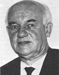
Erwin Gigas
Professor Dr. Ing. Erwin Gigas was one of the promoters of the International Cartographic Association and its first Secretary-Treasurer. At the beginning of his professional career he was mainly concerned with geodesy. In 1928 he joined the Reichsamt für Landesaufnahme, the then central organisation for surveying and mapping in Germany. He became one of the outstanding specialists in trigonometrical surveys and during the first years after World War II he became widely known for his contribution to the unification of the various national European triangulation networks into one European system. But Gigas’ genius was wide-ranging; he was one of the last Universal Men. He did not limit himself to geodesy; his interests also embraced photogrammetry, cartography and even reproduction. In the second half of his life, his involvement in international cooperation and the problems of developing countries became dominant. In 1952 he was appointed Director of the Institut für Angewandte Geodäsie (Institute of Applied Geodesy) in Frankfurt am Main. In this position he succeeded in transforming the institute into a Federal Office.
His international contacts started in 1955, when he represented his country at the first United Nations Regional Cartographic Conference for Asia and the Far East in Mussoorie (India). When the discussion on international cooperation in the field of cartography proper was initiated by Dr. Mannerfelt in 1956, Gigas became one of the most active supporters. He was elected a member of the so-called Committee of Six, with Dr. Mannerfelt as chairman. Subsequent conferences at Evanston, Chicago (USA) and at Mainz (FRG), both in 1958, pointed the way, increasingly clearly and convincingly, to the eventual formation of the ICA in Bern in 1959. Thus, the ICA was born. At its first General Assembly of Delegates in Paris in 1961 Professor Gigas was elected Secretary-Treasurer of the young Association with Professor Imhof as President.
One year later the United Nations convened the UN Technical Conference on the International Map of the World 1:1 000 000 (IMW) at Bonn it was the first UN conference held in the Federal Republic of Germany. Gigas was elected President of the conference, which elaborated new specifications for the compilation of the IMW, still valid today. In the same year Prof. Gigas organised the First Technical Conference of the ICA in his institute in Frankfurt am Main. At the ICA conference in London/Edinburgh (1964), both Imhof and Gigas retired from their ICA duties. They were succeeded by Brigadier Thackwell (UK) and Dr. Ormeling (Netherlands) respectively. Thus, after the foundation period of the ICA as an international non-governmental organisation, a period of consolidation began, making ICA the world-renowned association.
Parallel to his activities for ICA, Professor Gigas was in much demand as a specialist in seminars and conferences of the United Nations. Thus we find him at the UN seminar in Teheran (Iran) in 1957 and at the UN Regional Cartographic Conference for Asia and the Far East in 1962 in Bangkok.
In 1964 Gigas retired as Director of the Institut für Angewandte Geodäsie, but no one was astonished that he remained very active. He had cultivated an interest in automation and after his retirement worked for two years with the US Coast and Geodetic Survey in Silver Spring, Maryland. Here he worked on automated procedures for data processing for the preparation and maintenance of aeronautical charts.
Many of his publications deal with cartography proper, with automation in cartography and with promoting cartography in developing countries. The last years of his life were spent in southern Spain, where he left the great family of cartographers in 1976.
