


The 29th International Cartographic Conference and 18th General Assembly took place in Tokyo, Japan, 15–20 July 2019.
#icc2019tokyo in Numbers
- 950 participants from over 75 countries
- Papers: 750 presentations, 150 sessions
- 4 keynote speeches + 2 special sessions
- International Map Exhibition: 385 maps and related objects from 30 countries
- International Children’s Map Competition: 188 maps from 33 countries
- 22 booths for Technical and Commercial Exhibition
- 400 participants for the Opening reception
- 250 participants for the Gala Dinner
- 50 grants for young researchers
Proceedings
The proceedings can be found here:- Advances of the ICA, eISSN 2570-2084: Volume 1, 2019
- Proceedings of the ICA, eISSN 2570-2092: Volume 2, 2019
- Abstracts of the ICA, eISSN 2570-2106: Volume 1, 2019
General Assembly
The conference hosted the 18th General Assembly of ICA. Details can be found here.ICA Awards
At the ICA Awards Ceremony at ICC2019 the following awards were presented in recognition of contributions to the ICA:| Evangelos Livieratos | Greece | ICA Honorary Fellowship |
| Miljenko Lapaine | Croatia | ICA Honorary Fellowship |
| Takashi Morita | Japan | Diploma for outstanding services to ICA |
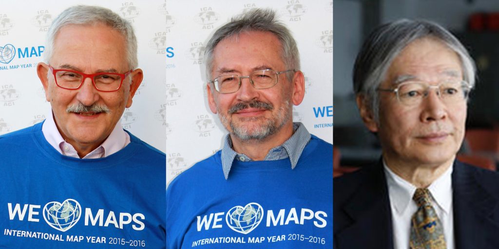
Evangelos Livieratos, Miljenko Lapaine, Takashi Morita
Pre-Conference Activities
Several ICA Commissions were organizing pre-conference events.
| Date | Venue | Title | Organized by the Commission(s) on |
|---|---|---|---|
| July 10–12 | Beijing, China | Geospatial and Cartographic Education – Contemporary Challenges and Opportunities | Education and Training |
| July 11–12 | Beijing, China | User Experience Design for Mobile Cartography: Setting the Agenda | Cognitive Issues in Geographic Information Visualization | Location Based Services | Visual Analytics | Use, User and Usability Issues |
| July 12–14 | Akita, Japan | Future Internet and Ubiquitous Cartography 2019 | Maps and Internet | Ubiquitous Mapping |
| July 13–14 | Tokyo, Japan | Reclaiming through Mapping: Olympic Sites of Tokyo | Art and Cartography |
| July 13–14 | Tokyo and Tsukuba, Japan | Disaster Risk Reduction (DRR) Challenges for Cartography in Big Data Era | Cartography for Early Warning and Crises Management |
| July 14 | Tokyo, Japan | Atlases and Infographics | Atlases |
| July 14 | Tokyo, Japan | Map Projections | Map Projections |
| July 15 | Tokyo, Japan | Abstraction, Scale & Perception | Cognitive Visualization | Generalisation and Multiple Representation |
| July 15 | Tokyo, Japan | Cartography as a Cultural Encounter: How East and West have Mapped and Influenced Each Other | History of Cartography | Topographic Mapping |
| July 15 | Tokyo, Japan | Cartography for Specific Users | Cartography and Children | Maps and Graphics for Blind and Partially Sighted People | Planetary Cartography |
| July 15 | Tokyo, Japan | Location-based Big Data 2019 | LBS | Geospatial Analysis and Modelling |
| July 15 | Tokyo, Japan | Role and Structure of National Names Boards | Toponymy |
| July 15 | Tokyo, Japan | Spatial Data Infrastructures, Standards, Open Source and Open Data for Geospatial (SDI-Open 2019) | SDI and Standards | Map Production & Geoinformation Management | Open Source Geospatial Technologies |
Map awards
The winning entries are listed below. For a full list of map products exhibited during ICC2019, please check the PDF catalogue.| Atlases | 1st: National Atlas of Hungary, Hungary 2nd: Graphical Statistical Atlas of Switzerland 1897–2017, Switzerland 3rd: Atlas of Poland's Political Geography, Poland |
| Digital Products | 1st: Politics of Remembrance 1945–2015, Austria 2nd: Caydence, United Kingdom 3rd: Water Rhyme in Gusu, China |
| Educational cartographic products | 1st: Cartography. USA-Esri 2nd: TouchIt3D Tactile Maps, Czech Republic 3rd: Statistical Maps: Data Elaboration and Presentation, Poland |
| Other cartographic products | 1st: Map Data Provision Products, Japan 2nd: Transparent Globes, China 3rd: 3D model of Domnica Cave, Czech Republic |
| Charts on panels | 1st: The map of Northern Sea Area, China 2nd: Tokyo Wan, Japan 3rd: Abords et port de I'île Saint-Pierre, France |
| Maps on panels | 1st: Fimbulheimen in Dronning Maud Land, Antarctica, Norway 2nd: Ecological Area Map of the Estuary Wetland of Dagu River, China 3rd: The Melbourne Map, Australia |
| Public vote | Water Rhyme in Gusu, China |
- Co-chairs: Kenneth Field and Ian Muehlenhaus
- Temenoujka Bandrova
- William Cartwright
- Serena Coetzee
- Igor Drecki
- David Fairbairn
- Georg Gartner
- Amy Griffin
- Anja Hopfstock
- Lorenz Hurni
- Antoni Moore
- Dušan Petrovic
- Hiroshi Une
- Nonoko Tsukada
Barbara Petchenik Competition
188 drawings from 33 countries were exhibited. All of them will soon be accessible in the Winner Map Collection at the Carleton University Library.
Bianca Belović (5), Slovenia, < 6 years, 1st place

Ye Shangke (5), China, < 6 years, 2nd place

Tara D. J. Suprapto (5), Indonesia, < 6 years, 3rd place

Liepa Jokubaitytė (7), Lithuania, 6–8 years, 1st place

Micah Allen Setianto Moore (8), Australia, 6–8 years, 2nd place

Luca Kunos (7), Hungary, 6–8 years, 3rd place

Kim Min-Chan (12), Korea, 9–12 years, 1st place

Barnaby Blampied (9), New Zealand, 9–12 years, 2nd place

Hande Körbalta (9), Turkey, 9–12 years, 3rd place

Rada Skumova (15), Bulgaria, 13–15 years, 1st place

Agata Filipiak (14), Poland, 13–15 years, 2nd place

Katarína Šáleková (15), Slovakia, 13–15 years, 3rd place

Noemí Sánchez (14), Spain, Public vote

Ugnė Rimkutė (15), Lithuania, Creativity Award

Robert Hopjan (11), Czech Republic, Special Mention


Members of the Jury
The jury members were
- Pilar Sánchez-Ortiz Rodríguez, Spain – Chair
- Ana María Garra, Argentina
- Temenoujka Bandrova, Bulgaria
- Simon Catling, Great Britain
- Koji Ohnishi, Japan
- Dariusz Dukaczewski, Poland
- Necla Ulugtekin, Turkey
- Naeema Al Hosani, United Arab Emirates
- Carla Sena, Brazil and Jesus Reyes, Hungary – Substitute Members
- Peter van der Krogt, The Netherlands – International Coordinator
Scholarships
| Name | Country | ICA event | Date | Title of paper / poster | Sum in € |
|---|---|---|---|---|---|
| Aytaç YÜRÜKÇÜ | TUR | History of Cartography and the Topographic Mapping | 07/2019 | How East and West Cartographic Studies Influenced the Most Important 16th Century Ottoman Cartographer of Piri Reis and His World Maps | 200 |
| Dr. Lei ZOU | USA | LocBigData 2019 | 07/2019 | Leveraging Location-Based Social Media for Smart Emergency Management | 200 |
| Christian RÖGER | DEU | LocBigData 2019 | 07/2019 | Visualizing the Complexity of Crossings using Star-Plot Maps | 200 |
| Wangshu WANG | AUT | Joint Pre-Conference Workshop of the ICA Commission on Use, Users, and Usability, the Commission on Cognitive Visualization, the Commission on Location-based Services and the Commission on Visual Analytics | 07/2019 | Towards a Functional Ontology for Mobile Map Applications | 200 |
| Nargiz Safaraliyeva | AZE | ICC2019 | 07/2019 | Teaching basic map concepts in three countries: Azerbaijan, Hungary and United Arab Emirates | 1000 |
| Malak Alasli | MAR | ICC2019 | 07/2019 | Toponyms’ contribution to identity: The case study of Rabat (Morocco) | Static Risk Mapping of Forest Fires - In the case of the Province of Chefchaouen (Morocco) | 800 |
| Shyamantha SUBASINGHE | LKA | ICC2019 | 07/2019 | Urban Growth: From pixel to reality | 700 |
| Dr. Alena Vondráková | CZE | ICC2019 | 07/2019 | TouchIt3D: Technology (not only) for Tactile Maps | The Specifics of Cartographic Semiology in Tactile Maps | 600 |
| Ashna Kareem Zada | IRQ | ICC2019 | 07/2019 | Testing Maps for Visually Impaired People in Kurdistan | 600 |
| Jagadish B | IND | ICC2019 | 07/2019 | Deriving Multiple Representation Database: A Model Generalisation Approach | 500 |
| Lukasz Halik | POL | ICC2019 | 07/2019 | Teaching of geographical space relations for cartography - Academic Outdoor Station in Poznan (Poland) | Workflow for 3D geovisualization of the data obtained with the use of Unmanned Aerial Vehicle in Augmented Reality | The visualization of the use of land on the basis of the dynamics of the pedestrian movement from the interval UAV imaging | Measuring user preferences in virtual reality (VR): 2D versus 3D urban geovisualizations of topographic data | 500 |
| Márton Pál | HUN | ICC2019 | 07/2019 | Digital cartography for geoheritage: turning an analogue geotourist map into digital | Possibilities of high precision GPS data in autonomous driving | 500 |
| Nikola Yonov | BGR | ICC2019 | 07/2019 | School Atlas with Augmented Reality | 500 |
| Radek Barvir | CZE | ICC2019 | 07/2019 | The Specifics of Cartographic Semiology in Tactile Maps | TouchIt3D: Technology (not only) for Tactile Maps | 500 |
| Pongpichaya William Limpisathian | USA / THA | ICC2019 | 07/2019 | Representations of Place in the Human Brain | 400 |
| Ivan Evgenyevich Fokin | Russia | ICC2019 | 07/2019 | The automation of processes of atlas mapping | Methods and algorithms for creation of structural schemes of rivers | 400 |
| Nick Lally | USA | ICC2019 | 07/2019 | Mapping dynamic, non-Euclidean spaces | Interactive & Multiscale Thematic Maps: A Preliminary Study | 400 |
| Xiao Huang | USA / CHN | ICC2019 | 07/2019 | Linking picture with text: tagging flood relevant tweets for rapid flood inundation mapping | 400 |
| Carolyn S. Fish | USA | ICC2019 | 07/2019 | Emotional responses to climate change map framing using facial emotion recognition technology | 300 |
| Harrison Cole | USA | ICC2019 | 07/2019 | Toward Accessible Hazard Mapping: Tactile Risk Maps and Disaster Preparedness | 300 |
| Laure De Cock | BEL | ICC2019 | 07/2019 | Linking perception to decision point complexity for adaptive indoor wayfinding support | 300 |
| Maja Kalinic | DEU / BIH | ICC2019 | 07/2019 | Floating Car Data and Fuzzy Logic for classifying congestion indexes in the city of Shanghai | 300 |
| Ross Thorn | USA | ICC2019 | 07/2019 | How to Play with Maps | 300 |
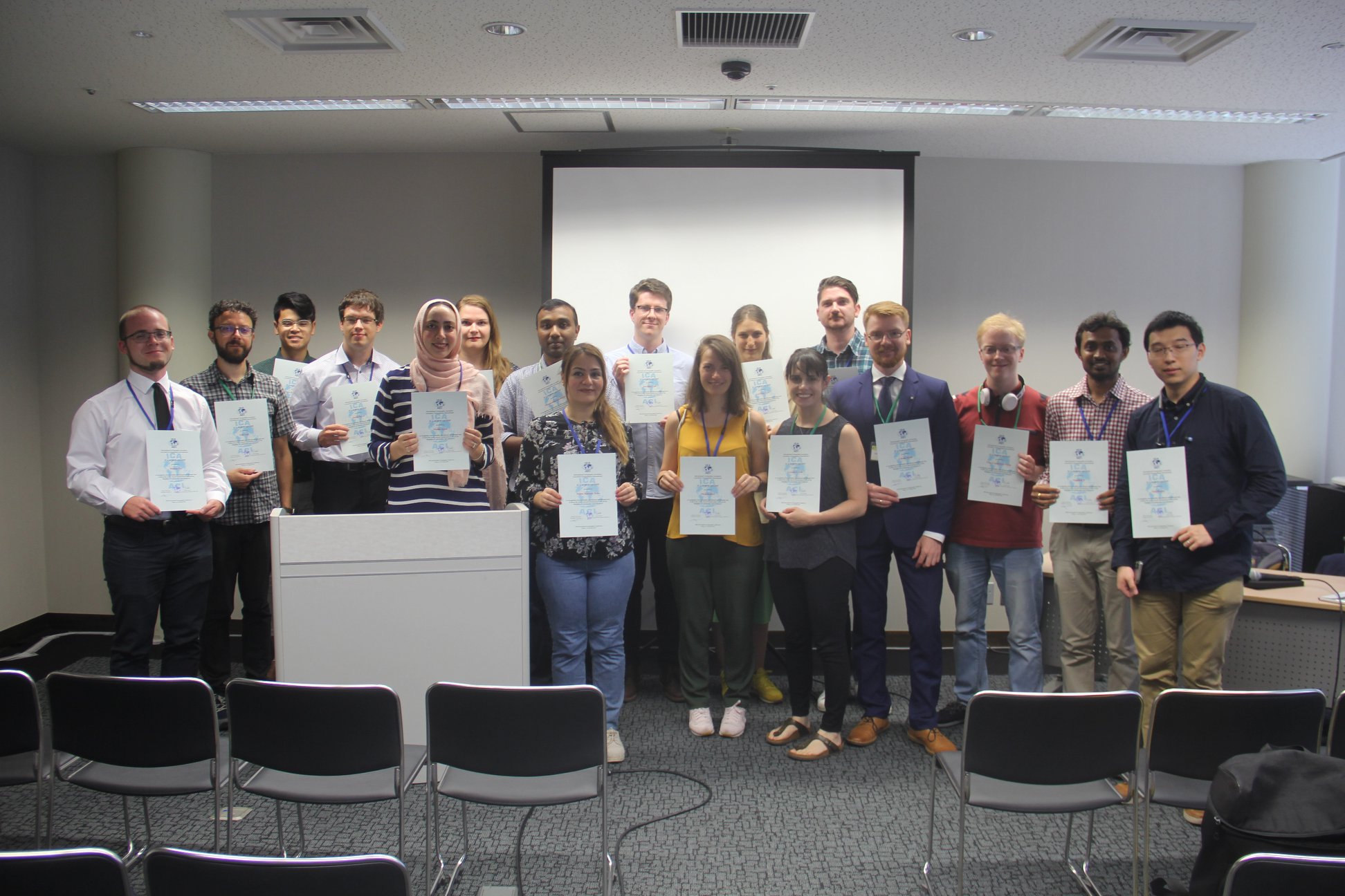
From left to right: Márton Pál, Nick Lally, Pongpichaya William Limpisathian, Radek Barvir, Malak Alasli, Dr. Alena Vondráková, Shyamantha Subasinghe, Ashna Kareem Zada, Harrison Cole, Maja Kalinic, Laure De Cock, Carolyn S. Fish, Nikola Yonov, Lukasz Halik, Ivan Evgenyevich Fokin, Jagadish B, Xiao Huang
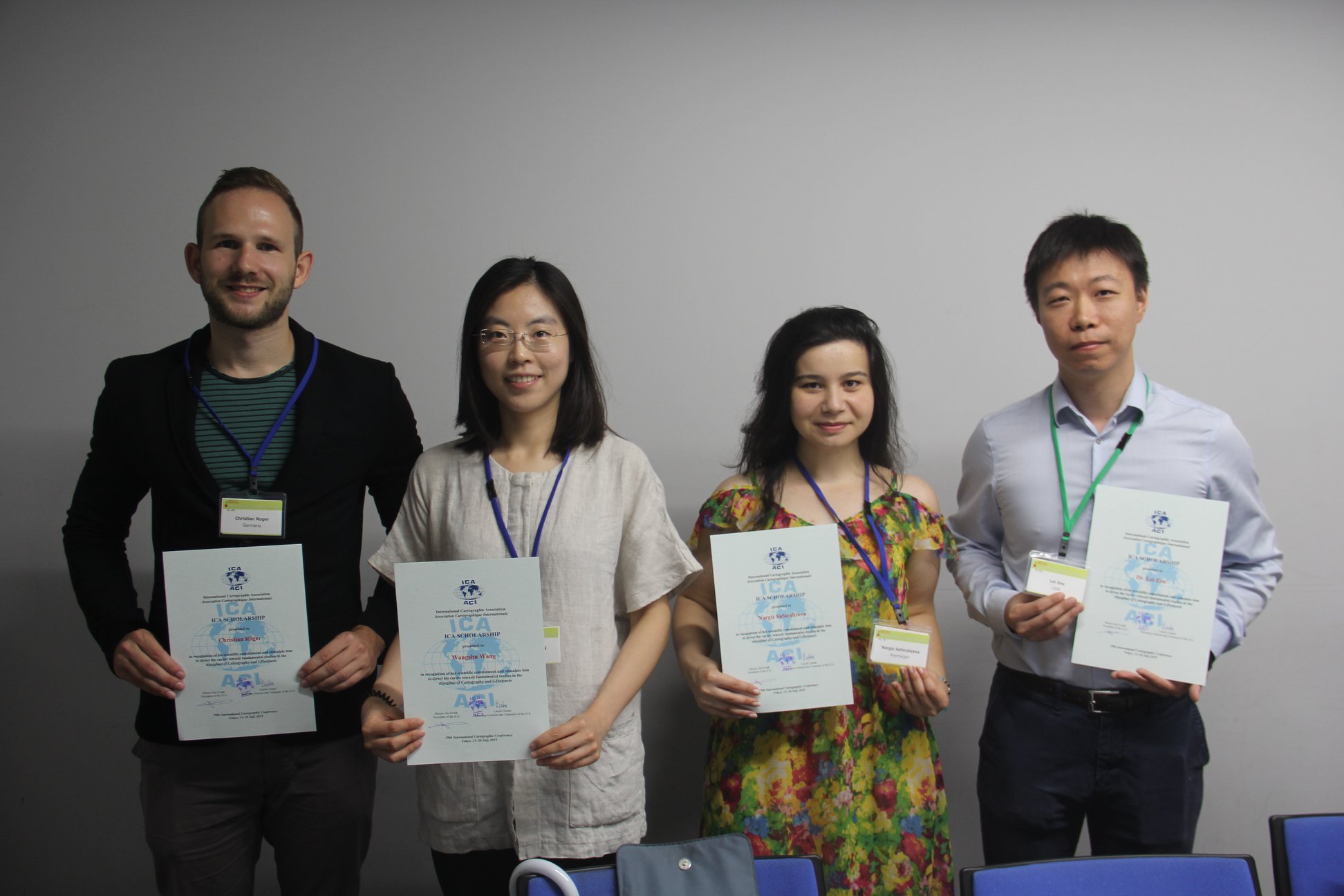
From left to right: Christian Röger (pre-conference), Wangshu Wang (pre-conference), Nargiz Safaraliyeva (ICC), Dr. Lei ZOU (pre-conference)
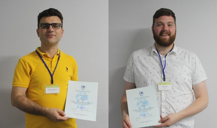
Left: Aytaç YÜRÜKÇÜ, Pre-conference; Right: Ross Thorn, ICC
Commission reports
During ICC 2019, the commissions presented posters of their activities in the 2015–2019 term:- Art and Cartography
- Atlases
- Cartographic Heritage into the Digital
- Cartography and Children
- Cartography in Early Warning and Crisis Management
- Cognitive Issues in Geographic Information Visualization
- Education and Training
- Generalisation and Multiple Representation
- Geospatial Analysis and Modeling
- GI for Sustainability
- the History of Cartography
- Location Based Services
- Map Design
- Map Production and Geoinformation Management
- Map Projections
- Maps and Graphics for the Blind and Partially Sighted People
- Maps and the Internet
- Marine Cartography
- Mountain Cartography
- Open Source Geospatial Technologies
- Planetary Cartography
- SDI and Standards
- Sensor-driven mapping
- Topographic Mapping
- Toponymy
- Ubiquitous Mapping
- Use, User and Usability Issues
- Visual Analytics
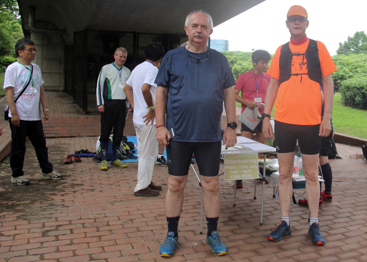
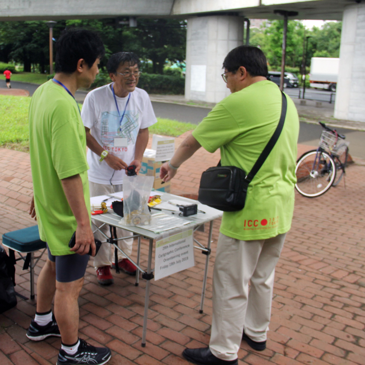
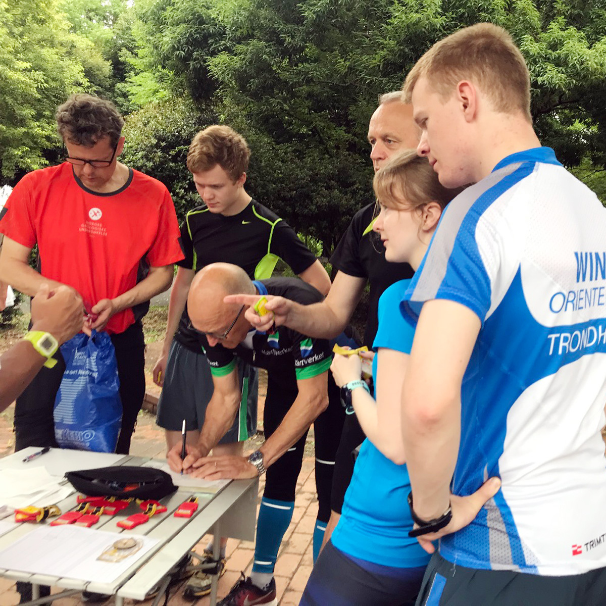
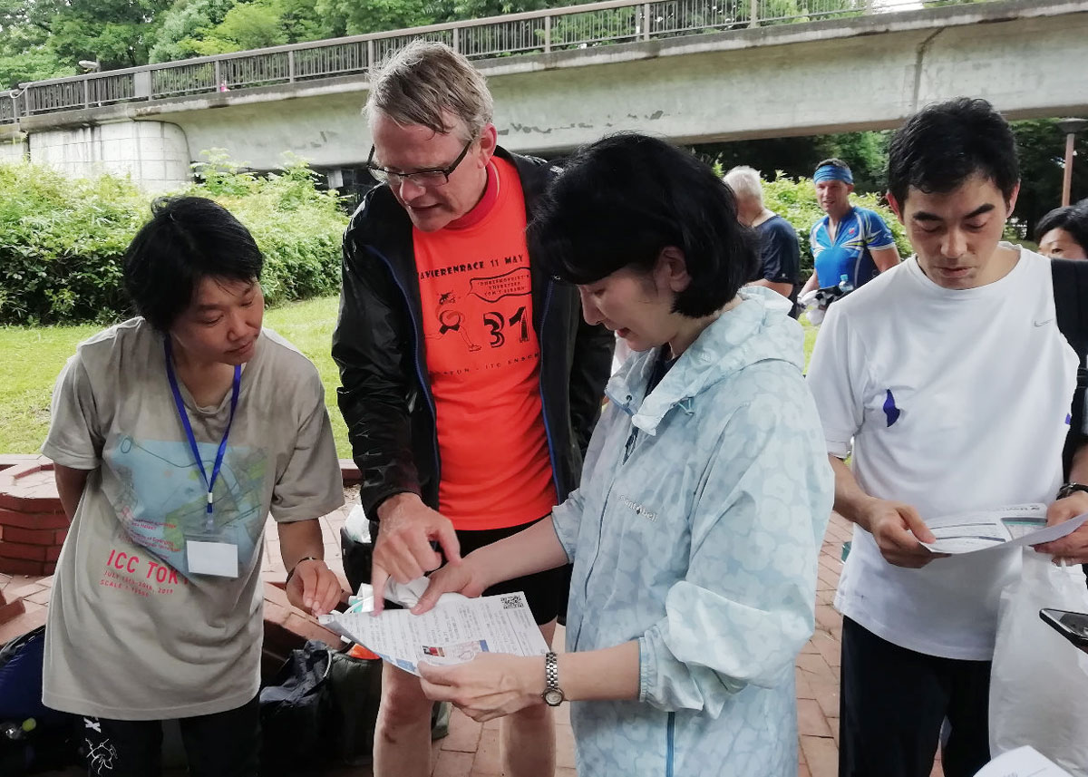
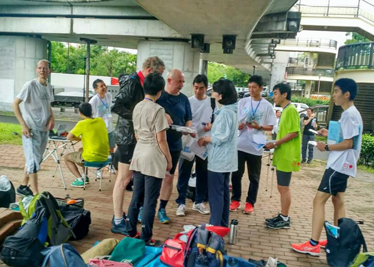
Orienteering event
Details and results of the orienteering event on July 19 at KIBA Park can be found in our orienteering section.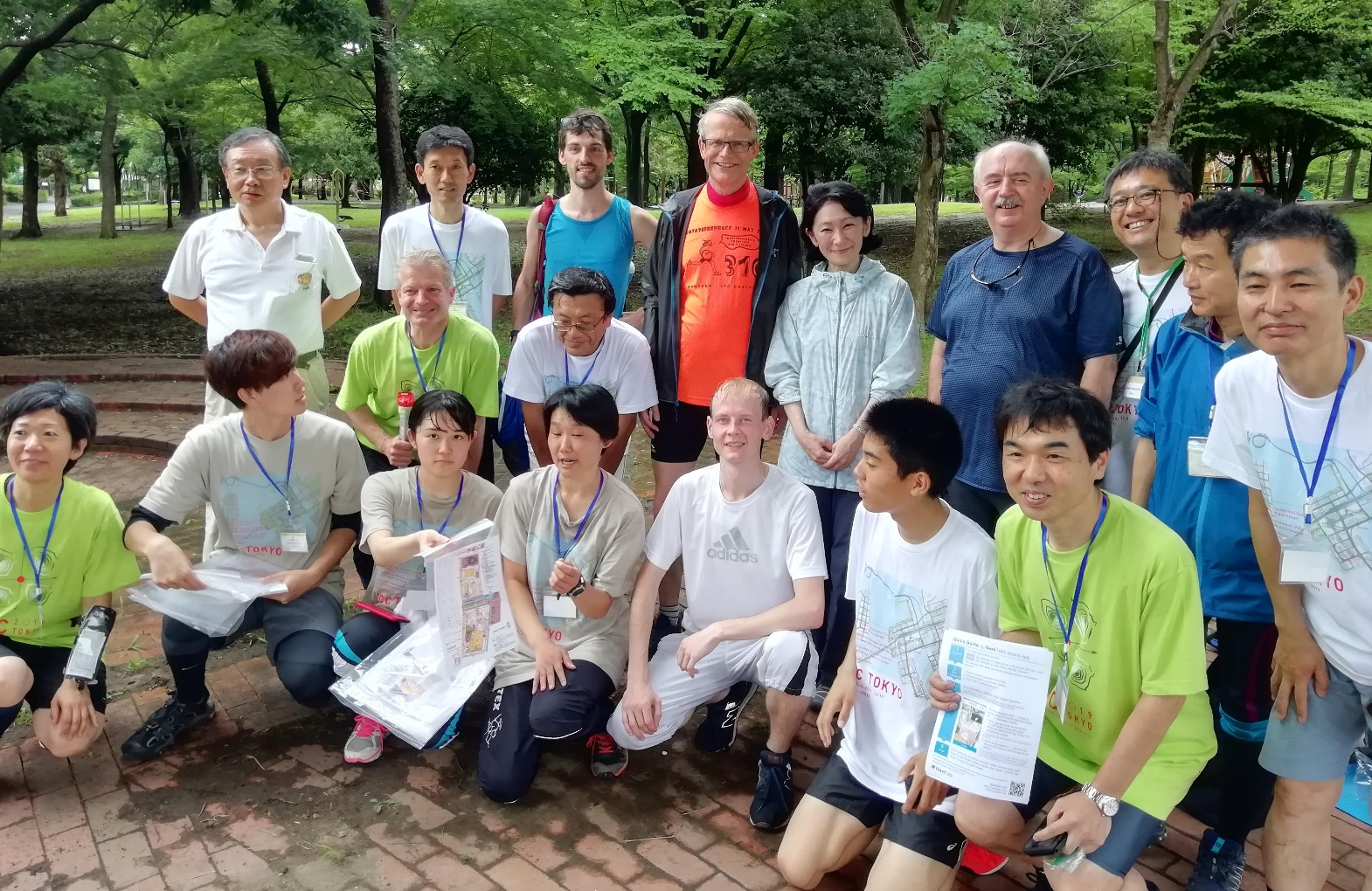
Group photo at the orienteering event


Pingback/Trackback
30th International Cartographic Conference and International Cartographic Exhibition – Cartography and Geographic Information Society