


The ICA is happy to feature the 13th Map of the Month: “New School Maps of Greece”
At the 24th International Cartography Conference in Santiago, Chile, the map won the first jury’s prize in the category “Other”. The jury stated:
“Eye-candy” for educational use with multiple views. Perfect composition as well as intuitive colouring with impressive terrain accentuation.


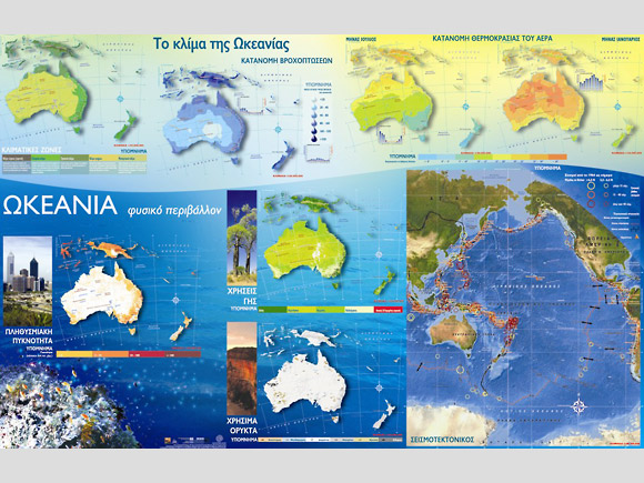
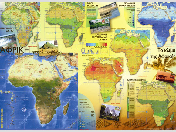
Publisher’s Description: In 2006 the Pedagogical Institute of the Greek Ministry of Education produced a new series of School Maps aiming to fully support the educational needs of Geography courses in the first and second year of high school (ages 12 and 13). Maps cover all geographical scales; global, continental and national. Thematic maps revealing aspects of the human and natural environment of Greece, Europe, north and south America, Africa and Asia provide appropriate geographic information to assist students in understanding spatial relationships and interactions of complex phenomena. Maps have been designed and produced by a consortium of Greek Universities with the scientific coordination of the Cartography and GIS Lab. of the Department of Geography at the University of the Aegean.
- Paper
- Scale: 1:800.000
- Size (mm): 900x650
- Authors: Department of Geography / University of the Aegean
- Publisher: Pedagogical Institute Greece
- Date of edition: 01/09/2006
- Languages: Greek
- Department of Geography, University of the Aegean
- Full cataloque of School Maps: Greece (Greek only)
- Full cataloque of School Maps: World, Europe, Asia, Africa, N & S. America (Greek only)
