


At the 25th International Cartography Conference in Paris, France, “Litto 3D sur l'ile de Ré et sur les îles Éparses” won the first jury’s prize in the category Digital Products. The jury stated:
Continuous 3D representation of submarine and terrestrial relief with high precision. May be used, for instance, to study the consequences of sea-level rises.
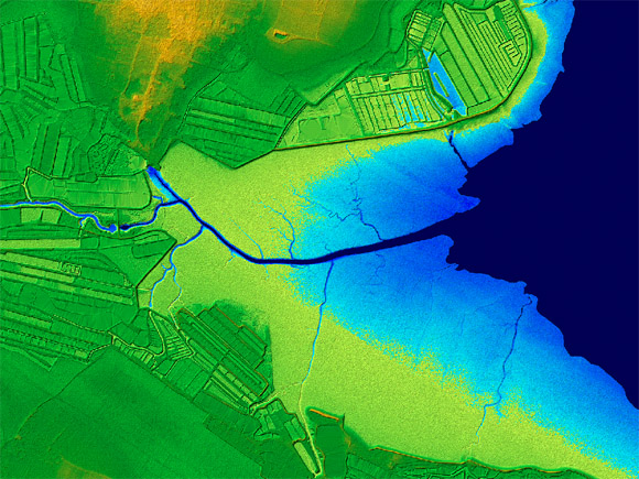

Publisher’s Description: Jointly operated by the National Institute of Geographic and Forest Information (IGN) and the French Navy’s Hydrographic and Oceanographic Agency (SHOM), the Litto3D program, using LIDAR technology, aims to cover the entire French coastline with a continuous high-resolution 3D land-sea model. This program is included with its altimetry for flood risk zones in the updated version of the Large-Scale Geographic Referential (RGE), whose development the French State decided to accelerate in 2010, in response to a European directive on flood risk assessment and management and in support of a national “rapid reaction to flood emergencies” plan.
- Publishers and Editors: National Institute of Geographic and Forest Information (IGN) and the French Navy’s Hydrographic and Oceanographic Agency (SHOM)
- Date of publication: 2010
- Language: French
