Welcome to the International Cartographic Association
Welcome to the website of the International Cartographic AssociationGet to know the new ICA Executive Committee for the term 2023-2027
Welcome to the website of the International Cartographic Association
Get to know the new ICA Executive Committee for the term 2023-2027

Obituary: Godfried Theodore Toussaint

Portrait Godfried Theodore Toussaint (CC BY-SA 3.0 via Wikimedia)

Godfried Theodore Toussaint

It is with great sadness that we share the news that Godfried Theodore Toussaint passed away while sharing his work at the International Cartographic Conference 2019 in Tokyo. He attended ICC2019 to present his work on “The Levenshtein distance as a measure of mirror symmetry and homogeneity for binary digital patterns” in a special session titled “Design & Computation in Geovisualization” convened by the Commission on Visual Analytics.

Godfried Theodore Patrick Toussaint (1944–2019) was a Canadian Computer Scientist, a Professor of Computer Science, and the Head of the Computer Science Program at New York University Abu Dhabi (NYUAD) in Abu Dhabi, United Arab Emirates. He was considered to be the father of computational geometry in Canada. He did research on various aspects of computational geometry, discrete geometry, and their applications: pattern recognition (k-nearest neighbor algorithm, cluster analysis), motion planning, visualization (computer graphics), knot theory (stuck unknot problem), linkage (mechanical) reconfiguration, the art gallery problem, polygon triangulation, the largest empty circle problem, unimodality (unimodal function), and others. Other interests include meander (art), compass and straightedge constructions, instance-based learning, music information retrieval, and computational music theory.


News from ICA Commission on Visual Analytics

A quick update on the two workshops that the ICA Commission on Visual Analytics is running this year:

Visually-Supported Computational Movement Analysis

cropped-Header_Blue-1

We have just published the list of accepted papers at the Visually-Supported Computational Movement Analysis (VCMA2016) workshop in Helsinki, Finland (14 June 2016). The contributions were excellent, promising a high-quality workshop. Stay tuned for final updates at the VCMA2016 website or on twitter (#VCMA2016) and join us for the workshop (registration details are on the website, and a side note that this is a co-located workshop with the AGILE2016 conference, which has the honour to have the ICA President, Prof Menno-Jan Kraak, as the keynote speaker).

Workshop website: viz.icaci.org/vcma2016

Understanding Spatial Data (Big and Small) with Visual Analytics

GIScience_2016_WorkshopHeader

Our second workshop, Understanding Spatial Data (Big and Small) with Visual Analytics (SpatialVA2016), will take place in Montreal, Canada (27 Sept 2016) and we are delighted to have two prominent scientists as keynote speakers: Prof Sheelagh Carpendale from the University of Calgary and Prof Alan MacEachren from Penn State University.

There is still time to contribute to this workshop: the deadline has been extended to 29 April 2016. So submit a contribution and join us in Canada for a great event.

Workshop website: http://viz.icaci.org/SpatialVA2016/


See you in Helsinki and Montreal!

– Urska Demsar & Anthony Robinson

A new website for the Archive of the Barbara Petchenik Map Competition

Archive of the Barbara Petchenik Competition

Archive of the Barbara Petchenik Competition

The website for the Archive of the Barbara Petchenik Map Competition was updated with a new design and new options to search data. The Barbara Petchenik Collection is maintained by the team working at the Maps, Data & Government Information Centre of the Carleton University Library in Ottawa, Canada. Through this website, users can search and browse through all children map entries since 1993. The address of the website remained the same: https://childrensmaps.library.carleton.ca

Our most sincere congratulations for Joel Rivard, Sherri Sunstrum and Sylvie Lafortune for their very valuable work!

Thank you, Jeet Atwal

Jeet Atwal retired. We would like to use this occassion to thank her for her work dedicated to the ICA.

Barbara Petchenik Map Competition website

Archive of the winning entries to the Barbara Petchenik Children’s Map Competition – coordinated by Jeet Atwal

Jeet Atwal worked in the Maps Data and Government Information Centre at Carleton University Library (Ottawa, Canada) for more than 20 years. She was there when the ICA began to organize the biennial Barbara Petchenik World Map Competitions from 1993. In 1996, then-president Fraser Taylor brought the first set of drawings from the competitions to Barbara Farrell (then Head of Map Library at Carleton University), who commissioned Jeet Atwal to organize the storage of all entries. A couple of years later, Susan Jackson (retired Head of Maps, Data and Government Information Centre) gave her full support to begin the project on creating a website to make the stored entries accessible and to participate in other tasks related to the Barbara Petchenik Competition. Jeet Atwal became the main coordinator of the website, which was made public in March 2000.

Children Map the World, Volume 2

Jeet Atwal is one of the authors of Children Map the World, Volume 2

Jeet Atwal was one of the founding members of the ICA Working Group from 1995, and later of the Commission on Cartography and Children from 1999. She was the organizer of the exhibition entitled “Maps of Our Children’s World” to present a selection of children’s map drawings from 1993 to 2003 organized during the ESRI User Conference in San Diego, California, July 25 to 29, 2005. Jeet Atwal is also one of the authors of the first two volumes of the series “Children Map the World”, which were published by Esri Press in 2005 and 2009.

Again, thank you, Jeet Atwal – best wishes for your retirement!

Former ICA president Fraser Taylor receives 2014 Killam Prize

Fraser Taylor, Source: canadacouncil.ca

D. R. Fraser Taylor, recipient of the 2014 Killam Prize

The ICA is pleased to inform that former ICA President Prof Fraser Taylor received one of the highest Canadian awards – the Killam Prize – for his outstanding contributions as a cartographer. This demonstrates once more that cartography is relevant, attractive and modern and it is good to see that proponents of our discipline are recognized in such a noble manner.

Congratulations, Fraser Taylor!

Georg Gartner
President, ICA


From the press release of the Canada Council for the Arts:

Ottawa, April 9, 2014 – Five of Canada’s top scholars and scientists were recognized today as the Canada Council for the Arts announced the winners of the 2014 Killam Prizes, which awards $100,000 to each recipient.

The winners are:

  • Sajeev John, University of Toronto
  • Andreas Mandelis, University of Toronto
  • James Miller, University of Saskatchewan
  • Francis Plummer, University of Manitoba
  • Fraser Taylor, Carleton University

These are Canadians who have made their mark in the international race to find an effective HIV vaccine, pioneered diffusion wave technologies that are revolutionizing medical diagnostic methods, introduced the new discipline of “Cybercartography” and its capacity to illuminate socio-economic issues, enhanced our understanding of relations between Canada’s Aboriginal and non-Aboriginal peoples, and developed optical technologies that will transform the way information systems transmit data.

For more information:

Cartographier les récits : enjeux méthodologiques et technologiques

The Art and Cartography Commission is organizing a colloquy (in French) entitled “Cartographier les récits : enjeux méthodologiques et technologiques” (Montréal, May 12–13, 2014). Deadline to submit an abstract (in French) for this event is January 31, 2014. The call for papers, as well as all the details are available at http://artcarto.wordpress.com/2014/01/17/appel-a-communication-cartographie-et-recits-montreal-12-13-mai-2014/

Fraser Taylor is awarded the Carl Mannerfelt Gold Medal

Fraser Taylor

Fraser Taylor during his acceptance speech at ICC 2013

Fraser Taylor and Georg Gartner

Fraser Taylor and Georg Gartner

At the ICC 2013 in Dresden, the Carl Mannerfelt gold medal was awarded to Fraser Tayor. Read the laudation by Bill Cartwright, Immediate Past-President of ICA, below:

I first met Professor Taylor when he was President of the International Cartographic Association (ICA), at one of the early International Cartographic Conferences that I attended. I was involved in research in the application of interactive multimedia to cartography and the visualization of geography, an area that Professor Taylor championed in the international cartographic and geographic communities. His enthusiasm about contributing to international scientific communities was, and is, infectious and his encouragement to participate in research and development was extremely supportive to young and experienced scientists alike. This introduction to scholarly work in cartography and geography set me on a path of participation and collaboration with the International Cartographic Association and with international cartographic and geographical communities, a path that I continue to follow today.

Professor Taylor is Distinguished Research Professor of Geography and Environmental Science, and in International Affairs and Director of the Geomatics and Cartographic Research Centre, Carleton University, Canada. He has the immediate past Chair of the International Steering Committee for Global Mapping (ISCGM), an international project by world national mapping agencies of the to produce a 1:1 million digital map of the world to support environmental and sustainable development decision-making, for the past decade. This work supports international collaboration and decision-making by ensuring that appropriate, current and timely geospatial information is available.

In 2008 Professor Taylor was elected Fellow to the Social Sciences Division of the Academy of Social Sciences of the Royal Society of Canada. In 2009 he was appointed to the United Nations Expert Group on Geospatial Information Management and to the Open Geospatial Consortium (OGC) Global Advisory Council. Also in 2009, he was elected Chair, Technical Committee III, Geospatial Data Collection, Management and Dissemination, Ninth United Nations Regional Cartographic Conference for the Americas. In 2010 he was presented with the Distinguished Service Award by the Canadian Association of African Studies.

He has contributed to regional cartographic and geographical activities, particularly the application of geomatics to socioeconomic development in a national and international context with special reference to the Canadian North, Africa, Latin America, China and Antarctica. He has also advanced regional and rural development theory and practice with special emphasis on sustainable development and indigenous development strategies in Africa and Latin America. In 2006 he was nominated by the Permanent Committee on GIS Infrastructure for Asia and the Pacific and accepted by the UN Conference Secretariat, for the position of Vice Chairman, Technical Committee 3 of the United Nations Regional Cartographic Conference for Asia and the Pacific. He was also Head of the Canadian Delegation at this conference. As well, he has been active in Africa – as a member, International Cartographic Association Working Group on Mapping Africa for Africans and Antarctica – in 2000 he was appointed a member of the International Scientific Committee for Antarctic Research (SCAR) Working Group for Geodesy and Geographic Information, now entitled SCAR Group of Experts on Geospatial Information.

In the International Cartographic Association he was elected Vice-President in 1984, and then President in 1987. He was again elected President for a further 4-year term of office in 1991. In August 1999, to recognise his outstanding contributions to the Association, Professor Taylor was elected an Honorary Fellow of the International Cartographic Association. As well, Professor Taylor represented the ICA on Joint Boards. In 1989 he was elected President of the International Union for Surveys and Mapping and in 2004 he was appointed a member of the Joint Board of the Geospatial Information Societies (JBGIS).

In Canada Professor Taylor is an esteemed contributor to cartographic and geographical societies. In 1978, and again in 1979 he was elected President of the Canadian Cartographic Association. In 1999 he was appointed Co-Chair of the National Atlas Advisory Committee by Natural Resources Canada. And, in 2006 he received the Award of Distinction for exceptional scholarly contributions to cartography by the Canadian Cartographic Association. He has been active in many areas of research in Canada, receiving funding for a “Living” Cybercartographic Atlas of Indigenous Artifacts and Knowledge from The Inukshuk Fund in 2007 and a Research Initiative Grant from the SSHRC in 2002 for the Cybercartography and the New Economy project. In 2012 he was awarded the Royal Canadian Geographic Society and 3M Canada Canadian Award for Environmental Innovation.

As well as these activities, Professor Taylor has undertaken research and development and published in areas where his expertise is internationally recognised, namely:

  • The theory and practice of cybercartography;
  • Electronic atlases, interactive cartographic systems and visualization;
  • The preservation and archiving of geospatial data;
  • Mapping for the blind and visually impaired; and
  • Canada’s international policies towards developing nations.

He has published extensively and presented in many fora on these topics. As well, he was appointed member of Advisory Board for Volume Six of the History of Cartography Series, University of Chicago Press, as Series Editor of the book Series entitled Modern Cartography published by Elsevier Science and Editor, Progress in Contemporary Cartography Series, Wiley & Sons. He has also edited and co-edited two editions of publications related to Cybercartography Theory and Practice.

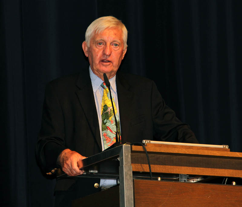
Professor Taylor has made significant contributions and undertaken leadership roles in cartography and geography, both internationally and in Canada. Professor Taylor works tirelessly in research, teaching, publishing and outreach programmes. He is respected globally for his rigorous research, quality publications and enthusiastic approach to furthering scientific knowledge related to cartography and geography.

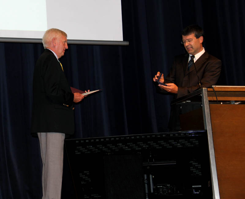
The Carl Mannerelt Medal Recognises excellence in scholarship and research in Cartography and GI Science. It is awarded Ob Merita Egregia (acquired) by extraordinary merits. The award of the Carl Mannerfelt Medal formally acknowledges Professor Taylor’s achievements, his effort in the international cartographic research and professional communities and his contributions to humanity.

Category: General News

Honorary Fellowship for Helen Kerfoot

Helen Kerfoot was already presented with a diploma for outstanding services to ICA as member of the LOC that organised the 1999 International Cartographic Conference in Ottawa. She has played a more important role for cartographers worldwide however as chairperson of the UNGEGN standing advisory commission of the ECOSOC, UN.

After an MSc in Geology in Britain she took up a job as geologist in Northern Canada, where she became interested in toponymy and did toponymic fieldwork. Later she went to work for the Govt. Department of Energy, Mines and Resources in Ottawa. She is a past president of the Canadian Society of the Study of Names, which she presided over from 1997-2003. She was delegated by the Canadian Government to the United Nations Group of Experts on Geographical Names around 1987, and was elected as chairperson in 2002.

Since then she has succeeded in turning UNGEGN into a more professional body and in bringing its work in line with current SDI-initiatives. She is one of the few experts with hands-on experience in practically all fields of toponymic standardization. Her drive to attend all the meetings of UNGEGN working groups, her participation in toponymy courses world wide, in scientific seminars and technical meetings as well as her endeavours to make all UNGEGN ‘jurisprudence’ on geographical names accessible through its website have benefited the whole spatial information community, as geographical names standardisation is a most important aspect in the exchange and linking of geospatial data.

For her services and contribution to cartography Helen Kerfoot is awarded an Honorary Fellowship of ICA.

Category: General News
rawboned-refined