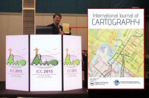
The new issue of the International Journal of Cartography is now available on the Journal website.
A synopsis of papers published in the issue is provided below.
- The contributions in this Issue begins with a paper from Jason Van Horn, entitled Erwin Raisz Plan to Advance Academic Cartography in the United States. Van Horn notes that “Erwin Raisz represents the vanguard of early Twentieth Century American cartography.” The paper covers Raisz’s plans to build academic cartography as its own sub-discipline in geography. It examines his strategy and how his 1938 textbook, General Cartography, acted as a catalyst for the establishment of new courses in Cartography. The paper also covers how he continued to champion the further development of cartographic programmes.
- Uncovering urban circadian pulses based on an animated cartogram: the example of Bogotá by Hugo Thomas & Florent Demoraes describes a dynamic map that shows the differing location of ‘day’ and ‘night’ populations and how they balance over a 24 hour period. This was done using a smoothed animated cartogram of the Bogotá metropolitan area in Colombia. The main goal of the project was to provide visual effectiveness.
- Marina Viličić and Miljenko Lapaine contribute the paper Determining the Scale and Map Projection of Stjepan Glavač’s Map from 1673. The authors consider this map to be an exceptionally important part of Croatian cultural heritage due to its uniqueness and the detailed depiction of Croatian regions. From the relationship between the coordinates from the map, the authors concluded that Glavač used the equidistant cylindrical projection with the equator as a standard parallel. The paper concludes with the calculation of the interval of the numerical scale of the map, enabling them to refute and/or accept the theses of other authors who have cited different scales of Glavač’s map.
- Ruud Stelten’s paper, The Caribbean’s mythical Aves Bank, addresses the cartographic myth of the Aves Bank, a long and narrow submarine bank that connected Aves Island with Saba and St. Eustatius. This is one of many fictitious topographic elements introduced into early maps and charts of the Caribbean. The Aves Bank myth came about in the 1720s and was adopted by many cartographers, who included it in their maps and charts. The paper reports on the research undertaken by Stelten on this Caribbean cartographic myth.
- Stefan Fuest, Olga Shkedova & Monika Sester offer information on their approach for promoting routes that reduce exposure of road users to areas that should be temporarily avoided due to traffic related or environmental reasons. Promoting favorable routes through visual communication: A design study for creating route maps for the case of air pollution outlines their method, that recommends routes be calculated as the shortest path while minimizing the current concentrations of particulate matter along the route. They proposed seven different visualization variants for representing line and areal objects in a route map that visualize route options based on pollution levels.
- Certain arguments against the hypothesis that portolan charts were genuine late-medieval cartographic products by Tome Marelić reports on a series of tests conducted on sample of 12 representations of the Adriatic Sea on portolan charts, created between the late 13th and the late 16th century. This was done to examine their navigational applicability. By-products of their results strongly suggest that it is impossible that portolan charts were, in terms of their geometry, genuine late-medieval cartographic products.
- Miljenko Lapaine, in his paper, A Problem in Basic Cartography offers proof that standard parallels and secant parallels generally do not match. He argues that that the widely accepted facts about secant and standard parallels are wrong and need to be revised. Further, he explains that cylindrical projections are not a good approach, as they lead to misunderstanding important properties of projection.
- The Issue concludes with the Invited essay: MAPS IN HISTORY by Imre Demhardt. The topic of this essay is Richard Harrison as media cartographer.
- Two book reviews are also included:
- New directions in radical cartography: Why the map is never the territory edited by Phil Cohen and Mike Duggan, Landham, Maryland, US, Rowman & Littlefield, 2021. Review by Peter Vujakovic.
- Atlas of the Invisible: Maps & Graphics That Will Change How You See The World by James Cheshire and Oliver Uberti. Review by Antoni Moore.
Papers can be viewed via the Journal website.
Bill Cartwright and Anne Ruas
Editors, International Journal of Cartography
Category: General News