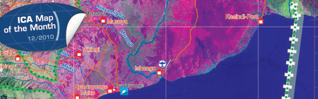
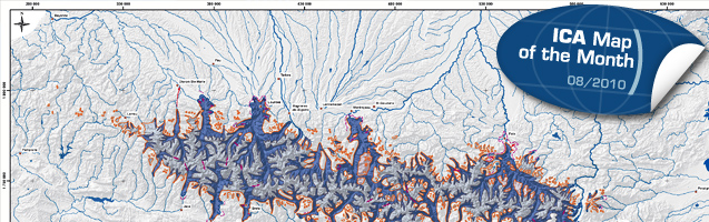
This month’s ICA Map of the Month is a map based on a satellite image and depicts the Parc National des Virguna.
At the last ICC in Chile it won the first jury prize in the category “Maps based on satellite images and remote sensing”.


This month’s ICA Map of the Month is a map based on a satellite image and depicts the Parc National des Virguna.
At the last ICC in Chile it won the first jury prize in the category “Maps based on satellite images and remote sensing”.
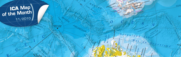
This month’s ICA Map of the Month is the Atlas of Canada International Polar Year Circumpolar Map, issued by the Atlas of Canada Program.
At the last ICC in Chile it won the first jury prize in the category “Thematic Maps”.
Get more information and zoom in on the map!
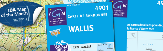
This month’s ICA Map of the Month is the Carte de Randonnée 4901 Wallis, issued by the National Geographic Institute of France (IGN).
At the last ICC in Chile it won the second jury prize in the category “Topographic Maps”.
Get more information and zoom in on the map!
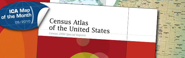
This month’s ICA Map of the Month is the Census Atlas of the United States by the Commerce Deptartment of the US Census Bureau.
At the last ICC in Chile it won the second jury prize in the category “Globes and Atlases”.
Get more information and have a look at the map! We have some nice zoomable pages of the atlas!
This month’s ICA Map of the Month is the entitled Carte Géologique des Pyrénées. Despite the French title it is bilingual: French and Spanish. It was published by the institutes of minerology and geology of France and Spain.
At the last ICC in Chile it won the second jury prize in the category “Thematic Maps”.
Get more information and have a look at the map!
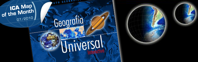
This month’s ICA Map of the Month is the entitled CD-ROM Geografía Universal Interactiva by the Military Geographic Institute of Chile.
At the last ICC in Chile it won the first jury prize in the category “Digital Products (Maps and Digital Images)”.
Get more information and have a look at the map!
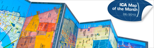
This month’s ICA Map of the Month is the Panamap Manhattan by Urban Mapping, Inc. It shows three themes on a single map by using a clever layer printing technology.
At the last ICC in Chile it won the second jury prize in the category “Others: Cartography belonging to other themes”.
Get more information and have a look at the map!
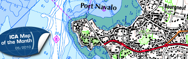
This month’s ICA Map of the Month is the map SCAN Littoral® chart of the golfe du Morbihan (Brittany). It was published as a joint project between the French Navy Hydrographic and Oceanographic Service (SHOM) and the French National Geographic Institute (IGN). It consists of a seamless merging of SHOM’s nautical charts and IGN’s terrestrial maps. At the last ICC in Chile it won the second jury prize in the category “hydrography or maritime navigational charts”.
Get more information and have a look inside at the ICA website!
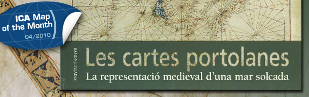
This month’s ICA Map of the Month is the map colletion Portolan Charts – The Medieval Representation of a Ploughed Sea (Les cartes portolanes. La representació medieval d’una mar solcada). It was published by the Inst. Cartogràfic de Catalunya. At the last ICC in Chile it was the “winner of the public vote”.
Get more information and have a look inside!
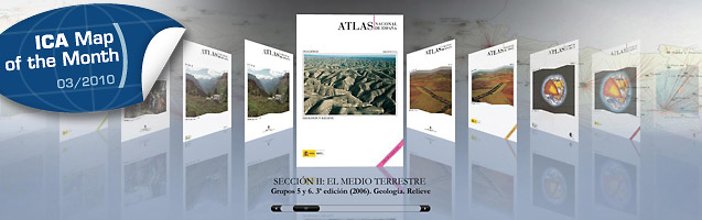
This month’s ICA Map of the Month is The National Atlas of Spain (1986–2008): Facsimile digital version. The digital atlas was published by the National Centre of Geographical Information and the National Geographic Institute of Spain and won in the category “Digital Products (Maps and Digital images)” at the last ICC in Chile. Have a look at it!