Welcome to the International Cartographic Association
Welcome to the website of the International Cartographic AssociationGet to know the new ICA Executive Committee for the term 2023-2027
Welcome to the website of the International Cartographic Association
Get to know the new ICA Executive Committee for the term 2023-2027

Cartographier pour un monde durable

Le livre de Menno-Jan Kraak (ACI), Robert E. Roth (ACI), Britta Ricker (ACI), Ayako Kagawa (ONU), Guillaume Le Sourd (ONU), que l’ICA a publié en 2021 en collaboration avec les Nations Unies sur le thème important des Objectifs de Développement Durable (ODD), existe maintenant aussi en français – la deuxième langue officielle de l’ICA.

La version pdf du livre peut être téléchargée à partir de la page accessible via digitallibrary.un.org/record/3898826.

Une version imprimée est en préparation.

Category: General News

Cartographier pour un monde durable – French version of Mapping for a Sustainable World published

The book “Mapping for a Sustainable World”, a co-publication by the United Nations and the International Cartographic Association, has been translated to French – the second offical language of the ICA.

The pdf-version of the book written by Menno-Jan Kraak (ICA), Robert E. Roth (ICA), Britta Ricker (ICA), Ayako Kagawa (UN) and Guillaume Le Sourd (UN) can be downloaded from digitallibrary.un.org/record/3898826. A printed version is in preparation.

Category: General News

Mapping for a Sustainable World

Dear colleagues,

It is with great pleasure we present you the book “Mapping for a Sustainable World”, a co-publication by the United Nations and the International Cartographic Association. This co-insides with today’s International Day of Education (24 January 2021).

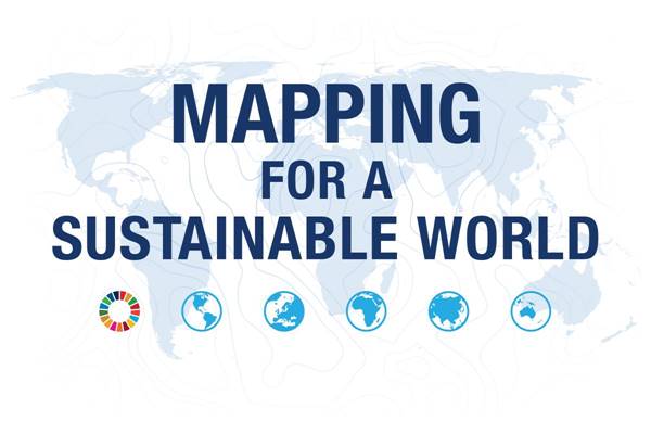
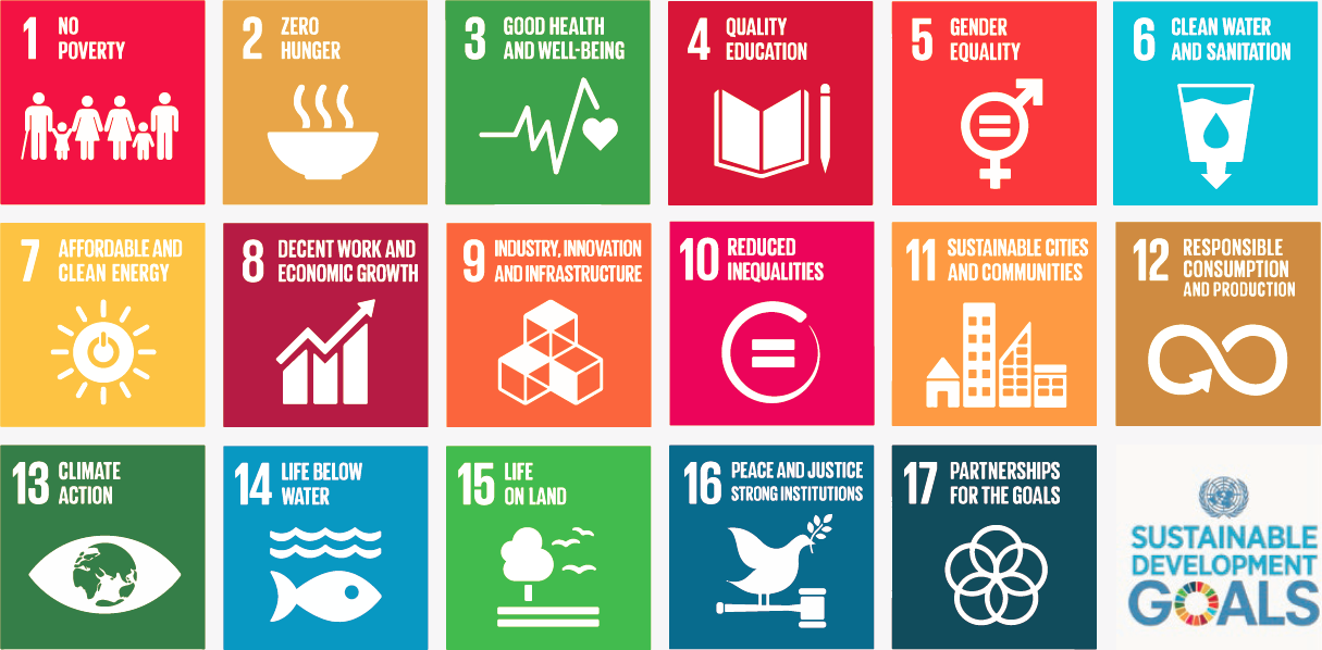
In 2015, the United Nations identified 17 Sustainable Development Goals (henceforth SDGs) in an effort to address, collectively, the most pressing problems facing our world. The SDGs relate to broad social, economic, and environmental challenges, and provide a framework for shared action. Each of the seventeen SDGs has a set of targets and indicators to assist countries towards meeting the goal. To achieve the SDGs, governments and people need to understand each challenge and monitor progress towards alleviating it.

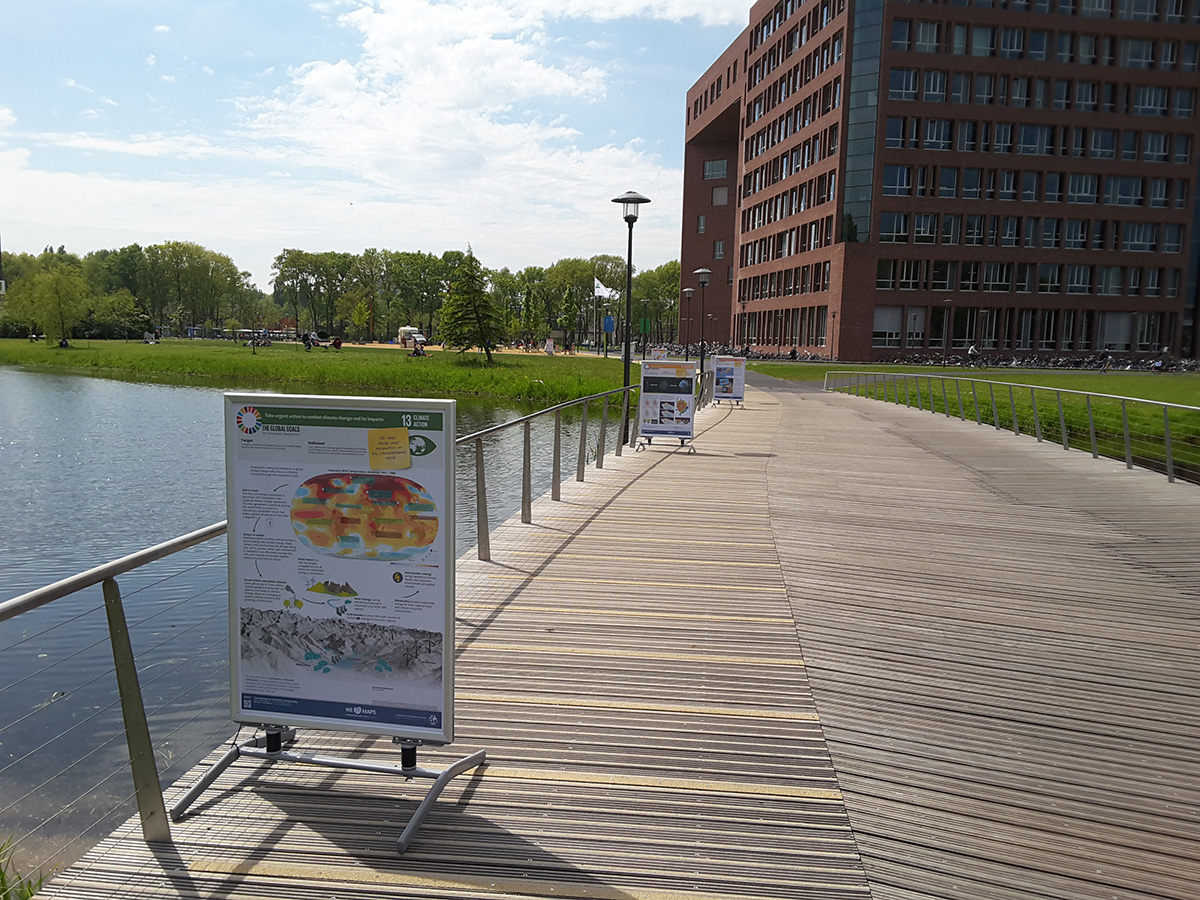
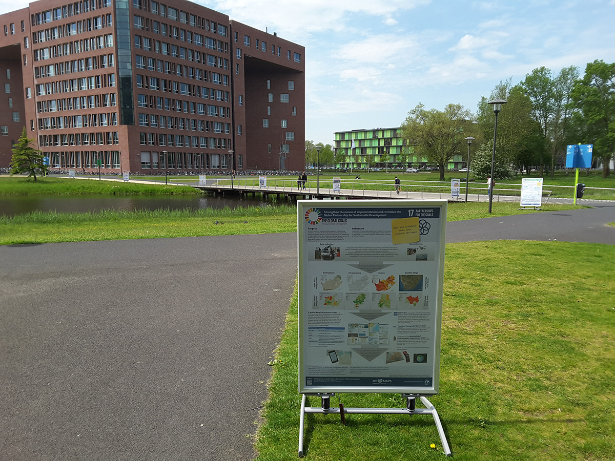
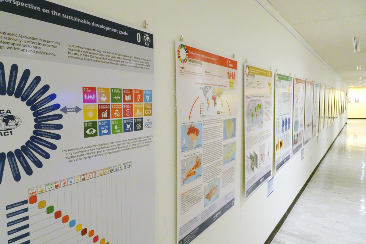
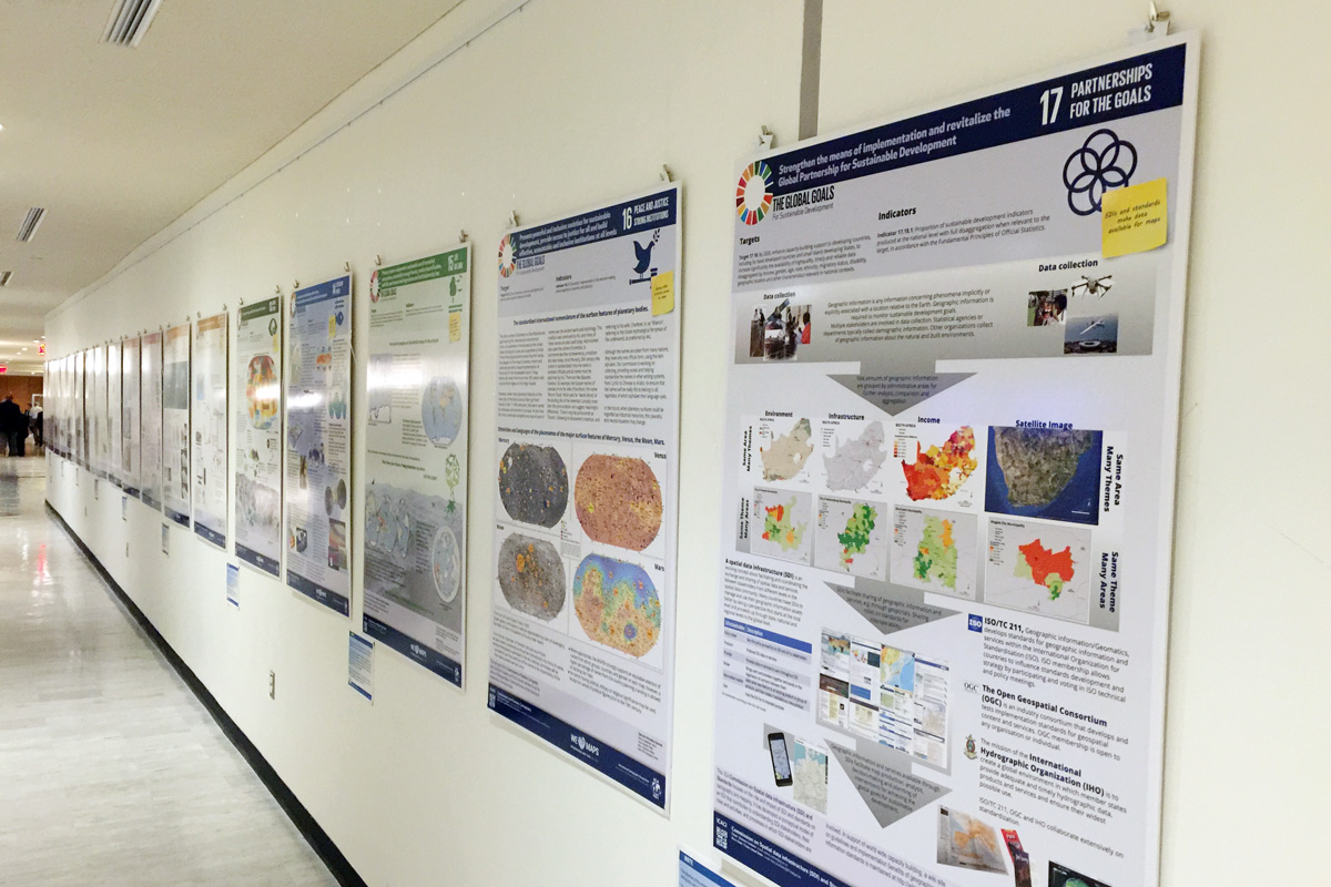
Inspired by this initiative and eager to contribute ICA started a map poster project in 2015. It cumulated in a map exhibition at the United Nations Headquarters in 2016. This book project, executed in together with the Geospatial Information Section of the United Nations, can be considered the follow-up of the map poster project.

Drawing from cartography, the book offers guidelines for mapping geographic datasets related to the SDGs by introducing basic principles of map design and use, discussing established best practices and conventions, and explaining how different mapping techniques support understanding of the SDGs.

The book comprises four sections. Section 1 introduces the SDGs and their relation to geospatial data, describing SDG indicators and data transformations for mapping. Section 2 describes foundational design decisions in the cartographic workflow, including projections, scale, generalization, symbolization, typography, and visual hierarchy, among others. Section 3 introduces the common map types (e.g., choropleths, proportional symbols, dasymetric maps, bivariate maps, cartograms) and diagrams (e.g., bar graphs, scatterplots, timelines) for representing the SDG indicators. Finally, Section 4 discusses considerations for map use environments, such as audiences, user interfaces and interaction operators, mobile and web media, storytelling versus exploration, and open access.

The book has an editorial team comprising writers from the International Cartographic Association (ICA) and the Geospatial Information Section of the United Nations (UN). The book is published as an open access document according to the CC-BY-NC license. When drawing from or reusing text or figures from this book, attribute/cite as follows Kraak MJ, RE Roth, B Ricker, A Kagawa, and G Le Sourd. 2020. Mapping for a Sustainable World. The United Nations: New York, NY (USA). The institutes of the editors (University of Twente / ITC, University of Wisconsin-Madison), and the UW Cartography Laboratory (design and layout), and the United Nations Geospatial Information Section have made the necessary resources available to realize the book.

The pdf-version of the book can be downloaded from the page accessible via the following link https://www.un-ilibrary.org/content/books/9789216040468. A direct DOI link will follow. A printed version is in preparation. At a later stage we plan to also release all data used to create the maps in the book.

Menno-Jan Kraak (ICA)
Robert E. Roth (ICA)
Britta Ricker (ICA)
Ayako Kagawa (UN)
Guillaume Le Sourd (UN)

Category: General News

President’s blog: Revised ICA posters on “Maps and Sustainable Development Goals”

Last August the posters created by ICA’s Commissions on the Sustainable Development Goals were on exhibit in the conferences area in United Nations Headquarters in New York. During the exhibition, we did get many comments. Most were positive, but also critical remarks were made. This prompted an additional internal peer review by our Commission chairs and the Executive Committee members, resulting in a long list of potential improvements. They were related to language, the base map (boundaries), content, cartographic representations and graphic quality. These have now all been processed.

The ICA posters as presented in the conferences area in United Nations Headquarters in New York

The ICA posters as presented in the conferences area in United Nations Headquarters in New York


As one can imagine, the boundary problem was most sensitive at the UN. It proved difficult to follow the UN guidelines, and therefore we have included the following disclaimer on all posters: Boundaries on maps may seem definitive, but there are often different perspectives on their status and position. This poster series is compiled from many sources by cartographers from different countries. The ICA tries to be neutral in such matters and boundaries shown reflect those found on the ground, in existing maps, or recognized by the United Nations. The ICA acknowledges that there may be different opinions and interpretations.

The revised posters as well as the newly design catalog for the poster exhibition can be found on icaci.org/maps-and-sustainable-development-goals.

Let’s make the world a better place with maps!

– Menno-Jan Kraak
President of the International Cartographic Association

President’s blog: ICA posters on display at the United Nations Headquarters in New York

ICA posters at the UN GGIM meeting

During the sixth session of the Committee of Experts on Global Geospatial Information Management (UN-GGIM, 3–5 August 2016), the posters created by ICA’s Commissions on the Sustainable Development Goals were on exhibit in the conferences area in United Nations Headquarters in New York. During the opening session the participants were pointed to the exhibition of the ICA posters. During the first day of the conference the exhibition catalog was distributed to all participants. ICA’s contribution to the Sustainable Development Goals was well received.

The posters as well as the catalog for the poster exhibition can be found on icaci.org/maps-and-sustainable-development-goals.

Let’s make the world a better place with maps!

Menno-Jan Kraak
– President of the International Cartographic Association

 
posters-at-un2
More photos can be found on the ICA Facebook page

Tag:

President’s Blog: A map perspective on the sustainable development goals

The Sustainable Development Goals, officially known as Transforming our world: the 2030 Agenda for Sustainable Development are a UN Initiative. Official website: https://sustainabledevelopment.un.org

In the light of the International Map Year (IMY), the ICA and its commissions are highlighting the value of cartography by “mapping” the UN sustainable development goals.

In the past months, a set of posters has been created, one for each sustainable development goal. They do not map the goals and their target based on indicators as such. The poster series tells the story of cartographic diversity, of mapping options, and of multiple map perspectives. Each of the goals has been mapped from a particular perspective by different ICA Commissions. All posters have a short take-home-message that should make one aware of particular strengths of the map.

The posters as well as the catalog for the poster exhibition can be found on icaci.org/maps-and-sustainable-development-goals

A huge thank you to all commissions involved and to Wim Feringa from ITC for the poster design and production. Let’s make the world a better place with maps!

Menno-Jan Kraak
– President of the International Cartographic Association

President’s Blog: International Map Year 2015–2016

Logo of the International Map Year 2015/2016

It is my sincere pleasure to inform you that at the fourth session of the United Nations Committee of Experts on Global Geospatial Information Management at the UN Headquarters in New York, 6–8 August 2014, the ICA Initiative on an International Map Year 2015–2016 was positively discussed.

The resolution states:

The committee endorses the International Map Year 2015–2016 as proposed by the International Cartographic Association as a valuable means to promote the importance of maps and geoinformation.

With this we have reached a most prominent framework for the planned acitivities and I invite all members of the ICA family to consider their active participation. To stay up-to-date with all activities around the International Map Year, please visit mapyear.org.

Georg Gartner
– President of the International Cartographic Association


rawboned-refined