I first met Professor Taylor when he was President of the International Cartographic Association (ICA), at one of the early International Cartographic Conferences that I attended. I was involved in research in the application of interactive multimedia to cartography and the visualization of geography, an area that Professor Taylor championed in the international cartographic and geographic communities. His enthusiasm about contributing to international scientific communities was, and is, infectious and his encouragement to participate in research and development was extremely supportive to young and experienced scientists alike. This introduction to scholarly work in cartography and geography set me on a path of participation and collaboration with the International Cartographic Association and with international cartographic and geographical communities, a path that I continue to follow today.
Professor Taylor is Distinguished Research Professor of Geography and Environmental Science, and in International Affairs and Director of the Geomatics and Cartographic Research Centre, Carleton University, Canada. He has the immediate past Chair of the International Steering Committee for Global Mapping (ISCGM), an international project by world national mapping agencies of the to produce a 1:1 million digital map of the world to support environmental and sustainable development decision-making, for the past decade. This work supports international collaboration and decision-making by ensuring that appropriate, current and timely geospatial information is available.
In 2008 Professor Taylor was elected Fellow to the Social Sciences Division of the Academy of Social Sciences of the Royal Society of Canada. In 2009 he was appointed to the United Nations Expert Group on Geospatial Information Management and to the Open Geospatial Consortium (OGC) Global Advisory Council. Also in 2009, he was elected Chair, Technical Committee III, Geospatial Data Collection, Management and Dissemination, Ninth United Nations Regional Cartographic Conference for the Americas. In 2010 he was presented with the Distinguished Service Award by the Canadian Association of African Studies.
He has contributed to regional cartographic and geographical activities, particularly the application of geomatics to socioeconomic development in a national and international context with special reference to the Canadian North, Africa, Latin America, China and Antarctica. He has also advanced regional and rural development theory and practice with special emphasis on sustainable development and indigenous development strategies in Africa and Latin America. In 2006 he was nominated by the Permanent Committee on GIS Infrastructure for Asia and the Pacific and accepted by the UN Conference Secretariat, for the position of Vice Chairman, Technical Committee 3 of the United Nations Regional Cartographic Conference for Asia and the Pacific. He was also Head of the Canadian Delegation at this conference. As well, he has been active in Africa – as a member, International Cartographic Association Working Group on Mapping Africa for Africans and Antarctica – in 2000 he was appointed a member of the International Scientific Committee for Antarctic Research (SCAR) Working Group for Geodesy and Geographic Information, now entitled SCAR Group of Experts on Geospatial Information.
In the International Cartographic Association he was elected Vice-President in 1984, and then President in 1987. He was again elected President for a further 4-year term of office in 1991. In August 1999, to recognise his outstanding contributions to the Association, Professor Taylor was elected an Honorary Fellow of the International Cartographic Association. As well, Professor Taylor represented the ICA on Joint Boards. In 1989 he was elected President of the International Union for Surveys and Mapping and in 2004 he was appointed a member of the Joint Board of the Geospatial Information Societies (JBGIS).
In Canada Professor Taylor is an esteemed contributor to cartographic and geographical societies. In 1978, and again in 1979 he was elected President of the Canadian Cartographic Association. In 1999 he was appointed Co-Chair of the National Atlas Advisory Committee by Natural Resources Canada. And, in 2006 he received the Award of Distinction for exceptional scholarly contributions to cartography by the Canadian Cartographic Association. He has been active in many areas of research in Canada, receiving funding for a “Living” Cybercartographic Atlas of Indigenous Artifacts and Knowledge from The Inukshuk Fund in 2007 and a Research Initiative Grant from the SSHRC in 2002 for the Cybercartography and the New Economy project. In 2012 he was awarded the Royal Canadian Geographic Society and 3M Canada Canadian Award for Environmental Innovation.
As well as these activities, Professor Taylor has undertaken research and development and published in areas where his expertise is internationally recognised, namely:
- The theory and practice of cybercartography;
- Electronic atlases, interactive cartographic systems and visualization;
- The preservation and archiving of geospatial data;
- Mapping for the blind and visually impaired; and
- Canada’s international policies towards developing nations.
He has published extensively and presented in many fora on these topics. As well, he was appointed member of Advisory Board for Volume Six of the History of Cartography Series, University of Chicago Press, as Series Editor of the book Series entitled Modern Cartography published by Elsevier Science and Editor, Progress in Contemporary Cartography Series, Wiley & Sons. He has also edited and co-edited two editions of publications related to Cybercartography Theory and Practice.
Professor Taylor has made significant contributions and undertaken leadership roles in cartography and geography, both internationally and in Canada. Professor Taylor works tirelessly in research, teaching, publishing and outreach programmes. He is respected globally for his rigorous research, quality publications and enthusiastic approach to furthering scientific knowledge related to cartography and geography.
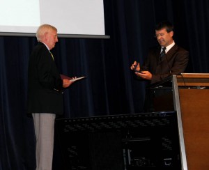
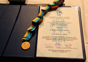
The Carl Mannerelt Medal Recognises excellence in scholarship and research in Cartography and GI Science. It is awarded Ob Merita Egregia (acquired) by extraordinary merits. The award of the Carl Mannerfelt Medal formally acknowledges Professor Taylor’s achievements, his effort in the international cartographic research and professional communities and his contributions to humanity.


