Nuremberg, Germany
September 27, 2011

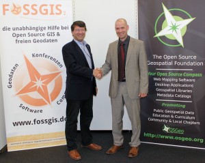
Professor Georg Gartner (left), President of ICA and Arnulf Christl, President of OSGeo shake hands after signing the Memorandum of Understanding between the two organizations
The Open Source Geospatial Foundation (OSGeo) and the International Cartographic Association (ICA) have signed a Memorandum of Understanding with the aim of developing on a global basis collaboration opportunities for academia, industry and government organizations in open source GIS software and data. The MoU aims to provide expertise and support for the establishment of Open Source Geospatial Laboratories and Research Centres across the world for supporting development of open-source geospatial software technologies, training and expertise. In the first phase five laboratories will be established, one each in Asia, Europe, Africa, the Americas and Australasia which will act as nodes for future expansion. It also aims to provide support for building-up and supporting development of open source GIS teaching and training materials, joint organization of open source GIS events, workshops through the ICA network for wider participation globally etc.
Professor Georg Gartner, President of the ICA, said “The International Cartographic Association (ICA) is committed to supporting society and governments by collaboratively facilitating initiatives and programmes that establish and grow the capacity to deliver timely, comprehensive and useful geospatial information. This MoU responds to the challenges and issues related to the use of open source cartographic and GI software and data. In considering this response, it is pertinent to note that ICA is interested in contributing to this initiative, and will champion the advancement of the initiative through their various individual and collaborative efforts.”
Arnulf Christl, President of OSGeo, said “The Open Source Geospatial Foundation (OSGeo) is committed to support and build the highest level Open Source geospatial technology. It is our pleasure to be able to serve as a platform and multiplier for the cartographic domain, an area which needs creativity beyond pure technology. This MoU intends to bridge the gap between technology and cartographic requirements and we very much look forward to work with members of the International Cartographic Association to improve this. A very much hands-on objective of this MoU is to jointly organize walk-in events where cartographic professionals can access and use a set of software unencumbered by proprietary restrictions and vendor lock-in.Both organizations are also interested in supporting young academics by lowering the barrier to good cartography through collaborative efforts on both sides.”
Dr Suchith Anand, Chair of ICA Commission on Open Source Geospatial Technologies welcomed this excellent initiative and said “this will be landmark opportunity for both OSGeo and ICA in building up synergies and bringing opportunities for lots of people worldwide to learn and benefit from geospatial technologies especially in developing countries. This will build upon the Open Source Geospatial Lab UK initiative started at the University of Nottingham. We are also pleased to announce that Open Source Geospatial Lab Malaysia is now being established by Dr. Tuong Thuy Vu. We are pleased to see many Universities are rapidly following this example (such as University of Girona in Spain). Over the next few months we will be building collaborations with key Universities and research organisations worldwide for the establishment of Open Source Geospatial Research Laboratories and Research Centres for development of open-source geospatial software technologies, training, expertise and building up momentum in Open Source GIS education and research worldwide.”
OSGeo is a not-for-profit organization founded in 2006 whose mission is to support and promote the collaborative development of open source geospatial technologies and data.
ICA is the world authoritative body for cartography, the discipline dealing with the conception, production, dissemination and study of maps.
—
See details about the ICA/OSGeo memorandum of understanding or see a list of all ICA MOUs.


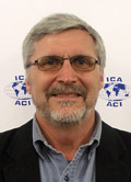
 Prof. Michael P. Peterson has an outstanding career in education research and service to the disciplines of cartography and geographic information science. His record of teaching accomplishments and awards, his excellent research particularly with topics of maps and the Internet, and his significant record of service to the his university, the discipline, and the ICA are exemplary of an ICA honoree. Professor Peterson has served the ICA as an exceptional Chair of the Commission on Maps and the Internet from 1999 to the present. His accomplishments as Commission Chair include expanding the research and educational frontier of Maps and the Internet, maintaining an exceptional Website for the Commission, conducting numerous short courses and workshops for the Commission in places around the world including Warsaw, Vienna, Madrid, Tokyo, Karlsruhe, Guangxhou, and Denver, Knoxville, and Shepherdstown in the United States. Publications by Professor Peterson under the auspices of the Commission include Maps and the Internet, a seminal book on the domain subject of the Commission.