Welcome to the International Cartographic Association
Welcome to the website of the International Cartographic AssociationGet to know the new ICA Executive Committee for the term 2023-2027
Welcome to the website of the International Cartographic Association
Get to know the new ICA Executive Committee for the term 2023-2027

Invitation to the ICA Symposium on Early Warning and Crisis Management in the Big Data Era

The ICA Symposium on Early Warning and Disaster Risk Management for Urban Areas in Big Data Era is being reconvened following the success of the previous meetings. This series of symposiums aims to bring together leading academic scientists, researchers and domain experts to share their research results on all aspects of Early Warning (EW) and Crises Management (CM). Recent major disasters such as earthquakes, floods, hurricanes and landslides have resulted in huge losses in terms of human life and property destruction in urban areas. Therefore, policies, mechanisms and solutions to handle the increasing risk of disasters is urgently needed. Organizers would like to provide an interdisciplinary platform for researchers, practitioners and educators to discuss the most recent innovations, trends, challenges and practical solutions of EW and CM for Urban Areas in the Big Data Era.

The event will be held on 1–3 December 2018 at Shenzhen University, Shenzhen.

The final program can be downloaded here.

Further details can be found on the conference website: conf.fishmap.site

Call for Papers, AAG Session on Mapping Difficult Stories

The ICA Commission on Art and Cartography invites papers to be included in the session Mapping Difficult Stories at the 2019 Association of American Geographers Annual Meeting in Washington, D.C., from April 3–7 April, 2019. 

In this session we are interested in exploring new forms of spatial expression designed to visualize stories that are difficult to tell: stories of individual and mass violence, stories of containment and forced displacements, stories of painful memories and tragedies. Mapping such stories can serve different purposes. It can contribute to a better understanding of personal and collective experiences, of the socio-political forces that have shaped them and of the relationships that individuals and communities have developed with places throughout these difficult moments. Mapping difficult stories can also make these experiences more tangible and accessible to a broader audience.

Mapping difficult stories requires us to revisit and expand our cartographic language. Stories in general do not land particularly well on maps. While stories are spatial, they are also fluid; their geographies fluctuate, change shape and scale, as can their context and the individual who bears them. Whether expressed in interviews, memoirs, diaries, or letters, the elusive geographies of stories don’t easily mesh with the rigid Euclidean structure of the conventional map, and the transformation of difficult memories into abstract cartographic symbols generates ethical and methodological issues that mapmakers must engage. Building on the growing interest in mapping experience among scholars, artists and cartographers in across the arts and humanities, this session aims to bring together a broad range of individuals interested in sharing their efforts to find spatial forms of expression for difficult stories.

If you are interested in joining this session please send an abstract (no more than 250 words) to Anne Knowles (anne.knowles@maine.edu), and Sébastien Caquard (sebastien.caquard@concordia.ca) by October 25, 2018.

Tag: , ,

Research Agenda on Location Based Services (LBS) is online

The ICA Commission on Location Based Services is happy to announce that the LBS Research Agenda has been published online as an open access paper in the Journal of Location Based Services.

Haosheng Huang, Georg Gartner, Jukka M. Krisp, Martin Raubal & Nico Van de Weghe (2018): Location based services: ongoing evolution and research agenda, Journal of Location Based Services, DOI: 10.1080/17489725.2018.1508763

A multi-phase collaborative process was adopted during the development of this research agenda: Based on the 31 one-paragraph proposals of “big challenges in LBS”, and the feedback and results of the workshop at LBS 2016 and conference session at ICC 2017, we identified a list of “key research challenges” that should be addressed to bring LBS to a higher level to better benefit our society and environment. Thank you to all the participants during this process!

The current research agenda highlights a series of research challenges in six broad areas:

  • Ubiquitous positioning,
  • Context modelling and context-awareness,
  • Mobile user Interfaces and interaction,
  • Analysis of LBS-generated data,
  • User studies and evaluation, and
  • Social and behavioral implication of LBS.

As the research agenda is not set in stone, you are encouraged to provide your comments here.

We hope this research agenda helps to motivate further LBS research and stimulate collective efforts. Particularly, through the work of the ICA Commission on LBS and the Journal of LBS, a series of activities (conferences, workshops, and special issues) on LBS will be organized in the coming years to bring together the broader community to answer these open research questions, as well as to “positively” shape the future of our mobile information society.

One of these activities is the annual international conference series on LBS. Next year the conference will be hosted by TU Wien, Vienna, Austria, in November 2019. More details regarding the conference will be available in the coming months at lbsconference.org.

ICA Publications and Publication Policy — first Publication Volume is online

In 2017 the EC introduced a new publication policy, which focuses on the conference proceedings. In order to give them an adequate visibility and reputation, a conference publication series has been established, which is adminstrated and hosted by a professional publisher. There are three publication options, depending on the review and the extent of the papers: ICA Advances, ICA Proceedings and ICA Abstracts.

The benefits will be manyfold:

  • Visibility: one single point of contact for the publications of ICA events
  • Reliability: the publications will be available at the time of the conference
  • Open Access: the publications are published online and under the Creative Commons licence
  • Reputation: the publisher will suggest the ICA Advances and Proceedings for inclusion in several data bases and indices (e.g. Scopus, Web of Science)
  • Standardization: one standardized format of the publications

This new policy will not interfere with publications in ICA related journals; in contrast, it will provide an excellent basis for developing high-level journal publications.

New ICA conference and events publications

Starting in 2017, the ICA records the outcomes of their Conferences like ICC, RCC as well as all other ICA events in three official publication outlets, which are hosted by a commercial publisher, Copernicus GmbH:

  1. Advances in Cartography and GIScience of the International Cartographic Association (short: Advances of the ICA, eISSN 2570-2084): single-blind peer review based on a full paper – termed Advances in the following;
  2. Proceedings of the International Cartographic Association (short: Proceedings of the ICA, eISSN 2570-2092): single-blind peer review based on submitted abstracts, developed to full paper – termed Proceedings in the following;
  3. Abstracts of the International Cartographic Association (short: Abstracts of the ICA, eISSN 2570-2106): single-blind peer review based on submitted abstracts; publication of abstract only – termed Abstracts in the following.

With these three series, the ICA can offer excellent opportunities for their authors to present their work – full papers for more research-oriented work, abstract based full papers for advanced work-in-progress, as well as abstracts for practically oriented work or artwork, which typically are not adequately represented in a full paper.

For the ICC and for the RCC, Advances and Proceedings are published; for other ICA events, either Advances or Proceedings are published. Exceptions from this general rule require prior approval by EC. All event formats have the option to also publish the Abstracts.

These publications are generated from all ICA events. Organisers will be required to provide Copernicus with camera-ready manuscripts in pdf format, together with the respective metadata, four to six weeks prior to the scheduled meeting, depending on the size of the event. For each published paper a moderate APC (article processing charge) has to be paid (as of January 1st it is €17,50). This sum should be included in the event fees.

Role of International Journal of Cartography (IJC)

In order to promote the International Journal of Cartography (IJC), there is a special option for the International Cartographic Conferences (ICCs): the IJC can select 8–12 papers from the full paper peer-review track for a special issue published at the event.

In addition to the regulations above, all event organizers are expected to seek high quality papers at the conferences and meetings to be published in the Journal of Cartography. Furthermore, they do always have the option to approach the IJC for a special issue.

Main changes in a nutshell …

  • one visible location (at Copernicus) and structure for publication of all ICA events
  • no longer the need for event organizers to organize their own publications because all go into one of our series
  • no longer Springer books from our bi-annual International Cartographic Conferences (ICCs)
  • Springer ICA books will be available for special events (old agreements will be honoured)
  • conference papers may be extended and handed in for a journal publication after the event

First proceedings volume

Journal Website Proceedings of the ICA

The first papers published in the new series are the papers from the ICC in Washington, which appear in the “Proceedings of the International Cartographic Association“ as Volume 1. They are accessible via www.proc-int-cartogr-assoc.net


Monika Sester
– Chair of the ICA Publication Committee

Category: General News

2nd Call for Papers for the 7th International Symposium on the History of Cartography: Mapping Empires Colonial Cartographies of Land and Sea

You still have until 1 March to submit an abstract for the international symposium Mapping Empires: Colonial Cartographies of Land and Sea, which will be held from 13–15 September 2018 in Oxford (UK) and is jointly organised by the ICA Commission on the History of Cartography, the ICA Commission on Topographic Mapping and the Bodleian Libraries of the University of Oxford.

Besides its scientific programme, the symposium will also include a nice array of social events, namely an ice-breaker reception, a maps and rare books exhibit and reception at Christ Church Library, a guided tour of Oxford, a conference dinner and a full-day visit to nearby Blenheim Palace.

For more information please visit the symposium website at mappingempires.icaci.org.

Invitation to the 7th International Conference on Cartography & GIS

7th International Conference on Cartography & GIS

7th International Conference on Cartography & GIS and the Seminar with EU cooperation on Early Warning and Disaster Management will be held during 18–23 June 2018 in Sozopol, Bulgaria. A special session “Digital Earth for Smart Solutions” supported by the International Society for Digital Earth will be part of the conference.

The event will be held during the Bulgarian Presidency of the Council of the EU, 2018.

Please find all details and important dates on the conference website: iccgis2018.cartography-gis.com

 
Welcome to Sozopol, Bulgaria

Tag:

Pluto and Charon mapped – for children

Pluto and Charon Map

The new map showing the New Horizons encounter hemispheres of Pluto and Charon is the result of a cooperation between the worlds of planetary science, cartography and arts.

It is the 7th map in the series of multilingual maps of planets and moons designed for children.

The map shows the geology of the surface together with characters taken from the informal nomenclature.

The map of the double planet, the larger named after Pluto, the god of the underworld; and the smaller after Charon, the ferryman between the worlds of the living and the dead, has the theme of the Halloween.

A specialty of this map compared to other, “scientific” maps is that while keeping cartographic accuracy, it links arts and science, and visualizes features in a way that is easier to interpret for the non-scientists.

The map premiered at the AGU Fall Meeting in San Francisco last week.

The map is joint effort of graphic artist Adrienn Gyöngyösi and scientists working at NASA and SETI Institute (Henrik Hargitai, editor; and Ross Beyer who contributed with the text describing Pluto).

This nonprofit project is supported by the International Cartographic Association.

The map is free to download at childrensmaps.wordpress.com

Contact: henrik.i.hargitai//at//nasa.gov [ Press release ]

International Map Year is coming to a close…

IMY logo translations

International Map Year (IMY) is coming to a close. Over the last 18 months, some 40 countries have been involved in arranging National Map Days and other types of national events in celebration of IMY. The Executive Committee (EC) of the International Cartographic Association (ICA) and its IMY Working Group are now working to determine whether the IMY concept could be continued with an annual Map Day. Because International GIS Day is held every year in November, it is possible that a suitable month for an International Map Day could be April or May, about six months later. A preliminary decision whether and when to declare such an International Map Day may be made by the IC EC at the 2017 International Cartographic Conference (ICC) in July in Washington, DC, USA, to be followed by a final decision by the ICA General Assembly at the 2019 ICC in Tokyo.

In the meantime, the IMY book, The World of Maps, will be extended with a chapter on Geological Maps to be written by an Italian team and based on a presentation at the Italian Map Day in September 2016 which concentrated on geological maps. The book has already been translated from English to French, Spanish, Italian and Portuguese and there are now several translation teams working in China, Indonesia, Germany/Switzerland, and United Arabic Emirates.

The IMY Working Group is in the process of producing a report on the IMY activities held worldwide. An abstract of a paper, titled Outcomes of the International Map Year, has been submitted for presentation at ICC 2017. That report is also being considered for publication in the ICA’s Cartographic Journal.

The IMY Working Group is grateful to the writers of the various chapters of The World of Maps and to the book’s many translation teams. It is also indebted to Manuela Schmidt for acting as webmaster of the IMY website, for continually updating the website with the latest news and events, and for design of the IMY logo. Members of the ICA Executive Committee, ICA Commission Chairpersons, as well as United Nations Committee of Experts on Global Geospatial Information Management (UN-GGIM) and the Joint Board of Geographic Information Societies (JBGIS) have also been very supportive, in particular by producing the posters of the UN sustainability goals. In all, IMY has been a great success and we congratulate everyone for their participation in this worldwide effort to celebrate of maps and their unique role in our world.

– Bengt Rystedt
Chair of the IMY Working Group

Category: Commission News

Report of the 13th International Conference on Location-Based Services

lbs2016_logoThe 13th International Conference on Location-Based Services, organized by the ICA Commission on Location-Based Services and the Research Group Cartography of Technische Universität Wien (TU Wien), took place in Vienna, Austria from 14–16 November 2016. The conference was endorsed by the Association of Geographic Information Laboratories in Europe (AGILE), International Federation of Surveyors (FIG), International Association of Geodesy (IAG), and the German Cartographic Society e.V. (DGfK).

More than 120 participants from 23 countries gathered in the historical Celebration Hall of TU Wien. The conference was opened by Rector Prof Sabine Seidler, Conference Director and ICA Past President Prof Georg Gartner, and AGILE Co-Chair Prof Martin Raubal. After the opening, Haosheng Huang presented the current development of an LBS research agenda, which is an initiative started by the LBS Commission to identify key research questions and challenges that are essential for the LBS development in the next 5 or 10 years.

LBS2016 opening session

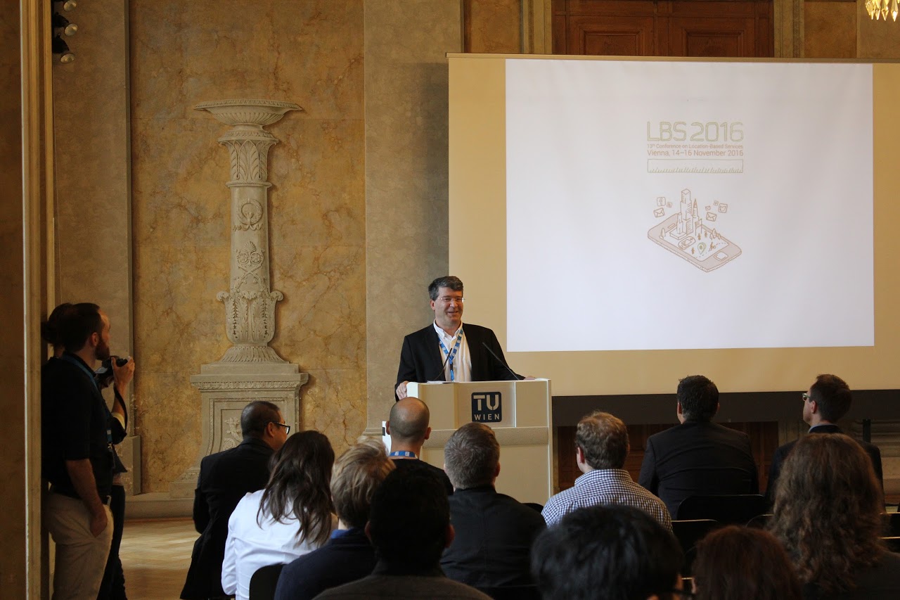
Opening session of the 13th International Conference on Location-Based Services – LBS 2016 held in Vienna, Austria | Photograph courtesy of Research Group Cartography, TU Wien

Oral session at LBS 2016

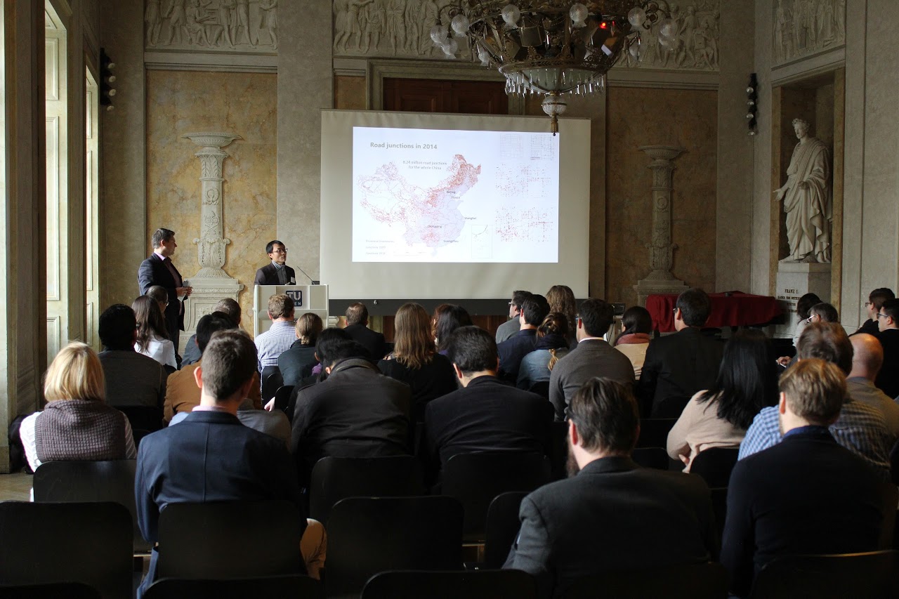
Oral session at LBS 2016 | Photograph courtesy of Research Group Cartography, TU Wien

A total of 48 oral presentations have been given in 12 single-stream sessions over three days. The conference also featured two interactive sessions, consisting of 4 showcases and 22 posters. These oral presentations, showcases and posters provide a general picture of recent research activities related to the domain of LBS. Such activities emerged in the last years, especially concerning issues of outdoor/indoor positioning, smart environment, spatial modeling, personalization, context-awarenesss, cartographic communication, novel user interfaces, crowdsourcing, social media, big data analysis, usability and privacy. As a first time, this conference also featured an industrial session, in which 4 invited LBS companies and start-ups presented their on-going research and development related to LBS.

A selection of peer-reviewed full papers has been published in the book “Progress in Location-Based Services” of the Springer Lecture Notes in Geoinformation and Cartography. Work in progress submissions are included in the conference proceedings (ISBN 978-1-907075-02-5), which are available online. A special issue of the Journal of Location-Based Services is planned as well.

Besides the technical and scientific program, the conference provided several social networking opportunities, including an ice-breaker reception on the first day, a conference dinner in an old and traditional Viennese wine cellar on the 2nd day, and a farewell drinks event.

LBS2016 ice breaker event

Ice-breaker reception at LBS 2016 | Photograph courtesy of Research Group Cartography, TU Wien

Since its initiation by Georg Gartner from TU Wien (Austria) in 2002, the LBS conference series has become one of the most important scientific events decided to LBS. The conferences have been held in Vienna (2002, 2004, 2005), Hong Kong (2007), Salzburg (2008), Nottingham (2009), Guangzhou (2010), Vienna (2011), Munich (2012), Shanghai (2013), Vienna (2014), Augsburg (2015), and Vienna (2016). Starting from 2015, the LBS conferences have become the annual event of the newly established ICA Commission on Location-Based Services. The next LBS conference has been planned, and will be hosted by Prof. Martin Raubal at ETH Zurich (Switzerland) on January 2018. We look forward to meeting you at the next LBS conference.

For more information, please refer to the conference website.

– Haosheng Huang
Chair of the Commission on Location-Based Services

LBS research agenda: A first list of “key problems” and the vision workshop at LBS 2016

mapbulbThe ICA Commission on Location-Based Services (LBS) is currently working on a cross-cutting research agenda, identifying key research questions and challenges that are essential for the LBS development in the next 5 or 10 years. In the first step of this process, we received 31 one-paragraph proposals (thank you to everyone who contributed). Based on these proposals, a first list of key problems was compiled.

In order to further refine this list and develop a comprehensive LBS research agenda, we invite everyone to comment and give feedback on this list. Is there anything important missing from your perspective? Please provide your feedback here by 4 November. Any comments and feedback are welcome!

In addition, we will organize a research agenda workshop immediately before the 13th International Conference on Location-Based Services to discuss these key problems in detail. Anyone interested is invited to attend this workshop. The registration is free. If you plan to join, please register by 30 October.

More details of the initiative can be found at: http://lbs.icaci.org/research-agenda/

We are looking forward to your comments and feedback, as well as your participation in the research agenda workshop.

Category: General News
rawboned-refined