Welcome to the International Cartographic Association
Welcome to the website of the International Cartographic AssociationGet to know the new ICA Executive Committee for the term 2023-2027Get to know the ICA Commissions for the term 2023-2027
Welcome to the website of the International Cartographic Association
Get to know the new ICA Executive Committee for the term 2023-2027
Get to know the ICA Commissions for the term 2023-2027

International Journal of Cartography – Issue 10.2, 2024 published online

Cover International Journal of CartographyThis Special Issue of the International Journal of Cartography – A Sense of Impending Doom and emotional or critical cartography – PART 1 – has been recently published online.

This Special Issue, and Part II of the Special Issue, Issue 10.3 2024 (published later this year) is an initiative of the Commission on Art and Cartography.

Guest editors for this Issue are Taien Ng-ChanNick Lally and Sharon Hayashi. Joanna Gardener and Glenn Finley contributed to the initial conversations and thinking around these special issues.

A list of papers published in the issue is provided below:

Papers can be viewed via the Journal website.

Bill Cartwright and Anne Ruas
Editors, International Journal of Cartography

Category: General News

Report of the 13th Mountain Cartography Workshop

The 13th ICA Mountain Cartography Workshop, organized by the Commission on Mountain Cartography (CMC), was held April 3-7, 2024 at the base of Poland’s Tatra Mountains.

Workshops are usually held biennially, alternating with the International Cartographic Conferences (ICC). This year, CMC workshop got back on this traditional schedule, after the 12th ICA CMC Workshop in the Colorado Rockies needed to be rescheduled twice due to the COVID-19 pandemic. It was originally scheduled for April 2020, then initially rescheduled to April 2022, and finally convened in April of 2023.

The workshop organizer was Rafał Jońca of AMG Maps. CMC Chair Patrick Kennelly supported the team in preparation of the workshop, and previous workshop organizer Tom Patterson and ICC liaison Dušan Petrovič provided plenty of logistical support. Tom Patterson was especially helpful in building the web site for the workshop, as well as answering numerous questions about how we could recreate the success of the Colorado 2022 ICA CMC workshop.  We selected Limba Grand & Resort as the workshop venue because of its proximity to Krakow, Poland (about three hours away by train or car), and for its beautiful mountain setting. Limba Grand & Resort is near the city of Zakopane and within easy reach of the Tatra Mountains that serve as the southern border of Poland with Slovakia.

The workshop had 36 participants from Poland, Austria, France, Germany, Greece, Croatia, India, New Zealand, Portugal, Romania, Slovenia, Switzerland, and the United States. Five of the participants were female and five were students.

The theme of this year’s workshop was “Mapping Mountains in a New Era” to focus on how we approach mapping mountains, and how this focus may change in the coming years. The workshop featured 23 presentations grouped into 7 sessions. Rafał Jońca organized the program and was flexible in accommodating the needs of speakers both before and during the workshop. He asked several younger participants to chair sessions with the goal of making them feel welcome and involved.

The workshop began on Wednesday evening with welcoming remarks from Rafał Jońca and Patrick Kennelly.

This was followed by a social time in our spacious dining room, which the Limba Grand & Resort allowed us to use in addition to our meeting and recreation rooms. A downstairs great room provided access to pool, ping pong, and foosball tables for evening recreation. Nearby was a third room we had available to us for social gathering. Our meeting room had all the needed equipment for presentations, and also served as a map and poster gallery.

Thursday and Saturday were devoted to presentations covering a variety of topics related to mountain cartography. Presentations were either 10 or 20 minutes in length. Thursday evening after dinner opened with shorter Avalanche Talks by presenters who discussed their poster contributions. This year, all five Avalanche Talks were given by undergraduate students from Middlebury College in Vermont, USA who completed their posters as part of a Senior Seminar with their professor, Jeff Howarth, who unfortunately was not able to attend. Many participants noted these beautifully designed and thought-provoking posters, along with the interesting and engaging overviews from the students’ Avalanche Talks, as a highlight of the conference. This session was followed by the CMC business meeting which was run by CMC Chair Patrick Kennelly.

Friday was the Field Study Day. The purpose is for participants to get to know both the beautiful mountain setting of the Tatras and one another better in a more informal manner. Participants had three options. Rafał Jońca led a cultural tour of Zakopane and its environs, including city center of Zakopane, with a focus on local wooden architecture in Zakopane’s style and an old cemetery of Zakopane. The tour also included a funicular to a stunning view of the Tatras and Zakopane. After organizing transportation to the nearby Tatra National Park for all interested participants, Dušan Petrovič led a field study to the iconic Morskie Oko, while Charly Kriz led other participants on a hike to a spectacular viewpoint of the Tatras.

Upon returning to the Grand Limba & Resort, the last activity on Friday was the always challenging mountain trivia quiz hosted by Tom Patterson. The winning team (Alex Fries, Karel Kriz, Dušan Petrovič, Ondrej Prochazka, and Silviu Bumbak) scored 20 out of 27 possible points.

The workshop continued on Saturday with additional presentations. Also, Dušan Petrovič, our liaison on the ICA Executive Committee, provided an overview of the ICA and other items that were of interest to the CMC attendees. He also presented two attendees with Young Scientist Scholarships to assist in their travel costs, Madeline Grubb from the United States and Shekhar Kumar from India.

ICA scholarship awardee Madeline Grubb from the US

ICA scholarship awardee Madeline Grubb from the US

ICA scholarship awardee Shekhar Kumar from India

ICA scholarship awardee Shekhar Kumar from India

The workshop concluded Saturday evening with a night out in Zakopane at the Góralski Browar, a fun and festive conclusion to the workshop.

The workshop program, CMC business meeting notes, and other information are available on the CMC website at https://mountaincartography.icaci.org, and all photos in this report are courtesy of Charly Kriz and Dušan Petrovič.

Rafał Jońca, Patrick Kennelly, and Dušan Petrovič

Selection of a theme for the Barbara Petchenik Competitions 2025 & 2027

Every four years, the ICA Commission on Cartography and Children is responsible for the selection of a theme for the next two Barbara Petchenik Competitions. Again, the commission decided to organize a voting process to select a new theme.

First, members and colleagues were asked to propose themes for the competitions. We received 54 themes that were sent by colleagues from 11 countries and an international organization. An online voting slip was created with Google Forms to allow commission members and interested colleagues in general to participate in the voting process from May 6 to May 24, 2024.

In the end, we counted fifty responses in the voting process for the new theme for the competitions in 2025 and 2027. The winner theme with 20 votes is ‘Maps in everyday life’, submitted by the Argentine Centre of Cartography and proposed by David Díaz. Our warmest congratulations on behalf of the ICA to both the centre and David!

We would like to thank all the colleagues who sent their proposals and also all those who sent their votes in the last weeks. The detailed results of the voting process can be seen here:

Our next task is to update the rules for the 2025 competition, which will be discussed at the next commission meeting on 18 June at 4 p.m. as part of the 9ICCGIS2024 conference programme in Nessebar, Bulgaria.

Silvia Marinova & José Jesús Reyes Nuñez
Commission on Cartography and Children

Save the Date: Invitation to the 32nd International Cartographic Conference (ICC 2025)

The Local Organizing Committee is delighted to invite you to the 32nd International Cartographic Conference (ICC 2025): “Mapping the Future: Innovation, Inclusion, and Sustainability.” This event will be held in Vancouver, British Columbia, Canada, from August 16 to 22, 2025. For more details, please visit our website at icc2025.com. The conference aims to unite a diverse group of global participants to foster innovation and expand the frontiers of Cartography and GIScience. Our goal is to guide the field toward an inclusive and sustainable future in our interconnected world. We eagerly anticipate welcoming you to Vancouver in the summer of 2025!

Réservez la date!

Le Comité Organisateur Local, a le plaisir de vous inviter à la 32ème Conférence Cartographique Internationale (CCI 2025): “Cartographier l’Avenir: Innovation, Inclusion, et Durabilité.” Cet événement se tiendra à Vancouver, Colombie-Britannique, Canada, du 16 au 22 août 2025. Pour plus de détails, veuillez visiter notre site web à l’adresse icc2025.com. La conférence vise à encourager l’innovation et à repousser les limites de la Cartographie et de la Science de l’Information Géographique, en les orientant vers un avenir inclusif et durable dans notre monde interconnecté. Nous attendons avec impatience de vous accueillir à Vancouver à l’été 2025!

Category: General News

Where Cartography Meets Industry: Trust in Mapping

We are happy to announce the online event “Where Cartography Meets Industry – Trust in Mapping,” by our sister society IMIA. It brings together the leading organizations International Map Industry Association (IMIA), the International Cartographic Association (ICA) with Prof. Georg Gartner, the British Cartographic Society (BCS), and the Cartography and Geographic Information Society (CaGIS).

Join insightful discussions on advancing geo-ethics and exploring strategies to build trust in various aspects of cartography and mapping businesses. The online event is scheduled for April 24, 2024, from 5 to 6:30 PM (CET); admission is free of charge.

For further information, visit https://imiamaps.org/events/wcmi-2024/.

Category: General News

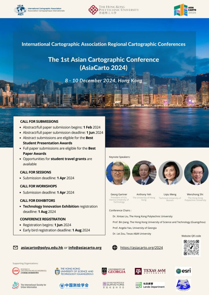
Invitation to AsiaCarto 2024 – The First Asian Cartographic Conference of ICA

The International Cartographic Association (ICA) and The Hong Kong Polytechnic University (PolyU) are pleased to initiate the first Regional Cartographic Conferences (RCC) in Asia, namely Asian Cartographic Conference (AsiaCarto 2024). AsiaCarto 2024 will be held from 8th to 10th December 2024 at the Hong Kong Polytechnic University, Hong Kong, China.

AsiaCarto 2024 aims to bring together Cartographers, GIS scientists, and professionals from related fields to provide a platform for discussion, exchange, and stimulation of research and collaborative projects on Cartography and GIScience. In the long run, AsiaCarto envisions becoming a biannual series of conferences hosted in various Asian countries, consistently supporting the promotion of Cartography and GIScience within Asia and worldwide.

We invite submissions, session proposals, workshop proposals, and exhibitor applications! Don’t miss out on the chance to win prestigious awards such as Best Paper, Best Presentation, and Student Travel Grants. For detailed information registration, please visit AsiaCarto 2024’s official website. ICA has also opened up its Scholarship programme for this new Regional Cartographic Conference. The deadline for Scholarship applications by young scientists is 7 August 2024: https://icaci.org/scholarship/

We are happy to welcome you to AsiaCarto 2024 in Hong Kong!

Category: Member News
Tag:

Invitation to CartoVis 2024 – ICA Workshop on AI, Geovisualization, and Analytical Reasoning

The University of Warsaw Department of Geoinformatics, Cartography, and Remote Sensing in collaboration with the International Cartographic Association Commissions on Cognitive Issues in Geographic Information VisualizationGeovisualization, and User Experience (UX), as well as ICA Next Generation Cartographers Working Group are pleased to invite you to the 2024 ICA Workshop on AI, Geovisualization, and Analytical Reasoning, on Saturday, 7 September 2024 at the University of Warsaw, Poland.

Early-stage work is explicitly encouraged, especially by junior scholars or those new to cartography.

We invite you to contribute to our Call for Papers. Short papers (2 pages) can be submitted until 15 May 2024 and abstracts (300 words) until 1 June 2024. Submissions are expected to report on ongoing and emergent work that aims to tackle one of the many dimensions of cartography: specifically, we welcome those that relate to supporting geovisualization and analytical reasoning, including approaches that leverage AI methods applied at various stages: data processing, analysis, visualization generation and interpretation, as well as support in user perception interpretation. Broadly speaking, we are seeking work that focuses on understanding users, their cognitive processes, and/or their interactions with visual representations and computational methods via maps or geographic visualization. We welcome research that tackles these and related problem areas through computational, representational, artificial intelligence (AI), ethical, or contextual methodological lenses. This workshop will provide a forum in which new approaches and ideas can be discussed and where new research collaborations can be formed.

There will be no conference fee!

For details please visit our workshop website: http://carto-vis-workshop.uw.edu.pl/ 

We are looking forward to your contributions and to welcoming you to Warsaw!

CartoVis24 Organizers

Tag: ,

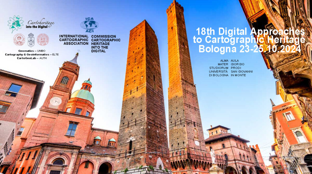
Invitation to the 18th ICA Conference on Digital Approaches to Cartographic Heritage

The ICA Commission on Cartographic Heritage into the Digital, continuing the tradition of its annual Cartoheritage Conferences since 2006, is pleased to invite you at the 18th ICA Conference on Digital Approaches to Cartographic Heritage in Bologna, 23-25 October 2024 – in partnership with the the University of Bologna, Department of Civil, Chemical, Environmental and Materials Engineering (DICAM), supported by the MAGIC – Map & Geoinformation Curators Group.

Call for Papers

The Programme will be organised in thematic sessions dedicated to issues relevant to the subjects usually treated in the Conferences of the ICA Cartoheritage Commission, according to its Terms of Reference (2023-2027).

Possible topics include but are not limited to:

  • Digitisation – Georeference.
  • Content analysis in terms of geometry and thematics of cartodiversity.
  • Landscape change studies based on map-archival sources.
  • Visualisation of Cartoheritage, including thematic portals.
  • Interconnection of cartographic archival sources, especially map and textual data.
  • Historical terrestrial and aerial photography, including photo-related post-cards and relevant material – cartographic parametrisation.
  • Cartoheritage web providing issues.
  • Interaction of cartoheritage with map and geoinformation curatorship of cartodiversity.
  • Development of cartoheritage as a cultural issue, within the context of GLAM, addressed to education and to the general public.
  • Geographic affinities with Cartoheritage.
  • Cartoheritage and Digital Humanities.
  • Other relevant issues of the Cartoheritage ecosystem.

The presented papers are published in the Conference Proceedings (ISSN-2459-3893) available in digital form during the Conference.

For your participation in the conference, please fill and submit online your participation form.

For abstract submission, please fill and submit online the paper title & abstract form (Deadline: 30 April 2024)

For more information about the conference please visit cartography.web.auth.gr/ICA-Heritage/Bologna2024.

Tag: ,

International Journal of Cartography – Issue 10.1, 2024 published online

Cover International Journal of CartographyThe new issue of the International Journal of Cartography is now available on the Journal website

A synopsis of papers published in the issue is provided below.

  • The contributions in this Issue begins with a paper from Jason Van Horn, entitled Erwin Raisz Plan to Advance Academic Cartography in the United States.  Van Horn notes that “Erwin Raisz represents the vanguard of early Twentieth Century American cartography.”  The paper covers Raisz’s plans to build academic cartography as its own sub-discipline in geography.  It examines his strategy and how his 1938 textbook, General Cartography, acted as a catalyst for the establishment of new courses in Cartography. The paper also covers how he continued to champion the further development of cartographic programmes.
  • Uncovering urban circadian pulses based on an animated cartogram: the example of Bogotá by Hugo Thomas & Florent Demoraes describes a dynamic map that shows the differing location of ‘day’ and ‘night’ populations and how they balance over a 24 hour period. This was done using a smoothed animated cartogram of the Bogotá metropolitan area in Colombia.  The main goal of the project was to provide visual effectiveness.
  • Marina Viličić and Miljenko Lapaine contribute the paper Determining the Scale and Map Projection of Stjepan Glavač’s Map from 1673.  The authors consider this map to be an exceptionally important part of Croatian cultural heritage due to its uniqueness and the detailed depiction of Croatian regions. From the relationship between the coordinates from the map, the authors concluded that Glavač used the equidistant cylindrical projection with the equator as a standard parallel.  The paper concludes with the calculation of the interval of the numerical scale of the map, enabling them to refute and/or accept the theses of other authors who have cited different scales of Glavač’s map.
  • Ruud Stelten’s paper, The Caribbean’s mythical Aves Bank, addresses the cartographic myth of the Aves Bank, a long and narrow submarine bank that connected Aves Island with Saba and St. Eustatius.  This is one of many fictitious topographic elements introduced into early maps and charts of the Caribbean. The Aves Bank myth came about in the 1720s and was adopted by many cartographers, who included it in their maps and charts. The paper reports on the research undertaken by Stelten on this Caribbean cartographic myth.
  • Stefan Fuest, Olga Shkedova & Monika Sester offer information on their approach for promoting routes that reduce exposure of road users to areas that should be temporarily avoided due to traffic related or environmental reasons. Promoting favorable routes through visual communication: A design study for creating route maps for the case of air pollution outlines their method, that recommends routes be calculated as the shortest path while minimizing the current concentrations of particulate matter along the route.  They proposed seven different visualization variants for representing line and areal objects in a route map that visualize route options based on pollution levels.
  • Certain arguments against the hypothesis that portolan charts were genuine late-medieval cartographic products by Tome Marelić reports on a series of tests conducted on sample of 12 representations of the Adriatic Sea on portolan charts, created between the late 13th and the late 16th century.  This was done to examine their navigational applicability. By-products of their results strongly suggest that it is impossible that portolan charts were, in terms of their geometry, genuine late-medieval cartographic products.
  • Miljenko Lapaine, in his paper, A Problem in Basic Cartography offers proof that standard parallels and secant parallels generally do not match. He argues that that the widely accepted facts about secant and standard parallels are wrong and need to be revised. Further, he explains that cylindrical projections are not a good approach, as they lead to misunderstanding important properties of projection.
  • The Issue concludes with the Invited essay: MAPS IN HISTORY by Imre Demhardt. The topic of this essay is Richard Harrison as media cartographer.
  • Two book reviews are also included:
    • New directions in radical cartography: Why the map is never the territory edited by Phil Cohen and Mike Duggan, Landham, Maryland, US, Rowman & Littlefield, 2021. Review by Peter Vujakovic.
    • Atlas of the Invisible: Maps & Graphics That Will Change How You See The World by James Cheshire and Oliver Uberti. Review by Antoni Moore.

Papers can be viewed via the Journal website.

Bill Cartwright and Anne Ruas
Editors, International Journal of Cartography

Category: General News

International Journal of Cartography – Issue 9.3, 2023 Special Issue ICC2023, Cape Town, South Africa, published online

Cover International Journal of CartographyThe new issue of the International Journal of Cartography is now available on the Journal website

Details of papers published in the Issue are provided below:

  • The paper Options for systematizing cartographic rules was provided by Václav Talhofer, Jiří Drozda and Filip Dohnal. This paper suggests a systematization of the rules that are used in the whole technological cycle of map creation. The suggested system of rules is processed into the design of a knowledge-based ontology database intended for solving especially collision situations during the creation of topographic maps.
  • Otakar Čerba, Tomáš Andrš, Loic Fournier and Martin Vaněk contribute Cartography & Web3. This article addresses the relationship between cartography and Web3. It describes the basic features of Web3 and its future relationship to the field of cartography. The paper aims to generate discussion regarding the evolutionary changes in cartography that may occur due to the emergence of Web3 technologies such as Blockchain.
  • Square-glyphs: Assessing the readability of multidimensional spatial data visualized as square-glyphs is provided by Gianna Daniela Müller, Daria Hollenstein, Arzu Çöltekin and Susanne Bleisch.  In this paper, the authors present a user study evaluating the readability and interpretability of the square-glyphs. They compare the user performance with squareglyphs containing two and four simultaneously mapped data dimensions and different value compositions.
  • The following paper is Understanding Relevance in Maps through the use of Knowledge Graphs by José Pablo Ceballos Cantú, Markus Jobst and Georg Gartner. The paper describes ‘SeMaptics’, a tool has been developed to better understand the relationship between the two domains of ontological and spatial dimensions. Ontological mapping allows for discrete ontologies to be projected into the spatial field. Such ontologies are regularly seen in a continuous or overlapping layered format in the spatial dimension. However, integrating both spaces results in a novel method, which could add additional perspectives to the map-making process. SeMaptics implements a graph structure to accommodate graph visualizations using D3js.
  • Visualising temporal changes in visitors’ areas of interest using online geotagged photographs by Bochra Bettaieb and Yoshiki Wakabayashi. Details a study undertaken to visualise the spatial patterns and temporal changes in the areas of interest (AOIs) of foreign visitors using data derived from geotagged photos on Flickr. The results show differences in the distribution of AOIs between visitors from Asia and Europe.  Furthermore, the distribution of changed AOIs may reflect environmental changes due to a redevelopment project.
  • Behind the first Habsburg map of Transylvania – comparative analysis of contemporary manuscript maps by Zsombor Bartos-Elekes provides results from a study analysed, for the first time, three other contemporary manuscript maps: “Mappa della Transilvania”; “Continet mappas comitatuum”; and the map by Morando Visconti. The research was conducted to determine the relationship between the printed map and the manuscript maps, the map sources and if they were copies. They also wanted to determine the authors and the date of the manuscript maps.
  • Gertrud Schaab, Serena Coetzee, Nerhene Davis and Faith N. Karanja, in their paper Developing teaching/learning materials on “Sense of Place” with students in an international university cooperation: overall approach and first phase outcomes at Karlsruhe University of Applied Sciences report on their project to jointly develop digital teaching and learning resources related to sense of place, which can be used in blended learning at several universities.  This paper provides the results of the first phase of the project.
  • Spatial aspects of evacuation: A closer look at user interaction during route choice by Dajana Snopková and Lukáš Herman reports on one aspect of a larger project that dealt with the study of the influence of spatial parameters of buildings on decision-making during evacuation.  They focussed on the analysis of the collected interaction data (mouse rotation) and their relationship to the laterality of the participants and the final choice of an evacuation corridor. Statistical analysis using correlation coefficients and the Welch t-test were employed in the study.
  • The paper by Haowen Yan, Weifang Yang and Xiaomin Lu: provided information on their research: Quantitative expressions of spatial similarity between road networks in multiscale map spaces. Using road networks as an example, the authors proposed an approach to calculating the spatial similarity degree between a road network at a larger scale and its generalized counterpart at a smaller scale. They argue that the proposed quantitative method lays a foundation for using spatial similarity as a constraint during map generalization.
  • José Jesús Reyes Nunez provides a paper entitled: The presence of geoinformatics in Hungarian secondary education. The paper offers a brief background on the influence that geoinformatics currently exerts on geography teaching in Hungarian secondary schools:  the main characteristics of geography teaching at elementary and secondary levels; skills and competences that should be developed by geography in this level; and how geoinformatics could assist further development. Finally, some ideas are proposed that might increase the presence of geoinformatics in the teaching of geography at the secondary level.
  • Orienteering maps, perhaps the least familiar map type to cartographers, are addressed in the paper History of orienteering maps: in the light of the evolution of survey and reproduction techniques by László Zentai. Map symbology, surveying methods and printing technologies employed in the development and production of orienteering maps are explained.
  • Atlassing Sustainable Development: A Participatory and Critical Approach to Neighbourhoods in Transition by Barbara Roosen and Mela Zuljevic paper discusses the production of an atlas as a critical and trans-disciplinary practice for participatory research in sustainable development.  Starting from critical cartography and participatory mapping, the authors propose the process of ‘atlassing’ as a tool to support negotiation between various sustainability aspects in relation to everyday practices, different research inputs, actors and participatory activities.
  • The primary goal of the article by Nina Polous, Smart Cartography: representing complex geographical reality of 21st century, is to reflect on the term “Smart Cartography”. The author makes the term “cartography”, the focal point of the debate rather than the word “smart”. This paper simplifies the definition of cartography to the unexcludable “geographical reality,” critical for understanding our environment. It examines how this term has been interpreted historically and contemporarily since the mid-19th century.
  • Krzysztof Pokonieczny and Wojciech Dawid provide the paper The Application of Artificial Neural Networks for the Generalisation of Military Passability Maps. Passability maps are cartographic studies that are generally used by commanders when planning military operations. This article presents a methodology for the automated generalization of passability maps. For this purpose, artificial neural networks (ANN) were used, and, specifically, a multilayer perceptron. The paper describes the manner of preparing teaching data to train artificial neural networks and their implementation, which led to the creation of the resulting maps. In order to test the consistency of maps, Moran’s I spatial autocorrelation coefficient was determined.
  • Finally, a regular column in issues of this Journal – MAPS IN HISTORY by Imre Demhardt – focusses on : Cape Town’s changing waterfront.  Three maps – Plan of Cape Town (1854), South African Railways – Table Bay Harbour (1911) and Map of Cape Town (1948) – are used to ‘track’ the changes to the harbour.

Papers can be viewed via the Journal website.

Bill Cartwright and Anne Ruas
Editors, International Journal of Cartography

Category: General News
rawboned-refined