Welcome to the International Cartographic Association
Welcome to the website of the International Cartographic AssociationGet to know the new ICA Executive Committee for the term 2023-2027Get to know the ICA Commissions for the term 2023-2027
Welcome to the website of the International Cartographic Association
Get to know the new ICA Executive Committee for the term 2023-2027
Get to know the ICA Commissions for the term 2023-2027

International Journal of Cartography – Issue 9.3, 2023 Special Issue ICC2023, Cape Town, South Africa, published online

Cover International Journal of CartographyThe new issue of the International Journal of Cartography is now available on the Journal website

Details of papers published in the Issue are provided below:

  • The paper Options for systematizing cartographic rules was provided by Václav Talhofer, Jiří Drozda and Filip Dohnal. This paper suggests a systematization of the rules that are used in the whole technological cycle of map creation. The suggested system of rules is processed into the design of a knowledge-based ontology database intended for solving especially collision situations during the creation of topographic maps.
  • Otakar Čerba, Tomáš Andrš, Loic Fournier and Martin Vaněk contribute Cartography & Web3. This article addresses the relationship between cartography and Web3. It describes the basic features of Web3 and its future relationship to the field of cartography. The paper aims to generate discussion regarding the evolutionary changes in cartography that may occur due to the emergence of Web3 technologies such as Blockchain.
  • Square-glyphs: Assessing the readability of multidimensional spatial data visualized as square-glyphs is provided by Gianna Daniela Müller, Daria Hollenstein, Arzu Çöltekin and Susanne Bleisch.  In this paper, the authors present a user study evaluating the readability and interpretability of the square-glyphs. They compare the user performance with squareglyphs containing two and four simultaneously mapped data dimensions and different value compositions.
  • The following paper is Understanding Relevance in Maps through the use of Knowledge Graphs by José Pablo Ceballos Cantú, Markus Jobst and Georg Gartner. The paper describes ‘SeMaptics’, a tool has been developed to better understand the relationship between the two domains of ontological and spatial dimensions. Ontological mapping allows for discrete ontologies to be projected into the spatial field. Such ontologies are regularly seen in a continuous or overlapping layered format in the spatial dimension. However, integrating both spaces results in a novel method, which could add additional perspectives to the map-making process. SeMaptics implements a graph structure to accommodate graph visualizations using D3js.
  • Visualising temporal changes in visitors’ areas of interest using online geotagged photographs by Bochra Bettaieb and Yoshiki Wakabayashi. Details a study undertaken to visualise the spatial patterns and temporal changes in the areas of interest (AOIs) of foreign visitors using data derived from geotagged photos on Flickr. The results show differences in the distribution of AOIs between visitors from Asia and Europe.  Furthermore, the distribution of changed AOIs may reflect environmental changes due to a redevelopment project.
  • Behind the first Habsburg map of Transylvania – comparative analysis of contemporary manuscript maps by Zsombor Bartos-Elekes provides results from a study analysed, for the first time, three other contemporary manuscript maps: “Mappa della Transilvania”; “Continet mappas comitatuum”; and the map by Morando Visconti. The research was conducted to determine the relationship between the printed map and the manuscript maps, the map sources and if they were copies. They also wanted to determine the authors and the date of the manuscript maps.
  • Gertrud Schaab, Serena Coetzee, Nerhene Davis and Faith N. Karanja, in their paper Developing teaching/learning materials on “Sense of Place” with students in an international university cooperation: overall approach and first phase outcomes at Karlsruhe University of Applied Sciences report on their project to jointly develop digital teaching and learning resources related to sense of place, which can be used in blended learning at several universities.  This paper provides the results of the first phase of the project.
  • Spatial aspects of evacuation: A closer look at user interaction during route choice by Dajana Snopková and Lukáš Herman reports on one aspect of a larger project that dealt with the study of the influence of spatial parameters of buildings on decision-making during evacuation.  They focussed on the analysis of the collected interaction data (mouse rotation) and their relationship to the laterality of the participants and the final choice of an evacuation corridor. Statistical analysis using correlation coefficients and the Welch t-test were employed in the study.
  • The paper by Haowen Yan, Weifang Yang and Xiaomin Lu: provided information on their research: Quantitative expressions of spatial similarity between road networks in multiscale map spaces. Using road networks as an example, the authors proposed an approach to calculating the spatial similarity degree between a road network at a larger scale and its generalized counterpart at a smaller scale. They argue that the proposed quantitative method lays a foundation for using spatial similarity as a constraint during map generalization.
  • José Jesús Reyes Nunez provides a paper entitled: The presence of geoinformatics in Hungarian secondary education. The paper offers a brief background on the influence that geoinformatics currently exerts on geography teaching in Hungarian secondary schools:  the main characteristics of geography teaching at elementary and secondary levels; skills and competences that should be developed by geography in this level; and how geoinformatics could assist further development. Finally, some ideas are proposed that might increase the presence of geoinformatics in the teaching of geography at the secondary level.
  • Orienteering maps, perhaps the least familiar map type to cartographers, are addressed in the paper History of orienteering maps: in the light of the evolution of survey and reproduction techniques by László Zentai. Map symbology, surveying methods and printing technologies employed in the development and production of orienteering maps are explained.
  • Atlassing Sustainable Development: A Participatory and Critical Approach to Neighbourhoods in Transition by Barbara Roosen and Mela Zuljevic paper discusses the production of an atlas as a critical and trans-disciplinary practice for participatory research in sustainable development.  Starting from critical cartography and participatory mapping, the authors propose the process of ‘atlassing’ as a tool to support negotiation between various sustainability aspects in relation to everyday practices, different research inputs, actors and participatory activities.
  • The primary goal of the article by Nina Polous, Smart Cartography: representing complex geographical reality of 21st century, is to reflect on the term “Smart Cartography”. The author makes the term “cartography”, the focal point of the debate rather than the word “smart”. This paper simplifies the definition of cartography to the unexcludable “geographical reality,” critical for understanding our environment. It examines how this term has been interpreted historically and contemporarily since the mid-19th century.
  • Krzysztof Pokonieczny and Wojciech Dawid provide the paper The Application of Artificial Neural Networks for the Generalisation of Military Passability Maps. Passability maps are cartographic studies that are generally used by commanders when planning military operations. This article presents a methodology for the automated generalization of passability maps. For this purpose, artificial neural networks (ANN) were used, and, specifically, a multilayer perceptron. The paper describes the manner of preparing teaching data to train artificial neural networks and their implementation, which led to the creation of the resulting maps. In order to test the consistency of maps, Moran’s I spatial autocorrelation coefficient was determined.
  • Finally, a regular column in issues of this Journal – MAPS IN HISTORY by Imre Demhardt – focusses on : Cape Town’s changing waterfront.  Three maps – Plan of Cape Town (1854), South African Railways – Table Bay Harbour (1911) and Map of Cape Town (1948) – are used to ‘track’ the changes to the harbour.

Papers can be viewed via the Journal website.

Bill Cartwright and Anne Ruas
Editors, International Journal of Cartography

Category: General News

International Journal of Cartography, Issue 9.2, 2023 published

Cover International Journal of CartographyThe new issue of the International Journal of Cartography is now available on the Journal website

The list of papers published is provided below:

  • Editorial – New directions for the state of the art and science in Cartography
    Anthony C. Robinson, Pyry Kettunen, Luciene Delazari and Arzu Çöltekin
  • Potential of eye-tracking for interactive geovisual exploration aided by machine learning (Open Access)
    Merve Keskin & Pyry Kettunen
  • Moving Indoors: A Systematic Literature Review of Locomotion in Virtual Indoor Environments
    Pavel Pospíšil
  • Study about the appropriate number of participants in map user studies
    Vinicius Bergmann Martins, Fabrício Rosa Amorim, Marcio Augusto Reolon Schmidt & Luciene Stamato Delazari
  • Cartography & Geovisual Analytics in Personal Contexts: Designing for the Data Creator (Open Access)
    Jonathan Nelson
  • Eye-tracking in map use, map user and map usability research: what are we looking for? (Open Access)
    David Fairbairn and Jessica Hepburn
  • Missing the City for Buildings? A Critical Review of Pan-Scalar Map Generalization and Design in Contemporary Zoomable Maps
    Maieul Gruget, Guillaume Touya and Ian Muehlenhaus.
  • Using Geovisual Analytics to Enrich Conservation Science: A Review of Interactive Visualization of Wildlife Movement and Environmental Spatial Data Across Ecosystems
    Lindsay Lacey and Jonathan Nelson
  • Minimum Dimensions for Cartographic Symbology – History, Rationale and Relevance in the Digital Age (Open Access)
    Florian Ledermann
  • Incorporating Ideas of Structure and Meaning in Interactive Multi Scale Mapping Environments
    Guillaume Touya, Quentin Potie and William A. Mackaness
  • Cartographic perspectives on spatial and thematic levels of detail in augmented reality: a review of existing approaches
    Niki Anastopoulou, Margarita Kolka, Eleni Tomai, Kostas Cheliotis, Fotis Liarokapis, Katerina Pastra and Marinos Kavouras
  • How we see time — The Evolution and Current State of Visualizations of Temporal Data (Open Access)
    Verena Klasen, Edyta P. Bogucka, Liqiu Meng & Jukka M. Krisp

Also, you may have papers that you might wish to publish in the Journal. We would welcome the submission of appropriate papers.

William Cartwright, Melbourne, Australia
Anne Ruas, Paris, France
Editors, International Journal of Cartography

Category: General News

Invitation to Pre-ICC2023 Workshop: The Future of Atlases

Kindly note that this workshop has been CANCELLED.
Apologies for any inconvenience caused.


The ICA Commission on Atlases is happy to invite you to another interesting Atlas Workshop: „The Future of Atlases“. We want to discuss with you the possibilities and challenges of atlases, perhaps resulting in an innovative, new atlas concept.

Background

In an era dominated by digital technologies and real-time information, the future of traditional atlases has become increasingly uncertain. These once-revered compilations of maps, charts, and geographic knowledge are now facing a myriad of challenges that question their relevance and longevity in the modern world.

One of the primary issues confronting atlases is their rather static nature. Geographic features such as coastlines, borders, and urban development are in a constant state of flux, while political shifts and territorial disputes further complicate the accuracy of conventional maps. As a result, atlases often fail to capture the most up-to-date and accurate information, undermining their utility in today’s dynamic global environment.

Moreover, the climate crisis has introduced an unprecedented level of environmental instability. Rising sea levels, shifting climate zones, and extreme weather events are redefining the very geography we once took for granted. The impact of these changes is significant and demands agile cartographic solutions that can quickly adapt to the new realities.

In addition, the rise of digital mapping platforms and GPS technology has further compounded the predicament of atlases. Online maps like Google Maps and interactive navigation tools on smartphones have revolutionized the way we access and interact with geographic information. With these tools offering real-time updates and personalized directions, the traditional atlas appears cumbersome and outdated in comparison. The ease and convenience of these digital services are gradually overshadowing the once-prestigious allure of physical and digital atlases.

The future of atlases lies in their ability to adapt and evolve. Hybrid approaches, combining physical maps with digital interfaces, might offer a compromise that respects tradition while harnessing the advantages of modern technology. Collaborative efforts between cartographers, geographers, and local communities can help ensure greater accuracy and inclusivity in geographic representation.

The workshop will address these and additional issues publisher of atlases are facing today. Keywords, such as narration and storytelling, openness, participation and transparency that seem to challenge atlas productions will discussed and evaluated.

Details

  • Workshop date: SAT 12. August
  • Workshop time: 09h00-13h00
  • Venue: Stellenbosch University, Chamber of Mines Building
  • Directions from CTICC: https://goo.gl/maps/ikHB9aw6oWdmaNfV8
  • Registration and Contact: Eric Losang (E_Losang [a] leibniz-ifl.de)

In the afternoon, we will participate in a trip to a winery and taste fine wine. The costs for the wine trip and the return trip to Capetown will be 750 Rand (40 Euro), with 15 participants at least.

Please register as soon as possible!

– Eric Losang & René Sieber

ICC2023: Early Bird Registration Special Ends May 31st

If you’re planning to attend the 31st Cartographic Conference 2023, now is the perfect time to register as our early bird registration offer ends on May 31st, 2023. Join 800 delegates from nearly 78 countries in Cape Town, South Africa!

We are also proud to announce that the UN-GGIM Africa 9th Meeting of the Regional Committee will be hosted alongside ICC 2023 as well as SDG DATA Hub Workshops that are open for all to attend. Register today on icc2023.org

We look forward to welcoming you in Cape Town!

Category: General News

Invitation to Pre-ICC2023 Workshop Other Cartographies

The ICA Commission on Art and Cartography invites to a workshop prior to ICC2023 in Cape Town, South Africa, on August 11, 2023. 

Background

The ICC2023’s theme is SMART CARTOGRAPHY FOR SUSTAINABLE DEVELOPMENT. How can this theme be interpreted through Art? The Commission on Art & Cartography’s Terms of Reference include the directive to “advance the field of artistic and experimental cartographies, including but not limited to such subfields as narrative cartography, cinematic cartography, sensory and phenomenological approaches to mapping, locative media, performative and performance-based cartographies, and media archaeological and other research-creation or practice-led processes.” What might “sustainability” mean in terms of these and other such subfields? However the theme is interpreted, one thing is clear: other ways are needed, other points of view, other methodologies, visions, practices. What other cartographies can challenge the status quo?

The goal of this workshop is to provide an intellectual and creative space to share different ideas around artistic methodologies of mapping and engaging with space and place, particularly those that challenge the status quo of capitalism, colonialism, extractive resource development (etc., the list is long). The format of the workshop will be as follows: a morning of lightning presentations from all of the participants, to introduce each other; an afternoon of 3-4 mini-workshops that explore different methodologies or practices related to our theme of Other Cartographies.

The workshop will be hosted by the National Geospatial Information in Cape Town, South Africa on Friday, August 11th from 10am-5pm. A catered lunch is included!

Please submit either a 100-150 word proposal if you are interested in leading a mini-workshop of about 45-60 minutes, or a short bio if interested in attending as a participant.

Submission Process & Registration

The workshop is open to everyone with an interest in alternative and sustainable mapping art practices and experimental cartographies. Registration is required and is free of charge. Please note that it is not necessary to be registered for the main ICC conference (which requires fees) to be able to attend the workshop. For more information or to register, please contact Workshop Coordinator Sharron Mirsky (see contact details on the workshop website).

Timeline

  • May 20, 2023 – Call for participants and workshop leaders
  • June 15, 2023 – Deadline for submitting abstracts and proposals (max. 150 words)
  • June 22, 2023 – Successful Applicants notified;
  • July 1, 2023 – Final program released;
  • August 11, 2023 – Workshop prior to the ICC 2023

Please find more information on the workshop website.

Cartographier pour un monde durable – French version of Mapping for a Sustainable World published

The book “Mapping for a Sustainable World”, a co-publication by the United Nations and the International Cartographic Association, has been translated to French – the second offical language of the ICA.

The pdf-version of the book written by Menno-Jan Kraak (ICA), Robert E. Roth (ICA), Britta Ricker (ICA), Ayako Kagawa (UN) and Guillaume Le Sourd (UN) can be downloaded from digitallibrary.un.org/record/3898826. A printed version is in preparation.

Category: General News

Invitation to Pre-ICC2023 Workshop on Cartographic and Geospatial Information Education: Transformation in the Era of AI

You are warmly invited to participate in and contribute your research, experiences and insights to the International Workshop on Cartographic and Geospatial Information Education: Transformation in the Era of AI, jointly organized by the Commission on Education and Training, the Working Group on the Cartographic Body of Knowledge and the Commission on Open Source Geospatial Technologies in partnership with the Stellenbosch University, South Africa.

The workshop will take place at the campus of the Stellenbosch University, Cape Town, South Africa, on August 12, 2023. It is scheduled for attendees to conveniently continue their journey to the 31st International Cartographic Conference in the same city between August 13-18, 2023.

Background

Education is recovering to a better normal after the pandemic, while facing an ever evolving digital revolution. Powerful digital technologies and tools ensure quality and sustainable education for all. Among these, artificial intelligence (AI) is transforming the contents and pedagogies of cartographic and geospatial information education. Debates about roles of generative AI tools in education are being heated in various fields. What will the role of AI be in cartography and GIS education, research and practice? It is exciting to explore how educators and learners can better tap such tools for the transformation of Cartographic and Geospatial Information Education in the era of AI.

Call for participation

This workshop will bring together educators and experts to share the latest work, best practices and developments on related themes. Suggested topics of interest can include, but are not limited to, the following:

  • Developing the Body of Knowledge for cartography
  • AI-powered teaching and learning in cartography and GIS
  • Integrating AI into cartographic and geospatial information education
  • Curriculum design for cartographic and geospatial information education
  • Developing on-line educational resources for cartography and GIS teaching
  • Best practices in teaching and learning in cartography and geospatial information
  • Open source software and datasets in cartographic and geospatial information education
  • Integrating cartography into education of geomatics, geography and other disciplines
  • Partnerships and collaborations between universities and industry in GIS
  • Experiences in teaching cartography and GIS in general education
  • Cartographic and geospatial information education in Africa

The workshop is designed to be hybrid depending on local conditions and open to all interested researchers in cartographic and geospatial information education. We cordially invite you to join forum to exchange thoughts on the Education Transformation in the Era of AI.

Submission Details

You are mostly welcome to present your work in this workshop by submitting abstracts to the organizers, using the ICA abstract template.

The deadline for submitting abstracts is June 06, 2023. Acceptance notification will be sent out before June 30, 2023. Authors of accepted submissions are expected to present their works in the workshop. Selected papers will be invited for a further review for an edited volume planned next year.

Please find more information on the workshop website.

Organizing Committee

  • Silvana Camboim, Federal University of Paraná, Brazil
  • Terje Midtbø, Norwegian University of Science and Technology, Norway
  • Zahn Münch, Stellenbosch University, South Africa
  • Stefan Peters, University of South Australia, Australia
  • Tao Wang, Capital Normal University, China

The Atlas Cookbook – finally published!

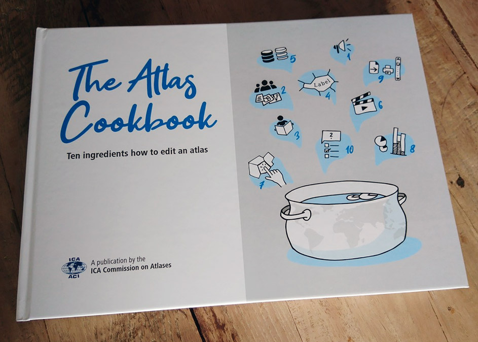
The ICA Commission on Atlases (CoA) proudly announces the publication of The Atlas Cookbook – 10 ingredients how to edit an atlas.

The intention of The Atlas Cookbook is to advise atlas authors in a general way:

  • to give an overview over the realization phases,
  • to show how to start a new atlas project (which is always the hardest part),
  • and how to deal with conceptual, organizational, graphical or publishing issues.

What’s in it?

We divided The Atlas Cookbook in 10 chapters, which reflect a viable and practicable way to carry out an atlas project. The chapters start with Organization & Marketing, followed by Editorial Aspects. After the administrative issues are addressed, the book focuses on Atlas Use and Data Management. Other components to be considered in the atlas process include the use of Multimedia Elements and the Atlas GUI Design, followed by detailed chapters on Map Design and on Interactive Atlas Functionality. And finally, Prototyping and Evaluation describes the last steps before publishing the atlas.

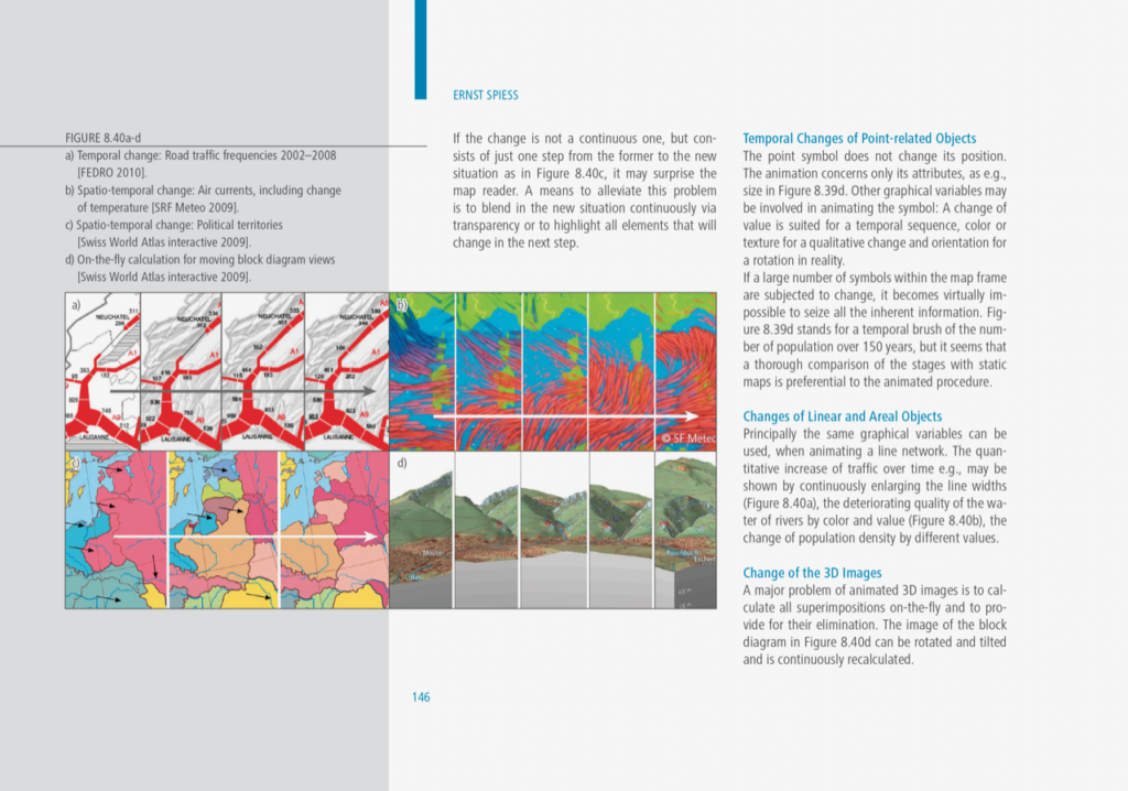
A peak inside chapter 8 by Ernst Spiess.

A peak into chapter 8 by Ernst Spiess.

For whom?

The Atlas Cookbook is intended for atlas makers, map producers, and all kind of cartographers; it can be read as a whole, but even just a single chapter can help!

The Atlas Cookbook is written at a management level, not in a technical way. Most comments and recommendations apply to current and emerging digital technologies, but many sections are also valid and useful for editing printed atlases.

And where to get?

To get a digital copy, we offer the The Atlas Cookbook as a PDF on the CoA Website. You can download it for free and use it according to the CC license.

Additionally, we produced a printed book in a limited edition of 200 copies, supported by ICA and ETH Zurich. If you’d like to receive a printed edition (also free of charge), please send your postal address together with some kind words and good reasons to René Sieber, the current chairman of the CoA: sieberr [at] ethz.ch

Registration open for “Conquering the World through Cartography”

From Tuesday 30 May till Wednesday 31 May 2023 the ICA Commission on the History of Cartography and the Belgian Royal Academy for Overseas Sciences will jointly host an international conference on colonial cartography. This will be organized as a hybrid event, both face-to-face at the Palace of the Academies in the centre of Brussels and via livestream.

Theme

The 21st century map image of continents beyond Europe is still decisively shaped by inherited aesthetics and content dating back to the turn from explorative to imperialist cartography. The symposium welcomes contributions (papers and posters) to analyse aspects of the imperialist Global North hegemony by investigating topographic mapping, hydrographic charting, and thematic mapping in personal, institutional, and regional case studies. The regional scope of the conference are overseas continents and seascapes within the time frame from about the Napoleonic wars to the European de-colonization in the mid-twentieth century (1940s to 1960s).

Programme & Registration

A provisional list of accepted oral and poster presentations can be found here.

Please visit history.icaci.org/brussels-2023 for more details and the link to the registration page. The early bird registration deadline is 5 May.

The conference’s scientific programme of lectures will take place all day on Tuesday 30 May and on Wednesday morning 31 May. Optional free tours are planned both on the afternoon of Wednesday 31 May, visiting the map collection of the AfricaMuseum, as well as on the morning of Thursday 1 June, for a visit to the Map room of the Royal Library of Belgium, themed “Not just Congo. Belgian colonial mapping in the 19th and 20th centuries”.

We hope to see many of you there!

Soetkin Vervust
Secretary ICA Commission on the History of Cartography

Tag:

Call for Presentations: ICC 2023 Pre-Conference Workshop on Cartography and AI (MapAI)

The ICA Commissions on Visual Analytics and Cognitive Issues in Geographic Information Visualization are pleased to announce a Workshop on Cartography and AI (MapAI 2023) taking place on August 12, 2023 in Stellenbosch, South Africa before the ICC 2023.

Motivation

Cartographers have assessed the potential use of artificial intelligence for mapping for decades. Early work on expert systems explored AI as early as the 1980s (e.g., Buttenfield 1984; Fisher & Mackaness 1987; Brassel & Weibel, 1988; Johnson & Basoglu 1989). The AI tools of the time were limited by the (lack of) availability of computing power and data. More recently, as AI tools have become both more powerful and easier to use, a few cartographers and computer scientists have begun experimenting with artificial intelligence technologies to see how they might be applied to maps and mapping processes (e.g., Kang et al., 2019; Zhao et al, 2021; Christophe et al., 2022; Zhou et al, 2022; Santos et al., 2023). Others have made initial efforts to review the potential of AI technologies for cartography (Kang et al., 2022), laying out some possibilities and also some points of caution by identifying ethical issues these technologies raise and/or exacerbate. The 2022 launches of DALL·E 2, ChatGPT, and other AI platforms have caught the attention of the general public by making artificial intelligence technologies easy to use for a range of everyday tasks. Some cartographers have already put these to use for assisting their mapping practice (see, for example, https://www.youtube.com/watch?v=OCOpxy3wk-o). There is much more for cartographers to explore, including the potential impacts of the use of AI on map users’ and map makers’ cognitive processes (see Keskin & Kettunen, 2023 for an initial investigation).

In this workshop, we aim to bring together ideation and practical experimentation to collaboratively explore some of the potential and limits of current AI technologies for cartographic practice and map use.

Call for Presentations

The first half of our planned 1-day workshop will be for participants to present Lightning Talks. In 5 minutes presenters will showcase either one major challenge or one significant opportunity you see that intersects between AI and Cartography.

These presentations should focus on frontiers in cartographic research that intersect with AI tools or techniques, and creative/unorthodox approaches are welcomed. Work-in-progress is the intended target, versus projects that are already fully completed.

Example topics could include, but are not limited to:

  • Implications of deepfake maps and satellite images
  • Machine-learning / AI based map updating based on image input
  • AI-generated wayfinding directions
  • Geographic aspects of algorithmic bias
  • Automated means of iterating design elements in cartographic layouts
  • Explainable AI & mapping
  • Natural language interaction with maps
  • Mapping with ChatGPT, DALL-E, Midjourney, Stable Diffusion, etc…
  • Human-machine collaboration using maps

Workshop presentations will be used to motivate group discussions and hands-on experimentation in the second half of the planned 1-day workshop. We are excited to work together to push the limits of various AI mechanisms for cartographic design and inquiry, learning along the way about where the frontiers lie for future research and applications of AI in Cartography.

Submission Details

Please submit an abstract of <250 words that showcases either one major challenge or one significant opportunity that intersects AI and Cartography by May 15, 2023 to EasyChair.  All submissions will be reviewed by the workshop organizers for clarity and fit with workshop themes. A final workshop agenda including accepted talks will be communicated by June 23, 2023.

Venue & Workshop Logistics

This workshop will take place on August 12, 2023 in Stellenbosch, South Africa. If you are attending the ICC 2023 in Cape Town, Stellenbosch is roughly an hour away by Taxi/Private Car. We recommend staying in Stellenbosch for 1 or 2 nights if you prefer not to commute to/from Cape Town. Stellenbosch is famous for its wineries and there are many scenic hotels located on wineries nearby.

We will notify authors and publish a preliminary workshop schedule by June 23, 2023.

Organizers

  • Amy L. Griffin, RMIT
  • Anthony C. Robinson, Penn State University
  • Arzu Çöltekin, FHNW – University of Applied Sciences Northwestern Switzerland

Please find more information on the workshop website.
rawboned-refined