Welcome to the International Cartographic Association
Welcome to the website of the International Cartographic AssociationGet to know the new ICA Executive Committee for the term 2023-2027Get to know the ICA Commissions for the term 2023-2027
Welcome to the website of the International Cartographic Association
Get to know the new ICA Executive Committee for the term 2023-2027
Get to know the ICA Commissions for the term 2023-2027

Invitation to Workshop on Indoor Cartography

The ICA Commissions on User Experience, on Location Based Services and on Cognitive Issues in Geographic Information Visualization, are pleased to announce the first call for papers on the Joint Workshop Indoor Cartography as part of the Cognition and Artificial Life Conference 2020 which takes place June 10–12, 2020 in Znojmo, Czech Republic.

The workshop considers an understudied map use context, that of using maps to navigate and understand indoor environments. As urban areas and individual buildings grow increasingly complex and people rely more and more on devices to assist in the navigation of these spaces, knowing how to design maps of the indoors well is becoming more important. It’s unclear what current map design principles transfer well to indoor maps (Griffin, White, et al. 2017), or what methods of map interactions might best support uses of maps in such contexts as well as what field methods can be used to study these map uses in ecologically valid ways (Roth et al., 2017). This workshop aims to focus attention on such issues and how we can better understand and support the design, use and wider implications of indoor maps.

The conference and the workshop is a cross-disciplinary platform intended to share and exchange knowledge between specialists in cartography, geoinformatics, psychology, cognitive science, neuroscience, informatics, and related fields.

The deadline for abstracts is 29 February 2020.

More information will be available on the conference website.

(CANCELLED) Invitation to the 12th Mountain Cartography Workshop

Update, March 2020: Sorry, this workshop had to be cancelled due to the coronavirus situation.


We invite you to participate at the 12th Mountain Cartography Workshop in the Colorado Rockies, April 14—18, 2020.

Banner 12th Mountain Cartography Workshop

The workshop theme is People, Maps, and Mountains. All topics broadly relating to maps and mountains are welcome as are a variety of presentation formats: from full papers to technical demos.

Call for Presentations is already open!

For more information about the workshop and to submit your abstract, visit www.shadedrelief.com/workshop/

Honorary Fellowship for Miljenko Lapaine

During ICC 2019, Miljenko Lapaine received the ICA Honorary Fellowship. Below you can read Lynn Usery‘s laudation:

It is an honor and pleasure to address Prof Dr Sc Miljenko Lapaine on the occasion of awarding the Honorary Fellowship of the International Cartographic Association. This award is given to a cartographer of international reputation who has made special contributions to ICA.

Professor Lapaine is internationally recognized for his work in geodesy and map projections and he has made special and significant contributions to the ICA. He is a cartographer who understands the fundamental basis of mathematics and computer science for geodesy, map projections and cartography in general. His international reputation is among the best in the world and he has made numerous special contributions to ICA through his work at International Cartographic Conferences, his support of ICA commissions and activities and his chairmanship of the Map Projection Commission.

He was born in 1952 in Zagreb. In his college education, he studied mathematics graduating in 1976 from the University of Zagreb, Department of Theoretical Mathematics. He received a master’s degree in 1991, with a thesis entitled Contemporary Approach to Cartographic Projections and a Ph.D. in 1996 with a dissertation under the direction of Prof Dr Sc Nedjeljko Frančula, on Mappings in Cartographic Projection Theory also from the University of Zagreb. While still studying mathematics, he started working, first as a teacher at a primary school then high school in Zagreb. At the Faculty of Geodesy, University of Zagreb, he was assistant professor, associate professor and awarded full professor status in 2003. He teaches courses in Cartography and GIS, Multimedia Cartography, Transformations in Cartography and History of Geodesy. At the postgraduate study of the Faculty of Geodesy University of Zagreb he taught Approximation Theory, Computer Graphics in Surveying, Surveying Cartography and Cartographic Heritage; at the postgraduate study of Geography at the University of Zadar he taught the application of digital cartography in the geography of littoral; and in graduate studies at the Faculty of Civil Engineering, University of Sarajevo Geodetic Cartography.

His scientific work is primarily in the application of mathematics and computer science in geodesy and cartography. He collaborated with surveyors where he worked on a variety of practical and engineering tasks in geodesy, equalization calculus, mechanics, hydrography, photogrammetry and cartography. One highlight is his computer system Kartomatika for removing deformities from drawings, plans or maps. He has published more than 450 articles in proceedings of scientific conferences and journals.

In working with students, he is particularly committed to introducing them to scientific research, so he is expert in assisting in the preparation of diploma and seminar papers successfully leading some twenty students who received The Rector’s Award.

He is the Project Manager of the State Border of the Republic of Croatia at Sea, Drawing in Science, Official Proposal cartographic projections of the Republic of Croatia, Cartography and new technologies. He is the head of the Department of Cartography of the Faculty of Geodesy 1999/2000; Vice Dean for Geodetic Studies Faculties 2003/05. For ten years he was the library manager at the Faculty of Geodesy. He is an associate of the Lexicographic Institute “Miroslav Krleža” since 1999. He has been an Associate of the Croatian Academy of Engineering since 1998 and major secretary since 2003; a member of the Croatian Chamber of Architects and Civil Engineers since 2002. He is founder and first President of the Croatian Cartographic Society and editor-in-chief of the journal Kartografija i geoinformacije (Cartography and Geoinformation) published in Croatian and English. He is a member of the Croatian Mathematical Society, the Croatian Society for Structural Geometry and Computer Graphics, Croatian Geodetic Society Croatian Geographical Society and associate member of the International Association of Geodesy.

Prof Dr Sc Lapaine has been a corresponding member of the ICA Spatial Data Standards Commission since 1995. He has participated in all International Cartographic Conferences since 1987. He was elected chair of the Map Projections Commission of the ICA in 2011 and successfully led that commission until 2019 with numerous workshops around the world; developing and publishing the book, Choosing a Map Projection. He graciously agreed to continue with the Map Projections Commission as vice-chair from 2019-2023.

Prof Lapaine has labored to address misconceptions about map projections and distortion properties. He maintains a clear perspective that all map projections are mathematically based and understanding map projection concepts requires understanding the mathematics. He is truly a leader in the theory and development of map projections and continues to mentor students and others in the field with his knowledge.

Prof. Dr. Sc Miljenko Lapaine is an outstanding scientist, teacher, mathematician, cartographer, and friend and a true contributor to cartography and the ICA.

My sincere congratulations on a well-deserved award for an outstanding scholar and person!

Congratulations to the ICA scholarship awardees at ICC2019 and pre-conference workshops

The goal of ICA Scholarships is to stimulate young scientists or professionals to direct their careers toward fundamental studies in the fields of Cartography and GISciences. The following scholarships were awarded for participation in the ICC2019 and pre-conference workshops.

Scholars at ICC2019

ScholarTitle of paper / poster
Nargiz Safaraliyeva, AzerbaijanTeaching basic map concepts in three countries: Azerbaijan, Hungary and United Arab Emirates
Malak Alasli, MoroccoToponyms’ contribution to identity: The case study of Rabat (Morocco) | Static Risk Mapping of Forest Fires – In the case of the Province of Chefchaouen (Morocco)
Shyamantha SUBASINGHE, Sri LankaUrban Growth: From pixel to reality
Dr. Alena Vondráková, Czech RepublicTouchIt3D: Technology (not only) for Tactile Maps | The Specifics of Cartographic Semiology in Tactile Maps
Ashna Kareem Zada, IraqTesting Maps for Visually Impaired People in Kurdistan
Jagadish B, IndiaDeriving Multiple Representation Database: A Model Generalisation Approach
Lukasz Halik, PolandTeaching of geographical space relations for cartography – Academic Outdoor Station in Poznan (Poland) | Workflow for 3D geovisualization of the data obtained with the use of Unmanned Aerial Vehicle in Augmented Reality | The visualization of the use of land on the basis of the dynamics of the pedestrian movement from the interval UAV imaging | Measuring user preferences in virtual reality (VR): 2D versus 3D urban geovisualizations of topographic data
Márton Pál, HungaryDigital cartography for geoheritage: turning an analogue geotourist map into digital | Possibilities of high precision GPS data in autonomous driving
Nikola Yonov, BulgariaSchool Atlas with Augmented Reality
Radek Barvir, Czech RepublicThe Specifics of Cartographic Semiology in Tactile Maps | TouchIt3D: Technology (not only) for Tactile Maps
Pongpichaya William Limpisathian, USA/ThailandRepresentations of Place in the Human Brain
Ivan Evgenyevich Fokin, RussiaThe automation of processes of atlas mapping | Methods and algorithms for creation of structural schemes of rivers
Nick Lally, USAMapping dynamic, non-Euclidean spaces | Interactive & Multiscale Thematic Maps: A Preliminary Study
Xiao Huang, USA/ChinaLinking picture with text: tagging flood relevant tweets for rapid flood inundation mapping
Carolyn S. Fish, USAEmotional responses to climate change map framing using facial emotion recognition technology
Harrison Cole, USAToward Accessible Hazard Mapping: Tactile Risk Maps and Disaster Preparedness
Laure De Cock, BelgiumLinking perception to decision point complexity for adaptive indoor wayfinding support
Maja Kalinic, Germany/Bosnia-HerzegovinaFloating Car Data and Fuzzy Logic for classifying congestion indexes in the city of Shanghai
Ross Thorn, USAHow to Play with Maps

Scholars at pre-conference workshops

ScholarWorkshopTitle of paper / poster
Aytaç YÜRÜKÇÜ, TurkeyHistory of Cartography and the Topographic MappingHow East and West Cartographic Studies Influenced the Most Important 16th Century Ottoman Cartographer of Piri Reis and His World Maps
Dr. Lei ZOU, USALocBigData 2019Leveraging Location-Based Social Media for Smart Emergency Management
Christian RÖGER, GermanyLocBigData 2019Visualizing the Complexity of Crossings using Star-Plot Maps
Wangshu WANG, AustriaJoint Pre-Conference Workshop of the ICA Commission on Use, Users, and Usability, the Commission on Cognitive Visualization, the Commission on Location-based Services and the Commission on Visual AnalyticsTowards a Functional Ontology for Mobile Map Applications

From left to right: Márton Pál, Nick Lally, Pongpichaya William Limpisathian, Radek Barvir, Malak Alasli, Dr. Alena Vondráková, Shyamantha Subasinghe, Ashna Kareem Zada, Harrison Cole, Maja Kalinic, Laure De Cock, Carolyn S. Fish, Nikola Yonov, Lukasz Halik, Ivan Evgenyevich Fokin, Jagadish B, Xiao Huang

From left to right: Christian Röger (pre-conference), Wangshu Wang (pre-conference), Nargiz Safaraliyeva (ICC), Dr. Lei ZOU (pre-conference)

Left: Aytaç YÜRÜKÇÜ, Pre-conference; Right: Ross Thorn, ICC


Congratulations to all scholars!

Recipients of the ICA Map Awards 2019

At the biennial International Cartographic Conferences, ICA organizes an International Map Exhibition, where map products originating from ICA member countries are exhibited. An international jury selects the best entries in six categories; in addition, there is also a public vote. Please find the winners of the ICA Map Awards 2019 below.

Atlases

3rd place: Atlas of Poland’s Political Geography (Poland)

3rd: Atlas of Poland's Political Geography (Poland)

2nd place: Graphical Statistical Atlas of Switzerland 1897–20 (Switzerland)

2nd place: Graphical Statistical Atlas of Switzerland 1897-20

1st place: National Atlas of Hungary (Hungary)

A comprehensive, and detailed atlas. The cartography is lavish and sets Hungary’s natural environment in its human context. The maps are accompanied by numerous well presented graphs, text and infographics.

1st place: National Atlas of Hungary (Hungary)

Digital products

3rd place: Water Rhyme in Gusu (China)

2nd place: Caydence (United Kingdom)

2nd place: Caydence (United Kingdom)

1st place: Politics of Remembrance 1945–2015 (Austria)

A rich map-based portal to explore the memorial landscape of Vienna. The maps are beautifully designed and positioned within a very well constructed application to give the user multiple ways to interact.

Educational cartographic products

3rd place: Statistical Maps: Data Elaboration and Presentation (Poland)

3rd place: Statistical Maps: Data Elaboration and Presentation (Poland)

2nd place: TouchIt3D Tactile Maps (Czech Republic)

2nd place: TouchIt3D Tactile Maps (Czech Republic)

1st place: Cartography. (USA-Esri)

A bit big to take on a plane.

1st place: Cartography. (USA-Esri)

Other cartographic products

3rd place: 3D model of Domnica Cave (Czech Republic)

3rd place: 3D model of Domnica Cave (Czech Republic)

2nd place: Transparent globes (China)

2nd place: Transparent globes (China)

1st place: Map Data Provision Products (Japan)

Incorporating maps into the design of various products is not new but when done well, creates interesting and attractive items. Cartographers will certainly be keen to be seen in these shoes!

1st place: Map Data Provision Products (Japan)

Charts on panels

3rd place: Abords et port de I’île Saint-Pierre (France)

3rd place: Abords et port de I'île Saint-Pierre (France)

2nd place: Tokyo Wan (Japan)

2nd place: Tokyo Wan (Japan)

1st place: The map of Northern Sea Area (China)

Highly colourful and visually stunning, this 3D depiction uses novel technology to provide a rich, immersive experience. Symbols are clear and the depth cues work well at different viewing angles.

1st place: ZThe map of Northern Sea Area (China)

Maps on panels

3rd place: The Melbourne Map (Australia)

3rd place: The Melbourne Map (Australia)

2nd place: Ecological Area Map of the Estuary Wetland of Dagu River (China)

2nd place: Ecological Area Map of the Estuary Wetland of Dagu River (China)

1st place: Fimbulheimen in Dronning Maud Land, Antarctica (Norway)

A huge map portraying a 600km Antarctic mountain range. The size of the map juxtaposes the sparse, barren, yet stunning landscape that skilfully combines satellite imagery with exquisite typography. Beautiful cartography.

1st place: Fimbulheimen in Dronning Maud Land, Antarctica (Norway)

Public Vote: Water Rhyme in Gusu (China)


Congratulations to all winners!


The international jury this year at ICC2019 was co-chaired by Kenneth Field and Ian Muehlenhaus. Further jury members were:

  • Kenneth Field and Ian Muehlenhaus
  • Temenoujka Bandrova
  • William Cartwright
  • Serena Coetzee
  • Igor Drecki
  • David Fairbairn
  • Georg Gartner
  • Amy Griffin
  • Anja Hopfstock
  • Lorenz Hurni
  • Antoni Moore
  • Dušan Petrovic
  • Hiroshi Une
  • Nonoko Tsukada


For a full list of map products exhibited during ICC2019, please check the PDF catalogue.

Honorary Fellowship for Evangelos Livieratos

During ICC 2019, Evangelos Livieratos received the ICA Honorary Fellowship. Below you can read Georg Gartner‘s laudation:

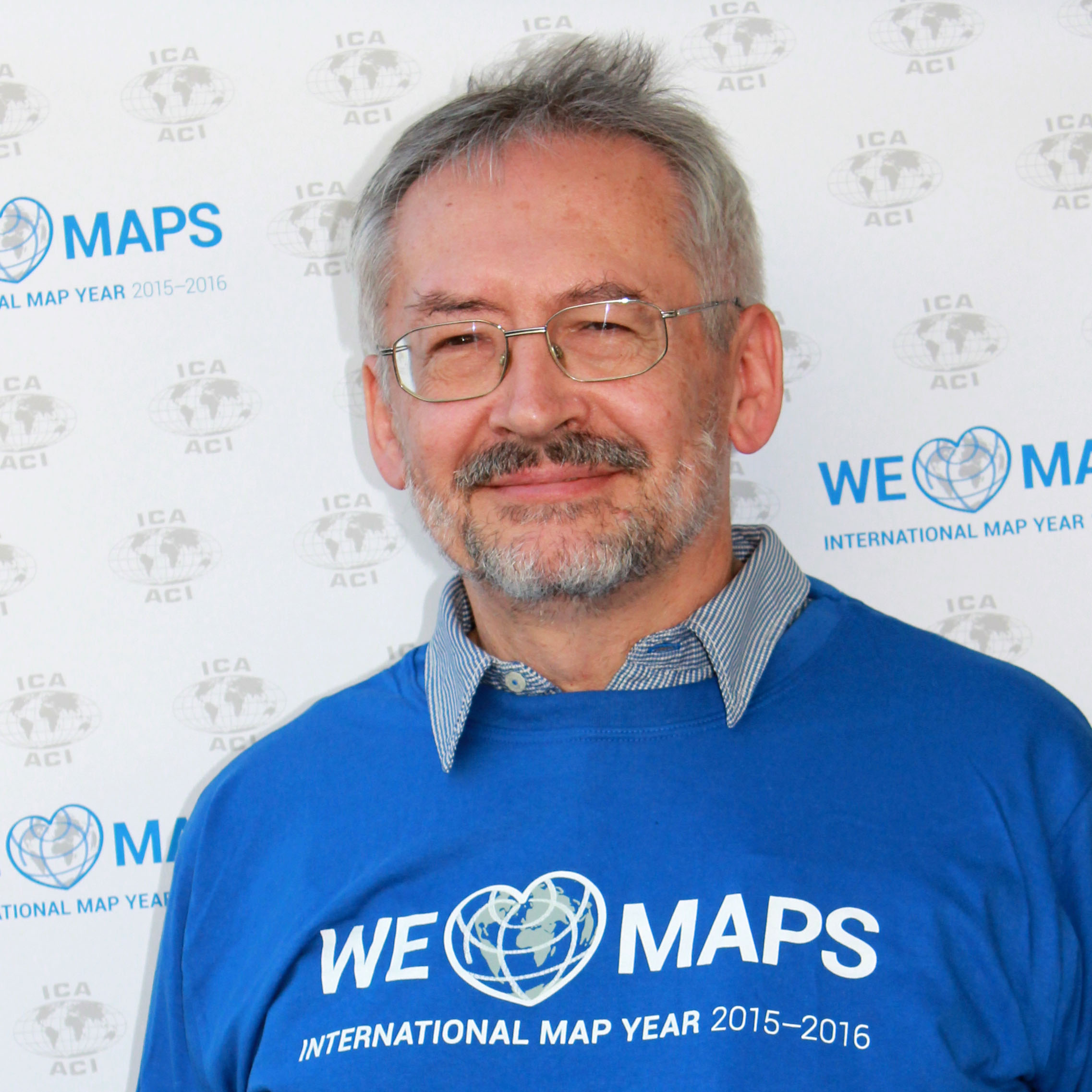
For me it is a real honor and pleasure to address Prof Evangelos Livieratos on the occasion on awarding the Honorary fellowship of the International Cartographic Association. Such an award should be given to a cartographer of international reputation who has made special contributions to ICA.

All of those criteria are more than appropriately applicable to Prof Evangelos Livieratos.

He is a cartographer in its core sense, understanding maps and cartography as a fundamental instrument of human mankind, bridging knowledge, skills, methods and knowledge from engineering to humanities.

He has undoubted international reputation. He has shaped our understanding and knowledge of “how we can see the maps of the past with the eyes of today” on an international stage.

And he has made numerous special contributions to ICA, allowing the organization to gain profile, benefit from his enthusiasm and capacities and establishing topics through a commission, publications and networks.

Born 1948 in Greece, he demonstrated his visionary interest beyond close domain borders. He graduated from surveying engineering at the National Technical University Athens, received a doctoral degree there as well as a Dr. phil. from Uppsala University in Sweden. He also did a docent dissertation at NTUA and moved his interests from geodesy to cartography to combine engineering and humanities oriented scientific thinking. Several fellowships followed, including such to the Smithsonian Institute, the Humboldt Foundation or from NSF.

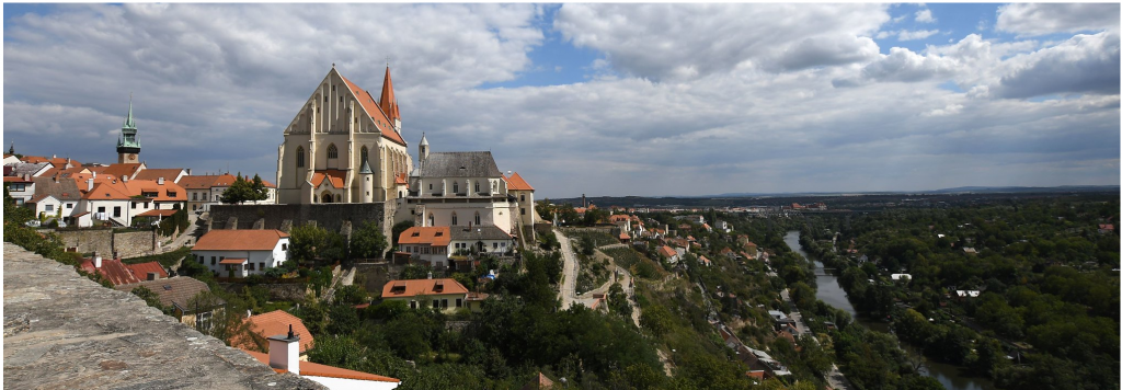
In his professional endeavours he contributed heavily to put the Aristotle University on the “international map of leading cartographic institutions”. He helped to found the Hellenic cartographic society, introducing national cartographic conferences in Greece and to found the national center for maps and cartographic heritage. As a career achievement with reference to the history of Greek cartography and of the Modern Greek Enlightenment he refers to the discovery of the existence of two versions of Rigas Velestinlis monumental Charta of Greece, which was highly recognized. This was very much in line with his core activities in geospatial sciences and engineering, particularly in mapping, as his long- lasting interest for arts and humanities offered the grounds for developing a line of thought converging to cartographic heritage, a field coupling the historic and cultural heritage of maps and mapping with the so far integration into the dominant digital mainstream. The foundation of the open access journal e-perimetron is an important element of these activities as well as his numerous efforts as teacher, mentor, scientist and organisator. He serves not only the domain of cartography and cartographic academic institutions but also in entities on organizing higher education in general as well as serving the society as minister of environment, energy and climate change of the Greek government.

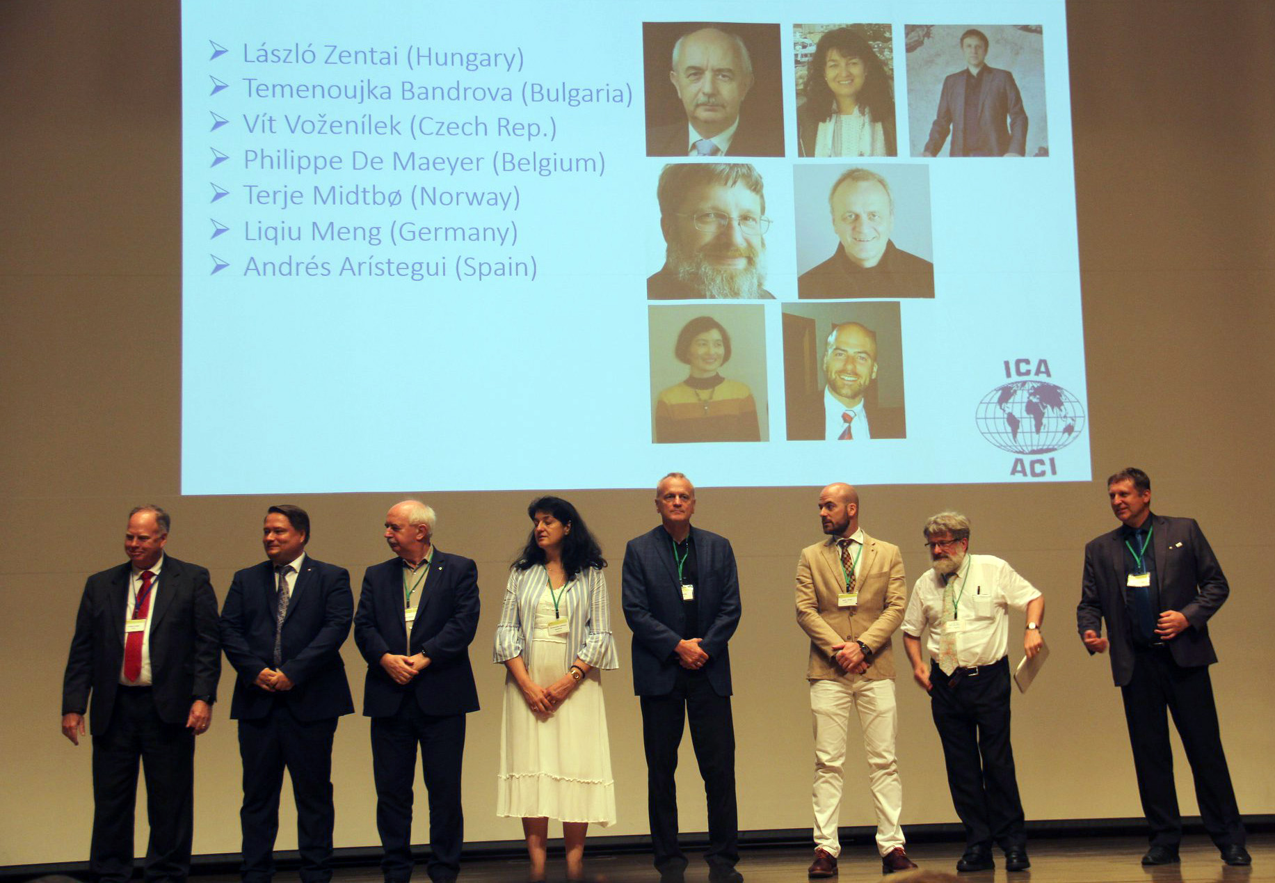
In respect to activities in relation to ICA he was active participant and discussant in several ICA activities, such as ICCs. He was chair of the WG Digital Technologies in Cartographic Heritage (2005–2007), Chair of the ICA Commission on Digital Technologies in Cartographic Heritage (2007–2015) and ICA Commission on Cartographic Heritage into the Digital (2015–2019). He was an active supporter of the UN-endorsed International Map Year and a long- standing Greek National Delegate to ICA.

In referring to his vision I am pleased to cite him as follows:

His strong vision for 21st century is a creative rapprochement of engineering with humanities, and vice-versa, designed the rapprochement to be open-minded, tolerant, pluralist, extrovert, fresh and attractive in order to develop composite common areas of thinking, study, research and scientific growth for the benefit of both, humanities and engineering, in a world embedded more and more into the digital manifold.“

To me, this is both, a guideline for many of our activities in cartography as well as a template for scientists in general, that we need to look beyond discipline borders and that we should embed what we do in a bigger picture.

I have found Prof. Evangelos Livieratos as an outstanding scientist, teacher, cartographer, friend.

My sincere congratulations to what I find a more than deserved award for an outstanding person!

ICA Awards Ceremony at ICC2019

In the ICA Awards Ceremony at ICC2019, the following awards were presented in recognition of contributions to the ICA.

Evangelos Livieratos, Miljenko Lapaine, Takashi Morita

From left to right: Evangelos Livieratos, Miljenko Lapaine, Takashi Morita

ICA Honorary Fellowship

The ICA Honorary Fellowship is for cartographers of international reputation who have made special contribution to the ICA. It includes a bronze medal.

  • Evangelos Livieratos, Greece
    • Active participant and discussant in several ICA activities, such as ICCs
    • Chair of the WG Digital Technologies in Cartographic Heritage (2005–2007)
    • Chair of the ICA Commission on Digital Technologies in Cartographic Heritage (2007–2015) and ICA Commission on Cartographic Heritage into the Digital (2015–2019)
    • Founder of e-Perimetron
    • Active supporter of the International Map Year
    • Greek National Delegate to ICA
  • Miljenko Lapaine, Croatia
    • Participation in all International Cartographic Conferences since 1989
    • Chair of the ICA Map Projections Commission (2011–2019)
    • Vice-Chair of the ICA Map Projections Commission (2019–2023)
    • Led the development and editing of the 2017 book Choosing a Map Projection for the ICA
    • Active supporter of the International Map Year
    • Croatian National Delegate to ICA

Diplomas for outstanding services to ICA

The Diplomas for outstanding services to ICA are for colleagues who have made special contribution to the ICA as commission officers or conference organizers.

  • Takashi Morita, Japan
    • Member of the ICA Commission on Theoretical Cartography
    • Vice-President of ICA (1999–2003)
    • Chair of the ICA Commission on Ubiquitous Mapping (2003–2011)
    • Chair of Local Organizing Committee for ICC2019
    • President of Japan Cartographers Association (JCA)
    • Chair of the National Committee for Cartography, Science Council of Japan


Congratulations to all awardees!

Winners of the Barbara Petchenik Competition 2019

The Barbara Petchenik Competition is a biennial map drawing competition for children. The competition is first organized on a national level. The national winners can then compete in the international round, which takes place during the International Cartographic Conferences. This year at ICC2019, 188 drawings from 33 countries were exhibited. An international jury selected 12 winners in 4 categories. There was also a public vote, a creativity award and a special mention. Please find the wonderful results below.

Winners <6 years

The Queen of the World by Bianca Belović (5)

1st: The Queen of the World by Bianca Belović (5)

A Boat Symbolizing Peace by Ye Shangke (5)

2nd: A Boat Symbolizing Peace by Ye Shangke (5)

Map is the Most Beautiful Flower in the World by Tara D. J. Suprapto (5)

3rd: Map is the Most Beautiful Flower in the World by Tara Dibbaratana Jayamanggala Suprapto (5)


Winners 6–8 years

Between the Clouds by Liepa Jokubaitytė (7)

1st: Between the Clouds by Liepa Jokubaitytė (7)

Treasure Map of My Dog by Micah Allen Setianto Moore (8)

2nd: Treasure Map of My Dog by Micah Allen Setianto Moore (8)

My Imagination by Luca Kunos (7)

3rd: My Imagination by Luca Kunos (7)


Winners 9–12 years

Dreaming of the Blue Self of the World by Kim Min-Chan (12)

1st: Dreaming of the Blue Self of the World by Kim Min-Chan (12)

A Turtle's Tear: Our Plastic Oceans by Barnaby Blampied (9)

2nd: A Turtle’s Tear: Our Plastic Oceans by Barnaby Blampied (9)

World of Colour Lines by Hande Körbalta (9)

3rd: World of Colour Lines by Hande Körbalta (9)


Winners 13–15 years

Creating Worlds by Rada Skumova (15)

1st: Creating Worlds by Rada Skumova (15)

We Love Maps by Agata Filipiak (14)

2nd: We Love Maps by Agata Filipiak (14)

Hemispherical Understanding by Katarína Šáleková (15)

3rd: Hemispherical Understanding by Katarína Šáleková (15)


Creativity Award

It Is All in Our Hands by Ugnė Rimkutė (15)

Creativity Award: It Is All in Our Hands by Ugnė Rimkutė (15)


Special Mention

The Map Shows Me the Way by Robert Hopjan (11)

Special Mention: The Map Shows Me the Way by Robert Hopjan (11)


Winner of the public vote

Good Morning World by Noemí Sánchez (14)

Public vote: Good Morning World by Noemí Sánchez (14)

Jury

Members of the Jury

Members of the Jury

The jury members were

  • Pilar Sánchez-Ortiz Rodríguez, Spain – Chair
  • Ana María Garra, Argentina
  • Temenoujka Bandrova, Bulgaria
  • Simon Catling, Great Britain
  • Koji Ohnishi, Japan
  • Dariusz Dukaczewski, Poland
  • Necla Ulugtekin, Turkey
  • Naeema Al Hosani, United Arab Emirates
  • Carla Sena, Brazil and Jesus Reyes, Hungary – Substitute Members
  • Peter van der Krogt, The Netherlands – International Coordinator


Congratulations to all winners! Also a huge thank you to all participating children, their parents, teachers and national organizers.

Results of the 18th General Assembly of the ICA

The 18th ICA General Assembly was closed on the last day of ICC2019.
Slides of the agenda can be found here.

EC at ICC2019

The new Executive Committee for the term 2019–2023 on stage at the closing ceremony of ICC2019


The Executive Committee for the term 2019–2023 is:

  • President: Tim Trainor (USA)
  • Secretary-General and Treasurer: Thomas Schulz (Switzerland)
  • Vice-Presidents:
    • Andrés Arístegui (Spain)
    • Temenoujka Bandrova (Bulgaria)
    • Philippe De Maeyer (Belgium)
    • Liqiu Meng (Germany)
    • Terje Midtbø (Norway)
    • Vít Voženílek (Czech Republic)
    • László Zentai (Hungary)
  • Past President: Menno-Jan Kraak (The Netherlands)

The 19th General Assembly and the 31st International Cartographic Conference in 2023 will be held in Cape Town, South Africa.

Honorary auditors: Harold Moellering (USA) and Bengt Rystedt (Sweden).

Category: General News

Welcome to ICC2019 in Tokyo #icc2019tokyo

The 29th International Cartographic Conference opened in Tokyo, Japan! After busy days with 13 pre-conference workshops, the main conference opened on Monday evening. Papers, proceedings and abstracts are available on the ICC2019 website:

The conference also hosts the International Cartographic Exhibition (click here to download the exhibition catalogue [22mb]), the Children’s Map Exhibition and a Technical Commercial Exhibition.

Also, the 18th General Assembly of the ICA takes place in connection with ICC2019. The first day (discussion) was on Monday; the second day including voting and elections will take place on Friday. The results will be published on the ICA website soon.

To share your experiences and to stay up-to-date with everything happening at the conference, please use hashtag #icc2019tokyo.

Enjoy the conference!

Category: General News
Tag: ,
rawboned-refined