Welcome to the International Cartographic Association
Welcome to the website of the International Cartographic AssociationGet to know the new ICA Executive Committee for the term 2023-2027Get to know the ICA Commissions for the term 2023-2027
Welcome to the website of the International Cartographic Association
Get to know the new ICA Executive Committee for the term 2023-2027
Get to know the ICA Commissions for the term 2023-2027

Invitation to the 19th International Conference on Location Based Services (LBS 2025)

Finnish Geospatial Research Institute (National Land Survey of Finland) and Aalto University are pleased to invite you to the 19th International Conference on Location Based Services (LBS2025), which will take place in Otaniemi, Espoo, Finland on 7-9 May 2025. The conference is a joint effort of the ICA Commission on Location Based Services, the Commission on Digital Transformation of National Mapping Agencies, and the Commission on Cognitive Issues in Geographic Information Visualization.

Built on the success of previous conferences in this series, LBS 2025 is addressed to scholars and researchers, digital industry / market operators, and students of different backgrounds (scientific, engineering and humanistic) whose work is either focused on or relevant to location-based services (LBS). The conference will offer a common ground to colleagues from various disciplines and practices where they can meet, interact and exchange knowledge, experience, plans and ideas on how LBS can and could be improved and on how it will influence both science and society.

Call for Papers

The Call for Papers is currently open. We call for full papers, work in progress, and showcases.

Important Dates

  • Deadline for full papers: 1.11.2024
  • Deadline for work in progress/abstracts: 1.2.2025
  • Deadline for showcases: 15.2.2024
  • Registration:
    • Early bird: 31.3.2025
    • Regular: 1.4.2025
  • LBS 2025 Conference, Otaniemi, Espoo: 7.–9.5.2025

Topics

We invite contributions in the following areas (but not limited to):

Geospatial Artificial intelligence (GeoAI) and LBS

  • Geography/GIScience-guided AI
  • Explainable GeoAI
  • GeoAI-enabled LBS

Context modelling and context-awareness

  • Smart environments and ambient spatial intelligence
  • Indoor spatial data modelling and mapping
  • Place modelling and understanding
  • Context modelling, personalisation, and context-aware adaptation

Mobile user interface and interaction

  • Visualisation techniques for LBS
  • Mobile human-computer interaction
  • Augmented reality and mixed reality

User studies and evaluation

  • Evaluation methodologies for LBS
  • User experiences of LBS
  • Mobile spatial cognition
  • Landmarks in LBS
  • Human wayfinding and navigation

Analysis, acquisition, management of location big data

  • Crowdsourcing and internet of things
  • Spatial data science and big data analytics
  • Computational mobility and activity analytics
  • Descriptive, diagnostic, predictive, and prescriptive analytics
  • Ubiquitous Positioning

Outdoor and indoor positioning

  • Multi-sensor system and sensor fusion
  • Social and behavioural implications of LBS

Location privacy

  • Legal, ethical, and business aspects of LBS
  • Biases in location data analytics and GeoAI
  • Innovative LBS and applications

LBS and security

  • Disruptive technologies and LBS
  • Intelligent navigation systems
  • Smart cities and sustainable mobility
  • Autonomous and connected vehicles
  • Public health
  • Location based social networks and games
  • Digital humanities

More information regarding LBS 2025 can be found at lbsconference.org.

Tag: ,

President’s Blog: A gathering of the ICA people – the ICA Retreat in Vienna

Many persons are involved in our organization. They have different roles, different background and different ideas. In order to learn to know each other better, to synchronize our understanding of “our” ICA and to allow for taking on board all those rich ideas, perspectives and thoughts all Executive Committee Members, Commission Chairs and Co-Chairs, Working Group Chairs and further ICA officers met at the Technische Universität Wien in Vienna, Austria from 22.3.2024 to 24.3.2024 for an intense working meeting.

The agenda included several information presentations on issues of mutual concern, several group-works and workshops and simply time to meet, discuss and be part of ICA.

In the unique venue of the “Kuppelsaal” of the Technical University of Vienna we found enough space and inspiration to gather and work together.

At the ICA retreat at TU Wien Kuppelsaal, Vienna, Austria 2024

At the ICA retreat at TU Wien Kuppelsaal, Vienna, Austria 2024

The meeting started with an introduction from President Georg Gartner on the nature, aims and scope and mission of the International Cartographic Association. It is really the global voice for Cartography and GIScience and the motto “We love maps” is a common nominator for all of us.

In order to learn to know each other better we performed a group work, where we paired in two to be able to introduce always the other person accordingly.

We then collected ideas about the questions:

  • What would you like to give to the ICA community?
  • What would you like to get from ICA?

which resulted in a long and rich list of relevant items.

Dusan Petrovic, Pyry Kettunen and Francis Harvey working hard and having fun at the retreat at TU Wien Kuppelsaal, Vienna, Austria 2024

Dusan Petrovic, Pyry Kettunen and Francis Harvey working hard and having fun at the retreat at TU Wien Kuppelsaal, Vienna, Austria 2024

Having set the tone for the meeting with this we then dived into several existing structures, instruments and elements of ICA, such as the ICA Webservices (presented by Webmaster Manuela Schmidt), the International Journal of Cartography (presented online from the Editors Anne Ruas and William Cartwright), the ICA Publication Regime (presented online from Publication Committee Chair Menno-Jan Kraak), the ICA Executive Committee (presented by President Georg Gartner and Secretary-General Thomas Schulz), the ICA Commissions and their Administration (presented by Secretary-General Thomas Schulz), the ICA Conferences (presented by Vice-President Serena Coetzee), the ICA memberships, MoUs and relations to other organisations (presented by Past-President Tim Trainor), the ICA Research Agenda (presented by Vice-President Haosheng Huang), the ICA Body of Knowledge (presented by Working Group Chair Terje Mitbo).

Inbetween further group interventions took place, refering to the idea of synchronizing our understanding of the core concept of our organization (What is a map?), identifying and presenting commission and working group plans and synergies (led by Vice-President Dusan Petrovic), a SWOT (Strengths-Weaknesses-Opportunities-Threads) – Analysis of ICA (led by Vice-President Alex Kent), a open mic session on ideas and visions (led by Vice-Presidents Amy Griffin, Jiping Liu and Dariusz Dukaczewski).

The ICA “people” in front of the Karlskirche during the ICA retreat, Vienna 2024

The ICA “people” in front of the Karlskirche during the ICA retreat, Vienna 2024

Socializing opportunities despite the amical, fruitful and constructive working atmosphere have been taken on a joined short “CartoWalk” around Karlsplatz and joined meals.

Participants of the ICA retreat in front of the Technische Universität Wien, Vienna 2024

Participants of the ICA retreat in front of the Technische Universität Wien, Vienna 2024

The event proofs my feeling right again, that ICA is really more like a family – it is such a privilege to be able to cooperate with so many bright, motivated, enthusiastic, fantastic scholars and persons!

List of Participants

Executive Committee

  • President: Georg Gartner
  • Past President: Timothy Trainor
  • Secretary-General and Treasurer: Thomas Schulz
  • Vice President: Serena Coetzee
  • Vice President: Dariusz Dukaczewski
  • Vice President: Amy Griffin
  • Vice President: Dusan Petrovic
  • Vice President: Haosheng Huang
  • Vice President: Alexander Kent
  • Vice President: Jiping Liu

Commission Chairs and Co-Chairs

  • Art and Cartography: Taien Ng-Chan
  • Atlases: Vitek Vozenilek, Eric Losang
  • Cartographic Heritage into the Digital: Matyas Gede
  • Cartography and Children: Silvia Marinova
  • Cartography and Sustainable Development: Britta Ricker
  • Cartography in Early Warning and Crisis Mgmt: Christophe Lienert, Jie Shen
  • Cognitive Issues: Tumasch Reichenbacher, Pyry Kettunen, Petr Kubicek
  • Digital Transformation of Mapping Agencies: Bin Jiang
  • Education and Training: Tao Wang
  • Ethics in Cartography: Aileen Buckley
  • GeoAI: Samantha Arundel
  • Geospatial Analysis and Modelling: Xintao Liu
  • Geospatial Semantics and Ontology: Francis Harvey
  • Geovisualization: Florian Ledermann, Arzu Cöltekin
  • High-Definition Maps: Qingyun Du
  • Integrated Geospatial Information: Anja Hopfstock, Kathryn Arnold
  • Location Based Services: Jukka Krisp
  • Map Design: Ian Muehlenhaus
  • Map Projections: Krisztian Kerkovits
  • Maps and the Internet: Otakar Cerba
  • Marine Cartography: Ron Furness, Lysandros Tsoulos
  • Mountain Cartography: Patrick Kennelly
  • Multi-scale Cartography: Guillaume Touya, Izabela Karsznia
  • Topographic Mapping: David Forrest, Lukas Halik
  • Toponomy: Matjaz Gersic
  • Ubiquitious Mapping: Toru Ishikawa, Angela Schwering, Armand Kapaj
  • User Experiences: Robert Roth

Working Group Chairs and Co-Chairs

  • Next Generation Cartographers: Katarzyna Slomska-Przech, Chelsea Nestel
  • Inclusive Cartography: Jakub Wabinski, Vincent van Altena
  • Body of Knowledge: Terje Mitbo

Invitation to CartoVis 2024 – ICA Workshop on AI, Geovisualization, and Analytical Reasoning

The University of Warsaw Department of Geoinformatics, Cartography, and Remote Sensing in collaboration with the International Cartographic Association Commissions on Cognitive Issues in Geographic Information VisualizationGeovisualization, and User Experience (UX), as well as ICA Next Generation Cartographers Working Group are pleased to invite you to the 2024 ICA Workshop on AI, Geovisualization, and Analytical Reasoning, on Saturday, 7 September 2024 at the University of Warsaw, Poland.

Early-stage work is explicitly encouraged, especially by junior scholars or those new to cartography.

We invite you to contribute to our Call for Papers. Short papers (2 pages) can be submitted until 15 May 2024 and abstracts (300 words) until 1 June 2024. Submissions are expected to report on ongoing and emergent work that aims to tackle one of the many dimensions of cartography: specifically, we welcome those that relate to supporting geovisualization and analytical reasoning, including approaches that leverage AI methods applied at various stages: data processing, analysis, visualization generation and interpretation, as well as support in user perception interpretation. Broadly speaking, we are seeking work that focuses on understanding users, their cognitive processes, and/or their interactions with visual representations and computational methods via maps or geographic visualization. We welcome research that tackles these and related problem areas through computational, representational, artificial intelligence (AI), ethical, or contextual methodological lenses. This workshop will provide a forum in which new approaches and ideas can be discussed and where new research collaborations can be formed.

There will be no conference fee!

For details please visit our workshop website: http://carto-vis-workshop.uw.edu.pl/ 

We are looking forward to your contributions and to welcoming you to Warsaw!

CartoVis24 Organizers

Tag: ,

Call for Presentations: ICC 2023 Pre-Conference Workshop on Cartography and AI (MapAI)

The ICA Commissions on Visual Analytics and Cognitive Issues in Geographic Information Visualization are pleased to announce a Workshop on Cartography and AI (MapAI 2023) taking place on August 12, 2023 in Stellenbosch, South Africa before the ICC 2023.

Motivation

Cartographers have assessed the potential use of artificial intelligence for mapping for decades. Early work on expert systems explored AI as early as the 1980s (e.g., Buttenfield 1984; Fisher & Mackaness 1987; Brassel & Weibel, 1988; Johnson & Basoglu 1989). The AI tools of the time were limited by the (lack of) availability of computing power and data. More recently, as AI tools have become both more powerful and easier to use, a few cartographers and computer scientists have begun experimenting with artificial intelligence technologies to see how they might be applied to maps and mapping processes (e.g., Kang et al., 2019; Zhao et al, 2021; Christophe et al., 2022; Zhou et al, 2022; Santos et al., 2023). Others have made initial efforts to review the potential of AI technologies for cartography (Kang et al., 2022), laying out some possibilities and also some points of caution by identifying ethical issues these technologies raise and/or exacerbate. The 2022 launches of DALL·E 2, ChatGPT, and other AI platforms have caught the attention of the general public by making artificial intelligence technologies easy to use for a range of everyday tasks. Some cartographers have already put these to use for assisting their mapping practice (see, for example, https://www.youtube.com/watch?v=OCOpxy3wk-o). There is much more for cartographers to explore, including the potential impacts of the use of AI on map users’ and map makers’ cognitive processes (see Keskin & Kettunen, 2023 for an initial investigation).

In this workshop, we aim to bring together ideation and practical experimentation to collaboratively explore some of the potential and limits of current AI technologies for cartographic practice and map use.

Call for Presentations

The first half of our planned 1-day workshop will be for participants to present Lightning Talks. In 5 minutes presenters will showcase either one major challenge or one significant opportunity you see that intersects between AI and Cartography.

These presentations should focus on frontiers in cartographic research that intersect with AI tools or techniques, and creative/unorthodox approaches are welcomed. Work-in-progress is the intended target, versus projects that are already fully completed.

Example topics could include, but are not limited to:

  • Implications of deepfake maps and satellite images
  • Machine-learning / AI based map updating based on image input
  • AI-generated wayfinding directions
  • Geographic aspects of algorithmic bias
  • Automated means of iterating design elements in cartographic layouts
  • Explainable AI & mapping
  • Natural language interaction with maps
  • Mapping with ChatGPT, DALL-E, Midjourney, Stable Diffusion, etc…
  • Human-machine collaboration using maps

Workshop presentations will be used to motivate group discussions and hands-on experimentation in the second half of the planned 1-day workshop. We are excited to work together to push the limits of various AI mechanisms for cartographic design and inquiry, learning along the way about where the frontiers lie for future research and applications of AI in Cartography.

Submission Details

Please submit an abstract of <250 words that showcases either one major challenge or one significant opportunity that intersects AI and Cartography by May 15, 2023 to EasyChair.  All submissions will be reviewed by the workshop organizers for clarity and fit with workshop themes. A final workshop agenda including accepted talks will be communicated by June 23, 2023.

Venue & Workshop Logistics

This workshop will take place on August 12, 2023 in Stellenbosch, South Africa. If you are attending the ICC 2023 in Cape Town, Stellenbosch is roughly an hour away by Taxi/Private Car. We recommend staying in Stellenbosch for 1 or 2 nights if you prefer not to commute to/from Cape Town. Stellenbosch is famous for its wineries and there are many scenic hotels located on wineries nearby.

We will notify authors and publish a preliminary workshop schedule by June 23, 2023.

Organizers

  • Amy L. Griffin, RMIT
  • Anthony C. Robinson, Penn State University
  • Arzu Çöltekin, FHNW – University of Applied Sciences Northwestern Switzerland

Please find more information on the workshop website.

Workshop on Adaptable Research Methods For Empirical Research with Map Users

The ICA Commission on Cognitive Issues in Geographic Information Visualization and the ICA Commission on User Experience are pleased to invite you an online workshop on Adaptable Research Methods For Empirical Research with Map Users on Thursday, 6 May 2021.

Everyone globally has been affected by the COVID-19 in one way or another. Most of us have probably had to make adjustments to planned research projects as a result of restrictions on mobility and interacting with people outside our own households.

Nevertheless, despite these challenges, people have been successful in undertaking research. We believe that there have probably been a number of creative solutions devised for running experiments that gather empirical data from people, and some of these solutions may be well worth preserving for use in the future.

Therefore we propose a workshop to share some of our collective experiences in doing this kind of work over the last 14 months. We hope to learn from each others’ successes and failures and contribute constructive suggestions for yet-to-be-solved problems presented by the situation.

Workshop format

We expect everyone attending the workshop to actively participate in the sharing and discussions. This could mean that you present a lightning talk about a problem you need help solving (we are looking at you, PhD students!), or it could mean you discuss an experience that didn’t work as you hoped/planned, or it could mean that you present a solution that worked well for you and that might help others.

We plan that the session will be relaxed and relatively informal as not all experiences may be easy to share in a standard, formal scientific presentation. For example, some experiences may be easier to communicate via demonstration. Therefore, we ask when you submit your abstract, you also specify how much time you would like and how you would like to spend your time.

Some possible options include:

  • Standard presentation
  • Demonstrating a technique or method you’ve devised
  • Facilitating a discussion about particular types of challenges you’ve wrestled with (to best do this, provide discussion points/questions that workshop participants can reflect on before the workshop);
  • Other creative uses of the time that you can negotiate with the workshop organisers – we are open to ideas!

Workshop Outcomes

We plan at a minimum to build a webpage to be hosted on the Commission website with a synthesis of the ideas presented at the workshop. It is hard to predict in advance if there will be sufficient material, but if it seems to be the case after the workshop, we suggest also the development of a collaborative paper to be submitted to the International Journal of Cartography.

Deadline for abstracts

We ask that you submit your abstract by 28 February 2021 (Anywhere on Earth) to this website.

We will use the ICA Abstracts template, which can be accessed at Copernicus. Note, you should NOT provide a paper – use only the abstract component of the template! Your abstract should be no longer than 500 words.

Schedule

Date(s): Thursday 6 May; additionally Friday 7 May (if demand is great enough).
Time: 22:00-2:00 (AUS), 20:00-0:00 (Beijing), 14:00-18:00 (CET), 13:00-17:00 (UK); 9:00-13:00 (Rio de Janeiro); 8:00-12:00 (East Coast US); 5:00-9:00 (West Coast US)

We have planned a half-day workshop on Thursday 6 May. If there is sufficient enthusiasm for participation based on the responses to the CFP, we have tentatively planned to extend the workshop to a second half-day on Friday 7 May.

There is no time of day that will perfectly suit all time zones, so we have tried to come up with a schedule that allows the greatest number of time zones to attend at least some of the workshop at an at least semi-civilised hour.

Cost

There is no cost for participation, but we ask that you register in advance by 31 March 2021 to support the logistical planning of the workshop. The registration link is available on the workshop website.

Workshop Platform

The platform we use will depend on registered numbers, but either Teams or Remo are being considered. We will advise the platform to all registered participants before the workshop.

Organizers

ICA Commission on Cognitive Issues in Geographic Information Visualization

  • Dr. Amy Griffin, RMIT University
  • Dr. Petr Kubíček, Masaryk University
  • Dr. Pyry Kettunen, Finnish Geospatial Research Institute (FGI, NLS)

ICA Commission on User Experience

  • Prof. Rob Roth, University of Wisconsin Madison
  • Prof. Luciene Delazari, Federal Univ. of Paraná
  • Dr. Zdeněk Stachoň, Masaryk University
  • Katarzyna Słomska-Przech, University of Warsaw

First Call For Papers: 2020 ICA Workshop on Analytical Reasoning for Cartography, Visualization, and Design


Date: Monday 14 September 2020 (ahead of GIScience 2020)
Location: University of Warsaw | Warsaw, Poland
Workshop website: http://carto-vis-workshop.uw.edu.pl/

Purpose

It has been 15 years since visual analytics was first established as the science of analytical reasoning facilitated by interactive maps and visualizations. Since then, new models have been proposed to understand cognitive reasoning processes, new technologies have been released to support interactive, mobile, and immersive mapping, and new methods have been developed to examine and evaluate user experiences with analytical support systems. We call for research papers in cartography, visualization, and allied design fields to capture the state-of-science on visuospatial analytical reasoning.

Analytical Reasoning goes beyond simply noticing a pattern, and invokes a complex set of processes that aim to explain what has been seen, or to predict what will happen next. Creating the conditions in which users are able to reason about spatial information is a difficult task, and there are many challenges to overcome. This workshop invites short reports on ongoing and emergent work that aims to tackle one of the many dimensions in cartography that relate to supporting analytical reasoning. Broadly speaking, we are seeking work that focuses on understanding users, their cognitive processes, and/or their interactions with visual representations and computational methods via maps or geographic visualization. We welcome research that tackles these and related problem areas through computational, representational, or contextual methodological lenses. This workshop will provide a forum in which new approaches and ideas can be discussed and where new research collaborations can be formed.

Early stage work is explicitly encouraged, especially by junior scholars or those who might be new to cartography.

This workshop represents the joint efforts of the University of Warsaw Department of Geoinformatics, Cartography, and Remote Sensing in collaboration with the International Cartographic Association Commissions on Cognitive Issues in Geographic Information VisualizationVisual Analytics, and User Experience (UX).

Format

We invite two kinds of contributions. First, we seek two-page short papers on completed research. Two-page short papers should be prepared using the CHI format, with accepted papers receiving 20 minutes for presentation and discussion. Second, we seek 150-word abstracts on work in progress or early graduate proposal ideas. Short abstracts will receive 5 minutes for a lightning talk presentation with discussion following all lightning talks. Select papers may be encouraged for expansion into a special journal issue, depending on participation.

Short papers and abstracts will be reviewed by two program committee members to gauge appropriateness for the workshop.

Relevant topics include:

  • Geovisualization and visual analytics
  • Storytelling for improved comprehension of geographic processes
  • User experience design for expert systems
  • Visuospatial cognition and reasoning
  • Models of spatial cognition
  • Models of human visuospatial reasoning
  • Individual and group differences in spatial abilities
  • Wayfinding and navigation
  • Reasoning on the go with augmented and mixed realities
  • Thematic map design
  • Visual variables and visual semiotics
  • User perspectives on thematic cartography
  • Human-computer interaction
  • Immersive analytics
  • Understandable machine learning
  • Algorithms and spatial decision making
  • Spatial decision support systems

Submission Details & Important Dates

Papers and abstracts should be submitted using our EasyChair site located at: https://easychair.org/conferences/?conf=cartoviz20

  • 2-page paper deadline: 15 May 2020
  • Short abstract deadline: 1 June 2020
  • Notification of acceptance: 15 June 2020
  • Registration deadline: 31 July 2020

If you need a visa to Poland to participate, or have other questions about the workshop, please contact the local organizers at carto-vis-workshop@uw.edu.pl.

Registration

Please visit our workshop website for registration details: http://carto-vis-workshop.uw.edu.pl/

Tag: ,

Invitation to Workshop on Indoor Cartography

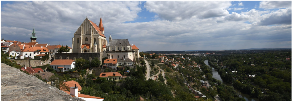
The ICA Commissions on User Experience, on Location Based Services and on Cognitive Issues in Geographic Information Visualization, are pleased to announce the first call for papers on the Joint Workshop Indoor Cartography as part of the Cognition and Artificial Life Conference 2020 which takes place June 10–12, 2020 in Znojmo, Czech Republic.

The workshop considers an understudied map use context, that of using maps to navigate and understand indoor environments. As urban areas and individual buildings grow increasingly complex and people rely more and more on devices to assist in the navigation of these spaces, knowing how to design maps of the indoors well is becoming more important. It’s unclear what current map design principles transfer well to indoor maps (Griffin, White, et al. 2017), or what methods of map interactions might best support uses of maps in such contexts as well as what field methods can be used to study these map uses in ecologically valid ways (Roth et al., 2017). This workshop aims to focus attention on such issues and how we can better understand and support the design, use and wider implications of indoor maps.

The conference and the workshop is a cross-disciplinary platform intended to share and exchange knowledge between specialists in cartography, geoinformatics, psychology, cognitive science, neuroscience, informatics, and related fields.

The deadline for abstracts is 29 February 2020.

More information will be available on the conference website.

Congratulations to the ICA scholarship awardees at ICC2019 and pre-conference workshops

The goal of ICA Scholarships is to stimulate young scientists or professionals to direct their careers toward fundamental studies in the fields of Cartography and GISciences. The following scholarships were awarded for participation in the ICC2019 and pre-conference workshops.

Scholars at ICC2019

ScholarTitle of paper / poster
Nargiz Safaraliyeva, AzerbaijanTeaching basic map concepts in three countries: Azerbaijan, Hungary and United Arab Emirates
Malak Alasli, MoroccoToponyms’ contribution to identity: The case study of Rabat (Morocco) | Static Risk Mapping of Forest Fires – In the case of the Province of Chefchaouen (Morocco)
Shyamantha SUBASINGHE, Sri LankaUrban Growth: From pixel to reality
Dr. Alena Vondráková, Czech RepublicTouchIt3D: Technology (not only) for Tactile Maps | The Specifics of Cartographic Semiology in Tactile Maps
Ashna Kareem Zada, IraqTesting Maps for Visually Impaired People in Kurdistan
Jagadish B, IndiaDeriving Multiple Representation Database: A Model Generalisation Approach
Lukasz Halik, PolandTeaching of geographical space relations for cartography – Academic Outdoor Station in Poznan (Poland) | Workflow for 3D geovisualization of the data obtained with the use of Unmanned Aerial Vehicle in Augmented Reality | The visualization of the use of land on the basis of the dynamics of the pedestrian movement from the interval UAV imaging | Measuring user preferences in virtual reality (VR): 2D versus 3D urban geovisualizations of topographic data
Márton Pál, HungaryDigital cartography for geoheritage: turning an analogue geotourist map into digital | Possibilities of high precision GPS data in autonomous driving
Nikola Yonov, BulgariaSchool Atlas with Augmented Reality
Radek Barvir, Czech RepublicThe Specifics of Cartographic Semiology in Tactile Maps | TouchIt3D: Technology (not only) for Tactile Maps
Pongpichaya William Limpisathian, USA/ThailandRepresentations of Place in the Human Brain
Ivan Evgenyevich Fokin, RussiaThe automation of processes of atlas mapping | Methods and algorithms for creation of structural schemes of rivers
Nick Lally, USAMapping dynamic, non-Euclidean spaces | Interactive & Multiscale Thematic Maps: A Preliminary Study
Xiao Huang, USA/ChinaLinking picture with text: tagging flood relevant tweets for rapid flood inundation mapping
Carolyn S. Fish, USAEmotional responses to climate change map framing using facial emotion recognition technology
Harrison Cole, USAToward Accessible Hazard Mapping: Tactile Risk Maps and Disaster Preparedness
Laure De Cock, BelgiumLinking perception to decision point complexity for adaptive indoor wayfinding support
Maja Kalinic, Germany/Bosnia-HerzegovinaFloating Car Data and Fuzzy Logic for classifying congestion indexes in the city of Shanghai
Ross Thorn, USAHow to Play with Maps

Scholars at pre-conference workshops

ScholarWorkshopTitle of paper / poster
Aytaç YÜRÜKÇÜ, TurkeyHistory of Cartography and the Topographic MappingHow East and West Cartographic Studies Influenced the Most Important 16th Century Ottoman Cartographer of Piri Reis and His World Maps
Dr. Lei ZOU, USALocBigData 2019Leveraging Location-Based Social Media for Smart Emergency Management
Christian RÖGER, GermanyLocBigData 2019Visualizing the Complexity of Crossings using Star-Plot Maps
Wangshu WANG, AustriaJoint Pre-Conference Workshop of the ICA Commission on Use, Users, and Usability, the Commission on Cognitive Visualization, the Commission on Location-based Services and the Commission on Visual AnalyticsTowards a Functional Ontology for Mobile Map Applications

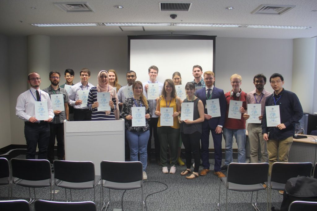
From left to right: Márton Pál, Nick Lally, Pongpichaya William Limpisathian, Radek Barvir, Malak Alasli, Dr. Alena Vondráková, Shyamantha Subasinghe, Ashna Kareem Zada, Harrison Cole, Maja Kalinic, Laure De Cock, Carolyn S. Fish, Nikola Yonov, Lukasz Halik, Ivan Evgenyevich Fokin, Jagadish B, Xiao Huang

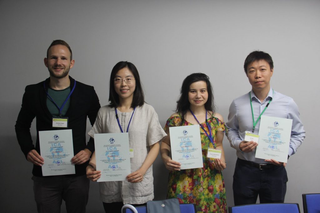
From left to right: Christian Röger (pre-conference), Wangshu Wang (pre-conference), Nargiz Safaraliyeva (ICC), Dr. Lei ZOU (pre-conference)

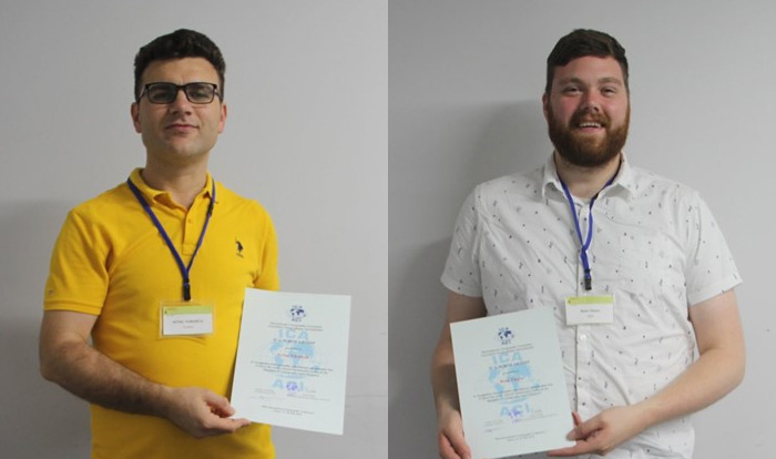
Left: Aytaç YÜRÜKÇÜ, Pre-conference; Right: Ross Thorn, ICC


Congratulations to all scholars!

New venue for Pre-ICC Workshop on Abstraction, Scale & Perception

The ICA Commissions on Cognitive Issues in Geographic Information Visualization and on Generalisation and Multiple Representation, are pleased to invite you to a one-day workshop on 15th July 2019, with several sessions of talks, a demo session and a brainstorming session to finish the day!

Please be careful, the location has change: It will be held at the National Museum of Emerging Science and Innovation (Miraikan) – Room “Venus” (7th Floor) – 9:00–16:30.

For more information on the workshop visit: icc2019abstraction.wordpress.com

If you want to join us, please register here.

Announcement of the Pre-ICC Workshop on Abstraction, Scale & Perception

The ICA Commissions on Cognitive Issues in Geographic Information Visualization, and on Generalisation and Multiple Representation, are pleased to organize a joint one-day workshop dedicated to advances, works in progress, and position statements about the perception of geospatial abstractions and scale in maps and geovisualisations.

Abstraction is the main process for moving from a geographic space or phenomenon to its representation as spatial information. Abstractions may be conceptual, geometric, semantic, graphic, visual, or cognitive. Examples include techniques to highlight, enhance, or simplify salient characteristics or properties, in order to support visual communication, recognition, understanding of spatial features and inferring knowledge about spaces. If different aspects of abstraction are not managed well, across different scales, for example when navigating through scales in geoportals, it can lead to perceptual difficulties in reading the map. Generalisation is the process of deliberately transforming existing geospatial data or their symbolisation into more abstract representations, and multiple representation involves creating a series of such generalisations, often distributed through map scale.

The workshop will feature research presentations and open-ended brainstorming sessions, and will focus on identifying open research gaps and the elaboration of a shared research agenda. We encourage submissions from any practitioner of abstraction or generalisation: those in academia, industry, or government, among other sectors, are welcome.

Paper deadline: 22nd February 2019

Topics of interest include but are not limited to:

  • multi-scale, multi-source and multi-view graphic representation
  • massive data (“Big Data”) generalization
  • continuous visualization (across scales) and fluid interaction with graphic representations
  • (semi) automated approaches for map design and geovisualization
  • generalisation, schematization, and stylization techniques
  • visual perception measures and experimental approaches to assess visual perception
  • thematic applications: statistical and socio-economic data, spatio-temporal data and phenomena, urban and environmental dynamics, etc.
  • technical applications, adaptation to visualization devices, (i.e., smartphones, tablets, VR/AR) and use contexts (e.g.,  emergency and crisis management, individual mobility, industrial purposes, etc.).


Please find more information on the workshop website: icc2019abstraction.wordpress.com

rawboned-refined