Welcome to the International Cartographic Association
Welcome to the website of the International Cartographic AssociationGet to know the new ICA Executive Committee for the term 2023-2027
Welcome to the website of the International Cartographic Association
Get to know the new ICA Executive Committee for the term 2023-2027

New venue for Pre-ICC Workshop on Abstraction, Scale & Perception

The ICA Commissions on Cognitive Issues in Geographic Information Visualization and on Generalisation and Multiple Representation, are pleased to invite you to a one-day workshop on 15th July 2019, with several sessions of talks, a demo session and a brainstorming session to finish the day!

Please be careful, the location has change: It will be held at the National Museum of Emerging Science and Innovation (Miraikan) – Room “Venus” (7th Floor) – 9:00–16:30.

For more information on the workshop visit: icc2019abstraction.wordpress.com

If you want to join us, please register here.

Announcement of the Pre-ICC Workshop on Abstraction, Scale & Perception

The ICA Commissions on Cognitive Issues in Geographic Information Visualization, and on Generalisation and Multiple Representation, are pleased to organize a joint one-day workshop dedicated to advances, works in progress, and position statements about the perception of geospatial abstractions and scale in maps and geovisualisations.

Abstraction is the main process for moving from a geographic space or phenomenon to its representation as spatial information. Abstractions may be conceptual, geometric, semantic, graphic, visual, or cognitive. Examples include techniques to highlight, enhance, or simplify salient characteristics or properties, in order to support visual communication, recognition, understanding of spatial features and inferring knowledge about spaces. If different aspects of abstraction are not managed well, across different scales, for example when navigating through scales in geoportals, it can lead to perceptual difficulties in reading the map. Generalisation is the process of deliberately transforming existing geospatial data or their symbolisation into more abstract representations, and multiple representation involves creating a series of such generalisations, often distributed through map scale.

The workshop will feature research presentations and open-ended brainstorming sessions, and will focus on identifying open research gaps and the elaboration of a shared research agenda. We encourage submissions from any practitioner of abstraction or generalisation: those in academia, industry, or government, among other sectors, are welcome.

Paper deadline: 22nd February 2019

Topics of interest include but are not limited to:

  • multi-scale, multi-source and multi-view graphic representation
  • massive data (“Big Data”) generalization
  • continuous visualization (across scales) and fluid interaction with graphic representations
  • (semi) automated approaches for map design and geovisualization
  • generalisation, schematization, and stylization techniques
  • visual perception measures and experimental approaches to assess visual perception
  • thematic applications: statistical and socio-economic data, spatio-temporal data and phenomena, urban and environmental dynamics, etc.
  • technical applications, adaptation to visualization devices, (i.e., smartphones, tablets, VR/AR) and use contexts (e.g.,  emergency and crisis management, individual mobility, industrial purposes, etc.).


Please find more information on the workshop website: icc2019abstraction.wordpress.com

Honorary Fellowship for Anne Ruas

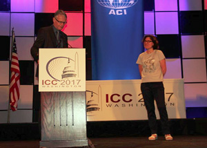
Anne Ruas receiving the ICA Honorary FellowshipAnne Ruas receiving the ICA Honorary FellowshipDuring ICC 2017, Anne Ruas received the ICA Honorary Fellowship. Below you can read Menno-Jan Kraak‘s laudation:
Dear Ann,

It is a great pleasure to address you for this occasion to hand you the ICA Honorary Fellowship. This award is for cartographers of international reputation who have made special contribution to the ICA.

You fit this category well because during a long ICA career you have been active as Co-chair of the Commission on Generalization and Multiple representation (2003–2007), as Vice-President (2007–2015), but also you have been President of ICC 2011, Paris. And you are still committed to ICA because currently you are one of the two Editors of our International Journal of Cartography (2015–).

But what many people do not know is that you have other talents too. You are a good football player. I remember we both played in the red-team during a legendary ICA Commission match in Leicester many years ago.

Ann, I congratulate you with this honor and would like to hand you the medal and certificate now.

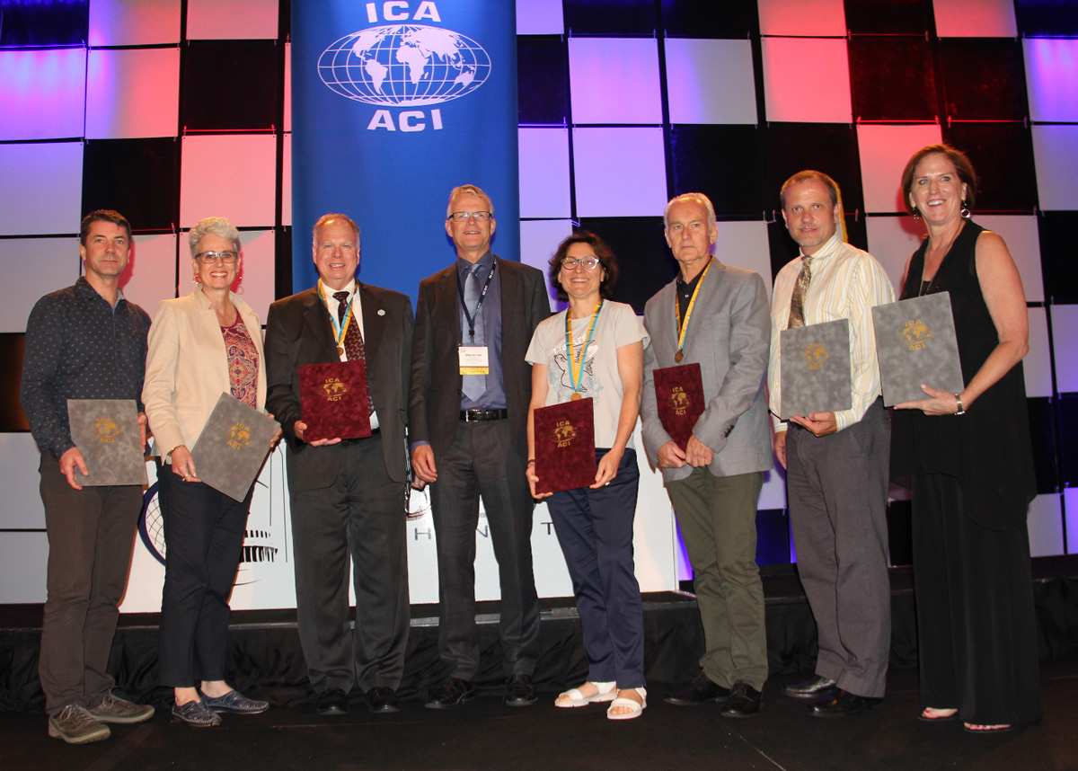
ICA Awards Ceremony at ICC2017

In the ICA Awards Ceremony at ICC2017, the following awards were presented in recognition of contributions to the ICA:
ICA Awardees 2017

From left to right: Igor Drecki, Cynthia Brewer, Timothy Trainor, Menno-Jan Kraak, Anne Ruas, William Cartwright, Matthew Rice, Aileen Buckley

ICA Honorary Fellowship

The ICA Honorary Fellowship is for cartographers of international reputation who have made special contribution to the ICA. It includes a bronze medal.

  • William Cartwright, Australia
  • Anne Ruas, France
    • Co-chair of the Commission on Generalization and Multiple Representation (2003–2007)
    • Vice-President (2007–2015)
    • President of ICC 2011, Paris
    • Editor of the International Journal of Cartography (2015–)
  • Timothy Trainor, USA
    • Chair or Co-chair of the Commission on National and Regional Atlases (1995–2007)
    • Chair of Census Cartography Working Group (2007–2011)
    • Vice-President (2007–2015)

Diplomas for outstanding services to ICA
The Diplomas for outstanding services to ICA are for colleagues who have made special contribution to the ICA as commission officers or conference organizers.

  • Igor Drecki, New Zealand
  • Aileen R. Buckley, USA
    • ICC2017 Organizing Committee member
  • Cynthia A. Brewer, USA
    • ICC2017 Organizing Committee member
  • Matthew Rice, USA
    • ICC2017 Organizing Committee member

 
Overview of ICA Awards presented at ICC2015

Congratulations to all awardees!

An overview over the ICC2017 Pre-Conference Workshops

white-house-451544_1920-1180x450

Many ICA commissions use the days before the ICC conference for dedicated workshops on their fields of research. This year, the following workshops will take place:

Charting the Cosmos of Cartography: History – Names – Atlases

Meeting on Maps & the Internet, Ubiquitous Mapping and Education & Training

Mapping Tools for Non-Mapping Experts: Incorporating Geospatial Visualization Tools in Libraries

Different Fields – One Cartography

Supporting sustainable development with geoinformation management and modern maps: things you hardly consider

Workshop on Maps & Emotions

Workshop on Spatial Data Infrastructures, Standards, Open Source and Open Data for Geospatial (SDI-Open 2017)

Workshop on Generalisation and Multiple Representation

Symposium on Location-Based Social Media and Tracking Data

Critical Review on Using Developable Surfaces in Map Projections Theory & Standardization in Map Projections

  • Date: July 2
  • Location: Marriott Wardman Park Hotel, Washington, DC
  • Involved commission: Map Projections

Disaster Management, Big Data, Services and Cartographic Representation

Preserving Map Production Methodology Information

Invitation to the 20th ICA Workshop on Generalisation and Multiple Representation

In the tradition of pre-conference workshops in association with the International Cartographic Conference (ICC) the ICA Commission on Generalisation and Multiple Representation will organise a workshop in Washington, United States, 1–2 July, 2017.

The workshop will explore new challenges and solutions in the domain of automated generalisation. A special focus will be set on approaches to generalise location-based social media data. The first day (1 July 2017) will be carried out as a regular workshop of the ICA Commission on Generalisation and Multiple Representation. For the second day we have the aim to have combined sessions with ICA Commission on Geospatial Analysis and Modeling and ICA Commission on Location-based Services on topics related to Scalability and Abstraction of Location-based Social Media Data and Tracking Data.

The challenges of research in Generalisation and Multiple Representation draws upon researchers and practitioners alike, working in the fields of on-demand mapping, geovisual analysis, multiple representations, data integration and generalisation of geographic information. Participants of the workshop are invited to submit research papers or positions papers.

Key dates

  • 1 March: Deadline for submission of short papers (limit 3000 words, and 8 pages including figures)
  • 17 April: Notification of acceptance of paper for presentation
  • 31 May: Deadline for submission of revised papers
  • 1–2 July: Workshop

Submission and review of short papers will be managed through EasyChair.

Workshop organizers: Dirk Burghardt, Cecile Duchene

For more information, please visit the conference website: generalisation.icaci.org/index.php/nextevents

President’s Blog: A map perspective on the sustainable development goals

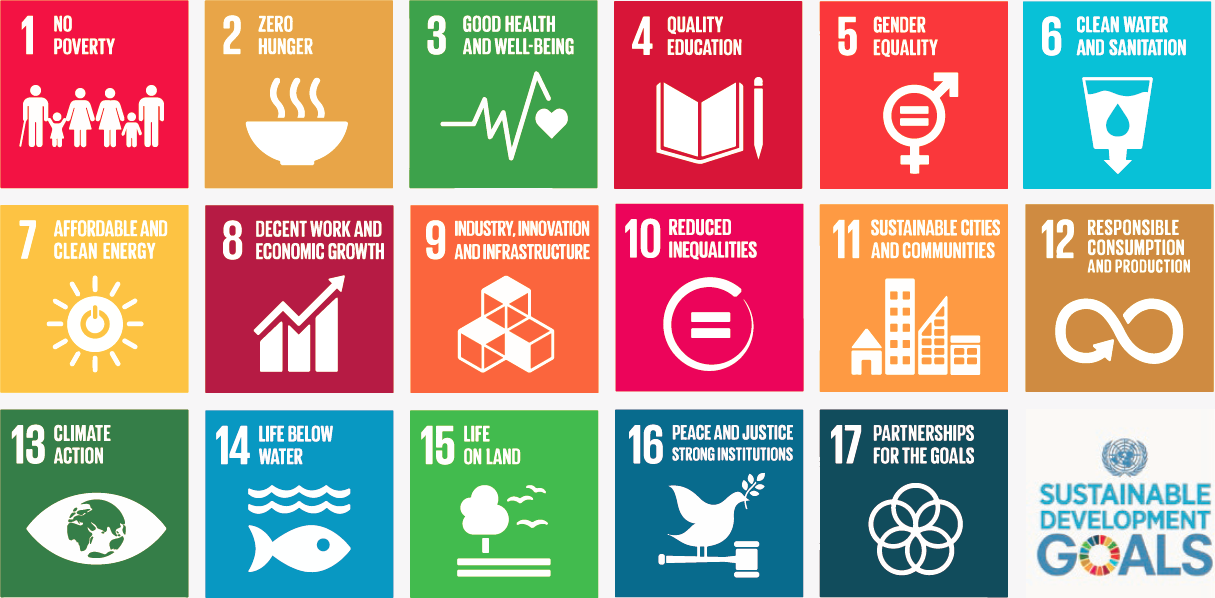
The Sustainable Development Goals, officially known as Transforming our world: the 2030 Agenda for Sustainable Development are a UN Initiative. Official website: https://sustainabledevelopment.un.org

In the light of the International Map Year (IMY), the ICA and its commissions are highlighting the value of cartography by “mapping” the UN sustainable development goals.

In the past months, a set of posters has been created, one for each sustainable development goal. They do not map the goals and their target based on indicators as such. The poster series tells the story of cartographic diversity, of mapping options, and of multiple map perspectives. Each of the goals has been mapped from a particular perspective by different ICA Commissions. All posters have a short take-home-message that should make one aware of particular strengths of the map.

The posters as well as the catalog for the poster exhibition can be found on icaci.org/maps-and-sustainable-development-goals

A huge thank you to all commissions involved and to Wim Feringa from ITC for the poster design and production. Let’s make the world a better place with maps!

Menno-Jan Kraak
– President of the International Cartographic Association

Joint ICA meeting in Vienna, November 8–9

ica-commission-meeting

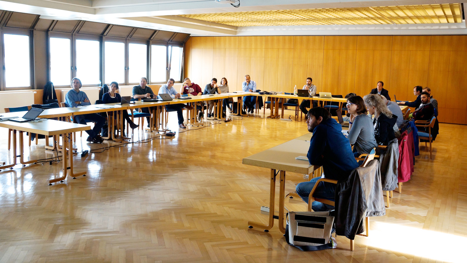
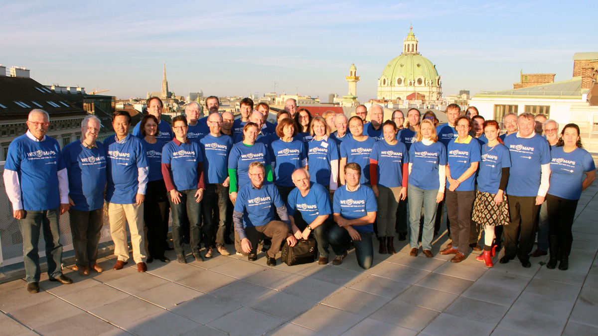
All chairs and vice-chairs of the ICA commissions and working groups were invited to join an ICA meeting in Vienna on 8–9 November 2015 to plan and discuss their activities for the term 2015–2019. 46 chairs, vice-chairs and members of the executive committee followed the invitation and spent two intensive workshop days at Technische Universität Wien.

Meeting participants

Commission chairs and vice-chairs

Working Group International Map Year

Executive Committee

Website

More photos of the workshop can be found on the ICA Facebook page.

Get to know the new ICA commissions for the term 2015–2019

27 commissions and 3 working groups were elected for the term 2015–2019 by the ICA General Assembly 2015. We are currently in the process of updating the website to reflect these changes. Also some of the commissions are still preparing or updating their websites. In the meantime, we invite you to have a look at the short “Commissions at a glance” presentations, which the new commissions chairs gave during ICC 2015:

Tag:

Abstracting Geographic Information in a Data Rich World – new book in the ICA book series

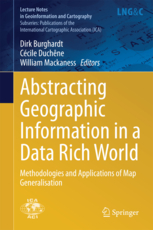
The newest book in the series Lecture Notes in Geoinformation and Cartography by Springer has been published:

Book cover for Abstracting Geographic Information in a Data Rich World
Abstracting Geographic Information in a Data Rich World
Burghardt, Dirk, Duchene, Cécile, Mackaness, William (Eds.)
2014, XV, 407 p. 180 illus., 128 illus. in color.


About the book

Research in the field of automated generalisation has faced new challenges in recent years as a result of technological developments in web-based processing, new visualisation paradigms and access to very large volumes of multi-source data generated by sensors and humans. In these contexts, map generalisation needs to underpin ‘on-demand mapping’, a form of mapping that responds to individual user requirements in the thematic selection and visualisation of geographic information. It is this new impetus that drives the research of the ICA Commission on Generalisation and Multiple Representation (for example through its annual workshops, biannual tutorials and publications in international journals). This book has a coherent structure, each chapter focusing on core concepts and tasks in the map generalisation towards on-demand mapping. Each chapter presents a state-of-the-art review, together with case studies that illustrate the application of pertinent generalisation methodologies. The book addresses issues from data gathering to multi scaled outputs. Thus there are chapters devoted to defining user requirements in handling specifications, and in the application and evaluation of map generalisation algorithms. It explores the application of generalisation methodologies in the context of growing volumes of data and the increasing popularity of user generated content.

Sample pages

Further links

rawboned-refined