Welcome to the International Cartographic Association
Welcome to the website of the International Cartographic AssociationGet to know the new ICA Executive Committee for the term 2023-2027Get to know the ICA Commissions for the term 2023-2027
Welcome to the website of the International Cartographic Association
Get to know the new ICA Executive Committee for the term 2023-2027
Get to know the ICA Commissions for the term 2023-2027

President’s Blog: A gathering of the ICA people – the ICA Retreat in Vienna

Many persons are involved in our organization. They have different roles, different background and different ideas. In order to learn to know each other better, to synchronize our understanding of “our” ICA and to allow for taking on board all those rich ideas, perspectives and thoughts all Executive Committee Members, Commission Chairs and Co-Chairs, Working Group Chairs and further ICA officers met at the Technische Universität Wien in Vienna, Austria from 22.3.2024 to 24.3.2024 for an intense working meeting.

The agenda included several information presentations on issues of mutual concern, several group-works and workshops and simply time to meet, discuss and be part of ICA.

In the unique venue of the “Kuppelsaal” of the Technical University of Vienna we found enough space and inspiration to gather and work together.

At the ICA retreat at TU Wien Kuppelsaal, Vienna, Austria 2024

At the ICA retreat at TU Wien Kuppelsaal, Vienna, Austria 2024

The meeting started with an introduction from President Georg Gartner on the nature, aims and scope and mission of the International Cartographic Association. It is really the global voice for Cartography and GIScience and the motto “We love maps” is a common nominator for all of us.

In order to learn to know each other better we performed a group work, where we paired in two to be able to introduce always the other person accordingly.

We then collected ideas about the questions:

  • What would you like to give to the ICA community?
  • What would you like to get from ICA?

which resulted in a long and rich list of relevant items.

Dusan Petrovic, Pyry Kettunen and Francis Harvey working hard and having fun at the retreat at TU Wien Kuppelsaal, Vienna, Austria 2024

Dusan Petrovic, Pyry Kettunen and Francis Harvey working hard and having fun at the retreat at TU Wien Kuppelsaal, Vienna, Austria 2024

Having set the tone for the meeting with this we then dived into several existing structures, instruments and elements of ICA, such as the ICA Webservices (presented by Webmaster Manuela Schmidt), the International Journal of Cartography (presented online from the Editors Anne Ruas and William Cartwright), the ICA Publication Regime (presented online from Publication Committee Chair Menno-Jan Kraak), the ICA Executive Committee (presented by President Georg Gartner and Secretary-General Thomas Schulz), the ICA Commissions and their Administration (presented by Secretary-General Thomas Schulz), the ICA Conferences (presented by Vice-President Serena Coetzee), the ICA memberships, MoUs and relations to other organisations (presented by Past-President Tim Trainor), the ICA Research Agenda (presented by Vice-President Haosheng Huang), the ICA Body of Knowledge (presented by Working Group Chair Terje Mitbo).

Inbetween further group interventions took place, refering to the idea of synchronizing our understanding of the core concept of our organization (What is a map?), identifying and presenting commission and working group plans and synergies (led by Vice-President Dusan Petrovic), a SWOT (Strengths-Weaknesses-Opportunities-Threads) – Analysis of ICA (led by Vice-President Alex Kent), a open mic session on ideas and visions (led by Vice-Presidents Amy Griffin, Jiping Liu and Dariusz Dukaczewski).

The ICA “people” in front of the Karlskirche during the ICA retreat, Vienna 2024

The ICA “people” in front of the Karlskirche during the ICA retreat, Vienna 2024

Socializing opportunities despite the amical, fruitful and constructive working atmosphere have been taken on a joined short “CartoWalk” around Karlsplatz and joined meals.

Participants of the ICA retreat in front of the Technische Universität Wien, Vienna 2024

Participants of the ICA retreat in front of the Technische Universität Wien, Vienna 2024

The event proofs my feeling right again, that ICA is really more like a family – it is such a privilege to be able to cooperate with so many bright, motivated, enthusiastic, fantastic scholars and persons!

List of Participants

Executive Committee

  • President: Georg Gartner
  • Past President: Timothy Trainor
  • Secretary-General and Treasurer: Thomas Schulz
  • Vice President: Serena Coetzee
  • Vice President: Dariusz Dukaczewski
  • Vice President: Amy Griffin
  • Vice President: Dusan Petrovic
  • Vice President: Haosheng Huang
  • Vice President: Alexander Kent
  • Vice President: Jiping Liu

Commission Chairs and Co-Chairs

  • Art and Cartography: Taien Ng-Chan
  • Atlases: Vitek Vozenilek, Eric Losang
  • Cartographic Heritage into the Digital: Matyas Gede
  • Cartography and Children: Silvia Marinova
  • Cartography and Sustainable Development: Britta Ricker
  • Cartography in Early Warning and Crisis Mgmt: Christophe Lienert, Jie Shen
  • Cognitive Issues: Tumasch Reichenbacher, Pyry Kettunen, Petr Kubicek
  • Digital Transformation of Mapping Agencies: Bin Jiang
  • Education and Training: Tao Wang
  • Ethics in Cartography: Aileen Buckley
  • GeoAI: Samantha Arundel
  • Geospatial Analysis and Modelling: Xintao Liu
  • Geospatial Semantics and Ontology: Francis Harvey
  • Geovisualization: Florian Ledermann, Arzu Cöltekin
  • High-Definition Maps: Qingyun Du
  • Integrated Geospatial Information: Anja Hopfstock, Kathryn Arnold
  • Location Based Services: Jukka Krisp
  • Map Design: Ian Muehlenhaus
  • Map Projections: Krisztian Kerkovits
  • Maps and the Internet: Otakar Cerba
  • Marine Cartography: Ron Furness, Lysandros Tsoulos
  • Mountain Cartography: Patrick Kennelly
  • Multi-scale Cartography: Guillaume Touya, Izabela Karsznia
  • Topographic Mapping: David Forrest, Lukas Halik
  • Toponomy: Matjaz Gersic
  • Ubiquitious Mapping: Toru Ishikawa, Angela Schwering, Armand Kapaj
  • User Experiences: Robert Roth

Working Group Chairs and Co-Chairs

  • Next Generation Cartographers: Katarzyna Slomska-Przech, Chelsea Nestel
  • Inclusive Cartography: Jakub Wabinski, Vincent van Altena
  • Body of Knowledge: Terje Mitbo

President’s Blog: Get your hands on! Check out what the pre-conference workshops of EuroCarto 2024 have to offer

The EuroCarto 2024 conference will take place from 9—11.9.2024 at Vienna, Austria. This conference will again see more then 180 contributions in oral presentations, posters and exhibitions demonstrating the wide range and contemporary character of cartography.

A number of pre-conference workshops are offered on Sunday, September 8, 2024 at TU Wien for the conference participants, covering a wide range of contemporary and highly relevant topics of cartography to be discussed in an interactive manner. I am sure there is something interesting for every cartographer included!


Barrier-Free Cartography

The ICA’s Working Group on Inclusive Cartography was established earlier this year to continue and extend the work of the former Commission on Maps and Graphics for Blind and Partially Sighted People. The primary objective of this working group is to advance the accessibility of cartographic products to all users and communities.

The idea is that special needs are not strictly related to physical aspects, and can also be related to social and educational aspects. These are also reflected in the UN’s SDGs that aim to “…ensuring that no one is left behind…”. Individuals with special needs remain underrepresented in the field of cartography. This underrepresentation may stem from the intricate and nuanced nature of their requirements, coupled with the need for highly tailored solutions. But what exactly are their needs? How can we define, develop, and promote barrier-free cartography, and who are the users that will benefit from accessible maps? We aim to provide a forum to address these questions and provide answers during the barrier-free cartography workshop.


Building the road to AI – how cartography links data integration, meaning and geospatial knowledge transmission

All countries need geospatial information to address their national strategic priorities. However, all countries have different levels of geospatial maturity. The United Nations Integrated Geospatial Information Framework (UN-IGIF) provides a basis and guide for developing, integrating and strengthening national arrangements in geospatial information management.

In this workshop, hosted by the ICA Commission on Integrated Geospatial Information for Cartography and Commission on Topographic Mapping, you will learn more about the development and activities of the UN-GGIM and UN-IGIF, how countries across Europe can adopt and implement the framework, how data can be provided via national Geoportals and how cartography builds the road to AI.


Collaborative mapping of commissions beyond the International Cartographic Association (ICA)

This workshop will allow participants to critically evaluate a landscape of map conceptions shaped by the ICA commissions. Drawing upon the work of the Iconoclasistas collective, the conception of a map as a collaborative practice will be explored. Through participatory methods, this workshop will reveal cartographic spaces where the ICA has yet to venture, both geographically and epistemologically.


Indoor location-based services (Indoor LBS)

The research on indoor LBS is not trivial. On the one hand, its design closely depends on both indoor themes (e.g., airports, shopping malls) and target users (e.g., passengers under time pressure, visually impaired customers). Therefore, there is a huge need to investigate the indoor LBS requirements and guarantee its usability. On the other hand, the emergence of agents, such as air drones and service robots, results in more diverse indoor LBS with various indoor map formats, including floor plans, BIM models, depth images, and point clouds. However, this is also challenging to communicate indoor spatial information among different agents and collaboratively provide indoor LBS for human users as well as other agents. The workshop is organized by the ICA Commission on Location Based Services.


Mapping Future Courses: Bridging Old and New in Cartographic Education for Europe

The ICA Commission on Education and Training, the ICA WG on Cartographic Body of Knowledge, and the ICA Commission on Digital Transformation of National Mapping Agencies are organizing a workshop, Mapping Future Courses: Bridging Old and New in Cartographic Education for Europe. The workshop brings together experts to share their latest thoughts and best practices on how to include new digital technologies and tools in cartographic education, including GIS, remote sensing and geomatics education. It will be a combination of oral presentations and live discussions.


Multiperspective Cartography in Conflict Visualisation

This workshop explores approaches, potentials and limitations of visualising multiple perspectives in peace and conflict cartography. It addresses complexities and uncertainties in how maps politicise space, and challenges in integrating critical perspectives in day-to-day cartographic research and practice. The engagement of maps with multiple perspectives is expected to enable discussions on scientific authority, transparency, and trustworthiness, as well as inclusion of bottom up and personal perspectives. The workshop takes up a reflective practice approach, starting from discussing existing examples of multiperspectivity in maps and visualisations (via short presentations). From there, participants work in groups on collecting and reviewing cartographic practices that engage with multiple perspectives in terms of both map analysis and production. The workshop aims to deliver an outline of a multiperspective approach to visualising peace and conflict, with the ambition of gathering a cartographic community around the topic.


Online User Experiments: Seeing What Map Users See without Seeing Them

This workshop is designed for researchers, practitioners, and students interested in conducting online user experiments in cartography with a special focus on webcam eye tracking to study map users’ behavior. Building up from a previous ICA workshop on “Workshop on Adaptable Research Methods For Empirical Research with Map Users”, we aim to collaboratively explore the possibilities and boundaries of the current state of conducting online experiments to inform cartographic practice and map use. This workshop represents the joint efforts of the ICA Commissions on Geovisualization and User Experience (UX).


Participatory mapping – new approaches and technologies

Participatory mapping, a widely employed geographical method across disciplines, remains relatively underexplored within the International Cartographic Association. This workshop seeks to introduce three distinct participatory mapping apps/approaches: an in-situ participatory mobile app, a web-based participatory mapping tool, and a paper-based “paper2GIS” style app. Each method has the potential to target diverse groups and serve different mapping purposes.


Storytelling with Geographical Visualization

This workshop explores how we express and communicate a current issue to a wide audience by visualizing geographical data. After an introductory talk on the implementation of cartographic design principles in data journalism (20 min), groups of participants will be given the task of devising a method for mapping a current issue using datasets, contextual maps, and drawing materials provided (70 min). After the activity, participants will be encouraged to feedback on their approach and discuss their decisions over the methods of representation chosen (30 min). The workshop provides an opportunity to discuss ways of visualizing data within the context of a current issue and by deliberately eliminating the need for technical skills in particular software. The workshop is therefore designed to maximise inclusivity (encouraging multinational and transgenerational participation) and to allow a greater focus on the process of creativity in exploring approaches to cartographic representation.


The Future of Atlases

In this workshop, hosted by the ICA Commission on Atlases, we want to rethink atlases and develop new approaches to both atlas production and atlas research – focal points of the Atlas Commission’s work. We believe it’s about recombining content structures, technical developments, geographical information and the re-organisation of knowledge. We would like to approach this by answering the following questions:

  • What will be the elements (or aspects) of an atlas of the future?
  • How will atlases of the future be technically realised?
  • What other aspects need to be taken into account in the future?
  • What research topics need to be focused to scientifically support these points?


Web Cartography Education in the Age of Artificial Intelligence

The main goal of the workshop is to promote knowledge sharing and collaboration among experts and stakeholders in the field of AI-enabled web cartography, to inspire participants to develop innovative solutions and projects in the field and to promote advancement in web cartography education through the responsible use of AI. During the interactive workshop, we will share experiences, challenges and examples of good practice in this dynamically developing field. The workshop will take the form of an interactive discussion to encourage active participation of all participants.

This workshop is organized by the Chair of the ICA Commission on Maps and the Internet.


One workshop will already take place on Saturday, Septemer 7 in Warsaw, Poland:

ICA Workshop on AI, Geovisualization, and Analytical Reasoning

This workshop is intended to relate to supporting geovisualization and analytical reasoning, including approaches that leverage AI methods applied at various stages: data processing, analysis, visualization generation and interpretation, as well as support in user perception interpretation.

For more details on the workshop in Warsaw, visit the CartoVis24 website.


For more details on all EuroCarto 2024 workshops, visit eurocarto2024.org/workshop-programme 

18th International Conference on Location Based Services (LBS 2023) – A Report

The LBS conference series started in 2002 in Vienna, Austria, initiated by Prof. Georg Gartner from TU Wien. Since 2015, it has become the annual conference of the ICA Commission on Location Based Services. In the past years, the LBS conferences travelled around the world – with venues in Hong Kong, Salzburg, Nottingham, Shanghai, Vienna, Augsburg, Zurich, Glasgow, and Munich.

In 2023, the LBS conference was hosted by Ghent University, Belgium, on November 20-22, 2023. Around 90 participants from all over the world gathered in the historical city center of Ghent. The conference was opened by the Conference Chairs Prof. Haosheng Huang and Prof. Nico Van de Weghe.
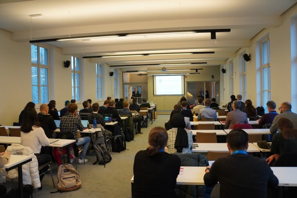
Opening session of the 18th International Conference on Location Based Services – LBS 2023 held in Ghent, Belgium

The conference featured five keynotes by Prof. Krzysztof Janowicz from University of Vienna, Bart Rosseau from Digitaal Vlaanderen, Prof. Wim Hardyns from Ghent University (UGent), Prof. Sofie Van Hoecke from UGent-imec, and Prof. Sidharta Gautama from UGent.

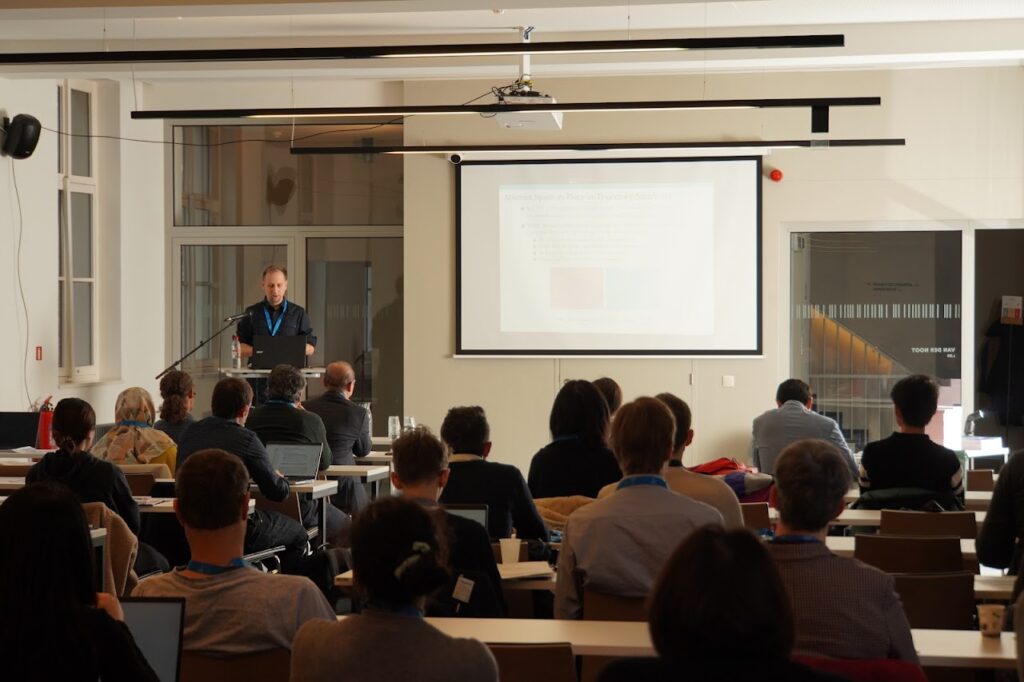
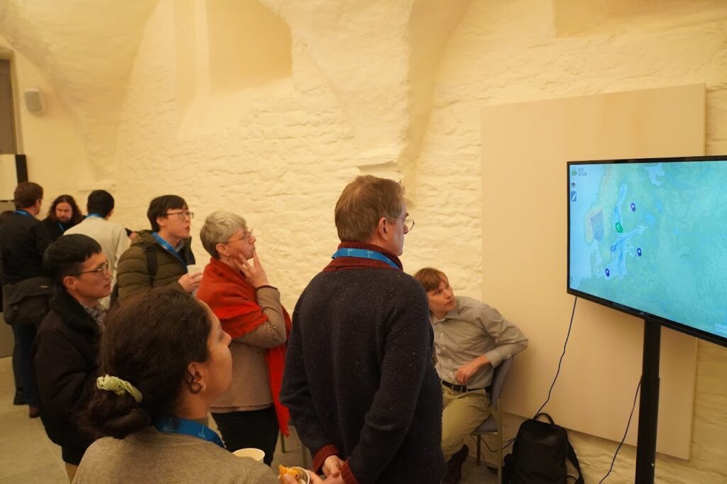
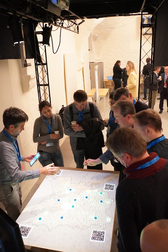
A total of 50 oral presentations have been given in 10 single-stream sessions over the two and half days. Another 4 showcases were presented all the conference. These oral presentations, showcases and posters provide a general picture of recent research activities related to the domain of LBS. Such activities emerged in the last years, especially concerning issues of GeoAI, outdoor/indoor positioning, smart environment, spatial modeling, personalization, context-awarenesss, cartographic communication, novel user interfaces, crowdsourcing, social media, big data analysis, usability and privacy.

Oral sessions of LBS 2023

Oral sessions of LBS 2023

Opening session of the 18th International Conference on Location Based Services – LBS 2023 held in Ghent, Belgium

Showcases at LBS 2023

Showcases at LBS 2023

Showcases at LBS 2023

Showcases at LBS 2023

The conference also featured a “Best paper session” on the 3rd conference day.

  • The best full paper award at LBS2023 went to Eva Nuhn, Kai Hamburger and Sabine Timpf from University of Augsburg, Germany for their full paper on “Mapping olfactory cues for wayfinding – A theoretical approach and an empirical study”.
  • The winner of the best short paper award at LBS2023 is “Towards Personalized Pedestrian Route Recommendation Based on Implicit Visual Preference”, authored by Lin Che, Martin Raubal and Peter Kiefer from ETH Zurich.

With the co-sponsoring of ESRI BeLux and ISPRS International Journal of Geo-Information, we were also happy to offer Travel Grants to support 7 young researchers to participate in the conference.

A selection of peer-reviewed full papers will be published in the Journal of Location Based Services. Accepted work in progress submissions are included in the conference online proceeding.

Besides the technical and scientific program, the conference provided several social networking opportunities, including an ice-breaker reception on the first day and a conference dinner in a traditional restaurant with famous Ghent cuisine on the 2nd day.

More details and photos regarding LBS 2023 can be found at lbs2023.lbsconference.org.

Invitation to the 18th International Conference on Location Based Services (LBS 2023)

The ICA Commission on Location Based Services and Ghent University are pleased to invite you to the 18th International Conference on Location Based Services (LBS 2023), which will take place in Ghent, Belgium on 20-22 November 2023.

Built on the success of previous conferences in this series, LBS 2023 aims to offer a common ground to colleagues from various disciplines and practice where they can meet, interact and exchange knowledge, experience, plans and ideas on how LBS can and could be improved and on how it will influence both science and society.

Call for Papers

The Call for Papers is currently open. We call for full papers, work in progress, and showcases. High-quality full paper submissions are intended to be published in the Journal of Location Based Services. Accepted work-in-progress submissions will be published in the online proceedings of the conference (with a DOI).

We are also pleased to announce two awards at LBS 2023: one Best paper award, and one work in progress award. Meanwhile, travel grants will be available for young researchers whose submissions are accepted. More details will follow.

Important Dates

  • Full paper submission: 15 June 2023
  • Work in progress submission: 15 July 2023
  • Notification of full paper acceptance: 1 August 2023
  • Showcase submission: 10 September 2023
  • Notification of work in progress acceptance: 16 September 2023
  • Early registration ends, author registration deadline: 30 September 2023
  • Conference: 20-24 November 2023

Topics

We invite contributions in the following areas (but not limited to):

Geospatial Artificial intelligence (GeoAI) and LBS

  • Geography/GIScience-guided AI
  • Explainable GeoAI
  • GeoAI-enabled LBS

Context modelling and context-awareness

  • Smart environments and ambient spatial intelligence
  • Indoor spatial data modelling and mapping
  • Place modelling and understanding
  • Context modelling, personalisation, and context-aware adaptation

Mobile user interface and interaction

  • Visualisation techniques for LBS
  • Mobile human-computer interaction
  • Augmented reality and mixed reality

User studies and evaluation

  • Evaluation methodologies for LBS
  • User experiences of LBS
  • Mobile spatial cognition

Acquisition, management, and analytics of Location big data

  • Crowdsourcing and internet of things
  • Spatial data science and big data analytics
  • Computational mobility and activity analytics
  • Descriptive, diagnostic, predictive, and prescriptive analytics

Ubiquitous Positioning

  • Outdoor and indoor positioning
  • Multi-sensor system and sensor fusion

Social and behavioural implications of LBS

  • Location privacy
  • Legal, ethical, and business aspects of LBS
  • Biases in location data analytics and GeoAI

Innovative LBS and applications

  • Intelligent navigation systems
  • Smart cities and sustainable mobility
  • Autonomous and connected vehicles
  • Public health
  • Location based social networks and games
  • Digital humanities

More information regarding LBS 2023 can be found at lbsconference.org.

Tag: ,

Call for Papers: Pre-ICC2023 Symposium on Location-based Big Data and GeoAI 2023 (LocBigDataAI 2023)

The ICA Commission on Location Based ServicesCommission on Geospatial Analysis and Modelling, and Working Group on Digital Transformation of National Mapping Agencies will jointly organize the pre-ICC 2023 Symposium on Location-Based Big Data and GeoAI (LocBigDataAI 2023).

The symposium will be held in hybrid mode, and will be associated with ICC 2023. It is a follow-up of the successful previous conferences of ICLSM 2015LSMTD 2017, and LocBigData 2019.

Conference Topics

Acquisition, management, and analytics of location-based big data

  • Crowdsourcing and Internet of Things
  • Data management, cleaning, and integration
  • Geovisual analytics
  • Computational mobility and activity analysis
  • Descriptive, diagnostic, predictive and prescriptive analytics

Geospatial artificial intelligence (GeoAI)

  • Big data analytics and machine/deep learning
  • Spatially explicit AI techniques
  • Geography/GIScience-guided AI
  • Explainable GeoAI
  • Integration of data- and theory-driven approaches

Applications of location-based big data and GeoAI

  • Human spatial behavior, activity, and mobility
  • Place modelling and understanding
  • Transportation and traffic
  • Social network analysis
  • Public health
  • Smart and sustainable cities

Social and ethical issues of location-based big data and GeoAI

  • Data quality and representativeness
  • Bias of LocBigData and GeoAI
  • Social inequality in cyber and physical space
  • (Geo)privacy and ethical issues
  • Governance of LocBigData and GeoAI

Call for papers (CFP as a PDF)

You are invited to submit work-in-progress or position papers with a length of 400-1200 words in PDF format at EasyChair. If accepted, at least one of the authors must attend (online or in-person) the symposium to present the work.  Authors of selected submissions will be invited to submit full papers for considerations for publications in a journal special issue.

Important dates

  • Short papers Due: April 15, 2023
  • Acceptance notification: May 15, 2023
  • Symposium: August 12, 2023

For more information visit the conference website: https://lbs.icaci.org/locbigdata2023/

17th International Conference on Location Based Services (LBS 2022) – A Report

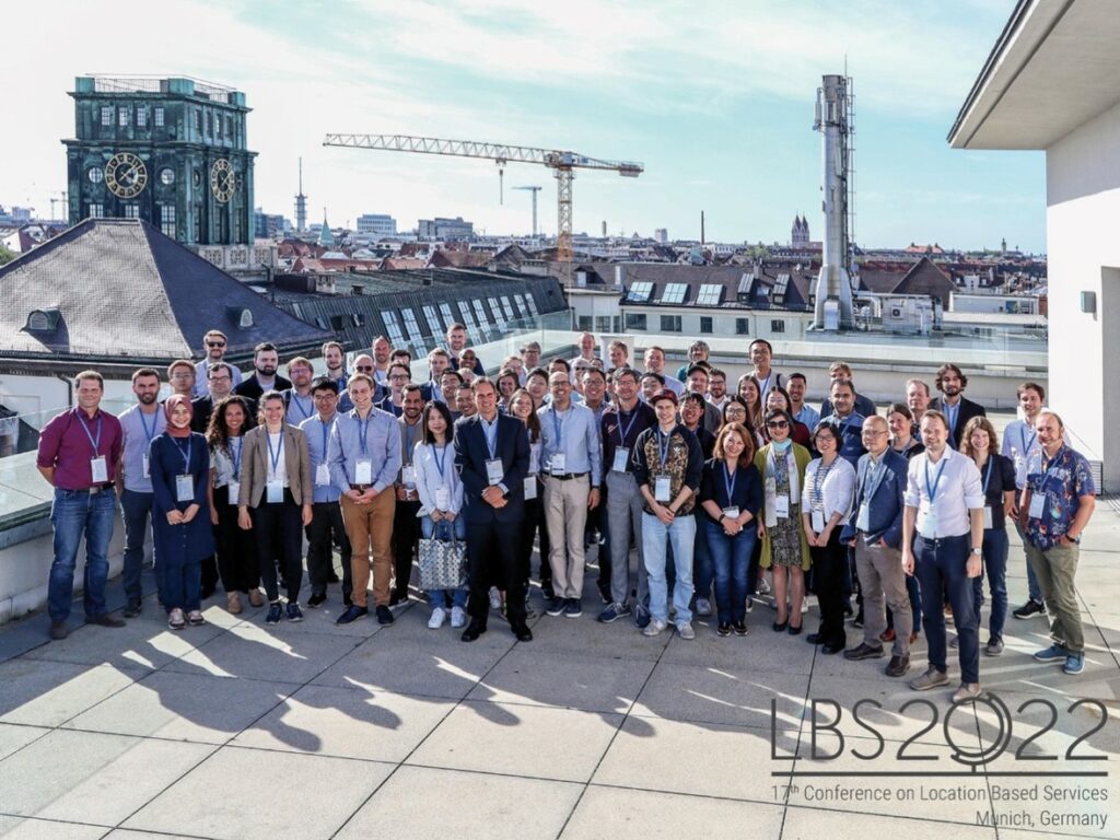
During 12-14 September 2022, the 17th International Conference on Location Based Services (LBS 2022) has been successfully held at TU Munich, Germany. The conference was organized by the ICA Commission on Location Based Services, and hosted by Prof. Liqiu Meng and Prof. Jukka Krisp and their teams at TU Munich and University Augsburg.

The conference featured two keynote presentations of Georg Gartner from TU Wien and Harvey Miller from Ohio State University. A total of 39 oral presentations have been given in 8 single-stream sessions over three days. These oral presentations provide a general picture of recent research activities related to the domain of LBS. Such activities emerged in the last years, especially concerning issues of outdoor/indoor positioning, smart environment, spatial modelling, personalization, context-awarenesss, cartographic communication, novel user interfaces, social media, big data analysis, usability, ethics, and privacy.

Group photo of LBS 2022 participants | Photograph courtesy of LBS 2022

Papers accepted in the category “Full papers” and accepted in the category “Work in progress” (double-blind peer-review based on full papers) are published as online proceedings LBS2022:

  • Krisp, Meng, Kumke, Huang (eds.) (2022) Proceedings 17th International Conference on Location Based Services (LBS2022), Munich / Augsburg, Germany, September 12-14.

More details regarding LBS 2022 can be found at http://lbsconference.org/.

The next LBS conference has been planned and will be hosted by Prof. Haosheng Huang and Prof. Nico Van de Weghe at Ghent University (Belgium) in November 2023. We look forward to meeting you there.

Invitation to the 17th International Conference on Location Based Services (LBS 2022)

The ICA Commission on Location Based ServicesApplied Geoinformatics @ Augsburg University, Prof. Dr. Jukka M. Krisp and the Chair of Cartography @ TUM, Prof. Dr. Liqiu Meng, are pleased to invite you to the 17th International Conference on Location Based Services which takes place in Munich on 12. – 14. September 2022.

Call for Papers

The Call for Papers is currently open: Please consider submitting a full paper or an abstract.

  • Deadline for full paper submission: 15 May 2022
  • Deadline for abstract submission: 1 June 2022

 
More information regarding LBS 2022 can be found at lbsconference.org.

We are looking forward to welcome you in Munich!

Prof. Dr. Jukka M. Krisp
Prof. Dr. Liqiu Meng
Dr. Holger Kumke
and the LBS2022 Organizing Committee

Tag: ,

Call for Participation: LBS 2021, 24-25 November 2021, online

The ICA Commission on Location Based Services and the University of Glasgow are pleased to invite you to the 16th International Conference on Location Based Services (LBS 2021), which will take place fully online on 24—25 November 2021.

Note that the preliminary program of LBS 2021 has been published online. It features five keynotes:

  • Michael Batty, University College London, “More Than One Digital Twin”
  • Urška Demšar, University of St Andrews, “Studying migratory bird navigation with spatial data science”
  • Matt Duckham, RMIT University, “LBS and Indigenous Data Sovereignty”
  • Anita Graser, Austrian Institute of Technology, “Open LBS Research: Why (not)?”
  • Ross Purves, University of Zurich, “Location, place and language”

The conference also features a “Best paper session” on the 2nd conference day, and five oral sessions on “Wayfinding and Navigation Systems”, “Positioning”, “Location tracking and systems”, “Mobility and Activity Analytics”, and “Visualization, Perception and Analysis”.
Please note that registration for the conference is free, but required. The registration will close on 20 Nov 2021.

More information regarding LBS 2021 can be found at lbsconference.org

Invitation to the 16th International Conference on Location Based Services (LBS 2020)

The ICA Commission on Location Based Services and  University College London (UCL) are pleased to invite you to the 16th International Conference on Location Based Services (LBS 2020), which will take place in London, UK on 11–13 November 2020.

Built on the success of previous conferences in this series, LBS 2020 aims to offer a common ground to colleagues from various disciplines and practice where they can meet, interact and exchange knowledge, experience, plans and ideas on how LBS can and could be improved and on how it will influence both science and society.

Call for Papers

The Call for Papers is currently open. We call for full papers, work in progress, and showcases. High-quality full paper submissions are intended to be published in Springer Lecture Notes in Geoinformation and Cartography. The best full and work in progress papers will be invited to submit an extended version to the Journal of Location Based Services and Journal of Navigation.

Important Dates

  • Pre-conference workshop and exhibition proposal: 15 March 2020
  • Full paper submission: 15 May 2020
  • Work in progress submission: 14 June 2020
  • Notification of full paper acceptance: 10 July 2020
  • Notification of work in progress acceptance: 01 September 2020
  • Camera-ready full paper (for the Springer book): 01 September 2020
  • Showcase submission: 13 September 2020
  • Early registration ends, author registration deadline: 13 September 2020
  • Camera-ready work in progress: 01 October 2020

More information regarding LBS 2020 can be found at lbs2020.lbsconference.org. We are looking forwards to your contributions and to meeting you in London!

Invitation to Workshop on Indoor Cartography

The ICA Commissions on User Experience, on Location Based Services and on Cognitive Issues in Geographic Information Visualization, are pleased to announce the first call for papers on the Joint Workshop Indoor Cartography as part of the Cognition and Artificial Life Conference 2020 which takes place June 10–12, 2020 in Znojmo, Czech Republic.

The workshop considers an understudied map use context, that of using maps to navigate and understand indoor environments. As urban areas and individual buildings grow increasingly complex and people rely more and more on devices to assist in the navigation of these spaces, knowing how to design maps of the indoors well is becoming more important. It’s unclear what current map design principles transfer well to indoor maps (Griffin, White, et al. 2017), or what methods of map interactions might best support uses of maps in such contexts as well as what field methods can be used to study these map uses in ecologically valid ways (Roth et al., 2017). This workshop aims to focus attention on such issues and how we can better understand and support the design, use and wider implications of indoor maps.

The conference and the workshop is a cross-disciplinary platform intended to share and exchange knowledge between specialists in cartography, geoinformatics, psychology, cognitive science, neuroscience, informatics, and related fields.

The deadline for abstracts is 29 February 2020.

More information will be available on the conference website.

rawboned-refined