Welcome to the International Cartographic Association
Welcome to the website of the International Cartographic AssociationGet to know the new ICA Executive Committee for the term 2023-2027
Welcome to the website of the International Cartographic Association
Get to know the new ICA Executive Committee for the term 2023-2027

Invitation to the ICC2015 Pre-Conference Workshop SDI-Open 2015

cropped-sdiopen

The Commission on Geoinformation Infrastructures and Standards, the Commission on Open Source Geospatial Technologies and the Open Geospatial Consortium (OGC) invite you to a joint Workshop on Spatial data infrastructures, standards, open source and open data for geospatial (SDI-Open 2015).

The workshop aims at recording examples of current SDI practices with the aim of identifying benefits and challenges of implementing free and open source software for geospatial, geographic information standards and open (spatial) data in an SDI.

Registration is now open! Places are limited and available on a first come, first served basis. Registration will be confirmed by e-mail.

For further information please visit the workshop website or contact the local organisors: Prof. Silvana Camboim, Head of ICA-OSGeo-ISPRS lab at Universidade Federal do Paraná (UFPR) and Dr. Julia Celia Mercedes Strauch

On behalf of the International Cartographic Association (ICA) and the Open Geospatial Consortium (OGC), we are looking forward to welcoming you to Rio!

Best wishes,
Suchith Anand

Second Symposium on Service-Oriented Mapping 2014

– Update: SOMAP 2014 is merged with the LBS 2014 symposium and will take place in Vienna, Austria, from 26–28 November 2014. Please find all details on the SOMAP website: somap.cartography.at –

The International Cartographic Association (ICA) is pleased to invite you to the Second International Symposium on Service-Oriented Mapping (SOMAP) in Potsdam from 6–8 October 2014 in Vienna, Austria from 26–28 November 2014.

Logo SOMAP2014

This symposium is coorganised by four ICA Commissions:

The call for papers is ongoing and registration has started at http://somap.cartography.at

Geospatial data and services are the main building blocks for geospatial infrastructures and fundamental to service-oriented mapping and realtime applications. Geospatial infrastructures make use of different paradigms: maintaining, sharing and use (instead of collect and own). Developments in these paradigms are leading to evolutions in availability and accessibility of geospatial data and services coupled with the added value of geospatial products and applications in the modern geospatial production environment.

Geospatial trends are constantly growing and developing such as sensor networks, realtime processing, volunteered geographic information, open governmental data, in-situ geospatial processing and striking visualization techniques creating many new possibilities but also new restrictions and problems based on massiveness, heterogeneity and contextual flexibility. Challenges like handling big data, aggregate different sources, standards for a homogenuous data, and disappearing sources/content are growing.

SOMAP2014 is a venue that brings together experts from research, government, non-governmental organisations, standardization bodies and industry to present, document and discuss trends in service-based mapping, which covers delivery, processing, integration, analysis, collaboration as well as visualization of geospatial data and services.

Markus Jobst
ICA Commission on Map Production and Geobusiness

Happy Open Education Week 2014

Open Education Week 2014

This week is Open Education Week 2014. It is a celebration of the global Open Education Movement with both online and locally hosted events around the world. Also geospatial science education is covered through the ELOGeo initiative.

ELOGeo was started with the aim to make geospatial science education available to everyone globally who wish to learn this. Till recently, geospatial science education was beyond the reach of financially poor students of our planet because of the high cost of the proprietary GI vendor softwares and non availability of good quality free education materials. We hope we can make a small step in helping widen geospatial education opportunities to all. We are extremely pleased that within two years since the launch of ELOGeo from very humble beginnings, it has now become the defacto Open Access Educational Platform for Geospatial thanks to the strong support of geospatial community worldwide. ELOGeo initiativeELOGeo is now used from Stanford University to universities in Africa.

A big thanks to all contributors, users and funders of ELOGeo!

Suchith Anand


Links:

LBS 2014 in Vienna, Austria

LBS2014 logoThe 11th International Symposium on Location Based Services will be held in Vienna, Austria, 26–28 November 2014.

The symposium will offer a common ground to colleagues from various disciplines and practice where they can meet, interact and exchange knowledge, experience, plans and ideas on how LBS can and could be improved and on how it will influence both science and society.

The Call for Papers is open. Please submit full papers and work in progress until May 31, 2014. Publication in a book within the series Lecture Notes on Geoinformation and Cartography is anticipated.

Five ICA commissions are involved:

Also other organizations endorsed the event, including AGILE, ISPRS, FIG, IAG, DGfK and ÖVG.

For further information, please visit lbs2014.org.

Update, May 2014: The symposium will be held in conjunction with the Second International Symposium on Service-Oriented Mapping (SOMAP 2014).

Webinar on NASA World Wind and the Europa Challenge

The ICA-OSGeo Lab Network and MundoGEO are now pleased to inform the fourth webinar of the “Open Geospatial Science & Applications” webinar series on 13 February 2014. The webinars will be open and free to all on first come register basis.

This webinar will be on NASA World Wind and also on the Europa Challenge by Patrick Hogan (NASA) and Maria Antonia Brovelli (Politecnico di Milano, Italy).

Students might want to have a look at the NASA World Wind Europa Challenge. Apply now! You can see last year’s winning projects at http://eurochallenge.como.polimi.it/projects2013.

To register for the webinar please go to https://www2.gotomeeting.com/register/604781066.

The schedule for the next three ICA-OSGeo Lab webinar series is below:

Feb 2014

“NASA World Wind Virtual Globe Technology” – Patrick Hogan (NASA) and Maria Antonia Brovelli (Politecnico di Milano, Italy)
Thursday, 13 February 2014, 9:00 AM – 10:00 AM PST

March 2014

“Australian Urban Research Infrastructure Network ” – Chris Pettit (University of Melbourne, Australia)
7 March 2014 (time to be confirmed)

April 2014

“Things to do with OpenStreetMap” – Lluís Vicens (University of Girona, Spain)
Date to be confirmed

Previous webinars recording will be available at both the Geo For All website and at MundoGeo.

Advisory Board of the “Geo for All” initiative

We are pleased to announce the Advisory Board of the “Geo for All” initiative:

  • Professor Georg Gartner (ICA President & co-chair)
  • Jeff McKenna (OSGeo President & co-chair)
  • Professor Josef Strobl
  • Professor Marguerite Madden
  • Professor Mike Jackson
  • Sven Schade
  • Gavin Fleming
  • Sergio Acosta y Lara
  • Dr Chris Pettit
  • Professor Venkatesh Raghavan
  • Geoff Zeiss
  • Jeroen Ticheler
  • Phillip Davis
  • Arnulf Christl
  • Professor Maria Brovelli
  • Dr Rafael Moreno

The ICA-OSGeo Lab network is a joint initiative of the Open Source Geospatial Foundation (OSGeo) and the International Cartographic Association (ICA). The ICA and OSGeo Presidents will be the co-chairs and permanent members of the Advisory Board. Others will have a 3 year term starting date of the Advisory Board being constituted (1 Dec 2013). The Advisory Board has brought together an excellent range of expertise (academia, government, industry) and geographical distribution (we have nearly all continents covered). Also it brought together members from other key communities ISPRS, AGILE, INSPIRE, UNIGIS etc which will make sure is it a fully inclusive global initiative. The Advisory Board will meet once every six months by telemeeting and AB members will keep an eye on the developments and provide strategic advice to the initiative through various forums.

While there has been tremendous growth in geospatial technology over the last few decades, the number of universities offering courses in geospatial science has not kept pace. Free and open geographic information (GI) software helps make geospatial education available to students from economically poor backgrounds worldwide (removing the need for high cost proprietary GI software). Our key aim is to make it possible for students in developing and poor countries to be also able to get geospatial education. This initiative will bring more opportunities for geospatial education worldwide. Over 50 Open Source Geospatial Labs have already been established in universities around the world as part of this initiative in just two year’s time, and we will be establishing over 100 research labs worldwide by September 2014.

We will have over 500 labs established worldwide in the next five years making us the biggest geospatial education and research network on the planet and we now have a good team of experts to guide us for the future. Welcome to all members of the Advisory Board and we are looking forward to their advice and ideas for expanding this education initiative globally!

We thank all of you for your strong support for this education initiative and it is very happy for us that our initiative has now grown rapidly from very humble beginnings and is helping to widen the benefits of geospatial education opportunities to thousands of students worldwide.

Suchith Anand

Website of Geo for All: http://www.geoforall.org/

Commissions at a glance

During ICC 2013 all commission chairs presented their commissions in a speed presentation. You can check out the presentation slides below (or via our ICC 2013 sub-page).

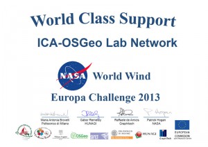
ICA-OSGeo awarded for support provided for the NASA World Wind Europa Challenge

The ICA-OSGeo Lab Network was awarded for the support provided for the NASA World Wind Europa Challenge.

The first edition of NASA World Wind Europa Challenge achieved its objective of inspiring ideas for building great applications that serve the INSPIRE Directive and uses NASA’s open source virtual globe technology World Wind.


Tag: , ,
rawboned-refined