Welcome to the International Cartographic Association
Welcome to the website of the International Cartographic AssociationGet to know the new ICA Executive Committee for the term 2023-2027
Welcome to the website of the International Cartographic Association
Get to know the new ICA Executive Committee for the term 2023-2027

Invitation to workshop Controlling the Waters: Seas, Lakes and Rivers on Historic Maps and Charts

Banner for Utrecht 2019 workshop

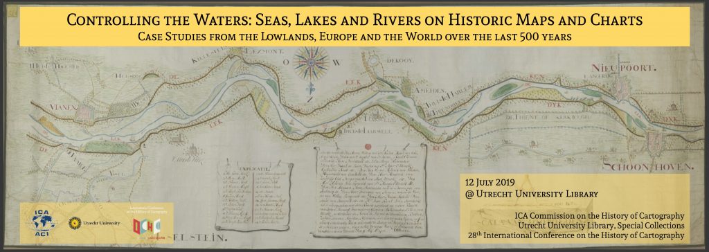
It is a tradition that the ICA Commission on the History of Cartography and the International Conference on the History of Cartography (ICHC) jointly organize a pre-ICHC event. For the 28th ICHC they have teamed up with the Map Collection of Utrecht University and will together host a workshop focusing on the cartography of water.

  • Date: 12 July 2019
  • Place: Utrecht University, University Library, Boothzaal and Map Collection, The Netherlands

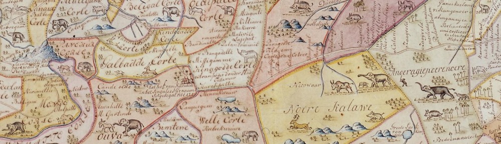
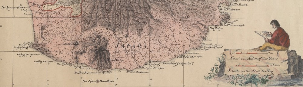
Fresh and salt waters are a key lifeline for all civilizations but at the same time can also threaten human habitats. Over the centuries, people have ventured out to navigate and explore the waters, while also putting systems in place to manage and control them. This has resulted in numerous categories of water-related maps such as portolan charts, maritime and river cartography, hydrographic surveys, VOC charts, polder maps etc. The workshop will offer a forum to discuss this rich variety in cartographic heritage.

Call for Papers

The organizers invite the submission of abstracts for oral presentations (25 minutes plus Q&A) focusing on the human interaction with water from a historical perspective.

  • Deadline for submissions: 30 November 2018
  • Notification of acceptance: December 2018

You can submit your abstract here.

Registration

The workshop is open to everyone with an interest in the history of cartography but requires participants to register. Registration will be open until the available seating is allocated and will be free of charge.

For more information on the workshop please visit history.icaci.org/utrecht-2019

2nd Call for Papers for the 7th International Symposium on the History of Cartography: Mapping Empires Colonial Cartographies of Land and Sea

You still have until 1 March to submit an abstract for the international symposium Mapping Empires: Colonial Cartographies of Land and Sea, which will be held from 13–15 September 2018 in Oxford (UK) and is jointly organised by the ICA Commission on the History of Cartography, the ICA Commission on Topographic Mapping and the Bodleian Libraries of the University of Oxford.

Besides its scientific programme, the symposium will also include a nice array of social events, namely an ice-breaker reception, a maps and rare books exhibit and reception at Christ Church Library, a guided tour of Oxford, a conference dinner and a full-day visit to nearby Blenheim Palace.

For more information please visit the symposium website at mappingempires.icaci.org.

Invitation to the 7th International Symposium on the History of Cartography: Mapping Empires Colonial Cartographies of Land and Sea

The ICA Commission on the History of Cartography, the ICA Commission on Topographic Mapping and the Bodleian Libraries of the University of Oxford are happy to invite you to their joint international symposium Mapping Empires – Colonial Cartographies of Land and Sea. This is already the 7th event in a series of two-yearly symposia on the History of Cartography.

  • Date: 13–15 September 2018
  • Place: Weston Library, Oxford, UK

To explore the city, its surroundings and its cartographic heritage, optional technical and social tours are planned.

Call for Contributions

The organizers invite contributions (papers and posters) investigating the cartography of Africa, Asia, Oceania and the Americas as influenced by cosmopolitan exploration and imperialistic activity during, but not limited to, the ‘long nineteenth century’ (mid-18th to mid-20th centuries). The rise of European hegemony coincided with a scientific turn that underpinned the evolution of topographic mapping and hydrographic charting, and  led to the emergence of thematic mapping. These colonial cartographies brought forth a rich legacy of mapping that continues to influence the aesthetics and authority of mapmaking today.

  • Deadline for submissions: 1 March 2018
  • Notification of acceptance: 31 March 2018

As with previous international symposia the organizers plan to publish accepted and presented papers and posters in the ICA series “History of Cartography” by Springer (Heidelberg et al.); for the recently published Proceedings of the previous 6th International Symposium held in Dubrovnik in October 2016 please see www.springer.com/us/book/9783319615141

For more information on the symposium and for the submission of abstracts please visit mappingempires.icaci.org

Call for Articles: “A Terrible Mother Of Invention” – Cartographic Progress during World War I (1914-18)

To commemorate the centenary of the end of what then was called the ‘Great War to end all wars’ (H.G. Wells 1914) from a cartographical perspective, the International Journal of Cartography (IJoC) has invited the ICA Commission on the History of Cartography to guest edit a special issue to appear in November 2018.

The emphasis of the special issue will be on how the first truly global and industrialized war helped to emerge new ways to capture survey data, speed up processing and printing and, last but not least, introducing significant map series. For that focus on technologies and resulting cartographic products, maps on diplomacy and propaganda are intentionally outside the scope of the special issue.

Alongside already solicited contributions the ICA Commission on the History of Cartography does invite expressions of interest by way of submitting brief abstracts on two categories of articles:

  • Overview papers of national scope (about 10-16 pages in print according to the IJoC guidelines on the manuscript) and
  • Papers on special topics (about 4-8 pages in print) either with a regional focus (e.g. the Gallipoli Campaign) or a topical focus (e.g. emergence of aeronautical charts).

For overview papers of national scope special consideration will be given to the following national cartographies of war:

  • United Kingdom (Western Front and other theatres of war)
  • France (Western Front and other theatres of war)
  • Russia (Eastern Europe and Caucasus Front)
  • Italy
  • Japan

To conceptualize a contribution please note that each page in the special issue equals about 700 words, will be printed in full color and that thus a half page size figure takes up about 350 words.

Abstracts should be up to 500 words, plus a brief biographical notice. Abstracts (and subsequently accepted articles) should be written in English.

Important dates

  • Deadline for submissions of abstracts: October 17, 2017
  • Notification of acceptance for the Special Issue: October 31, 2017
  • Deadline for submissions of manuscript, incl. all attachments (figures): March 31, 2018

All questions and submissions should be sent electronically to the guest editor: Prof. Dr. Imre Josef Demhardt (Chair of the ICA Commission on the History of Cartography)

An overview over the ICC2017 Pre-Conference Workshops

white-house-451544_1920-1180x450

Many ICA commissions use the days before the ICC conference for dedicated workshops on their fields of research. This year, the following workshops will take place:

Charting the Cosmos of Cartography: History – Names – Atlases

Meeting on Maps & the Internet, Ubiquitous Mapping and Education & Training

Mapping Tools for Non-Mapping Experts: Incorporating Geospatial Visualization Tools in Libraries

Different Fields – One Cartography

Supporting sustainable development with geoinformation management and modern maps: things you hardly consider

Workshop on Maps & Emotions

Workshop on Spatial Data Infrastructures, Standards, Open Source and Open Data for Geospatial (SDI-Open 2017)

Workshop on Generalisation and Multiple Representation

Symposium on Location-Based Social Media and Tracking Data

Critical Review on Using Developable Surfaces in Map Projections Theory & Standardization in Map Projections

  • Date: July 2
  • Location: Marriott Wardman Park Hotel, Washington, DC
  • Involved commission: Map Projections

Disaster Management, Big Data, Services and Cartographic Representation

Preserving Map Production Methodology Information

Invitation to the ICA Pre-Conference Workshop Charting the Cosmos of Cartography: History – Names – Atlases

loc-madison-building-banner

In conjunction with the 28th International Cartographic Conference, held in Washington DC on 2–7 July 2017 (http://icc2017.org/), the Library of Congress’ Geography & Map Division and the three ICA Commissions on the History of Cartography, Toponymy, and Atlases would like to invite you to attend their joint pre-conference Workshop Charting the Cosmos of Cartography: History – Names – Atlases.

The workshop will be held at the Library of Congress (Madison Building) in Washington DC (USA), from Wednesday, 28 June to Friday, 30 June 2017.

Call for Papers

  • Deadline for submissions: 15 February 2017
  • Notification of acceptance: 15 March 2017

Participants are invited to submit abstracts on any topic of merit addressing at least one of the subjects of the partnering ICA Commissions. The abstracts should be between 200 and 500 words long, written in English and provided as a Word file using this template. A brief biographical note should also be provided at the end of the abstract. Each author, either as sole author or co-author, may only submit one paper proposal; each paper has to be an original contribution that has not been published or presented before.

All submissions must be sent electronically via the online submission system. When submitting, authors will also be asked to indicate their interest to write a full paper after the conference which – if enough authors are interested – will be published in a dedicated conference volume.

Please find more information and updates on the workshop website: history.icaci.org/washington-dc-2017

Invitation to the International Symposium Mapping Asia – Cartographic Encounters between East and West

website-header-1

Leiden University Libraries and the ICA Commission on the History of Cartography kindly invite you to attend the International Symposium Mapping Asia – Cartographic Encounters between East and West on 15–16 September 2017 in Leiden, Netherlands.

The central theme of the conference is the mutual influence of Western and Asian cartographic traditions. The focus will be on where Western and Asian cartographic history meet. Geographically, the topics will be limited to South Asia, East Asia and Southeast Asia with special attention to India, China, Japan, Korea and Indonesia.

  • Topics and questions which will be discussed are:
  • What defines Asia? The arbitrary borders between Europe and Asia on the map
  • Asian cartographic traditions
  • Asian toponomy and cartography
  • Cartography and intercultural contact
  • Missionary and colonial cartographies of Asia
  • Asian cartography in the collections of Leiden University Libraries
  • Philipp Franz von Siebold and the cartography of Japan
  • and all papers of merit

lay-140_collbn-002-09-031-ceylon-olifantenkaart-1

During the symposium Leiden University Library will expose several exhibitions. The Asian collections of the special collections are internationally famous. The Bodel Nijenhuis Collection has large numbers of historical VOC maps. The Indonesia collection has many maps of the 19th and 20th century and includes the collections from the Royal Tropical Institute (KIT) and the Royal Netherlands Institute of Southeast Asian and Caribbean Studies (KITLV). The Siebold collection contains a lot of Japanese maps and the collection of the Sinology Institute holds several Chinese maps.

lay-136_collbn-053-46-cornelius-samarang-1

The symposium is held within the framework of the Leiden Asia Year. Throughout 2017, Leiden will be the leading center for Asia in terms of research, teaching, collections and expertise. The Leiden Asia Year 2017 was prompted by the building of the Asian Library on the roof of the University Library. The Asian Library will be opened on 14 September 2017. Participants are kindly invited to attend the opening of the Asian Library, the day before the symposium starts.

Fore more information, please consult the workshop website: blogs.library.leiden.edu/mappingasia

Save the Date & Call for Papers: 6th International Symposium on the History of Cartography

dubrovnik_History-of-Cartography1

The Dissemination of Cartographic Knowledge:
Production – Trade – Consumption – Preservation

Dubrovnik (Croatia), October 13–14, 2016

The ICA Commissions on the History of Cartography, Map Production & Geoinformation Management, Use, User & Usability Issues and the Institute of Social Sciences Ivo Pilar (Zagreb, Croatia) invite the submission of abstracts for papers and posters for a joint conference in Dubrovnik (Croatia), the medieval port city on the coast of the Adriatic and UNESCO World Heritage Site. The symposium and planned optional excursions are open to cartographers, geographers, historians, map collectors, academics and everyone with an interest in the diverse aspects of the history of cartography.

The Call for Papers can be found at the conference website histacartodubrovnik2016.com, including information on registration, programme, transportation and accommodation.

Questions regarding the conference and call for papers can be send to: Dr. Mirela Altic

dubrovnik

Tag: ,

Joint ICA meeting in Vienna, November 8–9

ica-commission-meeting

All chairs and vice-chairs of the ICA commissions and working groups were invited to join an ICA meeting in Vienna on 8–9 November 2015 to plan and discuss their activities for the term 2015–2019. 46 chairs, vice-chairs and members of the executive committee followed the invitation and spent two intensive workshop days at Technische Universität Wien.

Meeting participants

Commission chairs and vice-chairs

Working Group International Map Year

Executive Committee

Website

More photos of the workshop can be found on the ICA Facebook page.

Get to know the new ICA commissions for the term 2015–2019

27 commissions and 3 working groups were elected for the term 2015–2019 by the ICA General Assembly 2015. We are currently in the process of updating the website to reflect these changes. Also some of the commissions are still preparing or updating their websites. In the meantime, we invite you to have a look at the short “Commissions at a glance” presentations, which the new commissions chairs gave during ICC 2015:

Tag:
rawboned-refined