Welcome to the International Cartographic Association
Welcome to the website of the International Cartographic AssociationGet to know the new ICA Executive Committee for the term 2023-2027Get to know the ICA Commissions for the term 2023-2027
Welcome to the website of the International Cartographic Association
Get to know the new ICA Executive Committee for the term 2023-2027
Get to know the ICA Commissions for the term 2023-2027

eCARTO News April 2021

eCARTO News captures the latest cartographic news and developments from around the world. If you have any general cartography items of interest then please email them to David Fraser, editor of eCARTO News.

Cartographers

History

  • Bronze Age slab found in France is oldest 3D map in Europe – bbc.com
  • The Historical Importance of India’s Cartography Reforms – swarajyamag.com

Opinion

  • Digital Maps to hold the future of smart cities, autonomous cars, and much more – geospatialworld.net
  • Mapping the path to rewilding: The importance of landscape – sciencedaily.com
  • Internet Debates Worst Navigation App After Hilarious Google Maps Tweet – newsweek.com

Cartography and Society

  • Audubon Spotlight: Vero Couttee Uses Maps to Break the Cycle of Injustice – audubon.org
  • How One Man – And A Creative Map – Made A Difference In Panama’s COVID-19 Crisis – npr.org
  • First ever village-level mapping of childhood undernutrition in India reveals sharp local disparities – hsph.harvard.edu

Cartographic Applications

  • Scientists develop new mapping model to save Africa’s cycad plants from extinction – weforum.org
  • Ground and satellite observations map building damage after Beirut explosion – sciencedaily.com
  • Where is it hottest in the Triangle? Researchers set out to map urban heat islands. – newsobserver.com

Atlases

How To

Cartographic Industry News

  • Hydro International – hydro-international
  • Snap has acquired Pixel8earth, a 3D mapping developer, for $7.6M – au.news.yahoo.com
  • Exyn Technologies’ drones achieve autonomy milestone with on-board mapping – au.news.yahoo.com
  • Drone operators challenge surveyors’ turf in mapping dispute – conchovalleyhomepage.com
  • Strava personal heatmaps go 3D | Satellite imagery and in-app mapping also updated – bikeradar.com
  • Google promises better 3D maps – techcrunch.com
  • Airborne Digital Mapping Camera Market to move forward with regards to technological upgradations in the next 10 years – mccourier.com

Cartographic Trickery

  • Deepfake tech takes on satellite maps – techcrunch.com
  • Why ‘deepfake geography’ presents significant risks — and how researchers are detecting it – geekwire.com

Cartographic Reveals

Cartography Related

eCARTO News March 2021

eCARTO News captures the latest cartographic news and developments from around the world. If you have any general cartography items of interest then please email them to David Fraser, editor of eCARTO News.

Cartographers

Cartographic Standards, Guidelines and Rules

  • OGC membership approves new Community Standard: Indoor Mapping Data Format (IMDF) – ogc.org

Mapping the Environment

Online Cartography

Cartographic Discussion & Discoveries

  • Can This New Map Fix Our Distorted Views of the World? – nytimes.com
  • What scientists found while mapping underwater continent off Australia – brisbanetimes.com.au

The Psychology of Maps

Just Maps

Cartographic Industry News

Cartography Sources, Resources and Opportunities

Cartography Reads, Reviews and Rewinds

Cartography Related (perhaps!)

eCARTO News February 2021

eCARTO News captures the latest cartographic news and developments from around the world. If you have any general cartography items of interest then please email them to David Fraser, editor of eCARTO News.

Cartography – A World View

Cartography and History

Cartography – Viewpoints

Near Real Time Cartography

Cartographic Products

Out of This World Mapping Applications

Cartography storylines

Cartographic Industry News

Mapping the Environment

  • Un atlas pour mieux comprendre les récifs coralliens grâce à l’imagerie satellite – news.un.org
  • Geoinformation and satellite data reveal increasing rate of global ice loss – geospatialworld.net

Cartography Sources, Resources and Opportunities

Cartography Technically Speaking

Cartographic Information and Questions

Cartography Lite

Issue 7.1, 2021 of the International Journal of Cartography is now published online

Cover International Journal of CartographyThe new issue of the International Journal of Cartography is now published online

The contents of the issue are:

  • Editorial: Maps – essential information resources for integration, analysis and informing   William Cartwright & Anne Ruas
  • A year like no other – the ICA during the pandemic   Tim Trainor
  • The 1705 van Delft expedition to northern Australia: a toponymic perspective   Jan Tent
  • Famous charts and forgotten fragments: exploring correlations in early Portuguese nautical cartography   Bruno Almeida
  • Strengthening resilience in the Caribbean region through the Spatial Data Infrastructures   Paloma Merodio Gómez, Efrain Limones García & Andrea Ramírez Santiago
  • Minimum-error world map projections defined by polydimensional meshes   Justin H. Kunimune
  • Automating and utilising equal-distribution data classification   Gennady Andrienko, Natalia Andrienko, Ibad Kureshi, Kieran Lee, Ian Smith & Toni Staykova
  • Maps in History: Fighting Epidemics   Imre Josef Demhardt

Editorial: Maps – essential information resources for integration, analysis and informing

We currently live in a most awful time.  We are threatened by an invisible killer that we, as individuals and communities, must work hard to avoid, eliminate and, hopefully, eradicate.  To help us to better understand our local situation, about infections nearby, and the global situation we, as individuals, can source information from both local and global news services and publications.  This information that informs us generally includes infographics and maps.  These graphical, and geo-graphical information communication methods support and enhance the information that we mostly receive through the written word and tabulated number counts.

Data provided by  esteemed medical research facilities and governmental agencies are the sources for mapped information. For example, The New York Times provides information on the COVID-19 virus information via their ‘Coronavirus World map: Tracking the Global Outbreak” website.  Infographics and maps (generated via Mapbox), includes global information on hot spots, total cases, deaths and virus cases per capita (country-by-country).  The site brings-together information from local governments, The Center for Systems Science and Engineering at John Hopkins University, the National Health Commission of the PRC and the Wold Health Organisation. And, for the USA, the newspaper provides similar virus-related data (again using infographics and maps) on a state-by-state and county basis: trends in virus growth, vaccine rollout figures and the national situation generally.  This is repeated in a similar fashion by other major internationally-respected newspapers, as well as news services like Bloomberg, Reuters, BBC, CNN and France 24.   As well, our local newspapers and television news reports provide similar, more focussed information.  Maps are prominent in these news stories and reports, and they are used to inform us about the geographical reach of COVID-19.

It’s times like these that we need to better understand the impact of COVID-19 and the efforts being made to confront this challenge to humanity. Mapping has, and is, playing a major role for information collection, integration, analysis and informing. This utilisation of contemporary mapping services, whereby data can be sourced globally, and then presented to citizens, via print or digital media, illustrates the power of these mediums to better provide tools for decision-makers and to inform the general public.

In this issue, as part of the on-going column: Maps in history, Imre Demhardt provides some context about the use of maps as a tool for managing epidemics and developing strategic responses and spatially-informed strategies in his contribution,  ‘Fighting Epidemics’.  Professor Demhardt notes in his article that it wasn’t until the seventeenth century that printed maps were used as a tool to fight epidemics.  He provides examples from Bari on the Apulian coast of the Adriatic in the then Kingdom of Naples in 1690, New York City in 1795 and 1797 and London, 1849 and 1854.  This piece illustrates the usefulness of maps, historically, and we can reflect upon their usefulness today.

Other papers in this edition include a contribution from Jan Trent  – The 1705 van Delft expedition to northern Australia: A toponymic perspective.  The paper outlines the 1705 voyage of Dutch explorer Maerten van Delft, and the examination of the subsequent manuscript chart and report by two Councillors of the Dutch East India Company (VOC) in Batavia. The paper reports on the findings of research that was undertaken to compare the differences between the two historic records and motivations behind the naming of locations.

Bruno Almeida provides another historically-focussed paper – Famous Charts and Forgotten Fragments: Exploring Correlations in Early Portuguese Nautical Cartography.  Research was undertaken to ascertain the links between two anonymous early sixteenth century portolan charts: the portolan chart at the Bibliothèque Municipale of Dijon and a fragment of a chart from the Archive at Torre do Tombo, Lisbon.  As well, the research investigated the links between these two charts and the Kunstmann III chart.  This was completed using a comparative study and cartometric methods to access their implicit geometry.

Strengthening resilience in the Caribbean region through the spatial data infrastructures, by Andrea Paloma Merodio Gómez, Efrain Limones García & Andrea Ramírez Santiago provides information relating to the methodology and the results from the assessment of the initial status of the SDIs of the member of the Association of Caribbean States.  The research undertaken also assessed the activities carried out for Strengthening these National SDIs, user satisfaction of improvements that had been made and provided recommendations for strengthening the use of geospatial information for regional decision-making.

Justin H. Kunimune, in his paper Minimum-error world map projections defined by polydimensional meshes, presents a method that uses multi-dimensional optimization to optimize piecewise map projections, based on interpolation onto unstructured meshes.  These map projections are presented as the Danseiji projections, along with their potential applications. The results of the research reported are demonstrated using several new map projections. These map projections are presented as the Danseiji projections, along with their potential applications.

Equal-distribution data classification for studying relationships between spatial phenomena, is contributed by Gennady Andrienko, Natalia Andrienko, Ibad Kureshi, Kieran Lee, Ian Smith and Toni Staykova.  The paper outlines and develops their proposal of a data classification method for choropleth maps that defines intervals so that some quantity represented by values of another attribute is equally distributed among the classes. They consider that this approach may be most useful when the distribution of the phenomenon is very unequal, with many data items having zero or low quantities and quite a few items having larger quantities.  The method developed is demonstrated by analysing data that referred to a set of spatially distributed people (patients) in relationship to characteristics of the areas where they are domiciled.

William Cartwright, Melbourne, Australia
Anne Ruas, Paris, France
Editors, International Journal of Cartography

Category: General News

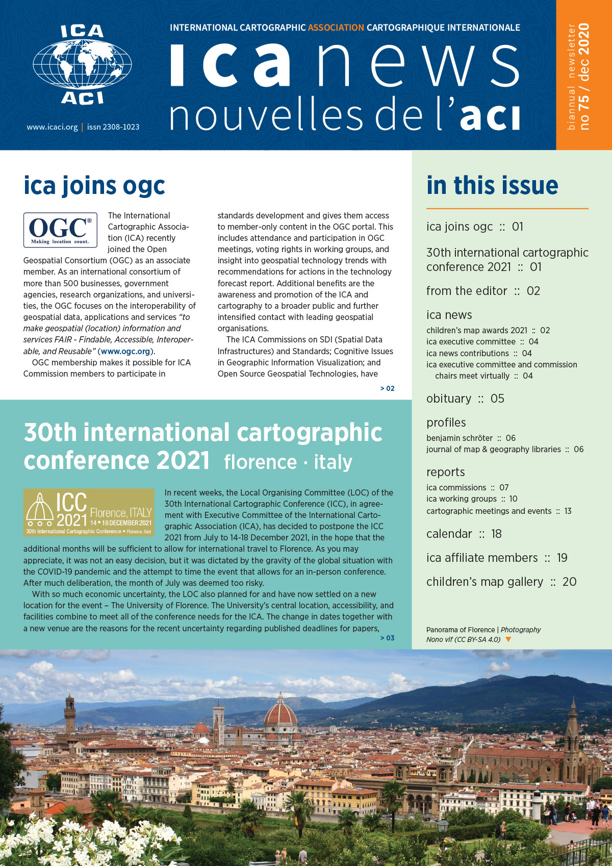
ICA News 75 now online

ICA News, Number 75, December 2020

We are pleased to announce that the 75th issue of the ICA News is now available for download:

This issue of ICA News brings you another update on ICC 2021, reports on the meeting of ICA Executive Committee with chairs of the ICA Commissions and Working Groups, and farewells Keith Smith, National Secretary of the Mapping Sciences Institute Australia. Thank you again for your continuous support and contributions.

– Igor Drecki, Editor ICA News

Category: General News
Tag:

Mapping for a Sustainable World

Dear colleagues,

It is with great pleasure we present you the book “Mapping for a Sustainable World”, a co-publication by the United Nations and the International Cartographic Association. This co-insides with today’s International Day of Education (24 January 2021).

In 2015, the United Nations identified 17 Sustainable Development Goals (henceforth SDGs) in an effort to address, collectively, the most pressing problems facing our world. The SDGs relate to broad social, economic, and environmental challenges, and provide a framework for shared action. Each of the seventeen SDGs has a set of targets and indicators to assist countries towards meeting the goal. To achieve the SDGs, governments and people need to understand each challenge and monitor progress towards alleviating it.

Inspired by this initiative and eager to contribute ICA started a map poster project in 2015. It cumulated in a map exhibition at the United Nations Headquarters in 2016. This book project, executed in together with the Geospatial Information Section of the United Nations, can be considered the follow-up of the map poster project.

Drawing from cartography, the book offers guidelines for mapping geographic datasets related to the SDGs by introducing basic principles of map design and use, discussing established best practices and conventions, and explaining how different mapping techniques support understanding of the SDGs.

The book comprises four sections. Section 1 introduces the SDGs and their relation to geospatial data, describing SDG indicators and data transformations for mapping. Section 2 describes foundational design decisions in the cartographic workflow, including projections, scale, generalization, symbolization, typography, and visual hierarchy, among others. Section 3 introduces the common map types (e.g., choropleths, proportional symbols, dasymetric maps, bivariate maps, cartograms) and diagrams (e.g., bar graphs, scatterplots, timelines) for representing the SDG indicators. Finally, Section 4 discusses considerations for map use environments, such as audiences, user interfaces and interaction operators, mobile and web media, storytelling versus exploration, and open access.

The book has an editorial team comprising writers from the International Cartographic Association (ICA) and the Geospatial Information Section of the United Nations (UN). The book is published as an open access document according to the CC-BY-NC license. When drawing from or reusing text or figures from this book, attribute/cite as follows Kraak MJ, RE Roth, B Ricker, A Kagawa, and G Le Sourd. 2020. Mapping for a Sustainable World. The United Nations: New York, NY (USA). The institutes of the editors (University of Twente / ITC, University of Wisconsin-Madison), and the UW Cartography Laboratory (design and layout), and the United Nations Geospatial Information Section have made the necessary resources available to realize the book.

The pdf-version of the book can be downloaded from the page accessible via the following link https://www.un-ilibrary.org/content/books/9789216040468. A direct DOI link will follow. A printed version is in preparation. At a later stage we plan to also release all data used to create the maps in the book.

Menno-Jan Kraak (ICA)
Robert E. Roth (ICA)
Britta Ricker (ICA)
Ayako Kagawa (UN)
Guillaume Le Sourd (UN)

Category: General News

eCARTO News January 2021

eCARTO News captures the latest cartographic news and developments from around the world. If you have any general cartography items of interest then please email them to David Fraser, editor of eCARTO News.

Featured Cartography

Cartography – Not the study of cartoons

Themed Cartography

Old maps – Eye Candy

  • Abbey Sanctuary and Environs of Holyrood – maps.nls.uk
  • Planisphaerivm Aratevm sive Compages Orbivm Mvndanorvm ex hypothesi Aratea in plano expressa. – loc.gov
  • Have you seen the first known map of Ireland from 140AD? – irishcentral.com
  • Every map ever published in the National Geographic magazine since the first issue in October 1888 – nationalgeographic.com
  • 20 Best Maps of 2020 – vividmaps.com

Cartographic Discussions

  • Something in the water: the mythology of Snow’s map of cholera – esri.com

Mapping Applications

  • New mangrove forest mapping tool puts conservation in reach of coastal communities – theconversation.com
  • Satellite mapping used to tackle social isolation ‘hotspots’ in UK cities – techrepublic.com
  • 72-ft autonomous Saildrone sets out on seafloor-mapping mission – newatlas.com

Modelling

Cartographic Industry News

Cartographic Animations & 3D Images

  • Into the eye of the storm: Nexrad Level II open data – mapbox.com
  • Introducing Unfolded Studio – The Platform for Geospatial Analytics – unfolded.ai
  • Citizen scientists create 3D map of brown dwarfs in our sun’s neighbourhood – space.com
  • Mapbox launches 3D Maps with 135 million sq km of global, high-resolution imagery from Maxar – finance.yahoo.com

Cartography Sources, Resources and Opportunities

Cartographic Exhibitions & Discussions

Cartography – A World View

Transport Cartography

Cartography Lite

eCARTO News December 2020

eCARTO News captures the latest cartographic news and developments from around the world. If you have any general cartography items of interest then please email them to David Fraser, editor of eCARTO News.

Cartography – A World View

Cartographic Crime

Cartographic Communication

Cartography – Interactive

Cartographic Algorithms

  • Machine Learning and Object Detection in Spatial Analysis – gislounge.com
  • Machine Learning and Object Detection for the rest of us – mapscaping.com

Mapping Applications

Sharing – real or virtual

Cartography Sources & Resources

Just Maps

History

  • The intriguing maps that reveal alternate histories – bbc.com
  • William Hacke: A Pirate’s Cartographer – blogs.loc.gov

Allied to Cartography

eCARTO News November 2020

eCARTO News captures the latest cartographic news and developments from around the world. If you have any general cartography items of interest then please email them to David Fraser, editor of eCARTO News.

Cartographic Relationships

  • “Understanding a map creates a new sort of relationship with the outdoors” – theguardian.com
  • Ireland’s mapping grid in harmony with GPS – irishtimes.com

Cartography as an Indicator

  • The maps that show life is slowly getting better – theguardian.com
  • The intriguing maps that reveal alternate histories – bbc.com
  • Indigenous cartographers work to decolonize mapping of traditional lands – miragenews.com
  • What Would It Look Like to Decolonize Cartography? A Volunteer Group Has Ideas – hyperallergic.com
  • More than 49,000 miles of paths lost from maps in England and Wales – theguardian.com
  • The first step to bridging the urban ‘canopy gap’? Counting and mapping trees. – grist.org
  • Everything you need to know about the US – in maps – aljazeera.com
  • Precision ag maps — what went wrong? – producer.com

Cartography Hubs

  • Center for Geospatial Solutions – lincolninst.edu
  • Alaska Geospatial Council helps state know ‘where it’s at’ – adn.com

Cartographic Forums

Mapping Applications

  • Mapping Landslide Hazards in Central America – nasa.gov
  • Mapping Michigan’s Most Climate-Resilient Landscapes – wxpr.org
  • Getting the long view: New map project identifies big game migrations across the West – magicvalley.com

Retrospective

Cartographic Industry News

  • Roads to Nowhere Cost Baidu $10 Million in Mapping Dispute – caixinglobal.com
  • Google Maps can now show real-time transit ‘crowdedness’ info, live food delivery status – 9to5google.com

Cartographic Relief

  • Imhof-ish cartography: now everywhere can look like Switzerland – esri.com
  • Cartographer Transforms Vintage Maps Into 3D Relief Maps Showing Elevation – mymodernmet.com
  • Contemporary Elevation Data and Historical Maps Merge in Scott Reinhard’s Digital Works – thisiscolossal.com
  • Volcano Watch: How has topography been modeled at Hawaii’s volcanoes? – hawaiitribune-herald.com
  • 3D Mapping and 3D Modelling Market – cheshire.media

Cartography Sources & Resources

  • Independent Map Sellers – docs.google.com
  • Analogue Meets Digital: History and Present IT Augmentation of Europe’s Largest Landscape Relief Model in Villach, Austria – mdpi.com
  • How Google Maps Gets Made – pittwire.pitt.edu

Cartographic Transition

Cartography – A World View

  • Seosat-Ingenio: Preparing to Fly an Earth-Observing Genius – scitechdaily.com
  • Which Countries are Mapping the Ocean Floor? – visualcapitalist.com
  • Global map of bees created in conservation first – bbc.com
  • NASA Uses Powerful Supercomputers and AI to Map Earth’s Trees, Discovers Billions of Trees in West African Drylands – scitechdaily.com
  • SpaceX launches advanced ocean-mapping satellite for NASA and Europe, nails rocket landing – space.com
  • Ocean mapping satellite to help UK scientists tackle climate change – miragenews.com

Citizen Cartography

  • Locate marker with your messages on a map or satellite image. – mapit.us
  • Community Maps Editor App Updated! – esri.com
  • Dawn of OSM Daylight in ArcGIS – esri.com

Cartographers

  • Norman Thrower – theguardian.com
  • Students’ success with data mapping to be honored at Geographic Information Systems Day – udel.edu
  • From concrete to jungle: cartoonist puts Mumbai’s wildlife on the map – theguardian.com

Thinking Creatively

  • Putting Manchester On The Map: Artist Plots Conversations And Moods Of City’s Residents – nhpr.org
  • Spotted: Amazon robot maps sidewalks north of Seattle, laden with cameras and sensors – geekwire.com
  • To own an AR future, Niantic wants to build a smarter map of the world – techcrunch.com
  • Drone Mapping In Real Estate: Here’s What Every Agent Should Know – lakeexpo.com

eCARTO News Oktober 2020

eCARTO News captures the latest cartographic news and developments from around the world. If you have any general cartography items of interest then please email them to David Fraser, editor of eCARTO News.

Storytelling

  • How a Secret Map Brought Down a Pirate Alliance on the Irish Coast – atlasobscura.com
  • Mapping Tools Open up New Possibilities in Property Storytelling – propmodo.com
  • The power behind the map in the 21st Century – arcgis.com
  •  Fifty Maps and the Stories they Tell – bodleianshop.co.uk
  • The maps that show life is slowly getting better – theguardian.com
  • Copperplate of Treasure Island map – twitter.com

Cartographers

Borders and Barriers

Cartographic Research & Development

  • The unlit light of the deepest dark – odt.co.nz
  • Satellites could soon map every tree on Earth – nature.com
  • Study maps global regrowth carbon capture potential – spatialsource.com.au
  • Deep Science: Alzheimer’s screening, forest-mapping drones, machine learning in space, more – techcrunch.com

In Case You Missed It

Cartographic Industry News

  • What3words embedded into Here mapping for even better destination navigation – pocket-lint.com
  • Aquatic Mapping Service Market to Witness Huge Growth By 2025 – prnewsleader.com
  • Esri Ireland partners with Bluesky to enhance its digital mapping offering in Ireland – directionsmag.com

Map Societies and Agencies

Cartography Books & Resources

Maps & Mapping Applications

  • A trawler’s chart – i.redd.it
  • National Library of Scotland – recent editions – maps.nls.uk
  • Norway funds satellite map of world’s tropical forests – bbc.com
  • Satellites put the world’s biggest methane emitters on the map – afr.com
  • Mapping ‘fossil water’ helps achieve sustainable groundwater management in California – miragenews.com

Cartography – 3D, Animated and Interactive

Cartography and Tourism

  • Sales of camping, hiking guides rise as Americans take to the outdoors – washingtonpost.com
  • Slow map: Mapping Britain’s intercity footpaths – bbc.com

Mapping and Measuring

Thinking Outside the Quadrilateral

rawboned-refined