This page lists commissions of former periods. For the current commissions, please go here.
2019–2023
Commission on Art and Cartography
- Advance the field of artistic and experimental cartographies, including but not limited to such subfields as narrative cartography, cinematic cartography, sensory and phenomenological approaches to mapping, locative media, performative and performance-based cartographies, and media archaeological and other research-creation or practice-led processes.
- Facilitate, through workshops and special events, interdisciplinary collaborations and exchanges of ideas and practices amongst diverse practitioners and theorists to promote the development of hybrid cartographic practices, from arts and digital humanities to social and geo-sciences.
- Produce new forms of knowledge on mapping, space and place theory, location and spatial studies, as well as new cartographic expressions.
- Promote creative research and scholarly publication on art and cartography in all of its aspects, to both an academic audience (special issues of journals and edited collections) and to the general public (websites, screenings, exhibitions).
- Explore alternative avenues of publication as research-creation documentations and experimentations.
- Hold bi-annual meetings, in conjunction with the International Cartographic Conference.
- Abide by the ICA directory, which includes outreach to developing countries when requested and possible, coordination with other ICA commissions or other international organizations when possible and advantageous, and to support equity-seeking groups to take active roles in professional activities.
Website of the commission on Art and Cartography
Department of Cinema and Media Arts
York University
4700 Keele Street
Toronto, Ontario
Canada
e-mail: taien@yorku.ca
School of Design, Swinburne University of Technology
Hawthorn, Victoria
Australia
e-mail: jgardener@swin.edu.au
Department of Cinema and Media Arts
York University
Toronto, Ontario
Canada
e-mail: hayashi@yorku.ca
Executive Committee liaison: Menno-Jan Kraak
Commission on Atlases
- Promote and support the design, production and use of all kind of printed and digital atlases (e.g. national, regional, city, educational, topographic and thematic atlases).
- Renew the concept of atlas: Analyse the structure of existing products systematically; revise atlas taxonomy.
- Conduct workshops to discuss and solve relevant issues and new approaches in atlas cartography.
- Generate publications that represent historic, recent and potential atlas issues.
- Develop easy-to-use frameworks to create atlases and to find atlas source data.
- Elaborate and maintain an electronic inventory of national atlases containing the main characteristics of these map works as well as relevant links.
- Maintain a commission website aiming to provide for information exchange between CoA members and disseminating information on CoA activities to a wider public.
Website of the commission on Atlases
 Chair: René Sieber
Institute of Cartography and Geoinformation, ETH Zurich
Stefano-Franscini-Platz 5
8093 Zurich
Switzerland
e-mail: sieberr@ethz.ch
Institute of Geographic Science and Natural Resources Research
Chinese Academy of Sciences
A11, Datun road, Chaoyang District
100101 Beijing
China
e-mail: qiqw@igsnrr.ac.cn
 Vice-chair: Eric Losang
Leibniz Institute for Regional Geography (IfL)
Schongauer Str. 9
04329 Leipzig
Germany
e-mail: E_Losang@ifl-leipzig.de
Executive Committee liaison: Vít Voženílek
Commission on Cartographic Heritage into the Digital
- Promote research and development on the field of cartographic heritage, more specifically on:
- objects – old maps, charts, globes, relief models, bird’s eye views, etc.
- digitisation – 2d, 3d; hardware, software, issues, solutions
- georeferencing – georeferencing methods, tools, recognising map projections
- archiving – how to store; metadata
- extracting content – possibility of automatic content extraction (vectorisation)
- providing cartographic heritage on-line
- analysing old maps in the terms of…
- geometry: accuracy analysis, projection recognition
- map symbols: how symbols depend on age, place, author etc.
- content: spatial/spatio-temporal analysis of map content
- Partnership with MAGIC (Map and Geoinformation Curators Group)
- Promote intra- and interdisciplinary co-operation
- annual conferences on Cartographic Heritage
- thematic workshops, joint projects and workshops with other commissions, societies
- connecting existing on-line collections, creating meta-search pages
- interdisciplinary research – cartography and various fields of geo- and biosciences (e.g. landuse/landscape/habitat change analysis based on old maps) and especially digital humanities (history, archaeology, linguistics, literature),
- Popularisation – tools, websites, campaigns to popularise cartographic heritage
- Tutorials – examples of good practice of all above
- Documentation of commission work
- abstract database of all cartoheritage conference/journal papers
Website of the commission on Cartographic Heritage into the Digital
 Chair: Mátyás Gede
Department of Cartography and Geoionformatics ELTE Eötvös Loránd University
Budapest
Hungary
e-mail: saman@map.elte.hu
 Vice-Chair: Angeliki Tsorlini
School of Rural and Surveying Engineering Aristotle University of Thessaloniki
Greece
e-mail: atsorlin@auth.gr
Executive Committee liaison: Andrés Arístegui
Commission on Cartography and Children
- Disseminating the outcomes of research into map use by children and young people. Deliverable: an enhanced set of online bibliography and web links on cartography and children including the popularization in social networks of activities developed by the commission developing stronger links between the ICA and relevant international and regional organizations related to Cartography and Children. Deliverable: following the contacts with the Commission for Geography Education of the International Geographical Union and other international/regional organizations.
- Stimulating a debate on the different aspects of cartography for children in interest of collecting and publishing (in digital or/and printed format) the research results. Deliverable: organizing and representing the commission in events and publications related to this theme.
- Following the promotion of the use of web-based cartographic solutions for the geovisualization of data in School Cartography, including the use of GIS software in schools. Deliverable: organizing and representing the commission in events and publications related to this theme.
- Providing support to the ICA Executive in relation to the rules, judging and other tasks related to the Barbara Petchenik Children's World Map Competition, including the popularization of the Barbara Petchenik Competition in social networks. Deliverable: appropriate support as required.
Website of the commission on Cartography and Children
 Chair: Carla Cristina Reinaldo Gimenes de Sena
Universidade Estadual Paulista “Júlio de Mesquita Filho” (UNESP)
Campus de Ourinhos
Avenue Vitalina Marcusso, 1500. Ourinhos – SP
Brazil
phone: +55 14 3302-5712
e-mail: cacrisusp@gmail.com
 Vice-chair: José Jesús Reyes Nuñez
Department of Cartography and Geoinformatics
Eötvös Loránd University
Pázmány Péter sétány 1/A
H-1117 Budapest
Hungary
phone: +36 1 372 2975
fax: +36 1 372 2951
e-mail: jesusreyes@caesar.elte.hu
personal website
Executive Committee liaison: Temenoujka Bandrova
Commission on Cartography in Early Warning and Crisis Management
- Disseminate information on Cartography in EW and CM to the ICA member nations through publications, joint meetings, seminars and websites. For publications act according our publication policy.
- Continue the implementation of the ICA Third World Policy by providing experts for workshops in developing countries when requested.
- Coordinate our activities with other ICA Commissions, whenever possible.
- Coordinate activities with Commissions of other international organizations if this is in the interest of the aims and objectives of ICA.
- Encourage and support under-represented groups to take an active role in professional activities and/or associations at national and international level.
- Initiate development of concepts, models and standard for geographic information services and mapping in early warning, damage assessment, monitoring and resilience.
- Promote the development of disaster risk reduction plans for pre-, during and post-disaster situations and enhance support for early warning systems, emergency events mitigation and decision making.
- Integrate fundamental geographic information with thematic data for disaster detection, early warning, monitoring, damage assessment and response.
- Produce Geo-information product pattern of vulnerability and hazard zone maps for different type of disasters.
- Conduct geospatial big data analysis, social computing, social awareness computation approaches and technologies for disaster risk reduction.
Website of the commission on Cartography in Early Warning and Crisis Management
 Chair: Liu Jiping
Vice President of Chinese Academy of Surveying and Mapping
28 Lianhuachi West Road
Haidian District
Beijing 100830
China
phone: +86 13801051915
e-mail: liujp@casm.ac.cn
 Vice-chair: Milan Konecny
Department of Geography
Masaryk University
Czech Republic
e-mail: konecnymilan3@gmail.com
 Vice-chair: Christophe Lienert
Managing Director Steering Committee «Intervention in Natural Hazards» LAINAT
Federal Department of the Environment, Transport, Energy and Communications DETEC
Federal Office for the Environment FOEN
CH-3003 Berne
Switzerland
e-mail: christophe.lienert@bafu.admin.ch
 Vice-chair: Shen Jie
Director of Department of Surveying and Mapping
School of Geography
Nanjing Normal University
1 Wenyuan Road
Nanjing 210023
China
phone: +86 13851609918
e-mail: shenjie@njnu.edu.cn
Executive Committee liaison: Philippe De Maeyer
Commission on Cognitive Issues in Geographic Information Visualization
- Promote the awareness of cognitive issues in cartography, developing human-centred cartographic theory and practice based on sound empirical findings on the use of cartographic displays for spatiotemporal inference and decision-making.
- Define short and medium term research goals that fall within the scope of commission-led research agenda that was published in late 2017, and that address key issues associated with building a sound theoretical base to support the construction and use of cognitively adequate and perceptually salient visual displays of geographic information.
- Explore opportunities to engage with standards organisations (e.g., Open Geospatial Commission) to use knowledge from our Commission to positively influence and contribute to standards related to maps and decision making.
- Encourage interdisciplinary and international collaboration with cognate disciplines and relevant stakeholders, including other ICA commissions and working groups.
- Actively seek to encourage more participation in the Commission from researchers in the African and Asia-Pacific regions, which are currently underrepresented among our membership. We will commit to trying to host at least one event in the African region during the term. We also seek, insofar as possible, to also open participation through electronic means, in workshops by using technologies such as Zoom to livecast and record events to improve access for those who cannot physically travel.
Website of the commission on Cognitive Issues in Geographic Information Visualization
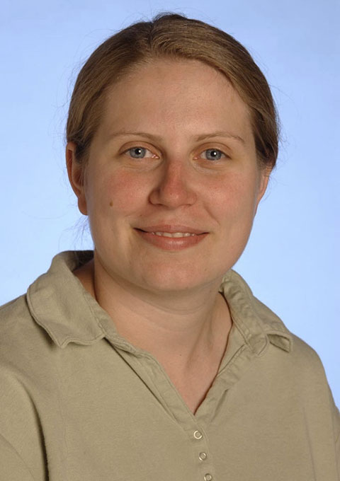 Chair: Amy Griffin
School of Science
Royal Melbourne Institute of Technology (RMIT) University
GPO Box 2476
Melbourne, Victoria 3001
Australia
phone: +61 3 9925 2338
e-mail: amy.griffin@rmit.edu.au
 Vice-Chair: Pyry Kettunen
Finnish Geospatial Research Institute
National Land Survey
Finland
e-mail: pyry.kettunen@nls.fi
 Vice-Chair: Petr Kubíček
Department of Geography
Masaryk University
Czechia
e-mail: kubicek@geogr.muni.cz
Executive Committee liaison: Liqiu Meng
Commission on Education and Training
- Organize and deliver workshops and sessions in ICCs (and online, eLearning alternatives), possibly in conjunction with other ICA Commissions, with committees on education of sister societies and other international bodies in UN-GGIM Geospatial Societies, to incorporate latest research findings into teaching and learning materials, introducing, in particular, knowledge transfer to developing member nations of ICA, and further to promote CET as an academic research community of cartographic and geospatial teaching.
- Organize training and capacity building seminars and summer schools, particularly engaging early career faculty members, with an emphasis on learning from those ICA member nations which have been successful in expanding cartographic and geospatial education into various application scenarios and motivate international collaboration among higher learning institutions.
- Compile an inventory of open courses (notably those delivered online, commercially presented, or professional development courses) in topics of cartography, geographic information science & technology and applications, which can further confirm the scope of cartographic and geospatial education in a multi-disciplinary context.
- Maintain a website for commission’s news update, a membership database and teaching materials of cartographic and geospatial education, including bibliography, free geospatial datasets, software tools and case studies, which can be used or adapted by cartographic, geospatial and geographic educators at different levels.
- Support the ICA efforts of developing a Body of Knowledge (BoK) for cartography, which could be used for developing contemporary educational programmes and encouraging the creation of specific cartographic modules with valid and viable learning outcomes.
- Organize a special issue of a specific academic journal or edited book to publish best practices and findings of cartographic and geospatial education research.
Website of the commission on Education and Training
 Chair: Tao Wang
College of Geospatial Information Science and Technology
Capital Normal University
West 3rd Ring, North Road 105
Beijing, 100048
China
phone: +86-10-68903472
e-mail: wangt@cnu.edu.cn
 Vice-Chair: Stefan Peters
University of South Australia
School of Natural and Built Environment
Room P2.29
phone: +61 8 830-25245
e-mail: stefan.peters@unisa.edu.au
Executive Committee liaison: Terje Midtbø
Commission on Generalisation and Multiple Representation
- Foster a community for geospatial analysis, modeling, and data analytics research, with strong links to the use of maps and visualization techniques
- develop a medium-term research agenda for the commission, which will serve as the guiding basis for commission events
- organize academic events for community members to share ideas and research findings
- Develop and maintain connections and joint efforts with other ICA commissions as well as other related GIScience and geographic academic organizations
- organize special sessions and workshops at ICC as well as other GIScience or geography conferences, in accordance with the research agenda
- collaborate with commissions within ICA or other academic associations to organize joint workshops on topics of shared interest
- Encourage concerted efforts on new research topics related to the research agenda themes;
- Publish research findings in the community through various outlets including special issues of academic journals and books.
Website of the commission on Generalisation and Multiple Representation
 Chair: Guillaume Touya
LaSTIG, COGIT team, IGN France
73 avenue de Paris
94165, Saint-Mandé
France
phone: +33 1 43 98 62 37
e-mail: firstname.lastname@ign.fr
personal website
 Vice-chair: Pia Bereuter
Institute of Geomatics Engineering
FHNW University of Applied Sciences of Northwestern Switzerland
Gründenstrasse 40, CH-4132 Muttenz
Switzerland
phone: +41 61 228 55 57
e-mail: firstname.lastname@fhnw.ch
personal website
Executive Committee liaison: Andrés Arístegui
Commission on Geospatial Analysis and Modeling
- Foster a community for geospatial analysis, modeling, and data analytics research, with strong links to geovisualization and location-based big data
- develop a medium-term research agenda for the commission, which will serve as the guiding basis for commission events
- organize academic events for community members to share ideas and research findings.
- Develop and maintain connections and joint efforts with other ICA commissions as well as other related GIScience and geographic academic organizations
- organize special sessions and workshops at ICC as well as other GIScience or geography conferences, in accordance with the research agenda
- collaborate with commissions within ICA or other academic associations to organize joint workshops on topics of shared interest
- Encourage concerted efforts on new research topics related to the research agenda themes;
- Publish research findings in the community through various outlets including special issues of academic journals and books.
Website of the commission on Geospatial Analysis and Modeling
 Chair: Xiaobai Angela Yao
Department of Geography
University of Georgia
Athens, GA 30602, USA
phone: +1 706 583 0326
e-mail: xyao@uga.edu
personal website
 Vice-chair: Xintao Liu
Department of Land Surveying and Geo-Informatics
Faculty of Construction and Environment
Hong Kong Polytechnic University
Hong Kong SAR
e-mail: xintao.liu@polyu.edu.hk
personal website
Executive Committee liaison: László Zentai
Commission on Geospatial Semantics
- Developing and maintaining a membership list, and a commission website for information dissemination and exchange, and organizing scholarly events.
- Research the following areas:
- The interfaces between natural language processing, cartography, and geographical information systems (GIS)
- Ontology design through knowledge graphs and query-based analysis
- Spatial semantic data infrastructures
- Institutional aspects of semantics and ontology
- Creating, finding, and communicating meaning
- Linked open data and controlled vocabularies
- Reasoning and inference axioms
- Facilitate science and humanities community interactions to connect semantic and ontological research in academic, government, and professional areas. The influence of institutions and their cultures on ontology and semantics is a particular area of interest. One or two central projects are proposed to provide a focus for collaborative work; a workshop with resulting edited publications, such as articles, journal special issues, and book publications (e.g, in The International Journal of Cartography or Springer's GIScience series); and education or resource building technology to advance geospatial semantics and ontology practices. The Chair and co-chair plan to organize conference sessions at ICC 2020 and 2022 and host or collaborate with conference-connected workshops. An off-site workshop of geographical proximity for its members will be organized. The commission will offer support to conferences and workshops where it is invited to do so.
- Using the ICA Research Agenda as a broad framework, the commission will support approaches that address the complexity of growing online data repositories through ontological analysis and automated knowledge extraction of geographic information. Aspects of various ICA themes, such as generalization, visualization, society, history, and theory are areas that support strong collaboration with other commissions and working groups and groups outside the ICA. Among these are coordination with IGU Commission on Geographic Information Science, University Consortium for Geographic Information Science (UCGIS), or other institutions represented or contacted by Commission members.
- Organize conference sessions at ICC 2021 in the Florence ICC and subsequent ICC and GA meeting in 2023 and host a conference-connected workshop in 2020 and 2022. The commission will offer support to conferences and workshops where it is invited to do so.
- Create publications, such as articles, journal special issues, and book publications (e.g, in ICA's Publication Series).
Website of the commission on Geospatial Semantics
U.S. Geological Survey
1400 Independence Road
Rolla, MO 65401
USA
phone: +1 573 308 3897
e-mail: dvaranka@usgs.gov
ORCID: 0000-0003-2857-9600
Leibniz-Institut für Länderkunde (IfL)
Schongauerstraße 9
04328 Leipzig
Germany
e-mail: f_harvey@ifl-leipzig.de
Executive Committee liaison: Temenoujka Bandrova
Commission on the History of Cartography
- Promote research and scholarly publication on the history of cartography in all of its aspects but with special consideration to the 19th and 20th centuries and the impact of technological innovations.
- Examine the changing role of maps worldwide as cartographical (as opposed to historical) documents in history.
- Hold annual meetings, alternatingly as Workshops in conjunction with the International Cartographic Conference and as International Symposia.
- Promote the spirit of co-operation both within ICA (sister commissions and working groups) and beyond to related societies and institutions.
- Maintain a website to facilitate contact between researchers in the field and make source material and literature available to the community and the general public alike.
Website of the commission on the History of Cartography
 Chair: Imre Josef Demhardt
University of Texas at Arlington
Department of History
Box 19529
Arlington, TX 76019-0529
USA
phone: +1 817-272-0122
e-mail: demhardt@uta.edu
 Vice-chair: Mirela Altic
Centre of Urban and Local History
Institute of Social Sciences
Marulicev trg 19
10 000 Zagreb
Croatia
e-mail: mirela.altic@gmail.com
Executive Committee liaison: Philippe De Maeyer
Commission on Location Based Services
- Promote research on Location based Services (LBS) in all its interdisciplinary aspects.
- Maintain the commission website and update it regularly to allow commission members to exchange information, as well as to disseminate information on activities in this field to a wider public.
- Maintain the commission E-Mail list for the exchange of activities, knowledge, news, and information on LBS.
- Update the LBS Research Agenda to reflect the new challenges brought by the new technological development, scientific advancement and societal changes.
- Organise ICC sessions, workshops and international conferences on LBS for colleagues from various disciplines to meet, and share research findings, ideas, and plans on how LBS can and could be improved and on how it will influence both science and society.
- Publish reports, books and special issues on LBS with scientific journals.
- Encourage interdisciplinary and international collaboration with cognate disciplines and relevant stakeholders, including other ICA commissions and working groups, and other allied research communities (e.g., ISPRS, FIG, IAG), mainly through joint meetings, seminars, and publications.
Website of the commission on Location Based Services
 Chair: Haosheng Huang
Research Group CartoGIS
Department of Geography
Ghent University
Krijgslaan 281, S8
9000 Gent, Belgium
phone: +32 (0)9 264 47 86
e-mail: haosheng.huang@ugent.be
personal website
 Vice-chair: Jukka M. Krisp
Institute of Geography
Augsburg University
Alter Postweg 118
86159 Augsburg
Germany
e-mail: jukka.krisp@geo.uni-augsburg.de
personal website
Executive Committee liaison: Liqiu Meng
Commission on Map Design
- Build usable media products that help ICA better brand itself as an authority on spatial visualization in the GIS industry, including:
- A short series of ICA-branded web video workshops helping people working in geospatial sectors design effective maps (these would be software agnostic, using both open-source and proprietary software).
- Expand the MapCarte initiative even further, creating an accompanying podcast series (that’s right, a podcast!) interviewing professional cartographers about their own tips, tricks, and thoughts on effective, applied map design.
- Continue creating online workshops, providing talks, and writing blog pieces.
- Prepare a Special Issue of a cartography journal to explore contemporary map design (e.g., augmented reality maps, mapping location within VR, game mapping, etc.).
- Collaborate with colleagues in other ICA Commissions as appropriate.
- Help organize sessions at the ICA in 2021 and 2023.
- Maintain and enhance the website with new content and contributions.
Website of the commission on Map Design
Executive Committee liaison: Vít Voženílek
Commission on Map Production and Geoinformation Management
- Enhance the study on map production- and process management, geoinformation logistics and geo-business;
- Research on the impact of modern communication methods on map production, business models, change management and design thinking;
- Research the impact of Service Oriented Architectures and future technologies on Map-Production, Publishing and Archiving.
- Research the methods of Service-Oriented Mapping maturity evaluation and SOMAP management.
- Evaluating the impact of digitalisation with its characteristics of sharing, reuse and transparency on map production.
- Collect requirements and document procedures of collaborative map production.
- Considering the geospatial semantic web for map production.
- Encourage international collaboration on the study of map production and geoinformation management with particular emphasis on bridging research, government and commercial sectors.
- Participate and contribute to activities of other relevant ICA interest groups (e.g. relevant ICA Commissions, National Mapping Organisations, NGO´s, Enterprises, URISA).
- Publications in and support of the International Journal of Cartography.
Website of the commission on Map Production and Geoinformation Management
 Chair: Peter Schmitz
Department of Geography
University of South Africa
Florida Science Campus
Florida, Johannesburg
South Africa
e-mail: schimpmu@unisa.ac.za
 Vice-chair: Markus Jobst
Coordination INSPIRE
Austrian Federal Office for Metrology and Surveying
Information Management
Schiffamtsgasse 1–3
1020 Vienna
Austria
e-mail: markus@jobstmedia.at
Executive Committee liaison: Philippe De Maeyer
Commission on Map Projections
- Prepare an Operational Plan, to accomplish the objectives of the Terms of Reference approved by the General Assembly. Set achievable targets for the Commission for a four-year period. Enhance and maintain the Commission web site.
- Promote and foster research on map projections, coordinate systems, transformations and conversions, and disseminate the outcomes. Specifically, encourage research, development, and use of correct and possibly adaptable map projections for Web implementations and applications. Expected result: an enhanced set of online bibliographic tools and web links on map projections, coordinate systems, transformations and conversions
- Continue the study of terminology on map projections and preparation of the multilingual dictionary for this area of cartography. Expected result: the dictionary on map projections, coordinate systems, transformations and conversions.
- Develop semantic representation of Map Projection knowledge including the developed terminology and dictionary on map projections, coordinate systems, transformations and conversions and make available through the ICA Map Projections Commission website and the ICA Cartography Body of Knowledge (CartoBoK).
- Promote the proper use of map projections at all levels of education. Expected result: publications with recommended approaches to map projections for specific uses.
- Organize sessions, workshops, and meetings at least once a year to stimulate a debate on all aspects of map projections with the aim of collecting and publishing the research results.
- Provide consultative support in relation to map projections. This will be activated though the Commission Website and the map projection semantic links.
- Link all known map projection websites into the Commission site and provide a Commission assessment of the use and value of each site. Assemble links and guides for map projection selection including existing web tools such as map projection decision support systems. Provide single stop from which users can determine the appropriate map projection to use for a specific application.
- Develop new map projections that adapt to the changing mapping requirements of location-based services and web mapping.
Website of the commission on Map Projections
 Chair (2019-2022): Lynn Usery †
Research Geographer and Director
Center of Excellence for Geospatial Information Science
U.S. Geological Survey
website
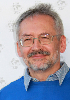
Vice-Chair: Miljenko Lapaine
University of Zagreb, Faculty of Geodesy
Croatian Cartographic Society, President
Kaciceva 26
10000 Zagreb
Croatia
e-mail: mlapaine@geof.hr
website
Executive Committee liaison: Temenoujka Bandrova
Commission on Maps and Graphics for Blind and Partially Sighted People
- Disseminate information about Cartography Accessible to Disabled People to the ICA member nations through publications, joint meetings, seminars and websites; Deliverable: Maintain the digital newsletter of the Commission at a frequency of at least twice a year; Representing the commission in events and publications related to this theme; Maintain, expand and improve the content on web site for news updates and share of information.
- Coordinate activities with Commissions of other international organizations in accordance with the interest of the aims and objectives of ICA. Deliverable: Developing stronger links between the ICA and relevant international and regional organizations related to Cartography Accessible to Disabled People.
- Coordinate activities with other ICA Commissions, for the purpose of sharing experiences, adding to, adapting and building up the potential of geo-cartographic knowledge in the various forms of multi-sensory expression.; Deliverable: To develop joint activities with the Commission on Cartography and Children.
- Continue the implementation of the ICA Third World Policy by providing experts for workshops in developing countries when requested about Cartography Accessible to Disabled People; Deliverable: To promote and deliver workshops (including eLearning alternatives), disseminating knowledge related to this theme.
- Encourage and support under-represented groups to take an active role in professional activities and/or associations at national and international level. Deliverable: Representing the commission in associations at national and international level related to this theme.
Website of the commission on Maps and Graphics for Blind and Partially Sighted People
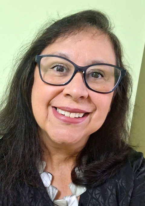 Chair: Waldirene Ribeiro
Universidade de São Paulo
FFLCH - Departamento de Geografia
Av. Prof. Lineu Prestes, 338
05508-000 Sao Paulo - SP
Brazil
phone/fax: +11 3091 3737
e-mail: walcarmo@usp.br
 Vice-Chair: Alejandra Coll Escanilla
Tactile Cartography Center of the UTEM
Dieciocho 414
Santiago Centro
Chile
phone: +56-2-7877362
e-mail: acollescanilla@gmail.com
Executive Committee liaison: Andrés Arístegui
Commission on Maps and the Internet
- Detect and integrate new trends related to the interconnection of cartography and the Internet such 3D cartography, semantic issues in cartography and spatial data, participatory mapping and co-creation approach in cartography, new education methods related to the Internet, Big data, Linked Open Data or Internet of Things.
- Define short and medium term research goals that address significant challenges associated with maps and the Internet – for example, new Internet mapping technologies, multinational and multicultural perspectives of Internet maps or Service-Oriented Mapping.
- Support education activities related to maps on the Internet.
- Publish the documents relevant for the commission domain with scientific journals (Open Access journals are preferred) and appropriate Internet channels, including the official website of the commission and social media.
- Organise (or co-organise) ICC sessions, workshops, hackathons, mapathons and international conferences to meet, interact and exchange knowledge, experience and ideas (in several cases, the events can be transformed into the virtual space to arrange a higher number of participants).
- Actively promote activities of the commission and ICA in general to eliminate the most critical problem of the Commission on Maps and the Internet, which consists of a low number of active people involved in its activities.
- Foster cooperation with other ICA commissions (for example Commission on Education and Training, Commission on Cartographic Heritage into the Digital, Commission on Location Based Services, Commission on Open Source Geospatial Technologies, Commission on Ubiquitous Mapping or Commission on Use, User and Usability Issues) to support „cross-commissions“ research and sharing information.
Website of the commission on Maps and the Internet
 Chair: Otakar Čerba
Department of Geomatics
Faculty of Applied Sciences
University of West Bohemia
Technická 8
301 00 Plzeň
Czech Republic
phone: +420 37763 9206
e-mail: ota.cerba@gmail.com
 Vice-Chair: Stefan Bonchev
Laboratory on Cartography
Department of Photogrammetry and Cartography
Faculty of Geodesy
University of Architecture
Civil Engineering and Geodesy
Sofia
Bulgaria
e-mail: bonchev_st@abv.bg
Executive Committee liaison: Temenoujka Bandrova
Commission on Marine Cartography
- Disseminate information on Marine Cartography as the ICA Expert Marine Cartography Focus Group to ICA members and to other affiliated organisations, covering research on cartography relating to the visualisation and management of ocean data.
- Promote the establishment of a global network for marine cartographers using media to facilitate the strengthening of the access of interested communities to marine cartographic knowledge.
- When practicable, foster and support local meetings for workshops on Marine Cartography and assist in engaging appropriate recognised experts.
- Liaise and coordinate with other relevant ICA Commissions and Working Groups.
- Liaise and coordinate with relevant groups from other organisations and associations (e.g. IHO, FIG, IGU…).
- Provide appropriate qualified members representing ICA membership on the FIG/IHO/ICA International Board on Standards of Competence for Hydrographic Surveyors and Nautical Cartographers (IBSC).
- Encourage and promote policies of equal opportunity wherever possible within the Marine Cartography profession.
Website of the commission on Marine Cartography
 Chair: Ron Furness
IIC Technologies Pty Ltd
PO Box 174
Belrose West NSW 2085
Australia
phone: +61 (0)405 576 196
e-mail: rfurness@ozemail.com.au
 Vice-Chair: Lysandros Tsoulos
National Technical University of Athens
Greece
e-mail: lysandro@central.ntua.gr
Executive Committee liaison: Andrés Arístegui
Commission on Mountain Cartography
- Define the topics of Mountain Cartography and promote the methods and knowledge of mountain cartography among scientists and professionals in cartography and related fields.
- Provide an updated, attractive web-portal with information about Commission activities, links to other events, theme-specific knowledge, related web-sites and bibliographic information.
- Discuss different issues about mountain cartography and map related representations in large scale topographic mapping, as similarity and differences in symbolization and map design, technological issues, maps use, connections to Location-based Services (LBS).
- Continue the well-established workshop series.
- Promote publication activities (proceedings, web-proceedings, journal articles and special issues) and common research/activities.
Website of the commission on Moutain Cartography
 Chair: Dušan Petrovič
University of Ljubljana, Faculty of Civil and Geodetic Engineering
Chair of Cartography, Photogrammetry and Remote Sensing
Jamova c. 2
1000 Ljubljana
Slovenia
phone: +386 1 476 85 43
fax: +386 1 476 85 45
e-mail: dusan.petrovic@fgg.uni-lj.si
Executive Committee liaison: Terje Midtbø
Commission on Open Source Geospatial Technologies
- Maintain the website for the exchange of knowledge, news and information on open source geospatial technologies.
- Maintain the e-mail list.
- Keep an active role in GeoforAll initiative and in relation with OSGeo, OpenStreetMap Foundation and other open source/open data organizations.
- Organize sessions on Open Source GIS at future ICA conferences.
- Participate in / contribute to other workshops / seminars organized by representatives of other disciplines or by other ICA Commissions / Working Groups.
Website of the commission on Open Source Geospatial Technologies
 Chair: Silvana Philippi Camboim
Department of Geomatics
Federal University of Paraná – UFPR
Caixa Postal 19001 – CEP 81531-980
Curitiba PR
Brazil
phone: +55 41 3361-3636
e-mail: silvanacamboim@gmail.com
Executive Committee liaison: Vít Voženílek
Commission on Planetary Cartography
- Promotion of a digital spatial data infrastructure to grant access to (already published) digital planetary maps and make them usable. For this purpose existing catalogues and databanks (like the USGS planetary map catalogue, the International catalogue of international planetary maps 1600-2018, and others) and, as much as possible, the experience of Earth-based developments shall be used.
- Update, development and provision of resources (tutorials/documentations, cartographic symbols, data models) for the creation of digital maps in the planetary sciences (with a focus on geological and geomorphological maps).
- Concept and implementation of a global web-based vector map of Mars and Moon that shall facilitate the exchange and visualisation of planetary contents of laymen and professionals alike.
- Focus on the collaboration with other ICA commissions and other associations (e.g. ISPRS) to promote the exchange of content and of experiences. Continuation of the ICA Commission Website.
Website of the commission on Planetary Cartography
 Chair: Andrea Naß
Deutsches Zentrum für Luft- und Raumfahrt e. V. (DLR)
Rutherfordstraße 2
12489 Berlin
Germany
e-mail: Andrea.Nass@dlr.de
Astrogeology Science Center
United States Geological Survey USGS
2255 N. Gemini Drive, AZ 86001 Flagstaff
USA
e-mail: THare@usgs.gov
Executive Committee liaison: László Zentai
Commission on SDI and Standards
- In collaboration with other ICA Commissions, explore research on the impact and use in SDIs oi cartography, standards, spatial semantics, ontologies, volunteered geographic information (VGI), data quality and other technological developments that might become relevant in future, and identify the associated education needs.
- In collaboration with other ICA Commissions, participate at the scientific level with other organizations active in SDI, standards and quality of geospatial data and services.
- Develop reports, conference presentations and/or journal articles on our work and help to arrange workshops, conferences or other meetings on SDI and standards, and present tutorials at them.
- Organize reporting sessions on the Commission's activities at the 2021 and 2023 International Cartographic Conferences.
- Organize and hold full Commission meetings in 2020, 2021, 2022 and 2023, and mini-meetings of the Commission at suitable meetings and conferences.
- Continue to serve as the liaison for the ICA to ISO/TC211, Geographic Information/Geomatics, to the Open Geospatial Consortium, and establish liaisons with other: SDI and standards organizations.
Website of the commission on SDI and Standards
 Chair: Serena Coetzee
Department of Geography, Geoinformatics and Meteorology
University of Pretoria
Private Bag X20
Hatfield 0028, South Africa
phone: +27 12 420 3823
e-mail: serena.coetzee@up.ac.za
 Vice-chair: Franz-Josef Behr
Laboratory for Open Geospatial Software, Data and Standards
Stuttgart University of Applied Sciences
Schellingstraße 24
70174 Stuttgart
Germany
phone: +49 711 8926 2606
e-mail: franz-josef.behr@hft-stuttgart.de
personal website
Executive Committee liaison: Vít Voženílek
Commission on Sensor-driven Mapping
- Promote the original and practical research in use of image and range data acquired by various sensors for mapping with a focus on spatial big data handling, cartographic information extraction, 3D reconstruction of built environments, and integration of indoor mapping with BIM.
- Network cartographers with the researchers and practitioners in the photogrammetry and remote sensing community, computer science community involved in sensor-driven mapping.
- Develop closer links with ISRPS, IAG, FIG, IEEE-societies, and other ICA commissions with similar interests in sensor-driven mapping to organize ICA workshops or joint symposia during 2019-2023.
- Publish special issues with the International Journal of Cartography and other related journals as well as books and reports.
- Promote knowledge transfer at fundamental and advanced levels on sensor-driven mapping technology to natural and built environments, early warning and natural disaster mitigation.
- Prepare promotional materials reflecting the commission’s terms of reference and activities that can be used to support ICA’s presence at international forums (e.g., World Map, Map Middle East, meetings of the Joint Board of Geospatial Information Societies (JB GIS), UN meetings, and other regional conferences).
Website of the commission on Sensor-driven Mapping
 Chair: Jonathan Li
Department of Geography & Environmental Management
University of Waterloo
200 University Avenue West.
Waterloo, Ontario N2L 3G1
Canada
phone: +1-519-888-4507-34504
e-mail: junli@uwaterloo.ca
personal website
 Vice-chair: Yifang Ban
Royal Institute of Technology
Department of Urban Planning & Environment
SE - 100 44 Stockholm
Sweden
phone: +46 8 790 8648
e-mail: yifang@kth.se
personal website
 Vice-chair: Jan Feranec
Institute of Geography
Slovakia Academy of Sciences
Stafanikova 49, 814 73 Bratislava
Slovak Republic
phone: +421 2 57510219
e-mail: feranec@savba.sk
personal website
 Vice-chair: Ruisheng Wang
Department of Geomatics Engineering
University of Calgary
2500 University Drive NW
Calgary, Alberta T2N 1N4
Canada
phone: +1-403-210-9509
e-mail: ruiswang@ucalgary.ca
personal website
Executive Committee liaison: Liqiu Meng
Commission on Topographic Mapping
- Establish and develop a research agenda for topographic mapping in association with partners in academia and in industry (national mapping organizations and commercial producers of topographic maps).
- Work in partnership with other ICA Commissions to organise and participate in joint events with the aim of advancing and disseminating knowledge regarding topographic mapping past, present and future.
- Create, develop and maintain the Commission website to incorporate news items relating to topographic mapping.
- Enable and facilitate research generation and staff exchange between producers of topographic mapping.
- Develop an online portal to allow easy access to information about producers of topographic mapping worldwide.
- Organise sessions at the 2021 and 2023 ICCs that focus on presenting the latest research with regard to topographic mapping and pursue its publication and wider dissemination.
Website of the commission on Topographic Mapping
 Chair: Alexander Kent
School of Human and Life Sciences
Canterbury Christ Church University
Canterbury
Kent
United Kingdom
phone: +44 1227 922324
e-mail: topochair@icaci.org
 Vice-chair: Łukasz Halik
Department of Cartography and Geomatics
Faculty of Geographical and Geological Sciences
Adam Mickiewicz University in Poznań
Krygowskiego 10
61-680 Poznań
Poland
phone: +48 61 829 62 46
e-mail: topovicechair@icaci.org
Executive Committee liaison: László Zentai
Commission on Toponymy (ICA-IGU joint commission)
- Act jointly with IGU fostering the geographic and cartographic research on all fields involving toponymy;
- Disseminate the scientific knowledge on processing and use of toponyms within geography and cartography;
- Verify the use of other sciences' toponymy concepts, such as anthropology, linguistics and others, in favour of cartography and geography;
- Maintain contacts and scientific exchange with UNGEGN and ICOS, such as by organizing joint events;
- Support and encourage the elaboration and publication of gazetteers, toponymic data files and toponymic reference systems (such as EuroGeoNames);
- Organize regional joint IGU/ICA events (workshops, symposia and others) with IGU and ICA members;
- Participate in IGU and ICA Regional, Thematic and Main Conferences;
- Organize and maintain a website to facilitate contact between researchers in the field of toponymy and disseminate source material and literature available to the community and the general public alike;
- Organize and publish books, chapters and encourage paper publishing in specialized journals and the International Journal of Cartography.
- Establish a consortium of universities organizing training courses on toponymy.
- Publish a study book on Critical Toponomastics.
- Promote the representation of under-represented groups on the research agenda (e.g. female commemorative naming, indigenous names).
Website of the commission on Toponymy
 Co-Chair: Peter Jordan
Institute of Urban and Regional Research
Austrian Academy of Sciences
Postgasse 7/4/2
1010 Vienna
Austria
phone: +43 1 51 581 3539
fax: +43 1 51 581 3533
e-mail: peter.jordan@oeaw.ac.at
personal website
Executive Committee liaison: Menno-Jan Kraak
Commission on Ubiquitous Mapping
- Organize international workshop or joint meeting on ubiquitous mapping with other ICA commissions at future ICA conferences and other regional conferences on Cartography and GIScience.
- Publish special issues on the trends and technologies of ubiquitous mapping in international journals of cartography and other related disciplines as well as books and reports.
- Evaluate the theory and application of ICT-based technologies for context-aware mapping: e.g., AI, Robotics, Autonomous Cars, and location-based games.
- Evaluate the theory and application of crowdsourced geospatial information and collaborative mapping: e.g., OpenSteetMap, crisis mapping.
- Examine the positive/negative effects of Ubiquitous Mapping on human society: e.g., spatial literacy, navigation skills, digital divide and privacy issues.
- Place the notion of Ubiquitous Mapping in domain of Theoretical Cartography.
Website of the commission on Ubiquitous Mapping
 Chair: Yoshiki Wakabayashi
Department of Geography
Tokyo Metropolitan University
Minami-osawa 1-1, Hachioji-shi
192-0397 Japan
phone: +81-42-677-2601
e-mail: wakaba@tmu.ac.jp
 Chair: Daniela Carrion
Department of Civil and Environmental Engineering
Politecnico di Milano
Piazza Leonardo da Vinci, 32
20133 Milano
Italy
e-mail: daniela.carrion@polimi.it
Executive Committee liaison: Philippe De Maeyer
Commission on User Experience
- Website: Maintain and expand the ICA Commission website on user experience (UX) issues: https://use.icaci.org/. Usability is identified as one of the 10 main research themes in the ICA agenda, and UX design encapsulates issues related to map use, maps users, and map usability. Map UX design herein is defined as the set of workflows, methods, and techniques needed for a successful user outcome with a map or interactive mapping system, as well as a productive and satisfying user process while arriving at this outcome.
- Bibliography: Maintain an online bibliographic database on user studies and UX design research in Cartography and related fields. The bibliography includes references on the following topics: map-based user interfaces (Ul) and user experience (UX) design; user-centered design and usability engineering, as applied to map design and development; studies of user abilities and differences therein; use case studies with print, web-based, and mobile maps; methods and techniques for evaluating products; the use of emerging mapping technologies.
- Student Services: Hold listening sessions to involve young (PhD) researchers and researchers from different cultural environments in all UX Commission activities in order to promote scientific research and support them in their activities.
- Educational Workshops: Organize training workshops for students and non-specialists on map-based user studies and UX design. The resulting educational materials will be made available on the commission's website.
- Scholarly Workshops: Jointly organize with other ICA Commissions pre-conference workshops in disciplines adjacent to Cartography (e.g., GIScience, Information Visualization, Human-Computer Interaction) aimed at research and design innovations.
- ICA Sessions: Organize special sessions on map-based user studies and UX design at future ICA conferences as well as other regional cartography conferences. Original scientific contributions will be gathered and organized through the UX Commission website.
- UX Research Agenda: Jointly organize with other ICA Commissions research agenda papers and/or special issues on topics intersecting with user studies and UX design. Planned topics include mobile map UX and reproducibility in cartography, although topics will evolve through the workshop process.
- User Studies Handbook: Jointly organize with other ICA Commissions a workshop to produce a handbook on user methods for cartography. The handbook will support an audience of both students and practitioners, treating user methods for basic science and user-centered design. The handbook will discuss best practices for a range of UX methods, breaking down method alternatives by participants, materials, procedures, and analyses.
Website of the commission on User Experience
 Chair: Robert Roth
Department of Geography
University of Wisconsin‒Madison
550 N. Park Street
Office #375
Madison, WI 53706
USA
e-mail: reroth@wisc.edu
Executive Committee liaison: Terje Midtbø
Commission on Visual Analytics
- Promote and advance visual analytics in cartography, which is the science of analytical reasoning as supported by interactive visual interfaces to spatio-temporal data.
- Develop science, technology, and design approaches to address major challenges associated with geographic information analysis and synthesis that enable users to solve key societal and environmental problems.
- Foster interdisciplinary and international collaboration between potential users of geospatial visual analytics and researchers, as well as between allied research communities in other disciplines and other ICA Commissions. o The Commission will achieve this vision by:
- Actively disseminating technical and methodological advances in cartographic visual analytics through workshops, seminars, edited special issues of journals, and peer-reviewed publications - with linkages to other ICA Commissions and allied organizations in other fields.
- Conducting annual meetings, workshops, or tutorials to develop research in key thematic areas, partnering with international conferences and other ICA commissions to expand our reach beyond traditional venues and audiences and to diversify who engages with visual analytics in the ICA.
- Recruiting and retaining a co-chair and bolstering the core membership to help guide Commission activities and foster collaboration within and outside of the ICA.
- Maintaining a dedicated web presence and engaging with members via social media to highlight Commission activities and promote participation beyond attendance at in-person meetings through new forms of distance collaboration.
Website of the commission on Visual Analytics
 Co-Chair: Anthony C. Robinson
 Penn State University
318 Walker Building
University Park, PA, 16802
USA
phone: +1 814 865 3433
fax: +1 814 863 7943
e-mail: arobinson@psu.edu
personal website
 Co-Chair: Arzu Çöltekin
Institute of Interactive Technologies
University of Applied Sciences and Arts Northwestern Switzerland
Bahnhofstrasse 6
5210 Windisch
Switzerland
phone: +41 56 202 84 73
e-mail: arzu.coltekin@fhnw.ch
personal website
Executive Committee liaison: Liqiu Meng
2015–2019
Commission on Art and Cartography
- Explore the art element of cartography. Exploring the interaction at large between art and cartography involves rethinking the way we approach spatial expressions. This entails: developing an inclusive approach of artistic mapping expressions; facilitating and encouraging interaction between cartographers who work with the Art aspects of cartography and artists who produce cartographic artifacts; and developing conceptual elements about the relationships between art and cartography.
- Facilitate interdisciplinary cross-fertilisation of ideas and practices. Cartographers, artists, students, researchers from the humanities need to work collaboratively in order to revisit the relationships between arts and cartography. Real interdisciplinary activities call for special measures, such as developing a common language and a mutual understanding; promoting the development of hybrid cartographic practices; and supporting the diversification of activities that enable exchanges and interactions (e.g. workshops, festivals, performances).
- Produce knowledge and new forms of cartographic expression and disseminate them to both an academic audience (e.g. publication of special issues and edited collections) and to the general public (e.g. blog posts, screenings, exhibitions, public talks).
Website of the commission on Art and Cartography
 Chair: Sébastien Caquard
 Concordia University
Department of Geography, Planning and Environment
1455 de Maisonneuve W. (H 1255-26)
Montreal, Qc, H3G 1M8
Canada
phone: +1 514 848-2424-2052
e-mail: sebastien.caquard@concordia.ca
 Vice-chair: Julia Mia Stirnemann
University of the Arts, Bern
Department of Communication Design
Fellerstrasse 11
3027 Bern
Switzerland
phone: +41 797179722
e-mail: juliamia.stirnemann@hkb.bfh.ch
Executive Committee liaison: Sara Fabrikant
Commission on Atlases
- Promote and support the design, production and use of all kind of printed and digital atlases (e.g. national, regional, city, educational, topographic and thematic atlases).
- Update the concept of Atlas
- Conduct workshops to discuss and solve relevant issues and new approaches in atlas cartography.
- Generate publications that represent state‐of‐the‐art and potential atlas issues.
- Produce a cookbook for planning, design and production of digital atlases.
- Elaborate and maintain an electronic inventory of atlases containing the main characteristics of these map works as well as relevant links.
- Maintain a commission website aiming to provide for information exchange between CoA commission members and disseminating information on activities in this field to a wider public.
Website of the commission on Atlases
 Vice-chair: Eric Losang
Leibniz Institute for Regional Geography (IfL)
Schongauer Str. 9
04329 Leipzig
Germany
e-mail: E_Losang@ifl-leipzig.de
National Atlases Editioral Office Institute of Geographic Science and
Natural Resources Research, Chinese Academy of Sciences
A11, Datun road, Chaoyang District
100101 Beijing
China
e-mail: qiqw@igsnrr.ac.cn
Executive Committee liaison: Vít Voženílek
Commission on Cartographic Heritage into the Digital
- Elaboration and promotion of the issue of Cartographic Heritage Ecosystems and of cartodiversity legacy embedded into the Digital. [Cartodiversity: manuscript and printed maps -loose and/or bound-, books with maps, map atlases, globes and related cartographic representations in 2D and 3D, depicted in a variety of supporting material like e.g. parchment, paper, wood or other writable/engravable media.]
- Addressing methodologies, techniques and standards for proper 2- and 3-D digitization of cartodiversity in terms of image capturing, processing, visualization and transfer.
- Addressing georeferencing and applying analytical tools on the comparative research concerning the geometric and thematic content of cartodiversity. The issue and use of cartodiversity metadata.
- Cooperation and interaction with cartodiversity stakeholders in the context of GLAM (Galleries, Libraries, Archives, Museums).
- Evaluation and remodeling of web-based providers of cartographic heritage assets.
- Linking the Cartographic Heritage digital assets with Digital Humanities.
- Documentation of the reference work carried out by the ICA Commission on Digital Technologies in Cartographic Heritage in the period 2006–2015.
Website of the commission on Cartographic Heritage into the Digital
 Chair: Evangelos Livieratos
Faculty of Engineering
School of Rural and Surveying Engineering
Geodesy and Cartography
Aristotle University of Thessaloniki
541 24 Thessaloniki
Greece
e-mail: livier@auth.gr
personal website
 Vice-chair: Carme Montaner
 Map Library of Catalonia
Institut Cartogràfic de Catalunya
Parc de Montjuoc
08038 Barcelona
Spain
e-mail: carme.montaner@icgc.cat
 Vice-chair: Mátyás Gede
 Faculty of Informatics
Department of Cartography & Geoinformatics
Eötvös Loránd University
1518 Budapest Pf. 32
Hungary
e-mail: saman@map.elte.hu
personal website
Executive Committee liaison: Pilar Sánchez-Ortiz Rodríguez
Commission on Cartography and Children
- Disseminating the outcomes of research on map use by children and young people. Deliverable: an enhanced set of online bibliography and web links on cartography and children.
- Developing stronger links between the ICA and relevant international and regional organizations related to Cartography and Children. Deliverable: following the contacts with the Commission for Geography Education of the International Geographical Union and other international/regional organizations.
- Stimulating a debate on the different aspects of cartography for children in interest of collecting and publishing (in digital or/and printed format) the research results. Deliverable: representing the commission in events and publications related to this theme.
- Following the promotion of the use of web-based cartographic solutions for the geovisualization of data in School Cartography in cooperation with other ICA Commission such as the Education and Training and Open Source Geospatial Technologies, including the use of GIS software in schools. Deliverable: representing the commission in events and publications related to this theme.
- Providing support to the ICA Executive in relation to the rules, judging and other tasks related to the Barbara Petchenik Children's World Map Competition. Deliverable: appropriate support as required.
Website of the commission on Cartography and Children
 Chair: Carla Cristina Reinaldo Gimenes de Sena
Universidade Estadual Paulista “Júlio de Mesquita Filho” (UNESP)
Campus de Ourinhos
Avenue Vitalina Marcusso, 1500. Ourinhos – SP
Brazil
phone: +55 14 3302-5712
e-mail: cacrisusp@gmail.com
 Vice-chair: José Jesús Reyes Nuñez
Department of Cartography and Geoinformatics
Eötvös Loránd University
Pázmány Péter sétány 1/A
H-1117 Budapest
Hungary
phone: +36 1 372 2975
fax: +36 1 372 2951
e-mail: jesusreyes@caesar.elte.hu
personal website
Executive Committee liaison: Pilar Sánchez-Ortiz Rodríguez
Commission on Cartography in Early Warning and Crisis Management
- Contributing in the mapping aspects of the development of concepts, ontologization and standardization (developing new e.g. for automatic metadata extraction from existing data) for disaster risk reduction (DRR), crises/disaster management (DRM), and early warning (EW) through the hazard, risk and vulnerability mapping.
- Emphasize aspects of cartographic communication in the context of early warning and disaster management such as the use of remotely sensed and other geospatial data, including concepts of Volunteer Geographic Information (VGI) and Public participation Geographic Information Systems (PPGIS), psychological conditions of users, cartographic modelling of state-of-the-art visualization technologies, geospatial processing and publishing tools, dynamic and real-time cartographic visualization for enhanced operational early warning activities through active collaboration with governmental authorities.
- Participate and contribute to global initiatives in early warning and crisis management through the maintenance of a website, newsletters and social network channels and establish and cultivate professional networks for exchange of information among stakeholders in the domains of crisis management and early warning.
- Prepare concept of a contemporary book on Cartography for DRR.
- Develop cooperation with world leading initiatives and organizations in DRR efforts, such as UN-ISDE, ICSU-IRDR and regional organizations, further GEO, GEOS, COPERNICUS, ISDE, IEAS, CODATA and sister organizations in JB GIS.
- Keep world network of commission conferences and promote cooperation with above mentioned organizations and initiatives in international, regional and local levels.
Website of the commission on Cartography in Early Warning and Crisis Management
 Chair: Milan Konecný
Laboratory for Geoinformatics and Cartography
Department of Geography
Masaryk University
Kotlárská 2
611 37 Brno
Czech Republic
phone: +420 5 4949 5135
fax: +420 4949 1061
e-mail: konecny@geogr.muni.cz
personal website
 Vice-chair: Liu Jiping
Vice President of Chinese Academy of Surveying and Mapping
28 Lianhuachi West Road
Haidian District
Beijing 100830
China
phone: +86 13801051915
e-mail: liujp@casm.ac.cn
 Vice-chair: Christophe Lienert
Canton of Aargau
Dept. Construction, Traffic & Environment
Entfelderstrasse 22
CH-5001 Aarau
Switzerland
phone: +41 62 8353487
fax: +41 62 8353459
e-mail: christophe.lienert@ag.ch
Executive Committee liaison: Yaolin Liu
Commission on Cognitive Issues in Geographic Information Visualization
- Promote the awareness of cognitive issues in cartography, developing human-centered cartographic theory and practice based on sound empirical findings on the use of cartographic displays for spatiotemporal inference and decision-making.
- In conjunction with the Commission on Geovisualization, Commission on Use and User Issues, and Commission on Map Design, develop and publish a research agenda for that outlines major research challenges for interactive cartography that we should work towards addressing as a community.
- Define short and medium term research goals that fall within the scope of this research agenda and that address key issues associated with building a sound theoretical base to support the construction and use of cognitively adequate and perceptually salient visual displays of geographic information.
- Encourage interdisciplinary and international collaboration with cognate disciplines and relevant stakeholders, including other ICA commissions and working groups.
Website of the commission on Cognitive Issues in Geographic Information Visualization
 Chair: Amy Griffin
School of Science
Royal Melbourne Institute of Technology (RMIT) University
GPO Box 2476
Melbourne, Victoria 3001
Australia
phone: +61 3 9925 2338
e-mail: amy.griffin@rmit.edu.au
 Vice-Chair: Sidonie Christophe
COGIT Lab.
IGN-France
73 avenue de Paris
F-94160 Saint Mandé
France
e-mail: sidonie.christophe@ign.fr
Executive Committee liaison: Sara Fabrikant
Commission on Education and Training
- To promote and deliver workshops (and online, eLearning alternatives), possibly in conjunction with other ICA Commissions, introducing, in particular, knowledge transfer to developing member nations of ICA.
- To maintain a record of educational courses at all levels which include cartography, with an emphasis on learning from those ICA member nations which have been successful in expanding cartographic education in recent years.
- To record ad hoc courses (notably those delivered online, commercially presented, or professional development courses) and their creators/deliverers, to confirm the scope of cartographic education.
- To explore the possibilities of developing a Body of Knowledge (BoK) for cartography, which could be used for developing contemporary educational programmes and encouraging the creation of specific cartographic modules with valid and viable learning outcomes.
- To examine the role of accreditation of educational courses by professional bodies and to report on the formalisation of cartography qualifications.
- To work towards the overall aims of ICA: long term as indicated in the Statutes, shorter term such as International Map Year, and ongoing including contributing to the new International Journal of Cartography and to International Cartographic Conferences.
- To work with other ICA Commissions, with committees on education of sister societies within the JBGIS, and with other international bodies including UN-GGIM.
Website of the commission on Education and Training
 Chair: David Fairbairn
School of Civil Engineering and Geosciences
Cassie Building
Newcastle University
Newcastle upon Tyne NE1 7RU
England
phone: +44 (0)191 222 6353
fax: +44 (0)191 222 6502
e-mail: dave.fairbairn@newcastle.ac.uk
 Vice-chair: Stefan Peters
UTM – Universiti Teknologi Malaysia
Geospatial Information Infrastructure Research Group
Room C03-313-01
81310 Johor Bahru, Johor
Malaysia
phone: +60 7-55 30850
mobile: +60 18-7620190
e-mail: stefan.peters@directbox.com
Executive Committee liaison: László Zentai
Commission on Generalisation and Multiple Representation
- To foster research and practical experience in multi-scale issues and automated map generalisation and to form a network and focal point for researchers and practitioners in this domain.
- To foster and maintain a liaison with related commissions and working groups within the ICA as well as in related national and international organisations (e.g. ISPRS, IGU, EuroSDR), including:
- identification of contact persons
- timely mutual updating on planned activities
- organisation of joint conference sessions and/or workshops
- To maintain a World Wide Web site for electronic dissemination of research on multiscale issues and map generalisation, including:
- a membership database,
- a bibliographic database,
- examples of research projects and test data,
- links to related web sites,
- and (optionally) an electronic discussion list.
- To organise sessions and meetings for exploring the issues named above, including:
- workshops held every two years in conjunction with international cartographic conferences
- special sessions and/or panel sessions at international cartographic conferences, in collaboration with local organisers
- To produce publications for dissemination of the above efforts, including one special issue of a peer-reviewed scientific journal or a book every two years.
Website of the commission on Generalisation and Multiple Representation
 Chair: Guillaume Touya
LaSTIG, COGIT team, IGN France
73 avenue de Paris
94165, Saint-Mandé
France
phone: +33 1 43 98 62 37
e-mail: firstname.lastname(at)ign.fr
personal website
 Vice-chair: Paulo Raposo
Department of Geography
The University of Tennessee, Knoxville
1000 Philip Fulmer Way
Knoxville, Tennessee, 37996
USA
e-mail: praposo@utk.edu
personal website
 Vice-chair: Pia Bereuter
Institute of Geomatics Engineering
FHNW University of Applied Sciences of Northwestern Switzerland
Gründenstrasse 40, CH-4132 Muttenz
Switzerland
phone: +41 61 228 55 57
e-mail: pia.bereuter@fhnw.ch
personal website
Executive Committee liaison: Monika Sester
Commission on Geospatial Analysis and Modeling
- foster a research community on spatial analysis, modeling, and data mining, with strong links to geovisualization and visual analytics;
- develop and maintain a membership database and a mailing list for dissemination of information
- develop and maintain a commission website for news updates and share of information
- organize academic events for community members to share ideas and research findings
- develop and maintain connections and joint efforts with other ICA commissions as well as other related GIScience and geographic academic organizations
- organize special sessions and workshops at ICC as well as other GIScience or geography conferences,
- collaborate with commissions within ICA or other academic associations to organize joint workshops on topics of shared interest
- encourage consorted efforts on new research topics related to the analysis and modeling of emerging location-based social media data and other big data;
- edit and publish research findings through various academic publication outlets, such as special issues on journals, particularly the new International Journal of Cartography.
Website of the commission on Geospatial Analysis and Modeling
 Chair: Xiaobai Angela Yao
Department of Geography
University of Georgia
Athens, GA 30602
United States of America
phone: +1 706 583 0326
fax (office): +1 706 583 0326
fax (department): +1 706 542 2388
e-mail: xyao@uga.edu
personal website
 Vice-chair: Bin Jiang
Division of Geomatics
Dept. of Technology and Built Environment
University of Gävle
SE-801 76 Gävle
Sweden
phone: +46 26 648901
fax: +46 26 648828
e-mail: bin.jiang@hig.se
personal website
Executive Committee liaison: Yaolin Liu
Commission on GI for Sustainability
- To produce a methodological structure for GIS and cartographic basis of sustainable development.
- To organize events (including presentations of projects, holding InterCarto/InterGIS conferences etc.) and hold conferences in particular that will bring together different experts interested in the sustainable development.
- To organize regional workshops and summer-schools on GIS and cartography for developing projects in Sustainable Development.
- To provide the connections and performance of teamwork, holding conferences, schools with the adjacent organizations - the IGU Commission on Geographical Information Sciences, CODATA (ICSU Committee on Data for Science and Technology), Digital Earth, UNIGIS, ENVIROINFO etc.
- To document and publish best practice results, proceedings of conferences, textbooks on geoinformatics, and contributions to sustainable development. To publish a new magazine Cartography under umbrella of GI&SD ICA commission.
- To encourage and support the involvement of student of cartography in the commission activities.
Website of the commission on GI for Sustainability
 Chair: Vladimir Tikunov
Laboratory of Integrated Mapping and Laboratory of Sustainable Development of Territories
Faculty of Geography
M. V. Lomonosov Moscow State University
Vorobievy Gory, MSU, main building
119991 Moscow
Russia
phone: +7 495 939 13 39
fax: +7 495 932 88 36
e-mail: tikunov@geogr.msu.su
 Vice-chair: Horst Kremers
P.O. Box 20 05 48
13515 Berlin
Germany
phone: +49 172 3211738
e-mail: office@Horst-Kremers.de
personal website
Executive Committee liaison: Menno-Jan Kraak
Commission on the History of Cartography
- Promote research and scholarly publication on the history of cartography in all of its aspects but with special consideration to the 19th and 20th centuries and the impact of technological innovations.
- Examine the changing role of maps worldwide as cartographical (as opposed to historical) documents in history.
- Investigate and develop Monumenta Cartographica Moderna as a framework for a book series and database to analyse major achievements of regional cartography in 19th and 20th centuries
- Hold annual meetings, alternatingly as Workshops in conjunction with the International Cartographic Conference and as International Symposia.
- Promote the spirit of co-operation both within ICA (sister commissions and working groups) and beyond to related societies and institutions.
- Maintain a website to facilitate contact between researchers in the field and make source material and literature available to the community and the general public alike.
Website of the commission on the History of Cartography
 Chair: Imre Josef Demhardt
University of Texas at Arlington
Department of History
Box 19529
Arlington, TX 76019-0529
USA
phone: +1 817-272-0122
e-mail: demhardt@uta.edu
 Vice-chair: Mirela Altic
University of Zagreb
Institute of Social Sciences, Department of History
Marulicev trg 19
10 000 Zagreb
Croatia
e-mail: mirela.altic@gmail.com
Executive Committee liaison: Lynn Usery
Commission on Location Based Services
- Promote research on Location-based Services (LBS) in all its interdisciplinary aspects.
- Define short and medium term research goals that address major challenges associated with LBS, such as positioning, modelling, communicating context-based geoinformation preferably through maps, privacy and social issues, with the aim to facilitate users’ daily activities and decision-making in space.
- Organise ICC sessions, workshops and international conferences on LBS for colleagues from various disciplines to meet, interact and exchange knowledge, experience, plans and ideas on how LBS can and could be improved and on how it will influence both science and society.
- Publish LBS-related reports, books and special issues with scientific journals.
- Maintain a commission website and update it regularly to allow commission members to exchange information, as well as to disseminate information on activities in this field to a wider public.
- Foster interdisciplinary and international collaboration with cognate disciplines and relevant stakeholders, including other ICA commissions and working groups, and other allied research communities (e.g., ISPRS, FIG, IAG).
Website of the commission on Location Based Services
 Chair: Haosheng Huang
Geographic Information Science (GIS)
Department of Geography
University of Zurich - Irchel
Winterthurerstr. 190
CH-8057 Zurich
Switzerland
phone: +41 44 635 66 34
fax: +41 44 635 68 48
e-mail: haosheng.huang@geo.uzh.ch
personal website
 Vice-chair: Jukka M. Krisp
Institute of Geography
Augsburg University
Alter Postweg 118
86159 Augsburg
Germany
e-mail: jukka.krisp@geo.uni-augsburg.de
Executive Committee liaison: Georg Gartner
Commission on Map Design
- Conceptualization on the role of design – link to research
- To maintain, expand and improve the content on our web site and across our various social media platforms;
- To add to the MapCarte initiative and develop the content into a book;
- To prepare a major book that explores the interface of cartography, graphic and information design;
- To take a leading role in the organization of the jury of cartographic exhibitions at ICA conferences
Website of the commission on Map Design
 Chair: Kenneth Field
Esri Inc
380 New York Street
Redlands CA 92373
United States of America
phone: +1 909 793 2853
e-mail: kfield@esri.com
USA
Australia
Executive Committee liaison: Vít Voženílek
Commission on Map Production and Geoinformation Management
- Enhance the study on map production- and process management, geoinformation logistics and geobusiness;
- Research on the impact of modern communication methods on map production, business models, change management and design thinking;
- Research the impact of Service Oriented Architectures and future technologies on Map-Production, Publishing and Archiving.
- Research the methods of Service-Oriented Mapping maturity evaluation and SOMAP management.
- Encourage international collaboration on the study of map production and geoinformation management with particular emphasis on bridging research, government and commercial sectors;
- Participate and contribute to activities of other relevant ICA interest groups (e.g. relevant ICA Commissions, National Mapping Organisations, NGO´s, Enterprises, URISA).
- The applications thereof in Developing Countries.
- Publications in and support of the International Journal of Cartography
Website of the commission on Management and Economics of Map Production
 Chair: Peter Schmitz
CSIR Built Environment
Meiring Naude Rd
Brummeria 0186
Pretoria
and
Centre for Geoinformation Science
University of Pretoria
Private Bag X20
Hatfield 0028
South Africa
phone: +27 12 841 3841
e-mail: Peter.Schmitz1961@gmail.com
 Vice-chair: Markus Jobst
Coordination INSPIRE
Austrian Federal Office for Metrology and Surveying
Information Management
Schiffamtsgasse 1–3
1020 Vienna
Austria
e-mail: markus@jobstmedia.at
Executive Committee liaison: Georg Gartner
Commission on Map Projections
- Promote and foster research on map projections, coordinate systems, transformations and conversions, and disseminate the research outcomes. Expected result: an enhanced set of online bibliographic tools and web links on map projections, coordinate systems, transformations and conversions using a wiki established by Commission on Map Projections - CoMP.
- A flagship project: Create web-based material as a guide to software capable of dealing with map projections and coordinate system conversions, soliciting input from all countries and CoMP members.
- Organise sessions and meetings at least once a year to stimulate a debate on all aspects of map projections with the aims of collecting and publishing research results and promoting the International Map Year. Expected result: a collection of papers on case studies in map projections prepared for a special issue of the International Journal of Cartography as well as active participation in all International Cartographic Conferences organized by ICA.
- Promote proper use and understanding of map projections at all levels of education. Expected result: a publication (e-book) with a recommended approach to map projections at different levels of education.
- Study terminology on map projections and prepare an online multilingual dictionary for this area of cartography. There are many open questions in this field, such as the definition of map projection aspect, whether to use the auxiliary surface method, the notion of errors and their connection with map projection distortions, etc. Expected result: a dictionary in the form of an online glossary on map projections, coordinate systems, transformations and conversions. It will be produced after discussions between CoMP members and others linked to the CoMP wiki.
- Provide consultative support in relation to map projections. Expected result: appropriate support as required.
Website of the commission on Map Projections
 Chair: Miljenko Lapaine
Faculty of Geodesy
University of Zagreb
Kaciceva 26
10000 Zagreb
Croatia
phone: +385 1 4639273
fax: +385 1 48 28 081
e-mail: mlapaine@geof.hr
 Vice-chair: Keith C. Clarke
Professor of Geography
Department of Geography
1720 Ellison Hall University of California
Santa Barbara CA 93106-4060
USA
phone: 805-456-2827
fax: 805-893-2578
e-mail: kclarke@geog.ucsb.edu
personal website
Executive Committee liaison: Lynn Usery
Commission on Maps and Graphics for Blind and Partially Sighted People
- Maintain the network of contacts that has been established in the previous Commission and bring in new contacts from the ICC events in 2015, 2017 and 2019.
- Maintain the digital newsletter of the Commission at a frequency of at least once a year.
- Encourage persons in the Commission to submit articles to be published on the ICA web site and/or the newsletter, to achieve at least two publications with authorization to be distributed and published through the Commission Web pages.
- Joint activities with the Commission on Cartography and Children, for the purpose of sharing experiences, adding to, adapting and building up the potential of geo-cartographic knowledge in the various forms of multi-sensory expression.
- Active participation in the International Map Year 2015/16
- Preparation of a book on tactile cartography.
- Encourage publication of papers in appropriate journals.
Website of the commission on Maps and Graphics for Blind and Partially Sighted People
 Chair: Alejandra Coll Escanilla
Tactile Cartography Center of the UTEM
Dieciocho 414
Santiago Centro
Chile
phone: +56-2-7877362
fax: +56-2-7877392
e-mail: acollescanilla@gmail.com
 Vice-chair: Waldirene Ribeiro
Universidade de São Paulo
FFLCH - Departamento de Geografia
Av. Prof. Lineu Prestes, 338
05508-000 Sao Paulo - SP
Brazil
phone/fax: +11 3091 3737
e-mail: walcarmo@usp.br
Executive Committee liaison: Pilar Sánchez-Ortiz Rodríguez
Commission on Maps and the Internet
- Focus scholarship on the dissemination of maps and spatial data through distributed data networks. Product: Journal articles and web pages.
- Examine Internet map usage trends to better serve users in a multi-platform environment. Product: Oral or published reports.
- Examine the dynamically changing nature of Internet mapping, in regards to Service Oriented Mapping (SOM) and Application Programing Interfaces (API’s) for Internet distribution. Product: Oral and published reports.
- Examine the use of new Internet mapping technologies for social interaction and empowerment with online maps. Product: Oral or published report.
- Examine differences in the application of Internet maps between different parts of the world. Product: Oral or published reports.
- Examine Internet maps through social media platforms. Product: Oral or published reports.
- Encourage Internet maps that support multinational and multicultural perspectives: Product: Oral and Published guidelines
- Examine an international construction kit for Internet maps that supports multinational and multicultural perspectives. Product: Oral and Published reports.
- Promote instruction on Internet mapping through collaboration / coordination with agencies for research and mapping. Product: Materials to be used in workshops.
Website of the commission on Maps and the Internet
 Chair: Rex G. Cammack
Department of Geography and Geology
University of Nebraska
6001 Dodge Str
Omaha, NE 68182
United States of America
phone: +1 402 554 2282
e-mail: rcammack@mail.unomaha.edu
 Vice-chair: Pyry Kettunen
Department of Geoinformatics and Cartography
Finnish Geospatial Research Institute (FGI)
National Land Survey of Finland
Geodeetinrinne 2
02430 Masala
Finland
phone: +358 50 443 2958
e-mail: pyry.kettunen@nls.fi
Executive Committee liaison: Sara Fabrikant
Commission on Mountain Cartography
- Define the topics of Mountain Cartography and promote the methods and knowledge of mountain cartography among scientists and professionals in cartography and related fields.
- Provide an updated, attractive web-portal with information about Commission activities, links to other events, theme-specific knowledge, related web-sites and bibliographic information.
- Discuss different issues about mountain cartography and map related representations in large scale topographic mapping, as similarity and differences in symbolization and map design, technological issues, maps use, connections to Location-based Services (LBS).
- Continue the well-established workshop series.
- Promote publication activities (proceedings, web-proceedings, journal articles and special issues) and common research activities.
Website of the commission on Moutain Cartography
 Chair: Dušan Petrovič
University of Ljubljana, Faculty of Civil and Geodetic Engineering
Chair of Cartography, Photogrammetry and Remote Sensing
Jamova c. 2
1000 Ljubljana
Slovenia
phone: +386 1 476 85 43
fax: +386 1 476 85 45
e-mail: dusan.petrovic@fgg.uni-lj.si
 Vice-chair: Tom Patterson
US National Park Service
Harpers Ferry Center
West Virginia
USA
phone: +1 304 535 6020
e-mail: Tom_Patterson@nps.gov
Executive Committee liaison: Georg Gartner
Commission on Open Source Geospatial Technologies
- Continue maintaining a website for the exchange of knowledge, news and information on the developments in open source geospatial technologies.
- Contribute to further instruments of ICA such as development of Open Education materials for educational and capacity building programmes.
- Maintain an email discussion group and database of individuals working on, or with expertise in, open source GIS, open data to stimulate exchange of information.
- Produce a major publication on Open Source Geospatial Technologies (either a special issue of a refereed journal or a text book).
- Organize sessions/hands on workshops on Open Source GIS at future ICA conferences.
- Participate in / contribute to other workshops / seminars organized by representatives of other disciplines or by other ICA Commissions / Working Groups.
- Be the main contact in ICA for expanding successful flagship projects of this Commission, the ICA-OSGeo Labs and the Geo4All initiative and will contribute to its expansion in close ongoing consultancy with the ICA Executive Committee.
- Contribute to the International Map Year activities.
Website of the commission on Open Source Geospatial Technologies
 Chair: Silvana Philippi Camboim
Department of Geomatics
Federal University of Paraná – UFPR
Caixa Postal 19001 – CEP 81531-980
Curitiba PR
Brazil
phone: +55 41 3361-3636
e-mail: silvanacamboim@gmail.com
 Vice-chair: Michael P. Finn
USGS
W 6th Ave Kipling St
Lakewood, CO 80225
USA
phone: +1 303-202-4544
e-mail: finn.cartographer@gmail.com
Executive Committee liaison: Lynn Usery
Commission on Planetary Cartography
- Strengthen Education and Public Outreach activities through the series of Multilingual Maps of Terrestrial Planets and their Moons and development of derived products
- Development of online resources in professional planetary cartography (databases, symbology, landform classes), including participation in Specialized Planetary Cartography GIS projects and Planetary Nomenclature / Gazetteer supplements
- Book or book chapter in planetary cartography related topics for use by researchers and university students
- Continuous updating of the Commission website, Facebook page and International Planetary Cartography Database.
Website of the commission on Planetary Cartography
 Chair: Henrik Hargitai
Eötvös Loránd University
Institute for Art Theory and Media Studies
Múzeum krt. 6-8.
1088 Budapest
Hungary
SMS: +36 70-506-1158
e-mail: hhargitai@gmail.com
 Vice-Chair: Irina Petrovna Karachevtseva
Moscow University of Geodesy and Cartography (MIIGAiK)
MIIGAiK Extraterrestrial Lab (MExLab)
Gorokhovsky pereulok 4
105064 Moscow
Russian Federation
Phone: +7 499 267-35-13
e-mail (official): i_karachevtseva@mexlab.ru or icar2003@mail.ru
Executive Committee liaison: László Zentai
Commission on SDI and Standards
- In collaboration with other ICA Commissions, explore research on the impact and use in SDIs of cartography, standards, spatial semantics, ontologies, volunteered geographical information (VGI), data quality, virtual globes and other technological developments that might become relevant in future, and identify the associated education needs.
- Continue the work on extending, improving and applying conceptual models of SDI using various modelling techniques, working in the areas of science, technology and standards.
- In collaboration with other ICA Commissions, participate at the scientific level with other organizations active in SDI, standards and quality of geospatial data and services.
- Develop reports, conference presentations and/or journal articles on our work and help to arrange workshops, conferences or other meetings on SDI and standards, and present tutorials at them.
- One or more of the above activities will specifically focus on the International Map Year’s purpose of showing the necessity of the sustainable development of geographic information infrastructures.
- Organize reporting sessions on the Commission's activities at the 2017 and 2019 International Cartographic Conferences.
- Organize and hold full Commission meetings in 2016, 2017, 2018 and 2019, and mini-meetings of the Commission at suitable meetings and conferences.
- Continue to serve as the liaison for the ICA to ISO/TC211, Geographic Information/Geomatics, the liaison for the ICA to the Global Spatial Data Infrastructure Association (GSDI), and establish liaisons with other SDI and standards organizations.
Website of the commission on SDI and Standards
 Chair: Serena Coetzee
Centre for Geoinformation Science
University of Pretoria
Private Bag X20
Hatfield 0028
South Africa
phone: +27 12 420 3823
e-mail: serena.coetzee@up.ac.za
 Vice-chair: Franz-Josef Behr
Laboratory for interoperable, and open-source Geospatial Software, Data and Standards
Stuttgart University of Applied Sciences
Faculty of Geomatics, Computer Science and Mathematics
Schellingstraße 24
70174 Stuttgart
Germany
phone: +49 711 8926 2606
home office: +49 721 453980 1
e-mail: franz-josef.behr@hft-stuttgart.de
personal website
Executive Committee liaison: David Forrest
Commission on Sensor-driven Mapping
- To promote the original and practical research in use of image and range data acquired by various sensors for mapping with a focus on spatial big data handling, cartographic information extraction, 3D reconstruction of built environments, integration of indoor mapping with BIM.
- To network cartographers with the researchers and practitioners in photogrammetry and remote sensing community, computer science community involved in sensor-driven mapping.
- To develop closer links with ISRPS, IAG, FIG, IEEE-societies, and other ICA commissions with similar interests in sensor-driven mapping to organize ICA workshops or joint symposia during 2015-2019.
- To publish special issues with the International Journal of Cartography and other related journals as well as books and reports.
- To promote knowledge transfer at fundamental and advanced levels on sensor-driven mapping technology to natural and built environments, early warning and natural disaster mitigation.
- Prepare promotional materials reflecting the Commission’s terms of reference and activities that can be used to support ICA’s presence at international forums (e.g., World Map, Map Middle East, meetings of the Joint Board of Geospatial Information Societies (JB GIS), UN meetings, and other regional conferences).
Website of the commission on Sensor-driven Mapping
 Chair: Jonathan Li
Department of Geography & Environmental Management
Interdisciplinary Centre on Climate Change
Faculty of Environment, University of Waterloo
200 University Avenue West
Waterloo, Ontario, Canada N2L 3G1
Office: EV1-111
phone: +1-519-888-4567-34504
fax: +1-519-746-0658
e-mail: junli@uwaterloo.ca
personal website
 Vice-chair: Yifang Ban
Department of Urban Planning & Environment
Royal Institute of Technology
SE - 100 44 Stockholm
Sweden
phone: +46 8 790 8648
fax: +46 8 790 7343
e-mail: yifang.ban@abe.kth.se
personal website
 Vice-chair: Jan Feranec
Institute of Geography
Slovak Academy of Sciences
Stafanikova 49
814 73 Bratislava
Slovak Republic
phone: +421 2 57510219
fax: +421 2 52491340
e-mail: feranec@savba.sk
personal website
Executive Committee liaison: Monika Sester
Commission on Topographic Mapping
- Provide a forum for those whose primary focus is the design, production and use of topographic mapping and related geospatial data products, informing national mapping organisations on how they can better serve the interests of their users in an environment of changing methods of production and dissemination (e.g. from geoportals to print-on-demand)
- Establish best practice in assessing the national needs for topographic mapping (including topographic base data for deriving products such as geological and emergency planning maps) and how this impacts on their design and vice versa
- Work in partnership with other ICA Commissions (e.g. Atlases, Map Design, Use and Usability, Map Production) to organise and participate in joint events – particularly with a view to sharing research on the design and production of topographic mapping and its use
- Collaborate with the Commission on Education and Training to identify the cartographic educational and training requirements of national mapping organisations and seek ways to meet these effectively, drawing on existing expertise within this and other Commissions
- Engage with the national mapping organisations of countries who are not yet members of ICA by outreach and invitation to Commission activities (particularly those involving other ICA Commissions, as mentioned above), effective sharing of published research, training, and explaining the wider benefits of ICA membership
- Organise and host a conference focusing on the relevance of cartography to topographic mapping, focusing on how national mapping organisations can preserve, develop and assert their identity through the cartography of existing and new products, and to publish the associated papers in an international cartographic periodical
- Initiate and publish a special series of ‘Survey’ articles in an international cartographic periodical, each of which providing an expert assessment of the design and content of topographic mapping on a national (or regional) basis
- Create, develop and maintain a Commission website that incorporates an online listing of the websites and/or geoportals of national mapping organisations to facilitate access for research and networking
- Organise sessions at the 2017 and 2019 ICA conferences that focus on presenting the latest research with regard to topographic mapping and pursue its publication and wider dissemination
Website of the commission on Topographic Mapping
 Chair: Alexander Kent
Reader in Cartography and Geographic Information Science
Geography, Events, Leisure and Tourism
School of Human and Life Sciences
Canterbury Christ Church University
North Holmes Road
Canterbury
Kent CT14 7QQ
United Kingdom
phone: +44 1227 782324
e-mail: alexander.kent@canterbury.ac.uk
 Vice-chair: Anja Hopfstock
Unit GI 1 – General Affairs
Department GI – Geoinformation
Federal Agency for Cartography and Geodesy (BKG)
Richard-Strauss-Allee 11
60598 Frankfurt am Main
Germany
phone: +49 69 6333 353
e-mail: anja.hopfstock@bkg.bund.de
Executive Committee liaison: Lynn Usery
Commission on Toponymy
- To act jointly with IGU fostering the geographic and cartographic research on all fields involving toponymy;
- to disseminate the scientific knowledge on processing and use of toponyms within geography and cartography;
- to verify the use of other sciences' toponymy concepts, such as anthropology, linguistics and others, in favour of cartography and geography;
- to maintain contacts and scientific exchange with UNGEGN and ICOS, such as by organizing joint events;
- to support and encourage the elaboration and publication of gazetteers, toponymic data files and toponymic reference systems (such as EuroGeoNames);
- to organize regional joint IGU/ICA events (workshops, symposia and others) with IGU and ICA members;
- to participate in IGU and ICA Regional and Main Conferences;
- to organize and maintain a website to facilitate contact between researchers in the field of toponymy and disseminate source material and literature available to the community and the general public alike;
- to organize and publish books, chapters and encourage paper publishing in specialized journals and the International Journal of Cartography.
Website of the commission on Toponymy
 Chair: Peter Jordan
Institute of Urban and Regional Research
Austrian Academy of Sciences
Postgasse 7/4/2
1010 Vienna
Austria
phone: +43 1 51 581 3539
fax: +43 1 51 581 3533
e-mail: peter.jordan@oeaw.ac.at
personal website
 Vice-chair: Paulo Menezes
R Conselheiro Zenha 21 Cob 01
Tijuca
Rio de Janeiro, RJ 20550-090
Brazil
phone: +55 21 25901880
fax: +55 21 22707773
e-mail: pmenezes@acd.ufrj.br
personal website
Executive Committee liaison: David Forrest
Commission on Ubiquitous Mapping
- Place the notion of Ubiquitous Mapping based on real-world map interaction and ICT-based context-aware mapping services in the domain of Theoretical Cartography; examining (1) Primal mapping between geomedia (real, graphic and language spaces) and human (cognitive space), and (2) Secondary or ICT-based mapping between geomedia (real, graphic and language spaces) and geodatabase.
- Develop the theory of Map Evolution on ICT enabled socio-cultural environment, by (1) Clarifying similarity and difference in comparing variant systems to establish an evaluation scheme, (2) Revealing significant factors such as ubiquity and egocentrism for Map Evolution on ICT, and (3) Creating map evolutional tree diagrams representing natural selection of maps in past, current and future according to real ICT-based ubiquitous mapping services and socio-cultural environment of different regions and countries.
- Organize regional workshops including site observation to comprehend contemporary situation of ubiquitous mapping. Particularly, this commission focuses on East Asian modern cultures such as visual style and storytelling tailored for various user groups in Cartography, which is important as a growing economic-center and clarifies the regional differences between Eastern and Western situations of Cartography. We will investigate the diversity and soundness in the evolution of Cartography in the world. We will also create publications about Cartography for ubiquitous computing environments.
Website of the commission on Ubiquitous Mapping
 Chair: Masatoshi Arikawa
Center for Spatial Information Science
The University of Tokyo
5-1-5, Kashiwa-no-ha, Kashiwa City
Chiba 277-8568
Japan
phone: +81-4-7136-4305
fax: +81-4-7136-4292
e-mail: arikawa@csis.u-tokyo.ac.jp
Institute of Remote Sensing and Geographic Information System
Peking University
China
e-mail: yuefengliu@pku.edu.cn
Executive Committee liaison: Monika Sester
Commission on Use, User and Usability Issues
- Update and maintain a website for the exchange of knowledge, news, and information on use, users, and usability in cartography, geo-information processing, and related fields (univie.ac.at/icacomuse). Usability is identified as one of the 10 main keywords in the ICA’s Research Agenda and herein defined as: a range of issues which connect the human user of spatial data with its representation, its processing, its modelling and its analysis.
- Maintain an online bibliographical database on use, user, and usability research in Cartography and related fields. The bibliography includes references on the following topics: studies of user abilities and differences therein; use case studies with print, web-based, and mobile maps; map-based user interfaces (UI) and user experience (UX) design; user-centred design and usability engineering, as applied to map design and development; methods and techniques for evaluating products; the use of emerging mapping technologies. The importance of these sub-topics is further illustrated in the ICA’s Research Agenda.
- Synthesize the bibliographical database into a review paper for the ICA journal ‘International Journal of Cartography’ that includes a final research agenda on map use, users, and usability for Cartography.
- Generate an online overview resource on usability methods and techniques, including FAQ, why/when one would use the techniques, aspects of experiment design, and tips for analysis.
- Organize special sessions on map use, users, and usability at future ICA conferences as well as other regional conferences on Cartography and related topic. Through this channel, original scientific contributions can be gathered and communicated.
- Organize training workshops for non-specialists on use, user, and usability issues in Cartography and related fields. The resulting training materials will be made available on the commission’s website.
- Jointly organize a special journal issue with sibling ICA Commissions for ICAs ‘International Journal of Cartography’.
- Participate in and contribute to workshops and seminars organized in other disciplines (e.g. Computer Science, Geography, GIScience) and by other ICA Commissions.
- Involve young (PhD) researchers and researchers from different cultural environments in all Commission activities in order to promote scientific research and support them in their activities.
Website of the commission on Use, User and Usability Issues
 Chair: Kristien Ooms
Department of Geography
Ghent University
Krijgslaan 281, S8
9000 Gent
Belgium
phone: +32 9 264 46 36
fax: +32 9 264 49 85
e-mail: kristien.ooms@ugent.be
 Vice-Chair: Robert Roth
Department of Geography
University of Wisconsin‒Madison
550 N. Park Street
Office #375
Madison, WI 53706
USA
e-mail: reroth@wisc.edu
Department of Civil, Environmental and Geomatic Engineering
University College London (UCL)
Pearson Building, Gower Street, WC1E 6BT
Great Britain
phone: +44 20 7679 0447
e-mail: a.skarlatidou@ucl.ac.uk
 Vice-chair: Alena Vondráková
Department of Geoinformatics
Faculty of Science
Palacky University Olomouc
17. listopadu 50,
771 46 Olomouc
Czech Republic
phone: +420 585634517
e-mail: alena.vondrakova@upol.cz
Executive Committee liaison: David Forrest
Commission on Visual Analytics
- Developing a new research agenda for visual analytics in cartography that couples key scientific and societal challenges in collaboration with related ICA Commissions
- Actively disseminating technical and methodological advances in cartographic visual analytics through workshops, seminars, and peer-reviewed publications – with linkages to other ICA Commissions and allied organizations in other fields.
- Conducting annual meetings to develop research in key thematic areas, partnering with international conferences and other ICA commissions to expand our reach beyond traditional venues and audiences.
- Maintaining a dedicated web presence and engaging with members via social media to highlight Commission activities and promote participation beyond attendance at in-person meetings through new forms of distance collaboration.
Website of the commission on Visual Analytics
 Chair: Anthony C. Robinson
 Penn State University
318 Walker Building
University Park, PA, 16802
USA
phone: +1 814 865 3433
fax: +1 814 863 7943
e-mail: arobinson@psu.edu
personal website
 Vice-chair: Urška Demšar
Department of Geography & Sustainable Development
School of Geography & Geosciences
University of St Andrews
KY16 9AJ
St Andrews
Scotland, United Kingdom
phone: +44 01334 462894
fax: +44 01334 463949
e-mail: urska.demsar@st-andrews.ac.uk
personal website
Executive Committee liaison: Menno-Jan Kraak
2011–2015
Commission on Art and Cartography
- Explore the art element of cartography Art in cartography means much more than designing aesthetically pleasing maps. Exploring the interaction at large between art and cartography entails: developing an inclusive approach of artistic mapping expressions; facilitating and encouraging interaction between cartographers who work with the Art aspects of cartography and artists who produce cartographic artefacts; and developing conceptual elements about the relationships between art and cartography.
- Facilitate interdisciplinary cross-fertilisation of ideas and practices Cartographers, artists, researchers from the humanities need to work collaboratively in order to redefine the contours of the relationships between arts and cartography. Real interdisciplinary activities call for special measures, such as developing a common language and a mutual understanding; promoting the development of hybrid cartographic practices; and promoting diversity in terms of activities and outcomes (e.g. festivals, public lectures, performances, exhibitions, screenings, etc.).
- Produce and disseminate knowledge and artefacts emerging from the interaction of art and cartography by facilitating installations with associated annotated catalogues, developing multiple forms of expression (e.g. blogs, exhibits), publishing special issues of journals, developing and publishing books.
Website of the commission on Art and Cartography
 Chair: Sébastien Caquard
 Concordia University
Department of Geography, Planning and Environment
1455 de Maisonneuve W. (H 1255-26)
Montreal, Qc, H3G 1M8
Canada
phone: +1 514 848-2424-2052
e-mail: sebastien.caquard@concordia.ca
 Vice-chair: Barbara Piatti
ETH Zurich
Institute of Cartography and Geoinformation
Wolfgang-Pauli-Strasse 15
CH-8093 Zurich
Switzerland
e-mail: bpiatti@ethz.ch
Executive Committee liaison: William Cartwright
Commission on Atlases
- Produce a cookbook for the production of (digital) national and regional atlases.
- Promote and support the design, production and use of national, regional, city and thematic atlases and atlas information systems.
- Conduct workshops and / or seminars that present recent and potential atlas developments and innovations.
- Document guidelines and procedures for the design, production and use of national, regional, city and thematic atlases.
- Elaborate and maintain an electronic inventory of national, regional, city and thematic atlases containing the main characteristics of these map works as well as relevant addresses in order to support information exchange between atlas editors as well as to disseminate information on atlases to a wider public.
- Maintain a commission website and update it regularly with the major aims of providing for information exchange between commission members and disseminating information on activities in this field to a wider public.
- Encourage efforts for integrating data for the development of electronic atlases and national and regional atlas information systems by:
- evaluating metadata standards as they apply to atlas design, creation and dissemination.
- acknowledging requirements for diverse geographic and temporal data themes.
- identifying and exploring various alternatives to data integration issues.
Website of the commission on National and Regional Atlases
 Chair: Peter Jordan
Institute of Urban and Regional Research
Austrian Academy of Sciences
Postgasse 7/4/2
1010 Vienna
Austria
phone: +43 1 51 581 3539
fax: +43 1 51 581 3533
e-mail: peter.jordan@oeaw.ac.at
personal website
 Second vice-chair: Qingwen Qi
Head of the National Atlases Editorial Office
Institute of Geographic Science and Natural Resources Research
Chinese Academy of Sciences
China
e-mail: qiqw@igsnrr.ac.cn
Executive Committee liaison: Timothy Trainor
Commission on Cartography and Children
- Disseminate the outcomes of research into map use by children and young people. Deliverable: an enhanced set of online bibliography and web links on cartography and children.
- Develop stronger links between the ICA and relevant international and regional organizations related to Cartography and Children. Deliverable: following the contacts with the Commission for Geography Education of the International Geographical Union and other international/regional organizations.
- Stimulate a debate on the different aspects of cartography for children in interest of collecting and publishing (in digital or/and printed format) the research results. Deliverable: representing the commission in events and publications related to this theme.
- Follow the promotion of the use of digital cartography, web cartography and GIS in schools. Deliverable: representing the commission in events and publications related to this theme.
- Provide consultative support to the ICA Executive in relation to the rules and judging of the Barbara Petchenik Children's World Map Competition. Deliverable: appropriate support as required.
Website of the commission on Cartography and Children
 Chair: José Jesús Reyes Nuñez
Department of Cartography and Geoinformatics
Eötvös Loránd University
Pázmány Péter sétány 1/A
H-1117 Budapest
Hungary
phone: +36 1 372 2975
fax: +36 1 372 2951
e-mail: jesusreyes@caesar.elte.hu
personal website
 Vice-chair: Carla Cristina Reinaldo Gimenes de Sena
Universidade Estadual Paulista “Júlio de Mesquita Filho” (UNESP)
Campus de Ourinhos
Avenue Vitalina Marcusso, 1500. Ourinhos – SP
Brazil
phone: +55 14 3302-5712
e-mail: carla@ourinhos.unesp.br or cacrisusp@gmail.com
Executive Committee liaison: Sukendra Martha
Commission on Cartography in Early Warning and Crisis Management
- Provide leadership in the development of concepts, ontologisation and standardization for early warning, hazard, risk and vulnerability mapping.
- Promote the cartographic use of remotely sensed and other geospatial data for early warning and crisis management through scientific conferences, seminars and workshops.
- Investigate psychological condition of end user given by their personal character and situation and psychological condition of rescued persons (with support of ubiquitous and adaptive mapping).
- Foster quality mapping and cartographic modeling, including state-of-the-art visualization technologies, geospatial processing and publishing tools, for early warning and crisis management through topic related publication activities.
- Participate and contribute to global initiatives in early warning and crisis management through the maintenance of a website, newsletters and social network channels.
- Promote the development of dynamic and real-time cartographic visualization concepts and techniques for enhanced operational early warning activities through active collaboration with governmental authorities.
- Establish and cultivate professional networks for exchange of information among stakeholders in the domains of crisis management and early warning.
- Develop mechanisms of command and control systems integration as well as improve real-time data-centric intelligence based on field sensors for purposes of Crisis Management.
- Develop mapping methodologies and technologies for EW&CM in children perspectives. Promote the process of teaching, understanding and using maps for EW&CM in children aspects.
 Chair: Milan Konecný
Department of Geography
Masaryk University
Kotlárská 2
611 37 Brno
Czech Republic
phone: +420 5 4949 5135
fax: +420 4949 1061
e-mail: konecny@geogr.muni.cz
personal website
 Vice-chair: Christophe Lienert
Canton of Aargau
Dept. Construction, Traffic & Environment
Entfelderstrasse 22
CH-5001 Aarau
Switzerland
phone: +41 62 8353487
fax: +41 62 8353459
e-mail: lienertc@ethz.ch
personal website
 Vice-chair: Li Jing
Director, Institute of Geoinformatics
College of Disaster Reduction and Emergency Management
Beijing Normal University
Beijing, 100875
China
phone: +86 13911357229
e-mail: lijing@bnu.edu.cn
Executive Committee liaison: Liu Yaolin
Commission on Cognitive Visualization
- Promote the awareness of cognitive issues in cartography developing human-centered cartographic theory and practice based on sound empirical findings on the use of cartographic displays for spatio-temporal inference and decision-making.
- Define short and medium term research goals that address key issues associated with building a sound theoretical base to support the construction and use of cognitively adequate and perceptually salient visual displays of geographic information.
- Specific envisioned research foci will include (but are not limited to):
- empirical geovisualization design research (2-3D, static, animated and interactive, virtual and immersive, mobile, etc.)
- the application of cognitive theories and methods to understanding visuo-spatial displays and tool use for inference and decision-making (including mental maps, space-time behavior, navigation, etc.)
- the application of visuo-spatial displays and tools to understanding spatial cognition - spatial reasoning, inference and decision making with visuo-spatial displays and tools
- cognitive principles supporting human-visualization interaction research
- Encourage interdisciplinary and international collaboration with cognate disciplines and relevant stakeholders, including other ICA commissions and working groups.
Website of the commission on Cognitive Visualization
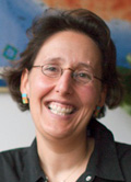 Chair: Sara Irina Fabrikant
Department of Geography
University of Zurich
Winterthurerstr. 190
CH-8057 Zurich
Switzerland
e-mail: sara.fabrikant@geo.uzh.ch
 Vice-chair: Amy Griffin
School of Physical, Environmental & Mathematical Sciences
UNSW@ADFA
POBox 7916
Canberra BC ACT 2610
Australia
Executive Committee liaison: Menno-Jan Kraak
Commission on Data Quality
- Networking cartographers, geographic information scientists and other researchers involved in geospatial data quality.
- Define short and medium term research goals that address key issues associated with geospatial data quality and its application.
- Encourage a multi-disciplinary and international approach to knowledge creation of uncertainties in geospatial data.
- Foster a new research community centered on modeling and visualizing error propagation in spatial analysis.
- Organize ICC sessions and ICA workshops focusing on geospatial data quality.
- Edit and publish geospatial data quality related reports, books, and special issues with some scientific journals.
- Website of the commission on Geospatial Data Quality.
 Chair: Xiaoyong Chen
School of Geoinformatics, East China Institute of Technology
No. 56 Xuefu Road
Fuzhou, Jiangxi 344000
P.R. China
phone: +86-794-8258812
fax: +86-794-8258828
e-mail: chenxy@ecit.cn
 Vice-chair: Rongxing (Ron) Li
Lowber B. Strange Designated Professor
Mapping and GIS Lab, CEEGS
The Ohio State University
470 Hitchcock Hall, 2070 Neil Avenue
Columbus, OH 43210-1275
United States of America
phone: +614-292-6946
fax: +614-292-3780
e-mail: li.282@osu.edu
 Vice-chair: Xiaohua Tong
The Department of Surveying and Geomatics
Tongji University
1239 Siping Road, 200092 Shanghai
P.R. China
e-mail: xhtong@tongji.edu.cn
Executive Committee liaison: Timothy Trainor
Commission on Digital Technologies in Cartographic Heritage
- Theoretical deepening and broadening of the issue of cartographic heritage.
- Development of methodologies and standards applied on proper two and three- dimensional digitization of Cartographic heritage objects, materials and documents.
- Study and implementation of analytical tools applied on the comparative research concerning the geometric and thematic content of old maps.
- Digital map libraries and map collections: Archiving, matching, management, networking and accessibility in-situ and in the web.
- Modern information technologies and interactivity in attracting the general public to Cartographic heritage: Implementations in Museology and virtual map exhibitions.
Website of the commission on Digital Technologies in Cartographic Heritage
 Chair: Evangelos Livieratos
Faculty of Engineering
School of Rural and Surveying Engineering
Geodesy and Cartography
Aristotle University of Thessaloniki
541 24 Thessaloniki
Greece
phone: +302310 996121
fax: +302310 996137
e-mail: livier@auth.gr
personal website
 Vice-chair: Alastair Pearson
 University of Portsmouth
Lion Terrace, Buckingham Building
PO1 3HE Portsmouth
United Kingdom
phone: +4402392842472
fax: +4402392842512
e-mail: alastair.pearson@port.ac.uk
 Vice-chair: Carme Montaner
 Map Library of Catalonia
Institut Cartogràfic de Catalunya
Parc de Montjuoc
08038 Barcelona
Spain
e-mail: carme.montaner@icc.cat
Executive Committee liaison: Anne Ruas
Commission on Education and Training
- Work for reaching the general aims conceived in the ICA Statutes.
- Support cartography and cartographic education in developing nations by holding seminars in these nations.
- Develop the existing ICA-sponsored Internet cartography teaching programme (modules), with regional workshops for training the teachers.
- Produce an ICA-sponsored Internet programme for continuing professional development, with regional workshops for training the teachers.
- Produce appropriate publications for dissemination of results of the above efforts and publish it according to the IOF publication policy.
- Promote integration by establishing linkage with the committees on education of sister surveying and mapping disciplines, by maintaining the list of institutions providing cartography course programmes, and interact as much as possible with other ICA commissions and working groups (organize joint meetings).
- Improving dissemination of information on educational theory and practice of cartography to the members across the world.
- Contribute to international forums where applicable.
- Investigate the role of emerging technologies for use in education and training.
- Develop mapping awareness competitions.
Website of the commission on Education and Training
 Chair: David Fairbairn
School of Civil Engineering and Geosciences
Cassie Building
Newcastle University
Newcastle upon Tyne NE1 7RU
England
phone: +44 (0)191 222 6353
fax: +44 (0)191 222 6502
e-mail: dave.fairbairn@newcastle.ac.uk
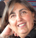 Vice-chair: Necla Ulugtekin
Istanbul Technical University
Civil Engineering Faculty
Geomatics Engineering Department
34469 - Maslak/İSTANBUL
Turkey
phone: +90 212 285 3774
fax: +90 212 285 3414
e-mail: ulugtek@itu.edu.tr
Executive Committee liaison: László Zentai
Commission on Generalisation and Multiple Representation
- Foster research and practical experience in multi-scale issues and automated map generalisation and to form a network and focal point for researchers and practitioners in this domain.
- Foster and maintain a liaison with related commissions and working groups within the ICA as well as in related national and international organisations (e. g. ISPRS, IGU, EuroSDR), including:
- identification of contact persons
- timely mutual updating on planned activities
- organisation of joint conference sessions and / or workshops
- Maintain a World Wide Web site for electronic dissemination of research on multi-scale issues and map generalisation, including:
- a membership database
- a bibliographic database
- examples of research projects and test data
- links to related web sites
- Organise sessions and meetings for exploring the issues named above, including:
- workshops held every two years in conjunction with international cartographic conferences
- special sessions and / or panel sessions at international cartographic conferences, in collaboration with local organisers
- Produce publications for dissemination of the above efforts, including one special issue of a peer-reviewed scientific journal or a book every two years.
Website of the commission on Generalisation and Multiple Representation
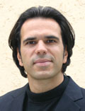 Chair: Dirk Burghardt
Institute of Cartography
Dresden University of Technology
Helmholtzstr. 10
01062 Dresden
Germany
phone: +49 (0351) 463-36200
fax: +49 (0351) 463-37028
e-mail: firstname.lastname(at)tu-dresden.de
personal website
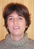 Vice-chair: Cecile Duchene
COGIT laboratory, IGN France
phone: +33 1 43 98 85 43
e-mail: firstname.lastname(at)ign.fr
personal website
 Vice-chair: William Mackaness
School of GeoSciences
Geography Building
Drummond Street
Edinburgh EH8 9XP
United Kingdom
phone: +44 (0) 131 650 8163
fax: +44 (0) 131 650 2524
e-mail: firstname.lastname(at)ed.ac.uk
personal website
Executive Committee liaison: Anne Ruas
Commission on Geoinformation Infrastructures and Standards
- In collaboration with other ICA Commissions, explore research on the impact and use in SDIs of cartography, standards, spatial semantics, ontologies, volunteered geographical information (VGI), virtual globes and other technological developments that might become relevant in future, and identify the associated education needs.
- Continue the work on developing conceptual models of an SDI using various modelling techniques, working in the areas of science, technology and standards.
- Participate at the scientific level with other organizations active in SDIs, standards and geospatial quality.
- Develop reports, conference presentations and/or journal articles on our work and help to arrange workshops, conferences or other meetings on SDIs and standards, and present tutorials at them.
- Organize reporting sessions on the Commission's activities at the 2013 and 2015 International Cartographic Conferences.
- Organize and hold full Commission meetings in 2012, 2013, 2014 and 2015, and mini-meetings of the Commission at suitable meetings.
- Continue to serve as the Category A Scientific Liaison for the ICA to ISO/TC211, Geographic Information/Geomatics, and establish liaisons with various SDI organizations.
- Maintain the Commission website and mailing list.
Website of the commission on Geoinformation Infrastructures and Standards
 Chair: Antony Cooper
Built Environment Unit
CSIR
PO Box 395
Pretoria 0001
South Africa
phone: +27 12 841 4121
fax: +27 12 841 3037
e-mail: acooper@csir.co.za
 Vice-chair: Serena Coetzee
Centre for Geoinformation Science
University of Pretoria
Private Bag X20
Hatfield 0028
South Africa
phone: +27 12 420 3823
fax: +27 12 841 3037
e-mail: serena.coetzee@up.ac.za
Executive Committee liaison: Derek Clarke
Commission on Geospatial Analysis and Modeling
- Network cartographers, geographic information scientists, and other researchers involved in geospatial analysis and modeling.
- Facilitate the interaction and communication between the computational community and cartographic community for creation of geographic knowledge.
- Foster a new research community centered on visual geospatial analysis and modeling.
- Organise ICC sessions and ICA workshops on geospatial analysis and modeling.
- Edit and publish geospatial analysis and modeling related reports, books, and special issues with some scientific journals.
- Activities including
- Organization of the 4th ICA workshop and continuation of the ICA workshop series in general
- Use of Web 2.0 technologies for networking and recruiting more members and researchers
- Organization of specialty tutorials for young researchers
Website of the commission on Geospatial Analysis and Modeling
 Chair: Bin Jiang
Division of Geomatics
Dept. of Technology and Built Environment
University of Gävle
SE-801 76 Gävle
Sweden
phone: +46 26 648901
fax: +46 26 648828
e-mail: bin.jiang@hig.se
personal website
 Vice-chair: Xiaobai Yao
Department of Geography
University of Georgia
Athens, GA 30602
United States of America
phone: +1 706 583 0326
fax (office): +1 706 583 0326
fax (department): +1 706 542 2388
e-mail: xyao@uga.edu
personal website
Executive Committee liaison: Liu Yaolin
Commission on Geovisualization
- Promote, develop and report upon the use of cartography in its widest sense in the exploration and analysis of spatial information through interactive visual interfaces.
- Define short and medium term research goals that address key issues associated with this work and its application.
- Encourage a multi-disciplinary and international approach to this work that draws upon and contributes to the efforts of relevant stakeholders (such as international and national organisations promoting and coordinating research), cognate disciplines and ICA commissions and working groups.
Outline of activities:
- expert workshops for defining key issues, promising research directions, and opportune goals and, on this basis, planning further activities of the Commission.
- annual meetings focusing on particular discipline / theme / objective hosted in different countries in conjunction with international research conferences.
- committed co-chairs and key committee members - each to coordinate one such meeting.
- developing and publishing research presented at these meetings through peer-reviewed papers where appropriate.
- a web-log of activities, research undertaken and related research / activity.
Website of the commission on Geovisualization
 Chair: Gennady Andrienko
Fraunhofer Institute for Intelligent Analysis and Information Systems
Schloss Birlinghoven
53754 Sankt-Augustin
Germany
phone: +49 2241 142486
fax: +49 2241 142072
e-mail: gennady.andrienko@iais.fraunhofer.de
personal website
 Vice-chair: Jason Dykes
giCentre
Department of Information Science
City University
London EC1V OHB
United Kingdom
phone: +44 20 7040 8906
fax: +44 20 7040 8584
e-mail: j.dykes@soi.city.ac.uk
personal website
Executive Committee liaison: Menno-Jan Kraak
Commission on GI for Sustainability
- Produce a methodological structure for GIS and Cartographic basis of sustainable development (SD) of territories.
- The organization of events (including presentations of projects, holding conferences etc.), on which experts from the different spheres of Cartography, Geoinformation and neighboring disciplines (environmental sciences, regional and cross-border planning etc.) would be involved. In particular to hold conferences that will bring together the different experts interested in sustainable development of territories. The press will be involved for propagation of achievements of cartography and GIS.
- Organise regional workshops and summer-schools on GIS and Cartography for developing projects in Sustainable Development.
- Provide the connections and performance of teamwork, holding conferences, schools with the adjacent organizations - the IGU Commission on Geographical Information Sciences, CODATA (ICSU Committee on Data for Science and Technology), Digital Earth, UNIGIS, ENVIROINFO etc.
- Continue the work on realization of international conferences InterCarto, which since 1994 were annually carried out in Russia and in other countries (http://susgis.net).
- Document and publish best practice results, proceedings of conferences, textbook on geoinformatics contributions to sustainable development.
- Encourage and support the involvement of student cartographers in the commission activities. Since two years there is continuing success of funding student participation in the SD Commission activities.
- Cooperate with other ICA Commissions (e.g. "Education and training", "Management and Economics of Map Production", "Digital Technologies in Cartographic Heritage")
Website of the commission on GI for Sustainability
 Chair: Vladimir Tikunov
Laboratory of Integrated Mapping and Laboratory of Sustainable Development of Territories
Faculty of Geography
M. V. Lomonosov Moscow State University
Vorobievy Gory, MSU, main building
119991 Moscow
Russia
phone: +7 495 939 13 39
fax: +7 495 932 88 36
e-mail: tikunov@geogr.msu.su
 Vice-chair: Horst Kremers
P.O. Box 20 05 48
13515 Berlin
Germany
phone: +49 172 3211738
e-mail: office@Horst-Kremers.de
personal website
Executive Committee liaison: Sukendra Martha
Commission on the History of Cartography
- Investigate the impact of technological innovations (printing methods, topographical surveying, aerial photography, satellite imagery and geographical information systems) on cartography during the last two centuries.
- Document the recent history of GI science in general and computer-aided mapping and Geographical Information Systems in particular.
- Examine the changing role of maps worldwide as cartographical (as opposed to historical) documents in history during the 19th and 20th centuries.
- Examine the significance of the cartographical work undertaken during the 19th and 20th centuries by the traditional colonial powers and all countries which extended their sovereignty over territory beyond their borders.
- Compile a list of useful sources on the history of cartography since 1800, which do not as yet appear in published catalogues or electronic databases.
- Maintain a dedicated website to act as a database for interested researchers.
- Hold annual meetings/conferences to discuss and monitor research work undertaken.
- Publish research findings in accredited journals and on the Commission website.
Website of the commission on the History of Cartography
 Chair: Elri Liebenberg
University of South Africa
PO Box 36345
0102 Menlo Park, Pretoria
South Africa
phone: +27 12 361 187, +27 82 683 223
e-mail: elri@worldonline.co.za
 Vice-chair: Imre Josef Demhardt
The University of Texas at Arlington
Department of History
Box 19529
Arlington, TX 76019-0529
United States of America
phone: +1 817-272-0122
fax: +1 817-272-2852
e-mail: demhardt@uta.edu
 Vice-chair: Peter Collier
Department of Geography
University of Portsmouth
Portsmouth
PO1 3HE
United Kingdom
phone: +44 2392 842473
fax: +44 2392 842512
e-mail: peter.collier@port.ac.uk
Executive Committee liaison: Paulo Menezes
Commission on Map Design
- Discuss, develop, illustrate and promote the principles of map design
- Identify examples of good cartographic practice which underpin high quality, effective map design
- Provide appropriate mechanisms and support for the dissemination of current map design research
- Develop high quality materials to support cartographers and map-makers in the development of their own maps (e.g., books, exemplars, tutorials)
- Develop support for the design of specific cartographic products that are challenged by new modes of production (e.g., design for maps that use imagery as the base)
- Inform, enthuse and engage with fledgling map-makers (such as neo-cartographers) in a mutual exchange of methods, needs and ideas
- Maintain a Web site that includes a bibliographical database of map design research, a community identity for those who work in the area of map design, resources to assist map-makers in their design endeavors, and a forum for the exchange of ideas and expertise
- Work with other ICA Commissions which incorporate a design perspective and
- Have fun designing maps and enthuse others to approach their own work with an eye on design
Website of the commission on Map Design
 Chair: Kenneth Field
Esri Inc
380 New York Street
Redlands CA 92373
United States of America
phone: +1 909 793 2853
e-mail: kfield@esri.com
 Vice-chair: Bernhard Jenny
Oregon State University
Dept. of Geosciences
104 Wilkinson Hall
Corvallis, OR 97331
United States of America
e-mail: jennyb@geo.oregonstate.edu
 Vice-chair: Alexander Kent
Canterbury Christ Church University
North Holmes Road
Canterbury
Kent CT1 1QU
United Kingdom
e-mail: alexander.kent@canterbury.ac.uk
Department of Geoinformation
Federal Agency for Cartography and Geodesy
Richard-Strauss-Allee 11
D-60598 Frankfurt a.M.
Germany
e-mail: Anja.Hopfstock@bkg.bund.de
Executive Committee liaison: Anne Ruas
Commission on Map Production and Geo-Business
- Enhance the study on map production- and process management, map economics and geobusiness
- Research on the impact by the modern communication methods on map production, business models, change management and design thinking
- Research the impact of Service Oriented Architectures and future technologies on Map-Production, Publishing and Archiving
- Encourage international collaboration on the study of map production and geobusiness with particular emphasis on bridging research, government and commercial sectors
- Participate and contribute to activities of other relevant ICA interests groups (e.g. Commission on Use and User Issues, National Mapping Organisations)
- These terms of reference should be achieved by specific meetings involving the different sectors, knowledge transfer via workshops and the wide usage of publication media
Website of the commission on Management and Economics of Map Production
 Chair: Philippe de Maeyer
Department of Geography
Ghent University
Krijgslan 281
9000 Gent
Belgium
phone: +32 9 264 46 88
fax: +32 9 264 49 85
e-mail: philippe.demaeyer@ugent.be
personal website
 Vice-chair: Markus Jobst
Coordination INSPIRE
Austrian Federal Office for Metrology and Surveying
Information Management
Schiffamtsgasse 1–3
1020 Vienna
Austria
e-mail: markus@jobstmedia.at
Executive Committee liaison: Derek Clarke
Commission on Map Projections
- Prepare an Operational Plan, which will acknowledge the Terms of Reference approved by the General Assembly and which will be used to set achievable targets for the Commission for a four year period. Organise and maintain the Commission web site.
- Promote and foster research on map projections, coordinate systems, transformations and conversions, and disseminate the outcomes. Expected result: an enhanced set of online bibliographic tools and web links on map projections, coordinate systems, transformations and conversions.
- Organise sessions and meetings at least once a year to stimulate a debate on all aspects of map projections with the aim of collecting and publishing the research results. Expected result: a collection of papers on case studies in map projections.
- Promote the proper use of map projections at all levels of education. Expected result: a publication with recommended approach to map projections at different levels of education.
- Study terminology on map projections and prepare the multilingual dictionary for this area of cartography. Expected result: the dictionary on map projections, coordinate systems, transformations and conversions.
- Provide consultative support in relation to map projections. Expected result: appropriate support as required.
- Work for reaching the general aims conceived in the ICA Statutes taking into account the recommendations of the ICA Executive Committee.
Website of the commission on Map Projections

Chair: Miljenko Lapaine
Faculty of Geodesy
University of Zagreb
Kaciceva 26
10000 Zagreb
Croatia
phone: +385 1 4639273
fax: +385 1 48 28 081
e-mail: mlapaine@geof.hr
 Vice-chair: Lynn Usery
Center of Excellence for Geospatial Information Science
U.S. Geological Survey
1400 Independence Rd.
Rolla, MO 65401-2502
phone: +1 573-308-3837
fax: +1 573-308-3652
e-mail: usery@usgs.gov
website
Executive Committee liaison: Paulo Menezes
Commission on Mapping from Remote Sensor Imagery
- Promote the original and practical research concerning the development and use of existing and forthcoming aerospace remote sensor systems for topographic and thematic mapping.
- Produce a book with a state-of-the-art review on remote sensors and data processing techniques applied for topographic and thematic mapping. It reviews the latest developments in remote sensors and information extraction techniques, examines the utilities of sensors and techniques for cartographic feature extraction, and showcases latest developments in thematic mapping.
- Network with ISRPS, IAG, FIG, and other ICA commissions with similar interests in applications of remote sensor imagery. Such networking would help organize one or more joint workshops, seminars, or symposia during 2011–2015.
- Develop closer links with international organizations concerned with the use of remote sensor imagery (e.g. UNOOSA, UNEP, PAIGH) for strengthening ICA‘s presence and developing joint courses or seminars on cartographic applications of remote sensor imagery.
- Promote knowledge transfer at fundamental and advanced levels on the use of remote sensor imagery for cartographic applications related to natural and built environments, early warning and natural disaster mitigation.
- Prepare promotional materials reflecting the Commission‘s terms of reference and activities that can be used to support ICA‘s presence at international forums (e.g. World Map, Map Middle East, meetings of the Joint Board of Geospatial Information Societies (JB GIS), UN meetings, and other regional conferences).
Website of the commission on Mapping from Satellite Imagery
 Chair: Xiaojun Yang
Department of Geography
Florida State University
PO Box 3062190
Tallahassee, Florida 32306
United States of America
phone: +850 644 8379
fax: +850 644 5913
e-mail: xyang@fsu.edu
personal website
 Vice-chair: Jan Feranec
Institute of Geography
Slovak Academy of Sciences
Stafanikova 49
814 73 Bratislava
Slovak Republic
phone: +421 2 57510219
fax: +421 2 52491340
e-mail: feranec@savba.sk
personal website
 Vice-chair: Yifang Ban
Department of Urban Planning & Environment
Royal Institute of Technology
SE - 100 44 Stockholm
Sweden
phone: +46 8 790 8648
fax: +46 8 790 7343
e-mail: yifang@infra.kth.se
personal website
 Vice-chair: Jonathan Li
Department of Geography & Environmental Management
Interdisciplinary Centre on Climate Change
Faculty of Environment, University of Waterloo
200 University Avenue West
Waterloo, Ontario, Canada N2L 3G1
Office: EV1-111
phone: +1-519-888-4567-34504
fax: +1-519-746-0658
e-mail: junli@uwaterloo.ca
personal website
Executive Committee liaison: Liu Yaolin
Commission on Maps and Graphics for Blind and Partially Sighted People
- Exchange and disseminate information on the design of and production technologies for maps and graphics for blind and partially sighted people.
- Study and evaluate developing and appropriate technologies and resources for the improvement of maps and graphics for blind and visually-impaired people.
- Explore the potential value of maps and graphics designed for blind and visually-impaired people to other user groups (e.g. children and those with learning difficulties, Develop closer links with the World Blind Union and extend this co-operation to deaf, mentally retarded children and old people).
- Engage with the International Mobility Conference and other appropriate organizations in order to further world-wide co-operation, communication and education in the use of maps and graphics by blind and visually-impaired people.
- Integrate the workings of this commission more closely with other ICA commissions, in order to expand the topics and facilitate access to information for disabilities people.
Website of the commission on Maps and Graphics for Blind and Partially Sighted People
 Chair: Alejandra Coll Escanilla
Tactile Cartography Center of the UTEM
Dieciocho 414
Santiago Centro
Chile
phone: +56-2-7877362
fax: +56-2-7877392
e-mail: acollescanilla@gmail.com
 Vice-chair: Waldirene Ribeiro
Universidade de São Paulo
FFLCH - Departamento de Geografia
Av. Prof. Lineu Prestes, 338
05508-000 Sao Paulo - SP
Brazil
phone/fax: +11 3091 3737
e-mail: walcarmo@usp.br
Executive Committee liaison: Paulo Menezes
Commission on Maps and Society
- Develop the Maps and Society web site to act as a clearinghouse and one-stop shop for researchers and practitioners in this area.
- Sponsor and organise sessions at future ICA conferences.
- Organize two specialist workshops on topics related to Maps and Society These would be local meetings to generate increased ICA participation from groups in different global contexts.
- Encourage publication in this area, specifically publication of a theme issue of The Cartographic Journal or Cartographica around critical approaches to mapping practice, and publication of a research monograph on Maps and Society.
- Collaborate with representatives of other disciplines in meetings and seminars.
- Hold joint meetings with specific mapping communities focusing upon different mapping encounters. In the next four years these might focus upon: mapping as artistic practice; graphic designer practice; active collaboration with crowdsourcing communities.
 Chair: Chris Perkins
School of Environment and Development
University of Manchester
Manchester M13 9PL
United Kingdom
phone: +44 161 275 3651
fax: +44 161 275 7878
e-mail: chris.perkins@manchester.ac.uk
personal website
 Vice-chair: Jörn Seemann
URCA - Universidade Regional do Cariri
Rua Cel. Antônio Luis, 1161
63.100-000 - Pimenta - Crato/CE
Brazil
e-mail: jorn.seemann@urca.br
personal website
Executive Committee liaison: Timothy Trainor
Commission on Maps and the Internet
- Focus scholarship on disseminating maps and spatial data through distributed data networks. Product: Journal articles and web pages.
- Examine Internet map usage to better serve users in a multi-platform environment. Product: Oral or published report.
- Examine the use of new Internet mapping technologies for social interaction and empowerment with online maps. Product: Oral or published report.
- Examine differences in the application of Internet maps between countries. Product: Oral or published report.
- Examine the role of Internet maps in both the data rich and data poor societies. Product: Oral or published report.
- Examine the potential of Internet map metadata. Product: Oral or published report.
- Examine an international construction kit for Internet maps that supports multinational and multicultural perspectives. Product: Oral and Published report.
- Examine the role of Internet maps in the growing field of Location-based services. Product: Collaboration with Map Use and Ubiquitous mapping Commissions and Published reports.
- Promote instruction on Internet mapping through collaboration / coordination with agencies for research and mapping. Product: Materials to be used in workshops.
Website of the commission on Maps and the Internet
Department of Geography and Geology
University of Nebraska
6001 Dodge Str
Omaha, NE 68182
United States of America
phone: +1 402 554 2282
e-mail: rcammack@mail.unomaha.edu
 Vice-chair: Pyry Kettunen
Finnish Geodetic Institute
Department of Geoinformatics and Cartography
P.O.Box 15 (Geodeetinrinne 2)
FI-02431 Masala
Finland
phone: +358 9 2955 5209
e-mail: pyry.kettunen@fgi.fi
Executive Committee liaison: Georg Gartner
Commission on Mountain Cartography
- Further define the topics of Mountain Cartography and promote the methods and knowledge of mountain cartography among scientists and professionals in cartography and related fields.
- Provide an updated, attractive web-site with information about Commission activities, links to other events and theme-specific knowledge.
- Provide an updated web-portal with links to related web-sites and bibliographic information.
- Emphasise cartographic design issues and map related representations in large scale topographic mapping.
- Continue the well-established workshop series.
- Promote publication activities (proceedings, web-proceedings, journal articles and special issues) and common research activities.
Website of the commission on Moutain Cartography
 Chair: Karel Kriz
Institute of Geography
University of Vienna
Universitätsstraße 7
1010 Vienna
Austria
phone: +43 1 4277 48641
fax: +43 1 4277 48649
e-mail: karel.kriz@univie.ac.at
 Vice-chair: Lorenz Hurni
Institute of Cartography and Geoinformation
ETH Zürich
Wolfgang-Pauli-Strasse 15
8093 Zurich
Switzerland
e-mail: hurni@karto.baug.ethz.ch
Executive Committee liaison: Georg Gartner
Commission on Neocartography
- Investigate the emergence of Neocartography and develop a web site to act as a shop window and reference point for researchers and practitioners in this area
- Organise sessions at future ICA conferences (commencing with ICC2013 in Dresden) and collaborate and with representatives of other disciplines and ICA Commissions in meetings and seminars (eg Maps and Society)
- Organize specialist conferences/workshops on topics related to Neocartography. These would be local meetings to encourage ICA participation from groups who might not normally do so
- Encourage publication in this area, specifically publication in what may be considered traditional cartography journals - such as the Cartographic Journal, Society of Cartographers Bulletin, and Cartographica
- Support research into, creation of, and dissemination of information about appropriate web-tools
- Hold joint meetings with mapping and allied communities. In the first four years these might focus upon participatory community mapping and map design.
Website of the commission on Neocartography
 Chair: Steve Chilton
Centre for Learning and Teaching Enhancement
Middlesex University, The Burroughs,
Hendon, London NW4 4BT
United Kingdom
phone: +44(0)208 411 5355
e-mail: steve8@mdx.ac.uk
personal website
 Vice-chair: Manuela Schmidt
Dept of Geoinformation and Cartography
Vienna University of Technology
Erzherzog-Johann-Platz 1/E127-2
1040 Vienna
Austria
phone: +43-1-58801-12613
fax: +43-1-58801-912613
e-mail: manuela.schmidt@tuwien.ac.at
personal website
 Vice-chair: Andrew Turner
FortiusOne
Washington, DC
United States of America
e-mail: ajturner@highearthorbit.com
personal website
Executive Committee liaison: Menno-Jan Kraak
Commission on Open Source Geospatial Technologies
- Maintain a website for the exchange of knowledge, news and information on use and user issues issues in open source geospatial technologies.
- Maintain an online bibliographical database.
- Maintain Web discussion forum.
- Maintain a database of individuals working on, or with expertise in, open source GIS to stimulate exchange of information.
- Produce a major publication on Open Source Geospatial Technologies (either a special issue of a refereed journal or a text book).
- Organize sessions on Open Source GIS at future ICA conferences.
- Participate in / contribute to other workshops / seminars organized by representatives of other disciplines or by other ICA Commissions / Working Groups.
Website of the commission on Open Source Geospatial Technologies
 Chair: Suchith Anand
Nottingham Geospatial Building
University of Nottingham
Nottingham NG7 2TU
United Kingdom
e-mail: suchith_anand@yahoo.com
Centre for Research in Geomatics
Louis-Jacques Casault Hall
1055, avenue du Séminaire
Laval University
Quebec (Quebec) G1V 0A6
Canada
phone: +1 418 656-7116
e-mail: thierry.badard@scg.ulaval.ca
Executive Committee liaison: Georg Gartner
Commission on Planetary Cartography
- Update of the Multilingual Maps of Terrestrial Planets and their Moons series
- Participation in Specialized Planetary Cartography GIS projects
- Planetary Nomenclature / Gazetteer supplements
- Foundation of a new, bi-annual international children‘s and student‘s drawing competition, with special focus on planetary cartography
- Development of a curriculum for geography or physics teachers at high school level, in which they can use planetary cartographic products
- Participation in the making of a textbook on Extraterrestrial Geography at high school and university level, and creation of cartographic products for this available online
- Online resources
- Creation of a new, updated website for the commission with various resources for the planetary cartographer community worldwide, including the International Planetary Cartography Database which is a documentation, bibliography and analysis of the international planetary cartography products
- Making official contacts with the WG of Extraterrestrial Mapping at ISPRS, with IAU Commission on Solar System Nomenclature, with planetary mapping groups in Germany (DLR), the USA (NASA/USGS), China and Japan
Website of the commission on Planetary Cartography
 Chair: Henrik Hargitai
Eötvös Loránd University
Institute for Art Theory and Media Studies
Múzeum krt. 6-8.
1088 Budapest
Hungary
SMS: +36 70-506-1158
e-mail: hhargitai@gmail.com
 Vice-Chair: Irina Petrovna Karachevtseva
Moscow University of Geodesy and Cartography (MIIGAiK)
MIIGAiK Extraterrestrial Lab (MExLab)
Gorokhovsky pereulok 4
105064 Moscow
Russian Federation
Phone: +7 499 267-35-13
e-mail (official): i_karachevtseva@mexlab.ru or icar2003@maii.ru
Executive Committee liaison: László Zentai
Commission on Theoretical Cartography
- Compare and study selected topics of theoretical interest in a multi-disciplinary, cross-cultural and historical, methodological perspective.
- Promote the research topics from carto-semiotics to more general philosophical concerns for Cartography theory construction including Ontology, Epistemology and Linguistics etc.
- Promote the application of theoretical research fruits and relevant adaption and improvement in cartographic and GIS practice.
- Establish an efficient information system to facilitate collaboration among the researchers in the field by maintaining an up-to-date Commission website with news important for the membership, reports on the activities of the commission, information on recent publications of interest, on the past and future meetings in the field, etc.
- Promote the existing glossary in multi-language in the circle of researcher and extending the glossary with the further research interest.
- Conduct workshops or symposia about selected aspects of theoretical cartography in different nations.
- Compile and publish reports and collected papers about the work of the commission.

Chair: Qingyun Du
School of Resource and Environmental Science
Wuhan University
430072 Wuhan
PR China
phone: +86 27 68778551
fax: +86 27 68778893
e-mail: qydu@whu.edu.cn
 Vice-chair: Florian Hruby
Department of Geography
University Center for Social Sciences and Humanities (CUCSH)
University of Guadalajara
Avenida de los Maestros y Mariano Bárcena (1er. piso)
Colonia Alcalde Barranquitas, CP.: 44260
Guadalajara, Mexico
phone: +52 3819-3381
fax: +52 3819-3387
e-mail: florian.hruby@univie.ac.at
personal website
Executive Committee liaison: William Cartwright
Commission on Ubiquitous Mapping
- Place the notion of Ubiquitous Mapping based on real-world map interaction and ICT-based context-aware mapping services in the domain of Theoretical Cartography; examining (1) Primal mapping between geomedia (real, graphic and language spaces) and human (cognitive space), and (2) Secondary or ICT-based mapping between geomedia (real, graphic and language spaces) and geodatabase.
- Develop the theory of Map Evolution on ICT enabled socio-cultural environment, by (1) Clarifying similarity and difference in comparing variant systems to establish an evaluation scheme, (2) Revealing significant factors such as ubiquity and egocentrism for Map Evolution on ICT, and (3) Creating map evolutional tree diagrams representing natural selection of maps in past, current and future according to real ICT-based ubiquitous mapping services and socio-cultural environment of different countries, particularly East Asia including Japan, China and Korea.
- Organize regional workshops including site observation to comprehend contemporary situation of ubiquitous mapping.
Website of the commission on Ubiquitous Mapping
 Chair: Masatoshi Arikawa
Center for Spatial Information Science
The University of Tokyo
5-1-5, Kashiwa-no-ha, Kashiwa City
Chiba 277-8568
Japan
phone: +81-4-7136-4305
fax: +81-4-7136-4292
e-mail: arikawa@csis.u-tokyo.ac.jp
Institute of Remote Sensing and Geographic Information System
Peking University
China
e-mail: yuefengliu@pku.edu.cn
Executive Committee liaison: William Cartwright
Commission on Use and User Issues
- Maintain and expand the website for the exchange of knowledge, news and information on use and user issues in cartography and geo-information processing and dissemination
- Maintain and fill the on-line bibliographical database on use and user issues which is accessible through the website.
- Set-up and maintain a database of individuals working on, or with expertise in, the various use and user issues and denote it with keywords (similar to the listings used in the bibliography) to stimulate exchange of information. This database will be accessible through the current website.
- Provide a Web discussion forum through the current website.
- Produce The Handbook for User Research in Geoinformation (textbook publication focusing on methods and techniques of use, user and usability research in cartography and geo-information processing and dissemination).
- Foster, stimulate and contribute to other publications on use and user issues in cartography and geo-information processing and dissemination.
- Organize (or help organizing) sessions on use and user issues at future ICA conferences.
- Establish one or more ―Project Groups‖ that deal with a specific aspect of use and user issues in cartography and geo-information processing and dissemination. The Project Groups will execute concrete tasks within a given time span.
- Organize (or help organizing) specialist workshops or seminars on focused topics related to use and user issues in cartography and geo-information processing and dissemination.
- Participate in / contribute to other workshops / seminars organized by representatives of other disciplines (e.g. human computer interaction, computer science) or by other ICA Commissions / Working Groups.
- Involve young (PhD) researchers in all Commission activities.
Website of the commission on Use and User issues
 Chair: Corné van Elzakker
ITC - Faculty of Geo-Information Science and Earth Observation, University of Twente
Department of Geo-Information Processing
P.O. Box 217, 7500 AE Enschede
The Netherlands
phone: +31534874478
fax: +31 53 4874 335
e-mail: c.vanelzakker@utwente.nl
personal website
 Vice-chair: David Forrest
School of Geographical & Earth Sciences
University of Glasgow
Glasgow G12 8QQ
United Kingdom
phone: +44 141 330 5401
e-mail: david.forrest@glasgow.ac.uk
personal website
 Vice-chair: Kristien Ooms
Department of Geography
Ghent University
Krijgslaan 281, S8
9000 Gent
Belgium
phone: +32 9 264 46 36
fax: +32 9 264 49 85
e-mail: kristien.ooms@ugent.be
 Vice-chair: Alexander Pucher
Cartography and Geoinformation
Department of Geography and Regional Research
University of Vienna
Universitätsstrasse 7
1010 Wien
Austria
phone: +43 1 4277 48644
fax: +43 1 4277 9531
e-mail: alexander.pucher@univie.ac.at
Executive Committee liaison: Derek Clarke
2007–2011
Commission on Cartography and Children
- Disseminate the outcomes of research into map use by children and young people. Deliverable: an enhanced set of online bibliographic tools and Web links on cartography and children.
- Develop stronger links between the ICA and relevant international and regional organizations. Deliverable: a joint international conference within the EU, other regional organization or worldwide.
- Stimulate a debate on all aspects of cartography for children with the aim of collecting and publishing the research results (in digital and / or printed format). Deliverable: a collection of papers on case studies in educational cartography.
- Promote the use of digital cartography and GIS in schools. Deliverable: an international (and / or regional) conference and associated publication.
- Provide consultative support in relation to the rules and judging of the Barbara Petchenik Children's World Map Competition. Deliverable: appropriate support as required.
Website of the commission on Cartography and Children
Chair: José Jesús Reyes Nuñez
Department of Cartography
Eötvös University
PO Box 32
1518 Budapest
Hungary
phone: +36 1 372 2975
fax: +36 1 372 2951
e-mail: jesus@ludens.elte.hu
personal website
Chair: Temenoujka Bandrova
Department ot Photogrammetry and Cartography
University of Architecture, Civil Engineering and Geodesy
1 Hr. Smirnenski Blvd.
1046 Sofia
Bulgaria
phone: +359 887 83 27 03
fax: +359 2 866 22 01
e-mail: bandrova_fgs@uacg.bg
Commission on Digital Technologies in Cartographic Heritage
Aim of the commission is the study and research on the possibilities of applying new information and communication technologies (ICT) on issues related to the cartographic heritage, focused on the following Terms of Reference:
- Support transformation of old maps, globes and cartographic documents into digital form.
- Apply digital techniques in the study of old maps.
- Develop digital tools for assisting the work of map curators and the functionality of map libraries networking and access to cartographic heritage.
- Apply digital support for the preservation and restoration of old maps, atlases and globes.
- Foster ICTs in teaching and diffusing history of cartography and maps to the public.
Website of the commission on Digital Technologies in Cartographic Heritage
Chair: Evangelos Livieratos
Department of Cadastre, Photogrammetry and Cartography
Aristotle University of Thessaloniki
541 24 Thessaloniki
Greece
phone: +302310 996121
fax: +302310 996137
e-mail: livier@auth.gr
personal website
Commission on Education and Training
- Work for reaching the general aims conceived in the ICA Statutes.
- Develop the existing ICA-sponsored Internet cartography teaching programme (modules), with regional workshops for training the teachers.
- Produce an ICA-sponsored Internet programme for continuing professional development, with regional workshops for training the teachers.
- Support cartography and cartographic education in developing nations by holding seminars in these nations.
- Promote integration by establishing linkage with the committees on education of sister surveying and mapping disciplines, by maintaining the list of institutions providing cartography course programmes, and interact as much as possible with other ICA commissions and working groups (organize joint meetings).
- Produce appropriate publications for dissemination of results of the above efforts and publish it in proceedings or on the CET website according to the IOF publication policy.
- Promote joint project cooperation between participating nations represented on the commission.
- Contribute to international forums where applicable.
- Develop mapping awareness competitions.
- Investigate the role of emerging technologies for use in education and training.
Website of the commission on Education and Training
Chair: David Fraser
Department of Geospatial Science
RMIT University
GPO Box 2476V
Melbourne, Victoria 3001
Australia
phone: +61 3 9925 3265
fax: +61 3 9663 2517
e-mail: david.fraser@rmit.edu.au
personal website
Commission on Generalisation and Multiple Representation
- Foster research and practical experience in multi-scale issues and automated map generalisation and to form a network and focal point for researchers and practitioners in this domain.
- Foster and maintain a liaison with related commissions and working groups within the ICA as well as in related national and international organisations (e. g. ISPRS, IGU, EuroSDR), including:
- identification of contact persons
- timely mutual updating on planned activities
- organisation of joint conference sessions and / or workshops
- Maintain a World Wide Web site for electronic dissemination of research on multi-scale issues and map generalisation, including:
- a membership database
- a bibliographic database
- examples of research projects and test data
- links to related web sites
- Organise sessions and meetings for exploring the issues named above, including:
- workshops held every two years in conjunction with international cartographic conferences
- special sessions and / or panel sessions at international cartographic conferences, in collaboration with local organisers
- Produce publications for dissemination of the above efforts, including one special issue of a peer-reviewed scientific journal or a book every two years.
Website of the commission on Generalisation and Multiple Representation
Chair: William A. Mackaness
School of GeoSciences
University of Edinburgh
Drummond Street
Edinburgh EH8 9XP
United Kingdom
phone: +44 131 650 8163
fax: +44 131 650 25
e-mail: william.mackaness@ed.ac.uk
personal website
Chair: Sébastien Mustière
Laboratoire COGIT
Institut Géographique National
2 Avenue Pasteur
94160 Saint Mandé
France
phone: +33 1 43 98 81 49
fax: +33 1 43 98 81 71
e-mail: sebastien.mustiere@ign.fr
personal website
Commission on Geospatial Analysis and Modeling
- Network cartographers, geographic information scientists, and other researchers involved in geospatial analysis and modeling.
- Facilitate the interaction and communication between the computational community and cartographic community for creation of geographic knowledge.
- Foster a new research community centered on visual geospatial analysis and modeling.
- Organise ICC sessions and ICA workshops on geospatial analysis and modeling.
- Edit and publish geospatial analysis and modeling related reports, books, and special issues with some scientific journals.
Website of the commission on Geospatial Analysis and Modeling
Chair: Bin Jiang
Division of Geomatics
Dept. of Technology and Built Environment
University of Gävle
SE-801 76 Gävle
Sweden
phone: +46 26 648901
fax: +46 26 648828
e-mail: bin.jiang@hig.se
personal website
Commission on Geospatial Data Standards
- Continue the work on developing conceptual models of the Spatial Data Infrastructure (SDI) using various modelling techniques, working in the areas of science, technology and standards, at the Global, Regional and National levels.
- Explore research in the area of spatial semantics, ontologies and standards, in collaboration with other ICA Commissions.
- Participate at the scientific level with other organizations active in standards and SDIs. This work will be closely coordinated with the ICA Executive Committee.
- Develop reports, conference presentations and / or journal articles on our work, or hold specialist meetings on these topics.
- Help to arrange workshops on standards and present tutorials at such workshops.
- Organize reporting sessions on the Commission's activities at the 2009 and 2011 ICA meetings.
- Organize and hold full Commission meetings in the summers of 2008, 2009, 2010 and 2011.
- Organise and hold mini-meetings of the Commission at suitable conferences and meetings being attended by members of the Commission.
- Continue to serve as a Category A Scientific Liaison with ISO / TC211, Geographic Information / Geomatics, and establish liaisons with various SDI organizations.
- Exchange information and reports by the ICA member countries and relevant bodies concerning the development standards for the transfer of digital spatial data, metadata and SDIs.
- Maintain the Commission website.
- Identify research and education needs that arise from the standards and SDI processes.
Website of the commission on Geospatial Data Standards
Chair: Antony Cooper
Built Environment Unit
CSIR
PO Box 395
Pretoria 0001
South Africa
phone: +27 12 841 4121
fax: +27 12 841 3037
e-mail: acooper@csir.co.za
Commission on Geovisualization
- Promote, develop and report upon the use of cartography in its widest sense in the exploration and analysis of spatial information through interactive visual interfaces.
- Define short and medium term research goals that address key issues associated with this work and its application.
- Encourage a multi-disciplinary and international approach to this work that draws upon and contributes to the efforts of relevant stakeholders (such as international and national organisations promoting and coordinating research), cognate disciplines and ICA commissions and working groups.
- expert workshops for defining key issues, promising research directions, and opportune goals and, on this basis, planning further activities of the Commission.
- annual meetings focusing on particular discipline / theme / objective hosted in different countries in conjunction with international research conferences.
- committed co-chairs and key committee members - each to coordinate one such meeting.
- developing and publishing research presented at these meetings through peer-reviewed papers where appropriate.
- a web-log of activities, research undertaken and related research / activity.
Website of the commission on Geovisualization
Chair: Gennady Andrienko
Fraunhofer Institute for Intelligent Analysis and Information Systems
Schloss Birlinghoven
53754 Sankt-Augustin
Germany
phone: +49 2241 142486
fax: +49 2241 142072
e-mail: gennady.andrienko@iais.fraunhofer.de
personal website
Commission on the History of Cartography
- Investigate the impact of technological innovations (printing methods, topographical surveying, aerial photography, satellite imagery and geographical information systems) on cartography during the last two centuries.
- Document the recent history of GI science in general and computer-aided mapping and Geographical Information Systems in particular.
- Examine the changing role of maps worldwide as cartographical (as opposed to historical) documents in history during the 19th and 20th centuries.
- Examine the significance of the cartographical work undertaken during the 19th and 20th centuries by the traditional colonial powers and all countries which extended their sovereignty over territory beyond their borders.
- Compile a list of useful sources on the history of cartography since 1800, which do not as yet appear in published catalogues or electronic databases.
- Maintain a dedicated website to act as a database for interested researchers.
- Hold annual meetings/conferences to discuss and monitor research work undertaken.
- Publish research findings in accredited journals and on the Commission website.
Website of the commission on the History of Cartography
Chair: Elri Liebenberg
University of South Africa
PO Box 36345
0102 Menlo Park, Pretoria
South Africa
e-mail: elri@worldonline.co.za
vice-Chair: Imre Josef Demhardt
University of Texas (Arlington)
USA
e-mail: demhardt@uta.edu
vice-Chair: Peter Collier
University of Portsmouth
UK
e-mail: peter.collier@port.ac.uk
Commission on Management and Economics of Map Production
- Extend Production Management knowledge in economics, planning and organizing, cost calculations, guidelines for production, quality assurance and quality control.
- Complete publications: Compendium of Cartographic Techniques, Flow Charting - Tools for Managing and Education, Surveys of software and hardware.
- Investigate (new) channels for publication with emphasis on technical, managerial and financial aspects. This includes also map publishing. Amongst all matters like Printing-on-demand- Webpublishing and Archiving should be researched.
Website of the commission on Management and Economics of Map Production
Chair: Philippe de Maeyer
Department of Geography
Ghent University
Krijgslan 281
9000 Gent
Belgium
phone: +32 9 264 46 88
fax: +32 9 264 49 85
e-mail: philippe.demaeyer@ugent.be
personal website
Chair: Erkki-Sakari Harju
Karttakeskus
Vuorikatu 14
00100 Helsinki
Finland
phone: +358 205 777 434
fax: +358 205 777 589
Commission on Mapping from Satellite Imagery
- Maintain and improve the digital repository of the Commission on topics related to:
- analysis of existing and forthcoming satellite imagery in view of their potential inputs for producing and updating topographic and thematic maps and databases.
- cartographic capabilities of different remote sensing systems.
- Produce a special edition the ICC theme Cartography and satellite imagery for the management of natural resources and the environment, early warning and natural disasters mitigation with papers to be presented at ICC2009 or ICC 2011, in a scholarly journal of remote sensing, or a book on Mapping from Satellite Imagery.
- Develop closer links with international organisations concerned with the use of satellite imagery (e.g. UNOOSA, UNEP, PAIGH), in view of strengthening ICA's presence, and to produce joint courses or seminars on cartographic applications of satellite imagery.
- Promote knowledge transfer at fundamental and advanced levels on the use of satellite imagery for cartographic applications related to natural and built environments, early warning and natural disaster mitigation.
- Prepare promotional materials reflecting the Commission's terms of reference and activities that can be used to support ICA presence at international forums (e.g. World Map, Map Middle East, meetings of Joint Societies, UN meetings, other regional conferences). Outcomes: posters, fact sheets, booklets.
- Network with ISPRS and other ICA commissions with similar interests in applications of satellite imagery. Such networking would be in view of producing joint workshops or seminars within the period 2007-2011.
Website of the commission on Mapping from Satellite Imagery
Chair: Xiaojun Yang
Department of Geography
Florida State University
PO Box 3062190
Tallahassee, Florida 32306
United States of America
phone: +850 644 8379
fax: +850 644 5913
e-mail: xyang@fsu.edu
personal website
Vice-chair: Jonathan Li
Department of Geography
Faculty of Environmental Studies
University of Waterloo
200 University Avenue West
Waterloo, Ontario N2L 3G1
Canada
phone: +1 519 8884567, ext. 34504
fax: +1 519 7460658
e-mail: junli@fes.uwaterloo.ca
personal website
Commission on Map Projections
- Establish a repository of knowledge on map projections.
- Promote map projections within all disciplines.
- Provide a platform to promote research and a common language in the field of map projections.
- Encourage collaboration between researchers within the field of mapping sciences as well as across disciplines.
Website of the commission on Map Projections
Chair: Daan Strebe
Mapthematics
2111 Olympia Avenue
NE Renton
Washington 98056
United States of America
phone: +1 425 793 0880
fax: +1 425 793 0881
e-mail: dstrebe@mapthematics.com
Commission on Maps and Graphics for Blind and Partially Sighted People
- Exchange and disseminate information on the design of and production technologies for maps and graphics for blind and partially sighted people.
- Study and evaluate developing and appropriate technologies and resources for the improvement of maps and graphics for blind and visually-impaired people.
- Explore the potential value of maps and graphics designed for blind and visually-impaired people to other user groups (e. g. children and those with learning difficulties).
- Develop closer links with the World Blind Union and to extend this co-operation to the International Mobility Conference and other appropriate organizations to further world-wide co-operation, communication and education in the use of maps and graphics by blind and visually-impaired people.
- Integrate the workings of this commission more closely with other ICA commissions.
- Disseminate, as appropriate, results of the above efforts.
Website of the commission on Maps and Graphics for Blind and Partially Sighted People
Chair: Dan Jacobson
Department of Geography
University of Calgary
2500 University Drive NW
Calgary, Alberta T2N 1N4
Canada
phone: +1 403 220 6192
fax: +1 403 282 6561
e-mail: dan.jacobson@ucalgary.ca
personal website
Commission on Maps and Society
This Commission would have parallel academic and practical rationales. These aim to facilitate and encourage the use of social scientific and critical approaches to mapping and to encourage a more active engagement between cartographers and other groups in society engaged in mapping activities.
In 2007 - 2011 we would:- Develop a Maps and Society web site to act as a clearinghouse and one stop shop for researchers and practitioners in this area.
- Sponsor and organise sessions at future ICA conferences.
- Organize two specialist workshops on topics related to Maps and Society These would be local meetings to generate increased ICA participation from groups in different global contexts.
- Encourage publication in this area, specifically publication of an issue of The Cartographic Journal in 2008 - 2009 arising from this theme and publication of a research monograph.
- Collaborate and participate with representatives of other disciplines in meetings and seminars.
- Hold joint meetings with specific mapping communities focusing upon different mapping encounters. In the first four years these might focus upon, artistic practice, participatory community mapping and graphic designer practice.
Chair: Chris Perkins
School of Environment and Development
University of Manchester
Manchester M13 9PL
United Kingdom
phone: +44 161 275 3651
fax: +44 161 275 7878
e-mail: chris.perkins@manchester.ac.uk
personal website
Commission on Maps and the Internet
- Focus attention on disseminating maps and spatial data through distributed electronic networks including wireless networks. Product: Books, journal articles and websites.
- Examine Internet and mobile Internet map usage and project future areas of growth. Product: Oral or published report.
- Examine Internet and mobile Internet map user issues to better serve user needs. Product: Oral or published report.
- Promote the exchange of information about effective Internet mapping for an international audience. Product: Workshop(s) and websites.
- Promote instruction on Internet mapping through collaboration / coordination with other ICA commissions and other cartographic institutions.
- Produce materials to be used in workshops.
Website of the commission on Maps and the Internet
Chair: Michael P. Peterson
Department of Geography and Geology
University of Nebraska
Omaha
Nebraska 68182 0199
United States of America
phone: +1 402 554 4805
fax: +1 402 554 3518
e-mail: mpeterson@unomaha.edu
personal website
Commission on Marine Cartography
- Promotion of marine cartography.
- Facilitate the networking of those member nations representatives on the commission as a resource through which marine cartography can be promoted.
- Establish a website for marine cartography.
- Establish and maintain routine and higher profile liaison with kindred scientific bodies such as the International Hydrographic Organization (IHO), the Hydrographic Society, Fédération Internationale des Géomètres (FIG), the International Association of Geodesy (IAG) and the International Geographical Union (IGU) and the International Society for Potogrammetry and Remote Sensing (ISPRS).
- Encourage authors writing in the general area of marine cartography and provide contacts and assistance in the accessing of resources and material.
- Represent and promote the work of ICA at appropriate fora.
- Respond to issues referred by the ICA Executive Committee for advice and information.
- Promotion of ICA and cartography as major contributors in the field of coastal zone management.
- Continue to conduct, in conjunction with the IGU Commission on Coastal Systems, the CoastGIS series of symposia.
- Explore opportunities for training and workshops in GIS applications to the Coastal Zone within developing nations.
- Encouragement of publications in the areas of marine cartography and, in particular, publications dealing with the coastal zone.
- Publish proceedings for all symposia/conferences/workshops organized by the commission. Encourage and where needed, seek out the preparation of articles in the area of coastal zone cartography.
- Target leading experts publishing an authoritative volume dealing with cartography and GIS within the coastal zone (planned in conjunction with IGU).
- Ongoing co-operative activity.
- Provide a list of special features, objects and attributes relating to the coastal zone to IHO and to the Digital Geographic Information Working Group (DGIWG) for consideration.
- Provide any proposed change to IHO Publication S-23 (Limits of Oceans and Seas) and to the Undersea feature names gazetteers (following the guidelines stated in IHO Publication B6).
Website of the commission on Marine Cartography
Chair: Patricio Carrasco
Servicio Hidrográfico y Oceanográfico de la Armada de Chile
Errázuriz 254
Playa Ancha
Valparaíso
Chile
phone: +56 32 2266666
fax: +56 32 2266542
e-mail: pcarrasco@shoa.cl
Commission on Mountain Cartography
- Further define the topics of Mountain Cartography and promote the methods and knowledge of mountain cartography among scientists and professionals in cartography and related fields.
- Provide an updated, attractive web-site with information about Commission activities, links to other events and theme-specific knowledge.
- Provide an updated web-portal with links to related web-sites and bibliographic information.
- Emphasise cartographic design issues and map related representations in large scale topographic mapping.
- Continue the well-established workshop series.
- Promote publication activities (proceedings, web-proceedings, journal articles and special issues) and common research activities.
Website of the commission on Moutain Cartography
Chair: Karel Kriz
Department of Geography and Regional Research
University of Vienna
Universitätsstraße 7
1010 Vienna
Austria
phone: +43 1 4277 48641
fax: +43 1 4277 48649
e-mail: karel.kriz@univie.ac.at
personal website
Commission on National and Regional Atlases
- Produce a cookbook for the production of (digital) national and regional atlases.
- Promote and support the design, production and use of national, regional, city and thematic atlases and atlas information systems.
- Conduct workshops and / or seminars that present recent and potential atlas developments and innovations.
- Document guidelines and procedures for the design, production and use of national, regional, city and thematic atlases.
- Elaborate and maintain an electronic inventory of national, regional, city and thematic atlases containing the main characteristics of these map works as well as relevant addresses in order to support information exchange between atlas editors as well as to disseminate information on atlases to a wider public.
- Maintain a commission website and update it regularly with the major aims of providing for information exchange between commission members and disseminating information on activities in this field to a wider public.
- Encourage efforts for integrating data for the development of electronic atlases and national and regional atlas information systems by:
- evaluating metadata standards as they apply to atlas design, creation and dissemination.
- acknowledging requirements for diverse geographic and temporal data themes.
- identifying and exploring various alternatives to data integration issues.
Website of the commission on National and Regional Atlases
Chair: Peter Jordan
Institute of Urban and Regional Research
Austrian Academy of Sciences
Postgasse 7-4-2
1010 Vienna
Austria
phone: +43 1 51 581 3539
fax: +43 1 51 581 3533
e-mail: peter.jordan@oeaw.ac.at
personal website
Commission on Planetary Cartography
- Continue the documentation and analysis of the planetary cartography status within the international community.
- Prepare and print the multilingual Glossary of planetary cartographic terms after necessary correction and reduction (in 5 languages).
- Continue the series of multilingual maps in two parallel directions; i. e. to organize and print existing maps for new groups of languages, and to compile and print maps of other Solar System Bodies. In the next series the moons of the giant-planets will be included. The Io map is in progress.
- Conduct a new project on construction of a Specialized Planetary Cartography GIS.
- Discuss the role of planetary cartography in the development of the Extraterrestrial Territory Geography, especially in connection with the global education process.
- Publish an Education Program and a Textbook on this field.
Website of the commission on Planetary Cartography
Chair: Kira B. Shingareva
Moscow State University for Geodesy and Cartography
Litovsky Boulevard 6 / 1-129
117588 Moscow
Russia
phone: +7 495 262 53 65 or +7 495 425 38 29
fax: +7 495 267 2518
e-mail: kirash1@yasenevo.ru
Vice-chair: James R. Zimbelman
Center for Earth and Planetary Studies
Smithsonian Institution
PO Box 37012
National Air and Space Museum, MRC 315
Washington DC 20013-7012
United States of America
phone: +202 633 2470
e-mail: zimbelmanj@si.edu
personal website
Commission on Theoretical Cartography
- Study selected topics of theoretical interest such as:
- general and applied cartosemiotics
- map language and cartographic conceptions
- mapping as a cognitive process
- cartographic ontology
- terminology and toponymy
- Compare and contrast theoretical structures in cartography.
- Publish a cartosemiotic glossary.
- Conduct workshops or symposia about selected aspects of theoretical cartography.
- Compile and publish a report and collected papers about the work of the commission.
- Continue to develop the Commission website.
Website of the commission on Theoretical Cartography
Chair: Alexander Wolodtschenko
Institute for Cartography
Technische Universität Dresden
Mommsenstrasse 13
01062 Dresden
Germany
phone: +49 351 463 34894
fax: +49 351 463 37028
e-mail: alexander.wolodtschenko@tu-dresden.de
personal website
Commission on Ubiquitous Mapping
- Organize regional workshop including site observation to comprehend contemporary situation of ubiquitous and pervasive mapping.
- Clarify similarity and difference in comparing variant systems to establish an evaluation scheme.
- Place the notion of Ubiquitous Mapping in the domain of Theoretical Cartography.
Website of the commission on Ubiquitous Mapping
Chair: Takashi Morita
Professor Emeritus
Hosei University
2-17-1, Fujimi, Chiyoda-ku,
102-8160, Tokyo
Japan
e-mail: morita@hosei.ac.jp
Commission on Underrepresented Groups and Cartography
- Encourage representatives of under-represented groups to participate in all ICA activities.
- Serve as a resource on issues related to gender and other under-represented groups problems and cartography by:
- preparing papers for presentation at conferences or for publication in cartographic journals.
- preparing and disseminating on the Web a basic, working bibliography on publications (professional papers, atlases, maps) related to gender and under-represented groups problems that are of interest to cartography.
- Contribute to the understanding and solution of under-represented groups problems through the use of cartography in decision-making processes by holding the debate and distribute the professional knowledge concerning the making and use of maps presenting spatial distribution of different problems relating the under-represented groups.
- Prepare a guide for the production and use of maps presenting the different problems of under-represented groups in the most effective way.
- Organise a conference on Using popular computer software for visualizing problems connected to under-represented groups.
- Continue the cooperation with other ICA Commissions and Working Groups, and with corresponding commissions or working groups of ICA sister societies.
Chair: Wieslawa Zyszkowska
Department of Cartography
University of Wroclaw
pl. Uniwersytecki 1
50-137 Wroclaw
Poland
phone: +48 71 375 22 44
fax: +48 71 343 51 84
e-mail: zyszkowska@geogr.uni.wroc.pl
Commission on Use and User Issues
- Maintain an on-line bibliographical database with a bibliography on the user, usability (including User Centered Design and methods and techniques of user research) and improvement of user abilities.
- Maintain a database of individuals working on, or with expertise in, the various use and user issues and denote it with keywords (similar to the category listings used in the bibliography) to stimulate exchange of information.
- Produce a major publication on use and user issues in cartography and geoinformation processing and dissemination (either a special issue or a refereed journal or a text book).
- Foster and stimulate other publications on use and user issues in cartography and geoinformation processing and dissemination.
- Organize sessions on use and user issues at future ICA conferences.
- Organize a specialist workshop in 2008 on a focused topic related to use and user issues in cartography and geo-information processing and dissemination.
- Participate in / contribute to other workshops / seminars organized by representatives of other disciplines (e. g. computer science) or by other ICA Commissions / Working Groups.
Website of the commission on Use and User issues
Chair: Corné van Elzakker
Department of Geo-Information Processing
International Institute for Geo-Information Science and Earth Observation
PO Box 6
7500 AA Enschede
The Netherlands
phone: +31 53 4874 478
fax: +31 53 4874 335
e-mail: elzakker@itc.nl
personal website
2003–2007
| Commission | Chair(s) Vice-Chair(s) |
| Cartography and Children | Patrick Wiegand |
| Education and Training | Laszlo Zentai Wolfgang Meissner, David Fraser |
| Gender and Cartography | Ewa K.-Blum |
| Generalization and multiple representations | Anne Ruas, William Mackaness |
| History of Cartography | Alexei Postnikov Elri Liebenberg |
| Incremental Updating and Versioning of Spatial data bases | Antony Cooper, Ammatzia Peled |
| Management and economics of map production | Philippe Demaeyer |
| Map projections | Daan Strebe Frank Canters |
| Mapping from satellite imagery | Serge LeBlanc Graciela Metternicht |
| Maps and Graphics for Blind and partially sighted people | Jonathan Rowell |
| Maps and the Internet | Michael Peterson Georg Gartner |
| Marine cartography | Ron Furness D. Green |
| Mountain Cartography | Lorenz Hurni Karel Kriz |
| National and regional atlases | Timothy Trainor Peter Jordan |
| Planetary cartography | Kira Shingareva James Zimbelman |
| Spatial data standards | Harold Moellering |
| Theoretical cartography | Alexander Wolodtschenko |
| Ubiquitous mapping | Takashi Morita |
| Visualization and virtual environments | Alan MacEachren Menno-Jan Kraak |
1999–2003
| Commission | Chair |
| Cartography and Children | Jacqueline Anderson |
| Census Cartography | Tim Davis |
| Education and Training | Vladimir Tikunov |
| Gender and Cartography | Ewa K.-Blum |
| History of Cartography | Christopher Board |
| Map Generalization | Robert Weibel |
| Map Production | Sjef van der Steen |
| Mapping from Satellite Imagery | Serge Le Blanc |
| Maps and Graphic for Blind and Visually-Impaired People | Andrew Tatham |
| Maps and the Internet | Michael Peterson |
| Marine cartography | Ron Furness |
| Mountain Cartography | Lorenz Hurni |
| National and regional atlases | Timothy Trainor |
| Planetary cartography | Kira Shingareva |
| Spatial data standards | Harold Moellering |
| Theoretical cartography | Alexander Wolodtschenko |
| Visualization and Virtual Environments | Alan MacEachren |
1995–1999
| Commission | Chair |
| Cartography and Children | Jacqueline Anderson, Regina Vasconcellos |
| Education and Training | Ferjan Ormeling |
| Gender and Cartography | Eva Siekierska |
| History of Cartography | Matthew Edney |
| Map Generalization | Robert Weibel |
| Map Production | Sjef van der Steen |
| Map Use | James Carter |
| Mapping from Satellite Imagery | Marc Bernard |
| Maps and Graphic for Blind and Visually-Impaired People | Andrew Tatham |
| Marine Cartography | Ron Furness |
| National and regional atlases | Timothy Trainor |
| Spatial Data Quality | Joel Morrison |
| Standards for the Transfer of Spatial Data | Harold Moellering |
| Theoretical Fields and Definitions in Cartography | Tositomo Kanakubo |
| Visualization | Alan MacEachren, Menno-Jan Kraak |
1991–1995
| Commission | Chair |
| Advanced technologies | Eric Anderson (USA) |
| Blinds and visually impaired | Joseph Wiedel (USA) |
| Census Mapping | István Kormoss (BEL) |
| Data standards | Harold Moellering (USA) |
| Education and Training | Ferjan Ormeling (NED) |
| History of Cartography | Monique Pelletier (FRA) |
| Map Production Technology | Miroslav Miksovsky (CZE) |
| Maps and use of spatial data | James Carter (USA) |
| National and regional atlases | Bengt Rystedt (SWE) |
| Quality of spatial data | Joel Morrison (USA) |
| Thematic Mapping with the Aid of Satellite Imagery | Bertrand Galtier (FRA) |
| Urban Cartography | Nestor Dutch-Gary (MEX) |
1987–1991
| Commission | Chair |
| Advanced Technology | Eric Anderson (USA) |
| Education and Training | Ferjan Ormeling (Netherlands) |
| The History of Cartography | Monique Pelletier (France) |
| Map Production Technology | Kjeld Burmester (Denmark) |
| Concepts in Cartography | Tositomo Kanakubo (Japan) |
| Map and Spatial Data Use | Judy M. Olson (USA) |
| Marine Cartography | Ronald H. W. Linton (USA) |
| National Atlases | Bengt Rystedt (Sweden) |
| Population Cartography | Prithvish Nag (India) |
| Tactual and Low-vision Mapping | Joseph W. Wiedel (USA) |
| Thematic Mapping from Satellite Imagery [Data] | Jean Denègre (France) |
| Urban Cartography | Heinz Pape (West Germany) |
| World Digital Data Bases for Environmental Science | David P. Bickmore (UK) |
1984–1987
| Commission | Chair |
| Advanced Technology | Lowell E. Starr (USA) |
| Education and Training | Karl-Heinz Meine (West Germany) |
| The History of Cartography | Helen Wallis (United Kingdom) |
| Map Production Technology | Kjeld Burmester (Denmark) |
| Marine Cartography | Ronald H. W. Linton (United Kingdom) |
| Population Cartography | Robert W. Marx (USA) |
| Tactual Mapping | Joseph W. Wiedel (USA) |
| Thematic Mapping from Satellite Imagery | Jean Denègre (France) |
| Urban Cartography | Yasuo Masai (Japan) |
1980–1984
| Commission | Chair |
| Base Maps for International Thematic Mapping | J. Carré (France) |
| Census Mapping | Ulrich Freitag (West Germany) |
| Communication in Cartography | Chris Board (UK) |
| Computer Assisted Cartography | Lower Starr (USA) |
| Continuing Education | K. H. Meine (West Germany) |
| History of Cartography | Helen Wallis |
| Map Production | K. Burmester (Denmark) |
| Marine Charting | Adam Kerr (Canada) |
| Natural and Regional Planning Cartography | Bogodar Winid (Poland) |
| Thematic Mapping with the Aid of Satellite Imagery | A. Ciolkosz (Poland) |
| Urban Cartography | Yasuo Masai (Japan) |


 Vice-Chair: Marcy Bidney
 Chair: Ian Muehlenhaus
 Chair (from 2023): Sarah Battersby
 Vice-chair: Luciene Stamato Delazari
 Vice-chair: Katarzyna Słomska
 Vice-chair: Zdeněk Stachoň