


Since 2016, ICA awards scholarships. In the following, you find pictures and a full list of awardees. For details on how to apply for an ICA Scholarship, please refer to icaci.org/scholarship.
Photos of Awardees
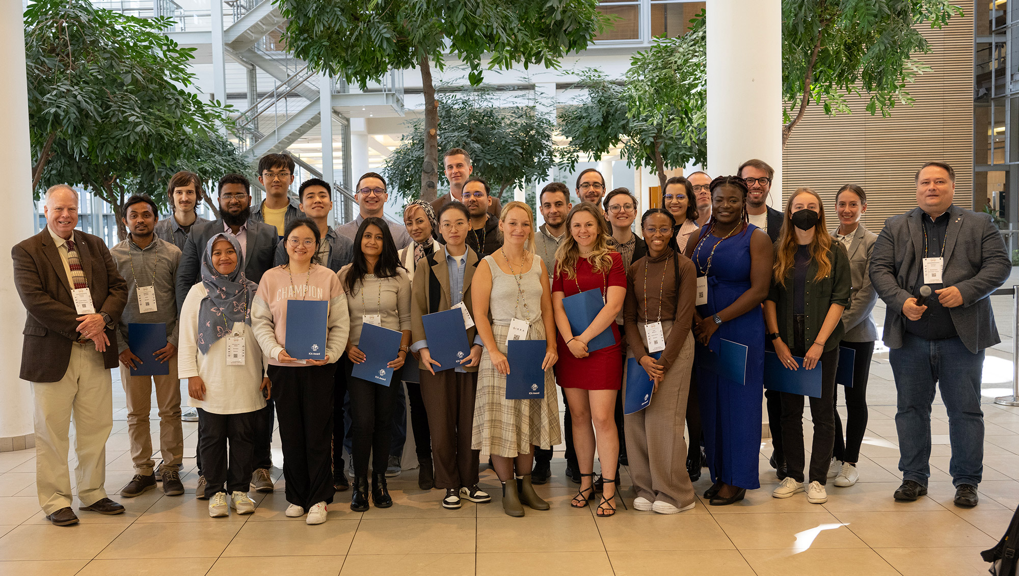
ICA Scholarship Awardees at ICC2023 together with ICA President Tim Trainor and Secretary General Thomas Schulz
ICA Scholarship Awardees at AutoCarto 2022 together with ICA Secretary General Thomas Schulz and President Tim Trainor

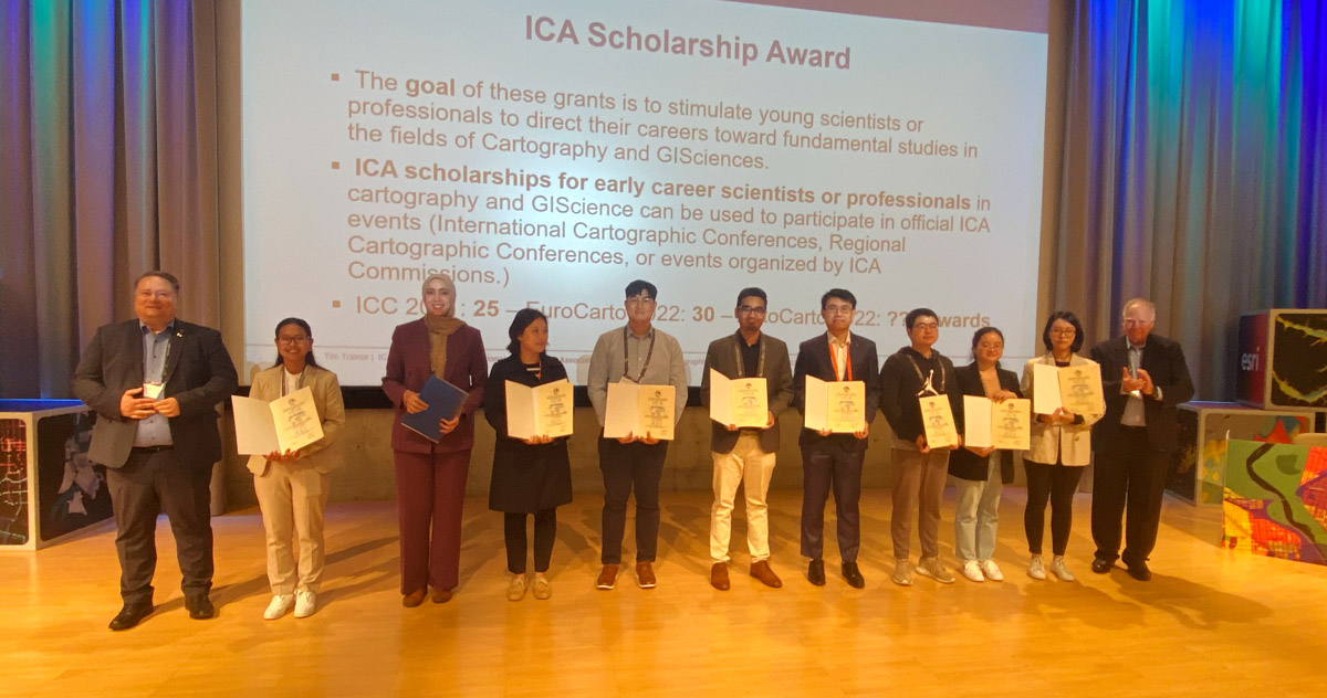
ICA Scholarship Awardees at EuroCarto 2022

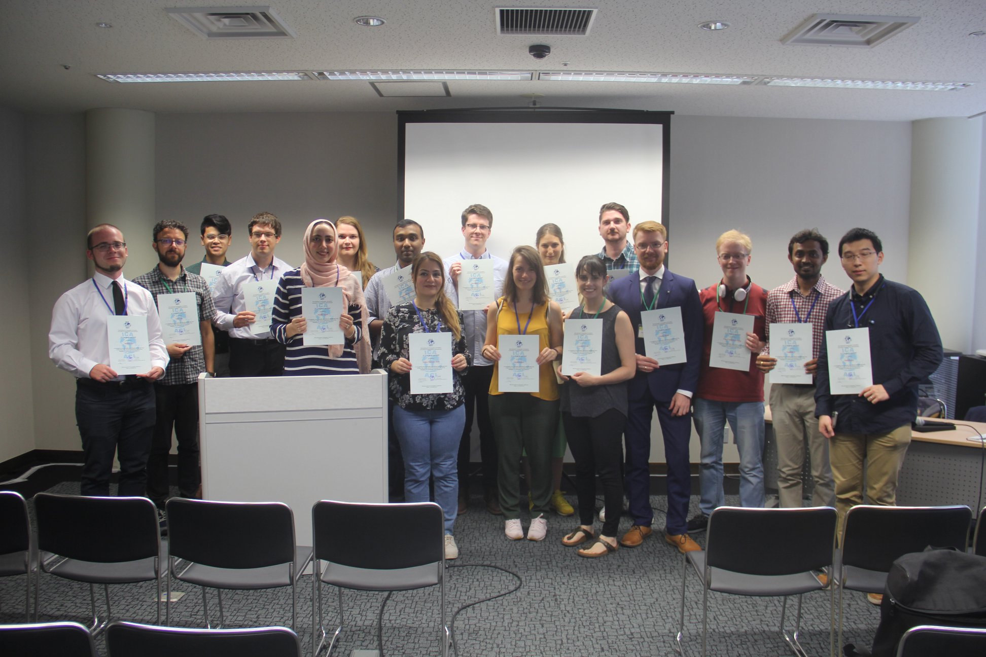
ICA Scholarship Awardees at ICC2021 together with ICA President Tim Trainor and Secretary General Thomas Schulz

Further awardees from ICC2021: Andong Ma, Jess Hepburn, Jakob Konicek, Marc Schulz, Nick Lally, Lei Zou
From left to right: Márton Pál, Nick Lally, Pongpichaya William Limpisathian, Radek Barvir, Malak Alasli, Dr. Alena Vondráková, Shyamantha Subasinghe, Ashna Kareem Zada, Harrison Cole, Maja Kalinic, Laure De Cock, Carolyn S. Fish, Nikola Yonov, Lukasz Halik, Ivan Evgenyevich Fokin, Jagadish B, Xiao Huang
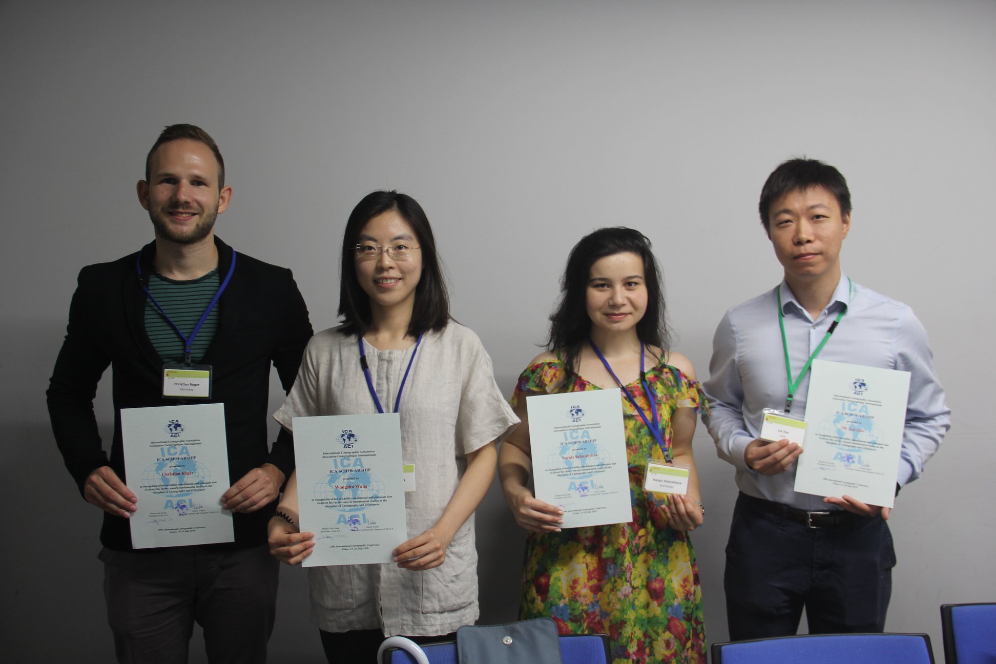
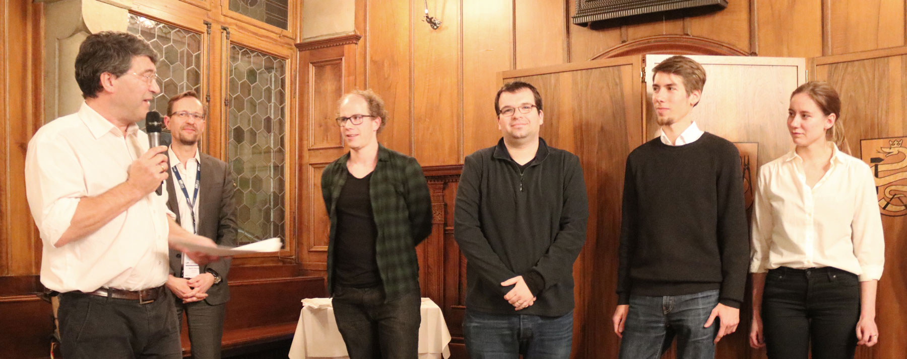
From left to right: Christian Röger (pre-conference), Wangshu Wang (pre-conference), Nargiz Safaraliyeva (ICC), Dr. Lei ZOU (pre-conference)

Krisztián Kerkovits with Miljenko Lapaine, chair of the Commission on Map projections
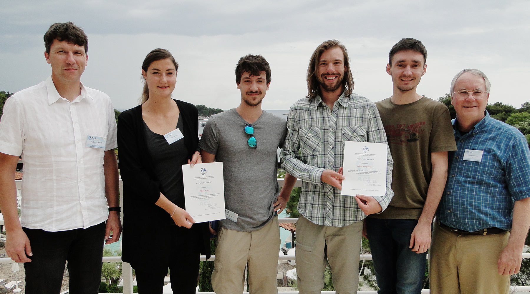
Chairs of the Commission on Mountain Cartography Dušan Petrovič (left) and Tom Patterson (right) with the awardees of ICA Scholarships at the 11th Mountain Cartography Workshop in Hvar, Croatia: Maša Arnež, Benedikt Hajek, Lukas Neugebauer, Tomislav Jogun
Georg Gartner and Martin Raubal congratulating the awardees of ICA Scholarships at LBS2018: Andreas Sedlmeier, Matan Mor, Joris van der Berg and Roos Teeuwen
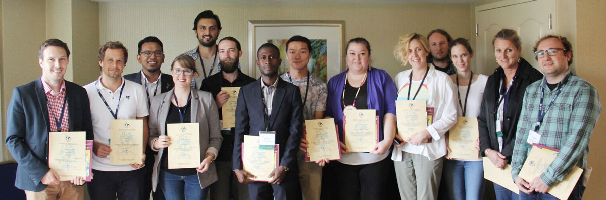
Some of the awardees of ICA Scholarships at ICC2017

Julia Mia Stirnemann Javiera Advis at ICC2017
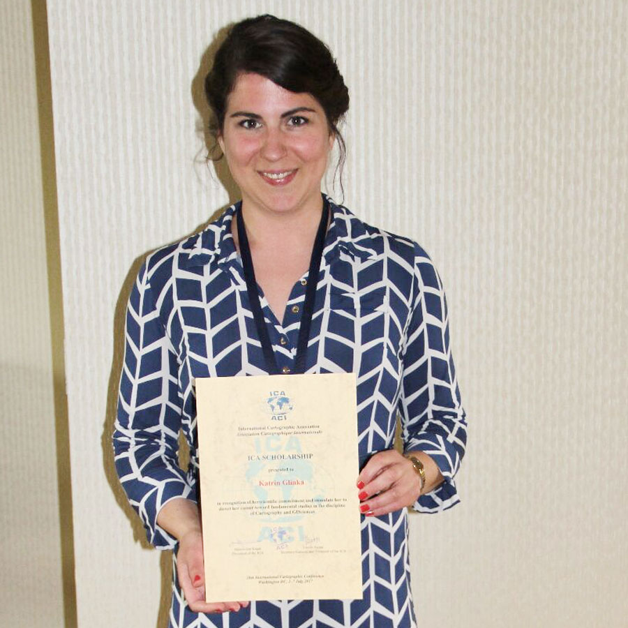
Katrin Glinka at ICC2017
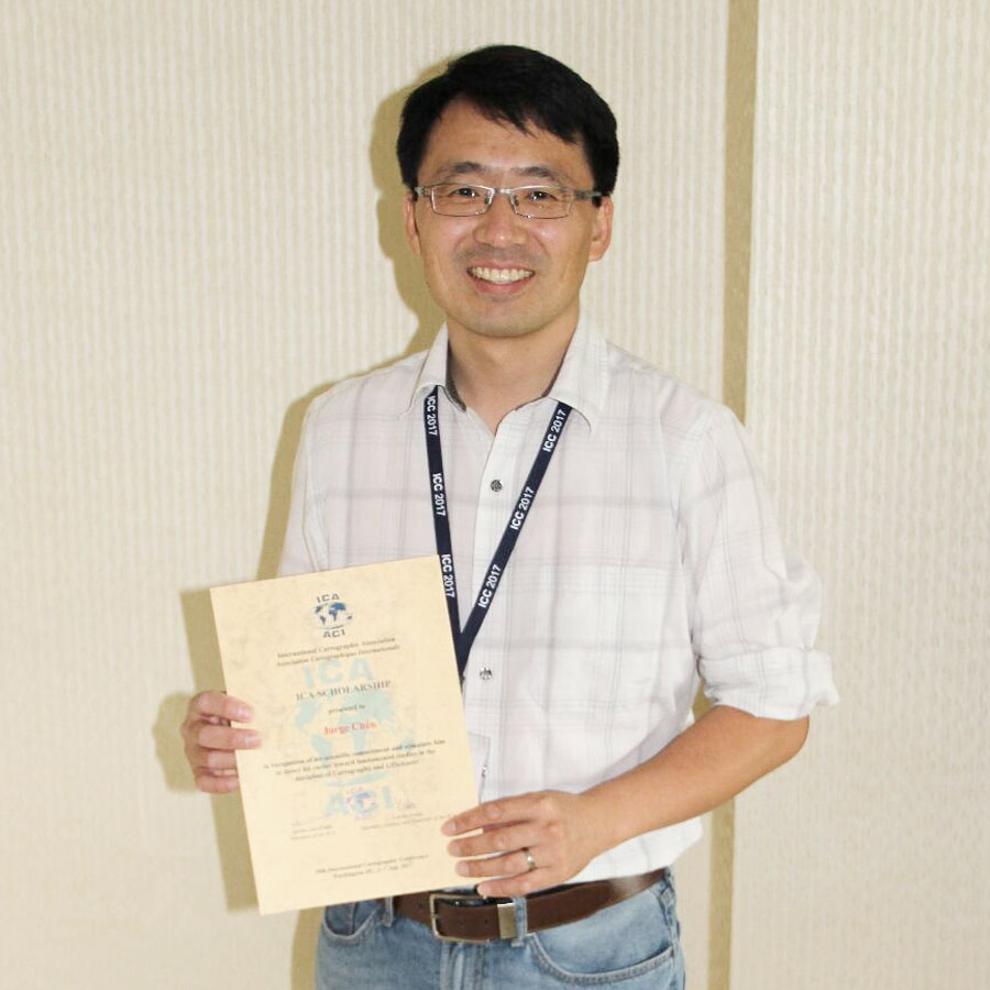
Jorge Chen at ICC2017
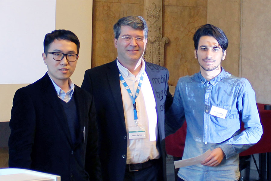
Georg Gartner, ICA past president, with Xingyu Zheng and Omid Reza Abbasi at the 13th Conference on Location-Based Services, Vienna
List of Awardees
| Name | Country | ICA event | Date | Title of paper / poster | Sum in € | Sum in $ |
|---|---|---|---|---|---|---|
| Carmelo Ignaccolo | USA | ICC2023 | 08/2023 | Exclusionary tales on Beirut’s spaces of craftsmanship: tracing forms of enduring inequities through historical cartography and geolocated archival images | 300 | |
| Timothy J. Prestby | USA | ICC2023 | 08/2023 | In Maps We Trust | 600 | |
| Esther Akoto Amoako | USA | ICC2023 | 08/2023 | Associations Between Spatial Patterns of 2020 Covid-19 Case Rates and Zip Code Level Residential Burglary (2019-2020) in Chicago, Illinois | 600 | |
| Binbin Lin | USA | ICC2023 | 08/2023 | Mapping the temporally evolved geographic disparities of public perceptions of COVID-19 through social media | 300 | |
| Nakul Gupta | USA | ICC2023 | 08/2023 | Spatial analysis of city-level weather and investor sentiments to study their impact on stock prices of dual-listed companies | Automating conversion of remote sensing images to human readable map images using generative AI | 600 | |
| Wojciech Dawid | POL | ICC2023 | 08/2023 | Generalization of the digital elevation model for the purposes of military passability maps development | 600 | |
| Zulfa Nuraini Afifah | IDN | ICC2023 | 08/2023 | Diet Map: Participatory Mapping Application for Specific Diets | 500 | |
| Jagadish Boodala | IND | ICC2023 | 08/2023 | Addressing the unresolved proximity conflicts during the generalization of buildings using CartAGen | 500 | |
| Lucy Roberts | USA | ICC2023 | 08/2023 | Creating a Global Historic Maritime Trade Model Using a Least-cost Surface Analysis | 300 | |
| Joynal Abedin | USA | ICC2023 | 08/2023 | Mapping the geographically and temporally evolved flood risks in the contiguous United States | 600 | |
| Chelsea Nestel | USA | ICC2023 | 08/2023 | Mapping Across the Curriculum: Cartographic Theory for K-8 Education | 300 | |
| Lily Houtman | USA | ICC2023 | 08/2023 | At the Intersection of Mobile Thematic Cartography and Data Journalism | 600 | |
| Márton Pál | HUN | ICC2023 | 08/2023 | Setting standards for cemetery spatial databases – a case study in the Roman Catholic Archdiocese of Eger, Hungary | Geosite database of the High Gerecse Hills (Hungary): with cartographic and GIS-based methodologies | Preparing the geodiversity map of Hungary in line with the UNESCO SDGs | Using drone photogrammetry for establishing a 3D geosite model application | 1000 | |
| Zihan Liu | DEU | ICC2023 | 08/2023 | The Potential of VGI and Traffic Flow Generation. Model for Solving the Traffic Sensor Location Problem | 150 | |
| Azile Mdleleni | ZAF | ICC2023 | 08/2023 | The challenge of co-operative governance of addresses and address data in Mankweng and surroundings in Limpopo, South Africa | What moderates the terrain reversal effect in shaded relief maps? | 900 | |
| Zhaoxu Sui | USA | ICC2023 | 08/2023 | Endonyms or Exonyms: How map purpose, data source, and map language impact place naming on maps | 300 | |
| Miloš Basarić | SRB | ICC2023 | 08/2023 | Automatic Extraction and Placement of Building Point Vector Data from Aerial Imagery for the 1: 25 000 Topographic Map Production | 300 | |
| Gabrielle Silva Gardim | BRA | ICC2023 | 08/2023 | Spatial Analysis and Geovisualization of Scoropion Accident in Brazil: its Relation with Climate and Urbanization | 900 | |
| Théo Szanto | FRA | ICC2023 | 08/2023 | Making the Minecraft® on demand project open-source and ex- tensible by the community | 600 | |
| Nuzhat Tabassum Nawshin | USA | ICC2023 | 08/2023 | Design Recommendations for Map-based Storytelling in Augmented Reality: A Preliminary Study | 150 | |
| Yanan Wu | USA | ICC2023 | 08/2023 | Modeling of emergency incident with GPS trajectory data using random forest algorithm | 300 | |
| Alicia Adelle Iverson | USA | ICC2023 | 08/2023 | An introduction to (C)art Therapy: Sketch mapping workshops for early teens as a case study in Post-Representational Cartography | 600 | |
| Edina Hajdú | HUN | ICC2023 | 08/2023 | Geosite database of the High Gerecse Hills (Hungary): with cartographic and GIS-based methodologies | 600 | |
| Roya Habibi | IRN | ICC2023 | 08/2023 | Dealing with spatial heterogeneities to discover spatiotemporal event behaviour | 900 | |
| Morteza Karimzadeh | USA | ICC2023 | 08/2023 | Characterizing Spatial Accessibility of COVID-19 Testing and Vaccination Sites using Dasymetric Mapping and GIs | 600 | |
| José Pablo Ceballos Cantú | AUT | ICC2023 | 08/2023 | Understanding Relevance in Maps through the use of Knowledge Graphs | 600 | |
| Yue Lin | USA | AutoCarto 2022 | 11/2022 | Developing Synthetic Individual-Level Population Datasets: The Case Of Contextualizing Maps Of Privacy-Preserving Census Data | 250 | |
| Gunjan Barua | USA | AutoCarto 2022 | 11/2022 | Understanding perception of different urban thermal model visualizations | 250 | |
| My-Thu Tran | USA | AutoCarto 2022 | 11/2022 | Estimating and mapping wildfire risk and its impacts on residents in the San Francisco Bay Area region | 100 | |
| Kwang-il (Jason) Yoo | USA | AutoCarto 2022 | 11/2022 | Cartographic Aspects of Animated Epidemiological Dashboards: A Human Subjects Experiment | 500 | |
| Malak Alasli | HUN | AutoCarto 2022 | 11/2022 | Hungarian Gazetteer of Maghrebian place names | 500 | |
| Yalin Yang | USA | AutoCarto 2022 | 11/2022 | Quantifying the impacts of social infrastructure on human networks | 100 | |
| Hoeyun Kwon | USA | AutoCarto 2022 | 11/2022 | The unequal impact of COVID-19: An analysis of mobility behaviors of sociallyvulnerable populations | 500 | |
| Yanan Wu | USA | AutoCarto 2022 | 11/2022 | Analyze emergency-vehicle dispatches in Dallas, Texas, USA | 250 | |
| Yuhao Kang | USA | AutoCarto 2022 | 11/2022 | A Review and Synthesis of Recent GeoAI Research for Cartography: Methods, Applications, and Ethics | 500 | |
| Timothy Prestby | USA | EuroCarto 2022 | 09/2022 | Content Analysis of COVID-19 Cartographic Journalism | 500 | |
| Nour Naaouf | HUN | EuroCarto 2022 | 09/2022 | GIS-based approach for assessing the Potential Sites of Large-Scale generation of Solar energy: A case study of Al-Hasakeh governorate, Syria | 300 | |
| Jesús Balado Frías | ESP | EuroCarto 2022 | 09/2022 | Automatic mapping direct sun glares on roads with point clouds. Case study of EP2005, Vigo, Spain | 300 | |
| Daniel Orongo Nyangweso | HUN | EuroCarto 2022 | 09/2022 | History and Potential National and Regional Atlas Issues in East Africa | 300 | |
| Katarzyna Słomska-Przech | POL | EuroCarto 2022 | 09/2022 | User Study of Heat Maps with Different Levels of Generalisation | Atlas Fontium – examples of the Historical Atlas of Poland 2.0 data use | 500 | |
| Mariam Gambashidze | GER | EuroCarto 2022 | 09/2022 | Mapping complex history on the web: Is a point-based approach a better way? | 300 | |
| Markéta Beitlová | CZE | EuroCarto 2022 | 09/2022 | How Czech Geography Teachers Use School Atlases? | Eye-tracking Assessment of Swipe and Multiple Views | 500 | |
| Carolin Rünger | GER | EuroCarto 2022 | 09/2022 | A free collection of adjustable typical German map symbols | 500 | |
| Lily Houtman | USA | EuroCarto 2022 | 09/2022 | Mapping U.S. Elections: An Empirical Analysis of Design Techniques | 500 | |
| Márton Pál | HUN | EuroCarto 2022 | 09/2022 | How to interpret geodiversity as a spatial variable? | Cartographic and GIS aspects of geosite assessment: a case study in the Gerecse Hills, Hungary | 500 | |
| Veronika Flóra Kiss | HUN | EuroCarto 2022 | 09/2022 | Developing cartographic literacy: Lessons learned from 20th century Hungarian school atlases | 500 | |
| Darya Lapo | GER | EuroCarto 2022 | 09/2022 | Semantic-driven Geospatial Data Visualization Approach for an Agricultural Use Case: Apple-growing in South Tyrol, Italy | 120 | |
| Edina Hajdú | HUN | EuroCarto 2022 | 09/2022 | Cartographic and GIS aspects of geosite assessment: a case study in the Gerecse Hills, Hungary | 300 | |
| Anja Cenameri | HUN | EuroCarto 2022 | 09/2022 | Comparing Local Climate Zone mapping results of Tirana through different approaches | 300 | |
| Zhiyong Zhou | CHE | EuroCarto 2022 | 09/2022 | Building simplification of vector maps using graph convolutional neural networks | 300 | |
| Camilo Cardona Torres | GER | EuroCarto 2022 | 09/2022 | Use of infrastructure parameters from OSM data to assess cyclist safety in European cities | 300 | |
| Héctor Ochoa Ortiz | AUT | EuroCarto 2022 | 09/2022 | Pedestrian routing of periodically changing areas using Volunteered Geographical Information (OpenStreetMap) | 120 | |
| Halil İbrahim Şenol | TUR | EuroCarto 2022 | 09/2022 | Building Footprint Extraction from High Resolution UAV Images Using Deep Learning Algorithms in the Context of Unplanned Urbanisation | 500 | |
| Tong Qin | BEL | EuroCarto 2022 | 09/2022 | Visual attention and neuro-cognitive processes in map use | Building Footprint Extraction from High Resolution UAV Images Using Deep Learning Algorithms in the Context of Unplanned Urbanisation | 500 | |
| Miloš Basarić | SER | EuroCarto 2022 | 09/2022 | Deep learning for anchor detection in multi-scale maps | Automatic Georeferencing, Ground Control Points, Scanned Maps, OpenCV, GDAL | 750 | |
| Iaroslav Andreevich Boretskii | GER | EuroCarto 2022 | 09/2022 | Developing a recommender system for suggesting alternative ways of data visualization for Sustainable Development Goals | 500 | |
| Ana Oliva Pinilla Pachon | GER | EuroCarto 2022 | 09/2022 | Analysis of a Workflow for the Automated Generalization of Geological Maps | 300 | |
| Zulfa Nur’aini ‘Afifah | NLD | EuroCarto 2022 | 09/2022 | Open Educational Resources for Teaching Thematic Mapping | 500 | |
| Malak Alasli | HUN | EuroCarto 2022 | 09/2022 | Addressing Maghrebian place names from a Hungarian perspective | 300 | |
| Filip Dohnal | CZE | EuroCarto 2022 | 09/2022 | Changes in the content of topographic maps in relation to their use in the history. | 300 | |
| Chukwuma John Okolie | GBR | EuroCarto 2022 | 09/2022 | Fusion of Copernicus and ALOS World 3D DEMs for watershed and stream network delineation | 300 | |
| Merve Polat Kayali | GBR | EuroCarto 2022 | 09/2022 | A Participatory Approach to Develop Missing Geospatial Data Visualisation | 120 | |
| Vivien van Dongen | GER | EuroCarto 2022 | 09/2022 | Comparing and establishing a new user centered design for ski touring maps | 300 | |
| Hatice Atalay | TUR | EuroCarto 2022 | 09/2022 | Readability Analysis of Covid-19 Maps | Comparing and establishing a new user centered design for ski touring maps | 500 | |
| Roya Habibi | IRN | EuroCarto 2022 | 09/2022 | A time-driven symbology for map visualization | 750 | |
| Rebeca Merino del Río | ESP | ICC2021 | 12/2021 | Historical Cartography Analysis For A Design Of Cultural Itineraries In The Lower Guadalquivir | 700 | |
| Andong Ma | USA | ICC2021 | 12/2021 | Computationally-Efficient Sequential Feature Extraction For Single Hyperspectral Remote-Sensing Image Classification | 260 | |
| Timothy Prestby | USA | ICC2021 | 12/2021 | Characterizing Storytelling In Covid-19 Cartographic Journalism | 700 | |
| Nicholas Lally | USA | ICC2021 | 12/2021 | Direct Manipulations Of Cartographic Space For Expressive Cartographies | 260 | |
| Edina Hajdú | HUN | ICC2021 | 12/2021 | The Digital Cartographic Reconstruction Of The 1897 ‘Mátra Guide’ (Hungary) | 700 | |
| Márton Pál | HUN | ICC2021 | 12/2021 | Automatic Vectorization Of Rectangular Manmade Objects: A Case Study Applying Opencv And Gdal On Uav Imagery | Where To Hike? – Mobile Application For Guiding Tourists In The Bükkalja Region, Hungary | Geodiversity Mapping Of The Bakony–Balaton Unesco Global Geopark, Hungary | 1000 | |
| Gergely Vassányi | HUN | ICC2021 | 12/2021 | Automatic Vectorization Of Point Symbols On Archive Maps Using Deep Convolutional Neural Network | 1000 | |
| Lourdes Johanna Avelar Portillo | USA | ICC2021 | 12/2021 | Measuring Closest Water, Sanitation, And Hygiene Facilities In Unhoused Communities Of Los Angeles, Usa | 700 | |
| Gene Trantham | USA | ICC2021 | 12/2021 | Focus On Orientation To Represent Terrain | 300 | |
| Lois Park | USA | ICC2021 | 12/2021 | Reimagining Measures Of Spatial Access To Health Care In Low- And Middle-Income Countries: Using Road Network Analysis To Validate Self-Reported Perceptions Of Geospatial Barriers | 700 | |
| Jakub Koníček | CZE | ICC2021 | 12/2021 | Mapping, Synthesis And Visualization Of Czech Dialects | Approaches For Infographics Evaluation In Maps | 1000 | |
| Jessica Kate Hepburn | GBR | ICC2021 | 12/2021 | How Do Decision Makers Interact With Geospatial Data? An Eye Tracking Study | 260 | |
| Malak Alasli | HUN | ICC2021 | 12/2021 | Dual Naming As A Mechanism To Recognize Multiple Identities; Casablanca Or Ad-Dar Al-Bayda | 1000 | |
| Harrison Cole | USA | ICC2021 | 12/2021 | Thematic Tactile Cartography: Evaluating Tactile Mapping Techniques For Novel Applications | 700 | |
| Yanan Wu | USA | ICC2021 | 12/2021 | Where And Why There: Location Analytics Of Routine Occurrences (Laro) With A Case Study On Traffic Accidents | 300 | |
| Chelsea Nestel | USA | ICC2021 | 12/2021 | Aesthetics In Cartographic Epistemology | 500 | |
| Dávid Gerzsenyi | HUN | ICC2021 | 12/2021 | Frmod, A Python Tool For Statistical Landslide Susceptibility Assessment | 1000 | |
| Pavel Ugwitz | CZE | ICC2021 | 12/2021 | Building A Virtual Cartographic Museum | 700 | |
| Ondřej Kvarda | CZE | ICC2021 | 12/2021 | Usability Of Building Information Modeling (Bim) For Generating Virtual Geographic Environments (Vges) | 700 | |
| Lei Zou | USA | ICC2021 | 12/2021 | Revealing The Geographical Disparities Of Global Covid-19 Awareness And Its Health Effects Through Social Media | 260 | |
| Julian Huiber | AUT | ICC2021 | 12/2021 | A Set Of Criteria For Evaluating Map Application Design In A Mobile Environment | 260 | |
| Marc Schulz | AUT | ICC2021 | 12/2021 | A Set Of Criteria For Evaluating Map Application Design In A Mobile Environment | 260 | |
| Veronika Flóra Kiss | HUN | ICC2021 | 12/2021 | The Sense Of North | 700 | |
| Niédja Sodré de Araújo | BRA | ICC2021 | 12/2021 | Perspectives About Implementation Of Colour Codes On Maps Accessible To Blind People | 150 | |
| Katarzyna Słomska-Przech | POL | ICC2021 | 12/2021 | Historical Atlas Of Poland 2.0 – Over 140 Years Of Joint Work Of Historians And Cartographers | 700 | |
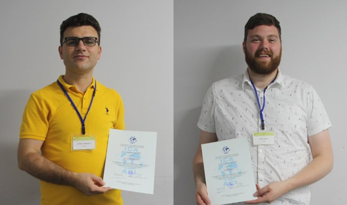
| Aytaç YÜRÜKÇÜ | TUR | History of Cartography and the Topographic Mapping | 07/2019 | How East and West Cartographic Studies Influenced the Most Important 16th Century Ottoman Cartographer of Piri Reis and His World Maps | 200 | |
| Dr. Lei ZOU | USA | LocBigData 2019 | 07/2019 | Leveraging Location-Based Social Media for Smart Emergency Management | 200 | |
| Christian RÖGER | DEU | LocBigData 2019 | 07/2019 | Visualizing the Complexity of Crossings using Star-Plot Maps | 200 | |
| Wangshu WANG | AUT | Joint Pre-Conference Workshop of the ICA Commission on Use, Users, and Usability, the Commission on Cognitive Visualization, the Commission on Location-based Services and the Commission on Visual Analytics | 07/2019 | Towards a Functional Ontology for Mobile Map Applications | 200 | |
| Nargiz Safaraliyeva | AZE | ICC2019 | 07/2019 | Teaching basic map concepts in three countries: Azerbaijan, Hungary and United Arab Emirates | 1000 | |
| Malak Alasli | MAR | ICC2019 | 07/2019 | Toponyms’ contribution to identity: The case study of Rabat (Morocco) | Static Risk Mapping of Forest Fires – In the case of the Province of Chefchaouen (Morocco) | 800 | |
| Shyamantha SUBASINGHE | LKA | ICC2019 | 07/2019 | Urban Growth: From pixel to reality | 700 | |
| Dr. Alena Vondráková | CZE | ICC2019 | 07/2019 | TouchIt3D: Technology (not only) for Tactile Maps | The Specifics of Cartographic Semiology in Tactile Maps | 600 | |
| Ashna Kareem Zada | IRQ | ICC2019 | 07/2019 | Testing Maps for Visually Impaired People in Kurdistan | 600 | |
| Jagadish B | IND | ICC2019 | 07/2019 | Deriving Multiple Representation Database: A Model Generalisation Approach | 500 | |
| Lukasz Halik | POL | ICC2019 | 07/2019 | Teaching of geographical space relations for cartography – Academic Outdoor Station in Poznan (Poland) | Workflow for 3D geovisualization of the data obtained with the use of Unmanned Aerial Vehicle in Augmented Reality | The visualization of the use of land on the basis of the dynamics of the pedestrian movement from the interval UAV imaging | Measuring user preferences in virtual reality (VR): 2D versus 3D urban geovisualizations of topographic data | 500 | |
| Márton Pál | HUN | ICC2019 | 07/2019 | Digital cartography for geoheritage: turning an analogue geotourist map into digital | Possibilities of high precision GPS data in autonomous driving | 500 | |
| Nikola Yonov | BGR | ICC2019 | 07/2019 | School Atlas with Augmented Reality | 500 | |
| Radek Barvir | CZE | ICC2019 | 07/2019 | The Specifics of Cartographic Semiology in Tactile Maps | TouchIt3D: Technology (not only) for Tactile Maps | 500 | |
| Pongpichaya William Limpisathian | USA / THA | ICC2019 | 07/2019 | Representations of Place in the Human Brain | 400 | |
| Ivan Evgenyevich Fokin | Russia | ICC2019 | 07/2019 | The automation of processes of atlas mapping | Methods and algorithms for creation of structural schemes of rivers | 400 | |
| Nick Lally | USA | ICC2019 | 07/2019 | Mapping dynamic, non-Euclidean spaces | Interactive & Multiscale Thematic Maps: A Preliminary Study | 400 | |
| Xiao Huang | USA / CHN | ICC2019 | 07/2019 | Linking picture with text: tagging flood relevant tweets for rapid flood inundation mapping | 400 | |
| Carolyn S. Fish | USA | ICC2019 | 07/2019 | Emotional responses to climate change map framing using facial emotion recognition technology | 300 | |
| Harrison Cole | USA | ICC2019 | 07/2019 | Toward Accessible Hazard Mapping: Tactile Risk Maps and Disaster Preparedness | 300 | |
| Laure De Cock | BEL | ICC2019 | 07/2019 | Linking perception to decision point complexity for adaptive indoor wayfinding support | 300 | |
| Maja Kalinic | DEU / BIH | ICC2019 | 07/2019 | Floating Car Data and Fuzzy Logic for classifying congestion indexes in the city of Shanghai | 300 | |
| Ross Thorn | USA | ICC2019 | 07/2019 | How to Play with Maps | 300 | |
| Krisztián Kerkovits | HUN | 7th ICC&GIS (commission meeting) | 06/2018 | Optimising distortions in projections of geographical maps | 250 | |
| Lukas Neugebauer | AUT | 11th Mountain Cartography Workshop | 05/2018 | Topographic Maps and Weather Information for Avalanche Prevention in Remote Mountainous Areas Utilizing a Collaborative Approach | 250 | |
| Tomislav Jogun | HRV | 11th Mountain Cartography Workshop | 05/2018 | Delineation of Croatian Mountains for the Purpose of Name Placement on Maps | 250 | |
| Maša Arnež | SVN | 11th Mountain Cartography Workshop | 05/2018 | Joint Course of Mapping in Mountainous Area: Physical and topographic mapping | 250 | |
| Benedikt Hajek | AUT | 11th Mountain Cartography Workshop | 05/2018 | Topographic Maps based on OpenStreetMap Data – Optimising Depiction of Water Streams | 250 | |
| Matan Mor | ISR | LBS 2018 | 01/2018 | Automatic Computation of Touristic Routes based on WWW Geotagged Photos | 500 | |
| Joris van der Berg | NED | LBS 2018 | 01/2018 | Towards a Dynamic Isochrone Map: Adding Spatiotemporal Traffic and Population Data | 400 | |
| Roos Teeuwen | NED | LBS 2018 | 01/2018 | Using a Dynamic Sensor Network to Obtain Spatiotemporal Data in an Urban Environment | 400 | |
| Andreas Sedlmeier | DEU | LBS 2018 | 01/2018 | Discovering and Learning Recurring Structures in Building Floor Plans | 300 | |
| Julia Mia Stirnemann | CHE | ICC Workshop on Maps & Emotions | 07/2017 | Viewpoints evoke emotions | 400 | |
| Javiera Advis | CHL / DEU | ICC Workshop on Maps & Emotions | 07/2017 | LINESCAPES: virtual and real experiences of cities | 400 | |
| Sébastein Biniek | FRA | ICC2017 | 07/2017 | Designing typefaces for maps. A protocol of tests. | 1000 | |
| Mateusz Pitura | POL | ICC2017 | 07/2017 | Hebrus Valles – The Mars Exploration Zone Map | 1000 | |
| Vit Paszto | CZE | ICC2017 | 07/2017 | Crowdsourcing Mapping and Participatory Planning Support System: Case Study of Brno, Czech Republic | Playing with maps – using geogames in geography field-courses | Reflective 2D visualization of 3D objects using cartographic projection | 1000 | |
| Yvette Bevis | RSA | ICC2017 | 07/2017 | Expert opinions on using the third dimension to visualise wind speed uncertainty for wind farm planning | 1000 | |
| Jelena Glisovic | SRB | ICC2017 | 07/2017 | The First Special Military Map Printed in Serbia | 1000 | |
| Katrin Glinka | DEU | ICC2017 | 07/2017 | Psychogeography in the age of the quantified self — Mental map modelling with georeferenced personal activity data | 1000 | |
| Syed Attique Shah | TUR | ICC2017 | 07/2017 | A Framework for Enhancing Real-time Social Media Data to Enhance Disaster Management Process | 1000 | |
| Olawale Oluwafemi | NIG | ICC2017 | 07/2017 | Effect of Sediment-Hosted Disseaminated Gold Deposit Mining on the Landscape of Itagunmodi-Igun Basin, SW. Nigeria | 1000 | |
| Shahmy Said | MAS / GBR | ICC2017 | 07/2017 | Classifying the Diversity of Bus Mapping Systems; Mapping Landslides Susceptibilty In a Traditional Northern Nigerian City | 1000 | |
| Lanfa Liu | CHN / DEU | ICC2017 | 07/2017 | Feature learning for soil property mapping using Vis-NIR spectroscopy | – | |
| Song Gao | USA | ICC2017 | 07/2017 | Identifying Geographic Features through Map Interpretation: A Case Study of Craters Using Controlling Variables | 100 | |
| Amber Bosse | USA | ICC2017 | 07/2017 | For the Essentially Subjective Elements of Cartography, 1953-1995 | 100 | |
| Annita Lucchesi | USA | ICC2017 | 07/2017 | Hóhta’Hané: Mapping Genocide & Restorative Justice In Native America | 100 | |
| Andreas Keler | DEU | ICC2017 | 07/2017 | Towards Traffic Bottleneck Visualization – Combining Traffic Congestion and Complicated Crossings | 100 | |
| Jorge Chen | USA | ICC2017 | 07/2017 | Rapid integration of indoor and outdoor coordinate reference systems using 3D point cloud data | 100 | |
| Jiri Pánek | CZE | ICC2017 | 07/2017 | Crowdsourcing Mapping and Participatory Planning Support System: Case Study of Brno, Czech Republic | Playing with maps – using geogames in geography field-courses; Reflective 2D visualization of 3D objects using cartographic projection | Psychophysics: The Foundation of Cartography | Research on Automatic Generation of Map Symbols based on Cognitive Semantics Analysis | Exploring visual cognition efficiency in map handling ability based on the eye movement experiment | 100 | |
| Michele Denner | RSA | ICC2017 | 07/2017 | Assessing a potential solution for spatially referencing of historical aerial photography in South Africa | 100 | |
| Omid Reza Abbasi | IRN | 13th Conference on Location-Based Services, Vienna | 11/2016 | Ranking the City: The Role of Location-Based Social Networks in Collective Human Mobility Prediction (co-author: Ali Asghar Alesheikh) | 500 | |
| Xingyu Zheng | CHN | 13th Conference on Location-Based Services, Vienna | 11/2016 | A Hiden Markov model for indoor tracking based on Bluetooth fingerprinting and step counting (three co-authors) | 500 | |
| Can Yang | CHN / SWE | Visually-supported Computational Movement Analysis, AGILE workshop (ICA Commission on Visual Analytics), Helsinki | 06/2016 | Interactive Visual Exploration of Most Likely Movements | 400 |
