


The 22nd International Cartographic Conference
took place in A Coruña, Spain, 9–16 July 2005.
Proceedings
Proceedings of the conference can be found here (external link).
General Assembly
The conference hosted the 13th General Assembly of the ICA.
Minutes (in English an French)
International Cartographic Exhibition
A total of 1000 maps were selected from the entries (including hydrographical charts) for the international map exhibition. The best products were selected in 8 categories by an international jury with the following members:
- Joel Morrison, Chair (USA)
- Cindy Brewer (USA)
- Takashi Morita (Japan)
- Kira Shingareva (Russia)
- Felicia Akinyemi (Nigeria)
- Peter Joly (IMYA)
- Christiane Ramos (Brazil)
- Lucie Friedmannova (Czech Republic)
- Fernando Aranaz (Spain)
| Topographic Maps | 1st: Topographic Map of Bhutan, The Netherlands, “With this map, our Dutch colleagues have introduced a new generation of topographic mapping. This outstanding map gives a vivid visual impression of the surface of the planet. Using Shuttle Radar Topography Mission, SRTM data, with ERDAS imagine 8.7 for mosaicing and shading, ArcGIS 9 enabled cartographic finishing. The results are outstanding.” 2nd: Map of Macao Special Administrative Region and Adjacent Regions, China 3rd: Topographic Map of the Netherlands, Sheet 17 H Emmen, The Netherlands |
| Thematic Maps | 1st: Land Environments of New Zealand, New Zealand, “This poster like map is very visually effective. It uses a collection of maps of different themes and explains how they were combined to provide Land Environments of New Zealand maps.” 2nd: The Population Map, USA 3rd: Sumatra Earthquake, Japan |
| Satellite Image Maps | 1st: Dovrefjell Mountain as seen from Satellite, Norway, “The geometrically corrected satellite image is draped over a DTM and results in a vivid presentation of this mountainous area. The linear features are well depicted and the color choice is outstanding.” 2nd: Overview blockmap sheet for the Land Parcel Identification System LPIS Tokaj and vicinity, Hungary 3rd: Satellitenbildkarte Galle, Austria |
| Relief | 1st: Sierra Nevada Las Alpujarras, Spain, “An impressive combination of hue and shading with physical form that show terrain while text remains easy to read on three dimensional plastic.” Only one award was given in this category due to the small number of entries. |
| Recreation and Orienteering Maps | 1st: Fife Coastal Path, UK, “This is a complete map guide. All the essential information for walkers is presented in an easy to read and carry format on compact waterproof paper in full color.” 2nd: Monte Bianco excursion map, Italy 3rd: ANWB=VVV Topographic bicycle map Noord-Holland, The Netherlands |
| Globes and Atlases | 1st: Urbes Finlandiae, The Historical Atlas of Finnish Towns, Finland, “This atlas shows the development of Finnish towns using two to five maps each. The layout is outstanding and the accompanying text clearly explains the development of each town.” 2nd: Maps of Europe 1520 to 2001, Hungary 3rd: Geographical Atlas of Poland, Poland |
| Urban Maps | 1st: City of Toronto Building Construction Data, Canada, “This map is a snapshot of growth trends in the city using yearly building information from assessment data. It has high legibility of the phenomena with brilliant color, simple design of map symbols, and appropriate map scale.” 2nd: Wroclaw plus 8. City Map, Poland 3rd: Town Map Series Tuen Mun and Yuen Long, Hong Kong |
| Other | 1st: Drawing Book of Siberia, compiled by Simon Remezov in the year 1701, Russia, “This is a very interesting collection of drawings prepared originally on the order of Peter the Great. Great care has been exercised in reproducing each of the drawings. It is a superbly rendered compilation. A companion volume of text is part of this entry.” 2nd: Model of Continental Drift, Chile 3rd: South Up Finger Map, Japan |
Barbara Petchenik Award
Too see all exhibited maps, please visit the Winner Map Collection at the Carleton University Library.
Shashini Umasha Jayawardena (8), Sri Lanka, < 9 years

Michelle Yang (5), China, < 9 years (public vote)

Moh. Afda (7), Indonesia, < 9 years (public vote)

Vilius Skrinska (8) , Lithuania, < 9 years (public vote)

Saba Andalib (10), Iran, 9–12 years

Biaoyunke Zhang (11), China, 9–12 years

Kelsi Fraser-Easton (11), Canada, 9–12 years

Daiana Emilova Hadjiiska (12), Bulgaria, 9–12 years

Holly Harrison (10), UK, 9–12 years (special)

Evelin Demeter (12), Romania, 9–12 years (special)

Marcia Grieva (12), Russia, 9–12 years (special)

Joanna Rozkosz (12) , Poland, 9–12 years (public vote)

Annamária Ferencz (12) , Romania, 9–12 years (public vote)

Nayafakda Ihsania (10) , Indonesia, 9–12 years (public vote)

Magdalena Stanisławska (11) , Poland, 9–12 years (public vote)
Alicja Ogorzelska (13), Poland, 13–15 years (special)

Gintarė Kvietkutė (13), Lithuania, 13–15 years (special)

Bar Omer and Liora Haimov (14), Israel, 13–15 years (jury+public)

Nicholas William (15), Indonesia, 13–15 years (jury+public)

Polina Kosovskaya (15) , Russia, 13–15 years (public vote)

Read the PDF report.
Travel Awards
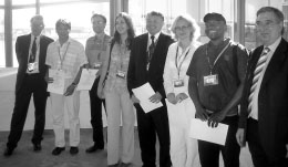
ICA Travel Awardees and members of the Executive Committee
| Elena Cherepanova | Russia | GIS solar planetary system: case study of the ArcGIS planet |
| Cristiane da Silva Ramos | Brazil | Expanding map access for Brazilian children: an open source template for publishing school atlases on the Web |
| Vadym Kaydash | Ukraine | New elemental abundance maps integrating optical and geochemical data on the lunar surface |
| Georges Herbert Chekuimo | Cameroon | Integrating ecological tools with GIS: modelling animal dispersal |
| Sergio Fiori | Brazil | Touristic maps: the challenge of using art in the digital era |
| Ulanbek Turdukulov | Kirgizistan | Visualization of events in time-series of remote sensing data |
| Dragutin Protic | Yugoslavia | Development of digital cartographic database for managing of the environment and natural resources in the republic of Serbia |
| Carla Gimenez | Brazil |
Orienteering event
To see details and results of the orienteering event, please visit our orienteering page.
