


The orienteering sport (see Wikipedia) plays an important role at ICA events. The following information was collected by László Zentai, who is always happy about emails with additional information, photos and materials.
2023 – Cape Town, South Africa
Orienteering-related presentations
- 3028 Use of LiDAR drone data for O-mapping and change detection in mountainous areas, Dušan Petrovič, Klemen Kozmus Trajkovski and Dejan Grigillo
- 5307 History of orienteering maps: in the light of the evolution of survey and reproduction techniques, László Zentai
Orienteering event
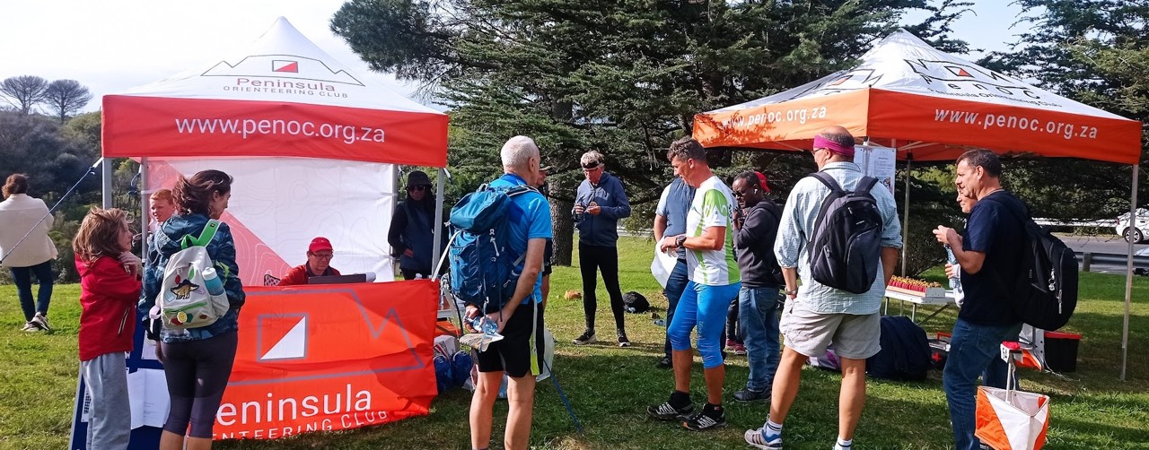
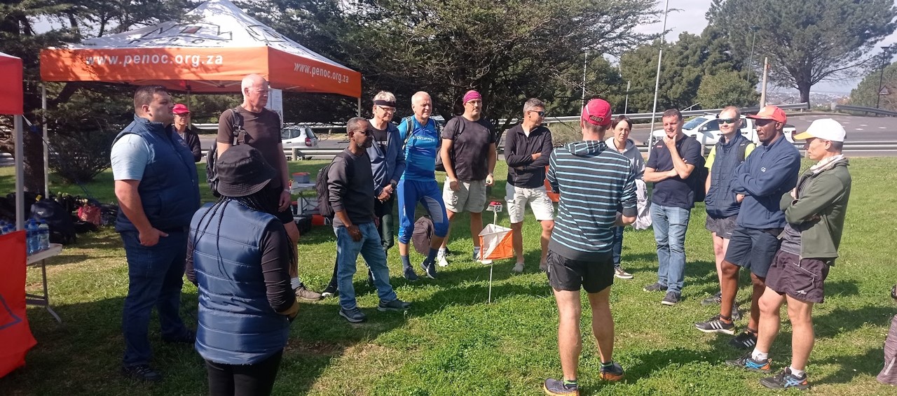
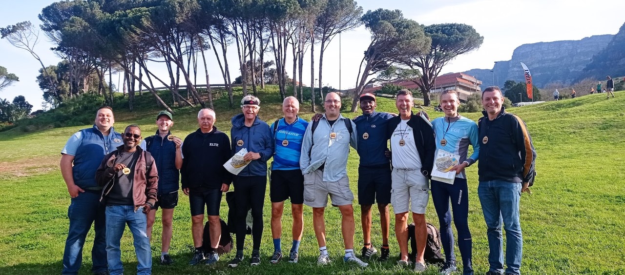
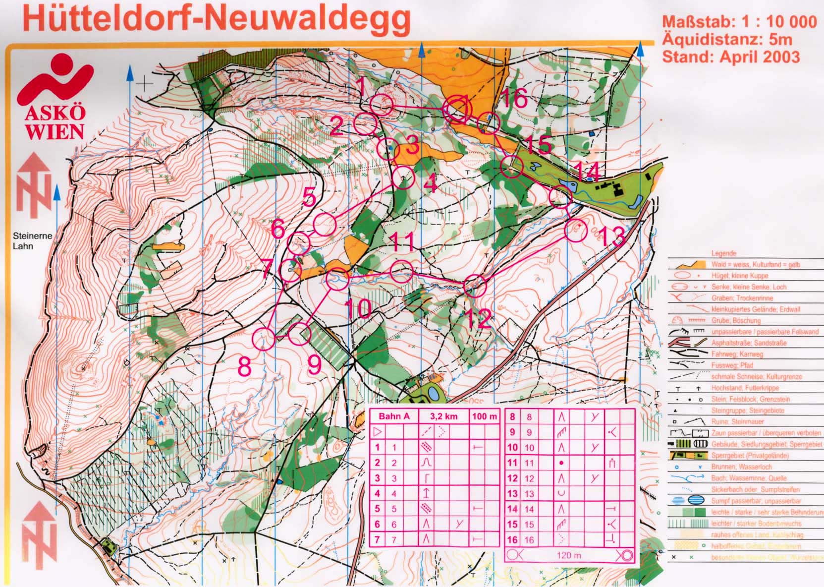
The ICC2023 orienteering event took place on August 12, 2034 at the University of Cape Town.
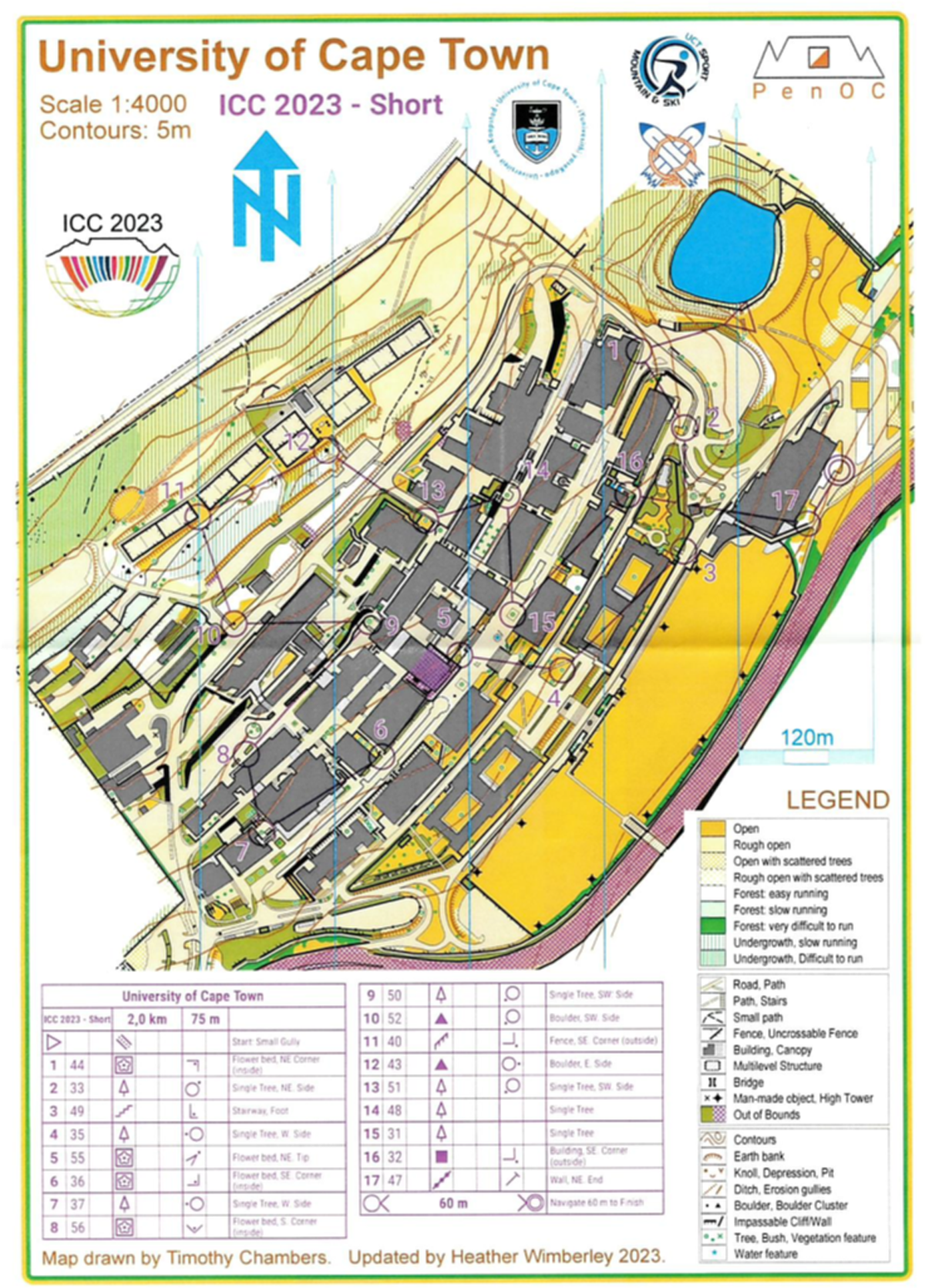
Map of the long course
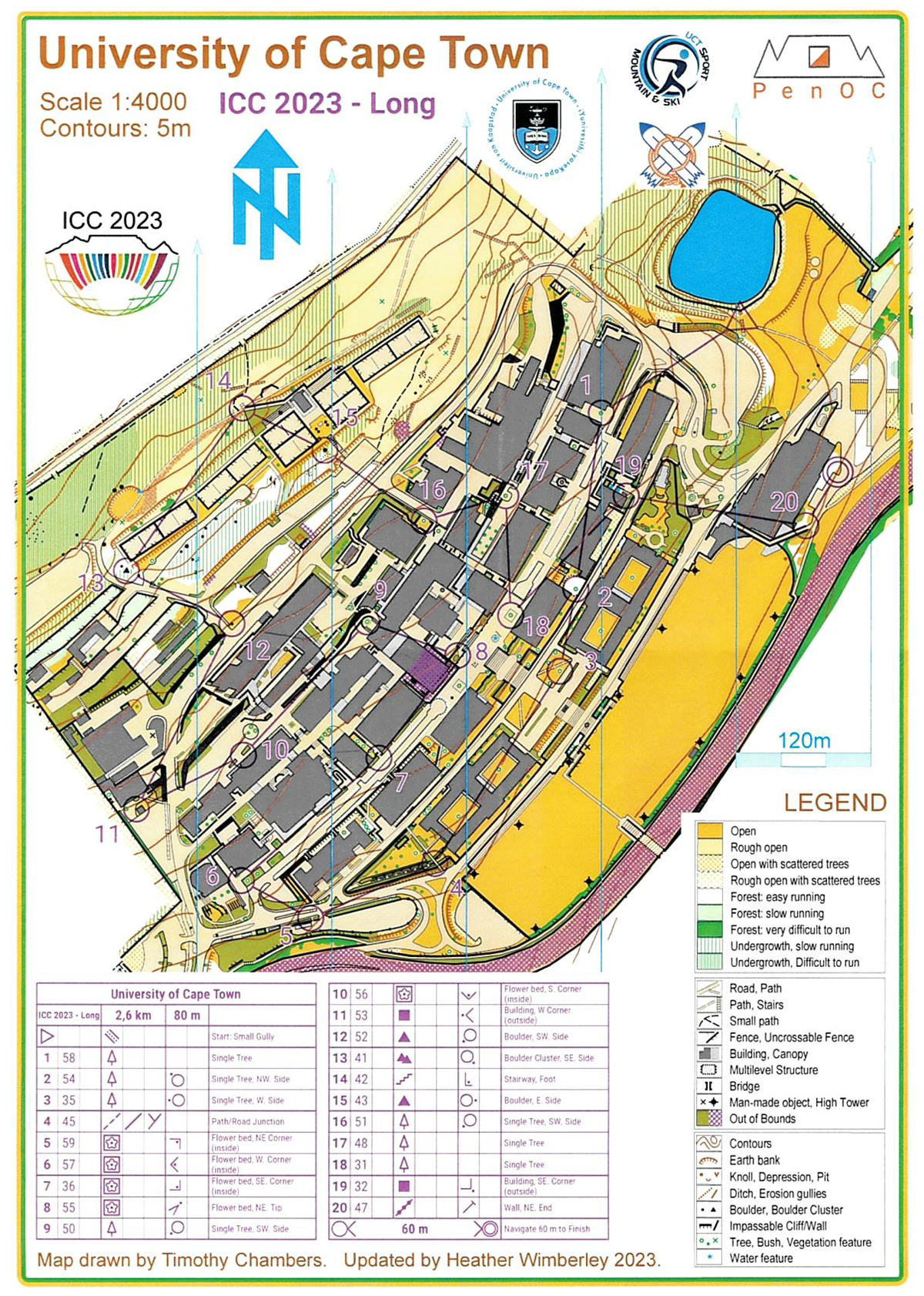
Map of the long course
Long course – 2.6 km, 80 m elevation, 20 control points
| Name | Country | Time | |
| 1 | Dušan Petrovič | Slovenia | 19:53 |
| 2 | Pyry Kettunen | Finland | 20:55 |
| 3 | Terje Midtbø | Norway | 27:21 |
Short course – 2.0 km, 75 m elevation, 17 control points
| Name | Country | Time | |
| 1 | Menno-Jan Kraak | Netherlands | 25:36 |
| 2 | László Zentai | Hungary | 25:56 |
| 3 | Dmitrii Loginov | Russia | 26:09 |
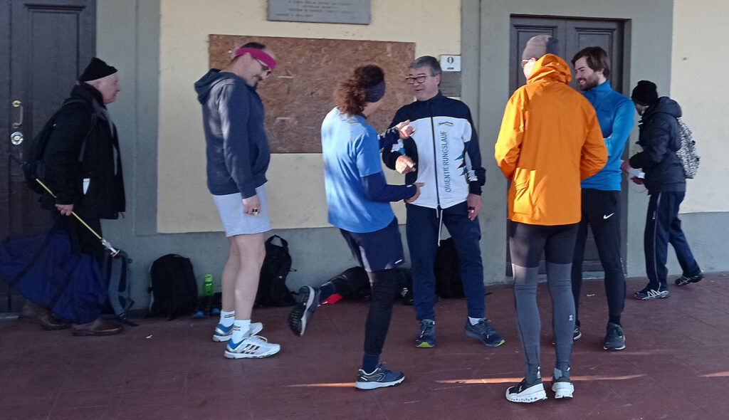
2021 – Florence, Italy
Orienteering-related presentations
- T18-1 Mapant Spain: an Automatically Generated Orienteering Map for Spain, Jesús María Garrido Sáenz De Tejada, Manuel Jurado Alonso, Agustín Caballero Belda, Javier Arufe Varela, Jesús Moreno Jabato
- T18-1 Route Planning on Orienteering Maps With Least-Cost Path Analysis, Albert Gáspár, Zsófia Sárközy
- T18-1 Maps of First Orienteering Events, László Zentai
- T18-1 Presenting Multilevel Environment on Orienteering Maps, Dušan Petrovič
Orienteering event
The ICC2021 orienteering event took place on December 18, 2021 at Piazzale delle Cascine, Firenze.

Map of the course
Advanced course – 3.6km, 17 control points
Males
| Name | Country | Time | |
| 1 | Dušan Petrovič | Slovenia | 16:28 |
| 2 | Mátyás Gede | Hungary | 18:47 |
| 3 | Maximilian Gartner | Austria | 19:24 |
Females
| Name | Country | Time | |
| 1 | Dojana Snopkova | Czech Republic | 23:32 |
| 2 | Bigi Velia | Italy | 30:56 |
2019 – Tokyo, Japan
Orienteering-related presentations
- T18-2-3 Cross-border topographic mapping, cross-border orienteering: the Hungarian overview, László Zentai, Gábor Gercsák
- T07-3-3 Orienteering in Geography Education in Japanese High School, Taketo Kobayashi
- P2-18 Using a free colour vision simulator to improve the accessibility of orienteering maps, Rebecca Schulga, David Forrest, Trevor Hoey
- T43-2-1 Long term archiving orienteering maps project in Slovenia, Dušan Petrovič
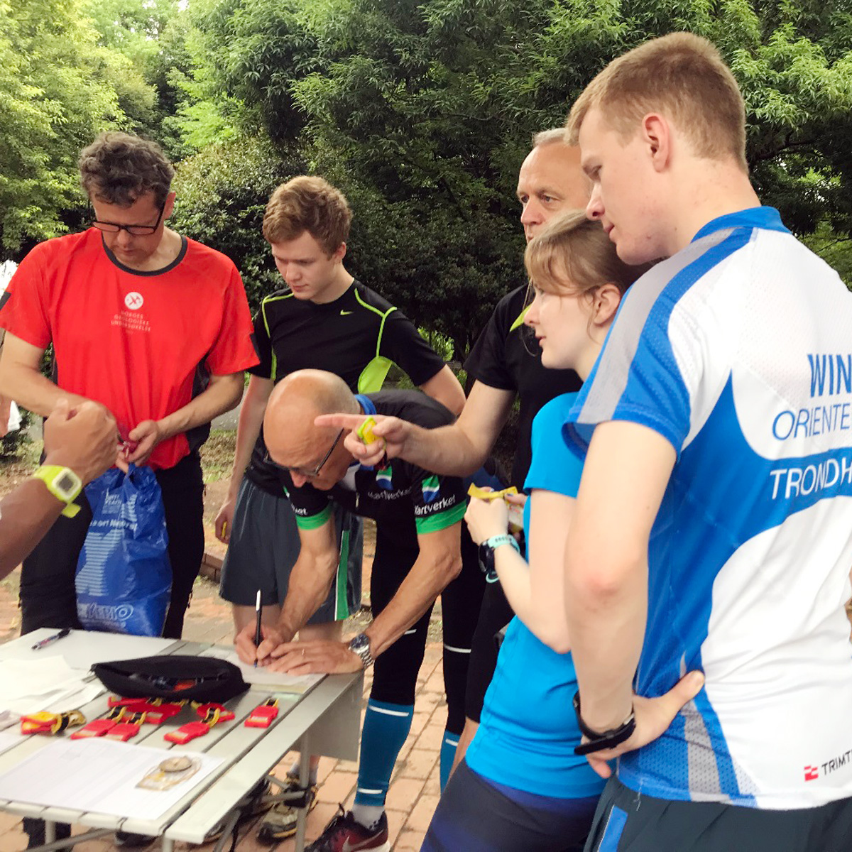
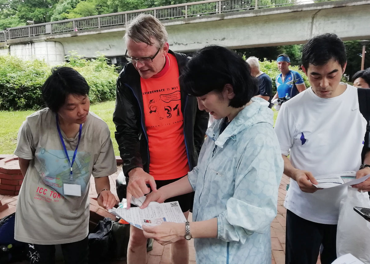
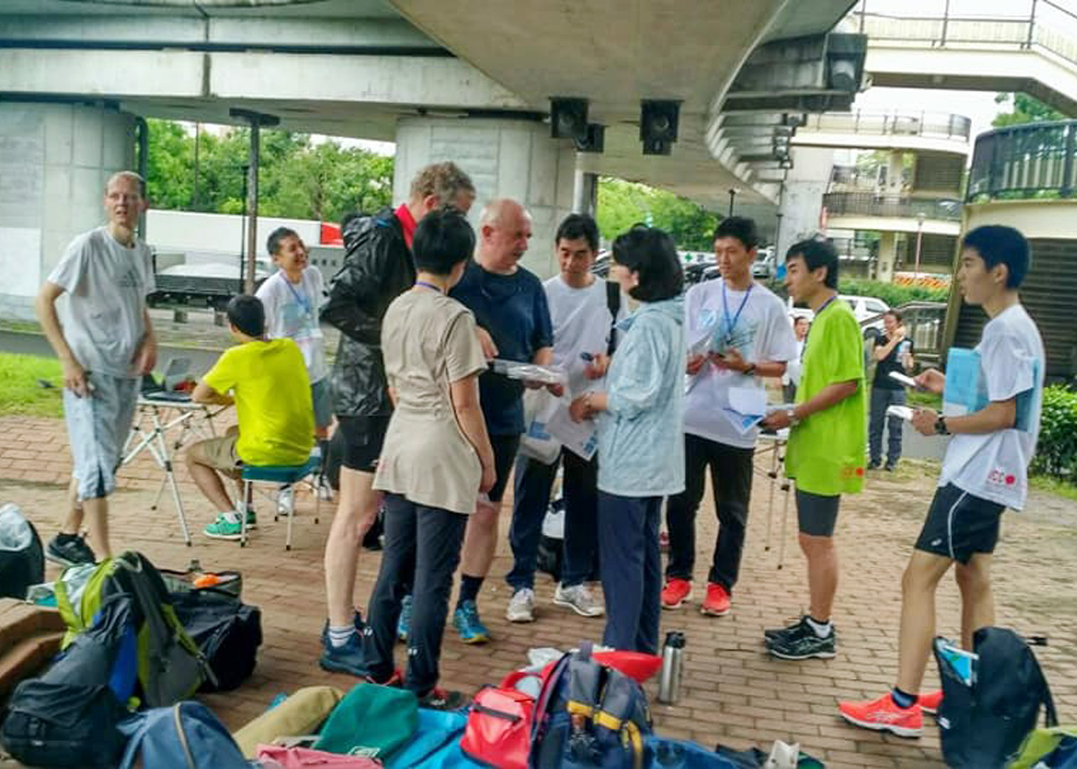
Orienteering event
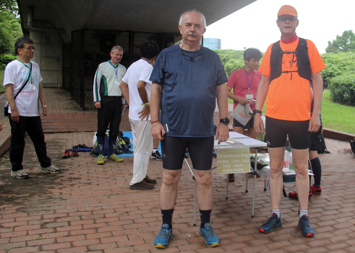
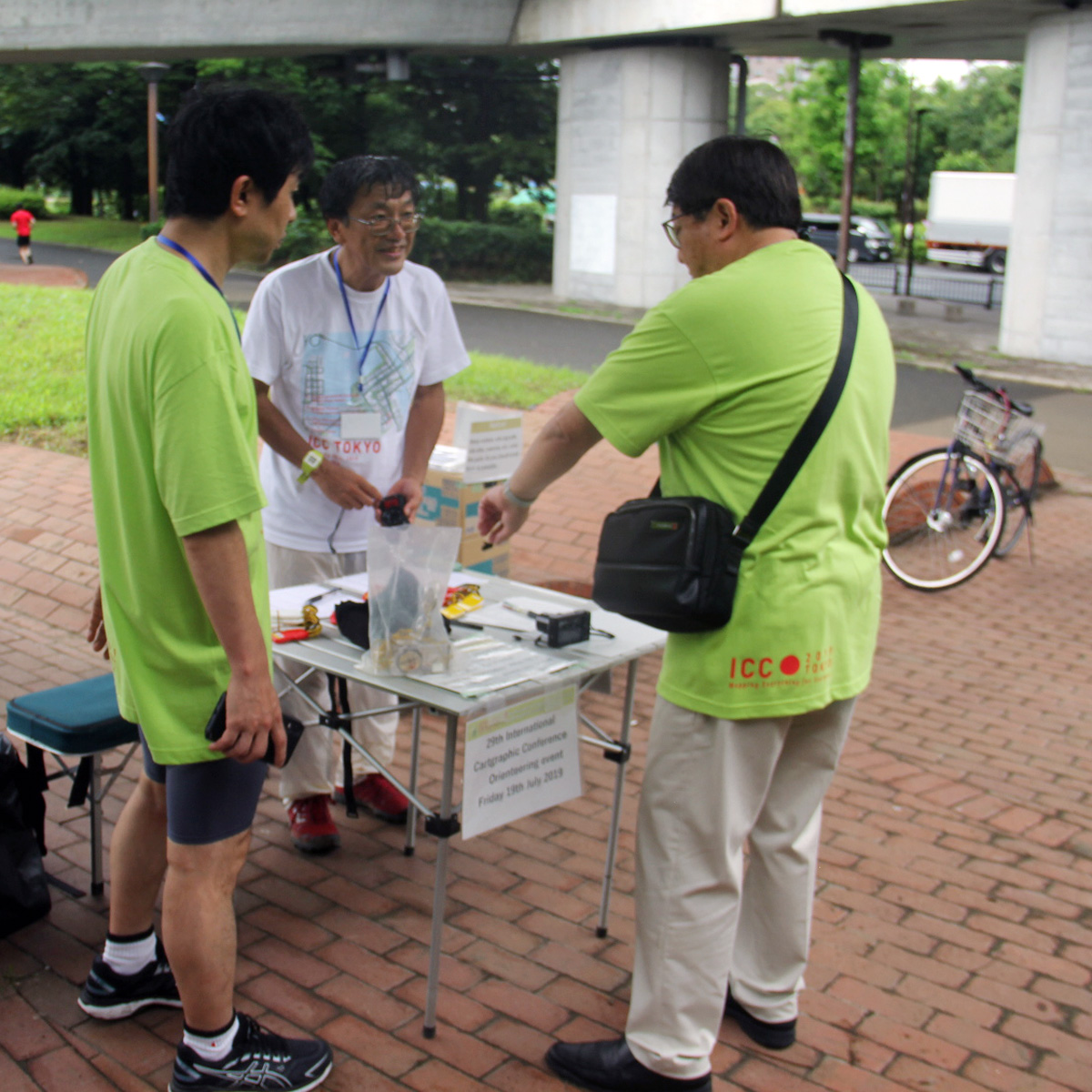
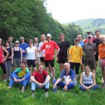
The ICC2019 orienteering event took place on July 19, 2019 at KIBA Park.
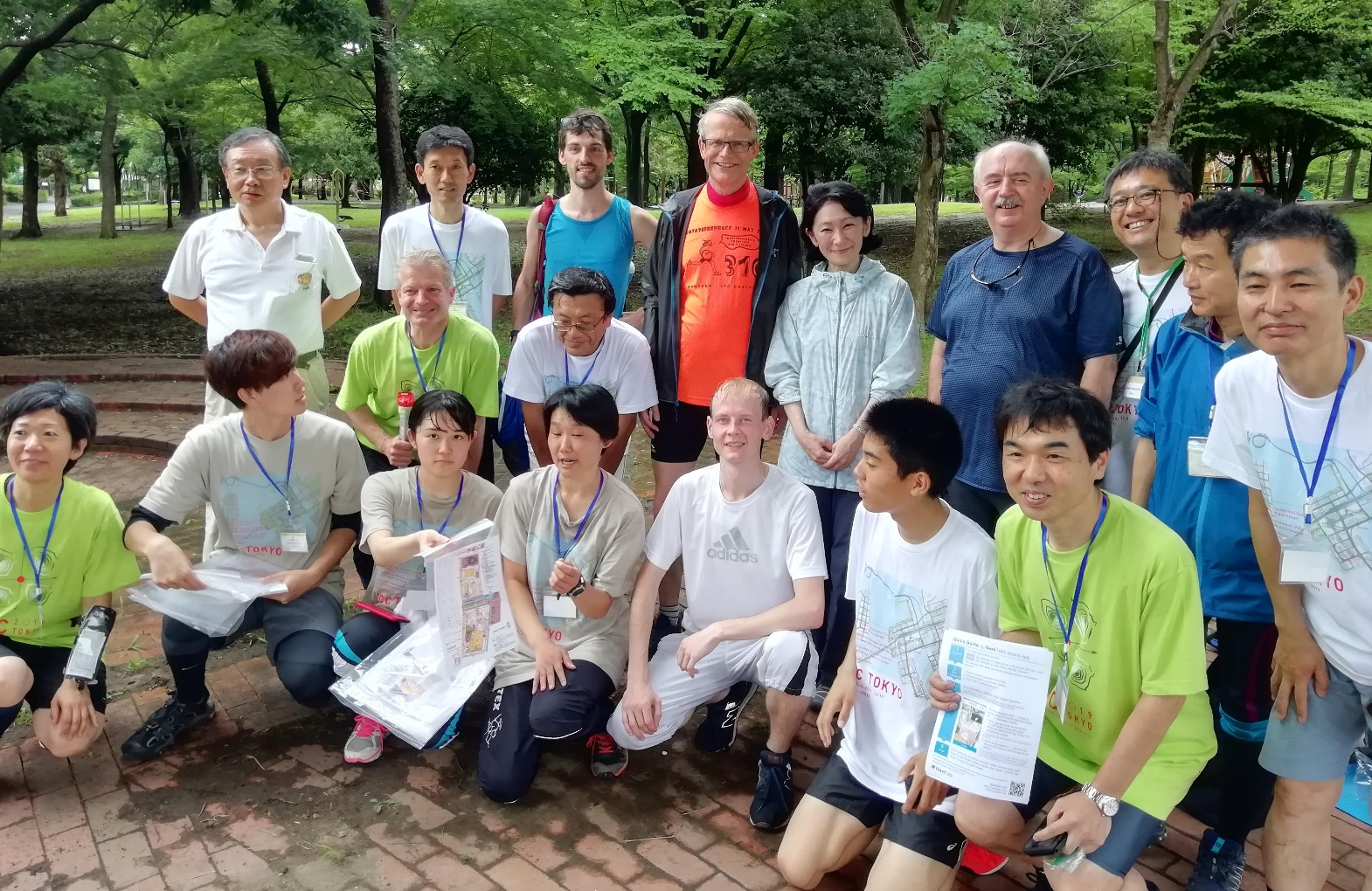
Group photo at the orienteering event
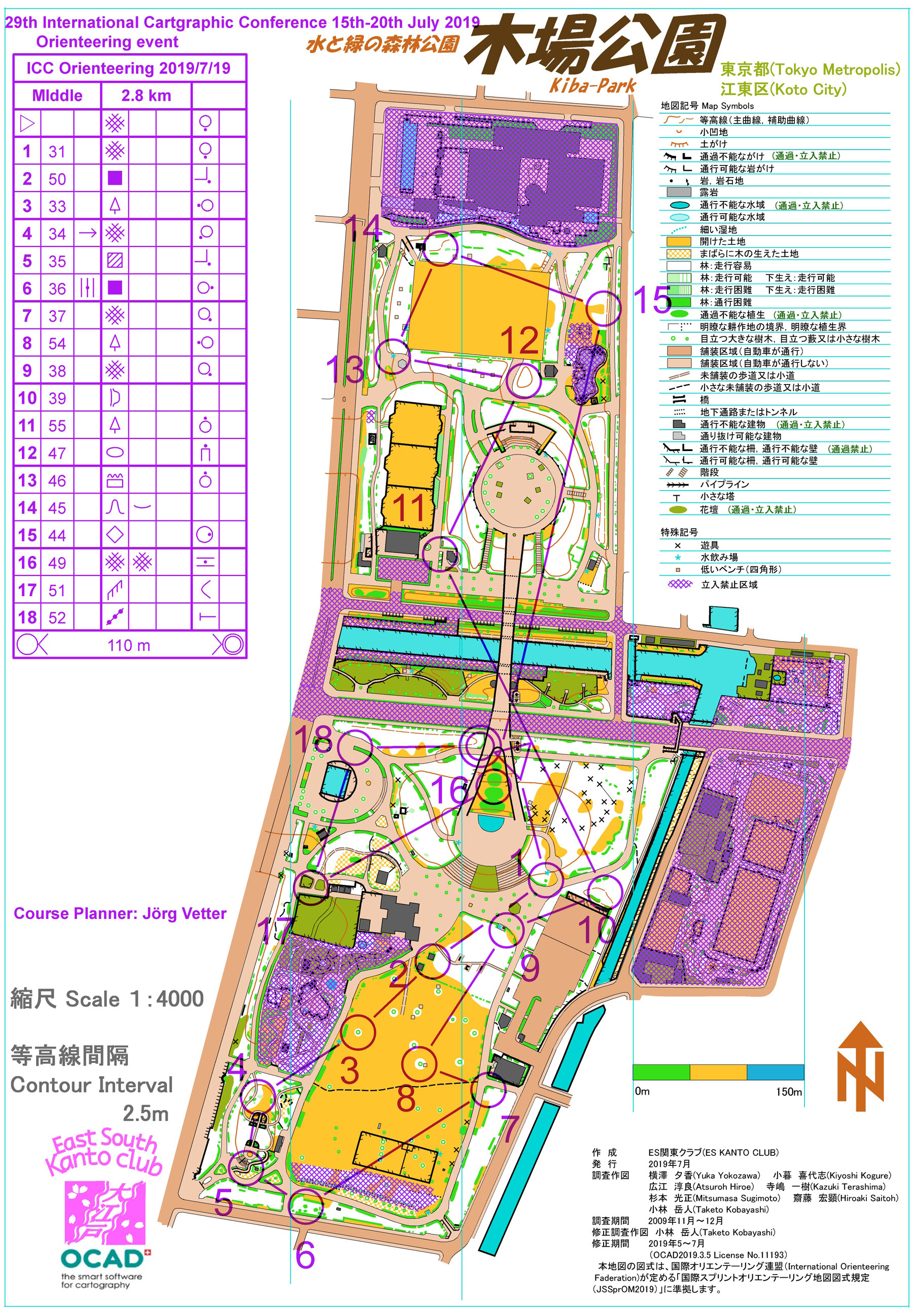
Map of the middle course
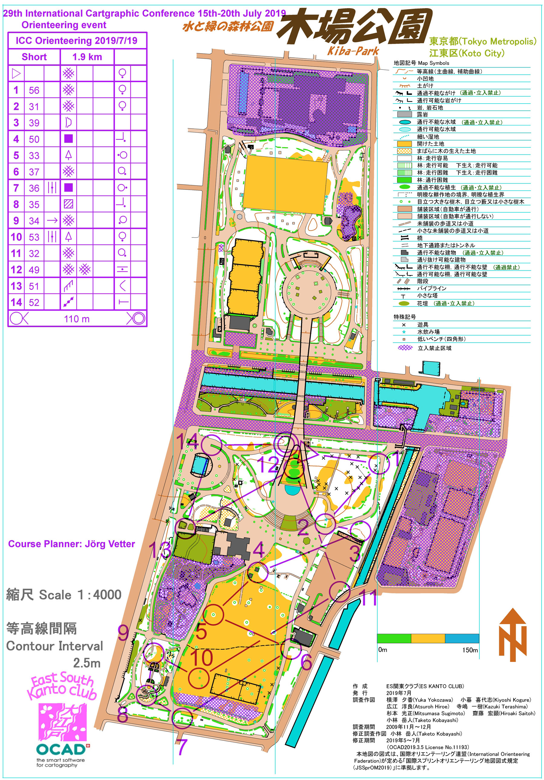
Map of the short course
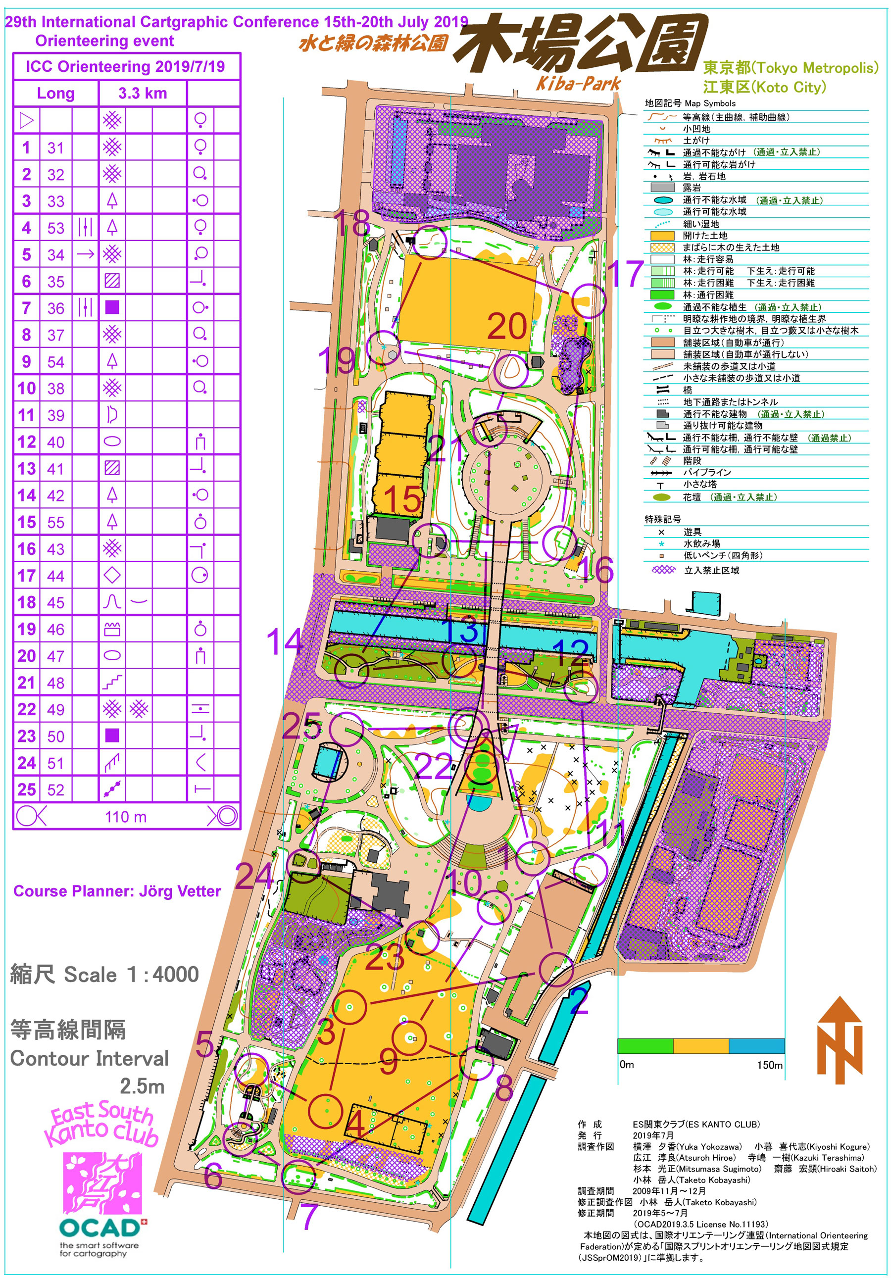
Map of the long course
Long course (men) – 3.3km 35m
| Name | Country | Time | |
| 1 | Dušan Petrovič | Slovenia | 19:51 |
| 2 | Asbjørn Magnus Midtbø | Norway | 20:27 |
| 3 | Zdeněk Stachoň | Czech Republic | 20:45 |
| 4 | Johannes Karstein Midtbø | Norway | 21:15 |
| 5 | Pyry Kettunen | Finland | 22:44 |
| 6 | Mátyás Gede | Switzerland | 24:25 |
| - | Gonzalo Moreno Vergara | Spain | - |
Middle course (women) – 2.8km 30m
| Name | Country | Time | |
| 1 | Kjersti Elisabeth Midtbø | Norway | 19:59 |
Middle course (men) – 2.8km 30m
| Name | Country | Time | |
| 1 | Gáspár Albert | Hungary | 16:32 |
| 2 | Terje Midtbø | Norway | 20:18 |
| 3 | Georg Gartner | Austria | 20:32 |
| 4 | Sebastian Hennig | Germany | 21:36 |
| 5 | Primoz Kete | Slovenia | 23:32 |
| 6 | William Mackaness | UK | 24:08 |
| 7 | Kristoffer Kristiansen | Norway | 25:07 |
| 8 | Laszlo Zentai | Hungary | 25:46 |
Short course (women) – 1.9km 10m
| Name | Country | Time | |
| 1 | Suzuki Noriko | Japan | 17:40 |
| 2 | Marit Varmedal | Norway | 26:25 |
Short course (men) – 1.9km 10m
| Name | Country | Time | |
| 1 | Menno-Jan Kraak | Netherlands | 17:15 |
| 2 | Jukka Krisp | Germany | 18:19 |
| 3 | Dmitrii Loginov | Russia | 19:31 |
| - | Aamod Srivastava | India | - |
| - | Sverre Iversen | Norway | - |


2017 – Washington, D.C., USA
Orienteering session
Oral Session, Room Virginia A, Monday, 3 July 2017, 14:50–15:50
- Schaad: Semi-Automatic Extraction of Near-Ground Vegetation from LiDAR Data as Base for Orienteering Maps
- Zentai: The evolution of printing technologies in the development of orienteering maps
- Petrovič: Automatically Generated Vegetation Density Maps with LiDAR Survey for Orienteering Purpose
Orienteering event
An orienteering event took place on July 6, 2017 at Fountainhead Regional Park.
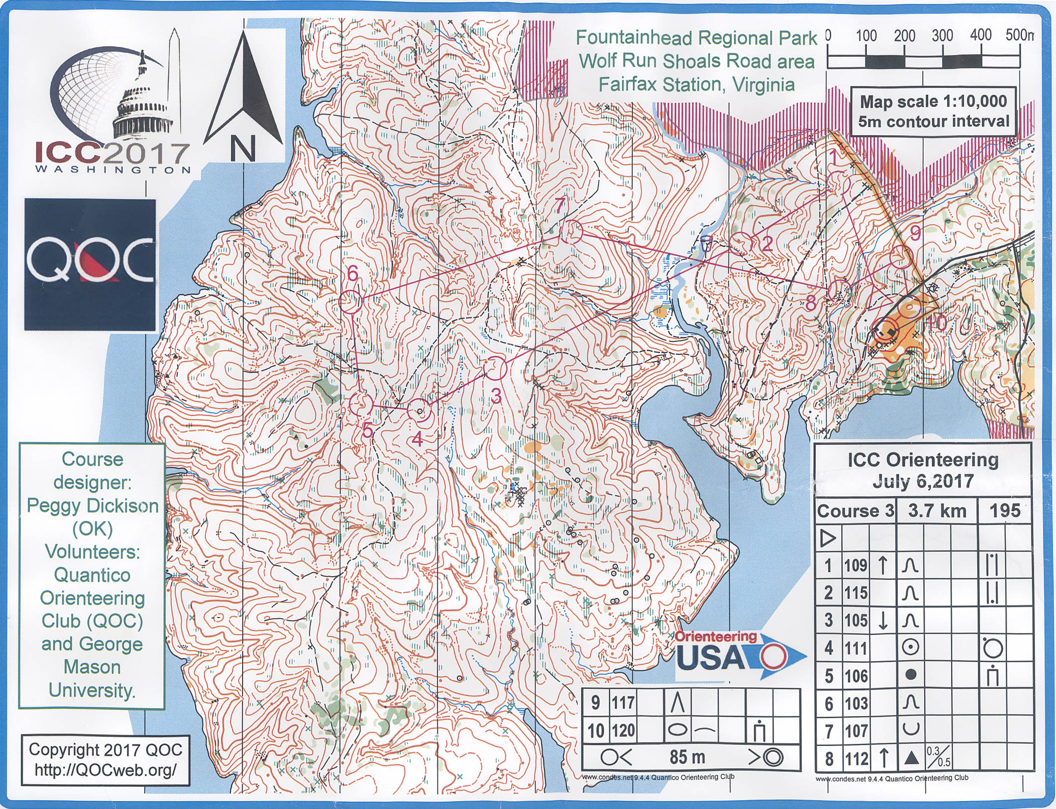
Map of the course
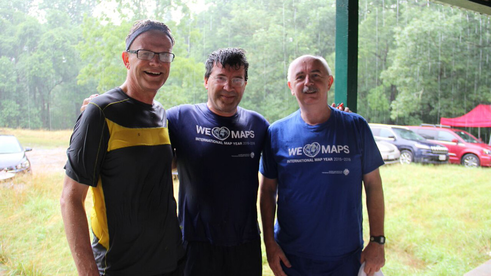
A very rainy race: Menno-Jan Kraak, Georg Gartner, Laszlo Zentai
Course 1 – 1.7km 95m
| Name | Country | Time | |
| 1 | William Mackaness | Scotland | 28:43 |
| 2 | Maria Rühringer | Austria | 43:55 |
| 3 | Marit Varmedal | Norway | 49:47 |
| 4 | Dmitriy Loginov | Russia | 1:06:15 |
Course 2 – 3.0km 175m
| Name | Country | Time | |
| 1 | Terje Midtbo | Norway | 40:08 |
| 2 | Markus Fuchs | Switzerland | 48:26 |
| 3 | Georg Gartner | Austria | 50:33 |
| 4 | Menno-Jan Kraak | Netherlands | 51:28 |
| 5 | Kristoffer Kristlansen | Norway | 1:02:36 |
| 6 | William Mackaness | Scotland | 1:11:21 |
| 7 | Fabian Bock | Germany | 1:24:11 |
| 8 | Rob Edsall | USA | 1:39:01 |
| 9 | Sverre Iversen | Norway | 1:45:31 |
| 10 | Roar Engell | Denmark | 2:07:39 |
| 11 | Alika Jensen | USA | 2:09:38 |
Course 3 – 3.7km 195m
| Name | Country | Time | |
| 1 | Zdenek Stachon | Czech Rep | 31:54 |
| 2 | Pyry Kettunen | Finland | 34:35 |
| 3 | Gian-Reto Schaad | Switzerland | 38:13 |
| 4 | Roland Hansson | USA | 39:13 |
| 5 | Dusan Petrovic | Slovenia | 42:39 |
| 6 | Thorsteinn Sigurjonsson | Norway | 48:12 |
| 7 | Trine Bjerva | Norway | 48:43 |
| 8 | Laszlo Zentai | Hungary | 48:57 |
2015 – Rio de Janeiro, Brazil
Orienteering session
Oral Session 7, Room 3, Wednesday, 26 August, 2015 13:30–14:50
- Glaner, Gartner: The Possibilities of Using Airborne Laser Scanning Data for the Creation of Orienteering Maps
- Zentai: Generalization Problems of Orienteering Maps
- Janata: The Use of Laser Altimetric Data for Orienteering Mapping in the Central-European Area
Orienteering event
An orienteering event took place on 26 August 2015 at Ilha de Fundão.
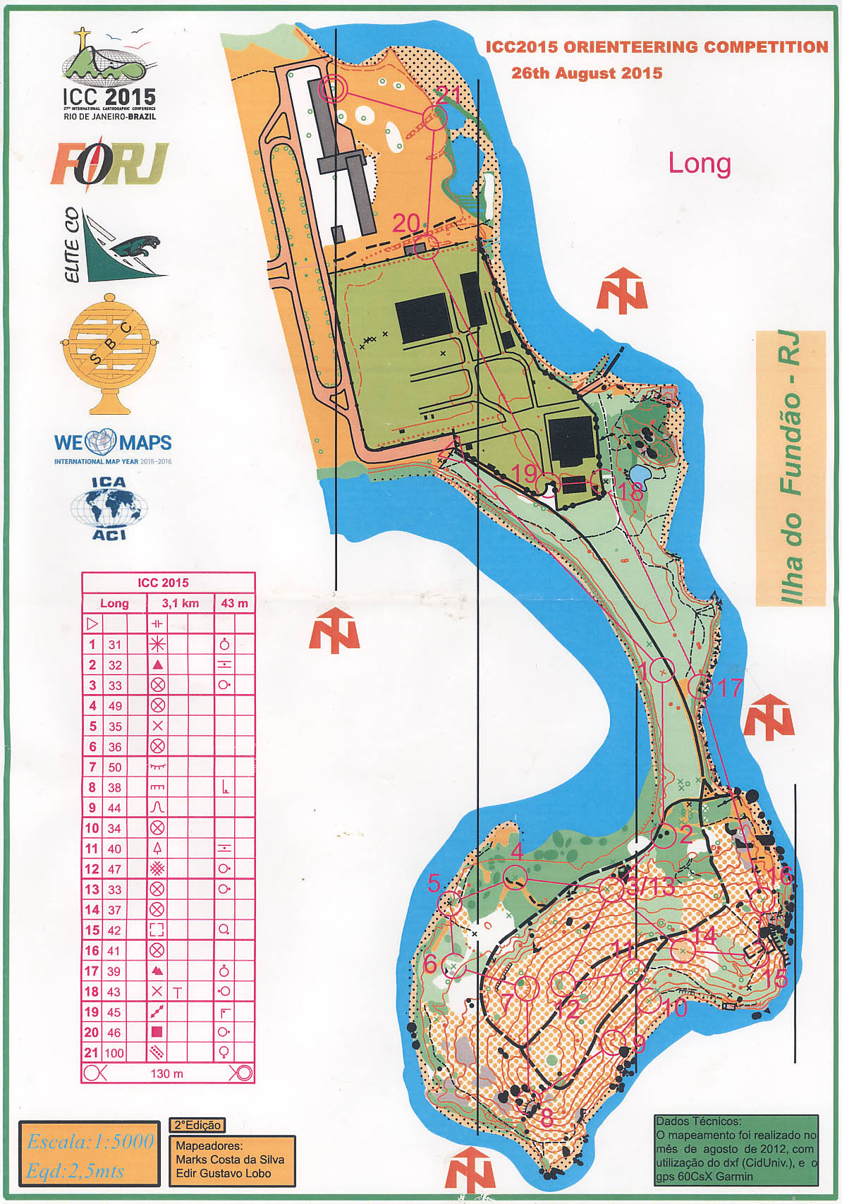
Map of the course

Participants of the orienteering event
Long course – female
| Name | Country | Time | |
| 1 | Olga Chesnokova | Switzerland | 31:51 |
| 2 | Josephine Biro | Sweden | 47:59 |
| 3 | Amanda Baumgartner | Sweden | 51:42 |
Long course – male
| Name | Country | Time | |
| 1 | Zbynek Sterba | Czech Republic | 17:20 |
| 2 | Andreas Hall | Finland | 17:34 |
| 3 | Gian-Reto Schaad | Switzerland | 21:04 |
| 4 | Hubert Klauser | Switzerland | 21:15 |
| 5 | GEDE Matyas | Hungary | 21:38 |
| 6 | Dusan Petrovic | Slovenia | 22:01 |
| 7 | Roland Hansson | USA | 22:11 |
| 8 | Thomas Koblet | Switzerland | 23:56 |
| 9 | Terje Midtbo | Norway | 25:01 |
| 10 | Thomas Gloor | Switzerland | 25:08 |
| 10 | Jedrzej Gasiorowski | Poland | 25:08 |
| 12 | Teemu Sipila | Finland | 29:19 |
| 13 | Anders Ek | Sweden | 31:07 |
| 14 | Sebastien Meier | Germany | 33:44 |
| 15 | Laszlo Zentai | Hungary | 34:31 |
| 16 | Primoz Kete | Slovenia | 37:02 |
| 17 | Bart Bruex | Netherlands | 38:47 |
| 18 | Sverre Iversen | Norway | 52:23 |
| 19 | Fernando Barroso | Brazil | 68:55 |
| Eric Losang | Germany | - |
Short course – female
| Name | Country | Time | |
| 1 | Marianna Serebryakova | Switzerland | 18:18 |
| 2 | Jana Moser | Germany | 20:38 |
Short course – male
| Name | Country | Time | |
| 1 | Georg Gartner | Austria | 18:21 |
| 2 | Kristoffer Johan Kristiansen | Norway | 18:27 |
| 3 | Rafael Barros | Brazil | 26:38 |
2013 – Dresden, Germany
Orienteering session
Session S9-F, Orienteering Maps, Wednesday, 28 August, 2013 14:45–16:00
- László Zentai: Implementation of Cartographic and Digital Techniques in Orienteering Maps (the full text was published in the Springer Proceedings)
- Dušan Petrovič: Automation in orienteering map production – fiction or reality, paper
- Thomas Gloor: Vegetation height maps derived from digital elevation models – the next innovation in the production of orienteering maps? Abstract on page 558
- Terje Midtbø: Orienteering moves indoor, paper
Orienteering event
Took place on 28 August 2013. See the results here or the split times here or visit the photo gallery.
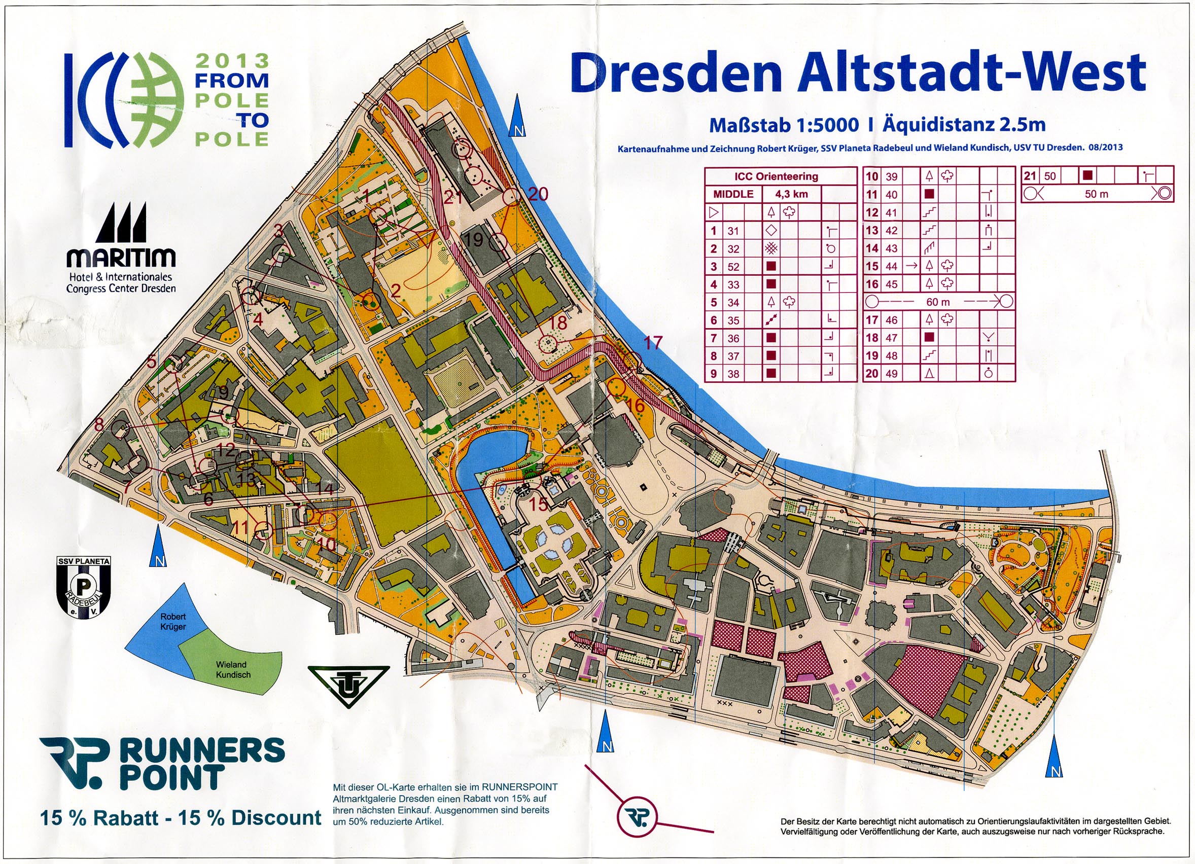
Map of middle course
Click for gallery
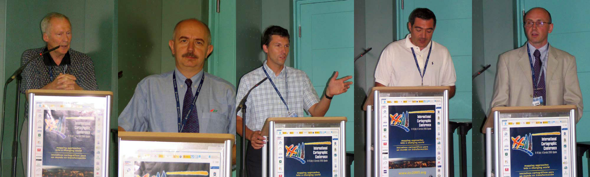
2011 – Paris, France
Orienteering session
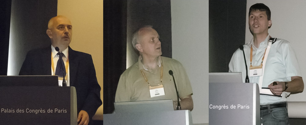
Zentai, Midtbø, Petrovič
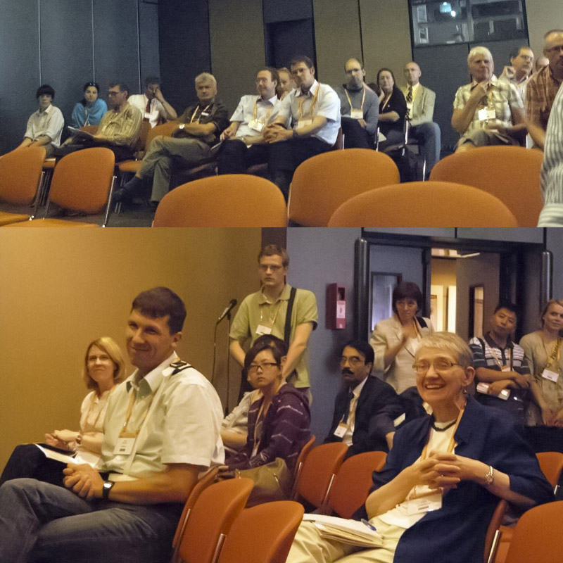
Audience
- László Zentai: Legibility of orienteering maps: evolution and influences, abstract, presentation, full text published in The Cartographic Journal, May 2011
- Terje Midtbø, Sindre Jansson Haverstad: Map animations for visualizing orienteering competitions, paper
- Dušan Petrovič: Some experiences in making orienteering maps in Slovenia from airborne laser scanning data, paper, presentation
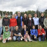
Orienteering event
Took place on 8 July 2011 at Parc du Tremblay. See the results below or visit the photo gallery. The split times can be seen here.
Click for gallery
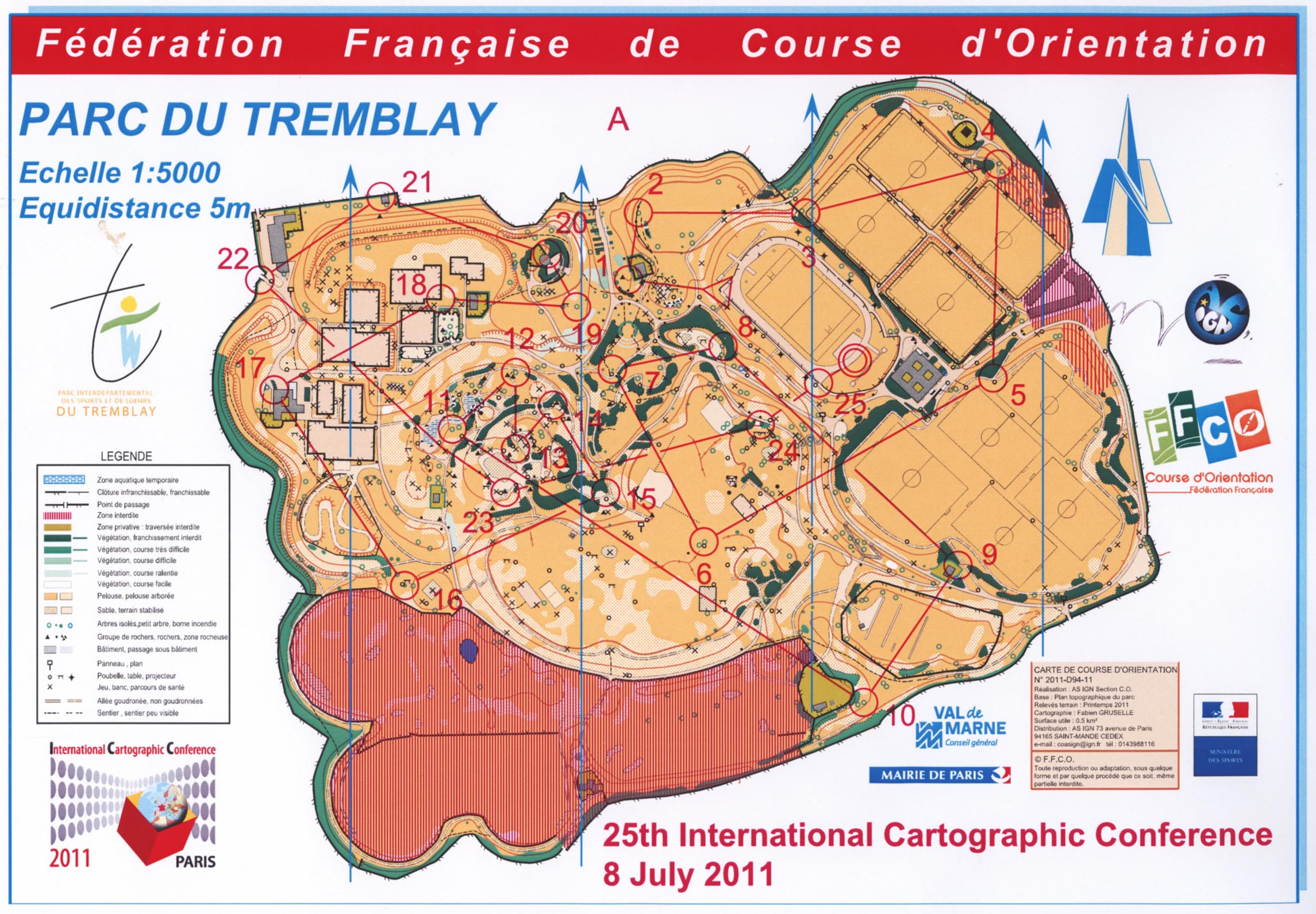
Map course A
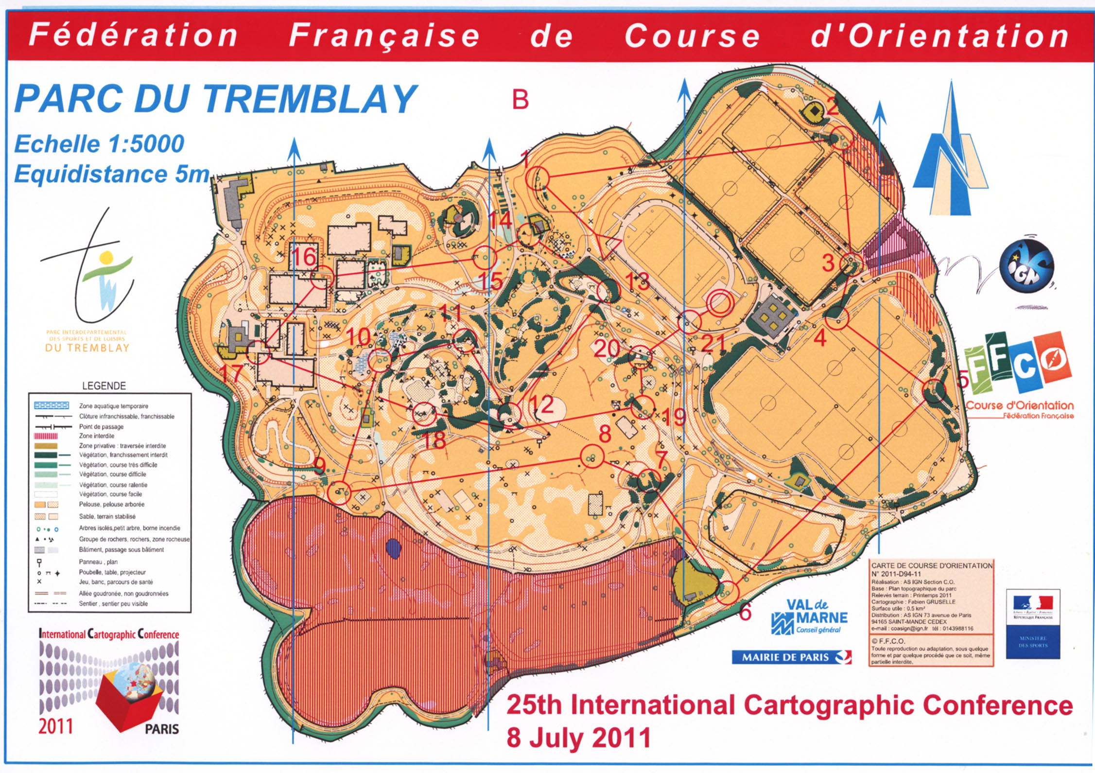
Map course B

Map course C
Course A: 4.9 km  25 P

1   65 KLAUSER, Hubert            Baar       HA   25:00
2   43 HAUSWIRTH, Sabine          Baar       DA   25:03
3  110 SCHAAD, Gian-Reto          Baar       HA   26:31
4    3 ANTOS, Filip               Zdiby      HA   26:58
5   31 GAFFURI, Julien            Ispra      HA   27:46
6      ROMIEU, Cyril              AS IGN     HA   36:59
7  103 PETROVIC, Blaz             Ljubljana  HA   39:32


Course B: 3.7 km  21 P

1   94 MIDTBO, Terje              Trondheim  HB   24:52
2   73 KRISTIANSEN, Kristoffer    Hønefoss   HB   30:49


Course C: 2.7 km  17 P

1   40 GRANAS, Karin              Uppsala    DC   28:57
2      PETROVIC, Gasper           Ljubljana  HC   42:03
3  128 VALLARINO KATZENSTEIN, Ana Montevideo DC   54:54
4   18 COTTERALL, Louise          Auckland   DC 1:01:54
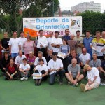
2009 – Santiago de Chile, Chile
Zentai, Petrovic, Gartner
Orienteering presentations
- Laszlo Zentai, Hungary: Maps For Different Forms Of Orienteering, paper
- Dusan Petrovic, Slovenia: Criteria For Selecting Areas For Orienteering Maps, paper
- Georg Gartner, Austria: Laserscanning Data as a Basis For Orienteering Maps – Advanced Potential And Further Research, paper
Orienteering event
Took place on 20 November 2009 at Hacienda Santa Martina. Program PDF. Guidelines PDF. See the results below or visit the photo gallery.
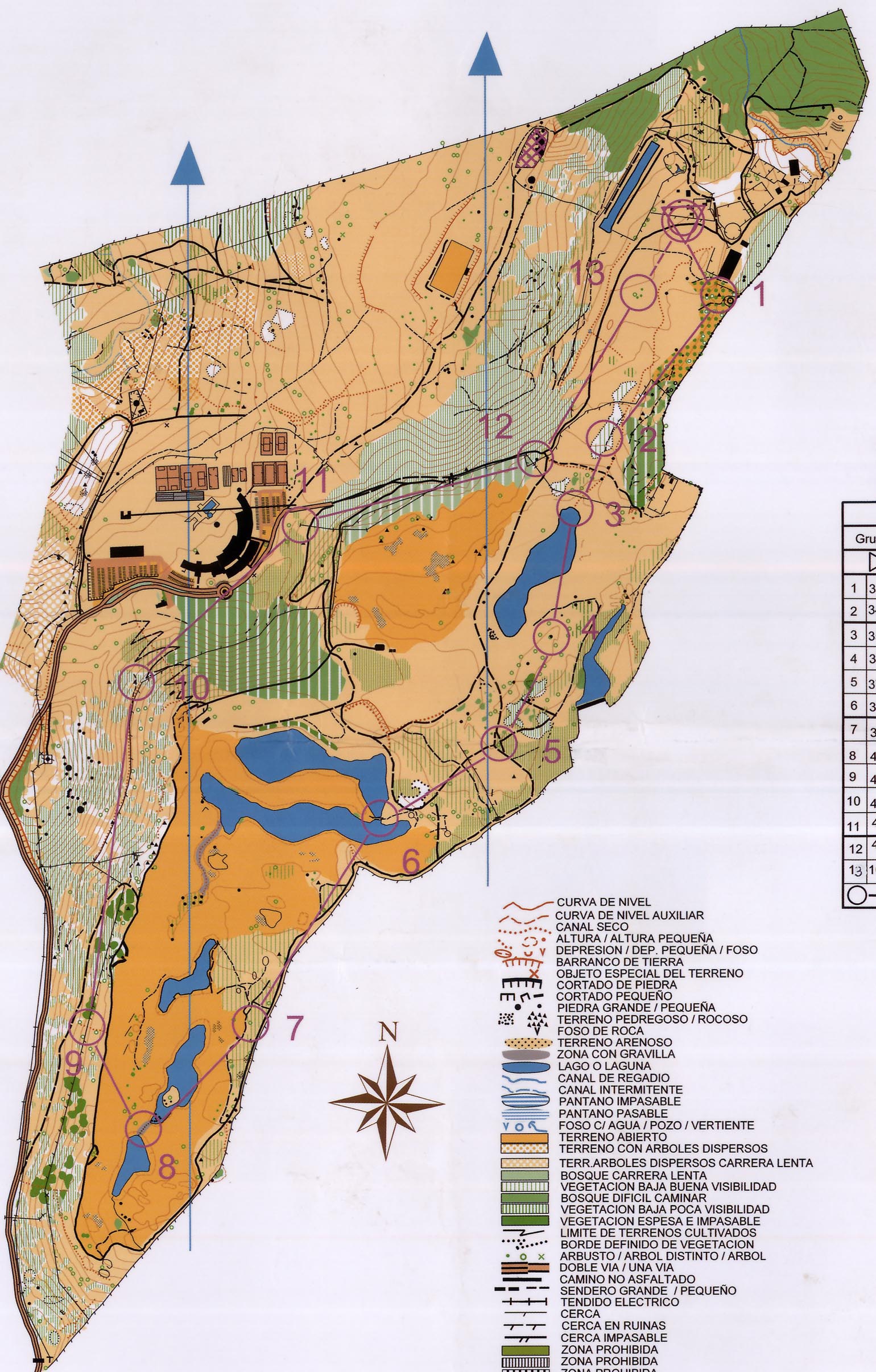
Map
Click for gallery
| Name | Country | Level | Start time | Finish time | Time | |
| Cifuentes Jorge | CHL | A | 00:04:00 | 00:35:24 | 00:31:24 | |
| Torres Jervacio | CHL | A | 00:22:00 | 00:53:54 | 00:31:54 | |
| Meliñir Domingo | CHL | A | 00:10:00 | 00:48:08 | 00:38:08 | |
| Gaffuri Julien | FRA | A | 00:00:00 | 00:38:27 | 00:38:27 | 1 |
| Hans Erik Aurell | SWE | A | 00:14:00 | 00:53:08 | 00:39:08 | 2 |
| Petrovic Dusan | SLO | A | 00:12:00 | 00:54:37 | 00:42:37 | 3 |
| Ditz Robert | AUT | A | 00:16:00 | 01:00:43 | 00:44:43 | |
| Oleggini Lorenzo | SUI | A | 00:06:00 | 00:52:00 | 00:46:00 | |
| Georg Gartner | AUT | A | 00:08:00 | 01:01:00 | 00:53:00 | |
| Podobnikar Tomaz | SLO | A | 00:18:00 | 01:17:18 | 00:59:18 | |
| Pinto Livio | ITA | A | 00:20:00 | 01:24:30 | 01:04:30 | |
| Holleman Scott | USA | A | 00:02:00 | 01:15:08 | 01:13:08 | |
| Zentai Laszlo | HUN | B | 00:04:00 | 00:43:57 | 00:39:57 | 1 |
| Neira Julio | CHL | B | 00:02:00 | 00:48:18 | 00:46:18 | 2 |
| Pantazis Dimos | GRE | B | 00:00:00 | Disq | 3 | |
| Kunz Melanie | SUI | B | 00:06:00 | 00:52:10 | 00:46:10 | 1 |
| Nass Andrea | GER | B | 00:10:00 | 00:58:43 | 00:48:43 | 2 |
| Fey Beatrix | GER | B | 00:12:00 | 01:27:24 | 01:15:24 | 3 |
| Gonzalez Victor | CHL | B | 00:28:00 | 01:18:18 | 00:50:18 | |
| Midtbø Terje | NOR | C | 00:16:00 | 00:40:18 | 00:24:18 | 1 |
| Kristiansen Kristoffer | NOR | C | 00:00:00 | 00:34:50 | 00:34:50 | 2 |
| Norheim Robert | USA | C | 00:02:00 | 00:38:27 | 00:36:27 | 3 |
| Iversen Sverre | NOR | C | 00:04:00 | 00:44:24 | 00:40:24 | |
| Zeisset Paul | USA | C | 00:08:00 | 01:12:00 | 01:04:00 | |
| Aldosari Ali | KSA | C | 00:06:00 | 01:21:14 | 01:15:14 | |
| Grånäs Karin | SWE | C | 00:10:00 | 00:43:44 | 00:33:44 | 1 |
| Marit Varmedal | NOR | C | 00:12:00 | 00:50:22 | 00:38:22 | 2 |
| Fasold Astrid | GER | C | 00:14:00 | 01:19:05 | 01:05:05 | 3 |
| Hunnes Einar | SWE | D | 00:16:00 | 00:00:00 | ||
| Parra Jorge | CHL | D | 00:18:00 | 00:00:00 | ||
| Cikic Sabine | GER | D | 00:18:00 | 00:00:00 | ||
| Lehmann-Grube Fritz | GER | D | 00:20:00 | 00:00:00 | ||
| Mercado Huerta Norman | CHL | D | 00:20:00 | 00:00:00 | ||
| Kiousopoulos John | GRE | D | 00:20:00 | 00:00:00 |
2007 – Moscow, Russia
Orienteering session
6 August 2007, chaired by László Zentai, Hungary. Presentations:
- László Zentai, Hungary: New technologies in making orienteering maps, presentation file
- Georg Gartner, Robert Ditz, Austria: Laser scanning data for cartographic data modelling of orienteering maps
- Dusan Petrovic, Slovenia: Adventure races and orienteering maps
- R.V. Atojan, Russia: Techniques of panoramic map-picture creation on the base of the locality perspective drawing
Joint training
There was no official orienteering event, but we had a joint training around Hotel Cosmos (Botanical garden, Jauza, Sokolniki) on 8 August 2007.

Early morning in front of the ICA hotel with pre-printed o-maps: Terje Midtbø (Norway), Menno-Jan Karrak (The Netherlands), László Zentai (Hungary), Dušan Petrovič (Slovenia), Georg Gartner (Austria), Kristoffer Kristiansen (Norway)
2006 – Vienna, Austria (Gicon)
Map
Click for gallery
Orienteering event on 14 July 2006, organized by Robert Ditz and Georg Gartner. Image gallery. Results:
 1. Gian-Reto Schaad     Switzerland      24:54
 2. Dušan Petrovic       Slovenia         25:12
 3. Laszlo Zentai        Hungary          28:10
 4. Feldmann Hans-Uli    Switzerland      29:03
 5. Menno-Jan Kraak      Netherlands      38:19
 6. Tomaž Podobnikar     Slovenia         40:50
 7. Frank Thiemann       Germany          45:01
 8. Andreas Pammer       Austria          45:48
 9. Ben Nausner          Austria          45:50
10. Alexandra Stadler    Austria          47:29
11. Jana Moser           Germany          49:10
12. Fam. Zentai          Hungary          50:48
13. Anja Hopfstock       Germany          52:26
14. Pavel Dergel         Czech Republic 1:01:34
15. Alexandra Kaiser     Germany        1:03:20
16. Jochen Wendel        Germany        1:04:31
17. Petr Fuks            Czech Republic 1:28:30
18. David Fairbairn      United Kingdom    dq
19. Tony Moore           New Zealand       dnf
20. Leonhard Suchenwirth Austria           dnf
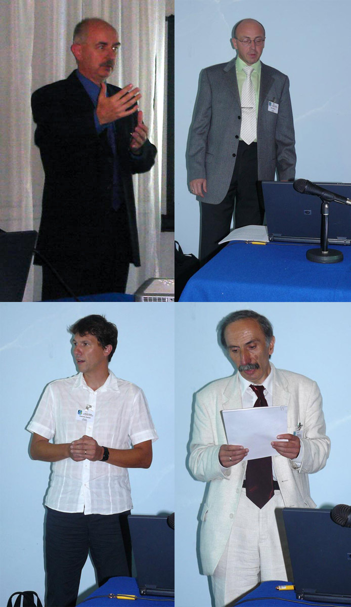
2005 – A Coruña, Spain
Rystedt, Zentai, Petrovic, Muñoz Nieto, Ditz
Participants
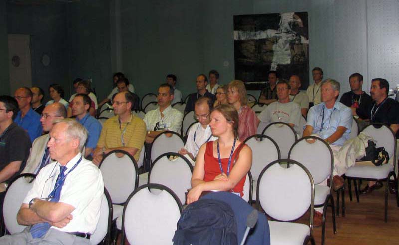
Orienteering session
12 July 2005, chaired by Bengt Rystedt, Sweden. Program PDF. Presentations:
- Mapping standard for sprint orienteering: standardized competition maps for urban, park and forest areas, L. Zentai, Hungary
- Orienteering maps in Slovenia, D. Petrovic, Slovenia
- The orienteering maps production: quality control, A.L. Muñoz Nieto, M. Herrero Matías and M. Vidal Triquell, Spain
- Orienteering maps in Vienna – data acquisition and cartographic data modelling, R. Ditz and G. Gartner, Austria
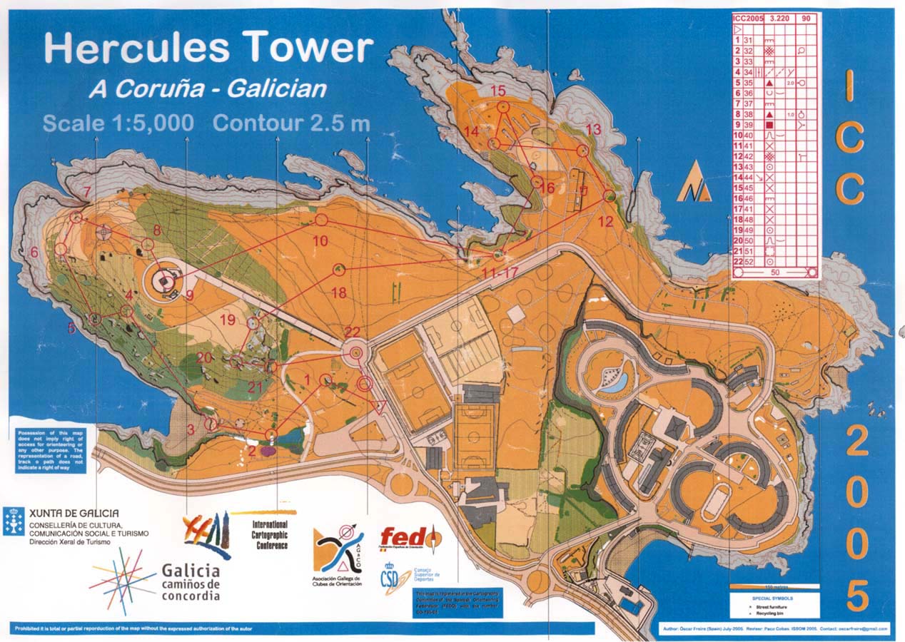
Map
Click for gallery
Orienteering event
14 July 2005. Program PDF. See the results below or visit the photo gallery.
 1. Dušan PETROVIC           Slovenia      20:43
 2. Reidar FOSSUM            Norway        21:14
 3. Ulf HEDLUND              Sweden        22:14
 4. Georg GARTNER            Austria       22:40
 5. Terje MIDTBO             Norway        23:02
 6. Lars HARRIE              Sweden        23:27
 7. Hans-Uli FELDMANN        Switzerland   23:30
 8. Robert DITZ              Austria       23:54
 9. Craig FEUERHERDT         Australia     24:01
10. Kjell RONNEBERG          Norway        25:06
11. Boris STERN              Switzerland   26:27
12. Kristoffer KRISTIANSEN   Norway        26:40
13. László ZENTAI            Hungary       26:55
14. Olaf SCHNABEL            Switzerland   27:28
15. Ingo PETZOLD             Switzerland   28:50
16. Karsten LIEN             Norway        28:55
17. Hanna MARAN              Estonia       29:26
18. Primoz KETE              Slovenia      29:43
19. David FAIRBAIRN          England       30:25
20. Marion WERNER            Switzerland   30:53
21. Edel Sofie NILSEN        Norway        31:11
22. Moritz NEUN              Switzerland   31:29
23. Jana MOSER               Germany       32:15
24. Jorma POYHIA             Finland       32:42
25. Amdrew NIERMAN           United States 33:22
26. Alexandra STADLER        Austria       34:00
27. Miklaucic LOJZE          Slovenia      34:24
28. Brit Torill HAUGEN       Norway        35:04
29. Lars PALM                Sweden        36:00
30. Elisabeth Marie CHESNEAU France        37:04
31. Helina HIRN              Finland       43:36
32. Vemund RONNEBERG         Norway        51:41
33. A-AGOT ELIGAADE HARTMON  Norway        51:54
34. James CARTER             United States 53:21
35. Ewa SIEKIERSKA           Canada        57:50
36. Amy GRIFFIN              Australia     61:53
37. Sverre IVERSEN           Norway        ERROR
2003 – Durban, South Africa
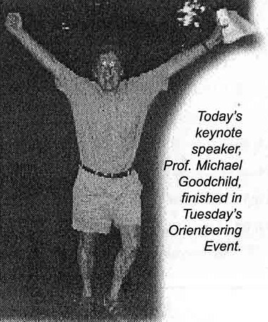
There was no dedicated presentation on orienteering maps. One of the ICC participants managed to take part in an orienteering event during the conference.
2001 – Beijing, China
There was one presentation on orienteering maps: László Zentai, Hungary: Development of orienteering maps' standardization
László Zentai also had a chance to take part in the Chinese Orienteering Championships during the Conference. This event was organized close to Beijing, the competition map and some photos are available here (in Hungarian).
1999 – Ottawa, Canada

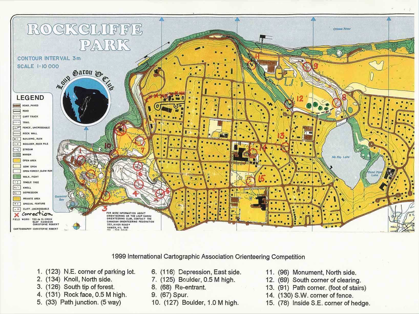
1st ICA (and 4th CCA) Orienteering event
by Diana Hocking
77 participants from 14 countries enjoyed an evening of exercises and socialising at Rockcliffe Park (and the New Edinburgh Pub) on Tuesday. Thanks to Intergraph for donating the excellent prizes.
Top results (approx. 5 km course)
- Hans Aureil, Sweden, 27:14 minutes
- Hans-Uli Feldmann, Switzerland, 27:28
- Dusán Petrovic, Slovenia, 28:28
- Tony Kusbach, Czech Republic, 29:33
- Reider Fossum, Norway, 31:50
Top Canadian: Roger Wheate, 37:45 (CCA President)
Top Women: Jen Turner, Erin Kuyvenhoven (Canadian students)
Personal report
by Dušan Petrovic, Slovenia
There was one event and due to many other activities (technical visits, excursions, commissions meetings etc.) I believe that one is enough. We had it in the afternoon, on Tuesday (try to avoid the day of national delegates meeting!), probably around 5 p.m. and there were more than 70 competitors who took part. The competition area was about one hour walking from the conference center and it covered embassies with surrounding parks, there was also a part of forest. It was Score-O, with limited time of one hour (there were also many non-orienteering runners who competed and just tried). There were also some small symbolic prices, probably from technical exhibitors (I got an Intergraph cup).
1989 – Budapest, Hungary
There were two presentations on orienteering maps according to the abstracts of the conference:
- Petr Uher, Czechoslovakia: Maps for Orienteering
- David J. Fairbairn, United Kingdom: Orienteering Mapping and higher education
Link to photo galleries about ICA Orienteering in 2005, 2006, 2009, 2011 and 2013.
