


At the biennial International Cartographic Conferences, ICA organizes an International Map Exhibition, where map products originating from ICA member countries are exhibited. An international jury selects the best entries in six categories; in addition, there is also a public vote.
The international jury this year at ICC2017 was chaired by Kenneth Field (UK), who is also the Chair of the ICA Commission on Map Design. Further jury members were:
- Antoni Moore, New Zealand
- David Fairbairn, United Kingdom
- Paulo Menezes, Brazil
- William Cartwright, Australia
- Lorenz Hurni, Switzerland
- Dirk Burghardt, Germany
- Dušan Petrovič, Slovenia
- Serena Coetzee, South Africa
- Rosemary Wardley, USA (LOC)
Please find the winners of the ICA Map Awards 2017 below.
Atlases
3rd place: Grand Topographic Atlas of Catalonia 1:25,000 (Institut Cartogràfic i Geològic de Catalunya)

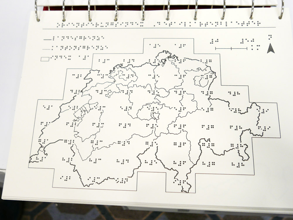
2nd place: Tactile Atlas of Switzerland (Switzerland)
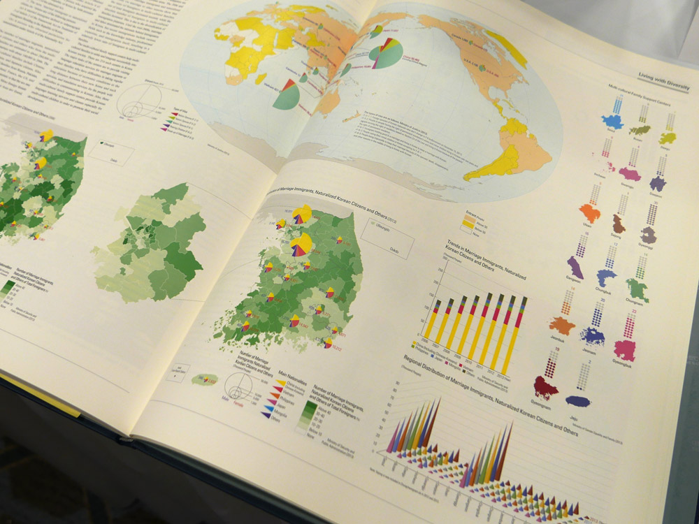
1st place: The National Atlas of Korea I (Republic of Korea)
A comprehensive, large format and very detailed atlas. The maps are well proportioned, clear and discernible. The highest quality throughout, accompanied by considerable graphs, accompanying text and infographics.
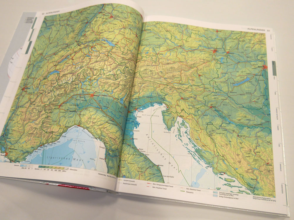
Public Vote: Swiss World Atlas 2017 Ed. (Switzerland)
Digital products
3rd place & Public Vote: Atlas of Switzerland online (Switzerland)

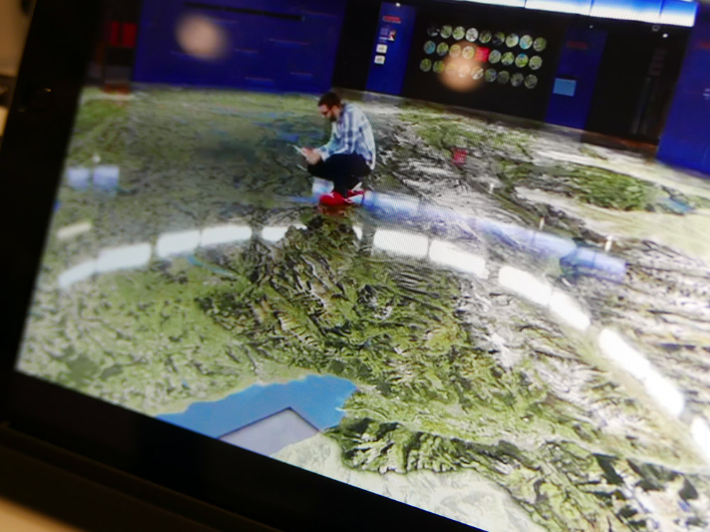
2nd place: Augmented Reality App Swissarena (Switzerland)
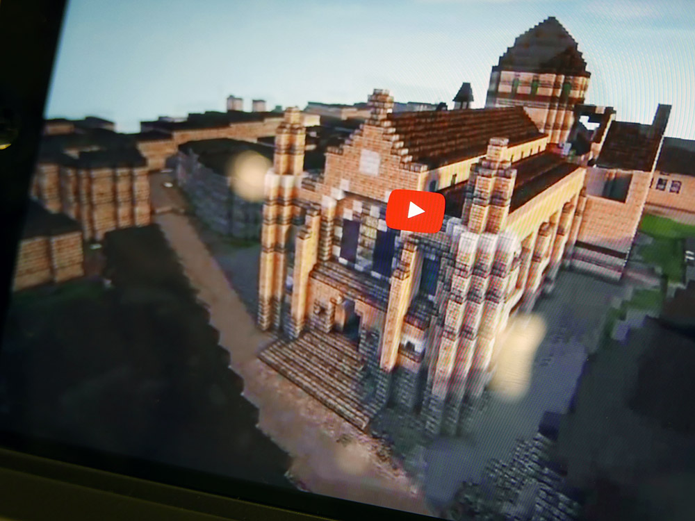
1st place: Minecraft® on Demand (France)
A wonderful mix of the real world and the popular world of Minecraft. An innovative idea that is superbly executed. Intuitive and playable cartography!
Educational cartographic products
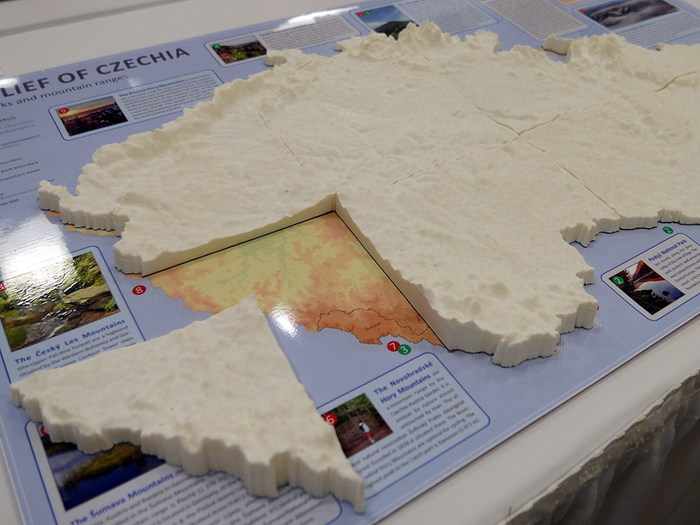
3rd place & Public Vote: 3D Relief of Czechia (Czechia)
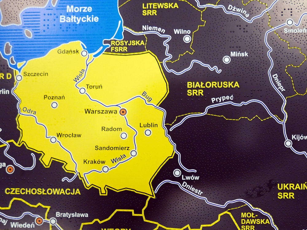
2nd place: Historical Atlas of Poland for blind and visually impaired (Poland)
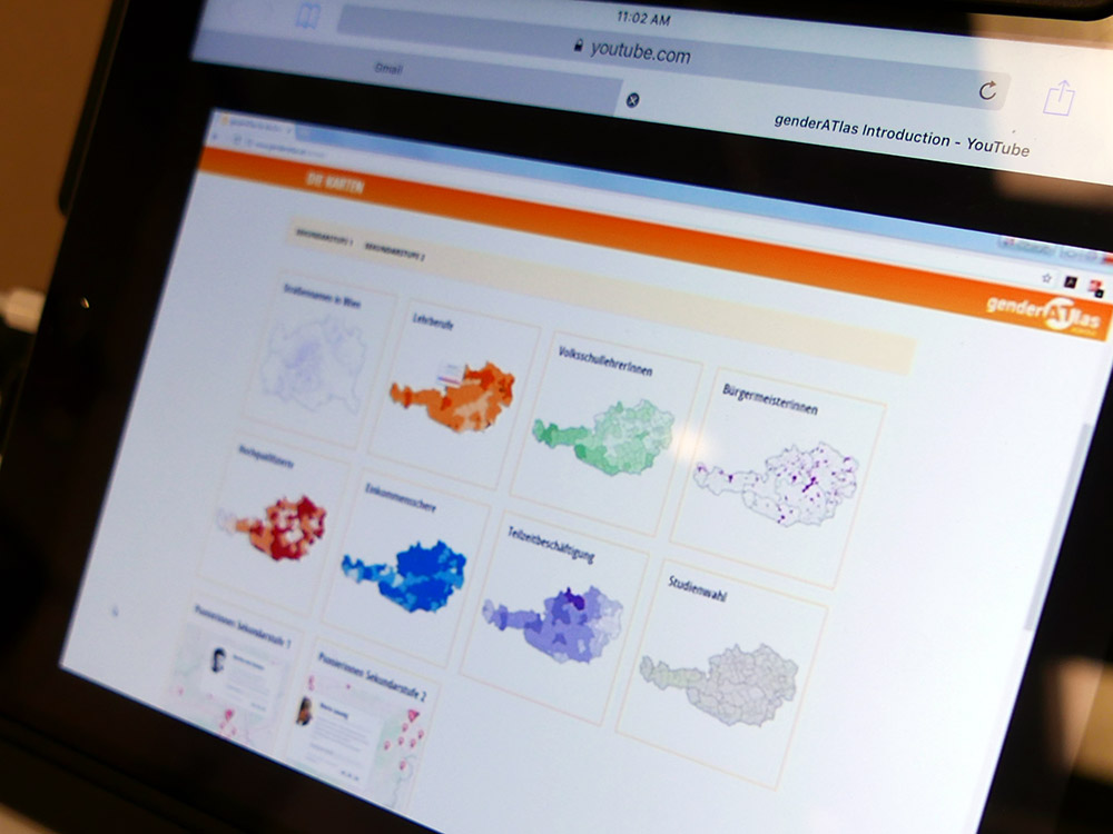
1st place: genderATlas goes school (Austria)
A very well thought through mini-atlas that explores gender issues for women and men. This version specifically aimed at school children to promote understanding of equality and support research initiatives.
Other cartographic products
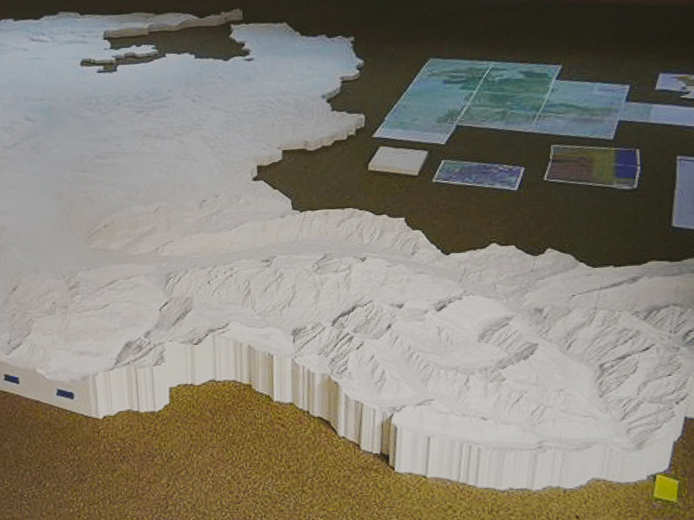
3rd place: Canton Berne – 3D printed Terrain Model, 1:25,000 (Switzerland)
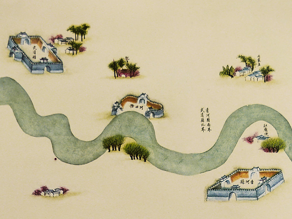
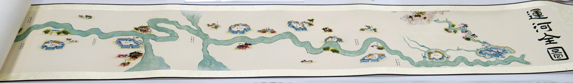
2nd place & Public Vote: Canal Full Map Long Scroll (China)
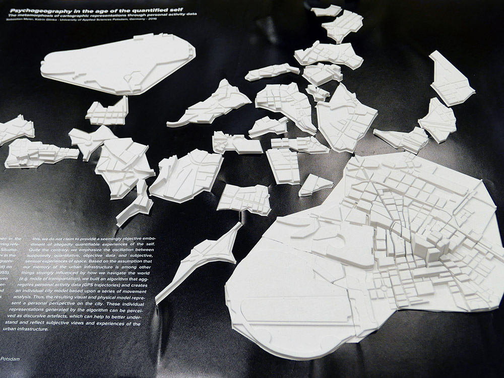
1st place: Psychogeography in the age of the quantified self (Germany)
Personal cartographies modelled from mental maps and movement data. A stylish form that builds art from the digital capture of our everyday activities.
Charts on panels
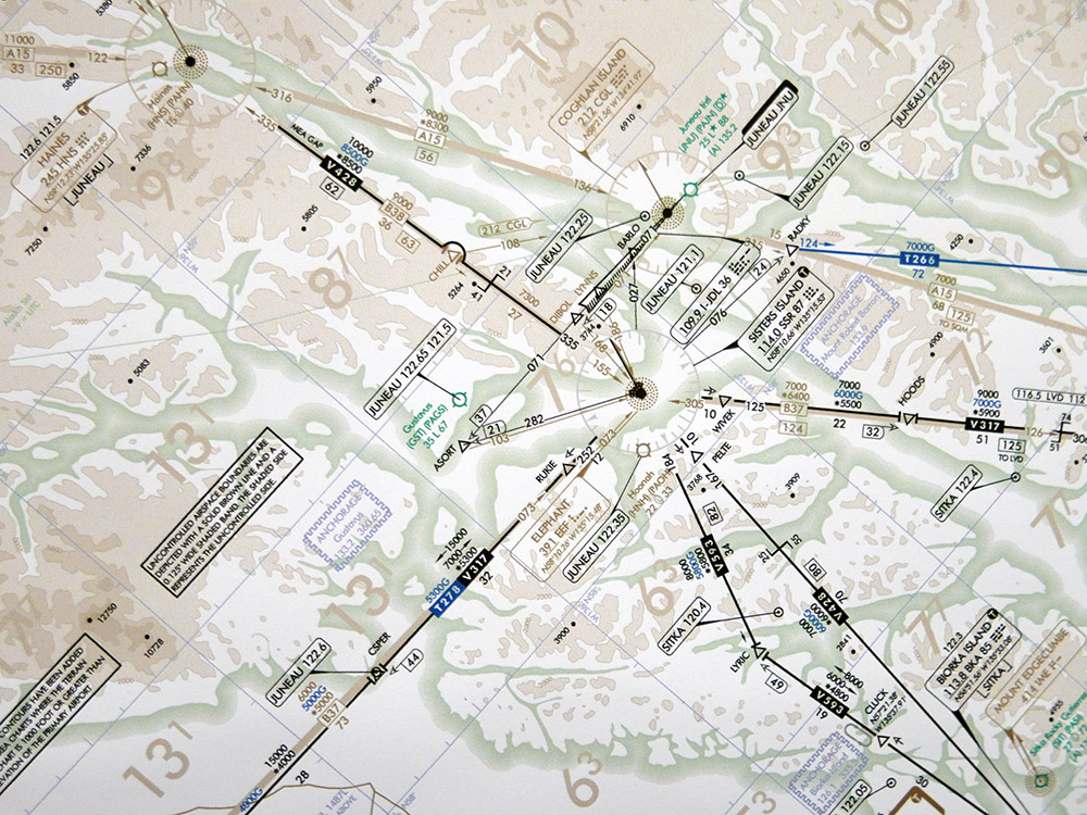
3rd place: IFR Enroute Low Altitude – Alaska L-1 (Esri)
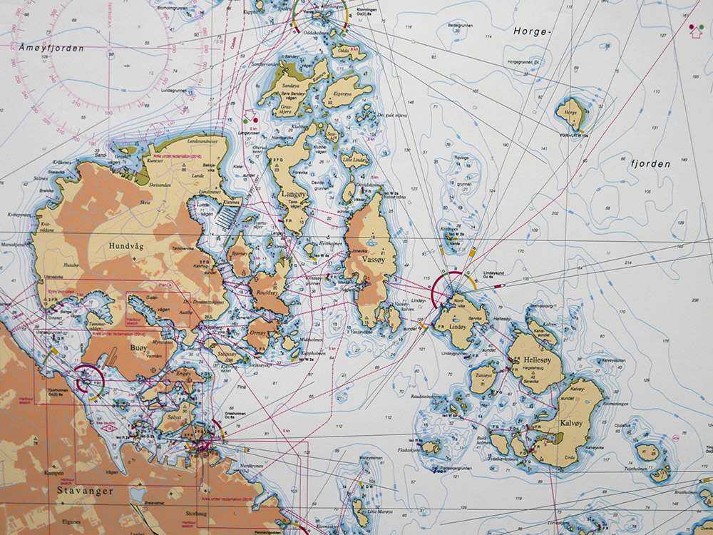
2nd place: Stavanger Harbor with Seaward approaches (chart no. 455) (Norway)
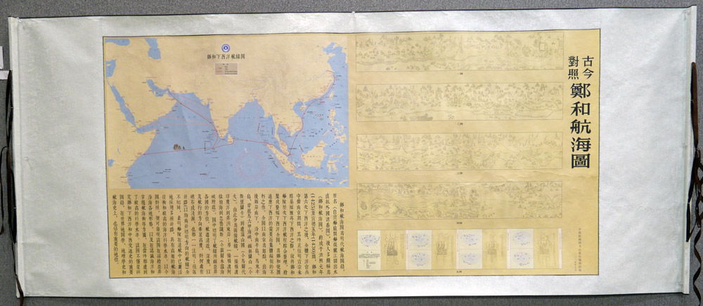
1st place: Zhenghe Navigational Chart with an Ancient vs. Modern Comparison (China)
Innovative representation displaying two contrasting but exquisite cartographic styles, complemented by the rich, high quality materials.
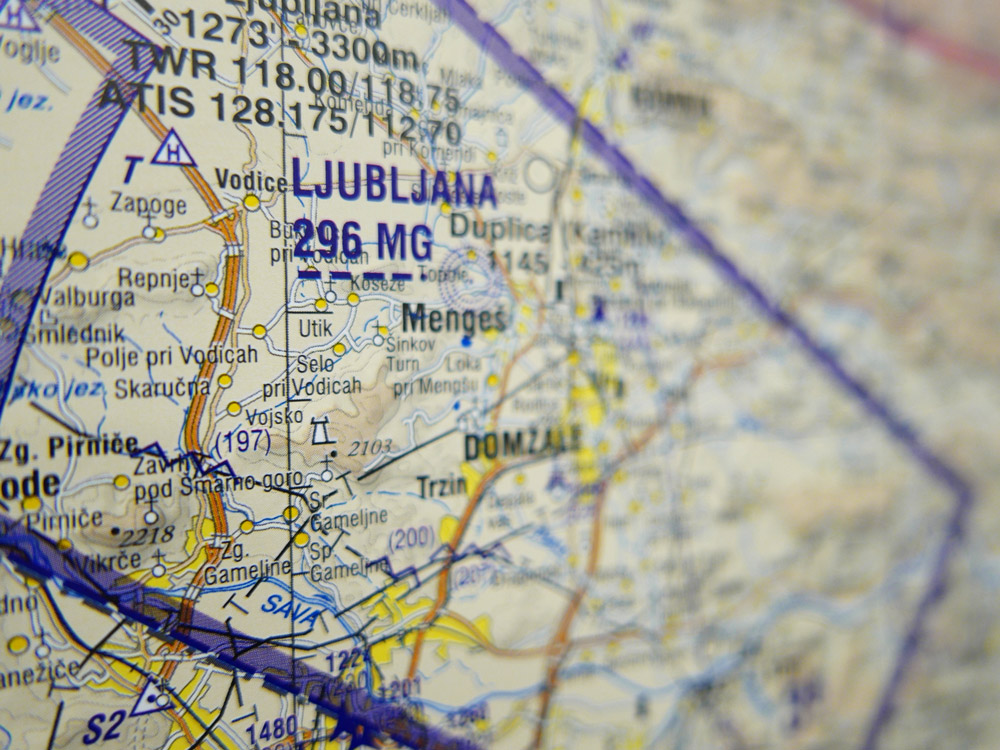
Public Vote: VFR Aeronautical Chart of the Republic of Slovenia (Slovenia)
Maps on panels
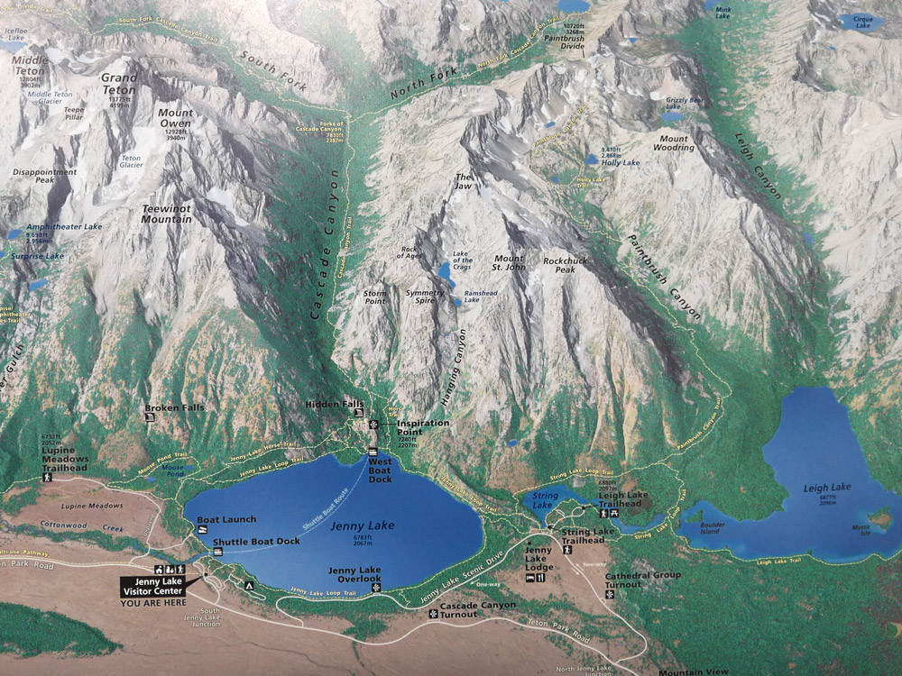
3rd place: Jenny Lake Hiking Map (USA)
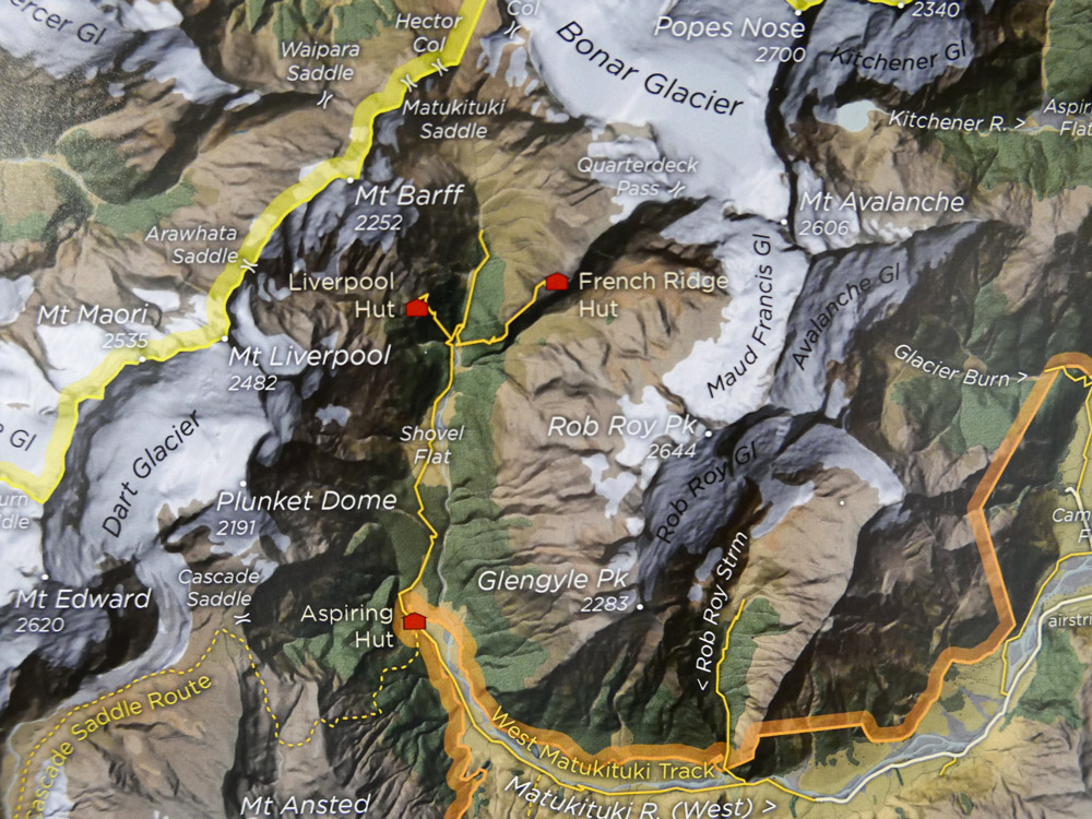
2nd place: The Olivine Wilderness (New Zealand)
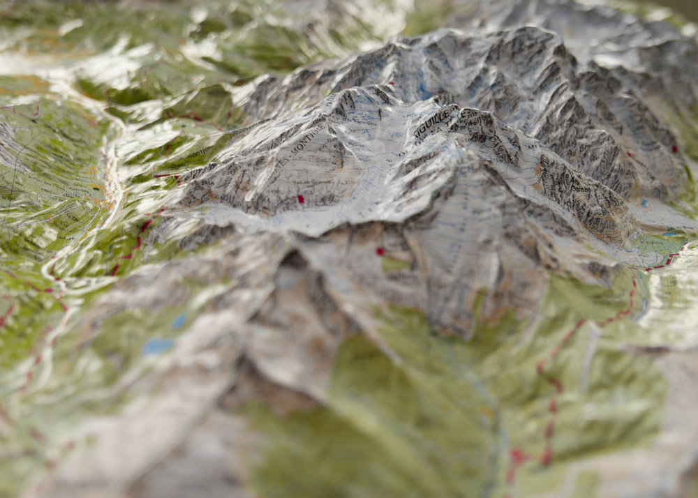
1st place: Relief MASSIF DU MONT BLANC (France)
A beautiful moulded model of Mont Blanc. The map content is well printed, avoiding significant stretching, yielding an evocative 3D, detailed product.
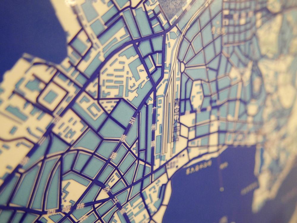
Public Vote: Blue and White Dream (China)
Congratulations to all winners!
All winners will be contacted to be featured in our Map of the Month section over the course of the next two years. For a full list of map products exhibited during ICC 2015, please check the PDF catalogue.
Photos and jury statements provided by Ken Field.
