Welcome to the International Cartographic Association
Welcome to the website of the International Cartographic AssociationGet to know the new ICA Executive Committee for the term 2023-2027
Welcome to the website of the International Cartographic Association
Get to know the new ICA Executive Committee for the term 2023-2027

Diploma for outstanding services for Coronel Juan Vidal García-Huidobro

The Executive Committee of the International Cartographic Association, by virtue of the power vested in it by the statutes and by-laws, hereby certifies that

Coronel Juan Vidal García-Huidobro
President of the Local Organizing Committee

has provided outstanding services to ICA by his commitment to and his engagement for the organisation of the 24th International Cartographic Conference.

David Fairbairn
Secretary-General

William Cartwright
President

Category: General News

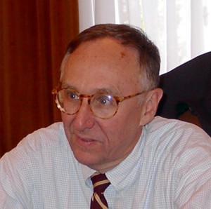
Jack Dangermond is awarded the Carl Mannerfelt Gold Medal

Jack Dangermond

Jack Dangermond

Jack Dangermond is a unique outstanding promoter of cartography, mapping and geography. His products created with strong confidence in the power of cartography and geography have influenced hundreds of government officials, private companies and millions of everyday users including pupils and students from basic schools to technical schools and universities all over the world. He is able to bridge the gap between research ideas and intentions of cartographers on one side, and real practical needs of users from many different fields on the other side.

Jack Dangermond is the founder and president of ESRI. Founded in 1969 and headquartered in Redlands, California, ESRI is widely recognized as the technical and market leader in geographic information system (GIS) software, pioneering innovative solutions for working with spatial data on the desktop, across the enterprise, in the field, and on the Web. ESRI has the largest GIS software install base in the world with more than one million users in more than 300,000 organizations worldwide. He fostered the growth of ESRI from a small research group to an organization of over 3,100 employees, known internationally for GIS software development, training, and services. Jack holds six honorary doctorates: California Polytechnic University-Pomona, State University of New York at Buffalo, University of West Hungary, City University in London, University of Redlands in California, and Ferris State University in Michigan.

Jack Dangermond supports development of new cartographic tools in cartographic generalization and cartographic visualization, creation of digital atlases and approaches promoting cartography in many various areas of human activities from crises management situations to the issues of healthy geography. He is a supporter of distributing and sharing knowledge and creation of capacity building through fundamental projects on the United Nations level – such as Global Mapping – providing opportunities for young users to become a part of the development of cartography by means of grants devoted to application of cartographic and geographic approaches in solving problems of the contemporary world.

Jack Dangermond helped to highlight and make globally visible one of the most successful ICA ideas by publishing – together with the ICA – the best drawings from Barbara Petchenik Contest in a book called “Children Map the World: Selection from the Barbara Petchenik Children’s World Map Competition”.

He promotes the ICA and cartography in general, and stresses the role of cartography in solving global problems. He supports projects highlighting cartographic and geographic science potentials in the process of designing information/knowledge-based society on a global scale. He supports ideas of ICA by creating new widely-known series of cartographic publications, and has published several very influential books, such as Imhoff’s “Three-Dimensional Representation of the Relief”. He still continues in publishing contemporary cartographic books helping to share the latest ideas of cartographers from all over the world.

Similarly as Joel Morrisson and David Rhind have been pioneers of the new era of digital cartography, Jack Dangermond is a pioneer of the delimitation and definition of the role of cartography and geographic information in the realization of the Global Millennium Goals and in the creation of an Information/Knowledge–based Society.

For his outstanding contribution to cartography and geographic information science Jack Dangermond is honored with the highest award of ICA – the Mannerfelt Gold Medal.

Category: General News

Honorary Fellowship for Kira B. Shingareva

Kira B. Shingareva is professor at the Moscow State University for Geodesy and Cartography. She graduated from the Dresden Technical University at 1961 and received her Ph.D in 1974, and became Doctor of Science in 1992. She has hold positions as principal scientist at the Planetary Cartography Laboratory and at the Laboratory of Comparative Planetology at the Institute of Space Researches at the Academy of Science.

At the University she participated in the National Space program by mapping the Moon, Mars, Phobos and Venus. She is an author of more than 150 publications, among them “Atlas of Terrestrial Planets and their Moons” and “Space Activity in Russia – Background, Current State, Perspectives”.

Since 1995 Professor Shingareva has been active in the ICA. She has been co-chairman of the ICA Planetary Cartography Working Group 1995-1999 and chairman of ICA Planetary Cartography Commission for two consecutive terms, 1999-2007. Among the achievements of her ICA activities we find “Series of multilingual maps of planets and their moons”, “Glossary on planetary cartography” and “Specialised map-oriented Databases on planetary cartography”.

Kira Shingareva has served ICA in an exemplary way. In spite of limited resources she has organised and documented several commissions meeting, and always reported the activities of her commission to the Executive Committee in a timely manner.

For her outstanding services to ICA Dr. Shingareva is awarded an Honorary Fellowship of ICA.

Category: General News

Honorary Fellowship for Graciela Metternicht

Graciela Metternicht has for the last 10 years been teaching at Curtin University, Perth Australia and is since July, 2007 professor of Geospatial Systems and Environmental Management at the School of Natural and Built Environments, University of South Australia, Adelaide, Australia. In 1985 she finished an education in cartography at Santa Fe, Argentina. In 1992 she received an MSc in Integrated Map and Geo-information Production at ITC in the Netherlands and in 1996 a PhD in Geography at the State University of Gent, Belgium.

Graciela Metternicht’s publication record contains over 100 works and she is active member of many organisations. In 1999 she took the responsibility to be the editor of ICA News, the newsletter of ICA. She is acting chair of the ICA Commission on Mapping from Satellite Images and active member of several other ICA commissions.

For her outstanding service to ICA, especially as editor of ICA News, Graciela Metternicht is awarded an Honorary Fellowship of ICA.

Category: General News

Honorary Fellowship for Helen Kerfoot

Helen Kerfoot was already presented with a diploma for outstanding services to ICA as member of the LOC that organised the 1999 International Cartographic Conference in Ottawa. She has played a more important role for cartographers worldwide however as chairperson of the UNGEGN standing advisory commission of the ECOSOC, UN.

After an MSc in Geology in Britain she took up a job as geologist in Northern Canada, where she became interested in toponymy and did toponymic fieldwork. Later she went to work for the Govt. Department of Energy, Mines and Resources in Ottawa. She is a past president of the Canadian Society of the Study of Names, which she presided over from 1997-2003. She was delegated by the Canadian Government to the United Nations Group of Experts on Geographical Names around 1987, and was elected as chairperson in 2002.

Since then she has succeeded in turning UNGEGN into a more professional body and in bringing its work in line with current SDI-initiatives. She is one of the few experts with hands-on experience in practically all fields of toponymic standardization. Her drive to attend all the meetings of UNGEGN working groups, her participation in toponymy courses world wide, in scientific seminars and technical meetings as well as her endeavours to make all UNGEGN ‘jurisprudence’ on geographical names accessible through its website have benefited the whole spatial information community, as geographical names standardisation is a most important aspect in the exchange and linking of geospatial data.

For her services and contribution to cartography Helen Kerfoot is awarded an Honorary Fellowship of ICA.

Category: General News

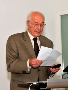
Ernst Spiess is awarded the Carl Mannerfelt Gold Medal

Ernst Spiess

Ernst Spiess

Ernst Spiess, former head of the Institute of Cartography at the Swiss Federal Institute of Technology (ETH) in Zurich, Switzerland, was a student of Eduard Imhof. A chartered surveyor, he was a personal assistant to Professor Imhof, worked in the topography and photogrammetry section of the Swiss Federal Office of Topography in Berne and succeeded Professor Imhof on the faculty at ETH, where he remained until his retirement in 1996.

Ernst Spiess was the founding Chair of the ICA Commission on Cartographic Technologies and was awarded the ICA Honorary Fellowship in 1995.  He is an Honorary Member of the Swiss Society of Cartography which he served twice as president, as well as president of the organizing committee of the international congress of cartography in Interlaken in 1996.  He was also president of the Swiss Society of Photogrammetry.  He has represented Switzerland at UN Congresses on geographic names and was member of the German-Speaking Commission on Geographic Names.  He was a collaborator of the Schweizer Mittelschulatlas and has been and still is editor-in-chief of the new Schweizer Weltatlas, which was awarded the ICA prize in 1997.

In 1959 Ernst Spiess participated in a Swiss Expedition to the Panta Mountains in Peru, from which an outstanding topographic relief map–including a breathtaking cliff representation–resulted.  In 1974, he introduced at the Institute one of the first digital cartographic computer systems, which became a basic tool for advanced scientific work on map production, thematic cartography, and map projections.  The adaptation and extension of Bertin’s “Graphical Semiology” to modern thematic cartography is one of his most important contributions.  He has always regarded the application of theoretical work as equal in importance to theory, and he has been a highly effective communicator and teacher of both.

For an outstanding career in cartography that has included contributions in topographic mapping, atlas production, technological advancement, and as an effective teacher and researcher, the International Cartographic Association awards Professor Ernst Spiess its highest honor, the Carl Mannerfelt Gold Medal.

Category: General News

David Rhind is awarded the Carl Mannerfelt Gold Medal

Professor David Rhind, Vice Chancellor at City University in London, occupies a unique position in the world of cartography and geographic information.  He was the first academic to become the Director General of Ordnance Survey of Britain, where he was instrumental in replacing analogue cartography with digital, which served as an inspiration for other countries as well as other entities within Britain.  He is a Fellow of the Royal Society (Britain’s National Academy of Sciences) and he is an Honorary Fellow of the British Academy (Britain’s National Academy of Social Sciences and Humanities). Has received the CBE award from the Queen and several honorary doctorates for his work as a geographer and cartographer.  He remains active in research and publishing and is the author (with three colleagues) of one of the world’s best-selling textbooks in the field, Geographic Information Systems and Science.

Professor Rhind currently chairs the UK Statistics Commission, which advises Parliament and the Chancellor of the Exchequer (Finance Minister) on whether Britain’s official statistics are trustworthy.  It influences the allocation of many billions of pounds each year.

A former Vice President of ICA, Professor Rhind has been active in the field for many years, and he has served on numerous committees and boards.  He has been associated with various academic institutions in the past including Birkbeck College, University of London, and the University of Durham.  He also served as Head of the Applications Section in the forward-looking Experimental Cartography Unit, RCA.  He has been a visiting fellow at both ITC in the Netherlands and Australian National University.

He is well known internationally as well as within Britain and has served on numerous boards and committees, but he is also a keen thinker within the field, in recent years concentrating on the position and role of cartography in the Information (or Knowledge-Based) Society, especially in the topics of self financing, financial models and the harmonization of the GI and IT fields.

For his outstanding contributions to cartography and geographic information systems and his expansive role in the broader context of the field, for his productive publication record, and his seminal thinking within the field, the International Cartographic Association awards Vice Chancellor David Rhind its highest honors, the Carl Mannerfelt Gold Medal.

Category: General News

Honorary Fellowship for Pinhas Yoeli

Pinhas Yoeli, Professor Emeritus at Tel-Aviv University, is known throughout the cartographic world for his breakthrough work on various difficult problems in automation including hill shading, contouring, name placement, and the colouring of undersea elevations. He has made outstanding scholarly contributions to cartography over a long and sustained period—about 50 years. A student and disciple of the Swiss cartographer Eduard Imhof, Professor Yoeli developed mathematical models that allowed the programming of Imhof’s principles. His book entitled Cartographic Drawing with Computers, published by the University of Nottingham in 1982, was the first teaching material of its kind that explained and further developed the background of graphic software suited to cartographic work. He offered his expertise as a professor in the field of digital cartography in many universities throughout the world. In the span of his career, he gained many disciples of his own and has been read by cartographers throughout the world who have been inspired as well as informed by his work.

For his inspired and sustained work in digital cartography—especially his work with mathematical models for hill shading, contouring, and name placement—and for his extensive record of teaching both in the classroom and through his publications, the International Cartographic Association awards Professor Emeritus Pinhas Yoeli its honorary fellowship.

Category: General News

Honorary Fellowship for Michael Wood

Michael Wood is Senior Lecturer at the Department of Geography and Environment, University of Aberdeen and was previously on the faculty at the University of Glasgow. He is a cartographer who artfully combines skill in mapmaking with an agenda of scholarly publication and service. His publications in recent years have been focused on the position of cartography within the broader information and social terrain. He thinks on a broad scale about methodology of world cartography starting from its traditional roots to its modern communication and information paradigms and technologies in which we are seeing increasingly customized and individualized mapping.

Professor Wood was awarded an honorary degree of Doctor of Science at Oxford Brookes University. His teaching includes mapping the environment, topographic mapping, cartographic visualization, and environmental remote sensing. Apart from his regular Departmental teaching and provision of adult evening lecture courses for the local region, he has designed and produced courses on mapping/GIS for various external groups – academic, local government, and commercial (especially oil companies). These courses have run on numerous occasions since the late 1970s. He is a frequent lecturer at professional cartographic events as well.

Professor Wood has served in such roles as external examiner and visiting lecturer on numerous occasions. He has served as President of the British Cartographic Society, member of the UK Committee for Cartography, Honorary President of the Society of Cartographers, and as Vice President, President, and Past President of ICA. During his tenure on the ICA Executive Committee, he was key in developing our Strategic Plan, a document and set of ideas that is guiding ICA into the 21st Century.
For his contributions to the discipline of cartography/GIS and his service to the discipline, and especially for his service to ICA in developing the Strategic Plan, the International Cartographic Association awards Professor Michael Wood its Honorary Fellowship.

Category: General News

Honorary Fellowship for Wanarat Thothong

Wanarat Thothong, head of photogrammetry of the Department of Land Development of the Ministry of Agriculture of Thailand has played an important role in supporting Cartography and the ICA in Southeast Asia over the last 20 years. She has not only been active in the cartographic life of Thailand but has actively participated in various UN meetings that have been held in its Southeast Asia headquarters and in UN conferences on Standardization of Geographical Names. She has also participated in UN Regional Cartographic Conferences for Asia and the Pacific.

Wanarat Thothong is a member of several ICA commissions, and has had strong input in the ICA Commission on Education and Training, the Commission on Map Production, and the Commission on Cartography and Gender. She has hosted at least three seminars for ICA on behalf of the commission on Education and Training, the Commission on Map Production, and the Commission on Mapping from Satellite Imagery. These hosted events included the Seminar on Basic Cartography in 1991, the Seminar on Digital Cartography and GIS in 1994, and the Seminar on GIS and Mapping for Agricultural Decision Support in 2003, all in Bangkok. In addition to doing the local organization for all three, she produced, with the help of her staff, the proceedings of each event, a practice she introduced in the ICA community.

For her outstanding contributions to cartography in Thailand, Southeast Asia, and the broader Asian and Pacific region, and for her tireless support of ICA activities in the region, the International Cartographic Association awards Wanarat Thothong its Honorary Fellowship.

Category: General News
rawboned-refined