Welcome to the International Cartographic Association
Welcome to the website of the International Cartographic AssociationGet to know the new ICA Executive Committee for the term 2023-2027Get to know the ICA Commissions for the term 2023-2027
Welcome to the website of the International Cartographic Association
Get to know the new ICA Executive Committee for the term 2023-2027
Get to know the ICA Commissions for the term 2023-2027

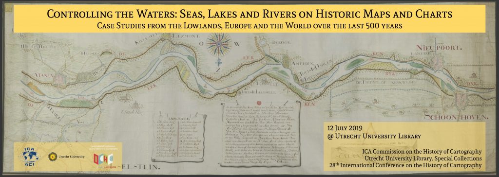
Invitation to workshop Controlling the Waters: Seas, Lakes and Rivers on Historic Maps and Charts

Banner for Utrecht 2019 workshop

It is a tradition that the ICA Commission on the History of Cartography and the International Conference on the History of Cartography (ICHC) jointly organize a pre-ICHC event. For the 28th ICHC they have teamed up with the Map Collection of Utrecht University and will together host a workshop focusing on the cartography of water.

  • Date: 12 July 2019
  • Place: Utrecht University, University Library, Boothzaal and Map Collection, The Netherlands

Fresh and salt waters are a key lifeline for all civilizations but at the same time can also threaten human habitats. Over the centuries, people have ventured out to navigate and explore the waters, while also putting systems in place to manage and control them. This has resulted in numerous categories of water-related maps such as portolan charts, maritime and river cartography, hydrographic surveys, VOC charts, polder maps etc. The workshop will offer a forum to discuss this rich variety in cartographic heritage.

Call for Papers

The organizers invite the submission of abstracts for oral presentations (25 minutes plus Q&A) focusing on the human interaction with water from a historical perspective.

  • Deadline for submissions: 30 November 2018
  • Notification of acceptance: December 2018

You can submit your abstract here.

Registration

The workshop is open to everyone with an interest in the history of cartography but requires participants to register. Registration will be open until the available seating is allocated and will be free of charge.

For more information on the workshop please visit history.icaci.org/utrecht-2019

ICC2019: Call for abstracts and papers is now open!

icc2019-logo

The 29th International Cartographic Conference will take place in Tokyo, Japan, 15–20 July 2019. The Organizing Committee of ICC2019 invites all interested participants to submit full papers or abstracts for the oral or poster presentations.

All submissions will be reviewed by the International Scientific Committee. All accepted submissions will be published as the Advances in Cartography and GIScience of the ICA, Proceedings of the ICA, or Abstracts of the ICA. Selected papers will also be published in the International Journal of Cartography.

All details and the submission form can be found on the ICC website: icc2019.org/papers.html.

Important Dates

Papers

  • Submission of full manuscript for Advances: 5 December 2018
  • Submission of abstracts for Abstracts and Proceedings: 19 December 2018
  • Notification of acceptance: 20 February 2019
  • Submission of final manuscripts for Proceedings and Advances: 3 April 2019

Exhibition

  • Submission interface for International Cartographic Exhibition opens: 12 December 2018
  • Submission interface for International Cartographic Exhibition closes: 6 March 2019

Registration

  • Conference registration deadline for presenters/authors: 3 April 2019
  • Deadline for Early-Bird-Fees: 3 April 2019

Conference Topics and Paper Themes

  • T01 Art and Cartography
  • T02 Atlases
  • T03 Cartographic Heritage into the Digital
  • T04 Cartography and Children
  • T05 Cartography in Early Warning and Crisis Management
  • T06 Cognitive Issues in Geographic Information Visualization
  • T07 Education and Training
  • T08 Generalisation and Multiple Representation
  • T09 Geospatial Analysis and Modeling
  • T10 GI for Sustainability
  • T11 History of Cartography
  • T12 Location Based Services
  • T13 Map Design
  • T14 Map Production and Geoinformation Management
  • T15 Map Projections
  • T16 Maps and Graphics for Blind and Partially Sighted People
  • T17 Maps and the Internet
  • T18 Mountain Cartography
  • T19 Open Source Geospatial Technologies
  • T20 Planetary Cartography
  • T21 SDI and Standards
  • T22 Sensor-driven Mapping
  • T23 Topographic Mapping
  • T24 Toponymy
  • T25 Ubiquitous Mapping, Spatial DB and IoT-Based Systems
  • T26 Use, User and Usability Issues
  • T27 Visual Analytics
  • T28 Marine Cartography
  • T29 Digital Humanities and GIS
  • T30 GIS, Remote Sensing and Cartographic Theory, Methodology and Applications
  • T31 Visualization and Analysis of Geographical Process
  • T32 Mapping Cities
  • T33 Design and visual variables: Rethinking Jacques Bertin
  • T34 Geo for All: Open source GIS education
  • T35 Crowdsourced Geospatial Information
  • T36 Transition to Modern and Contemporary Mappings
  • T37 Maps for SDGs
  • T38 Mapping the Environment
  • T39 Theoretical Cartography
  • T40 AI, Robotics, Autonomous Cars and Mapping
  • T41 Maps and Games
  • T42 Big Data and Data Science
  • T43 Others

For more details, please visit the conference website.

Category: General News
Tag: , ,

Invitation to Workshop on New Directions in Geovisual Analytics

The ICA Commission on Visual Analytics is pleased to announce a Call for Papers for a pre-conference workshop to be held in conjunction with GIScience 2018 on August 28, 2018 in Melbourne, Australia.

New Directions in Geovisual Analytics: Visualization, Computation, and Evaluation

The workshop focuses on eliciting and sharing nascent challenges in visual design, evaluation, and computation related to geovisual analytics. The core concept of this workshop is to focus on exploring ideas for new approaches – not simply to recap what has already been accomplished. Toward that end, workshop participants will be asked to submit extended abstracts that describe new research directions in visualization, evaluation, or computation (and may synthesize across these areas as well). We especially encourage high-risk ideas that have a potentially high-return in terms of scientific and social impact. Potential topics may include:

  • New visual representation types in geovisual analytics
  • Novel computational and visual methods for handling massive, streaming, spatiotemporal data
  • Opportunities for integrating immersive environments and geovisual analytics
  • Artistic approaches for expressing or interacting with big spatial data
  • New approaches for integrating users in the design of geovisual analytics systems
  • Ideas for integrating sensemaking into geovisual analytics

This workshop will have a discussion-centric format. Accepted talks will be given in short formats (10min or 5min in length) with an emphasis on having ample discussion and networking time connected to each series of talks.

The workshop will be held August 28, 2018 in Melbourne, Australia.

Deadline

The deadline for submitting extended abstracts (no longer than six pages using the GIScience 2018 format) has been extended to May 11, 2018.

A dedicated workshop website can be found at viz.icaci.org/GVIZ2018

Tag: ,

IJGI Special Issue on Human-Centered Geovisual Analytics

The ICA Commission on Visual Analytics and the ISPRS Working Group on Geovisualization, Augmented and Virtual Reality are excited to announce a special issue of IJGI.

Overview

Guest Editors: Dr. Arzu Çöltekin, Dr. Sidonie Christophe, Dr. Urška Demšar, Dr. Anthony Robinson

This special issue seeks papers on geovisual analytics and visuospatial display design with human-centered approaches.

Human abilities, limitations and attitudes are defining factors for adaptation of technological solutions, such as visuospatial displays used in geovisual analytics software environments. Human-centered issues (and associated solutions) can be complex to understand, model, and, importantly, generalize from individual experiments. Therefore, it is important that we continue asking new questions, or answer the old questions again with fresh perspectives to advance and solidify our knowledge. In addition to fundamental knowledge, technical solutions that are informed by fundamental knowledge (e.g., on the perceptual and cognitive factors) are still rare, even though it is understood that they could benefit users.

With this Special Issue, we intend to create a compendium of state-of-the-art knowledge on human-centered approaches to creating and using geovisual analytics environments; and the design of the visuospatial displays that are of core importance in visual analytics processes. We welcome contributions that feature technical solutions informed by human-centered user research; experimental studies demonstrating new knowledge in human visuospatial information processing, spatial perception and cognition, and studies focusing on usability engineering. Furthermore, we welcome literature reviews and theoretical papers that consolidates knowledge on any of the listed topics, or topics related to the scope of the Special Issue.

Topics of interest include (but are not limited to)

  • User-centered techniques for representing and interacting with big spatial data
  • Usability and utility evaluation of geovisual analytics
  • Cognitive studies of geovisualization
  • Personalization and customization of visuospatial displays
  • Ageing and visuospatial displays
  • Perceptually informed design principles for geovisual displays
  • Design and evaluation of virtual environments and augmented reality approaches for geovisualization
  • What about time? User-centered visual analytics for spatio-temporal data
  • Geovisual analytical solutions for movement and dynamic phenomena
  • Geovisual analytical solutions for environment and climate change
  • Geovisual analytics solutions for sustainability (from local to global scales)

Submission details

An expression of interest with a 200-word abstract should be sent to the editorial team latest by 15th of August 2018 at the email address human.isprs.ijgi@gmail.com. Please also mention if you will need a discount or waiver on the open access fees. If your institution has funds for open access publications, please consider that others might not, before asking for the waiver or discount.

Deadline for full paper submissions: 15 November 2018


Tag: ,

2nd Call for Papers for the 7th International Symposium on the History of Cartography: Mapping Empires Colonial Cartographies of Land and Sea

You still have until 1 March to submit an abstract for the international symposium Mapping Empires: Colonial Cartographies of Land and Sea, which will be held from 13–15 September 2018 in Oxford (UK) and is jointly organised by the ICA Commission on the History of Cartography, the ICA Commission on Topographic Mapping and the Bodleian Libraries of the University of Oxford.

Besides its scientific programme, the symposium will also include a nice array of social events, namely an ice-breaker reception, a maps and rare books exhibit and reception at Christ Church Library, a guided tour of Oxford, a conference dinner and a full-day visit to nearby Blenheim Palace.

For more information please visit the symposium website at mappingempires.icaci.org.

Invitation to the 11th ICA Mountain Cartography Workshop

In partnership with the University of Zagreb, Faculty of Geodesy, the ICA Commission on Mountain Cartography is organizing its 11th ICA Mountain Cartography Workshop on the island of Hvar, Croatia. From May 21–25, 2018, we invite you to this beautiful venue in the Adriatic Sea and welcome you for numerous interesting excursions. The workshop will be hosted in hotels Pharos and Amfora in one of the most popular tourist destinations in Croatia – the city of Hvar.

The ICA Mountain Cartography Workshop brings together cartographers, geographers and others who want to discuss the current developments in mountain cartography and spatial data analysis and representations related to mountain environments. Main conference topics are (but not limited to):

  • Mapping for outdoor activities in mountains
  • Mapping and GIS of mountainous areas
  • Physical and topographic mapping
  • Relief representation
  • Visualisation of mountain dynamics
  • Interactive atlases
  • New media applications
  • Glacier movement
  • Rock representation

Different presentation types are possible, from classic research papers to live software demonstrations and map discussions. With visits to the Hvar Observatory, St. Nikola and Pakleni Islands, the workshop includes outdoor thematic excursions, too.

Along with traditionally interesting scientific and professional programme and exchange of experiences among mountain cartographers from the whole world, there are many options for those interested for hiking and kayaking, local cuisine, charming beaches, historical sites or just strolling through the streets of the ancient Pharos. Our diversified programme with complementary activities will meet everyone’s interests.

Submit your abstract and take advantage of discounted early registration until February 28, 2018.

Find more information on the workshop web-site: science.geof.unizg.hr/cmc2018.

Tag:

Invitation to the 7th International Symposium on the History of Cartography: Mapping Empires Colonial Cartographies of Land and Sea

The ICA Commission on the History of Cartography, the ICA Commission on Topographic Mapping and the Bodleian Libraries of the University of Oxford are happy to invite you to their joint international symposium Mapping Empires – Colonial Cartographies of Land and Sea. This is already the 7th event in a series of two-yearly symposia on the History of Cartography.

  • Date: 13–15 September 2018
  • Place: Weston Library, Oxford, UK

To explore the city, its surroundings and its cartographic heritage, optional technical and social tours are planned.

Call for Contributions

The organizers invite contributions (papers and posters) investigating the cartography of Africa, Asia, Oceania and the Americas as influenced by cosmopolitan exploration and imperialistic activity during, but not limited to, the ‘long nineteenth century’ (mid-18th to mid-20th centuries). The rise of European hegemony coincided with a scientific turn that underpinned the evolution of topographic mapping and hydrographic charting, and  led to the emergence of thematic mapping. These colonial cartographies brought forth a rich legacy of mapping that continues to influence the aesthetics and authority of mapmaking today.

  • Deadline for submissions: 1 March 2018
  • Notification of acceptance: 31 March 2018

As with previous international symposia the organizers plan to publish accepted and presented papers and posters in the ICA series “History of Cartography” by Springer (Heidelberg et al.); for the recently published Proceedings of the previous 6th International Symposium held in Dubrovnik in October 2016 please see www.springer.com/us/book/9783319615141

For more information on the symposium and for the submission of abstracts please visit mappingempires.icaci.org

Atlases, Cognition, Usability: ICA Commissions Workshop in Olomouc, Czech Republic

The ICA Commission on Atlases in cooperation with the ICA Commission on Cognitive Issues in Geographic Information Visualization and the ICA Commission on Use, User and Usability Issues invite to a Joint Workshop in Olomouc, Czech Republic on April 27-30, 2018.

Although every atlas is intended for its users, cartographers should pay attention to the fundamental cognitive and usability issues of the product. The joint workshop addresses strengthening existing research on topics related to atlases, cognitive and usability issues and provides a platform for joint cooperation between cartographers dealing with atlases, cognitive, and user issues that will lead to new collaborations, new ideas and new friendships.

The workshop sessions will be managed as either oral presentation of research contribution or discussion motions where cartographer from each commission can present their ideas to the members of all three commissions and other workshop participants and invite further discussion from the audience.

Participants may also choose from some practical workshops. Optional guided tours to the romantic water cruise on the underground Punkva River and visit the Macocha Abyss, the largest gorge in the Central Europe, or a visit to the Moravian Cartographic Center.

Call for Papers

The Call for Papers is now open for submissions of abstracts on any topic of merit addressing at least one of the subjects of Atlases & Cognition & Usability. Deadline for submissions is February 10, 2018.

For more information, please consult the workshop website: spring2018.upol.cz

Invitation to the 14th International Conference on Location-Based Services

lbs2018_logoBuilt on the success of previous conferences in this series, LBS 2018 aims to offer a common ground to colleagues from various disciplines and practice where they can meet, interact and exchange knowledge, experience, plans and ideas on how LBS can and could be improved and on how it will influence both science and society.

The Call for Papers is currently open (also available as a PDF). We call for full papers, work in progress, and showcases. High-quality full paper submissions are intended to be published in Springer’s Lecture Notes in Geoinformation and Cartography Series. The best full and work in progress papers will be invited to submit an extended version to the Journal of Location Based Services.

Important Dates

  • 12 July 2017, Submission of full & work-in-progress papers
  • 29 September 2017, Notification of acceptance for full & work-in-progress papers
  • 13 October 2017, Camera-ready full & work-in-progress papers
  • 15 November 2017, Submission of showcases

More information regarding LBS 2018 can be found at lbsconference.org.

We are looking forwards to your contributions and to meeting you in Zurich!

Organizers:

  • General Chair: Martin Raubal (ETH Zurich)
  • PC Chairs: Peter Kiefer (ETH Zurich), Haosheng Huang (University of Zurich), Nico Van de Weghe (Ghent University)

Haosheng Huang
– Chair of the Commission on Location-Based Services

Tag: ,
rawboned-refined