Welcome to the International Cartographic Association
Welcome to the website of the International Cartographic AssociationGet to know the new ICA Executive Committee for the term 2023-2027
Welcome to the website of the International Cartographic Association
Get to know the new ICA Executive Committee for the term 2023-2027

President’s Blog #5: Announcing New Dates for ICC2021

Dear ICA Colleagues,

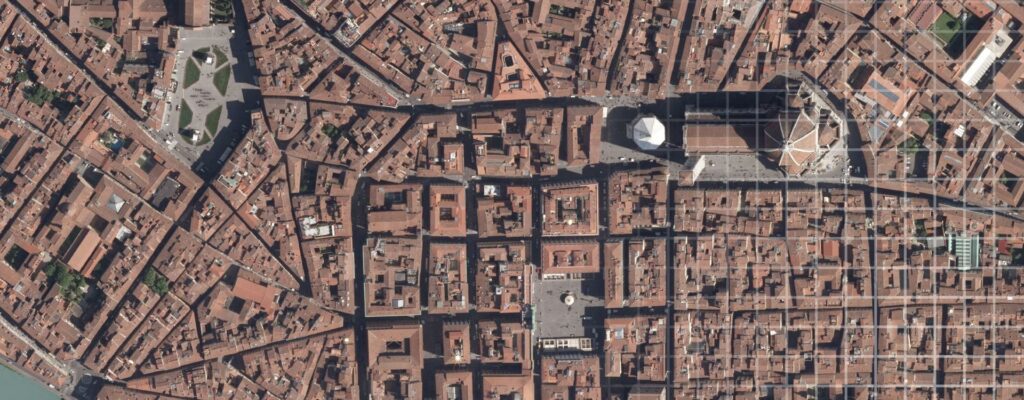
What better way to celebrate the New Year than to announce that the International Cartographic Conference will take place December 14-18, 2021 in Florence, Italy. The change in dates reflects careful planning on the part of the Italian Cartographic Society’s Local Organizing Committee (LOC). It was originally scheduled for July 2021. We all can appreciate how difficult it is to plan the timing for a conference during the pandemic, especially when trying to maneuver the timing of an event that allows for an in-person conference. After much deliberation, the month of July was deemed too risky. The organizers and the ICA Executive Committee concluded and agreed to move the date five months later to December. With so much economic uncertainty, the LOC also planned for and have now settled on a new location in Florence for the event – The University of Florence. The University’s central location, accessibility, and facilities combine to meet all of the conference needs for the ICA.

The change in dates together with a new venue are the reasons for the recent uncertainty regarding published deadlines for papers, abstracts, and the International Map Exhibition. We expect that you will understand the many challenges faced by the LOC and the ICA Executive Committee when several fundamental assumptions in planning a large international event suddenly went amiss because of the pandemic’s long reach.

Announcing a Hybrid Conference Opportunity

The ICC2021 will be a hybrid conference – a chance to participate in person or via remote access. This is the first time that the ICA has offered such a choice. A hybrid event opens access to more participants and now makes it possible for those unable to travel or with limited resources to experience the benefits of an international cartographic event, as long as you have internet access. This is a recent decision and specific details are being formulated to help you decide on your attendance preferences. We anticipate that the hybrid option will highlight selected program content and will not include the full program. Conference registration rates will reflect these distinctions. As more details are decided, information will be posted to the conference website. Future President blogs also will highlight these options and opportunities on the ICA website.

Next steps for each of us

  1. Review the conference website for recent information on deadlines and details. Periodically check the website for updates and new information.
  2. Authors planning to submit a full paper for review have an approaching deadline of January 15. The organizers anticipate that those who are considering this option have been working on their paper to meet prior deadlines and can now submit their work for review by the ICC Scientific Program Committee. If a short extension is needed, please contact the Scientific Program Committee.
  3. The abstract submission deadline is March 26 for consideration either as a full paper in the Proceedings or as stand-alone published abstract. See the ICC website for details.
  4. Conference registration options will be decided soon and will be available to you.
  5. ICA Members (countries and affiliate members) who plan to submit cartographic examples for the International Cartographic Exhibition, see the guidelines at https://www.icc2021.net/wp-content/uploads/2020/12/ICC_2021_Guidelines_201204_web.pdf.
  6. Sponsors, exhibitors, businesses, and associations that plan to have a presence at the ICC2021, please contact the LOC and check the conference website for details. This international conference is a great opportunity to make your mark in the rebirth of your enterprise coming out of the pandemic.

Contact LOC: https://www.icc2021.net/contacts/

I hope that this information has been informative and helpful. More information will follow but this is a great start for our collective efforts in 2021. I cannot explain to you how excited I am in looking forward to seeing you in Florence in December 2021. Until the next time…

– Tim Trainor
President of the International Cartographic Association

President’s Blog #4: Finally, an end to a challenging year … and prospects for a much better 2021

The past year has been an exceptional year for all of us – a time that we will certainly remember for our lifetimes. None of us could foresee what was coming when we shared our holiday wishes a year ago. The COVID-19 pandemic threatened our lives while also destroying many exciting plans for a normal year of activities, both professionally and personally. The pandemic imposed unprecedented challenges to our lives. For the ICA, it disrupted and affected professional collaboration around the world.

Like many international organizations, the ICA community had to adjust to the circumstances. This was not our norm. Many long-planned conferences and meetings had to be cancelled or postponed by their organizers. We could not stand by and let the pandemic rule every aspect of our existence. In response, meetings of the new ICA Executive Committee, the ICA Commissions and new ICA Working Groups shifted to virtual-only environments. We all had to get used to a “new normal” where technology empowered us to keep in touch. One positive outcome of distance meetings, workshops, and conferences was that many more people were able to participate that would not have been able to travel. In a virtual setting, numbers of participants were much higher than expected. While the technology allowed us to continue our programs, we all sorely miss person-to-person meetings with our friends and colleagues…with you.

With all the downsides of 2020 and the personal suffering and daily disruptions caused by the pandemic, we have also seen rays of hope pointing the way to what we expect will be a better new year in 2021. Since the beginning of the crisis, the need for information has increased tremendously worldwide. This need for data also affects us and our discipline as maps provide an essential information medium for our society and for science. We have all seen many vivid examples in recent months – showing the distribution and spread of the virus as well as geovisualizations on how to fight it. The world of cartography and geoinformation has come to the forefront in various ways that helped in addressing the pandemic.

We must admit that these pressing circumstances have initiated a wave of digital transformation in our lives that we would not likely have experienced so quickly in a more normal year. We all discovered new efficient virtual ways of working together across long distances while having a sense that our colleagues were in the room next to us. These previously little used techniques allowed us to be successful in not only maintaining the ICA’s mission, but expanding the activities of our Association by organizing new conferences, establishing new ICA Working Groups and even finding new members! We should and will use this motivation for the coming years, learn from it and continue our progress. The ICA Executive Committee and Commission Chairs have drawn various positive conclusions from this year’s experiences that are guiding us in planning for future activities and events that can be incorporated into those plans.

I am very hopeful that we will return to a more normal time where we will have the opportunity to meet in person again – while continuing to build on our new experiences from the society’s digital transformation. One special event is our next ICC in Florence, Italy which is now planned for December 2021. The conference is a beaming ray of hope where we can experience a second renaissance of humanity – getting together to advance cartography and GIScience. Please register and submit your contributions to this important event.

We wish you and your family, colleagues and friends peaceful holidays and all the best for 2021! We very much look forward to our continuing collaboration with you in the coming year.

– Tim Trainor
President of the International Cartographic Association

AutoCarto 2020 – Online on GIS Day!

CaGIS is proud to present AutoCarto 2020, the 23rd International Research Symposium at the intersection of cartography and GIScience.

AutoCarto 2020 is being offered virtually in an open access format that is online and free to all!

The program consists of 40 papers by 121 authors from 14 counties, 7 workshops by 16 organizers from 6 countries, and 4 visionary keynotes from international, government, industry, and academic perspectives.

All of this great content goes live on GIS Day — Wednesday, November 18, 2020 — so be sure to visit the AutoCarto website then!

Category: Member News

AutoCarto 2020 Online

We hope this message finds you safe and healthy during these unprecedented times. Regretfully, COVID-19 continues July to spread across the US at alarming rates which diminishes our hope for a safe environment to hold AutoCarto 2020 as an in-person conference in November. Therefore, we have decided to reformat the conference as an online experience.

AutoCarto 2020 will be offered online as a set of extended abstracts and associated recorded presentations. These will go live on Wednesday, November 18, 2020. Viewers will have the opportunity to contact presenters with questions or comments. Extended abstracts will also be published in the AutoCarto 2020 Online Proceedings.

Please find all details here:

  1. An AutoCarto 2020 proceedings will be published on the AutoCarto website. These proceedings will be comprised of extended abstracts that have been reviewed and accepted by the Program Committee. The deadline for submitting a new extended abstract is September 15, 2020. The deadline for submitting a revised abstract is September 30, 2020. The online proceedings will be open-access, and authors will retain copyright over their submissions. Please inform May Yuan, Program Chair, at myuan[at]utdallas.edu if you wish to exclude your extended abstract that has already been accepted from the proceedings.
  2. Authors whose extended abstracts have been accepted are invited to share a presentation of that will be published on the AutoCarto 2020 website alongside their presentation. The deadline for submitting presentations is November 10, 2020. These presentations may be in either PDF format and/or MP4 format. Upload a PDF of the presentation you created using PowerPoint or another presentation tool and/or a recording of your presentation in MP4 format to a cloud storage service (e.g., Dropbox, Box, Google Drive, or OneDrive). Please email the shared link to May Yuan and provide contact information for the corresponding presenter for questions or comments from viewers.
  3. All authors are free to submit their extended abstracts to other conferences since AutoCarto 2020 will not be held as an in-person conference.
  4. Rex Cammack (rcammack[at]unomaha.edu) is editing a Taylor & Francis book and will consider including papers expanded from the extended abstracts for AutoCarto 2020. Please contact Rex if you are interested in contributing a chapter based on your extended abstract.
  5. Authors may also consider submitting their work to the Cartography and Geographic Information Science journal. Please follow the normal submission guidelines for authors.

While we are saddened at the changes we must make to AutoCarto 2020, the Cartography and Geographic Information Society is already beginning to plan AutoCarto 2022 where we will look forward to seeing you in person.

Sincerely,
Aileen Buckley, AutoCarto 2020 Conference Chair
May Yuan, AutoCarto 2020 Program Chair

Category: Member News

ICA President’s Blog #2 by Tim Trainor

Dear ICA Colleagues,

I hope that everyone is healthy and safe during these continuing times of uncertainty and viral attacks on our well-being. Many of you are working tirelessly to help in managing the pandemic while others are working toward meaningful observations and data collection and synthesis. Still others are making maps on a variety of topics to help leaders, decision-makers and health providers in their daily challenges to arrest and control this deadly virus and its impacts.

There are more unknowns than knowns. Each day brings revelations while we observe the continued spread with little confidence of safety beyond burrowing in our living quarters or cautiously escaping out into spaces with variable public interactions. We face risk each day and we long for a sense of security for ourselves and our families.

What can we do as a cartographic community to help in responding to this frustrating situation? As we do our work, we are experiencing challenges that defy our efforts to provide what we think is needed to help. The absence of specific data at the needed level of resolution may be one example. Accurate data reflecting the necessary time-stamp might be another. Having effective data at helpful geographic areas to make decisions and manage impacts could be another challenge. We know from health experts that to be safer in our current circumstances there is a need to test, trace and isolate new cases until a vaccine is developed and administered to everyone. In order to accomplish these tasks, what data is needed and at what levels of geography?

We, as cartographers, can contribute to the demands for data and visualization aids during this crisis. Last week I participated in a global virtual meeting of the UN expert group on the integration of statistical and geospatial information. This group was formed collaboratively by the UN Statistical Commission and the UN Committee of Experts on Global Geospatial Information Management. The current efforts by this expert group could not be more timely. Tasks associated with challenges in integrating statistical and geospatial information include geocoding, common geographies, interoperability, privacy and confidentiality, and capacity building.

Each one of these topics is an issue of the day as we fight our way through the pandemic battle.

No one person has the perfect solution, but together, as we share information, ideas, experiences, failures and successes, we can take the best approaches as they apply to our circumstances by developing tools, techniques, methodologies, data, and technical solutions that will contribute to arresting the impacts of this virus. This is a call for sharing in a pandemic era.

Let’s use the tools available to us such as articles in the ICA News and eCARTO News, submission of research work in cartography and GIScience to the International Journal of Cartography, updates through social media like Facebook, and engagements with colleagues using the virtual tools that make our connections possible.

Be well and stay safe.

– Tim Trainor
President of the International Cartographic Association

ICA President’s Blog #1 by Tim Trainor

Dear ICA Colleagues,

I hope that everyone is well and that you are in a safe situation as we experience the reality of the Coronavirus Pandemic. With each day, we see changes in our local circumstances that require us to adjust our daily lives accordingly. For some, they have weathered a difficult time and are seeing some relief from periods of self-quarantining. For others on the other end of the virus spectrum, they may be seeing the first signs of exposure. This could take longer than we prefer as there is much to learn about the effects of the virus, how it can be best treated, and how it can be prevented in the future.

The ICA, like other organizations, has been impacted. Planned events for regional cartographic conferences and ICA Commission workshops and meetings have had to postpone or cancel plans in order to reduce physical contact. While unfortunate, this is a needed response as we observe the situation worsening in some areas.

Like you, I look to maps to help in understanding the impact of the virus on our communities. This is a time for each of us to reflect, as cartographers, what else we could do to have a positive impact on knowledge, understanding, prevention, and resolution of the virus. As scientists explore the cause, effect, and resolution, we stand ready to help communicate their findings through maps and mapping. Let’s share our expertise.

Take care and be safe!

– Tim Trainor
President of the International Cartographic Association

AutoCarto 2020 postponed to November

In light of the important public health considerations related to the novel coronavirus (COVID-19), the AutoCarto Organizing Committee has decided to postpone AutoCarto 2020 until November 2020. The new dates for the conference are Tuesday, November 18, through Friday, November 20, with workshops on Tuesday, November 17. The venue will remain the same – the Esri campus in Redlands, California.

We are still working out the details related to registrations and paper submissions. Please bear with us while we determine the best way to handle these and other important issues. In the meantime, please modify any arrangements you may have made to travel to California in May.

If you have any specific issues or concerns, please email the conference chair, Aileen Buckley (abuckley@esri.com). We appreciate your patience as we continue to make arrangements for these new dates for AutoCarto 2020.

Dr. Aileen Buckley, PhD
AutoCarto Conference Chair

Category: Member News

Workshop on Automatic Vectorisation of Historical Maps held as virtual conference

On 13th March, the Commission on Cartographic Heritage into the Digital had its workshop on the Automatic Vectorisation of Historical Maps. Due to the coronavirus situation the workshop had to be held online only. Despite the short time (the meeting ban at the hosting institution was announced only 3 days before the event) most authors managed to join the meeting. The workshop was streamed online, the discussion was realized in a chat group.

(CANCELLED) Invitation to the 12th Mountain Cartography Workshop

Update, March 2020: Sorry, this workshop had to be cancelled due to the coronavirus situation.


We invite you to participate at the 12th Mountain Cartography Workshop in the Colorado Rockies, April 14—18, 2020.

Banner 12th Mountain Cartography Workshop

The workshop theme is People, Maps, and Mountains. All topics broadly relating to maps and mountains are welcome as are a variety of presentation formats: from full papers to technical demos.

Call for Presentations is already open!

For more information about the workshop and to submit your abstract, visit www.shadedrelief.com/workshop/

rawboned-refined