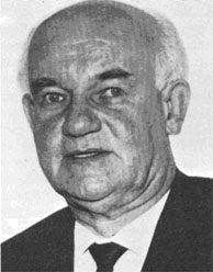
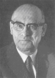
Welcome to the International Cartographic Association
Welcome to the website of the International Cartographic AssociationGet to know the new ICA Executive Committee for the term 2023-2027Get to know the ICA Commissions for the term 2023-2027
Welcome to the website of the International Cartographic Association
Get to know the new ICA Executive Committee for the term 2023-2027
Get to know the ICA Commissions for the term 2023-2027

Call for travel awards for ICC 2013

For the next International Cartographic Conference in Dresden, Germany (ICC 2013), a limited number of travel scholarships will be awarded to young cartographers who are nationals from developing countries. Please find all details in the PDF document below and note the deadline: 15 November 2012.

Edit on 25 October 2012: Deadline was extended to 15 November 2012.

Category: General News

CfP: LBS 2012 in Munich

We would like to inform you about the 9th International Symposium on Location-Based Services, which will take place in Munich, Germany, from October 16 to 18, 2012.
Given the fact, that a number of activities and industries in the domain of GNSS, LBS and geoinformation management are situated in and around Munich, this promises to be an excellent venue.

The call for paper is currently open, please consider the deadline of April 15, 2012.
Publication in either the Journal on LBS and/or a book within the series Lecture Notes on Geoinformation and Cartography is anticipated.

Detailed information can be found at http://www.lbs2012.tum.de.

Pinhas Yoeli (1920–2011)

The International Cartographic Association is saddened to hear of the passing of Professor Pinhas Yoeli. In 2005 Prof Yoeli received an Honorary Fellowship from the International Cartographic Association.

Prof Yoeli was born on 1 July 1920 in Bayreuth, Germany. In 1936 he immigrated to Israel (then British mandatory Palestine) and, in 1938 he volunteered into the Israeli pre-state army, the Hagana. He later headed the Topography Department. In 1948, he established and commanded the Cartography Department of the Israeli Defense Forces (IDF) with the rank of Lieutenant Colonel. Later he was also appointed deputy director of the Israel Survey Department.

From 1952 to 1956 he studied at the faculty of Geodesy and Cartography at ETH in Zürich, Switzerland, where he received his degree (Dip. Ing. ETH). In 1957 he was released from the IDF and started teaching at the Israeli Technological Institute (Teknion) in Haifa, Israel. He quickly attained the post of Associate Professor and was appointed the head of the Department of Geodesy and Cartography in the Faculty of Civil Engineering.

In 1972 he was appointed Full Professor in the Faculty of Geography at Tel Aviv University. He worked until his retirement in 1991 when he became Professor Emeritus till his death on 4 April 2011. From 1988 to 1991 he was chairman of the Israeli Cartographic Association.

Over the years, Professor Yoeli was invited for Sabbaticals to many academic institutes and universities throughout the world, including Switzerland (teaching and researching at the ETH Zürich and the Zürich University), Australia (at RMIT), England and USA. In addition, he worked as a consultant to well known cartographic firms in Switzerland, Sweden and Scotland.

He published many papers in all major international cartographic journals. His book, Cartographic Drawing With Computers, the first in its kind, was published by the University of Nottingham, UK in 1982.

Professor Yoeli’s contributions to Cartography and GI Science are respected by the international academic and professional Cartography and GI Science communities. The awards he received in Israel and internationally for his research reflects the esteem in which he was held globally.

The International Cartographic Association extends its sincere sympathy to Professor Yoeli’s widow, Agnes, his family, friends and colleagues.

William Cartwright

Category: General News

Honorary Fellowship for Ulrich Freitag

Dr. Ulrich Freitag is professor emeritus in the Institute of Geographical Science, Berlin Free University. His research interests include the theory of cartography, cartographic information processing, and the application of cartographic models. He has published more than 30 articles and books just in the last decade. An active member of the German Geographic Society, he served as its chair from 1987-1995. He enjoys great prestige in the field of cartography in Germany and worldwide, as evidenced in such appointments as Advisory Board for Exploratory Essays on the History of Cartography in the Twentieth Century, part of the multivolume History of Cartography project.

Prof. Freitag has been involved in many ICA activities over the years including active participation in the Working Group to Define the Main Theoretical Issues in Cartography, for which he wrote materials on map function. He was closely involved in bringing ICA to Germany (Cologne) in 1993, and his involvement was key to the success of that conference. At least as important as his direct involvement in ICA, he has been a promoter of ICA in the very large German cartographic community, and he has been an active “ambassador” for ICA in South Asia, especially in Thailand.

For his many services to ICA and for his rich contributions to the field of cartography, Professor Ulrich Freitag is awarded an ICA Honorary Fellowship.

Category: General News

Honorary Fellowship for Rolf Böhme

Rolf Böhme

Rolf Böhme

Rolf Böhme was born in Leipzig on 17 January 1917. After a classical education he studied first at the Technical University at Dresden and after the interruption of military service in World War II he went to the Technical University in Hannover, where he graduated as Dipl.Ing. in 1948. For a few years he was employed with the private Land Survey Office (later renamed Land- und Seevermessung Oro-Hydrographie) in Frankfurt am Main and then settled down at the Institut für Angewandte Geodäsie in 1956, where he stayed until his retirement in 1982. From 1972 Böhme was in charge of practical cartography in IfAG with the title of Scientific Director, to be promoted in 1979 to Head of the whole Cartography Division. His main tasks included the permanent revision of small scale topographic map series (1:200 000, 1:500 000 and the IMW) and the compilation of a new map series 1:500 000 in collaboration with IGN, France.

Over the years he became increasingly involved in geographical names, and he gained considerable experience and expertise in automated name processing. Since 1977 he is a member of the UN Group of Experts on Geographical Names (UNGEGN) and from 1977–1982 he was chairman of its Working Group on Automated Data Processing. He represented FRG at the UN Conferences in Athens (1977) and Geneva (1982). Further he represented UN at the first Training Course in Toponymy in Cisarua (Indonesia) organised by Professor Ormeling Sr. in 1982.

Rolf Böhme – delighted recipient of the Fellowship Award.

Rolf Böhme – delighted recipient of the Fellowship Award.

From 1960–1972 he was chairman of the Hessen subdivision of the German Cartographic Society and from 1975–1979 he was its Secretary. Further, for a few years he was a member of the editorial board of the bimonthly periodical Kartographische Nachrichten. Numerous articles, reports and reviews by his hand appeared in German and international periodicals, including the International Yearbook of Cartography. Among his publications the Gazetteer of the Federal Republic of Germany, completed in accordance with UN recommendations, deserves special mention. Now retired, he is currently concentrating on an Inventory of World Topographic Mapping, a large undertaking intended to be completed and published in the near future.

His involvement in ICA dates from the First Conference in Frankfurt am Main in 1962, the organisation of which was his responsibility. He was elected Vice-President of the Association in 1976 by the Fifth General Assembly in Moscow, 1976 and re-elected in Tokyo for another term. From 1976–1984 he was adviser of the ICA Publications Committee. He represented ICA at various conferences as session chairman or as speaker including the UN Regional Cartographic Conferences for Africa. As Vice-President in Joint Board meetings with FIG and ISPRS, he actively contributed on behalf of ICA to the formation of the International Union of Surveys and Mapping.

As a token of appreciation of his work he was awarded the Honorary Fellowship of the Association in Perth in August 1984. In presenting the distinction President Ormeling addressed him as follows:

“One of the shortcomings of the Statutes of ICA is undoubtedly the fact that the duties of Vice-Presidents are only vaguely defined. According to Article 12, Vice-Presidents have to assist and stand-in for the President in his different tasks. For most of them, living far away from the President, this remains a dead letter.

When presidential tasks accumulate, however, it can become dangerous for those Vice-Presidents who live within a day’s journey of the Presidency. This misfortune befell Rolf Böhme, near Frankfurt am Main, FRG, elected Vice-President in 1976 in Moscow and re-elected in Tokyo 4 years later. He carried it bravely.

As an exponent of German cartography, Böhme was of great importance to ICA. For more than 15 years he worked as a cartographic staff member under Professor Erwin Gigas, founder member and first Secretary-Treasurer of ICA, from whom he may have acquired the taste for international contacts. Böhme’s origin as geodetic engineer from Hannover and his wide experience and interest – from automation up to geographical names, ensured him good relations with neighbour sciences in surveying and mapping. His command of languages, including Russian and his savoir-vivre enabled him to tread in the footsteps of master Gigas and to become an advocate of international cooperation. His worldwide network of personal relations made him a valuable partner in the ICA management team. In his capacity as Vice-President, he represented the ICA in numerous meetings and conferences hosted respectively by FIG, ISPRS, DGfK or UN, at venues varying from Abidjan to Sofia, from Jakarta to Washington. Though often snowed under by ICA mail, particularly during the long sickness of the President in 1982, he was always ready to assist in new tasks. He was an appreciated member of several committees and working groups among which was the ICA Publications Committee in which he served as advisor for 10 years. Most important was his contribution as an intermediary with the German speaking cartographic community, a trendsetter in European, if not world cartography, from which various interesting ideas and initiatives originated.

As a token of appreciation, the Executive Committee upon recommendation of the Committee for the Selection of Award Recipients, has decided to confer the Honorary Fellowship of the Association to Rolf Böhme and I am honoured to present him the accompanying document which once more reflects our gratitude”.

Category: General News

Honorary Fellowship for Emil Meynen

Emil Meynen

Emil Meynen

Emil Meynen, born in Cologne on 22 October 1902, studied at the universities of Cologne, Leipzig, Innsbruck and Berlin and obtained his doctor’s degree in geography at Cologne in 1926. After having been assistant to Professor Albrecht Penck in Berlin, he was awarded a Rockefeller Fellowship for three years of study in the United States (1929–1932). These were years in which he gained great experience. After his habilitation in Cologne (1935) he went to the university of Berlin as a lecturer, where in 1942 he was appointed Assistant Professor in geography. In 1937 he became scientific secretary of the Zentralkommission für wissenschaftliche Länderkunde Deutschlands (Central Committee for Regional Studies of Germany) and at the same time editor of its Forschungen zur deutschen Landeskunde (Regional research studies of Germany). He held this post until 1970, editing the amazing total of 186 volumes. In 1942 Emil Meynen was appointed Head of the newly founded Abteilung für Landeskunde im Reichsamt für Landesaufnahme (Department of Regional Geography of the Land Survey Office) in Berlin, a position which he retained without interruption after 1945 at various temporary locations. The Department continued under his guidance until it was taken over by the Government of the new FRG and established in Bonn-Bad Godesberg (1953) under the name Institut für Landeskunde (Institute of Regional Geography), later renamed Bundesforschungsanstalt für Landeskunde und Raumordnung (Federal Research Institute for Geography and Regional Planning). He retired in 1969 as Director of this Institute.

In 1942 Meynen founded and edited the Berichte zur deutschen Landeskunde (Bulletin of Regional Studies of Germany) containing papers and documentation on geographic literature and since 1944 also on topographic and thematic maps. Another serial publication was the Bibliotheca Cartographica (1959–1972), an international bibliography of cartographic literature started by the Institut für Landeskunde in cooperation with the Deutsche Gesellschaft für Kartographie (German Society for Cartography).

Among Meynen’s tasks was the preparation of thematic maps (for instance of electric power lines, gas supply and water distribution at scales 1:300 000) for government administration and planning.

In cooperation with the Statistisches Bundesamt (Federal Office of Statistics) the Institut für Landeskunde published in 1970 a National Atlas entitled Die Bundesrepublik Deutschland in Karten (The Federal Republic of Germany in Maps) based upon census results and mainly containing maps at the scale 1:1 Million. It is worth remembering that Meynen introduced thematic computer mapping into his Institute as early as the 1960’s.

In 1949 Meynen founded the biennial Geographisches Taschenbuch (Geographical Pocketbook) and in 1966 the Orbis Geographicus (Geographical World Dictionary), publications of great value for geographiers and all who have a professional interest in geography.

From 1952–54 Meynen was chairman of the Committee on Geographical Names of the Deutsche Gesellschaft für Kartographie, while from 1954–1977 he was chairman of the Ständiger Ausschuss für Geographische Namen (German Permanent Committee on Geographical Names). For many years (1967–1984) he was a member of the UN Group of Experts on Geographical Names. His Bibliography of Gazetteers and Glossaries 1947–1979 is considered a standard work.

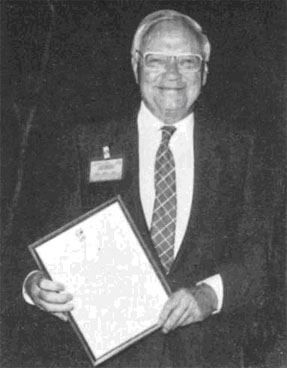
In 1962 on the occasion of the UN Conference on the IMW 1:1 000 000 in Bonn, Meynen prepared a bibliography of literature on this map series and at the end of the conference he surprised participants with a printed copy of the IMW legend in colour, produced overnight, which the meeting had just agreed upon. With regard to ICA, Professor Meynen attended the First General Assembly in Paris in 1962 as member of the FRG delegation. He participated in all ICA conferences until 1982 and prepared the ICA Bibliography 1956–1972, one of the first ICA publications. On the proposal of Past-President Imhof he was elected chairman of the ICA Commission on Definition, Classification and Standardisation of Cartographic Terms in 1964, which resulted in 1973 in the publication of the Multilingual Dictionary of Technical Terms in Cartography, with 1400 terms and definitions, the former in fourteen, the latter in five languages. Soon after its appearance Meynen started working with his commission on a second, even more extensive edition, the manuscript of which was completed in the early 1980’s. For his extremely valuable contribution to cartography and to the Association in particular, President Ormeling presented him with the Honorary Fellowship during a special session of the Deutsche Gesellschaft fur Kartographie in Kiel in 1983.

For obvious reasons it was not his only distinction, in 1955 he became Honorary Professor of the University of Cologne. He was honoured with the Robert Gradmann Medal in 1967, the Alexander von Humboldt Medal in gold (1969) and the Carl Ritter Medal in gold (1978). He was elected Honorary Member of the Deutsche Gesellschaft fiir Kartographie (1969). The Central Committee on Regional Studies on Germany elected him as their Honorary President (1986) and the IGU Working Group on the History of Geographical Thought made him its Honorary Member. His has been a career to be proud of.

Category: General News

Erwin Gigas (1899–1976)

Erwin Gigas

Erwin Gigas

Professor Dr. Ing. Erwin Gigas was one of the promoters of the International Cartographic Association and its first Secretary-Treasurer. At the beginning of his professional career he was mainly concerned with geodesy. In 1928 he joined the Reichsamt für Landesaufnahme, the then central organisation for surveying and mapping in Germany. He became one of the outstanding specialists in trigonometrical surveys and during the first years after World War II he became widely known for his contribution to the unification of the various national European triangulation networks into one European system. But Gigas’ genius was wide-ranging; he was one of the last Universal Men. He did not limit himself to geodesy; his interests also embraced photogrammetry, cartography and even reproduction. In the second half of his life, his involvement in international cooperation and the problems of developing countries became dominant. In 1952 he was appointed Director of the Institut für Angewandte Geodäsie (Institute of Applied Geodesy) in Frankfurt am Main. In this position he succeeded in transforming the institute into a Federal Office.

His international contacts started in 1955, when he represented his country at the first United Nations Regional Cartographic Conference for Asia and the Far East in Mussoorie (India). When the discussion on international cooperation in the field of cartography proper was initiated by Dr. Mannerfelt in 1956, Gigas became one of the most active supporters. He was elected a member of the so-called Committee of Six, with Dr. Mannerfelt as chairman. Subsequent conferences at Evanston, Chicago (USA) and at Mainz (FRG), both in 1958, pointed the way, increasingly clearly and convincingly, to the eventual formation of the ICA in Bern in 1959. Thus, the ICA was born. At its first General Assembly of Delegates in Paris in 1961 Professor Gigas was elected Secretary-Treasurer of the young Association with Professor Imhof as President.

One year later the United Nations convened the UN Technical Conference on the International Map of the World 1:1 000 000 (IMW) at Bonn it was the first UN conference held in the Federal Republic of Germany. Gigas was elected President of the conference, which elaborated new specifications for the compilation of the IMW, still valid today. In the same year Prof. Gigas organised the First Technical Conference of the ICA in his institute in Frankfurt am Main. At the ICA conference in London/Edinburgh (1964), both Imhof and Gigas retired from their ICA duties. They were succeeded by Brigadier Thackwell (UK) and Dr. Ormeling (Netherlands) respectively. Thus, after the foundation period of the ICA as an international non-governmental organisation, a period of consolidation began, making ICA the world-renowned association.

Parallel to his activities for ICA, Professor Gigas was in much demand as a specialist in seminars and conferences of the United Nations. Thus we find him at the UN seminar in Teheran (Iran) in 1957 and at the UN Regional Cartographic Conference for Asia and the Far East in 1962 in Bangkok.

In 1964 Gigas retired as Director of the Institut für Angewandte Geodäsie, but no one was astonished that he remained very active. He had cultivated an interest in automation and after his retirement worked for two years with the US Coast and Geodetic Survey in Silver Spring, Maryland. Here he worked on automated procedures for data processing for the preparation and maintenance of aeronautical charts.

Many of his publications deal with cartography proper, with automation in cartography and with promoting cartography in developing countries. The last years of his life were spent in southern Spain, where he left the great family of cartographers in 1976.

Category: General News
rawboned-refined