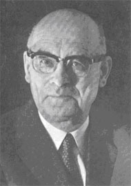
Rolf Böhme
Rolf Böhme was born in Leipzig on 17 January 1917. After a classical education he studied first at the Technical University at Dresden and after the interruption of military service in World War II he went to the Technical University in Hannover, where he graduated as Dipl.Ing. in 1948. For a few years he was employed with the private Land Survey Office (later renamed Land- und Seevermessung Oro-Hydrographie) in Frankfurt am Main and then settled down at the Institut für Angewandte Geodäsie in 1956, where he stayed until his retirement in 1982. From 1972 Böhme was in charge of practical cartography in IfAG with the title of Scientific Director, to be promoted in 1979 to Head of the whole Cartography Division. His main tasks included the permanent revision of small scale topographic map series (1:200 000, 1:500 000 and the IMW) and the compilation of a new map series 1:500 000 in collaboration with IGN, France.
Over the years he became increasingly involved in geographical names, and he gained considerable experience and expertise in automated name processing. Since 1977 he is a member of the UN Group of Experts on Geographical Names (UNGEGN) and from 1977–1982 he was chairman of its Working Group on Automated Data Processing. He represented FRG at the UN Conferences in Athens (1977) and Geneva (1982). Further he represented UN at the first Training Course in Toponymy in Cisarua (Indonesia) organised by Professor Ormeling Sr. in 1982.
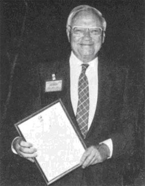
Rolf Böhme – delighted recipient of the Fellowship Award.
From 1960–1972 he was chairman of the Hessen subdivision of the German Cartographic Society and from 1975–1979 he was its Secretary. Further, for a few years he was a member of the editorial board of the bimonthly periodical Kartographische Nachrichten. Numerous articles, reports and reviews by his hand appeared in German and international periodicals, including the International Yearbook of Cartography. Among his publications the Gazetteer of the Federal Republic of Germany, completed in accordance with UN recommendations, deserves special mention. Now retired, he is currently concentrating on an Inventory of World Topographic Mapping, a large undertaking intended to be completed and published in the near future.
His involvement in ICA dates from the First Conference in Frankfurt am Main in 1962, the organisation of which was his responsibility. He was elected Vice-President of the Association in 1976 by the Fifth General Assembly in Moscow, 1976 and re-elected in Tokyo for another term. From 1976–1984 he was adviser of the ICA Publications Committee. He represented ICA at various conferences as session chairman or as speaker including the UN Regional Cartographic Conferences for Africa. As Vice-President in Joint Board meetings with FIG and ISPRS, he actively contributed on behalf of ICA to the formation of the International Union of Surveys and Mapping.
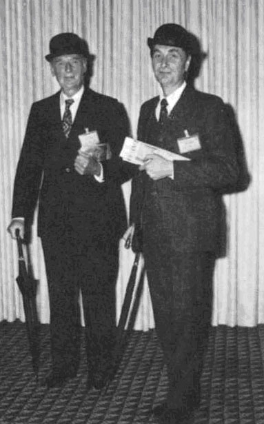
As a token of appreciation of his work he was awarded the Honorary Fellowship of the Association in Perth in August 1984. In presenting the distinction President Ormeling addressed him as follows:
“One of the shortcomings of the Statutes of ICA is undoubtedly the fact that the duties of Vice-Presidents are only vaguely defined. According to Article 12, Vice-Presidents have to assist and stand-in for the President in his different tasks. For most of them, living far away from the President, this remains a dead letter.
When presidential tasks accumulate, however, it can become dangerous for those Vice-Presidents who live within a day’s journey of the Presidency. This misfortune befell Rolf Böhme, near Frankfurt am Main, FRG, elected Vice-President in 1976 in Moscow and re-elected in Tokyo 4 years later. He carried it bravely.
As an exponent of German cartography, Böhme was of great importance to ICA. For more than 15 years he worked as a cartographic staff member under Professor Erwin Gigas, founder member and first Secretary-Treasurer of ICA, from whom he may have acquired the taste for international contacts. Böhme’s origin as geodetic engineer from Hannover and his wide experience and interest – from automation up to geographical names, ensured him good relations with neighbour sciences in surveying and mapping. His command of languages, including Russian and his savoir-vivre enabled him to tread in the footsteps of master Gigas and to become an advocate of international cooperation. His worldwide network of personal relations made him a valuable partner in the ICA management team. In his capacity as Vice-President, he represented the ICA in numerous meetings and conferences hosted respectively by FIG, ISPRS, DGfK or UN, at venues varying from Abidjan to Sofia, from Jakarta to Washington. Though often snowed under by ICA mail, particularly during the long sickness of the President in 1982, he was always ready to assist in new tasks. He was an appreciated member of several committees and working groups among which was the ICA Publications Committee in which he served as advisor for 10 years. Most important was his contribution as an intermediary with the German speaking cartographic community, a trendsetter in European, if not world cartography, from which various interesting ideas and initiatives originated.
As a token of appreciation, the Executive Committee upon recommendation of the Committee for the Selection of Award Recipients, has decided to confer the Honorary Fellowship of the Association to Rolf Böhme and I am honoured to present him the accompanying document which once more reflects our gratitude”.