Welcome to the International Cartographic Association
Welcome to the website of the International Cartographic AssociationGet to know the new ICA Executive Committee for the term 2023-2027
Welcome to the website of the International Cartographic Association
Get to know the new ICA Executive Committee for the term 2023-2027

Obituary: Eddy Lynn Usery

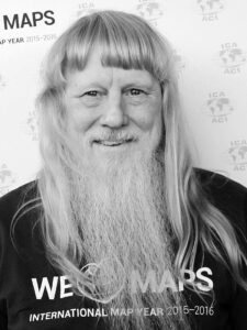
On March 22, 2022, the world lost a GIS giant and cartography compadre when Dr. E. Lynn Usery, current Chair of the ICA Commission on Map Projections and former ICA Vice-President, passed from this earthly plane. Not even a week earlier, Lynn was busily planning workshops for AutoCarto 2022. He will be sorely missed by ICA and our community, not only for his many research contributions, leadership and vision, and tireless service, but also for his friendship and camaraderie.

Michael Tischler of the U.S. Geological Survey (USGS) wrote, “On paper, we knew him as the Director of the Center of Excellence for Geographic Information Science [CEGIS]. But he was far more than that title would lead one to believe. Lynn leaves a remarkable legacy given his extraordinary scientific accomplishments, presence as a leader in the geographic science community, and impact on individual geographic scientists inside USGS and around the world.”

It’s a challenge to specify the impact that Lynn has had on the field of GIScience because of the breadth and depth of his involvement and contributions. He was centrally involved in many areas of the discipline, including cartography, GIS, remote sensing, and spatial analysis. His eclectic research interests included digital cartography, map projections, scale and resolution, image classification, temporal GIS, geospatial semantics and ontology, and high-performance computing for geospatial data. It would be difficult to name a subject in our field about which Lynn could not speak knowledgably and insightfully.

Lynn was unique in that his impact came through his careers in both government and academia. Lynn started working for the USGS in 1977. He was a cartographer and geographer for the USGS from 1978 to 1988 focusing on developing automated cartographic production systems. In 1988, he took on a geography faculty position at the University of Wisconsin (UW) – Madison. In January of 1994, he moved to Georgia to serve on the geography faculty at the University of Georgia (UGA). In May of 1999, Lynn took on a Research Geographer position with the USGS in addition to his academic job at UGA. In 2005, he returned to USGS and ultimately conceived and became Director of CEGIS. In this role, he directed the science program and the visions and plans for topographic mapping research. While at USGS, Lynn also taught remote sensing at the Missouri University of Science and Technology.

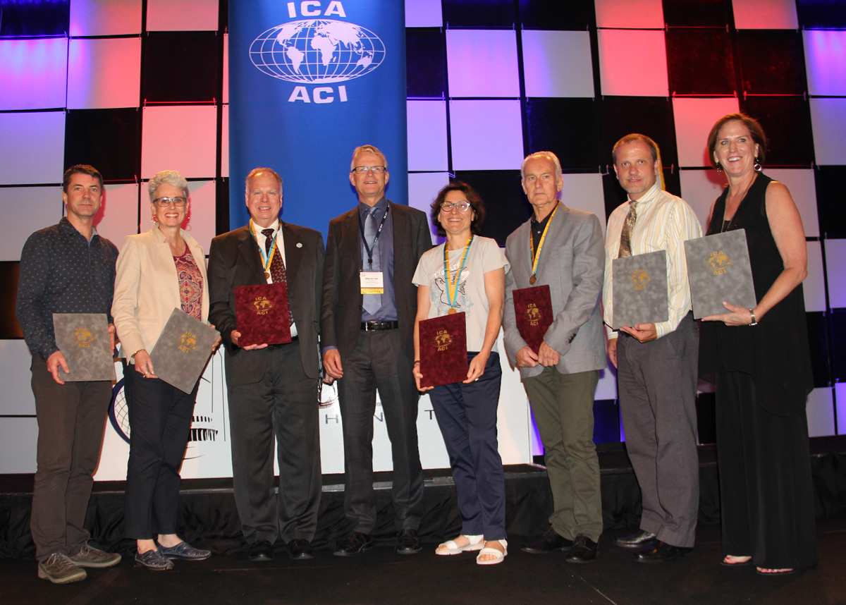
In all his positions, Lynn was a ground breaker. In his early days at USGS, he began the development of digital mapping systems for the automated production of printed topographic maps. At UW, he helped found a GIS program. At UGA, he helped establish certificate programs in GIScience at both the undergraduate and graduate levels. When he returned to USGS, he started a cartography research program that led to CEGIS. For CaGIS, he chaired AutoCarto 2005 to close an eight-year gap and resurrect the symposium series. He also spearheaded the effort to bring the International Cartographic Conference back to the United States for only the second time, the first being in 1978.

Lynn was involved in multiple activities of the ICA:

  • 2004–2008 US National Committee to the ICA member
  • 2007–2011 ICA Map Projections Commission Secretary
  • 2007–2015 US National Committee to the ICA Chair
  • 2011–2012 ICA Technology Outreach Working Group Chair
  • 2011–2015 ICA Map Projections Commission Vice Chair
  • 2011 Bid for ICC 2017
  • 2012–2017 ICC 2017 Conference Organizer
  • 2015–2019 ICA Vice President
  • 2018–2019 ICA Body of Knowledge for Cartography Working Group Chair
  • 2019–2022 ICA Map Projections Commission Chair

That Lynn was so involved in the association is admirable. That he did the same with many other societies, at the same time, makes Lynn exceptional and unparalleled. There is truly no match for him in this regard, and really not even anyone in the running. No other person has been elected vice-president of the ICA, president of the Cartography and Geographic Information Society (CaGIS), president of the American Society for Photogrammetry and Remote Sensing (ASPRS), and president of the University Consortium for Geographic Information Science (UCGIS), as Lynn was in 2015, 2002, 2004, and 2015, respectively. Additionally, as with the ICA, in all these associations, he also served in other roles.

On a personal note, Lynn was born in December 1951. He had two children, a son Kelynn, born 1986, and a daughter, Lacy, born 1988. Lynn received his BS in geography from the University of Alabama and MA and Ph.D. degrees in geography from UGA. He died Tuesday, March 22, 2022, after a brief illness.


Tim Trainor, President of ICA &
Aileen Buckley, U.S. national representative to ICA

ICA Publications and Publication Policy — first Publication Volume is online

In 2017 the EC introduced a new publication policy, which focuses on the conference proceedings. In order to give them an adequate visibility and reputation, a conference publication series has been established, which is adminstrated and hosted by a professional publisher. There are three publication options, depending on the review and the extent of the papers: ICA Advances, ICA Proceedings and ICA Abstracts.

The benefits will be manyfold:

  • Visibility: one single point of contact for the publications of ICA events
  • Reliability: the publications will be available at the time of the conference
  • Open Access: the publications are published online and under the Creative Commons licence
  • Reputation: the publisher will suggest the ICA Advances and Proceedings for inclusion in several data bases and indices (e.g. Scopus, Web of Science)
  • Standardization: one standardized format of the publications

This new policy will not interfere with publications in ICA related journals; in contrast, it will provide an excellent basis for developing high-level journal publications.

New ICA conference and events publications

Starting in 2017, the ICA records the outcomes of their Conferences like ICC, RCC as well as all other ICA events in three official publication outlets, which are hosted by a commercial publisher, Copernicus GmbH:

  1. Advances in Cartography and GIScience of the International Cartographic Association (short: Advances of the ICA, eISSN 2570-2084): single-blind peer review based on a full paper – termed Advances in the following;
  2. Proceedings of the International Cartographic Association (short: Proceedings of the ICA, eISSN 2570-2092): single-blind peer review based on submitted abstracts, developed to full paper – termed Proceedings in the following;
  3. Abstracts of the International Cartographic Association (short: Abstracts of the ICA, eISSN 2570-2106): single-blind peer review based on submitted abstracts; publication of abstract only – termed Abstracts in the following.

With these three series, the ICA can offer excellent opportunities for their authors to present their work – full papers for more research-oriented work, abstract based full papers for advanced work-in-progress, as well as abstracts for practically oriented work or artwork, which typically are not adequately represented in a full paper.

For the ICC and for the RCC, Advances and Proceedings are published; for other ICA events, either Advances or Proceedings are published. Exceptions from this general rule require prior approval by EC. All event formats have the option to also publish the Abstracts.

These publications are generated from all ICA events. Organisers will be required to provide Copernicus with camera-ready manuscripts in pdf format, together with the respective metadata, four to six weeks prior to the scheduled meeting, depending on the size of the event. For each published paper a moderate APC (article processing charge) has to be paid (as of January 1st it is €17,50). This sum should be included in the event fees.

Role of International Journal of Cartography (IJC)

In order to promote the International Journal of Cartography (IJC), there is a special option for the International Cartographic Conferences (ICCs): the IJC can select 8–12 papers from the full paper peer-review track for a special issue published at the event.

In addition to the regulations above, all event organizers are expected to seek high quality papers at the conferences and meetings to be published in the Journal of Cartography. Furthermore, they do always have the option to approach the IJC for a special issue.

Main changes in a nutshell …

  • one visible location (at Copernicus) and structure for publication of all ICA events
  • no longer the need for event organizers to organize their own publications because all go into one of our series
  • no longer Springer books from our bi-annual International Cartographic Conferences (ICCs)
  • Springer ICA books will be available for special events (old agreements will be honoured)
  • conference papers may be extended and handed in for a journal publication after the event

First proceedings volume

Journal Website Proceedings of the ICA

The first papers published in the new series are the papers from the ICC in Washington, which appear in the “Proceedings of the International Cartographic Association“ as Volume 1. They are accessible via www.proc-int-cartogr-assoc.net


Monika Sester
– Chair of the ICA Publication Committee

Category: General News

Recipients of the ICA Map Awards 2017

At the biennial International Cartographic Conferences, ICA organizes an International Map Exhibition, where map products originating from ICA member countries are exhibited. An international jury selects the best entries in six categories; in addition, there is also a public vote.

The international jury this year at ICC2017 was chaired by Kenneth Field (UK), who is also the Chair of the ICA Commission on Map Design. Further jury members were: 

  • Antoni Moore, New Zealand
  • David Fairbairn, United Kingdom
  • Paulo Menezes, Brazil
  • William Cartwright, Australia
  • Lorenz Hurni, Switzerland
  • Dirk Burghardt, Germany
  • Dušan Petrovič, Slovenia
  • Serena Coetzee, South Africa
  • Rosemary Wardley, USA (LOC)

Please find the winners of the ICA Map Awards 2017 below.

Atlases

3rd place: Grand Topographic Atlas of Catalonia 1:25,000 (Institut Cartogràfic i Geològic de Catalunya)

3rd: Grand Topographic Atlas of Catalonia 1:25,000 (Institut Cartografic i Geologic de Catalunya)

2nd place: Tactile Atlas of Switzerland (Switzerland)

2nd place: Tactile Atlas of Switzerland (Switzerland)

1st place: The National Atlas of Korea I (Republic of Korea)

A comprehensive, large format and very detailed atlas. The maps are well proportioned, clear and discernible. The highest quality throughout, accompanied by considerable graphs, accompanying text and infographics.

1st place: The National Atlas of Korea I (Republic of Korea)

Public Vote: Swiss World Atlas 2017 Ed. (Switzerland)

Public Vote: Swiss World Atlas 2017 Ed. (Switzerland)

Digital products

3rd place & Public Vote: Atlas of Switzerland online (Switzerland)

3rd place & Public Vote: Atlas of Switzerland online (Switzerland)

2nd place: Augmented Reality App Swissarena (Switzerland)

2nd place: Augmented Reality App Swissarena (Switzerland)

1st place: Minecraft® on Demand (France)

A wonderful mix of the real world and the popular world of Minecraft. An innovative idea that is superbly executed. Intuitive and playable cartography!

1st place: Minecraft® on Demand (France)
 

Educational cartographic products

3rd place & Public Vote: 3D Relief of Czechia (Czechia)

3rd place and public vote: 3D Relief of Czechia (Czechia)

2nd place: Historical Atlas of Poland for blind and visually impaired (Poland)

2nd place: Historical Atlas of Poland for blind and visually impaired (Poland)

1st place: genderATlas goes school (Austria)

A very well thought through mini-atlas that explores gender issues for women and men. This version specifically aimed at school children to promote understanding of equality and support research initiatives.

1st place: genderATlas goes school (Austria)
 

Other cartographic products

3rd place: Canton Berne – 3D printed Terrain Model, 1:25,000 (Switzerland)

3rd place: Canton Berne – 3D printed Terrain Model, 1:25,000 (Switzerland)

2nd place & Public Vote: Canal Full Map Long Scroll (China)

2nd place & public vote: 2nd place Canal Full Map Long Scroll (China)

2nd place & public vote: 2nd place Canal Full Map Long Scroll (China)

1st place: Psychogeography in the age of the quantified self (Germany)

Personal cartographies modelled from mental maps and movement data. A stylish form that builds art from the digital capture of our everyday activities.

1st place: Psychogeography in the age of the quantified self (Germany)
 

Charts on panels

3rd place: IFR Enroute Low Altitude – Alaska L-1 (Esri)

3rd place: IFR Enroute Low Altitude - Alaska L-1 (Esri)

2nd place: Stavanger Harbor with Seaward approaches (chart no. 455) (Norway)

2nd place: Stavanger Harbor with Seaward approaches (chart no. 455) (Norway)

1st place: Zhenghe Navigational Chart with an Ancient vs. Modern Comparison (China)

Innovative representation displaying two contrasting but exquisite cartographic styles, complemented by the rich, high quality materials.

1st place: Zhenghe Navigational Chart with an Ancient vs. Modern Comparison (China)

Public Vote: VFR Aeronautical Chart of the Republic of Slovenia (Slovenia)

Public vote: VFR Aeronautical Chart of the Republic of Slovenia (Slovenia)
 

Maps on panels

3rd place: Jenny Lake Hiking Map (USA)

3rd place: Jenny Lake Hiking Map (USA)

2nd place: The Olivine Wilderness (New Zealand)

2nd place: The Olivine Wilderness (New Zealand)

1st place: Relief MASSIF DU MONT BLANC (France)

A beautiful moulded model of Mont Blanc. The map content is well printed, avoiding significant stretching, yielding an evocative 3D, detailed product.

1st place: Relief MASSIF DU MONT BLANC (France)

Public Vote: Blue and White Dream (China)

Public vote: Blue and White Dream (China)
 

Congratulations to all winners!

All winners will be contacted to be featured in our Map of the Month section over the course of the next two years. For a full list of map products exhibited during ICC 2015, please check the PDF catalogue.

Photos and jury statements provided by Ken Field.

Winners of the Barbara Petchenik Competition 2017

The Barbara Petchenik Competition is a biennial map drawing competition for children. The competition is first organized on a national level. The national winners can then compete in the international round, which takes place during the International Cartographic Conferences. This year at ICC2017, 193 drawings from 34 countries were exhibited. An international jury selected 12 winners in 4 categories. There was also a public vote and two creativity awards. Please find the wonderful results below.

Winners <6 years

Crafting Our Dreams on the Land of Indonesia by Kenya Kesuma Dewi (5)

1st: Crafting Our Dreams on the Land of Indonesia by Kenya Kesuma Dewi (5)

Map of Life by Taja Koša (5)

2nd: Map of Life by Taja Koša (5)

My Happy World by Alicia Fleming (5)

3rd: My Happy World by Alicia Fleming (5)


Winners 6–8 years

Map, Communicate with the world by Oh Eun Ju (8)

1st: Map, Communicate with the world by Oh Eun Ju (8)

The World is in our hands by Preslava Ivanova (8)

2nd: The World is in our hands by Preslava Ivanova (8)

Drawing Maps by Beatrice Leoutsakou (8)

3rd: Drawing Maps by Beatrice Leoutsakou (8)


Winners 9–12 years

Oronce Fine through our eyes by Noemi Sanchez Avramova & Alba Serrano Suarez (12)

1st: Oronce Fine through our eyes by Noemi Sanchez Avramova & Alba Serrano Suarez (12)

Happy Earth by Okubo Kasumi (9)

2nd: Happy Earth by Okubo Kasumi (9)

We love maps by Klara Zagórska (11)

3rd: We love maps by Klara Zagórska (11)


Winners >12 years

We Love Maps by Ioana Larisa Guriţǎ (13)

1st: We Love Maps by Ioana Larisa Guriţǎ (13)

Through a Child's Eyes by Rebecca Kneale & Akira McTavish-Huriwai (15)

2nd: Through a Child’s Eyes by Rebecca Kneale & Akira McTavish-Huriwai (15)

World Map by Micaela Mendoz (15)

3rd: World Map by Micaela Mendoz (15)


Winner of the public vote

Maps – Our Path for Exploration by Champ Turner (15)

Public vote: Maps – Our Path for Exploration by Champ Turner (15)


Creativity Award

The Creativity Award was presented for the first time this year by the ICA Commission on Art and Cartography.

Trumps World by Phoebe McClean

Creativity Award: Trumps World by Phoebe McClean

Friends by Urtėja Kardašiūtė

Creativity Award: Friends by Urtėja Kardašiūtė

Jury

The jury members were

Members of the jury

  • Pilar Sánchez-Ortiz Rodríguez, Spain – Chair
  • Ana María Garra, Argentina
  • Paulo Menezes, Brazil
  • Temenoujka Bandrova, Bulgaria
  • Dariusz Dukaczewski, Poland
  • Necla Ulugtekin, Turkey
  • Naeema Al Hosani, United Arab Emirates
  • Rob Edsall, USA
  • Carla Sena, Brazil and Jesus Reyes, Hungary – Substitute Members
  • Peter van der Krogt, The Netherlands – International Coordinator


Congratulations to all winners! Also a huge thank you to all participating children, their parents, teachers and national organizers.

ICA Awards Ceremony at ICC2017

In the ICA Awards Ceremony at ICC2017, the following awards were presented in recognition of contributions to the ICA:

ICA Awardees 2017

From left to right: Igor Drecki, Cynthia Brewer, Timothy Trainor, Menno-Jan Kraak, Anne Ruas, William Cartwright, Matthew Rice, Aileen Buckley

ICA Honorary Fellowship

The ICA Honorary Fellowship is for cartographers of international reputation who have made special contribution to the ICA. It includes a bronze medal.

  • William Cartwright, Australia
  • Anne Ruas, France
    • Co-chair of the Commission on Generalization and Multiple Representation (2003–2007)
    • Vice-President (2007–2015)
    • President of ICC 2011, Paris
    • Editor of the International Journal of Cartography (2015–)
  • Timothy Trainor, USA
    • Chair or Co-chair of the Commission on National and Regional Atlases (1995–2007)
    • Chair of Census Cartography Working Group (2007–2011)
    • Vice-President (2007–2015)

Diplomas for outstanding services to ICA

The Diplomas for outstanding services to ICA are for colleagues who have made special contribution to the ICA as commission officers or conference organizers.

  • Igor Drecki, New Zealand
  • Aileen R. Buckley, USA
    • ICC2017 Organizing Committee member
  • Cynthia A. Brewer, USA
    • ICC2017 Organizing Committee member
  • Matthew Rice, USA
    • ICC2017 Organizing Committee member

 
Overview of ICA Awards presented at ICC2015

Congratulations to all awardees!

Welcome to ICC2017 in Washington, D.C. #icc2017dc

Today, the 28th International Cartographic Conference is opened in Washington, D.C., USA!

ICC 2017

After busy days with twelve well-attended pre-conference workshops, the main conference will be opened today with keynotes by Robert Cardillo, Tom Patterson, Dr. Lee Schwartz and Mikel Maron. More than 450 presentations in 160 sessions will follow in the next five days. You can download the conference program app by searching for “ICC2017” in the apple App store or on Google Play. The interactive online schedule is available at eventscribe.com/2017/ICC.

Later today, also the Exhibit, the International Cartographic Exhibition and the Children’s Map Exhibition will open. ICC2017 also hosted an Extraordinary General Assembly of the ICA, which took place yesterday. The results will be published on the ICA website soon.

To share your experiences and to stay up-to-date with everything happening at the conference, please use hashtag #icc2017dc.

Enjoy the conference!

Category: General News
Tag: ,

Programme of the ICC2017 Pre-Conference Symposium on Location-Based Social Media and Tracking Data is available

Symposium-header

The ICA Commission on Geospatial Analysis and Modeling and the ICA Commission on Location-Based Services are organizing a pre-ICC2017 symposium on location-based social media and tracking data.

The programme has just been published on the symposium at lbs.icaci.org. In total, we have accepted 27 oral presentations for the symposium. These presentations will be organized into 6 oral sessions, covering

  • theories and data models,
  • participation and user tasks,
  • traffic modelling,
  • analyzing human dynamics,
  • research applications using location-based big data and
  • place modelling.

After the symposium, a special issue of the International Journal of Geographical Information Science (IJGIS) is planned.

For more details regarding the symposium, please refer to http://gam.icaci.org/symposium2017/.

Looking forward to seeing you at the symposium.

– Huang Haosheng (LBS)
– Angela Yao (GAM)

Invitation to the ICC Joint Pre-Conference Meeting on Disaster Management, Big Data, Services, and Cartographic Representation

Click here to download the program as PDF

The ICA Commission on Cartography in Early Warning and Crises Management (CCEW&CM) and GEO (Group of Earth Observations) are organizing a joint workshop within the activities of the 28th International Cartographic Conference.

  • Location: Marriott Wardman Park Hotel, Washington, DC
  • Date: Sunday, July 2, 8.30am–6pm
  • Cost: 30 USD
  • Registration: via icc2017.org; also on-site registration starting at 7.30am in front of the workshop room

The final program can be downloaded here.

Milan Konecny, ICA CCEW&CM Commission Chairman, sent us the following details on the event:

You can see that in cooperation with GEO we arranged topic speakers leaded by Ms. Barbara Ryan, The GEO Secretariat Director, and Mr. Craig Fugate, former FEMA (USA) administrator. Keynotes deal with better, faster and smarter solutions in Big Data Era and also with international collaboration and hyper-partnering for Disaster Risk Reduction. Also research agenda of  the ICA CCEW&CM will be presented by commission chairman.

We also invited  specialists and experts in cartography and GI sciences and remote sensing, investigating various topics connected with workshop agenda, such as: problems with help of  geospatial information for disaster risk management, investigation on positioning technologies for emergency rescue, cartographic generalization and visualization  for disaster  management response, isaster risk, impact and recovery mapping supported by data and information from  Space, geodisasters for capacity building dealing with  Big Data, from satellites, drones and others, to products, attempts of  new Paradigm to access and interact with disaster related data services, and last but not least using data and creating and designers of new approaches inside the research frontiers efforts like Smart Cities or Big Data, from Japan, USA, P.R. of China, Czech Republic, Bulgaria, Chile, South Africa.

As inspiring are expected also speeches from important organizations dealing with early warning, crises management and civil protection, like NASA, World Bank and U.S. Geological Survey.

All research agenda of the workshop would like to contribute to the agenda defined by Sendai U.N. Conference for Disaster Risk Reduction (DRR).

Contacts: 

rawboned-refined