Welcome to the International Cartographic Association
Welcome to the website of the International Cartographic AssociationGet to know the new ICA Executive Committee for the term 2023-2027
Welcome to the website of the International Cartographic Association
Get to know the new ICA Executive Committee for the term 2023-2027

Announcement of the Pre-ICC Workshop on Abstraction, Scale & Perception

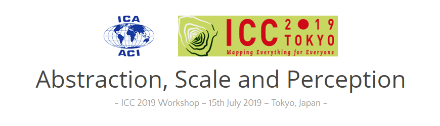
The ICA Commissions on Cognitive Issues in Geographic Information Visualization, and on Generalisation and Multiple Representation, are pleased to organize a joint one-day workshop dedicated to advances, works in progress, and position statements about the perception of geospatial abstractions and scale in maps and geovisualisations.

Abstraction is the main process for moving from a geographic space or phenomenon to its representation as spatial information. Abstractions may be conceptual, geometric, semantic, graphic, visual, or cognitive. Examples include techniques to highlight, enhance, or simplify salient characteristics or properties, in order to support visual communication, recognition, understanding of spatial features and inferring knowledge about spaces. If different aspects of abstraction are not managed well, across different scales, for example when navigating through scales in geoportals, it can lead to perceptual difficulties in reading the map. Generalisation is the process of deliberately transforming existing geospatial data or their symbolisation into more abstract representations, and multiple representation involves creating a series of such generalisations, often distributed through map scale.

The workshop will feature research presentations and open-ended brainstorming sessions, and will focus on identifying open research gaps and the elaboration of a shared research agenda. We encourage submissions from any practitioner of abstraction or generalisation: those in academia, industry, or government, among other sectors, are welcome.

Paper deadline: 22nd February 2019

Topics of interest include but are not limited to:

  • multi-scale, multi-source and multi-view graphic representation
  • massive data (“Big Data”) generalization
  • continuous visualization (across scales) and fluid interaction with graphic representations
  • (semi) automated approaches for map design and geovisualization
  • generalisation, schematization, and stylization techniques
  • visual perception measures and experimental approaches to assess visual perception
  • thematic applications: statistical and socio-economic data, spatio-temporal data and phenomena, urban and environmental dynamics, etc.
  • technical applications, adaptation to visualization devices, (i.e., smartphones, tablets, VR/AR) and use contexts (e.g.,  emergency and crisis management, individual mobility, industrial purposes, etc.).


Please find more information on the workshop website: icc2019abstraction.wordpress.com

Announcement of the Pre-ICC Workshop on Atlases and Infographics

Sunday, 14 July 2019, Tokyo
The final event location at the ICC venue will be announced

Over centuries atlases have been defined as a “book of maps” or “bound collection of maps” with a strong emphasis on the depicting geographic space through the sole use of maps. In 1795, William Playfair published, what was the first statistical atlas. In this Commercial and Political Atlas but he not only used maps, but also area and bar charts, line graphs and histograms.

These statistical information graphics became prominent in the 19th century, spawning iconic examples such as Minard’s map of Napoleon’s march on Moscow or Florence Nightingale’s graphs on the Crimean war.

Their prominent appearance in atlases has put statistical information graphics on the forefront in developing visualization forms for geographical information. The Statistical Atlas of the United States (1870), Otto Neurath’s Modern Man In The Making (1939), Erwin Raisz’ Atlas of Global Geography (1944) and the Atlas of Switzerland (2000) mark keystones on the way infographic became an inevitable constituent of modern atlases.

The one-day workshop consists of two parts. Part one will focus on historical and novel advancements in the use of infographics for atlases in two sessions with short paper contributions (10 minutes presentation + 5 minutes for discussion). Part two focuses on a discussion of recent developments to contribute to new atlas frameworks considering the future use of infographics and the utilization of different graphical techniques.

Contributions

Authors are invited to submit short abstracts (up to 100 words) until 1st March 2019 directly (e-mail) to the organizers.

In case of too many contributions, the organizers will select those who fit best the atlases and infographics’ scope.

Publications

After the workshop, PDFs of the presentations and further findings will be published on the CoA website. A paper publication of selected contributions will be envisaged.

Attendance

If you wish to attend without presenting or want to be updated personally, please register your interest by informing the organizers.

Organizers


Please find more information on the workshop website: atlas.icaci.org/icc-preconference-workshop-atlases-and-infographics

Announcement of the Pre-ICC Commission Workshop on Geospatial and Cartographic Education – Contemporary Challenges and Opportunities

The next workshop of the ICA Commission on Education and Training will take place at Capital Normal University, Beijing, China, Wednesday 10 July to Friday 12 July 2019.

Scheduled to allow for attendees to travel on to the International Cartographic Conference in Tokyo, Japan, the following week, this workshop will address a range of issues related to education in the discipline of cartography and related fields.  The suggested topics include the following:

  • Integrating cartographic principles into GIS curricula
  • Linking cartographic education with education in other geomatics and geospatial sciences
  • Experiences in teaching cartography and GIS to non-specialists
  • Technical support requirements for academic education in cartography and GIS
  • Use of open source software and datasets in geospatial and cartographic education
  • Theoretical foundations for the study of cartography
  • Curriculum design for GIS and cartographic education
  • Development of a ‘Body of Knowledge’ for cartography
  • Developing on-line educational resources for cartography and GIS
  • Ensuring relevance of geospatial and cartographic education for industry – what do employers want from graduates in cartography and GIS?
  • Accreditation and professional recognition of education in cartography and GIS

You are encouraged to consider contributing presentations on these and other relevant issues in Beijing.  The intention is that there will be opportunities to deliver full oral presentations, suitable for publication, relating to research and experiences.  After discussion, the submission of such presentations to the International Journal of Cartography will be advised.

A significant proportion of the programme will consist of shorter more informal contributions, including posters, to allow for effective discussion and knowledge-transfer.  The scope of attendance will be international, and good practice, experiences, and advice will be communicated (the workshop language is English) in formal presentation, discussion sessions, and learning workshops.

The venue, Capital Normal University, is in the west of central Beijing, close to the Central Television Tower and Beijing Zoo.  This University area has many hotels close by, is well-connected to the city’s transport links, and is an ideal location for academic, technical and touristic activities.

Further announcements of the workshop will be made on this website, and distributed in other relevant channels: you will have the opportunity to submit contributions and ideas through this site in the near future, and note advice on travel and accommodation opportunities.  If you wish to be updated personally, please register your interest by informing the Commission chair, david.fairbairn@newcastle.ac.uk  who will also be pleased to receive expressions of interest in contributing to the workshop and developing the agenda further.

Workshop organizers

  • Tao Wang, Local Organiser, Capital Normal University, Beijing, China
  • David Fairbairn, CET Chair, Newcastle University, Newcastle upon Tyne, UK
  • Stefan Peters, CET Vice-Chair, University of South Australia, Adelaide, Australia

 
Please find more information on the workshop website: cet2019.cnu.edu.cn

Announcement of the Pre-ICC Joint Commission Workshop on Mobile Map UX

The ICA Commissions on Cognitive Issues in Geographic Information Visualization, Location Based Services, Visual Analytics, and Use, User and Usability Issues are pleased to announce a joint workshop to outline a research agenda on Mobile Map UX. Since their first description in the cartographic literature, interactive mapping applications drawing on location-based services and mobile technologies have fundamentally transformed the way that people experience place. Accordingly, established tenets of cartography need to be reexamined and updated for the mobile platform. Further, new cartographic design strategies are needed for mobile maps to ensure a productive and satisfying user experience (UX).

Position Papers

This workshop builds upon the successful ICA joint workshops and special issues on Big Challenges in Interactive Cartography and Location Based Services to develop a research agenda for Mobile Map UX. To this end, we solicit 2-page position papers proposing emerging issues and pressing needs regarding Mobile Map UX. We encourage position statements from multiple sectors, including academia, industry, and government.

Format

The workshop will cross two days, the first focused on student engagement and establishing common ground on topics related to Mobile Map UX and the second on developing a working research agenda for Mobile Map UX (capped registration).

Day #2 papers should be 2-pages and focus on “big problems”, or key research challenges and opportunities, related to the dimensions of Mobile Map UX listed above. Please submit your 2-page white paper in the CHI Archive Format. Please use positions papers from the 2015 workshop as examples for reference (available for download the bottom of the page). Position papers will be peer-reviewed by the organizing committee based on intellectual merit, scope and timeliness, and engagement with new literature and technology.

Venue

The Beijing Normal University (BNU) Faculty of Geography was founded in 1910 and is one of the premier institutions for cartography and mapping sciences in China. BNU is located between the 2nd and 3rd city rings and is within 2km of multiple metro lines. BNU has graciously offered to provide space and coffee, as well as assistance with visas.

Timeline

  • 1 February 2019: Deadline for 2-page Position Papers (sent to reroth@wisc.edu)
  • 1 March 2019: Notification of Accepted Papers & Preliminary Schedule; Registration Opens
  • 1 June 2019: Deadline to Register (no cost)
  • 11–12 July 2019: Workshop


Please find more information on the workshop website: use.icaci.org/user-experience-design-for-mobile-cartography-setting-the-agenda

Invitation to Pre-ICC Symposium on Location-based Big Data 2019

We are happy to invite you to a pre-ICC2019 symposium on Location-based Big Data 2019 (LocBigData 2019), which will take place in Tokyo, Japan on 15 July 2019. This symposium is co-organized by the ICA Commission on LBS, and Commission on Geospatial Analysis and Modelling.

This symposium aims to offer a common ground for researchers from various fields and perspectives to share ideas and research findings, and to discuss the open challenges and future research direction on location-based big data (e.g., tracking or sensing data, social media data and crowdsourced geographic information).

You are invited to submit work-in-progress or position papers with a length of 600-1200 words by 15 February 2019. All submissions will be peer reviewed. We intend to have a special issue at an international journal after the symposium.

More information can be found at lbs.icaci.org/locbigdata/

We are looking forward to your contributions and to meeting you in Tokyo.
Haosheng Huang, Angela Yao, Jukka Krisp and Bin Jiang

Programme of the ICC2017 Pre-Conference Symposium on Location-Based Social Media and Tracking Data is available

Symposium-header

The ICA Commission on Geospatial Analysis and Modeling and the ICA Commission on Location-Based Services are organizing a pre-ICC2017 symposium on location-based social media and tracking data.

The programme has just been published on the symposium at lbs.icaci.org. In total, we have accepted 27 oral presentations for the symposium. These presentations will be organized into 6 oral sessions, covering

  • theories and data models,
  • participation and user tasks,
  • traffic modelling,
  • analyzing human dynamics,
  • research applications using location-based big data and
  • place modelling.

After the symposium, a special issue of the International Journal of Geographical Information Science (IJGIS) is planned.

For more details regarding the symposium, please refer to http://gam.icaci.org/symposium2017/.

Looking forward to seeing you at the symposium.

– Huang Haosheng (LBS)
– Angela Yao (GAM)

Invitation to the ICC Joint Pre-Conference Meeting on Disaster Management, Big Data, Services, and Cartographic Representation

Click here to download the program as PDF

The ICA Commission on Cartography in Early Warning and Crises Management (CCEW&CM) and GEO (Group of Earth Observations) are organizing a joint workshop within the activities of the 28th International Cartographic Conference.

  • Location: Marriott Wardman Park Hotel, Washington, DC
  • Date: Sunday, July 2, 8.30am–6pm
  • Cost: 30 USD
  • Registration: via icc2017.org; also on-site registration starting at 7.30am in front of the workshop room

The final program can be downloaded here.

Milan Konecny, ICA CCEW&CM Commission Chairman, sent us the following details on the event:

You can see that in cooperation with GEO we arranged topic speakers leaded by Ms. Barbara Ryan, The GEO Secretariat Director, and Mr. Craig Fugate, former FEMA (USA) administrator. Keynotes deal with better, faster and smarter solutions in Big Data Era and also with international collaboration and hyper-partnering for Disaster Risk Reduction. Also research agenda of  the ICA CCEW&CM will be presented by commission chairman.

We also invited  specialists and experts in cartography and GI sciences and remote sensing, investigating various topics connected with workshop agenda, such as: problems with help of  geospatial information for disaster risk management, investigation on positioning technologies for emergency rescue, cartographic generalization and visualization  for disaster  management response, isaster risk, impact and recovery mapping supported by data and information from  Space, geodisasters for capacity building dealing with  Big Data, from satellites, drones and others, to products, attempts of  new Paradigm to access and interact with disaster related data services, and last but not least using data and creating and designers of new approaches inside the research frontiers efforts like Smart Cities or Big Data, from Japan, USA, P.R. of China, Czech Republic, Bulgaria, Chile, South Africa.

As inspiring are expected also speeches from important organizations dealing with early warning, crises management and civil protection, like NASA, World Bank and U.S. Geological Survey.

All research agenda of the workshop would like to contribute to the agenda defined by Sendai U.N. Conference for Disaster Risk Reduction (DRR).

Contacts: 

An overview over the ICC2017 Pre-Conference Workshops

white-house-451544_1920-1180x450

Many ICA commissions use the days before the ICC conference for dedicated workshops on their fields of research. This year, the following workshops will take place:

Charting the Cosmos of Cartography: History – Names – Atlases

Meeting on Maps & the Internet, Ubiquitous Mapping and Education & Training

Mapping Tools for Non-Mapping Experts: Incorporating Geospatial Visualization Tools in Libraries

Different Fields – One Cartography

Supporting sustainable development with geoinformation management and modern maps: things you hardly consider

Workshop on Maps & Emotions

Workshop on Spatial Data Infrastructures, Standards, Open Source and Open Data for Geospatial (SDI-Open 2017)

Workshop on Generalisation and Multiple Representation

Symposium on Location-Based Social Media and Tracking Data

Critical Review on Using Developable Surfaces in Map Projections Theory & Standardization in Map Projections

  • Date: July 2
  • Location: Marriott Wardman Park Hotel, Washington, DC
  • Involved commission: Map Projections

Disaster Management, Big Data, Services and Cartographic Representation

Preserving Map Production Methodology Information

rawboned-refined