Welcome to the International Cartographic Association
Welcome to the website of the International Cartographic AssociationGet to know the new ICA Executive Committee for the term 2023-2027
Welcome to the website of the International Cartographic Association
Get to know the new ICA Executive Committee for the term 2023-2027

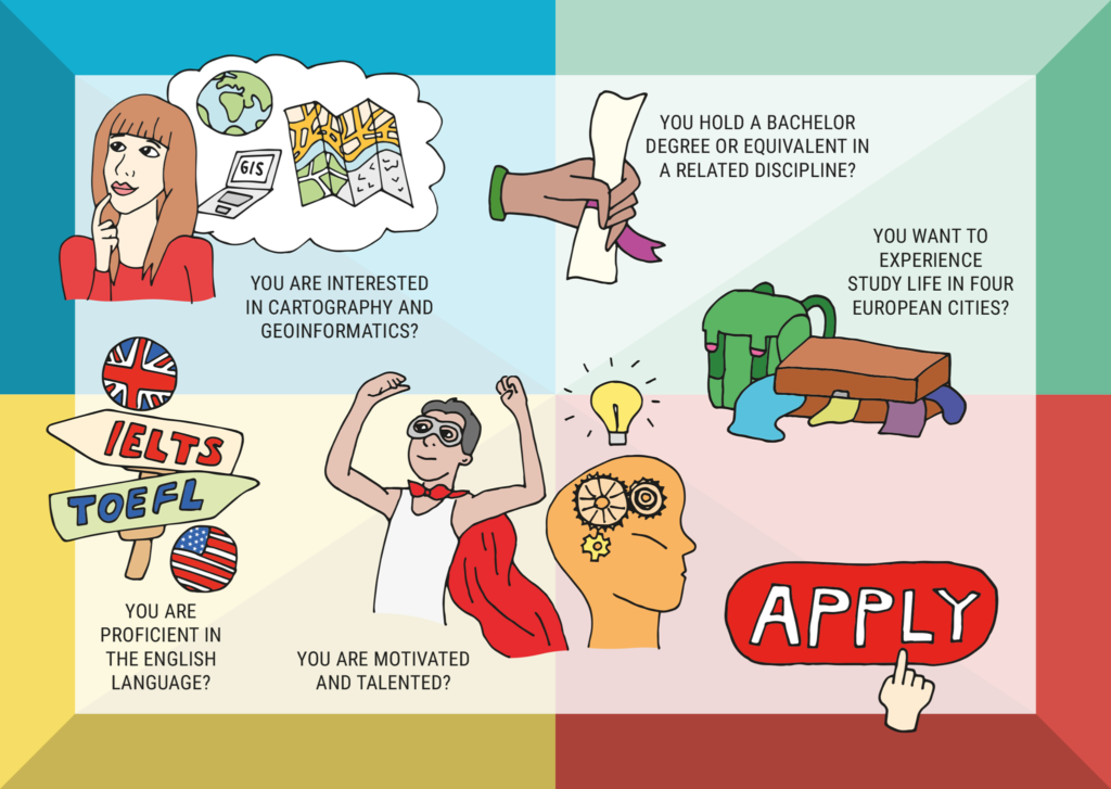
Apply for the 2021 intake of the Cartography Master programme

The online application for the 2021 intake of the International Joint Master Program “Cartography” between four European Universities is open until May 31, 2021.

All information about the application process can be found here.

The program particularly welcomes applications from ICA member countries or regions!

Let’s go mapping for a sustainable world.

Category: Member News

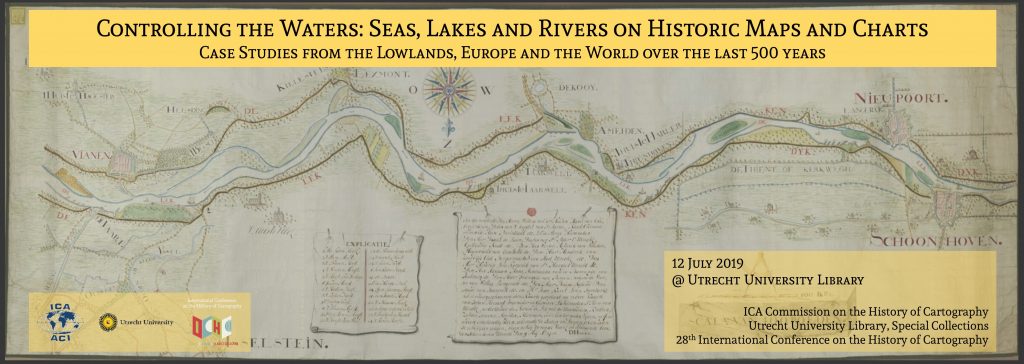
Invitation to workshop Controlling the Waters: Seas, Lakes and Rivers on Historic Maps and Charts

Banner for Utrecht 2019 workshop

It is a tradition that the ICA Commission on the History of Cartography and the International Conference on the History of Cartography (ICHC) jointly organize a pre-ICHC event. For the 28th ICHC they have teamed up with the Map Collection of Utrecht University and will together host a workshop focusing on the cartography of water.

  • Date: 12 July 2019
  • Place: Utrecht University, University Library, Boothzaal and Map Collection, The Netherlands

Fresh and salt waters are a key lifeline for all civilizations but at the same time can also threaten human habitats. Over the centuries, people have ventured out to navigate and explore the waters, while also putting systems in place to manage and control them. This has resulted in numerous categories of water-related maps such as portolan charts, maritime and river cartography, hydrographic surveys, VOC charts, polder maps etc. The workshop will offer a forum to discuss this rich variety in cartographic heritage.

Call for Papers

The organizers invite the submission of abstracts for oral presentations (25 minutes plus Q&A) focusing on the human interaction with water from a historical perspective.

  • Deadline for submissions: 30 November 2018
  • Notification of acceptance: December 2018

You can submit your abstract here.

Registration

The workshop is open to everyone with an interest in the history of cartography but requires participants to register. Registration will be open until the available seating is allocated and will be free of charge.

For more information on the workshop please visit history.icaci.org/utrecht-2019

Invitation to the International Symposium Mapping Asia – Cartographic Encounters between East and West

website-header-1

Leiden University Libraries and the ICA Commission on the History of Cartography kindly invite you to attend the International Symposium Mapping Asia – Cartographic Encounters between East and West on 15–16 September 2017 in Leiden, Netherlands.

The central theme of the conference is the mutual influence of Western and Asian cartographic traditions. The focus will be on where Western and Asian cartographic history meet. Geographically, the topics will be limited to South Asia, East Asia and Southeast Asia with special attention to India, China, Japan, Korea and Indonesia.

  • Topics and questions which will be discussed are:
  • What defines Asia? The arbitrary borders between Europe and Asia on the map
  • Asian cartographic traditions
  • Asian toponomy and cartography
  • Cartography and intercultural contact
  • Missionary and colonial cartographies of Asia
  • Asian cartography in the collections of Leiden University Libraries
  • Philipp Franz von Siebold and the cartography of Japan
  • and all papers of merit

lay-140_collbn-002-09-031-ceylon-olifantenkaart-1

During the symposium Leiden University Library will expose several exhibitions. The Asian collections of the special collections are internationally famous. The Bodel Nijenhuis Collection has large numbers of historical VOC maps. The Indonesia collection has many maps of the 19th and 20th century and includes the collections from the Royal Tropical Institute (KIT) and the Royal Netherlands Institute of Southeast Asian and Caribbean Studies (KITLV). The Siebold collection contains a lot of Japanese maps and the collection of the Sinology Institute holds several Chinese maps.

lay-136_collbn-053-46-cornelius-samarang-1

The symposium is held within the framework of the Leiden Asia Year. Throughout 2017, Leiden will be the leading center for Asia in terms of research, teaching, collections and expertise. The Leiden Asia Year 2017 was prompted by the building of the Asian Library on the roof of the University Library. The Asian Library will be opened on 14 September 2017. Participants are kindly invited to attend the opening of the Asian Library, the day before the symposium starts.

Fore more information, please consult the workshop website: blogs.library.leiden.edu/mappingasia

ICA Awards Ceremony #icc2015rio

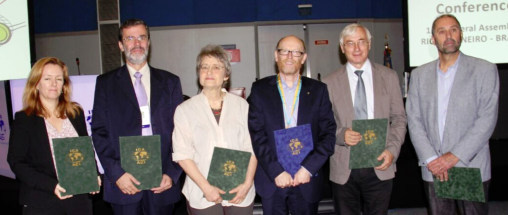
In the ICA Awards Ceremony this morning at ICC2015, the following six awards were presented in recognition of contributions to the ICA. Congratulations to all awardees!

Recipients of ICA Awards at ICC2015

From left to right: Trisha Moriarty as representative of David Fraser, José Jesús Reyes Nuñez, Elri Liebenberg, David Fairbairn, Vladimir Tikunov, Corné van Elzakker

ICA Honorary Fellowship

The ICA Honorary Fellowship is for cartographers of international reputation who have made special contribution to the ICA. It includes a bronze medal.

  • David Fairbairn, United Kingdom
    • Vice-President (2003–2007)
    • Secretary-General (2007–2011)
    • Chairman of the Commission on Education and Training (2012–)
    • Editor of the ICA GIM column

Diplomas for outstanding services to ICA

The Diplomas for outstanding services to ICA are for colleagues who have made special contribution to the ICA as commission officers or conference organizers.

  • Vladimir Tikunov, Russia
    • Chairman of the Commission on Education and Training (1999–2003)
    • Vice-President (2003–2007)
    • Chairman of the Working Group on GI for Sustainability (2007–2011)
    • Chairman of the Commission on GI for Sustainability (2011–2015)
  • Elri Liebenberg, South Africa
    • Vice-President (1999–2003)
    • Chair of the Working Group on the History of Colonial Cartography in the 19th and Early 20th Centuries (2003–2007)
    • Chair of the Commission on the History of Cartography (2007–2015)
  • José Jesús Reyes Nuñez, Hungary
    • Chairman of the Commission on Cartography and Children (2007–2015)
    • Key organizer of the Barbara Petchenik Children’s World Map Drawing Competition from 2007
    • Chairman of the International Jury (2005, 2007)
    • Co-editor of three of the four books showing selections of map drawings made by children for the Barbara Petchenik Competitions from 2007
  • David Fraser, Australia (not present)
    • Chairman of the Commission on Education and Training (2007–2012)
    • Editor of the eCARTO News (2012–present)
  • Corné van Elzakker, The Netherlands
    • Chairman of the Commission on Use and User Issues (2007–2015)
    • Chairman of the Jury: ICA International Cartographic Exhibition (2007–2013)

Overview of ICA Awards presented at ICC2015

More pictures of the award ceremony and the 2nd day of ICC2015 can be found on the ICA Facebook page.

Ferjan Ormeling is awarded the Carl Mannerfelt Gold Medal

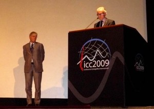
Ferjan Ormeling and William Cartwright at ICC 2009

Ferjan Ormeling and William Cartwright at ICC 2009

The Carl Mannerfelt gold medal of ICA is awarded rarely, to cartographers of outstanding merit who have made significant contributions of an original nature to the field of cartography; it is awarded only on rare occasions in order to emphasise its distinction.

Professor Dr Ferjan Ormeling of the Netherlands matches this requirement, by his tireless efforts to promote and develop the discipline of cartography, alongside his excellent service to the International Cartographic Association.

The research and educational interests of Professor Ormeling have matched his commitment to ICA, and it is to these topics we must direct our attention.  His original contributions have addressed a range of cartographic enquiries and thought, starting with his early PhD work on the important topic of toponymy.  Professor Ormeling has continued this work to the present day: he is the vice chair of the United Nations Group of Experts on Geographical Names, and has been convenor of its Working Group on Training Courses in Toponymy.  In this capacity he has travelled the world on a volunteer basis, meeting, educating, and directing local cartographic practitioners and decision makers; and has organised courses in countries from Algeria to Indonesia.

His educational activities have included practical studies of cartographic education in fields such as animated mapping, but most importantly his jointly authored textbook (with Professor Kraak), Cartography: Visualization of Spatial Data, now in its third edition.  He also co-chaired the ICA’s Commission on Education and Training for 12 years, and presented many workshops and publications on education.

His educational interests have supported strong research work also in the field of historical cartography; his specialisation in East Indies mapping has resulted in a number of extremely impressive large-format, academically-informed graphic works, but he has also studied the historical development of atlases closer to home – primarily his old school friend the famous Bos Atlas, used by every Dutch schoolchild.  Again, the ICA Commission on the History of Cartography has benefitted from his sound support, particularly in the form of educational workshops.

Professor Ormeling has extended his incisive approach to cartographic thinking to newly emerging fields such as geovisualisation, data quality, media mapping, and environmental and planning mapping.

This extensive academic and research career has led to the publication of approximately 450 items with his name as author.  Such a volume and quality of work, coupled with his support for ICA as Commission chair, national representative and Secretary General for 8 years, makes Ferjan Ormeling a worthy recipient of our highest honour, the Carl Mannerfelt gold medal.

Category: General News

Honorary Fellowship for Sjef van der Steen

Mr. Sjef van der Steen is a “Praktijkdocent” on the instructional staff at ITC in Enschede, the Netherlands, where he has enjoyed a reputation for excellent teaching and where he will soon become the institution’s Alumni Co-ordinator.

In ICA, Mr. van der Steen has been the Chair of the ICA Commission on Map Production Technology since 1995. He has been a staunch supporter of one of ICA’s most important objectives: the exchange and dissemination of cartographic knowledge. As part of the international network of people interested in aspects of map production technology, he has made several presentations on his work with map production flow diagrams. As commission chair he has organized numerous seminars and workshops, some in cooperation with other ICA commissions, in venues such as Cuba, Indonesia, Chile, Thailand, and Turkey. Under his leadership, the knowledge generated by his Commission was not just disseminated in lectures and exercises at the seminars and workshops but also in proceedings and other outlets. He has led the Commission through rapid technological changes in our discipline, has provided good new direction toward geo-information production management, and has demonstrated excellent networking and team playing skills.

For his special contributions to ICA through his leadership on the Commission on Map Production, and for his role in teaching and communicating in the field of cartography, Sjef van der Steen is awarded an ICA Honorary Fellowship.

Category: General News

Ferdinand Jan Ormeling (1912–2002)

A very special man, one of the great geographers and cartographers of our time – known to many as ‘Mr ICA’ – died on 1 May 2002. Not a moment of his often hyperactive life was wasted as he expanded his knowledge of the World and its people.

This genuinely charismatic man shared himself constantly through teaching, organisation and leadership, influencing others and helping change things for the better. His powerful intellect and special capacity for building bridges of friendship were in evidence throughout his life.

Born on 12 April 1912, his early childhood was spent in Amsterdam and in nearby Hilversum, where he experienced some of the difficulties, if not the damage, associated with WW1. After completing elementary studies at Hilversum High School he attended the State University of

Utrecht to read geography and history and went on to teach at grammar schools in Hilversum and The Hague. The Netherlands were invaded early in WW2 and this painful occupation continued until liberation in 1945. As a member of the Dutch Army, and true to his own character, Ormeling refused to succumb and joined the underground movement.

The War also affected the Netherlands’ Indonesian colonies where the Pacific conflicts had profound effect. In 1945, at the end of the Japanese occupation, Ormeling was sent, as part of an expeditionary force, to restore order to that troubled land. During the ensuing war-filled years, as a geographer/cartographer he was transferred from field activities to become part of the new Geographical Institute (formed in 1947 as part of the former government mapping organisation) in the capital, Batavia (Jakarta). Here he was involved in many important cartographic and geographical projects. With independence in 1949 most of the Dutch returned to Europe, but not Ormeling. The fact that he was asked, by those who had previously been foes, to remain and continue his work (in office and field), is convincing evidence of his special intellectual and personal qualities. Full recognition of this came in 1950 when he was appointed (at the young age of 37) as Head of the Institute, with almost 50 employees. The work evolved to include not only small-scale mapping and increasingly important geographical surveys of the country but also the education and training of the staff of the Indonesian Topographic Service.

During the years that followed he developed his knowledge of the country, in particular the Island of Timor (almost twice the size of the Netherlands) which became a focus of research into ethnic and socioeconomic factors. His pioneering study, ‘The Timor Problem, a Geographical Interpretation of an underdeveloped island’, not only gained him a Doctorate of Social Sciences from the University of Indonesia, but, on publication, it became a best-seller.

By the end of his 20-year Indonesian sojourn in 1955 he had demonstrated unequivocally his intellectual abilities in geography and mapping, his facility for organisation and leadership and his capacity for work. He had also developed a deep understanding of the people of developing countries and their problems.

His return home, at the age of only 43, was to herald a new phase in his life.

Having joined J.B. Wolters of Groningen, his major work would lie within cartography, especially the modernisation of their main atlas products.

Until 1963 he was fully employed by the company but continued thereafter as an expert consultant. He not only edited nine editions of the Grote Bosatlas and six editions of the Kleene Bosatlas but oversaw major changes in level of collaboration between users (teachers) and producers, in map style, content and design, as well as in improvements in effectiveness and economy of production. However, in parallel with these outstanding achievements he would also begin to develop (in his ‘spare time’!) his facility to motivate colleagues and stimulate links within geography and mapping, at home and abroad. The first result was a new Cartographic Section in the Royal Netherlands Geographical Society (which he chaired until 1968) and he also helped consolidate the many cartographic groups within the Netherlands into The Dutch Cartographic Society in 1975. He became the first President (1967–71) of the new enlarged Royal Netherlands Geographical Society (now incorporating many small geographical associations).

Between 1967 and 1984 he was a major representative of both the Netherlands and the ICA on the UN Group of Experts on Geographical Names and chaired the Working Group on Education and Training in Toponymy.

Although his atlas consultancy work continued after departure from Wolters, he was appointed in 1964 as Professor of Economic Geography at the University of Amsterdam and established a Research Institute in the subject. In 1971 he was appointed Professor at ITC following the Institute’s transfer from Delft to Enschede. There he established and became Head of the new Department of Cartography.

He had already noted the demise of traditional cartography with the rise of the quantitative revolution in Geography in the 1960s and ensured that the new ITC department was fully equipped with the latest computer facilities.

During his early years with Wolters, Ormeling (with Cornelius Koeman) led key discussions about the proposed establishment of the ICA, which eventually took place in Bern in 1959. He was a firm supporter of its founding principles which emerged during the first five years under Eduard Imhof’s presidency, and enthusiastically accepted election to the position of Secretary/Treasurer at the London/Edinburgh Conference and General Assembly (1964). The next technical conference took place three years later in Amsterdam under his directorship and is believed to have established a new informal and friendly family atmosphere which would become commonplace at future events. His pro-active and energetic 12-year support of Presidents Thackwell, Salitchtchev and Robinson is now legendary, supported most generously by ITC. He was elected President in Moscow (1976) and proceeded through two strong terms, ably supported by Olof Hedbom as Secretary/Treasurer, ending in Perth, Australia in 1984. At his final Conference/General Assembly in Morelia he presented his personal record of ICA entitled ‘ICA 1959–1984: The First Twenty-five Years of the International Cartographic Association’. His own 20-year period as a senior office-holder saw the introduction of many significant changes, relating to Commissions, Working Groups, statutes, etc.

A special example was the establishment of a medal for ICA’s highest distinction in recognition of the Swedish initiator of the ICA, Carl Mannerfelt. His personal experience of working for ICA was also memorable, punctuated by such as travel mishaps, a near fatal car crash in West Africa and a scary encounter (accompanied by John Bartholomew) in the bullring at the Madrid Conference of 1974!

Not surprisingly Ormeling has a long and distinguished list of publications extending from his Doctoral Thesis. It includes papers, books and atlases and echoes the many changes which have taken place during these turbulent years of cartography in the second half of the twentieth century. His retirement years were only slightly less busy than before as he continued to research, publish and accept speaking engagements.

His own lifetime of achievement has been awarded on many occasions, examples being Honorary Membership of the Dutch Cartographic Society, Membre d’Honneur de la Societé de Géographie de France, Honorary Fellowships of the Australian Institute of Cartographers, The Hungarian Academy of Sciences, The Polish Geographical Society, and the ITC itself, The British Cartographic Society Medal and, in 1987, the Carl Mannerfelt Medal. In 1978 he was appointed ‘Knight of the Order of the Netherlands Lion’ by the Queen of the Netherlands.

Although he missed the first ICA General Assembly in Paris, 1961 through work, he attended every other Technical Conference and General Assembly between 1962 and 1987, and continued as a regular visitor at ICA after his official responsibilities came to an end. He was, sadly, unable to attend the ICC 2001 in Beijing, China, but love and respect radiated from the international audience at the opening ceremony when he sent his video greeting. His passing has undoubtedly left a painful gulf in the lives of many, especially his dear wife, Rini (often described as the ‘Queen of ICA’ for her own outstanding support for him and our Association), and the children Piet, Hein, Ferjan, Ina, and Erik, Sonja and Roger. Apart from his great circle of ICA friends the other special people who will always treasure his memory are his students in the Netherlands and across the World. However our friend and colleague Fer Ormeling has left much more than a memory. This was a truly charismatic man, described by friends as ‘a demanding organiser’, ‘a fascinating speaker and entertainer’, and ‘a talented linguist… with a good sense of humour’.

This writer will always remember the warmth of his company, his ever-present smile and the twinkle in his eye. A fundamental law of physics states that energy cannot be destroyed, only changed in form. The energy released by Ferdinand J. Ormeling during his dynamic life of creativity, guidance and leadership, is thus still active within people and organisations throughout the world today. His was a life that truly made a difference.

M. Wood


Acknowledgements: Hedbom, O, Bohme, R, 1989, ‘Ferdinand J Ormeling: a Biography’, in ‘Cartography, Past, Present and Future’, Rhind, D W, and Taylor, D R F, Eds. Elsevier, 1989.

Category: General News
rawboned-refined