Welcome to the International Cartographic Association
Welcome to the website of the International Cartographic AssociationGet to know the new ICA Executive Committee for the term 2023-2027Get to know the ICA Commissions for the term 2023-2027
Welcome to the website of the International Cartographic Association
Get to know the new ICA Executive Committee for the term 2023-2027
Get to know the ICA Commissions for the term 2023-2027

President’s Blog: ICA as an Organization of Organizations

The International Cartographic Association is an organization of organizations. It is built upon its members, consisting of National Members and Affiliate Members.

What are members?

National Members are those national cartographic or geographical information organisations, national mapping and cadastral institutions, or coordinating national cartographic committees who wish to represent their nation as a member in ICA. Affiliate Members are organisations, institutions or companies wishing to support the mission and activities of the International Cartographic Association.

ICA has a long list of active members, which can be found at icaci.org/national-members and icaci.org/affiliate-members. Membership comes with a lot of benefits, the most important one as being an active and driving part of the mission, aims and scope of the world of cartography! Details about this can be found on icaci.org/membership-types.

What members do

It is important for ICA that our members flourish. Only if our members are strong, ICA can be a strong global voice for cartography. As the world is changing, the role of societies, institutions and associations is changing as well. In some of our member countries the representation of the national cartographic community might be decreasing, limited or changing. I want to therefore highlight from time to time some best practices and selected successful activities some of our members are pursuing. As I had the opportunity to participate in three recent events let me describe activities of the British Cartographic Society, the German Cartographic Society and the Hellenic (Greek) Cartographic Society as examples.

British Cartographic Society

On 20. September 2023 the British Cartographic Society (BCS) celebrated 60 years during their annual conference at Cambridge, UK. BCS has developed since its foundation 1963 a wide range of activities. To name a few highlights I want to mention publications, such as The Cartographic Journal as well as the magazine “Maplines”. To give map curators a home BCS is also providing a periodical newsletter called “Cartographitti”.  BCS has also developed a variety of awards for excellence in cartography, which are presented at the annual conferences. Those awards include entries for best map, printed maps, electronic maps, thematic maps, use of Ordnance Survey Data and 3D cartography as well as the Henry Johns Award for the most outstanding article published in the Cartographic Journal. On their website BCS provides also resources for education, including free data, software links and online support sites. Also, annual conferences are organized as well as so called “Tea Time Talks”, giving the members several opportunities to stay connected. It should be mentioned as well, that BCS has always been a key member of the International Cartographic Association, providing beneath two presidents (Deny Thackwell 1964-1968, Michael Wood 1995-1999) several Vice-Presidents, Commission Chairs and Map Enthusiasts!

During the celebrations of the 60th Anniversary I had the opportunity to address the members as well as hand over one of the BCS awards for excellence in cartography as well as hand over an ICA Map Exhibition Award Winner from ICC 2023.
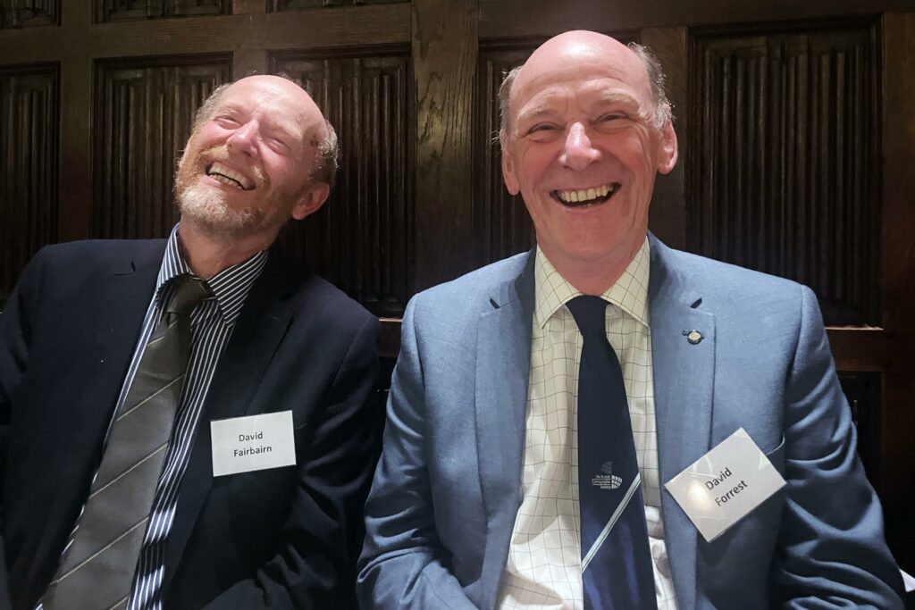
Former SG David Fairbairn and former VP David Forrest enjoying the festive celebrations of the 60th Anniversary of BCS
Former SG David Fairbairn and former VP David Forrest enjoying the festive celebrations of the 60th Anniversary of BCS

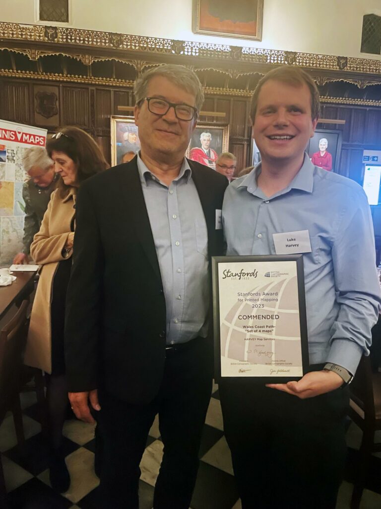
Georg Gartner handing over the Stanfords Award to Luke Harvey (Harvey Maps) for the Map “Wales Coast Path”
Georg Gartner handing over the Stanfords Award to Luke Harvey (Harvey Maps) for the Map “Wales Coast Path”

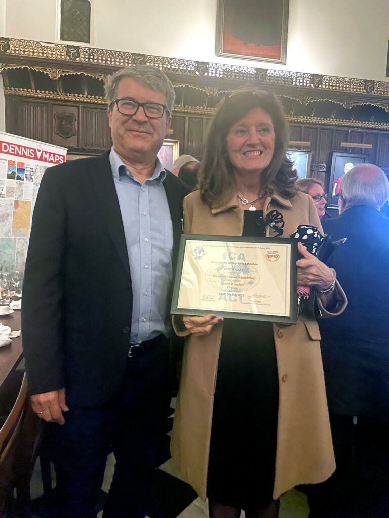
Georg Gartner handing over the Certificate for the 2nd place of the International Cartographic Exhibition at ICC 2023 in the category “Map on Panel” for the entry “The World – Great Discoveries”

Georg Gartner handing over the Certificate for the 2nd place of the International Cartographic Exhibition at ICC 2023 in the category “Map on Panel” for the entry “The World – Great Discoveries”

German Cartographic Society

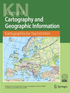
Cover of Kartographische Nachrichten

Cover of Kartographische Nachrichten

The German Cartographic Society (Deutsche Gesellschaft für Kartographie, DGfK) has just recently organised it‘s 71. German Cartographic Conference (Deutscher Kartographentag). The DGfK was founded already in 1950 and has since then developed several activities to promote cartography, such as thematic commissions, regional sections, educational materials, symposia (such as the legendary “Arbeitskurse Niederdollendorf” and the follow-up events called “Symposium Practical Cartography”), or the annual german cartographic conference. DGfK is also awarding outstanding scholars with the very prestigious “Mercator-Medal”. The recently offered “CartoCafé” is a regular series of online lectures and presentations and has found its audience. DGfK is also organizing once a year a “new year event”, which has become a very popular meeting point. It has to be mentioned especially, that the society is running its own journal, the “Kartographische Nachrichten”. DGfK has been always a strong member and supporter of ICA, contributing with ideas, activities and persons to all the ICA activities over decades.

Hellenic Cartographic Society

The Hellenic Cartographic Society was established 1994 in Thessaloniki. Soon the organization developed as the main forum for cartographers in Greece, organizing since 1994 sixteen cartographic conferences all over the country. The society is most successful in reaching out to all main stakeholders of cartography in Greece, including National Agencies, Academia, Practicioners as well as companies. The HCS is a very active partner of ICA, contributing regularly to the Barbara Petchenik Map Competition, supporting actively the FIG/IHO/ICA International Board of Standards of Competence for Hydrographic Surveyors and Nautical Cartogaphers, being the founder and driver of the ICA Commission on Cartographic Heritage into the Digital, which also runs its own journal called “e-perimetron”.
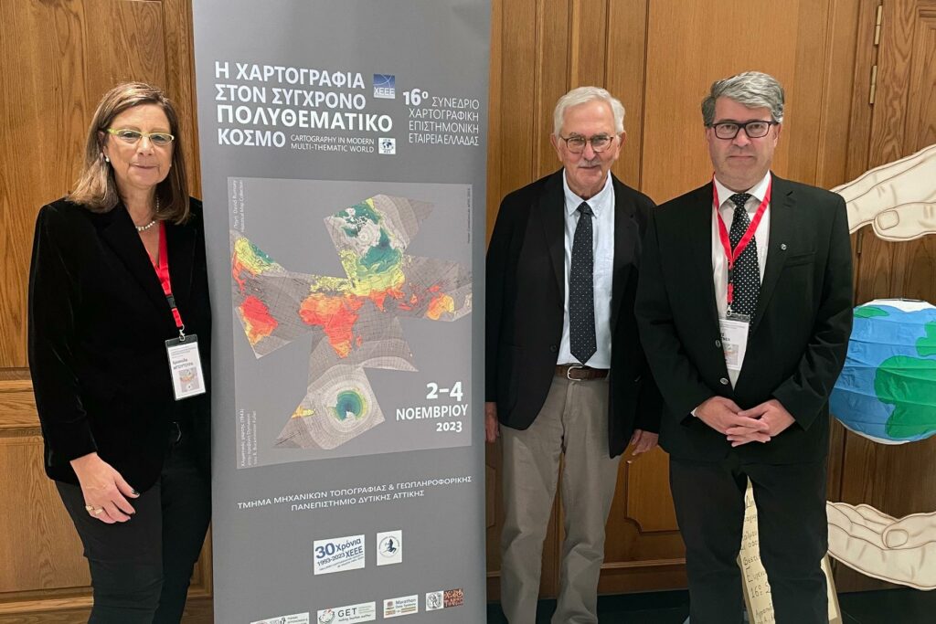
Current President of HCS Chrysoula Boutoura, Former President and ICA Honorary Fellow Evangelos Livieratos and ICA President Georg Gartner at the Hellenic Cartographic Conference in Athens, November 2023

Current President of HCS Chrysoula Boutoura, Former President and ICA Honorary Fellow Evangelos Livieratos and ICA President Georg Gartner at the Hellenic Cartographic Conference in Athens, November 2023

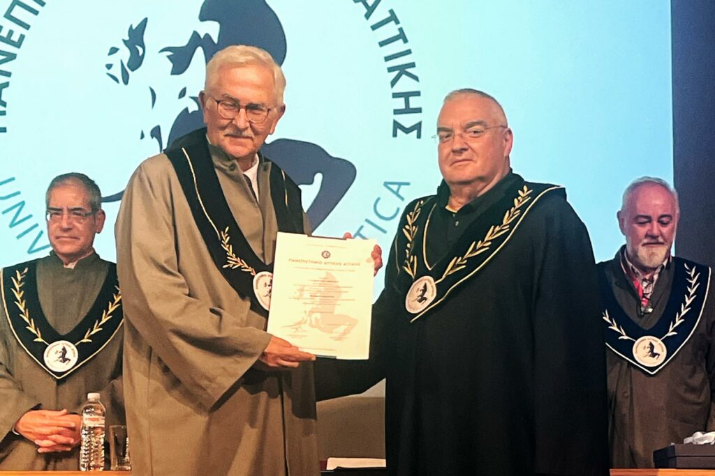
Prof Evangelos Livieratos receiving a honourable professorship of University of Western Attica during the Hellenic Cartographic Conference November 2023

Prof Evangelos Livieratos receiving a honourable professorship of University of Western Attica during the Hellenic Cartographic Conference November 2023

Call for Participation: LBS 2021, 24-25 November 2021, online

The ICA Commission on Location Based Services and the University of Glasgow are pleased to invite you to the 16th International Conference on Location Based Services (LBS 2021), which will take place fully online on 24—25 November 2021.

Note that the preliminary program of LBS 2021 has been published online. It features five keynotes:

  • Michael Batty, University College London, “More Than One Digital Twin”
  • Urška Demšar, University of St Andrews, “Studying migratory bird navigation with spatial data science”
  • Matt Duckham, RMIT University, “LBS and Indigenous Data Sovereignty”
  • Anita Graser, Austrian Institute of Technology, “Open LBS Research: Why (not)?”
  • Ross Purves, University of Zurich, “Location, place and language”

The conference also features a “Best paper session” on the 2nd conference day, and five oral sessions on “Wayfinding and Navigation Systems”, “Positioning”, “Location tracking and systems”, “Mobility and Activity Analytics”, and “Visualization, Perception and Analysis”.
Please note that registration for the conference is free, but required. The registration will close on 20 Nov 2021.

More information regarding LBS 2021 can be found at lbsconference.org

Invitation to the 16th International Conference on Location Based Services (LBS 2020)

The ICA Commission on Location Based Services and  University College London (UCL) are pleased to invite you to the 16th International Conference on Location Based Services (LBS 2020), which will take place in London, UK on 11–13 November 2020.

Built on the success of previous conferences in this series, LBS 2020 aims to offer a common ground to colleagues from various disciplines and practice where they can meet, interact and exchange knowledge, experience, plans and ideas on how LBS can and could be improved and on how it will influence both science and society.

Call for Papers

The Call for Papers is currently open. We call for full papers, work in progress, and showcases. High-quality full paper submissions are intended to be published in Springer Lecture Notes in Geoinformation and Cartography. The best full and work in progress papers will be invited to submit an extended version to the Journal of Location Based Services and Journal of Navigation.

Important Dates

  • Pre-conference workshop and exhibition proposal: 15 March 2020
  • Full paper submission: 15 May 2020
  • Work in progress submission: 14 June 2020
  • Notification of full paper acceptance: 10 July 2020
  • Notification of work in progress acceptance: 01 September 2020
  • Camera-ready full paper (for the Springer book): 01 September 2020
  • Showcase submission: 13 September 2020
  • Early registration ends, author registration deadline: 13 September 2020
  • Camera-ready work in progress: 01 October 2020

More information regarding LBS 2020 can be found at lbs2020.lbsconference.org. We are looking forwards to your contributions and to meeting you in London!

2nd Call for Papers for the 7th International Symposium on the History of Cartography: Mapping Empires Colonial Cartographies of Land and Sea

You still have until 1 March to submit an abstract for the international symposium Mapping Empires: Colonial Cartographies of Land and Sea, which will be held from 13–15 September 2018 in Oxford (UK) and is jointly organised by the ICA Commission on the History of Cartography, the ICA Commission on Topographic Mapping and the Bodleian Libraries of the University of Oxford.

Besides its scientific programme, the symposium will also include a nice array of social events, namely an ice-breaker reception, a maps and rare books exhibit and reception at Christ Church Library, a guided tour of Oxford, a conference dinner and a full-day visit to nearby Blenheim Palace.

For more information please visit the symposium website at mappingempires.icaci.org.

Invitation to the 7th International Symposium on the History of Cartography: Mapping Empires Colonial Cartographies of Land and Sea

The ICA Commission on the History of Cartography, the ICA Commission on Topographic Mapping and the Bodleian Libraries of the University of Oxford are happy to invite you to their joint international symposium Mapping Empires – Colonial Cartographies of Land and Sea. This is already the 7th event in a series of two-yearly symposia on the History of Cartography.

  • Date: 13–15 September 2018
  • Place: Weston Library, Oxford, UK

To explore the city, its surroundings and its cartographic heritage, optional technical and social tours are planned.

Call for Contributions

The organizers invite contributions (papers and posters) investigating the cartography of Africa, Asia, Oceania and the Americas as influenced by cosmopolitan exploration and imperialistic activity during, but not limited to, the ‘long nineteenth century’ (mid-18th to mid-20th centuries). The rise of European hegemony coincided with a scientific turn that underpinned the evolution of topographic mapping and hydrographic charting, and  led to the emergence of thematic mapping. These colonial cartographies brought forth a rich legacy of mapping that continues to influence the aesthetics and authority of mapmaking today.

  • Deadline for submissions: 1 March 2018
  • Notification of acceptance: 31 March 2018

As with previous international symposia the organizers plan to publish accepted and presented papers and posters in the ICA series “History of Cartography” by Springer (Heidelberg et al.); for the recently published Proceedings of the previous 6th International Symposium held in Dubrovnik in October 2016 please see www.springer.com/us/book/9783319615141

For more information on the symposium and for the submission of abstracts please visit mappingempires.icaci.org

Honorary Fellowship for David Fairbairn

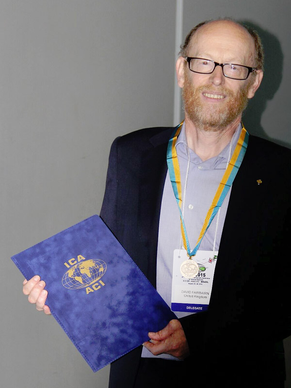
David Fairbairn receiving the ICA Honorary FellowshipDavid Fairbairn receiving the ICA Honorary Fellowship
During ICC 2015, David Fairbairn received the ICA Honorary Fellowship. Below you can read Bill Cartwright‘s laudation:

Dear colleagues,

It gives me great pleasure to give the Laudation on the occasion of the awarding of the ICA Honorary Fellowship to Dr David Fairbairn.

I have known my colleague and friend, David Fairbairn for many years, having first met at British and ICA conferences. As well, David spent a sabbatical at my university whilst undertaking research in Australia.

David and I worked as colleagues for ICA, firstly when we were both Vice-Presidents of ICA, being elected at the Durban, South Africa General Assembly. In the next term we again served ICA, David as Secretary-General & Treasurer, and me as President. So, I know David very well and I am most aware of his dedicated work on behalf of ICA.

So some information about David: David’s ‘day’ job is at the Newcastle University in the United Kingdom. Here he is the Degree Programme Director and undertakes research in the areas of accuracy of crowdsourced data and geovisualization and querying of spatial databases.

In ICA he has held a number of positions, namely:

  • Vice­‐President of ICA in the term 2003–2007
  • Secretary-General & Treasurer in the term 2007–2011
  • He is currently the Chair of the Commission on Education and Training

David has also represented ICA, as one of the ICA representatives (with me) on the Joint Board of Geospatial Information Societies. The Joint Board of Geospatial Information Societies (JBGIS) is a coalition of leading international geospatial societies that speaks on behalf of the geospatial profession at international level, especially to the United Nations and other global stakeholders.

He also supports the ICA agenda, by being the editor of the ICA column in the GIM magazine. He has also written many reference works.

In the United Kingdom, David contributes to the activities of the British Cartographic Society, the British member of ICA. He is a Fellow of this Society and he has been editor of The Cartographic Journal, the journal of the British Cartographic Society.

David has contributed to ICA over many years. He has worked tirelessly as Vice-President, Secretary General & Treasurer and Commission Chair of the Education and Training Commission.

I applaud his devoted work for ICA. I consider that this award to David recognises his devotion to activities that support and grow our Associaton.

Dr David Fairbairn – a most deserved awardee of the International Cartographic Association’s Honorary Fellowship.

Congratulations David.

ICA Awards Ceremony #icc2015rio

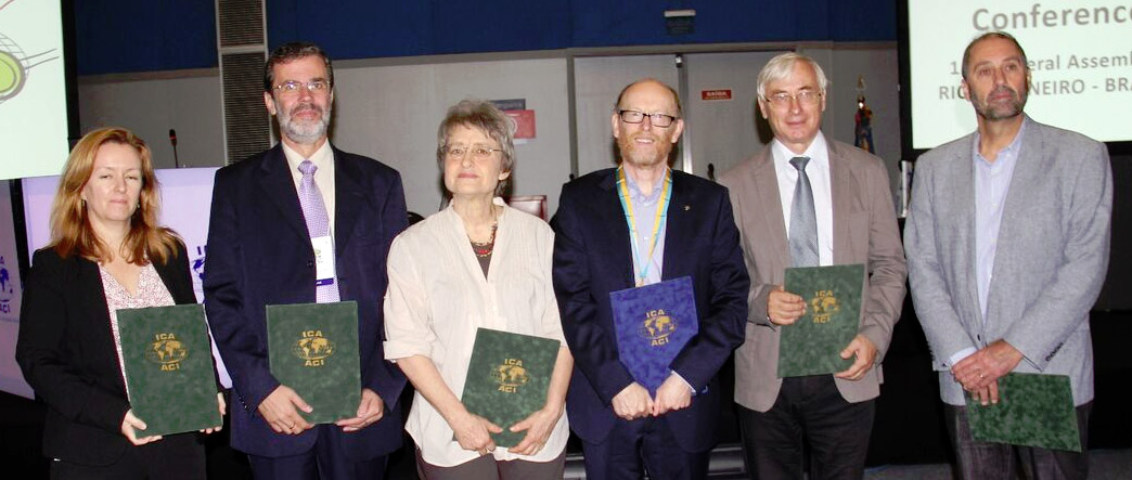
In the ICA Awards Ceremony this morning at ICC2015, the following six awards were presented in recognition of contributions to the ICA. Congratulations to all awardees!

Recipients of ICA Awards at ICC2015

From left to right: Trisha Moriarty as representative of David Fraser, José Jesús Reyes Nuñez, Elri Liebenberg, David Fairbairn, Vladimir Tikunov, Corné van Elzakker

ICA Honorary Fellowship

The ICA Honorary Fellowship is for cartographers of international reputation who have made special contribution to the ICA. It includes a bronze medal.

  • David Fairbairn, United Kingdom
    • Vice-President (2003–2007)
    • Secretary-General (2007–2011)
    • Chairman of the Commission on Education and Training (2012–)
    • Editor of the ICA GIM column

Diplomas for outstanding services to ICA

The Diplomas for outstanding services to ICA are for colleagues who have made special contribution to the ICA as commission officers or conference organizers.

  • Vladimir Tikunov, Russia
    • Chairman of the Commission on Education and Training (1999–2003)
    • Vice-President (2003–2007)
    • Chairman of the Working Group on GI for Sustainability (2007–2011)
    • Chairman of the Commission on GI for Sustainability (2011–2015)
  • Elri Liebenberg, South Africa
    • Vice-President (1999–2003)
    • Chair of the Working Group on the History of Colonial Cartography in the 19th and Early 20th Centuries (2003–2007)
    • Chair of the Commission on the History of Cartography (2007–2015)
  • José Jesús Reyes Nuñez, Hungary
    • Chairman of the Commission on Cartography and Children (2007–2015)
    • Key organizer of the Barbara Petchenik Children’s World Map Drawing Competition from 2007
    • Chairman of the International Jury (2005, 2007)
    • Co-editor of three of the four books showing selections of map drawings made by children for the Barbara Petchenik Competitions from 2007
  • David Fraser, Australia (not present)
    • Chairman of the Commission on Education and Training (2007–2012)
    • Editor of the eCARTO News (2012–present)
  • Corné van Elzakker, The Netherlands
    • Chairman of the Commission on Use and User Issues (2007–2015)
    • Chairman of the Jury: ICA International Cartographic Exhibition (2007–2013)

Overview of ICA Awards presented at ICC2015

More pictures of the award ceremony and the 2nd day of ICC2015 can be found on the ICA Facebook page.

rawboned-refined