Welcome to the International Cartographic Association
Welcome to the website of the International Cartographic AssociationGet to know the new ICA Executive Committee for the term 2023-2027
Welcome to the website of the International Cartographic Association
Get to know the new ICA Executive Committee for the term 2023-2027

President’s Blog: A year full of opportunities

The year 2024 is full of opportunities for Cartography and ICA.

In the advent of artificial intelligence and more and more digitalization in all parts of our lives and societies the functions of maps as instruments which bring some kind of order to complex phenomena, which help us to gain spatial awareness, to understand and attract attention, to provide illustrative information intuitively and to provide trustworthy information is eventually more important than ever.

The International Cartographic Association (ICA) is therefore seeking on pro-actively fostering research, education and exchange in the domain of Cartography and GIScience through all its channels, such as the commissions, publication instruments or conferences.

For the later, 2024 brings a number of excellent opportunities to meet, exchange ideas, pre-sent new insights and maps and learn from scholars. You can check out the ICA commissions to participate in one of the commission activities in person.

ICA has taken patronage or expressed endorsement for the following events:


CAGIS + UCGIS Symposium 2024

Jun 3–Jun 6 2024, Columbus (USA)
cartogis.org/conferences/cagis2024/

9th International Conference on
Cartography and GIS
Jun 16–Jun 21 2024, Nessebar (Bulgaria)
iccgis2024.cartography-gis.com

Regional Cartographic Conference EuroCarto 2024
Sep 9–Sep 11, Vienna (Austria)
eurocarto2024.org


Regional Cartographic Conference AsiaCarto 2024
Dec 8–Dec 10, HongKong (China)
asiacarto.org/2024/

All of those conferences have their Call for Submission currently open and allow excellent opportunities to network, learn, exchange and simply advance our discipline further.

I am looking forward to meeting you there!

Georg Gartner

Obituary: Eddy Lynn Usery

On March 22, 2022, the world lost a GIS giant and cartography compadre when Dr. E. Lynn Usery, current Chair of the ICA Commission on Map Projections and former ICA Vice-President, passed from this earthly plane. Not even a week earlier, Lynn was busily planning workshops for AutoCarto 2022. He will be sorely missed by ICA and our community, not only for his many research contributions, leadership and vision, and tireless service, but also for his friendship and camaraderie.

Michael Tischler of the U.S. Geological Survey (USGS) wrote, “On paper, we knew him as the Director of the Center of Excellence for Geographic Information Science [CEGIS]. But he was far more than that title would lead one to believe. Lynn leaves a remarkable legacy given his extraordinary scientific accomplishments, presence as a leader in the geographic science community, and impact on individual geographic scientists inside USGS and around the world.”

It’s a challenge to specify the impact that Lynn has had on the field of GIScience because of the breadth and depth of his involvement and contributions. He was centrally involved in many areas of the discipline, including cartography, GIS, remote sensing, and spatial analysis. His eclectic research interests included digital cartography, map projections, scale and resolution, image classification, temporal GIS, geospatial semantics and ontology, and high-performance computing for geospatial data. It would be difficult to name a subject in our field about which Lynn could not speak knowledgably and insightfully.

Lynn was unique in that his impact came through his careers in both government and academia. Lynn started working for the USGS in 1977. He was a cartographer and geographer for the USGS from 1978 to 1988 focusing on developing automated cartographic production systems. In 1988, he took on a geography faculty position at the University of Wisconsin (UW) – Madison. In January of 1994, he moved to Georgia to serve on the geography faculty at the University of Georgia (UGA). In May of 1999, Lynn took on a Research Geographer position with the USGS in addition to his academic job at UGA. In 2005, he returned to USGS and ultimately conceived and became Director of CEGIS. In this role, he directed the science program and the visions and plans for topographic mapping research. While at USGS, Lynn also taught remote sensing at the Missouri University of Science and Technology.

In all his positions, Lynn was a ground breaker. In his early days at USGS, he began the development of digital mapping systems for the automated production of printed topographic maps. At UW, he helped found a GIS program. At UGA, he helped establish certificate programs in GIScience at both the undergraduate and graduate levels. When he returned to USGS, he started a cartography research program that led to CEGIS. For CaGIS, he chaired AutoCarto 2005 to close an eight-year gap and resurrect the symposium series. He also spearheaded the effort to bring the International Cartographic Conference back to the United States for only the second time, the first being in 1978.

Lynn was involved in multiple activities of the ICA:

  • 2004–2008 US National Committee to the ICA member
  • 2007–2011 ICA Map Projections Commission Secretary
  • 2007–2015 US National Committee to the ICA Chair
  • 2011–2012 ICA Technology Outreach Working Group Chair
  • 2011–2015 ICA Map Projections Commission Vice Chair
  • 2011 Bid for ICC 2017
  • 2012–2017 ICC 2017 Conference Organizer
  • 2015–2019 ICA Vice President
  • 2018–2019 ICA Body of Knowledge for Cartography Working Group Chair
  • 2019–2022 ICA Map Projections Commission Chair

That Lynn was so involved in the association is admirable. That he did the same with many other societies, at the same time, makes Lynn exceptional and unparalleled. There is truly no match for him in this regard, and really not even anyone in the running. No other person has been elected vice-president of the ICA, president of the Cartography and Geographic Information Society (CaGIS), president of the American Society for Photogrammetry and Remote Sensing (ASPRS), and president of the University Consortium for Geographic Information Science (UCGIS), as Lynn was in 2015, 2002, 2004, and 2015, respectively. Additionally, as with the ICA, in all these associations, he also served in other roles.

On a personal note, Lynn was born in December 1951. He had two children, a son Kelynn, born 1986, and a daughter, Lacy, born 1988. Lynn received his BS in geography from the University of Alabama and MA and Ph.D. degrees in geography from UGA. He died Tuesday, March 22, 2022, after a brief illness.


Tim Trainor, President of ICA &
Aileen Buckley, U.S. national representative to ICA

AutoCarto 2020 – Online on GIS Day!

CaGIS is proud to present AutoCarto 2020, the 23rd International Research Symposium at the intersection of cartography and GIScience.

AutoCarto 2020 is being offered virtually in an open access format that is online and free to all!

The program consists of 40 papers by 121 authors from 14 counties, 7 workshops by 16 organizers from 6 countries, and 4 visionary keynotes from international, government, industry, and academic perspectives.

All of this great content goes live on GIS Day — Wednesday, November 18, 2020 — so be sure to visit the AutoCarto website then!

Category: Member News

AutoCarto 2020 Online

We hope this message finds you safe and healthy during these unprecedented times. Regretfully, COVID-19 continues July to spread across the US at alarming rates which diminishes our hope for a safe environment to hold AutoCarto 2020 as an in-person conference in November. Therefore, we have decided to reformat the conference as an online experience.

AutoCarto 2020 will be offered online as a set of extended abstracts and associated recorded presentations. These will go live on Wednesday, November 18, 2020. Viewers will have the opportunity to contact presenters with questions or comments. Extended abstracts will also be published in the AutoCarto 2020 Online Proceedings.

Please find all details here:

  1. An AutoCarto 2020 proceedings will be published on the AutoCarto website. These proceedings will be comprised of extended abstracts that have been reviewed and accepted by the Program Committee. The deadline for submitting a new extended abstract is September 15, 2020. The deadline for submitting a revised abstract is September 30, 2020. The online proceedings will be open-access, and authors will retain copyright over their submissions. Please inform May Yuan, Program Chair, at myuan[at]utdallas.edu if you wish to exclude your extended abstract that has already been accepted from the proceedings.
  2. Authors whose extended abstracts have been accepted are invited to share a presentation of that will be published on the AutoCarto 2020 website alongside their presentation. The deadline for submitting presentations is November 10, 2020. These presentations may be in either PDF format and/or MP4 format. Upload a PDF of the presentation you created using PowerPoint or another presentation tool and/or a recording of your presentation in MP4 format to a cloud storage service (e.g., Dropbox, Box, Google Drive, or OneDrive). Please email the shared link to May Yuan and provide contact information for the corresponding presenter for questions or comments from viewers.
  3. All authors are free to submit their extended abstracts to other conferences since AutoCarto 2020 will not be held as an in-person conference.
  4. Rex Cammack (rcammack[at]unomaha.edu) is editing a Taylor & Francis book and will consider including papers expanded from the extended abstracts for AutoCarto 2020. Please contact Rex if you are interested in contributing a chapter based on your extended abstract.
  5. Authors may also consider submitting their work to the Cartography and Geographic Information Science journal. Please follow the normal submission guidelines for authors.

While we are saddened at the changes we must make to AutoCarto 2020, the Cartography and Geographic Information Society is already beginning to plan AutoCarto 2022 where we will look forward to seeing you in person.

Sincerely,
Aileen Buckley, AutoCarto 2020 Conference Chair
May Yuan, AutoCarto 2020 Program Chair

Category: Member News

AutoCarto 2020 postponed to November

In light of the important public health considerations related to the novel coronavirus (COVID-19), the AutoCarto Organizing Committee has decided to postpone AutoCarto 2020 until November 2020. The new dates for the conference are Tuesday, November 18, through Friday, November 20, with workshops on Tuesday, November 17. The venue will remain the same – the Esri campus in Redlands, California.

We are still working out the details related to registrations and paper submissions. Please bear with us while we determine the best way to handle these and other important issues. In the meantime, please modify any arrangements you may have made to travel to California in May.

If you have any specific issues or concerns, please email the conference chair, Aileen Buckley (abuckley@esri.com). We appreciate your patience as we continue to make arrangements for these new dates for AutoCarto 2020.

Dr. Aileen Buckley, PhD
AutoCarto Conference Chair

Category: Member News

ICA workshops at AutoCarto 2020

AutoCarto 2020 will take place on the Esri campus in Redlands, CA, May 20–22, 2020. In advance of the conference, workshops will be held on Tuesday, May 19th. They range from 90 minutes to full-day workshops. Three of them are associated to ICA commissions:

Geospatial Semantics Modeling and Visualization; the First Workshop of the International Cartography Association Commission on Geospatial Semantics

Geospatial ontologies formalize representations for sets of interrelated concepts based on their semantics from theoretical and applied perspectives. The representation and reasoning of geographic knowledge must be cohesive with many interrelated disciplines, including: language, logic, cartography, social theory, geospatial analysis, and programming. To advance research in geospatial knowledge representation and reasoning, the International Cartography Association (ICA) is sponsoring a Commission on Geospatial Semantics (CGS). The CGS will solicit abstracts for presentations on both theoretical and applied aspects of geospatial and cartographic ontologies for the First Workshop of the CGS. This half-day workshop will bring together expert and newly interested specialists and technologists from across geospatial informatics to network and develop an agenda to advance the broad role of semantic technologies in geographic information science.

Prior to the meeting we encourage prospective attendees/participants to examine the agenda and guidelines at the CGS web site (to be provided with the announcement). A range of potential topics will be suggested for the workshop and opportunities will be provided for those interested in the day’s agenda to register a topic or an issue to be included. We will accept and cover complex issues for discussion. Participants will have the opportunity to develop papers within this framework for publication by the ICA prior to the International Cartography Conference in Florence, Italy in 2021. A secondary activity immediately before the research workshop is to offer participants a hands-on tutorial addressing basic concepts of geospatial semantics with the aim of expanding the community of scholars interested in the field. This workshop will also offer an opportunity for semanticians to formalize concepts using a compatible technology where more widespread forms of geographic information systems (GIS) are inflexible.

Scholars interested in presenting a paper or participating in the session as a discussant will be able to submit their abstract through the standard submission procedures whose guidelines will be provided. The CGS will cooperate and correlate all activities with the AutoCarto 2020 organizers.

For a proposed agenda, download this PDF.

Please submit abstracts for this workshop through EasyChair.

  • Organizers:
  • Duration: 4 hours
  • Participants: The tutorial is open to everyone attending AutoCarto 2020.

Map Projections – Practical Selection and Use with Current Research Directions: Workshop of the International Cartography Association

Map projections are a critical part of any map design and creation. The plethora of projections that exist allow a user to select an appropriate map projection to preserve the global characteristics that are critical to the map design. Unfortunately, many users of maps and geospatial information have little understanding of map projection concepts and are not able to determine a correct map projection for the type and purpose of the map being created. This workshop will thus include a brief tutorial on map projection concepts, selection, and use. The tutorial will also include presentation of existing tools to aid in selecting the correct map projection. The workshop will conclude with several presentations of current research in map projections.

Prior to the meeting we encourage prospective attendees/participants to examine the agenda and guidelines at the Commission on Map Projections web site. Participants will have the opportunity to develop papers within this framework for publication by the ICA prior to the International Cartography Conference in Florence, Italy in 2021.

For a proposed agenda, download this PDF.

  • Organizers:
    • E. Lynn Usery, U.S. Geological Survey, usery@usgs.gov, Chair Projections Commission
    • Miljenko Lapaine, University of Zagreb, mlapaine@geof.hr, Vice-Chair Map Projections Commission
  • Duration: 3.5 hours
  • Participants: Anticipated number of attendees, 10; maximum 20.

Cartographic and Geospatial Information Education: from Classroom to Anywhere

Conventionally, cartography has been mostly taught in classrooms with lectures and exercises, aiming to enhancing peoples’ map reading capabilities and map making skills. Nowadays, the general public has access to the wide spread of web map services, navigation apps on smart phones and open source software and datasets at no cost. Background knowledge of students entering professional training on cartography today is very different from those ten years ago. The body of knowledge for cartography and GIS has been transforming continuously by incorporating new ideas from applications and interdisciplinary research. Suites of online courses incorporate some of the new concepts and technologies and make teaching cartography and GIS more flexible and practical. Educators have been conducting reflections on these changes, which can be observed from publications in many conferences and journals.

This workshop serves as a forum to share the latest practices and insights on cartographic and GIS education in a rapidly changing landscape. The topics can include but limited to new course contents, curricular design, incorporation of online courses, education resources using open source software and datasets, teaching experience to non-specialists.

Please use the AutoCarto 2020 template and contact the organizers for submissions and detailed information.

  • Organizers:
    • Tao Wang, Capital Normal University, Beijing, China, wangt@cnu.edu.cn
    • Terje Midtbø, Norwegian University of Science and Technology, Trondheim, Norway, terjem@ntnu.no
  • Duration: 90–100 minutes (~6 presenters)
  • Participants: We expect 20–30 attendees to join the session.


An overview over all workshops at AutoCarto 2020 can be found here.

Tag: ,

AutoCarto 2020: 2nd Call for Submissions

The Cartography and Geographic Information Society (CaGIS) is pleased to announce the 2nd call for the submission of extended abstracts for AutoCarto 2020. The conference will take place on the Esri campus in Redlands, CA, May 20–22, 2020. Workshops will take place on Tuesday, May 19.

The deadline to submit extended abstracts, January 10, 2020, is fast approaching! See https://cartogis.org/autocarto/call-for-submissions/ for details. A call for posters will be announced at a later date.

The theme of AutoCarto 2020 is WhereNext. We welcome submissions of extended abstracts for research presentations and workshop proposals with a topical or technical emphasis related to WhereNext. We are not only looking at where we are and where to go next, but we challenge the ideas of where and next in terms of meaning, communication, visualization, and reasoning in the new age of automation, robotic revolution, and artificial intelligence (AI).

Cartography and Geographic Information Science (the journal of CaGIS) will publish a special issue following the conference. Authors who would like to submit a full manuscript to the CaGIS journal can indicate their interest in their extended abstract. The conference program committee will consider all submissions and select for publication those abstracts most likely to be accepted as manuscripts for the journal. Due dates for the full manuscripts will be announced after the conference.

Keynote speakers announced

AutoCarto 2020 will feature daily vision plenaries. Keynote speakers include Deirdre Dalpiaz Bishop (U.S. Census Bureau), Laura Bliss (CityLab), and Bernhard Jenny (Monash University). A variety of preconference workshops will also be offered. See https://cartogis.org/autocarto/autocarto-2020/program/ for details.

Student assistantships

Student assistantships of $750 are available on a competitive basis. See details at https://cartogis.org/autocarto/student-assistantships/.

Registration

Registration for AutoCarto 2020 is now open. We are offering a special registration rate for attendees who are not already members of CaGIS. This rate includes full conference registration plus a complimentary one-year membership in CaGIS, including access to its premier scientific journal, Cartography and Geographic Information Science.

Important dates

  • Workshop decisions: December 10, 2019
  • Extended abstracts due: January 10, 2020
  • Extended abstracts decisions: February 10, 2020
  • Student assistantship applications due: February 14, 2020
Category: Member News
Tag: ,

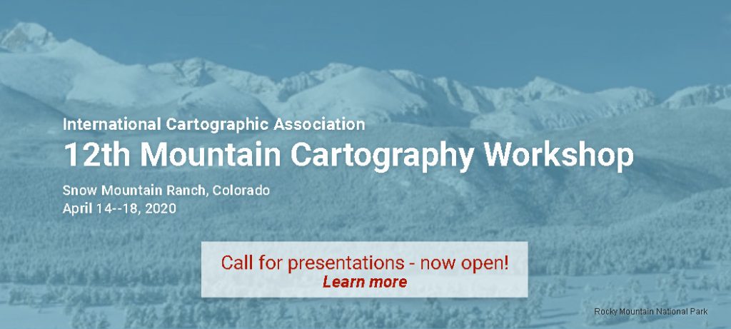
(CANCELLED) Invitation to the 12th Mountain Cartography Workshop

Update, March 2020: Sorry, this workshop had to be cancelled due to the coronavirus situation.


We invite you to participate at the 12th Mountain Cartography Workshop in the Colorado Rockies, April 14—18, 2020.

Banner 12th Mountain Cartography Workshop

The workshop theme is People, Maps, and Mountains. All topics broadly relating to maps and mountains are welcome as are a variety of presentation formats: from full papers to technical demos.

Call for Presentations is already open!

For more information about the workshop and to submit your abstract, visit www.shadedrelief.com/workshop/

Announcing AutoCarto 2020: WhereNext

The Cartography and Geographic Information Society (CaGIS) is pleased to announce AutoCarto 2020, to be held May 20–22 on the Esri campus in Redlands, California. Workshops will take place on Tuesday, May 19.

The theme of AutoCarto 2020 is WhereNext, looking at where we are—and where to go next—in terms of meaning, communication, visualization, and reasoning in this new age of automation, robotic revolution, and artificial intelligence (AI).

Cartography and Geographic Information Science, the journal of CaGIS, will publish a special issue with papers from the conference.

The call for extended abstracts and preconference workshop proposals is now open. See cartogis.org/autocarto/call-for-submissions for details. The call for posters will be announced later.

Student assistantships, including a $750 stipend, are available on a competitive basis. See cartogis.org/autocarto/student-assistantships for details.

Category: Member News
Tag: ,
rawboned-refined