Welcome to the International Cartographic Association
Welcome to the website of the International Cartographic AssociationGet to know the new ICA Executive Committee for the term 2023-2027
Welcome to the website of the International Cartographic Association
Get to know the new ICA Executive Committee for the term 2023-2027

Invitation to the ICC2017 Pre-Conference Workshop Mapping Tools for Non-Mapping Experts: Incorporating Geospatial Visualization Tools in Libraries

Detail of George Washington's map A plan of my farm on Little Huntg. Creek & Potomk. R., 1766. Free downloaded from the Library of Congress web-provider.

Detail of George Washington’s map A plan of my farm on Little Huntg. Creek & Potomk. R., 1766. Free downloaded from the Library of Congress web-provider.

The ICA Commission on Cartographic Heritage into the Digital organizes a one day pre-conference workshop in the frame of the 28th International Cartographic Conference, Washington DC, USA, in association and partership with the MAGIC group.

This one day workshop will highlight and discuss how librarians can easily incorporate user-friendly geospatial visualization tools into their work – whether that is instruction sessions, workshops for faculty, graduate students or the community, or other projects within libraries.

Date & Venue

To be defined – tentatively before or after the ICC2017 in the same conference venue, the Marriott Wardman Park Hotel, located in Northwest DC.

Fees & Registration

Participation is free. The registration form can be found here.

Organizers & Contact

  • Marcy BIDNEY, Curator, American Geographical Society Library
  • Nathan PIEKIELEK, Geosaptial Services Librarian, The Pennsylvania State University

Contributions

  • BGDb.be: a map based search tool for geological publications Annick ANCEAU, Eric PIRARD, Pierre STEVENS
  • CartoShop: Empowering non-mapping experts to get spatial, one workshop at a time Theresa QUILL, Erika JENNS
  • Digital spatial indexes for large-scale urban atlases using GeoJson.io, GitHub, and Leaflet.js Evan THORNBERRY
  • Geovisualization instruction at Columbia University Libraries’ Digital Social Sciences Center Jeremiah TRINIDAD-CHRISTENSEN, Eric GLASS
  • “GIS for the Rest of Us”: Collaborating on GIS Education and Outreach at Ohio State Joshua SADVARI
  • Visual Knowledge Aggregation: From Static To Dynamic Information Systems in Library Contexts Andrea NANETTI, Angelo CATTANEO, Siew-Ann CHEONG, Yao-Yi CHIANG, Chin-Yew LIN

For more and updated information, please consult the workshop website: cartography.web.auth.gr/ICA-Heritage/2015-2019/pg/ICC2017.html

Invitation to the ICC2017 Pre-Conference Symposium on Location-Based Social Media and Tracking Data

Symposium-header

The ICA Commission on Geospatial Analysis and Modeling and the ICA Commission on Location-Based Services invite you to a pre-ICC2017 symposium on location-based social media and tracking data. The growing availability and use of location-based social media data and tracking data (e.g., GPS tracking) have created unprecedented opportunities for researchers from various disciplines. At the same time, it also challenges people with new theoretical, technical, ethical, and social questions. This symposium attempts to bring together researchers from various fields and perspectives to share ideas and findings of their research related to location-based social media data or location tracking and sensing data.

Please find the detailed invitation here.

Timeline

  • 15 February 2017 – Deadline for submitting extended abstracts
  • 15 March 2017 – Acceptance notification
  • 1–2 July 2017 – Workshop prior to the ICC 2017
  • 15 July 2017 – Deadline for full paper (optional, only for those interested in the post-event publication in a journal special issue)

ICA Commission Meetings and Workshops at AutoCarto 2016

autocarto2016

AutoCarto is a Cartography and Geographic Information Society (CaGIS) research symposium held every two years. CaGIS is the US adhering body to the ICA. This year AutoCarto 2016 will be held in Albuquerque, New Mexico, USA, 14-16 September 2016.

The following ICA Commission Meetings and Workshops will take place:

Tag: ,

Invitation to the ICC2017 Pre-Conference Workshop on Maps & Emotions

white-house-451544_1920-1180x450

The ICA Commission on Cognitive Issues in Geographic Information Visualization, the ICA Commission on Art and Cartography and the ICA Commission on Topographic Mapping invite you to a pre-conference workshop on Maps and Emotions. The goal of this workshop is to provide an intellectual and creative space to share different ideas and methodologies that can help further exploring the complex relationships that exist between places, maps and emotions.

Please find the detailed Call for Papers here.

Location

The workshop will be hosted by The George Washington University, located downtown Washington DC. The workshop will be free of charge, but the participants will have to pay for their food and lodging (a list will be provided on the ICC2017 website).

Timeline

  • 30 September 2016 – Deadline for submitting abstracts or activities proposals
  • 1 November 2016 – Successful Applicants notified
  • 15 January 2017 – Participants confirm their participation
  • February 2017 – Preliminary program released
  • May 2017 – Final program released
  • 1–2 July 2017 – Workshop prior to the ICC 2017

President’s Blog: Invitation to ICC2017

Our bi-annual International Cartographic Conferences are highlights on the cartographic calendar. It is with great pleasure that I invite you to Washington, DC, in the United States to participate in ICA’s 28th conference. It promises to be a unique and successful event. It will be unique because we will experience the developments in our discipline since the previous conference. These developments will be expressed in papers and posters and in exhibitions of maps and technology. Unique because Washington, DC, is the center of US cartography, and many organizations and companies will share their knowledge with us. Successful because you will be there too.

Menno-Jan Kraak
– President of the International Cartographic Association


The Call for Papers is now open. Please find all details on the ICC2017 website.
Submissions are due October 26, 2016.

icc2017-logo
 

Tag: , , ,

ICC2017: Call for abstracts and papers is now open!

icc2017-logoThe 28th International Cartographic Conference will take place in Washington, D.C., USA, 2–7 July 2017. Abstracts and full papers for review for presentation at ICC 2017 are now being accepted. To begin your submission click here.

The world of cartography and GIS comes to Washington, DC, July 2 to 7, 2017 for the 28th International Cartographic Conference (ICC) of the International Cartographic Association. This call is your opportunity to submit your paper or poster abstract and join other cartographers and geographic information scientists from across the globe. Participate and see the latest innovations and developments in mapping techniques, technological advancements, and current research in cartography and GIScience—conference themes are listed below. The ICC is a unique experience to exchange ideas and encourage collaboration with colleagues from academia, government and industry. This event is a once in a generation opportunity in Washington, D.C., and will not be in the United States again for many years.

white-house-451544_1920-1180x450

Submissions

Submissions are due October 26, 2016.

There are two submission tracks:

  1. a full paper that includes a short abstract, or
  2. a long abstract only for presentation.

There are two presentation formats: an oral paper or a poster.

A collection of refereed conference papers will be published in a Springer book. These full papers are due October 26, 2016.

Long abstracts will be refereed to decide acceptance of presentations. Authors who submit a long abstract have the option to submit a paper for the online conference proceedings. These papers, which will not be refereed, are due later.

After the conference, selected papers will also be invited for submission to the official ICA journals: The International Journal of Cartography, Cartography and Geographic Information Science, Cartographica, and The Cartographic Journal.

For details please consult the conference website: icc2017.org Continue reading

Category: General News
Tag: , ,

President’s Blog: #CartoSummit – A Report

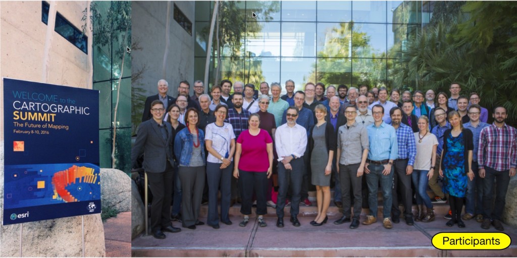
The International Cartographic Association (ICA) and Esri hosted a Cartographic Summit, 8–10 February 2016 in Redlands, California. This summit of invite-only guests from a broad array of fields assessed the state of play in mapping and visualization and explored where we’re headed. Leading thinkers from academia, government and industry explored trends and how they are shaping the work that we’re doing.

Participants of the Cartographic Summit 2016

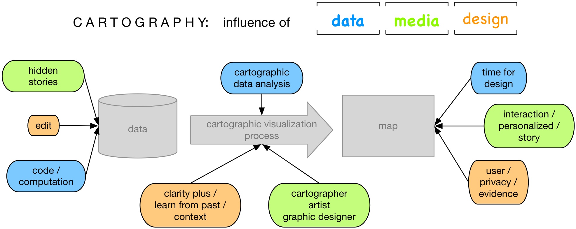
Broad themes of Data, Media, and Design provided a focus for open sharing and conversation to learn from each other, and share best practices, and find new or proposed solutions.

The summit intended draw together a plan for research, innovation and strategic thinking to support mapping and visualization needs as we move forward. The intent was to set a marker for understanding common challenges from a range of perspectives in and outside the traditional cartographic communities; to draw together different ways of thinking and working; and to build bridges across the many communities in the map-making and visualization fields.

Presentations (here by Menno-Jan Kraak) and break-out session for collecting and discussing keywords for each session

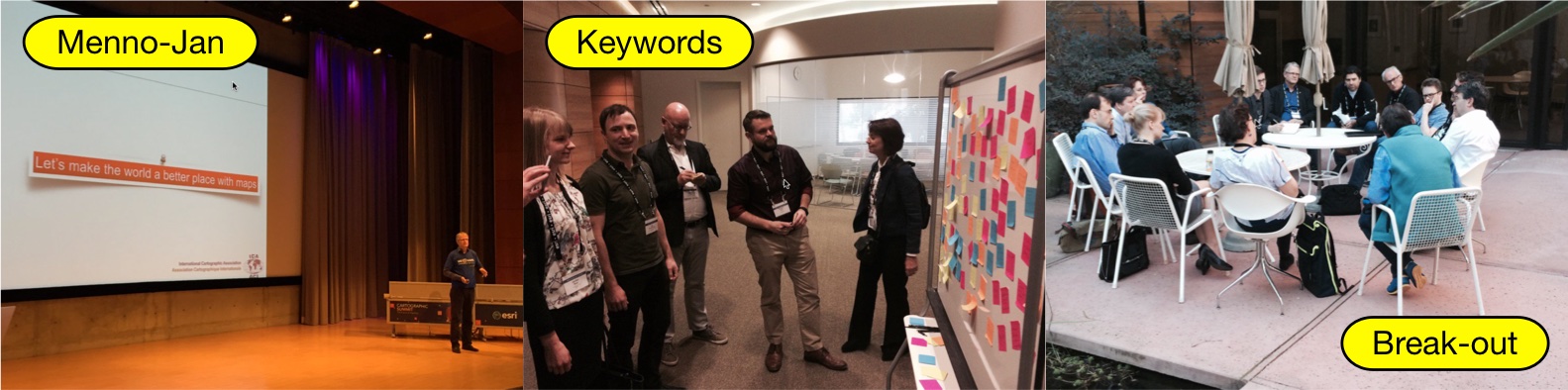
For each of the three topic half a day was reserved, and consisted of three speakers (a keynote and two lightning talks) and breakout sessions to discuss the topic based on the top five keywords generate by the audience after the talks. The findings of the four groups were reported after each session. In a final session an overall discussion was followed by a synthesis of the lessons learned.

Program

Data

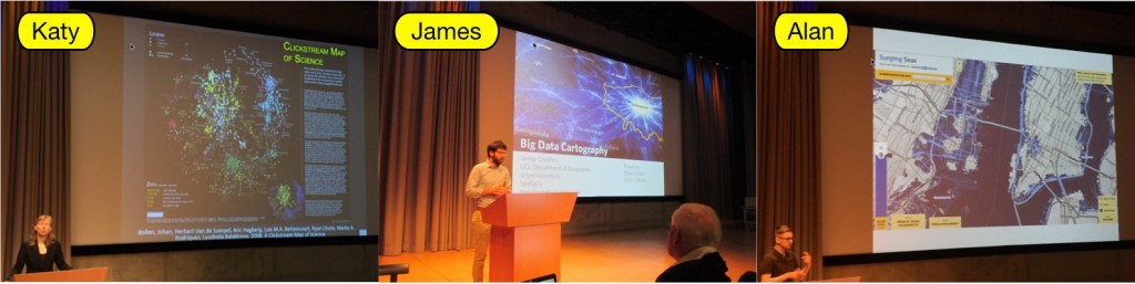
  • Keynote: Improving Data Visualization Literacy: How to Empower Anyone to Read and Make Visualizations – Katy Börner, Victor H. Yngve Professor of Information Science, Indiana University
  • Lightning Talk: Big Data Cartography – James Cheshire, Lecturer in Quantitative Human Geography, University College London
  • Lightning Talk: Doing Cartography as Professional Amateurs – Alan McConchie, Lead Cartographer, Stamen Design

Data session: Katy Börner, James Cheshire and Alan McConchie

Keywords for the topic of data: data design, data analysis, domain expertise, user and applications, conceptualization

Media

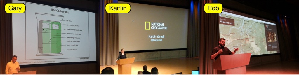
  • Keynote: carto-future-ography – Gary Gale, CTO, what3words
  • Lightning Talk: Mapping for new media. Building on 128 years at National Geographic. – Kaitlin Yarnall, Director of Maps, Graphics, and Art, National Geographic
  • Lightning Talk: Cartographic Design as Visual Storytelling – Robert Roth, Director, University of Wisconsin Cartography Laboratory Assistant Professor, UW-Madison Department of Geography

Media session: Gary Gale, Kaitlin Yarnall and Robert Roth

Keywords for the topic of media: storytelling, technology to create interaction; ethics, tracking; purpose of map; user, human make and using the maps

Design

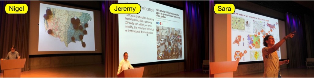
  • Keynote: Pictures and Geography – Nigel Holmes, Graphic Designer, Explanation Graphics
  • Lightning Talk: Geoprivacy in the Age of Big Data – Jeremy W. Crampton, Associate Professor of Geography, University of Kentucky
  • Lightning Talk: Evidence Based Design – Sara Irina Fabrikant, Professor, Department of Geography, University of Zurich

Design session: Nigel Holmes, Jeremy W. Crampton and Sara Irina Fabrikant

Keywords for the topic of design: clarity, user/audience, privacy, uncertainty, issues of design for big data

Synthesis

  • Synthesis: ICA Viewpoint & Lessons Learned – Menno-Jan Kraak, ICA president, Professor of Geovisual Analytics and Cartography, University of Twente / ITC

The third day was a view into the ESRI Kitchen. The participants were able to comment on planned developments related to topics such as Mapping and Visualization,  3D and Story Mapping as well as a few other topics, while discussing with ESRI developers.

Results

How the audience reacted to the summit can be found on Twitter via #cartosummit

The results of the discussions is summarized in the figure below. An more extensive interpretation will follow in a contribution to our International Journal of Cartography.

The results of the summit summarized in one chart

Follow-up

  • Further elaboration of the materials into a column for ESRI news.
  • The recordings of the event will be shared and disseminated widely (links via our website).
  • Convert this report into an ICA News article.
  • Elaborate into a paper for our International Journal of Cartography.

President’s Blog: Follow the future live: Cartographic summit

cartosummit

The International Cartographic Association (ICA) and Esri will host invited guests at the Cartographic Summit: Future of Mapping in Redlands, California, to examine new directions in mapping. Mapping is evolving at a rapid pace – enabling us to communicate in new ways, analyze important issues, and understand our world. At this summit, leading thinkers from academia, government, media and design will discuss how cartography can and should meet changing needs and expectations.

The event will be live streamed:

After the event I will report here about the outcome, but we also aim at a paper in the upcoming research agenda issue of our International Cartographic Journal, which will provide even more details.

Menno-Jan Kraak
– President of the International Cartographic Association

Call for Participation, AAG Special Sessions on Cognition, Visualization, and User Issues

AAG Annual Meeting 2016The ICA Commission on Cognitive Issues in Geographic Information Visualization (Amy Griffin, UNSW Canberra), the Commission on Visual Analytics (Anthony Robinson, Penn State) and the Commission on Use, User, and Usability Issues (Kristien Ooms, UGent) invite papers on spatial cognition, geovisual analytics, and usability/utility of geographic information systems to be included in a series of sessions at the 2016 Association of American Geographers Annual Meeting in San Francisco from March 29–April 2, 2015.

We welcome theoretical and empirical contributions exploring geocomputation, geovisualization, navigation and wayfinding, map use, user studies, and methodologies for designing, developing, and evaluating geographic information and tools that leverage geographic data.

Topics for these sessions include (but are not limited to):

  • geovisualization and visual analytics, implementation and use (technical and/or cognitive issues)
  • visualization, cognition, and use of uncertainty in decision making
  • application of geovisualization displays & tools to understanding spatial cognition
  • methods, techniques and tools for usability research
  • methods for and application of cognitive theories
  • human-geovisualization interaction and usability research
  • cognition of space-time representations
  • wayfinding and navigation: visualisation, usability and cognitive issues
  • cognitive map design research
  • user requirements for and usability of digital geographic displays

Participants

In addition to geographers, GIScientists, cartographers, and cognitive or behavioral geographers we also invite speakers from a broad range of disciplines, including psychology, cognitive science, education, HCI, etc.

To be considered for these sessions, please:

  1. Register and submit your abstract online following the AAG Guidelines.
  2. Email your presenter identification number (PIN), paper title, and abstract to Amy Griffin by October 25, 2015.
Tag: , ,
rawboned-refined